Record setting heat is expected over the next several days from the Intermountain West through the northern Plains. Furthermore, fire weather concerns increase with dry and breezy conditions. Meanwhile, heavy rainfall and severe thunderstorm threats for the Ohio/Tennessee Valleys, central Appalachians and Southeast today. The threat shifts to central Gulf Coast and across central Texas this week. Read More >
Overview
|
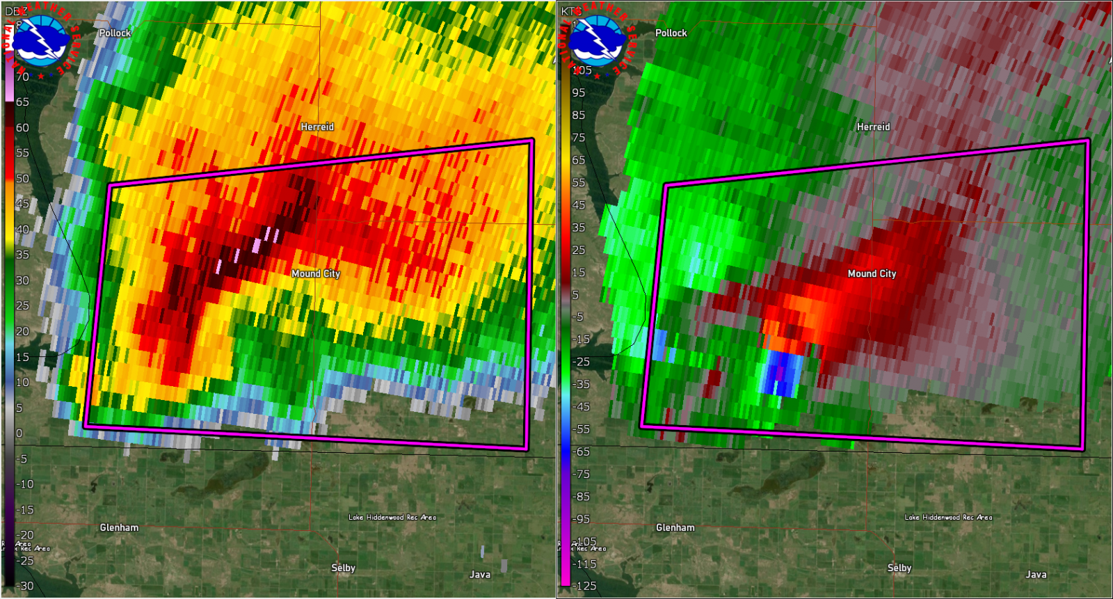
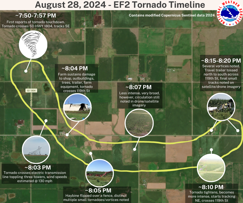
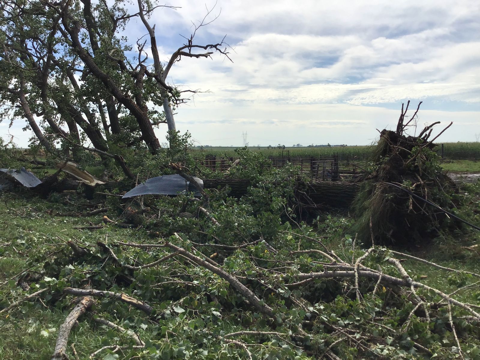
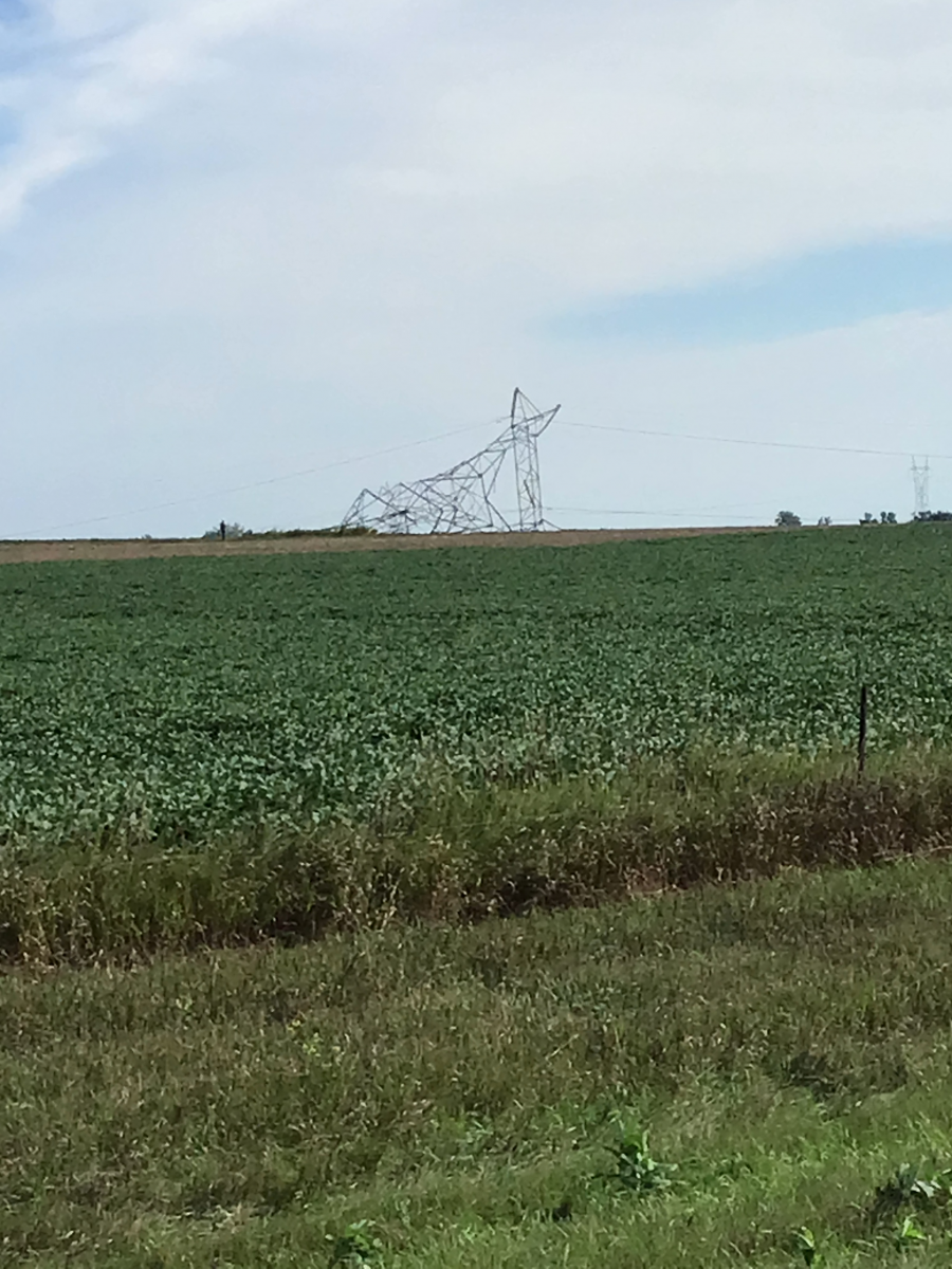
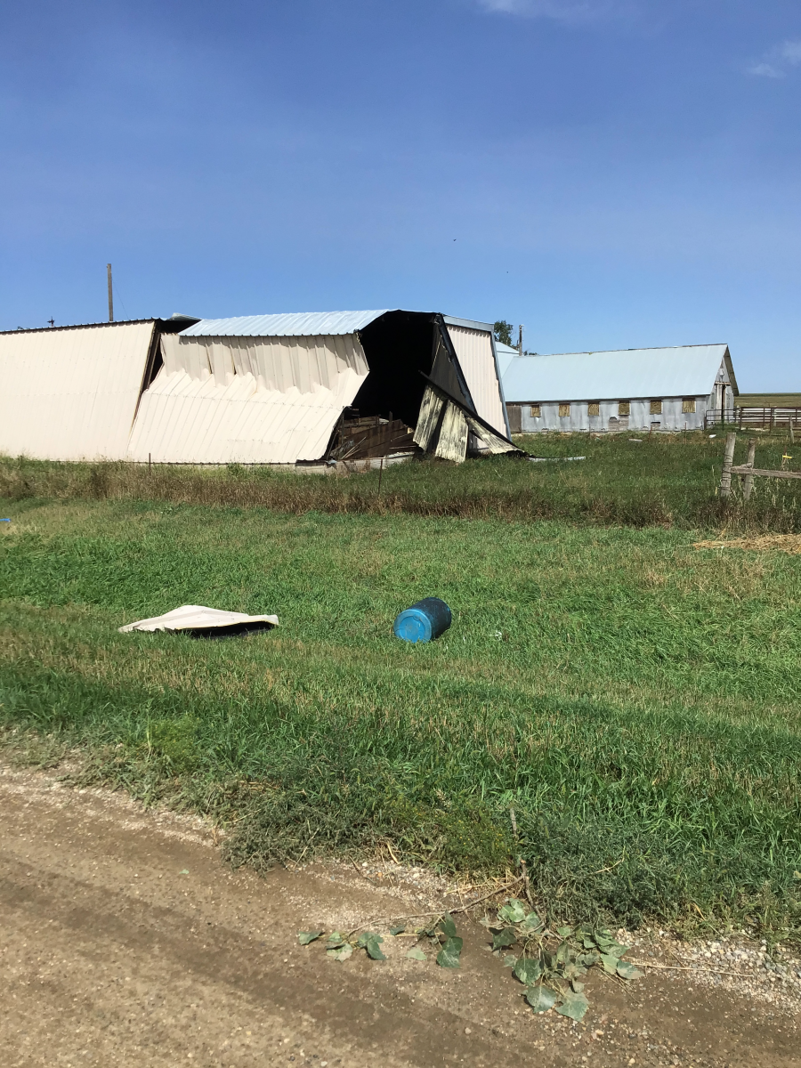
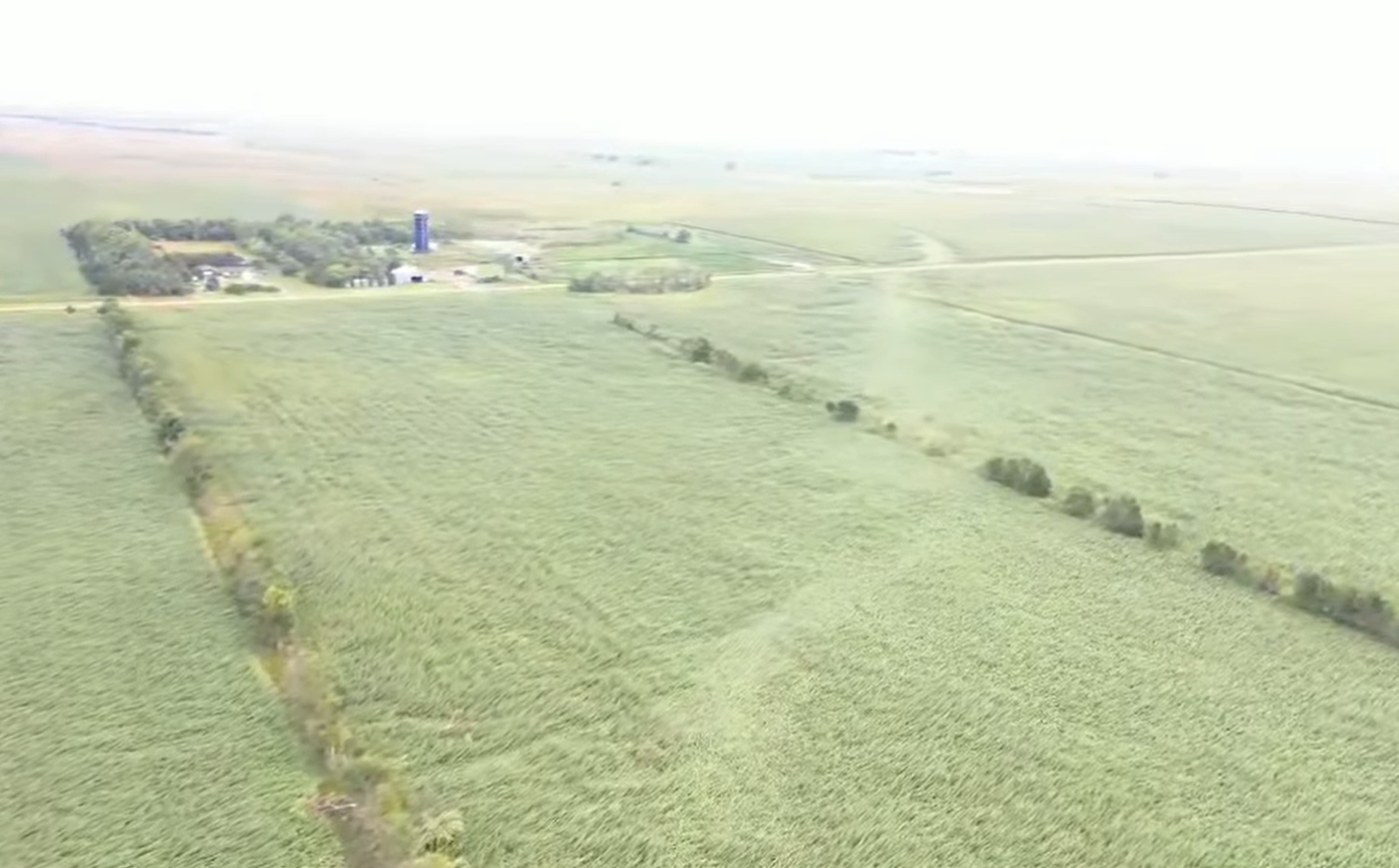
A thunderstorm developed in western Corson County late in the afternoon on August 28, 2024 and moved northeast into southern North Dakota. As that occurred, it turned into a supercell and produced a tornado. Then as new storms developed to the south of the storm and merged with it into northeast Corson County, the storm moved to the east and crossed the Missouri River (Lake Oahe). After crossing the river, the storm produced its first tornado just to the west of Highway 1804 in Campbell County. The storm continued eastward over the next 1.5-2 hours and produced multiple tornadoes before weakening over McPherson County and eventually moving northeast into North Dakota. 9/1/24 Update: The damage survey has been updated based on the collection of multiple data sources. Data from the original ground survey broke the path into three separate tracks. However, with the review of drone and high-resolution satellite imagery, there is evidence of a continuous track from beginning to end. The event was very complicated with many smaller tornadoes/vortices embedded within, or rotating around, the main circulation. This resulted in sporadic, intense areas of multi-directional tornado damage, as well as areas of very broad uniform damage. Experts were also consulted to determine wind speeds based on the electric transmission tower damage indicators. |
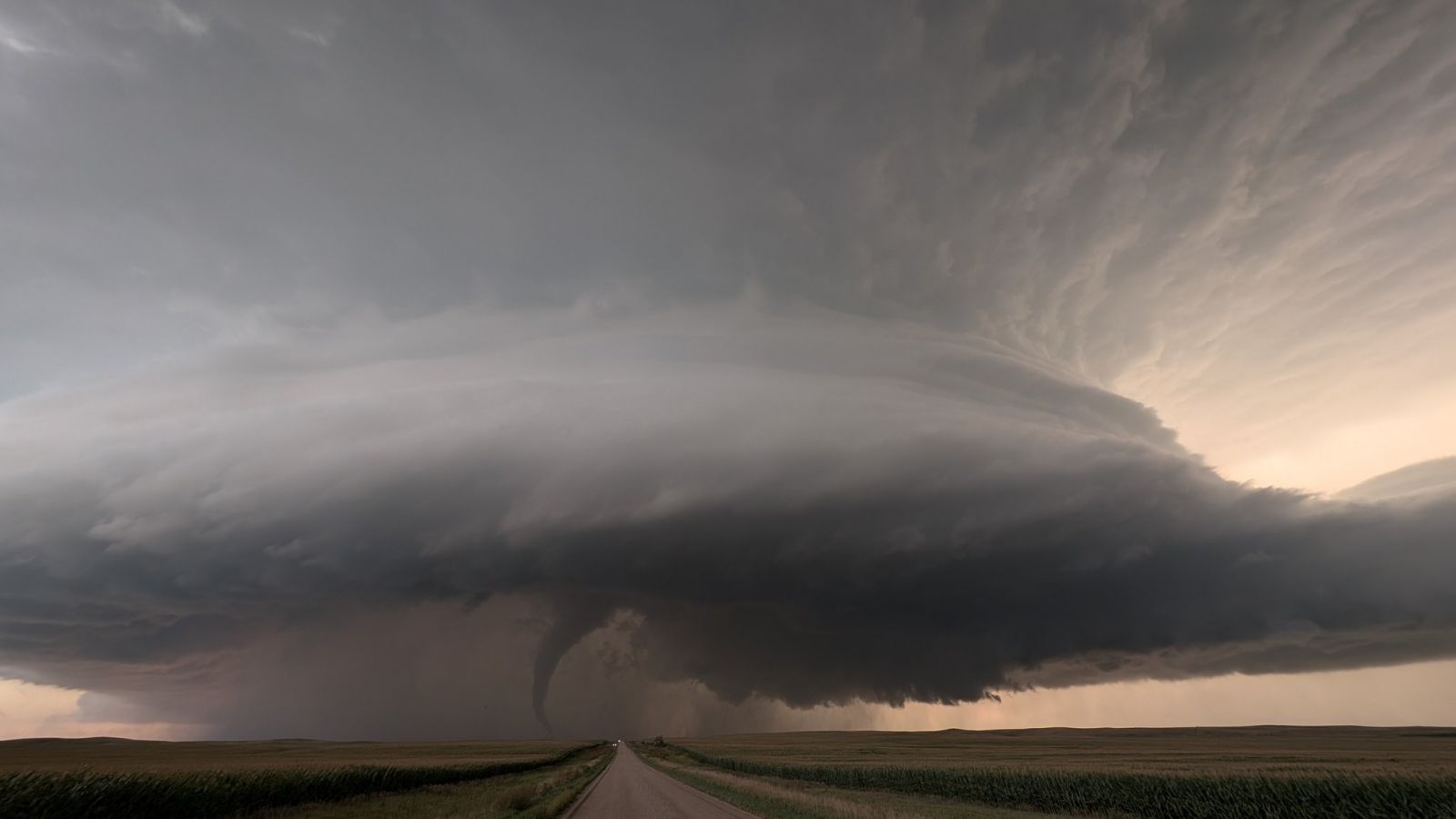
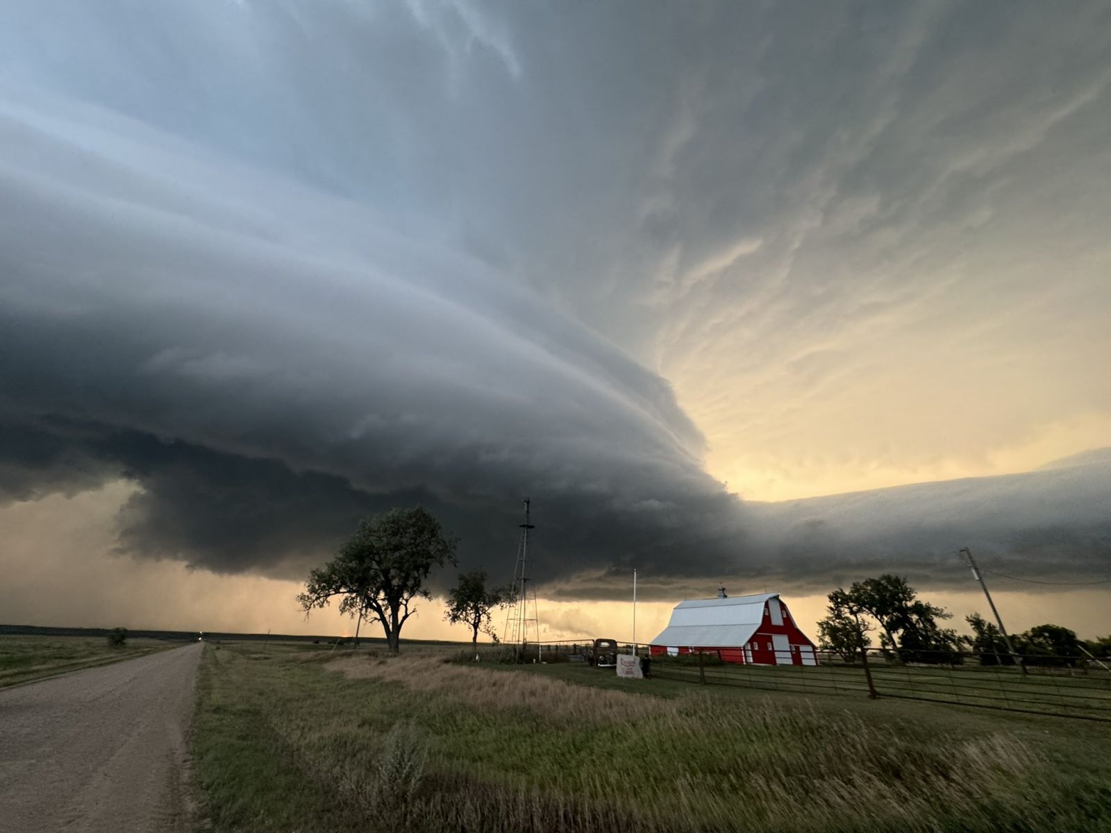
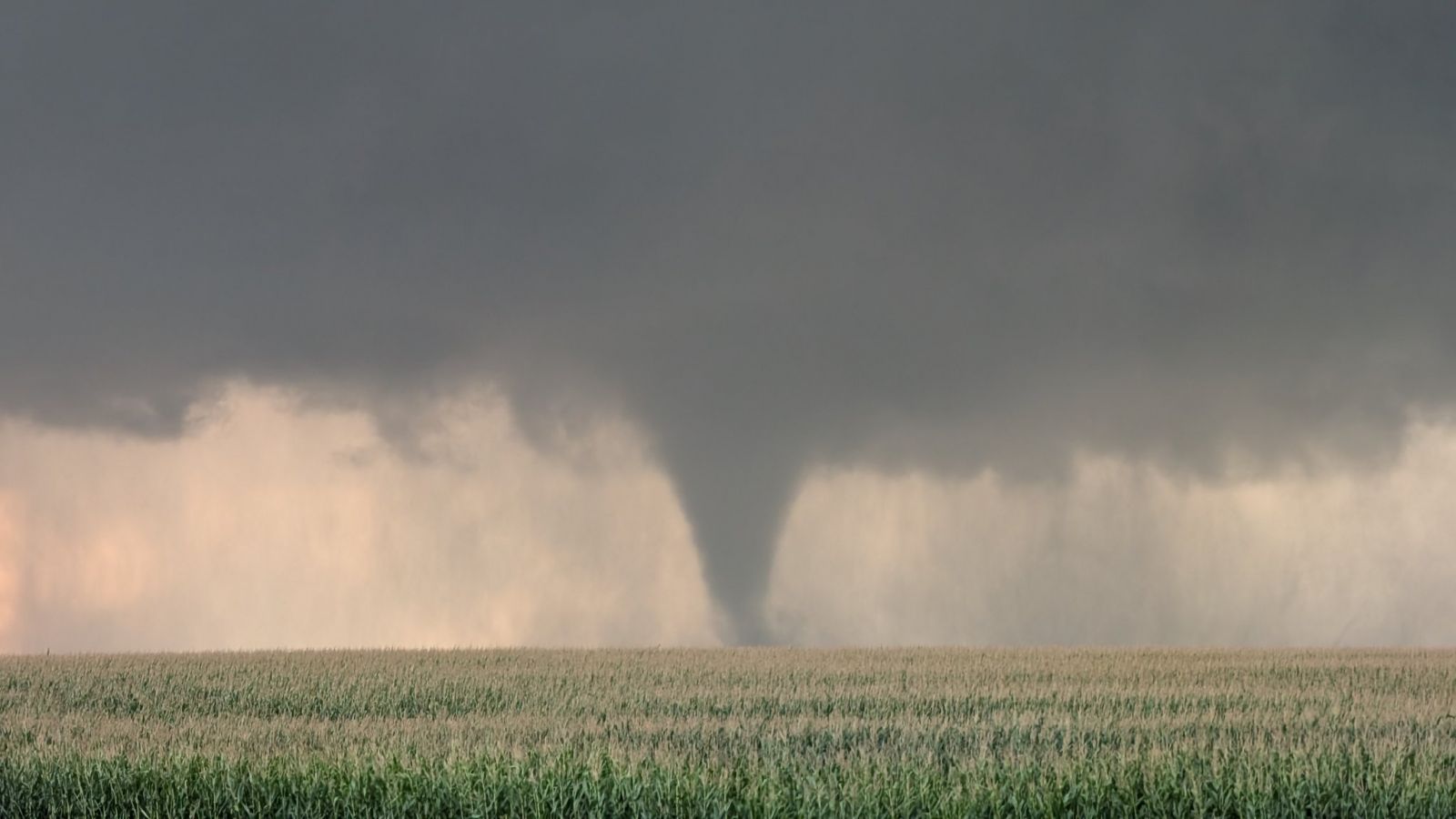
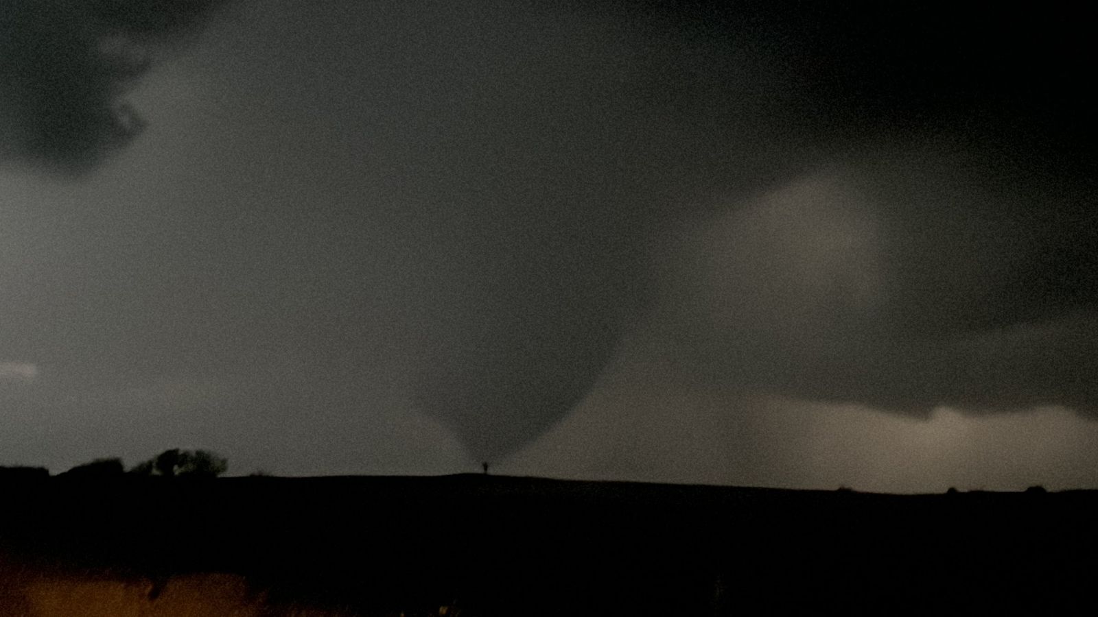
.jpg) A wide view of the supercell as it was producing a tornado to the west of Mound City, SD. Photo by Kyle Gillett. |
 |
 |
.jpg) |
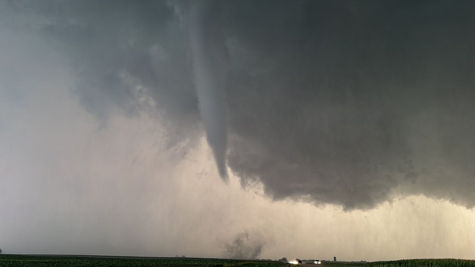
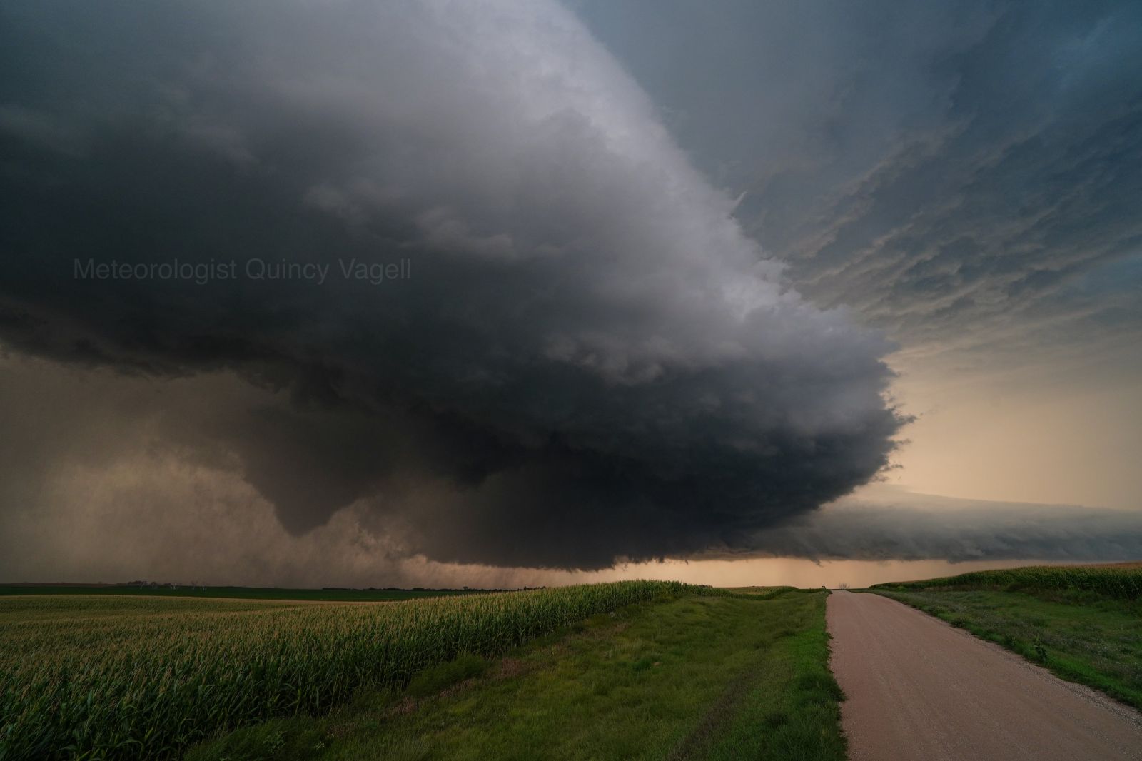
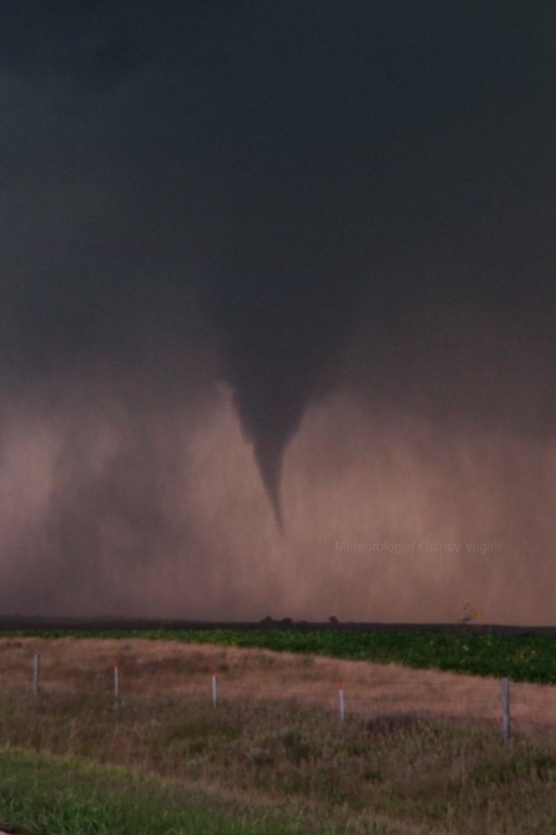
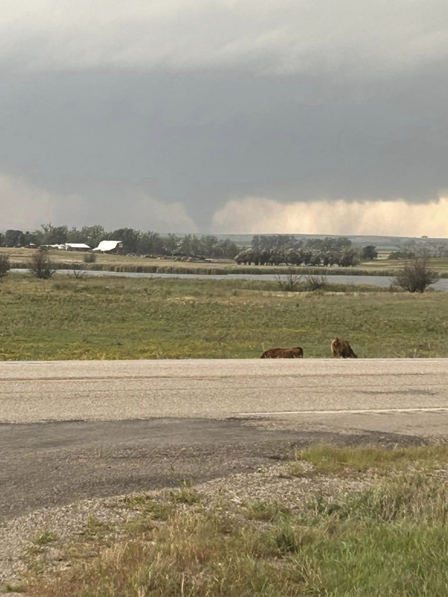
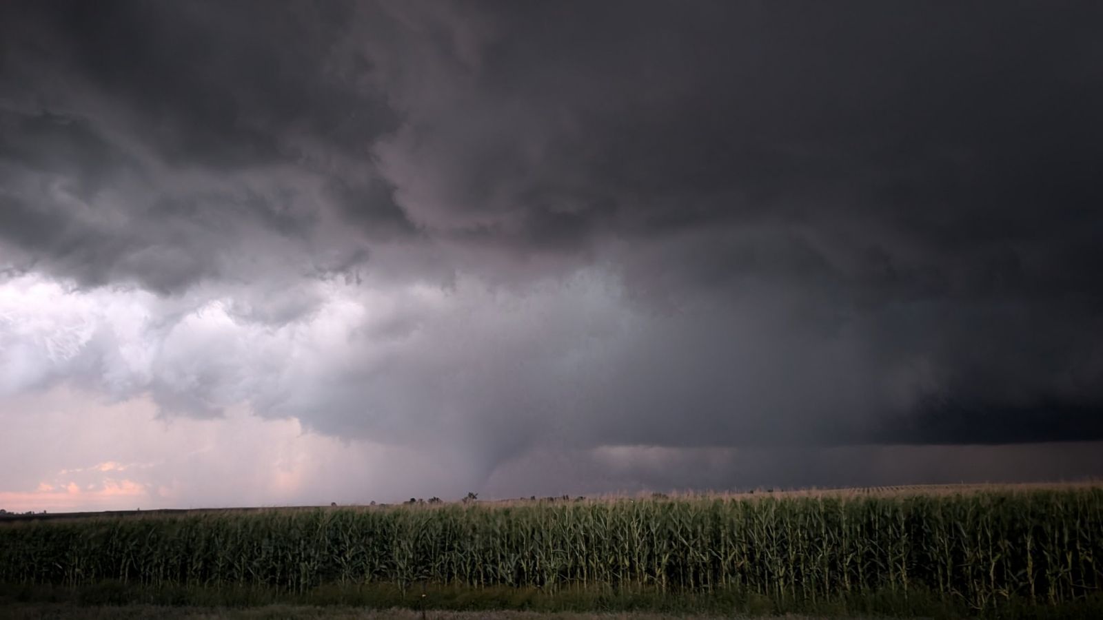
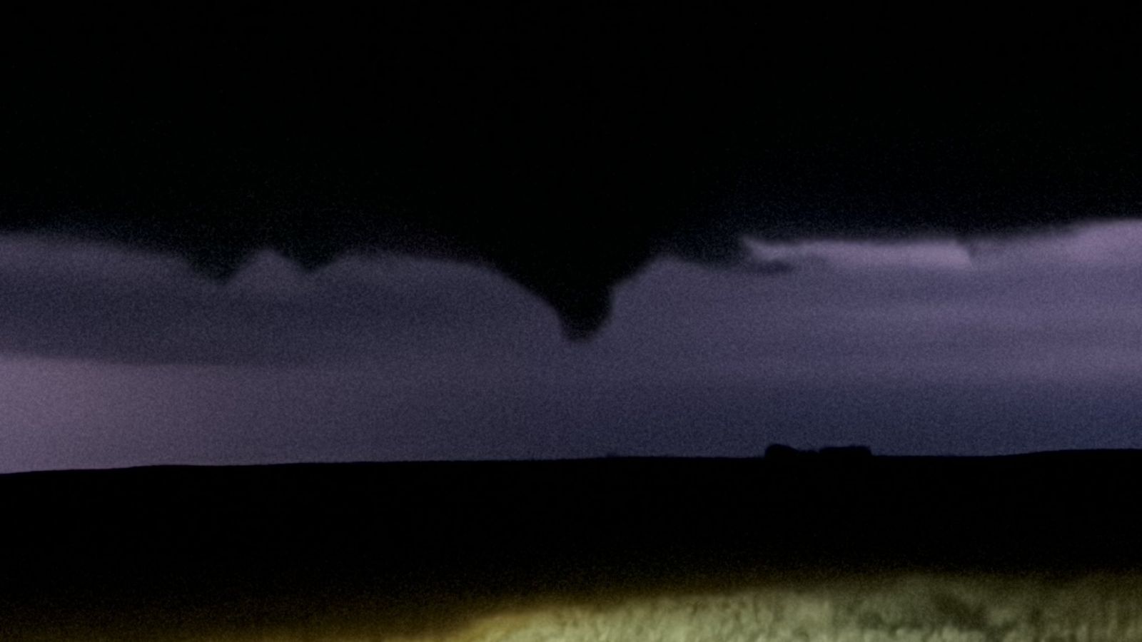
| Photo taken by Alex Resel at 8:03pm to the west of Mound City, SD | Photo taken by Devin Pitts at 8:10pm to the north of Mobridge, SD. | Photo taken by Quincy Vagell |
 |
 |
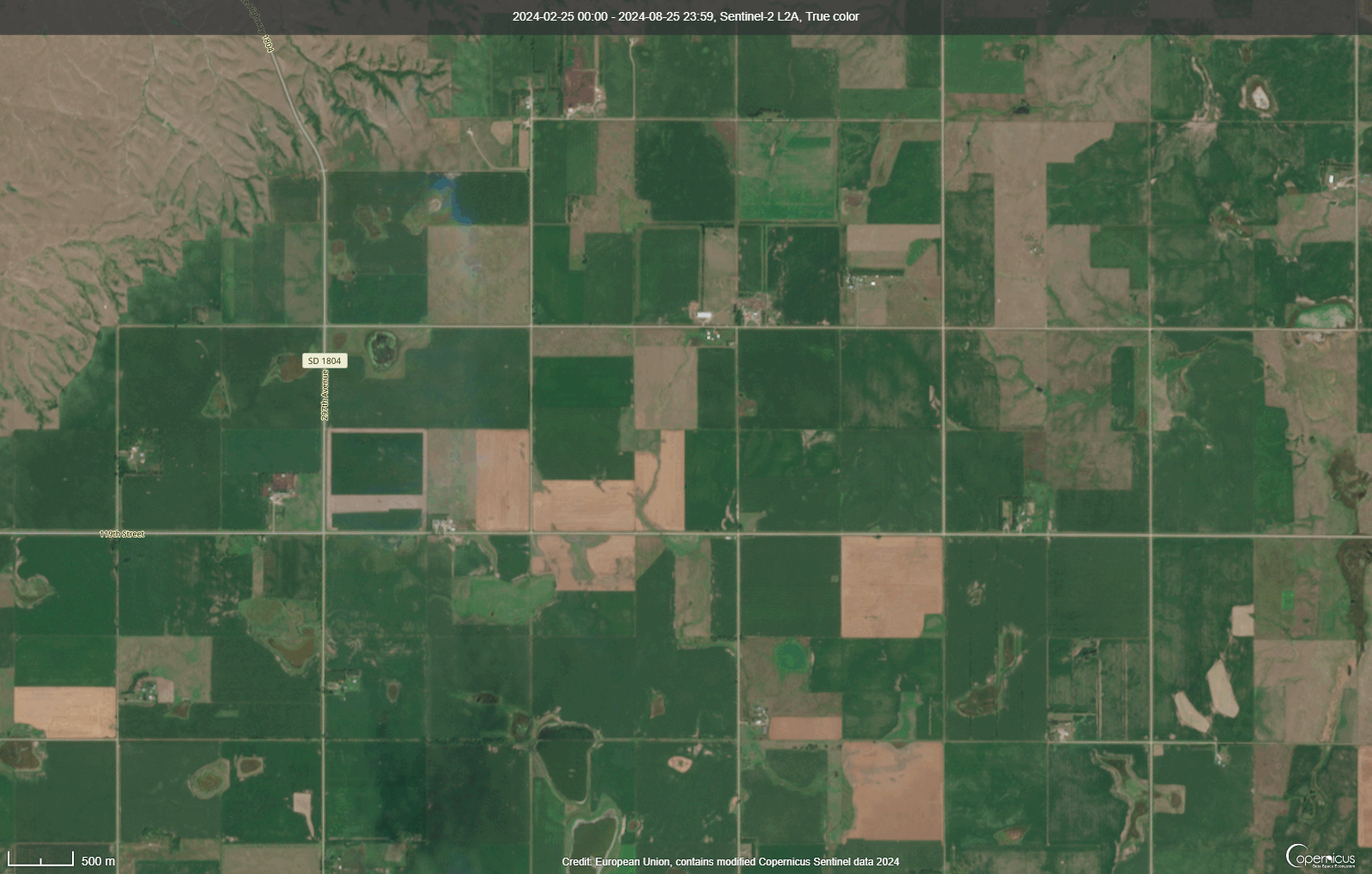 |
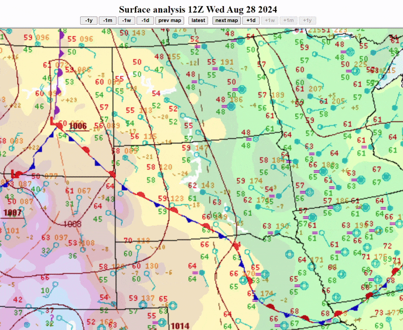
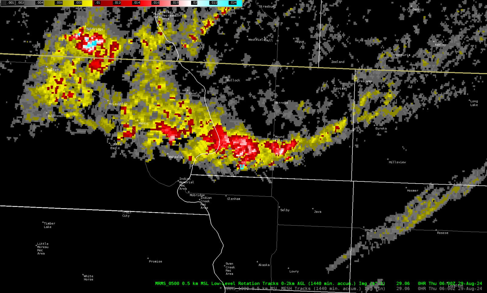
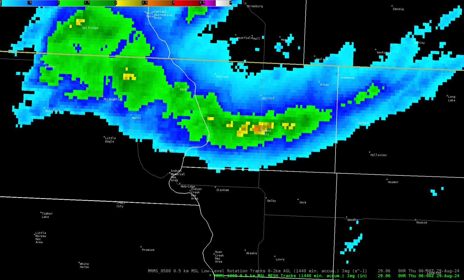
| A loop of the surface analysis from 7am CDT on August 28, 2024 to 7am CDT August 29, 2024. | MRMS Low Level Rotation Tracks over north central South Dakota. This shows areas of increased rotation in the lower portions of a storm. The areas in Red, White, and Aqua colors indicate the locations of strongest rotation. | The tornado track can be seen in this loop of Sentinel Satellite data. SD 1804 can be seen on the left side of this image, which is to the west-southwest of Mound City, SD. The first image is from 8/25/2024 and the second image is from 8/30/2024. (Data source: Copernicus Sentinel Data 2024) |
 |
||
| Timeline of the August 28th EF2 Tornado overlaid on Sentinel Satellite data from 8/30/2024. (Data source: Copernicus Sentinel Data 2024). |
Tornadoes:
|
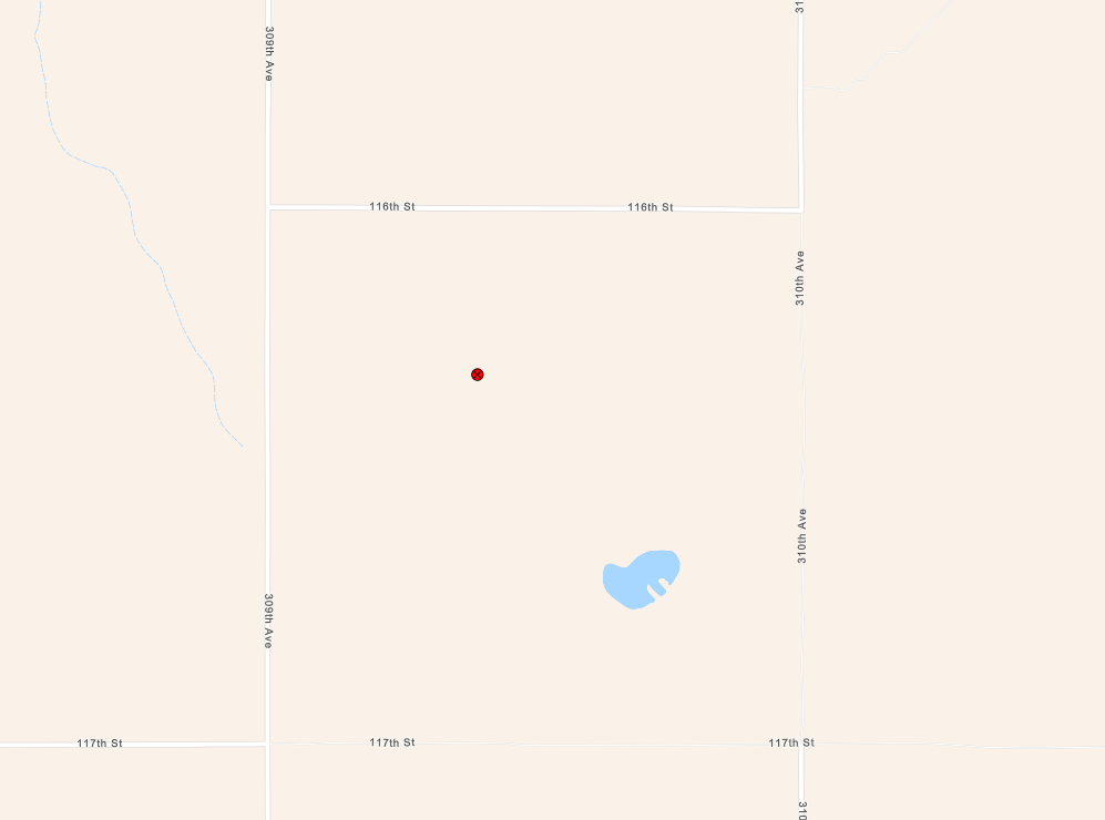
Tornado - Southeast Mound City #1
Track Map 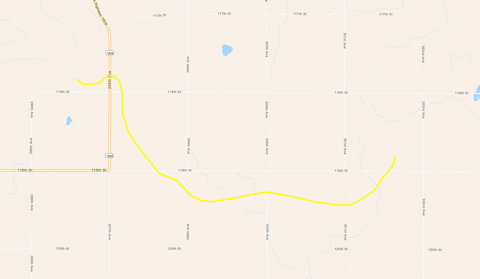 
Downloadable KMZ File |
||||||||||||||||||||||||
|
||||||||||||||||||||||||
|
||||||||||||||||||||||||
The Enhanced Fujita (EF) Scale classifies tornadoes into the following categories:
| EF0 Weak 65-85 mph |
EF1 Moderate 86-110 mph |
EF2 Significant 111-135 mph |
EF3 Severe 136-165 mph |
EF4 Extreme 166-200 mph |
EF5 Catastrophic 200+ mph |
 |
|||||
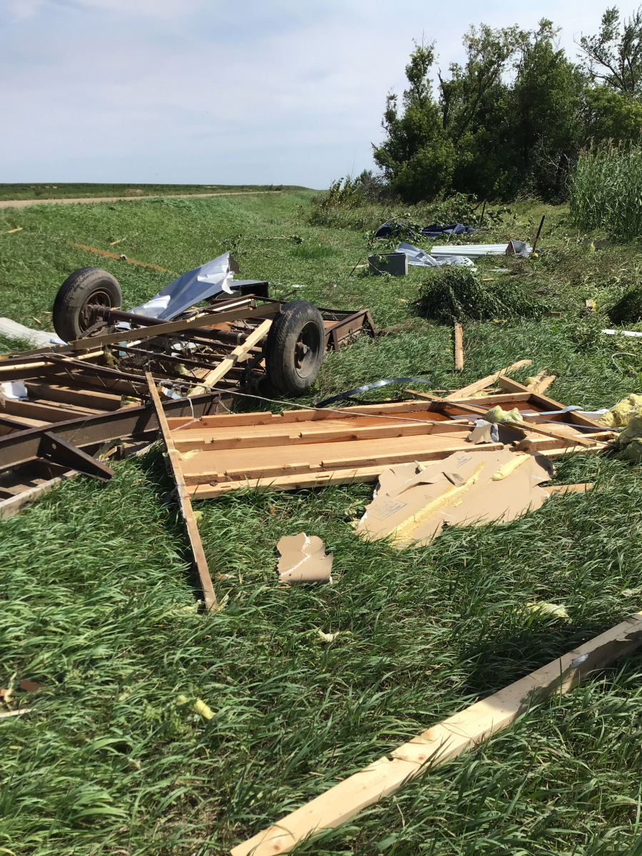
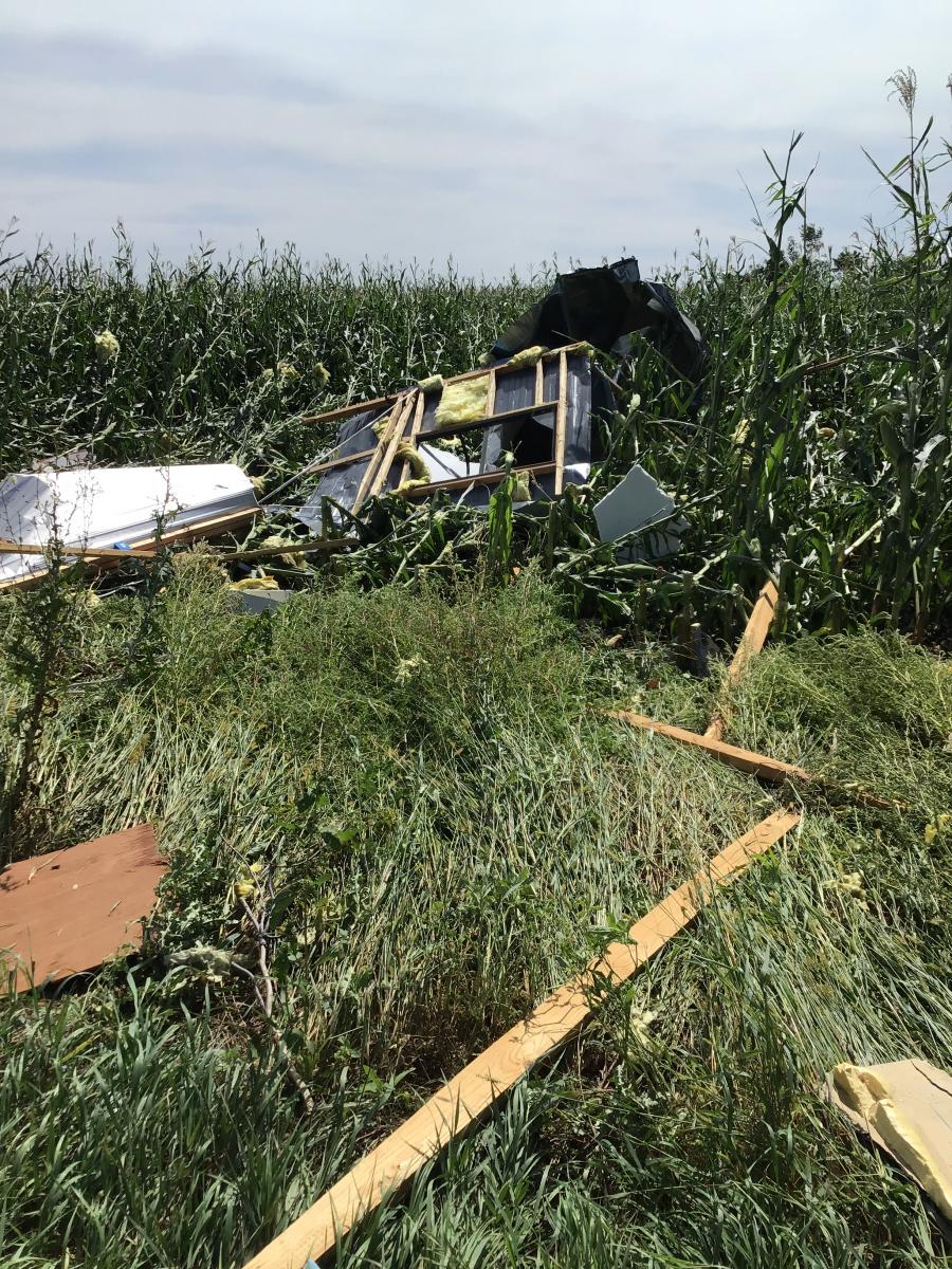
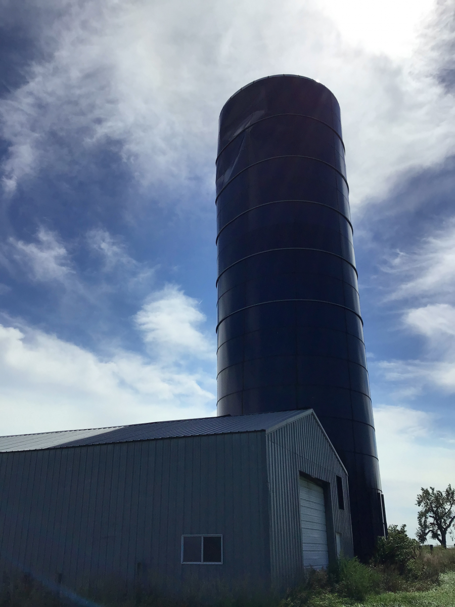
Photos & Video
Thank you to all of the people below for allowing us to share their pictures of the event.
 |
 |
 |
 |
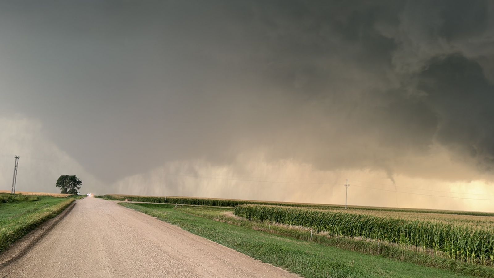
| Near Mound City, SD (Photo by Alex Resel) | Photo by Alex Resel | Tornado photo by Alex Resel | Tornado photo by Devin Pitts |
 |
.jpg) |
.jpg) |
 |
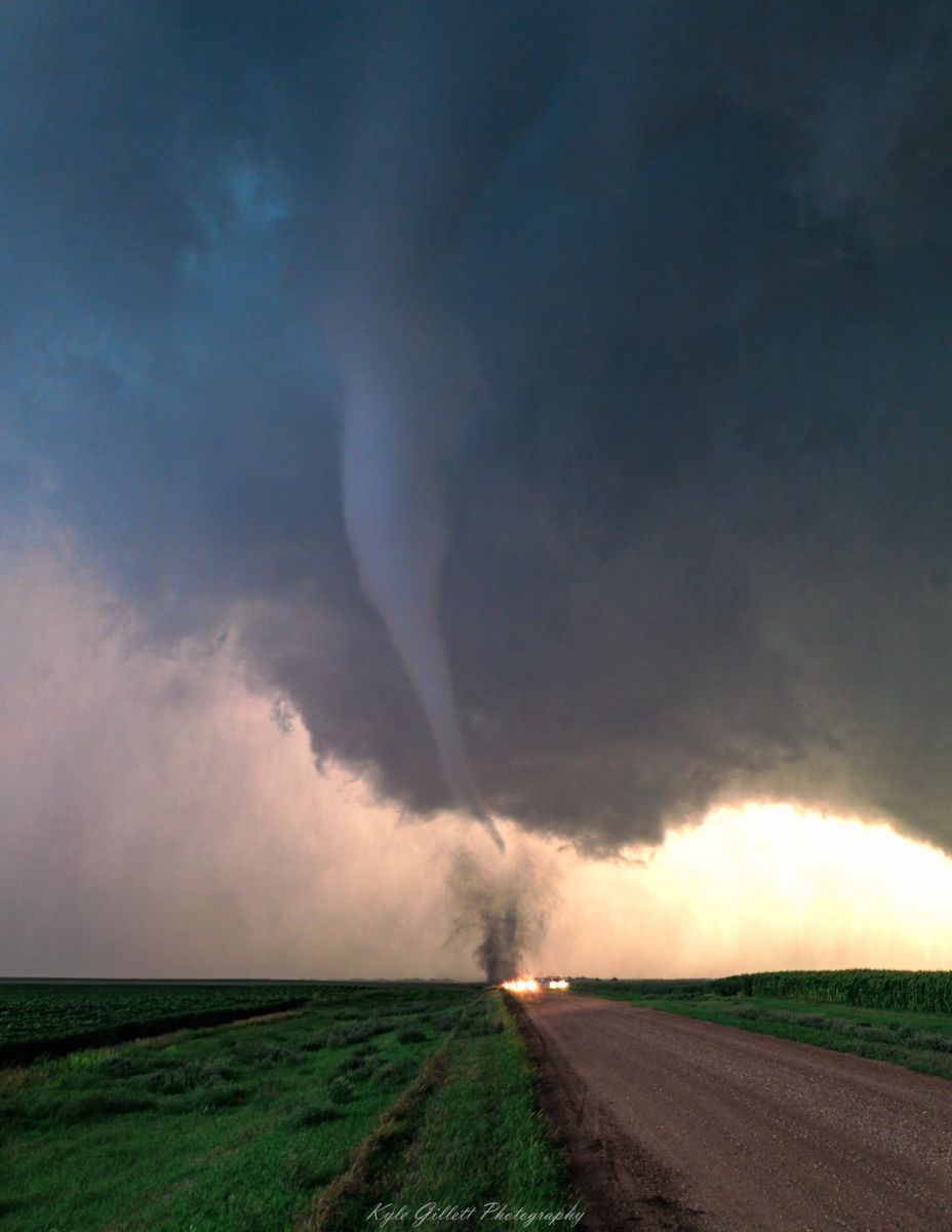
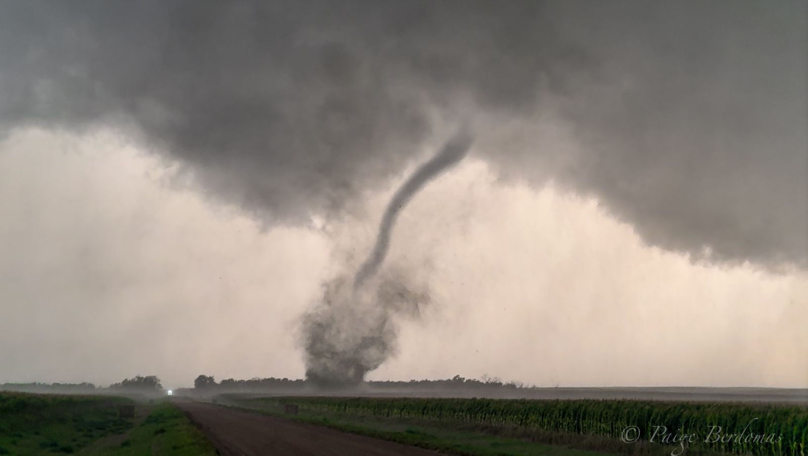
| Tornado photo by Kyle Gillett | Tornado photo by Quincy Vagell | Tornado photo by Quincy Vagell | Southwest of Mound City. Photo by Paige Berdomas and Bryce Shelton. |
 |
 |
 |
 |
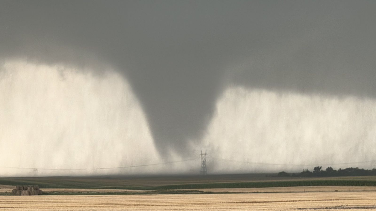
| Photo by Quincy Vagell | Photo by Quincy Vagell | Photo by Sheriff Boll | Tornado photo posted at 8:54 PM CDT near Mound City, SD. (Photo taken by Devin Pitts) |
 |
 |
 |
 |
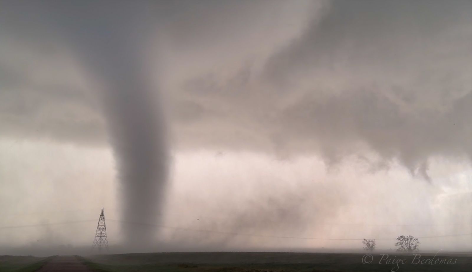
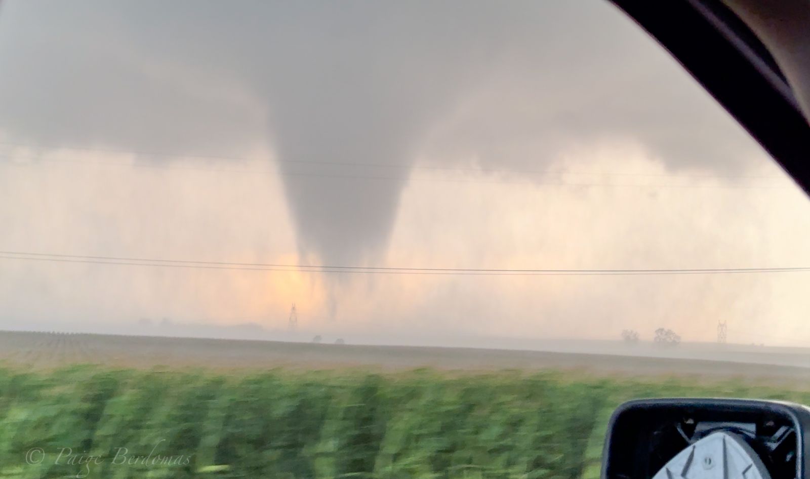
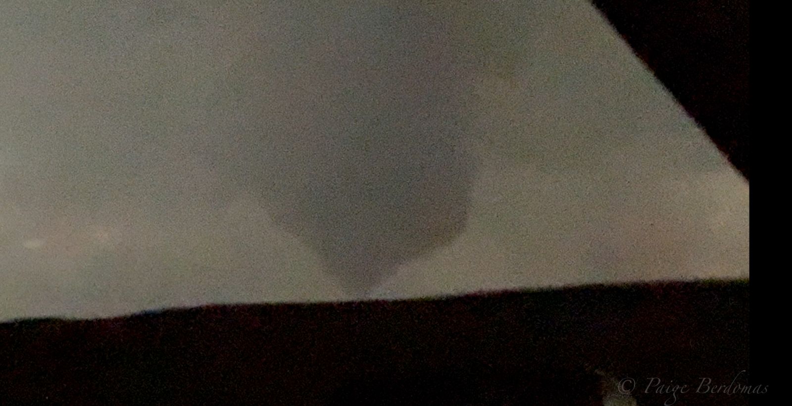
| Tornado at 8:54 PM CDT to the southeast of Mound City, SD. (Photo taken by Alex Resel) | Tornado at 8:58 PM CDT to the southeast of Mound City, SD. (Photo taken by Alex Resel) | Photo of a funnel at around 9:33 PM CDT around 8 miles to the west of Eureka, SD (Photo by Alex Resel) | Southwest of Mound City. Photo by Paige Berdomas and Bryce Shelton. |
 |
 |
 |
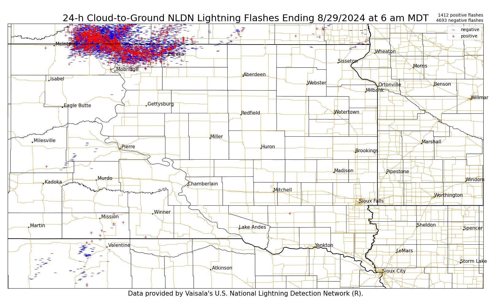 |
| Southwest of Mound City. Photo by Paige Berdomas and Bryce Shelton. | Southeast of Mound City. Photo by Paige Berdomas and Bryce Shelton. | MRMS Maximum Estimated Hail Size over north central South Dakota. | Cloud to Ground lightning strikes over the 24 hour period ending at 7am on August 29, 2024 |
| 1 Hour Timelapse from the Mound City, SD weather station from the SD Mesonet. Thank you to the SD Mesonet (https://climate.sdstate.edu/) for their capture and sharing of this timelapse. |
Radar & Satellite
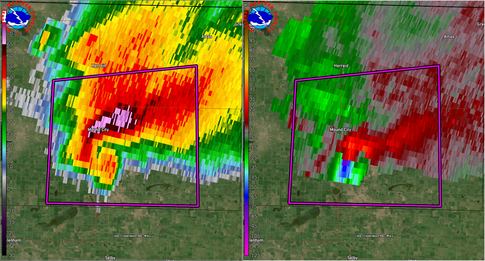
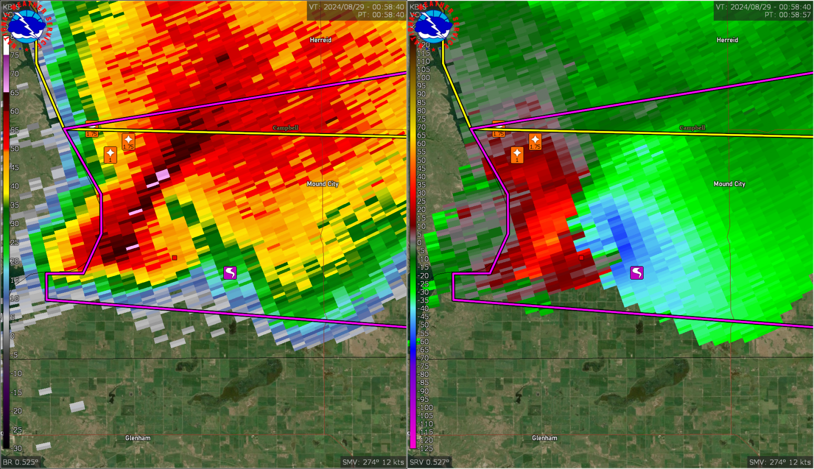
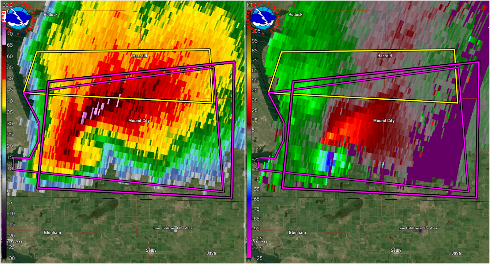
| Radar Loop of the Tornado Producing Supercell on August 28, 2024. The left panel is the reflectivity and the right panel is the storm relative velocity. The loop is valid from 7:05 PM CDT to 9:20 PM CDT. | MRMS Reflectivity of the August 28, 2024 Tornadic Supercell Event. The loop goes from 4PM CDT to midnight. | GOES-East Satellite Loop of the Tornado Producing Supercell on August 28, 2024. The loop goes from 2:00 PM CDT to Midnight on August 28, 2024. Satellite loop courtesy of College of DuPage Weather. |
Storm Reports
..TIME...   ...EVENT...      ...CITY LOCATION...     ...LAT.LON...
..DATE...   ....MAG....      ..COUNTY LOCATION..ST.. ...SOURCE....
            ..REMARKS..

0608 PM     Hail             5 E Walker              45.90N 100.98W
08/28/2024  E1.00 Inch       Corson             SD   Public

            Time estimated by radar.

0730 PM     Hail             10 S Pollock            45.76N 100.28W
08/28/2024  E1.75 Inch       Campbell           SD   Public

            Chaser reported golf ball sized hail.

0733 PM     Hail             10 S Pollock            45.75N 100.30W
08/28/2024  E1.00 Inch       Campbell           SD   Public

            Quarter sized hail reported south of
            Pollock.

0745 PM     Hail             9 SE Kenel              45.77N 100.32W
08/28/2024  E1.75 Inch       Campbell           SD   Public


0750 PM     Tornado          9 WSW Mound City        45.68N 100.24W
08/28/2024                   Campbell           SD   NWS Storm Survey

            Estimated touchdown time and point as found
            by Storm Survey of an EF2 rated tornado west
            of Mound City.

0810 PM     Tornado          7 SW Mound City         45.66N 100.17W
08/28/2024                   Campbell           SD   NWS Storm Survey

            Approximate touchdown time and point as
            determined by a Storm Survey of an EFU
            tornado southwest of Mound City.

0820 PM     Tornado          6 SW Mound City         45.67N 100.16W
08/28/2024                   Campbell           SD   NWS Storm Survey

            Approximate touchdown time and point as
            determined by Storm Survey of an EF1 rated
            tornado southwest of Mound City.

0850 PM     Tornado          3 ESE Mound City        45.71N 100.00W
08/28/2024                   Campbell           SD   NWS Storm Survey

            Estimated touchdown point of an EFU tornado
            southeast of Mound City.

0901 PM     Tornado          6 ESE Mound City        45.69N 99.95W
08/28/2024                   Campbell           SD   Public

            Report of a touchdown east of Mound City.
 |
Media use of NWS Web News Stories is encouraged! Please acknowledge the NWS as the source of any news information accessed from this site. |
|


.png)