Overview
|
After a relatively quiet and warm start to winter, the first significant winter storm to impact the area occurred from December 24-27th, with the greatest impacts on Dec 25-26th. The first wave of snow, rain, and freezing rain moved in from the south during the early morning hours of December 24th and initially brought rain to the region. The rain turned to snow during the morning of December 24th for central portions of SD (1-4" of snow accumulated), but remained rain or freezing rain over eastern SD and into Minnesota. That first period of precipitation came to an end during the evening hours on December 24th. The next wave of precipitation arrived on Christmas Day from the east. This was due to a low pressure system developing in Iowa (seen in the loop to the right), leading to easterly winds pushing ample moisture and precipitation into the area. The moisture and precipitation stretched all of the way southeast to Florida. As the precipitation moved into the area, the leading edge fell as snow before quickly switching over to sleet and freezing rain. There was just enough cold air in place to allow the snow to last longer over central SD, but eventually nearly all locations received a wintry mix of precipitation. While this initial precipitation was falling, northerly winds were gusting to 40-60 mph across the area. This produced blizzard conditions across portions of central SD, where the precipitation stayed snow the longest. The precipitation continued Christmas night and into December 26th, with primarily rain over eastern SD, freezing rain over north central SD, and snow over south central SD. The precipitation gradually came to an end on December 27th as the low pressure system departed. With the abundant moisture with this system, liquid equivalent precipitation totals (rain plus melting down the snow, sleet, and freezing rain) exceeded an inch over much of northeast SD. The highest totals were in Roberts, Grant, and Marshall counties, where liquid equivalent values were over 2 inches. In fact, a record daily precipitation was recorded on both December 25th (1.43") and 26th (1.17") in Sisseton, SD. Freezing rain accumulations on trees and elevated surfaces over the Prairie Coteau and westward into north central SD were between 0.1" and 0.5" on elevated surfaces. Finally, for snowfall/sleet amounts, totals ranged from 2-4" over northern portions of the James River Valley and western side of the Prairie Coteau to 8-15" over Lyman, Jones, and Stanley counties. The storm led to the closure of I-90 during the afternoon of December 25th and continuing into the morning hours of December 26th. In addition, "No Travel Advised" designations were provided across some state and county roads. |
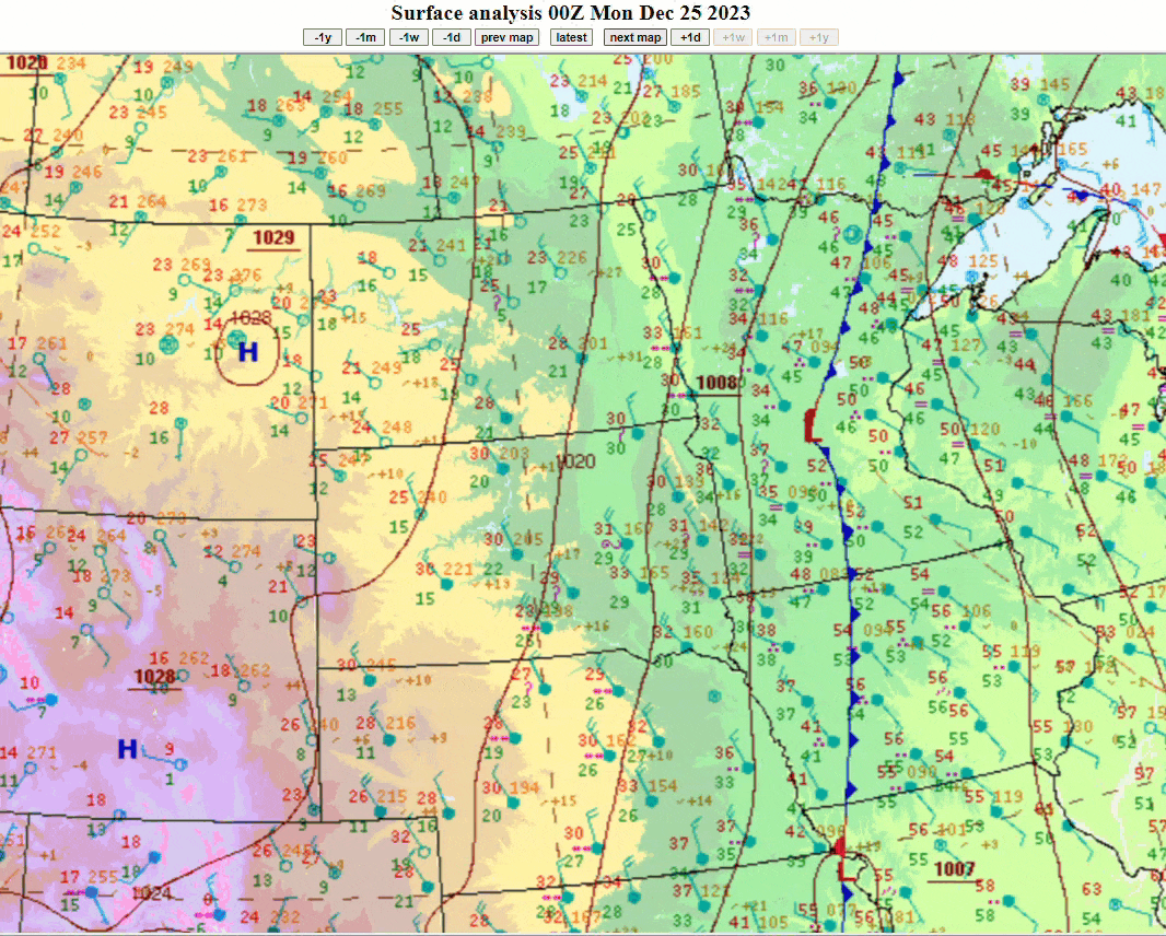 Surface Weather Map showing the low pressure system that rotated through the Upper Mississippi Valley and led to the wintry mix of rain, freezing rain, sleet, and snow across the region. The loop goes from from 6pm December 24th to 6am December 27th, 2023 |
 |
 |
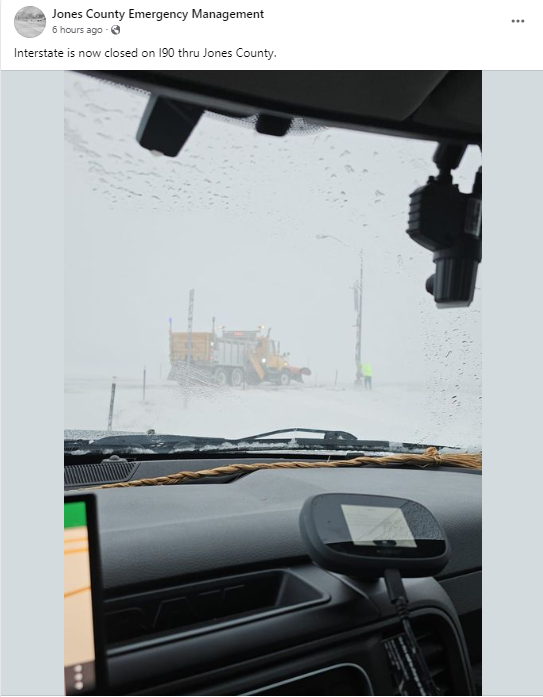 |
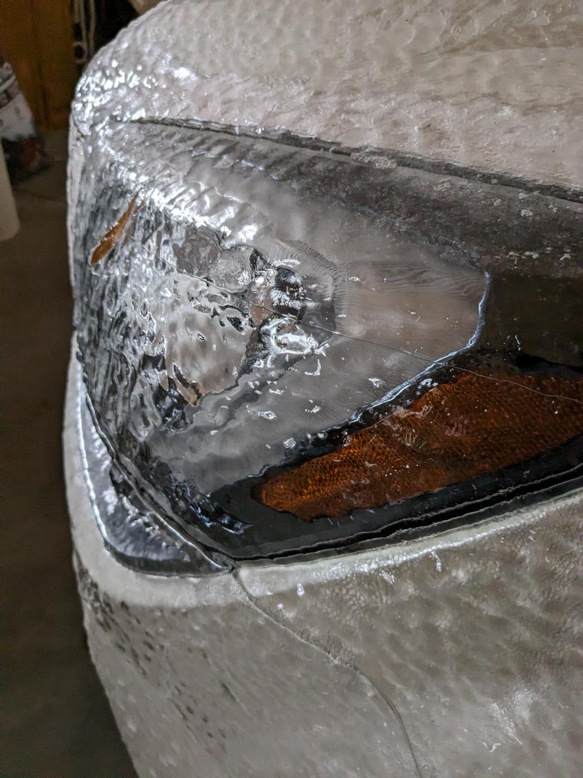
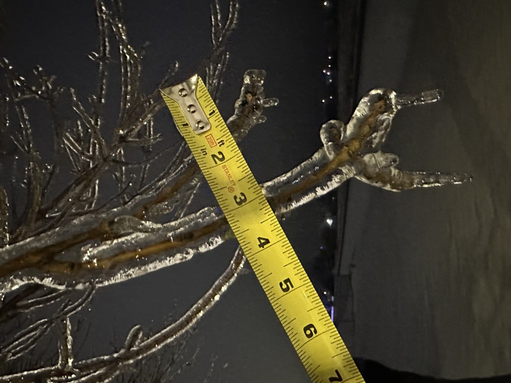
| Ice accumulation on a car in Eureka, SD (Photo by Kelly Serr) | Ice accumulation on the trees at NWS Aberdeen - Taken at 12:42 am on Dec 26, 2023 (Photo by NWS Aberdeen) | I-90 being closed during the afternoon on December 25th in Jones County SD. (Photo by Jones County EM - Facebook) |
Wind
The strongest winds were reported during the afternoon and evening hours of December 25th, with most locations experiencing gusts over 45 mph. The strongest gusts were located over the Missouri and James River Valleys, where gusts of 50 to 63 mph were reported.
The map and list below contain the peak wind gusts (in mph) on December 25, 2023 (click the image to view a larger version).
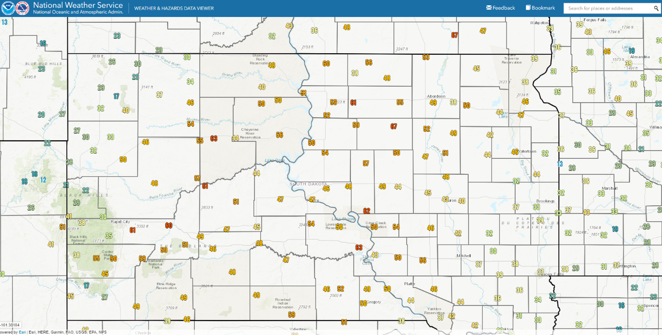
...HIGHEST WIND REPORTS ON DECEMBER 25, 2023...

Location                     Speed     Time/Date
Reliance (SDDOT)             63 MPH    0217 PM 12/25
Macs Corner (SDDOT)          62 MPH    0127 PM 12/25
Bowdle (SDDOT)               61 MPH    0408 PM 12/25
Herreid (SDDOT)              60 MPH    0753 PM 12/25
Tolstoy (SDDOT)              59 MPH    0448 PM 12/25
Lake City (SDDOT)            57 MPH    0449 PM 12/25
Polo 17 W JCT SD47/SD26 (SDD 57 MPH    0303 PM 12/25
Ridgeview (SDDOT)            56 MPH    0840 PM 12/25
Eureka 13 ENE                56 MPH    0615 PM 12/25
Craven (SDDOT)               55 MPH    0228 PM 12/25
Eureka (SDDOT)               54 MPH    0624 PM 12/25
Gann Valley (SDDOT)          54 MPH    0348 PM 12/25
Agar (SDDOT)                 54 MPH    0448 PM 12/25
Mobridge Muni AP             54 MPH    1028 PM 12/25
Oacoma 2W (SD Mesonet)       54 MPH    0140 PM 12/25
Vivian 13 N                  54 MPH    0259 PM 12/25
5SE Selby (SDDOT)            53 MPH    0633 PM 12/25
Frederick (SDDOT)            53 MPH    0113 PM 12/25
Mellette (SDDOT)             52 MPH    0358 PM 12/25
Lowry (SDDOT)                52 MPH    0659 PM 12/25
Seneca (SDDOT)               52 MPH    0407 PM 12/25
Pierre Muni AP               52 MPH    0833 PM 12/25
Doland (SDDOT)               51 MPH    0519 PM 12/25
Forest City (SDDOT)          50 MPH    0622 PM 12/25
Miranda (SDDOT)              50 MPH    0213 PM 12/25
Trail City (SDDOT)           50 MPH    0654 PM 12/25
14W Lower Brule (SDDOT)      50 MPH    0338 PM 12/25
Lees Corner (SDDOT)          50 MPH    0919 PM 12/25
Timber Lake (SDDOT)          50 MPH    0748 PM 12/25
Pierre                       50 MPH    0955 PM 12/25
Leola (SD Mesonet)           50 MPH    0525 PM 12/25
Timber Lake (SD Mesonet)     50 MPH    0730 PM 12/25
3S Conde (SDDOT)             49 MPH    0422 PM 12/25
Ree Heights (SDDOT)          49 MPH    1209 PM 12/25
Bowdle (SD Mesonet)          49 MPH    0415 PM 12/25
Aberdeen Rgnl AP             49 MPH    0644 PM 12/25
Onida 13WSW (SD Mesonet)     49 MPH    0810 PM 12/25
Vivian (SDDOT)               48 MPH    0339 PM 12/25
Harrold (SDDOT)              48 MPH    0124 PM 12/25
McLaughlin (SDDOT)           48 MPH    0825 PM 12/25
Spink Colony 9 SSE JCT SD28/ 48 MPH    0455 PM 12/25
U.s.75 - Ortonville - Mp 132 48 MPH    1050 AM 12/25
Hayes (SDDOT)                47 MPH    0445 PM 12/25
Andover (SDDOT)              47 MPH    0402 PM 12/25
Summit (SDDOT)               47 MPH    0313 PM 12/25
Faulkton (SD Mesonet)        47 MPH    0540 PM 12/25
Groton 9 NNE (SD Mesonet)    47 MPH    0510 PM 12/25
Redfield Muni AP             47 MPH    0835 PM 12/25
Peever (SDDOT)               46 MPH    0555 PM 12/25
Blunt (SDDOT)                46 MPH    0353 PM 12/25
Gettysburg 1.5 S (SD Mesonet 46 MPH    0410 PM 12/25
Watertown Muni AP            46 MPH    0254 PM 12/25
Eureka                       45 MPH    0600 PM 12/25
Frederick                    45 MPH    0230 PM 12/25
1 NNE Britton                45 MPH    0555 PM 12/25

Observations are collected from a variety of sources with varying
equipment and exposures. We thank all volunteer weather observers
for their dedication. Not all data listed are considered official.
Snow/Ice
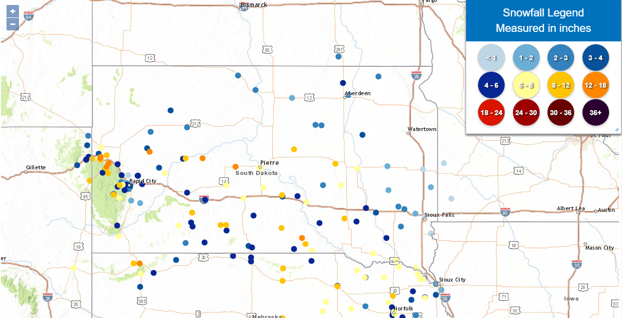
Snowfall Reports
The map below shows snowfall reports submitted to the NWS for the 2 days ending during the morning of Dec 27th, 2023
Ice Accumulation Reports
And this map highlights the ice accumulation reports during the event, as of 2pm on December 27, 2023.
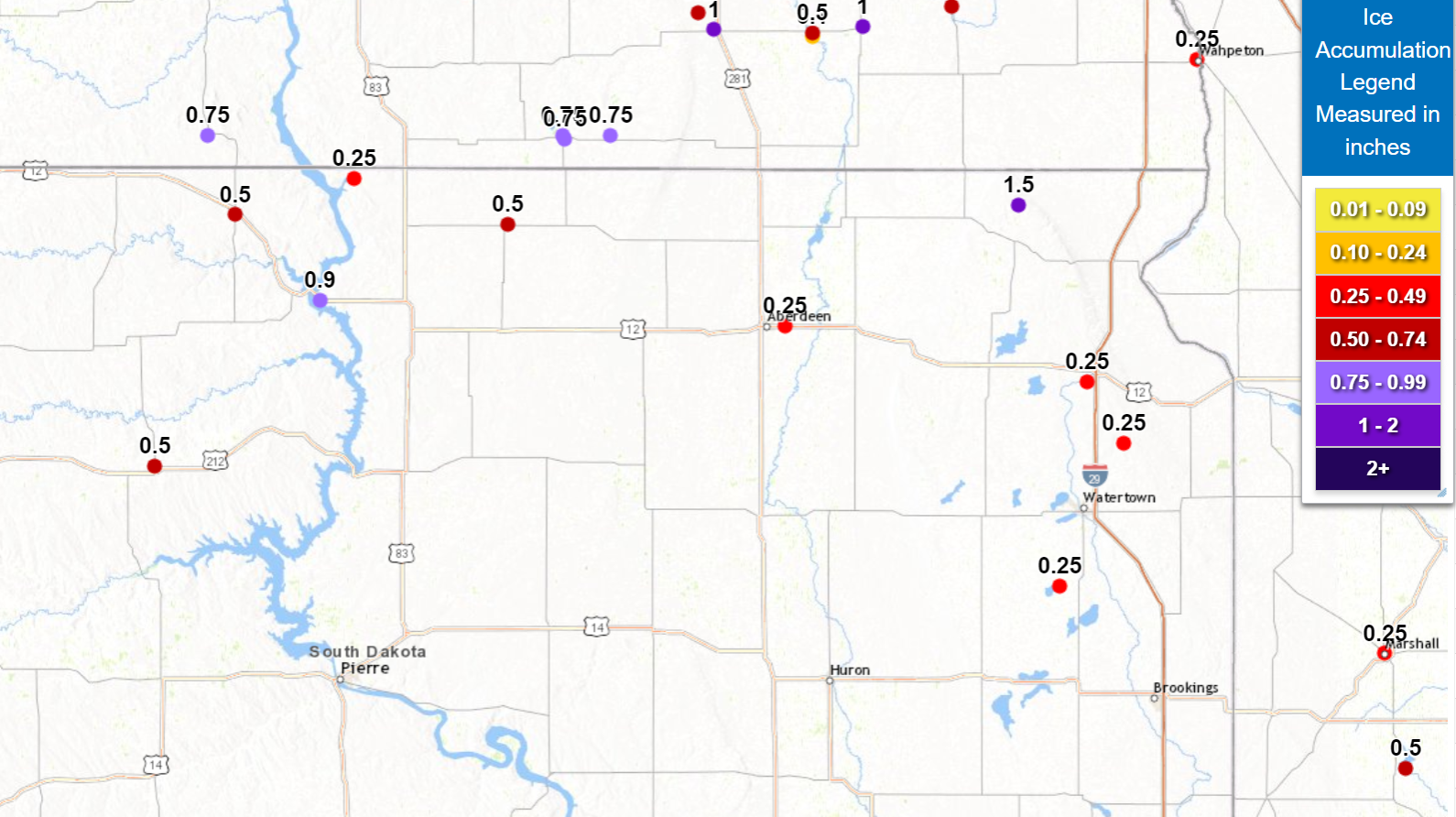
...REPORTS FROM THE DEC 25-27 WINTER STORM...

The following list contains freezing rain, snow, and wind reports
from the December 25 to 27, 2023 winter storm.

...FREEZING RAIN REPORTS...

Location                     Amount    Time/Date       Provider

...South Dakota...

...Brown County...
Aberdeen Regional Airport    0.25 in   0125 AM 12/26   Official NWS Obs

...Campbell County...
1 NNE Pollock                0.25 in   0733 PM 12/26   CO-OP Observer

...Codington County...
South Shore                  0.25 in   1255 PM 12/25   Public

...Corson County...
1 S Mclaughlin               0.50 in   0750 AM 12/26   Trained Spotter

...Dewey County...
3 W Parade                   0.50 in   0801 AM 12/26   Trained Spotter

...Grant County...
3 WSW Summit                 0.25 in   0800 AM 12/26   Public

...Hamlin County...
Hayti                        0.25 in   0711 PM 12/25   Trained Spotter

...Marshall County...
Hillhead                     1.50 in   0800 AM 12/26   Emergency Mngr

...McPherson County...
Eureka                       0.50 in   1100 AM 12/26   NWS Employee

...Walworth County...
Mobridge                     0.90 in   0830 PM 12/26   Public


...SNOWFALL REPORTS...

Location                     Amount    Time/Date       Provider

...South Dakota...

...Brown County...
Westport 2 NW                5.8 in    0700 AM 12/27   COOP
2 N Aberdeen Regional Airpor 2.4 in    0644 PM 12/25   Official NWS Obs

...Corson County...
2 SSW Mclaughlin             2.3 in    0800 AM 12/26   CO-OP Observer

...Faulk County...
Faulkton 6.2 E               2.6 in    0800 AM 12/26   COCORAHS
Faulkton 1 NW                2.0 in    0800 AM 12/26   COOP

...Hughes County...
Pierre                       7.0 in    0645 AM 12/27   UCOOP

...Hyde County...
Holabird 8.5 N               9.0 in    0700 AM 12/27   COCORAHS

...Jones County...
Murdo                        7.8 in    0900 AM 12/26   COOP

...Lyman County...
Kennebec                     10.2 in   0600 PM 12/26   COOP
Vivian 7 NNE                 6.0 in    0700 AM 12/27   COCORAHS
Reliance 4 ENE               4.0 in    0733 AM 12/26   COCORAHS

...Marshall County...
Britton                      2.5 in    0700 AM 12/26   COOP

...Spink County...
Doland 2 S                   3.2 in    0800 AM 12/26   UCOOP

...Stanley County...
Hayes 6 E                    12.0 in   0600 AM 12/26   UCOOP
Fort Pierre 0.5 SE           9.3 in    0700 AM 12/27   COCORAHS

...Walworth County...
2 NNW Mobridge               2.0 in    0700 AM 12/26   CO-OP Observer

Observations are collected from a variety of sources with varying
equipment and exposures. We thank all volunteer weather observers
for their dedication. Not all data listed are considered official.
Photos & Video
 |
 |
 |
 |
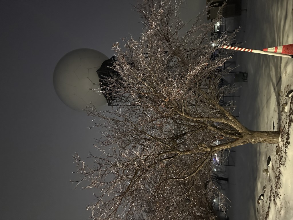
| Ice on a tree at NWS Aberdeen at 11:45am on December 25th, 2023 (Photo by NWS Aberdeen) |
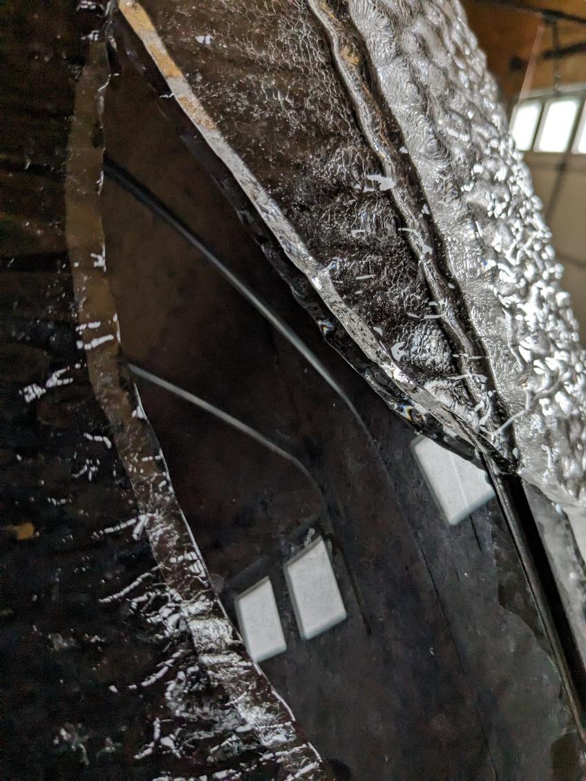
A closer view of ice on the branches of a tree at NWS Aberdeen (Photo by NWS Aberdeen) |
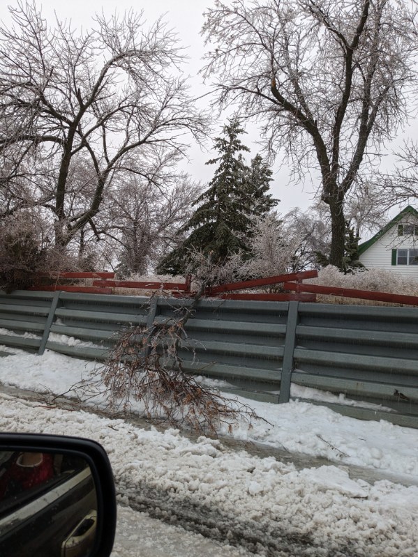
The ice thickness on a car in Eureka, SD (Photo by Kelly Serr) | Broken tree branch from the ice damaging a fence in Eureka, SD (Photo by Kelly Serr) |
 |
 |
 |
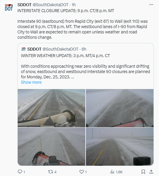 |
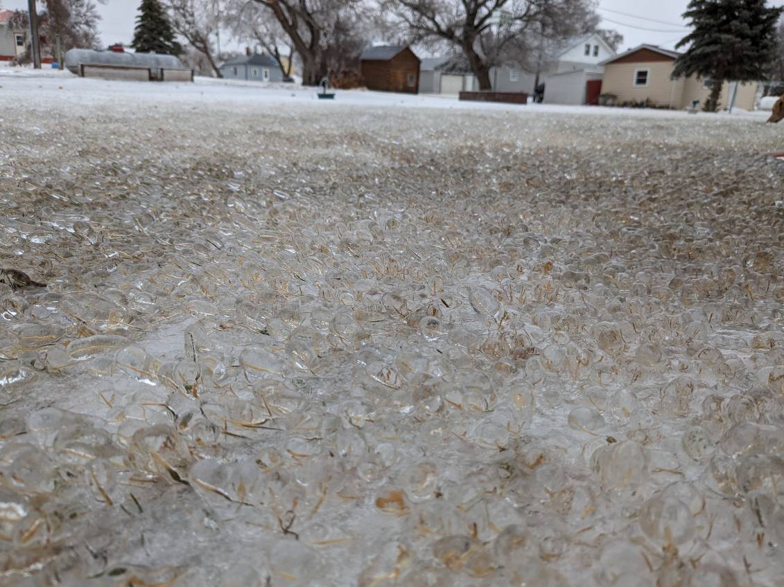
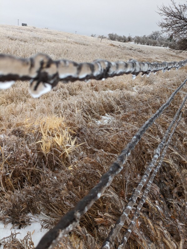
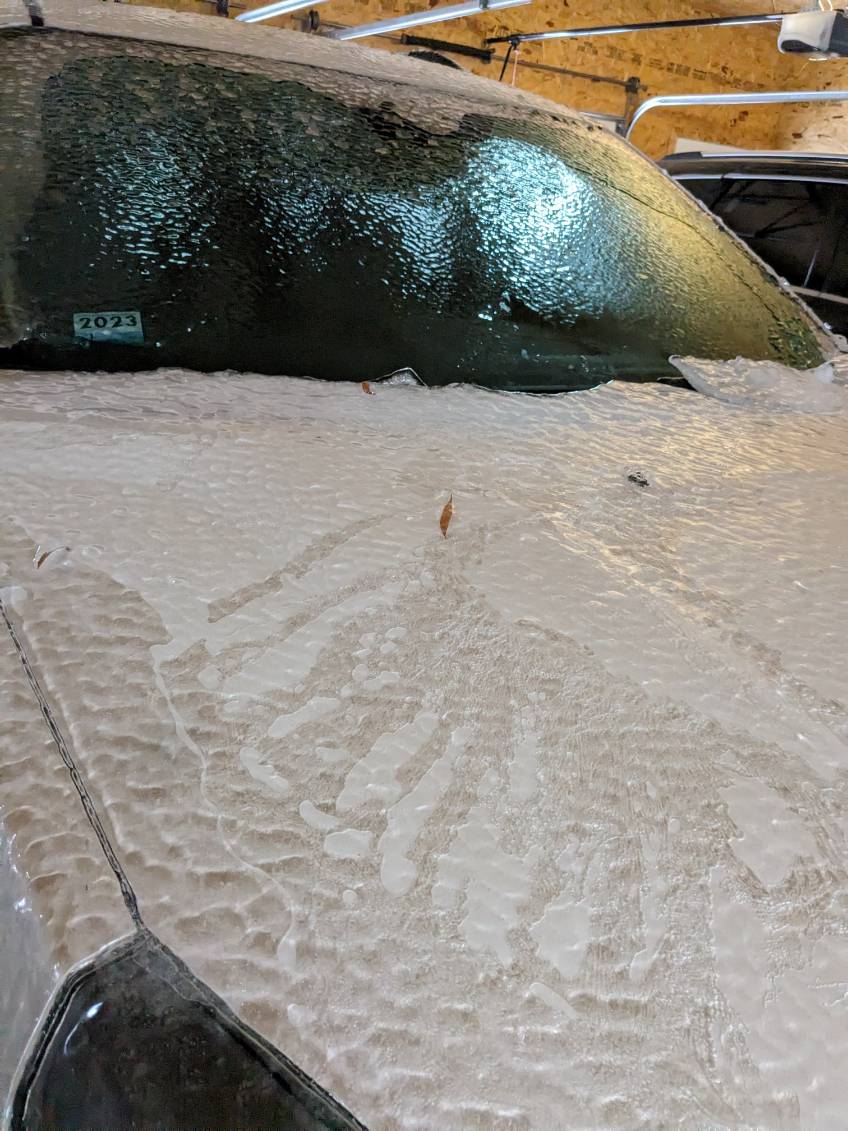
| Ice accumulation on grass in Eureka, SD (Photo by Kelly Serr) | Ice accumulation on a barbed wire fence near Eureka, SD (Photo by Kelly Serr) | Ice on a car in Eureka, SD (Photo by Kelly Serr) | Information on the I-90 closure on December 25, 2023 (SDDOT on Twitter) |
 |
 |
 |
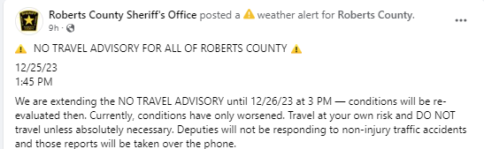 |
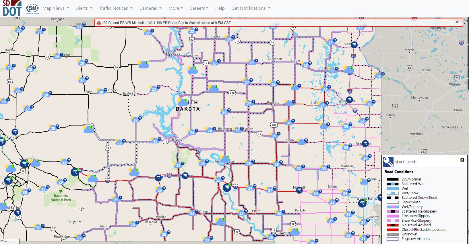
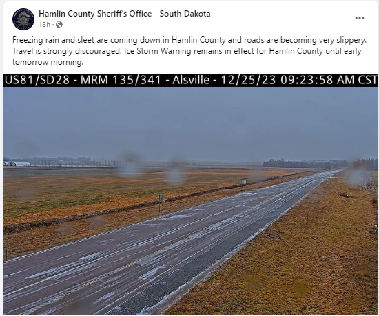
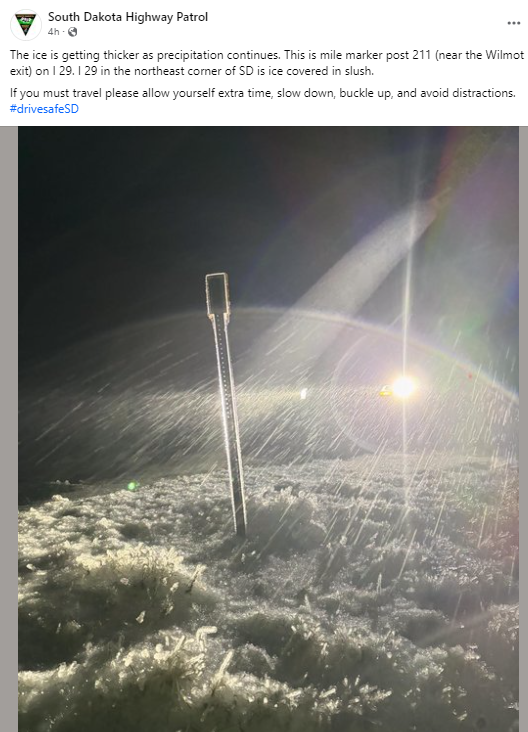
| SDDOT Road Conditions at 6pm on December 25, 2023 (via SD511.org) | Freezing rain and sleet report in Hamlin County South Dakota during the morning of December 25, 2023 (Via Hamlin County Sheriff's Office) | Ice accumulation on a mile marker along I-29 near Wilmot exit on the evening of December 25th, 2023.(via SD Highway Patrol) | No Travel Advised for Roberts county at 1:45pm on December 25, 2023 (Via Roberts County Sheriff's Office) |
 |
 |
 |
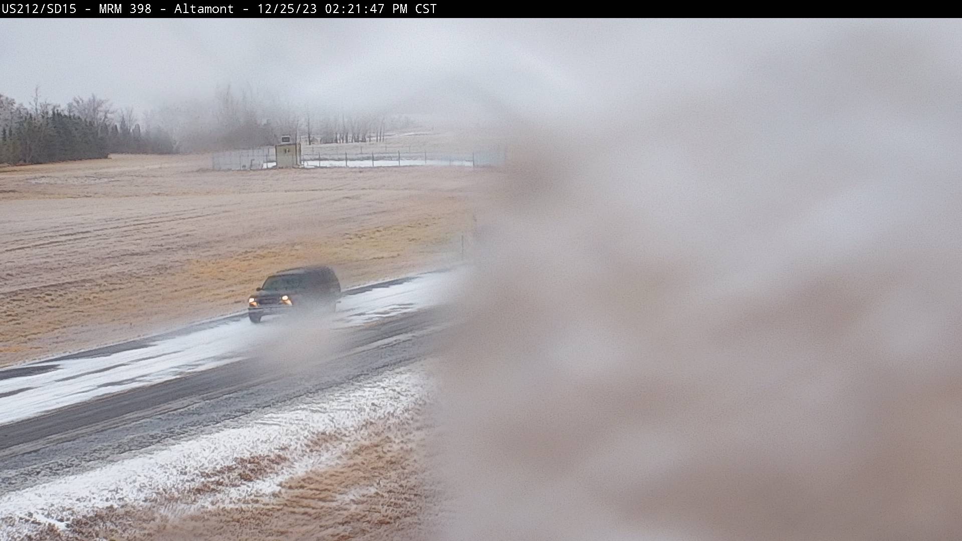 |
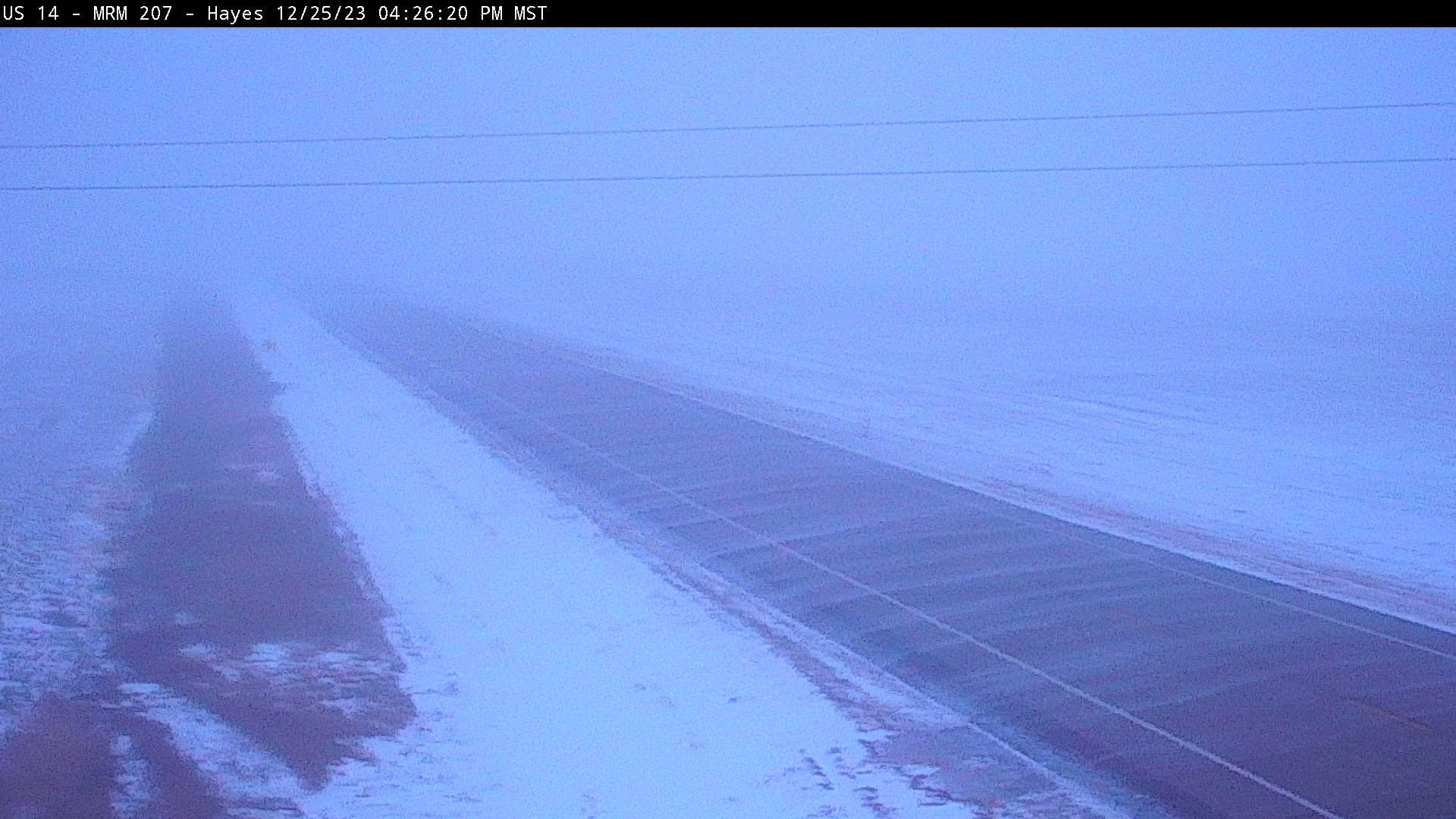
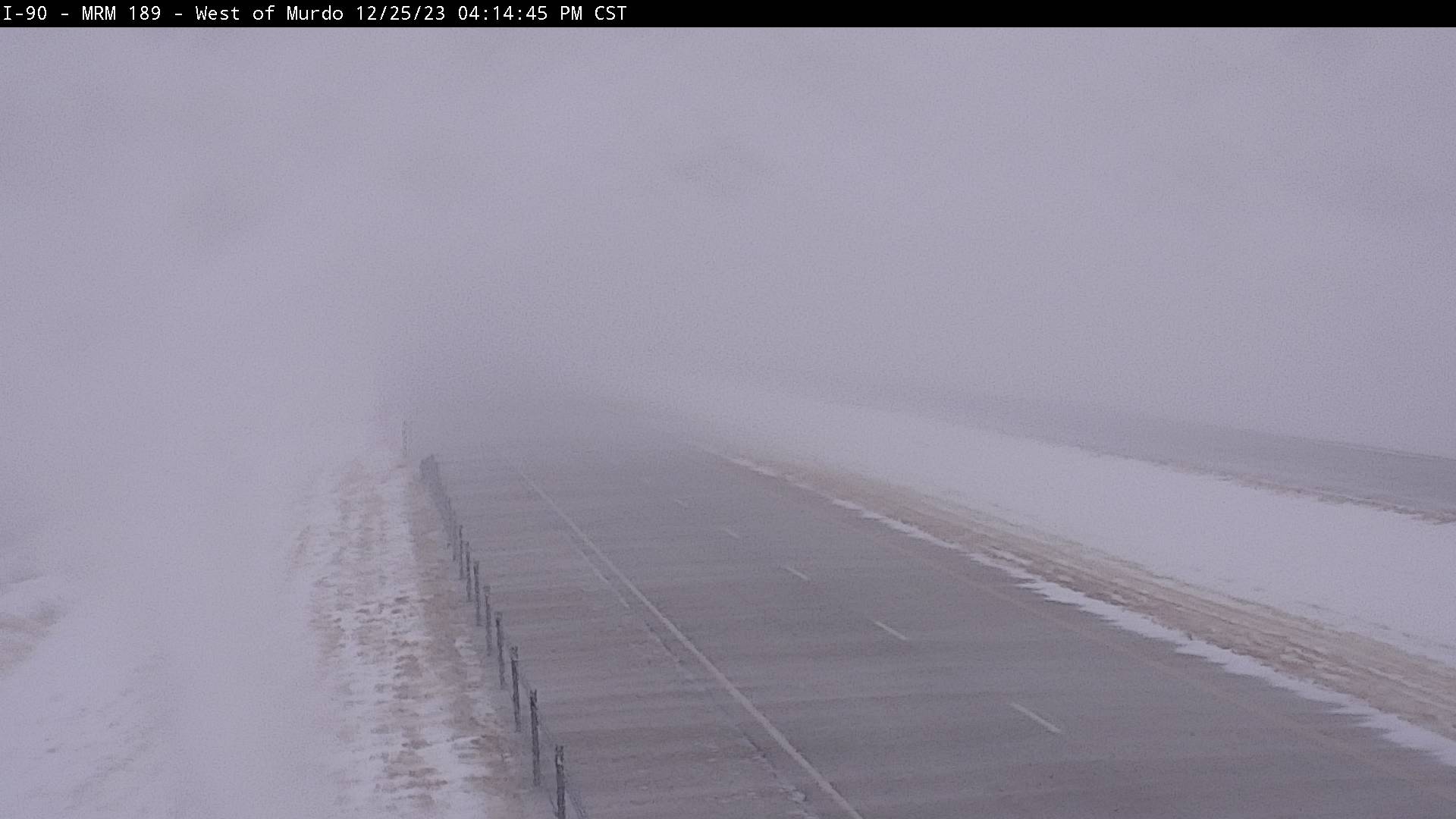
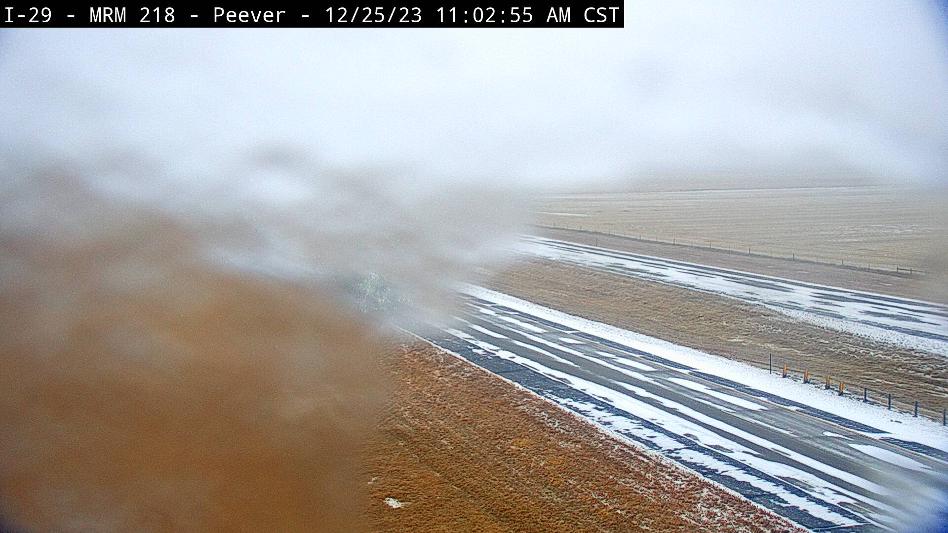
| Falling snow and drifting snow across the road between Hayes and Pierre, SD at 5:26pm MST on December 25, 2023 (via SDDOT) | Blizzard conditions at Murdo, SD on I-90 at 4:14pm CST on December 25, 2023 (via SDDOT) | Ice on the webcam on I-29 near Peever, SD at 11:02am CST on December 25, 2023 (via SDDOT) | Ice on the webcam on US-212 near Altamont, SD at 2:21pm CST on December 25, 2023 (via SDDOT) |
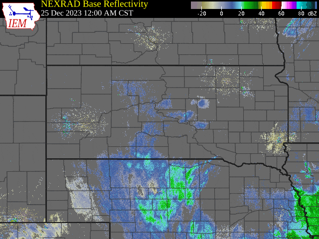
Radar
South Dakota Radar Loop from Midnight on December 25th to noon on December 27th, 2023 (Images courtesy of Iowa Environmental Mesonet)
The loop below was the forecasted precipitation type for this event, that was issued around mid day on December 25, 2023. The forecast matches the general trends in the precipitation types as the storm moved through the region.
1:17pm 12/25/2023: And here's the latest timing on the transition from snow to sleet, freezing rain, and rain as warmer air moves into eastern SD through the afternoon and into tonight. #SDwx pic.twitter.com/1ClxaNV20S
— NWS Aberdeen (@NWSAberdeen) December 25, 2023
Rain Reports
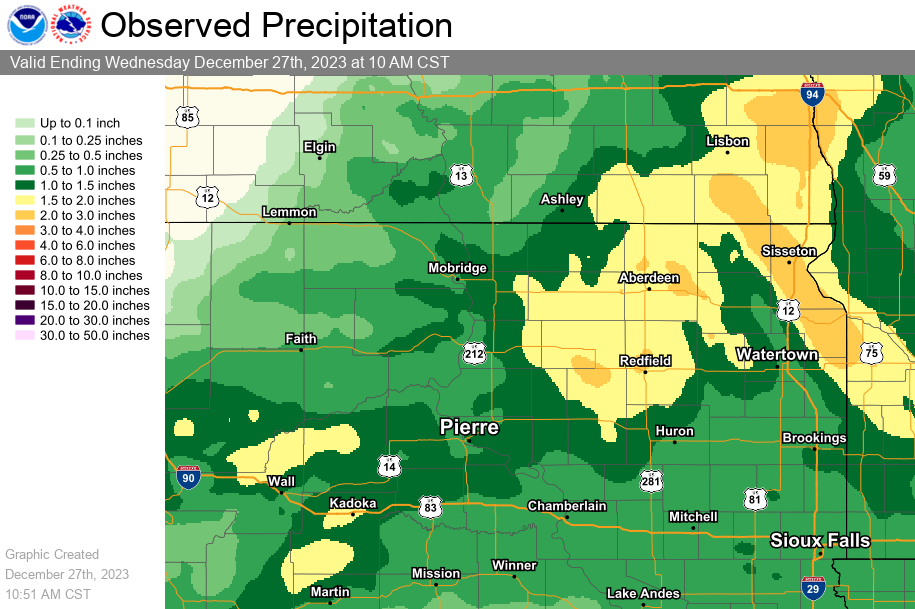
Precipitation reports included below include liquid equivalent totals (rain and melted snow/sleet/freezing rain) exceeding 0.5" and for the two days ending during the morning of Dec 27, 2023.
...2 DAY PRECIPITATION REPORTS ENDING THE MORNING OF 12/27...

Location                     Amount    Time/Date       Provider
LaBolt                       2.82 in   0800 AM 12/27   COCORAHS
Milbank                      2.68 in   0730 AM 12/27   COOP
Browns Valley 6 N            2.53 in   0700 AM 12/27   COCORAHS
2 E Sisseton                 2.44 in   0956 AM 12/27   AWOS
Hayes 6 E                    2.42 in   0600 AM 12/27   UCOOP
Sisseton 3 W                 2.27 in   0700 AM 12/27   COCORAHS
Westport 2 NW                2.15 in   0700 AM 12/27   COOP
8.3 SE Forbes                2.00 in   1030 AM 12/27   UCOOP
Faulkton 1 NW                1.93 in   0800 AM 12/27   COOP
Aberdeen 1.0 NNE             1.73 in   0700 AM 12/27   COCORAHS
Aberdeen 1 SSW               1.57 in   0700 AM 12/27   COCORAHS
Aberdeen 3 E                 1.54 in   0600 AM 12/27   COOP
Big Stone City 1 W           1.50 in   0945 AM 12/27   HADS
Eureka 11 WSW                1.48 in   0700 AM 12/27   COCORAHS
Chelsea 3.8 W                1.43 in   0700 AM 12/27   COCORAHS
Doland 2 S                   1.28 in   0800 AM 12/27   UCOOP
Odessa 1 W                   1.18 in   0951 AM 12/27   RAWS
Fort Pierre 0.5 SE           1.18 in   0700 AM 12/27   COCORAHS
NATURE CONSERVNCY ABERDEEN 3 1.16 in   1005 AM 12/27   HADS
Pierre                       1.15 in   0645 AM 12/27   UCOOP
Clark                        1.11 in   0600 AM 12/27   COOP
Aberdeen Rgnl AP             1.10 in   0953 AM 12/27   ASOS
Harrold 4 ESE                1.09 in   0800 AM 12/27   COCORAHS
Wheaton 7 NE                 1.06 in   1000 AM 12/27   HADS
Claremont 2 SSE              1.05 in   0700 AM 12/27   COCORAHS
Pierre 1 S                   1.01 in   0700 AM 12/27   COCORAHS
Vivian 7 NNE                 1.00 in   0700 AM 12/27   COCORAHS
7NE Milbank (SDDOT)          0.90 in   1038 AM 12/27   SDDOT
Groton 9 NNE (SD Mesonet)    0.83 in   1035 AM 12/27   SDSMESO
Hayti 1 W                    0.83 in   0800 AM 12/27   COOP
Bowdle (SD Mesonet)          0.80 in   1035 AM 12/27   SDSMESO
Britton                      0.79 in   0700 AM 12/27   COOP
Lake Cochrane (SD Mesonet)   0.79 in   0900 AM 12/27   SDSMESO
Holabird 8.5 N               0.79 in   0700 AM 12/27   COCORAHS
Webster                      0.79 in   0800 AM 12/27   COOP
Murdo                        0.76 in   0900 AM 12/27   COOP
Mound City 4 SW (SD Mesonet) 0.75 in   1035 AM 12/27   SDSMESO
3 W Henry                    0.74 in   0700 AM 12/27   COCORAHS
2 W Thomas                   0.70 in   1035 AM 12/27   AWS
Aberdeen 9 NW                0.70 in   1030 AM 12/27   CWOP
Wheaton 7 SW                 0.70 in   1000 AM 12/27   HADS
Watertown 2.3 E              0.68 in   0800 AM 12/27   COCORAHS
Leola (SD Mesonet)           0.67 in   1035 AM 12/27   SDSMESO
Summit (SDDOT)               0.63 in   1038 AM 12/27   SDDOT
4N Altamont (SDDOT)          0.59 in   1038 AM 12/27   SDDOT
Redfield (SD Mesonet)        0.57 in   1035 AM 12/27   SDSMESO
Faulkton (SD Mesonet)        0.55 in   1035 AM 12/27   SDSMESO
Aberdeen 6 NW                0.52 in   0945 AM 12/27   UCOOP
Revillo                      0.51 in   1030 AM 12/27   CWOP
Ashton 1 NE                  0.50 in   0845 AM 12/27   COOP

Observations are collected from a variety of sources with varying
equipment and exposures. We thank all volunteer weather observers
for their dedication. Not all data listed are considered official.
 |
Media use of NWS Web News Stories is encouraged! Please acknowledge the NWS as the source of any news information accessed from this site. |
|

