
Wildfire smoke continues to impact air quality from the Great Lakes region into New England and the Mid-Atlantic today with widespread Air Quality Alerts in effect. Severe thunderstorms are expected across portions of the Ohio Valley and Lower Great Lakes into the Mid-Atlantic and Northeast, this afternoon into the evening. Monsoonal thunderstorms may bring areas of flooding to the Southwest. Read More >
Overview
|
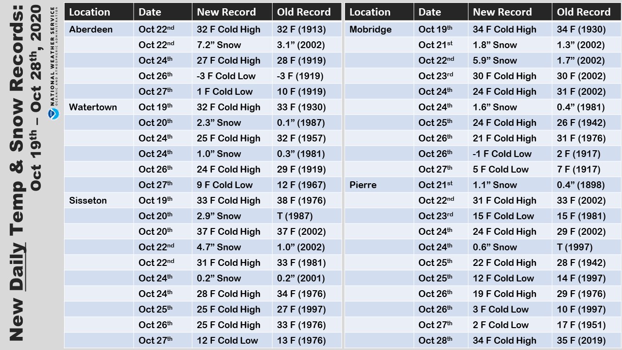
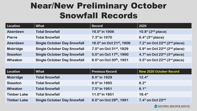
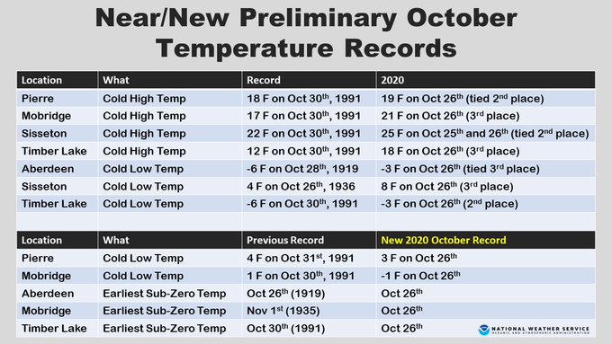
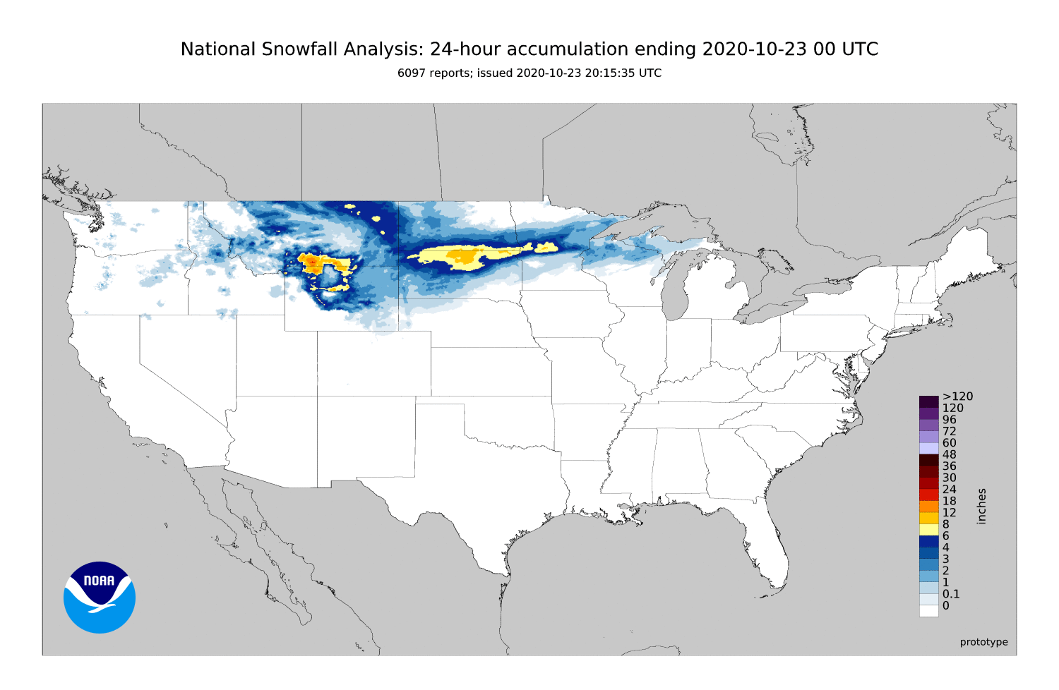
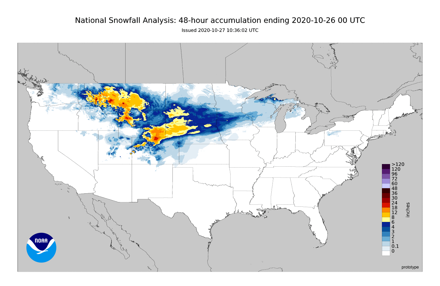
Three mid-October winter storms impacted the region from Oct 19th through the 25th. Record cold accompanied this activity as well. The first system began late Monday night, October 19, through the day Tuesday, October 20. This system brought both heavy snow, rain and mixed precipitation to parts of the region. The heaviest snow fell over northeast South Dakota and west central Minnesota where several locations reported over 6 inches. The second system developed late Wednesday night, October 21, through Thursday, October 22. This system brought heavy snow to parts of north central and northeast South Dakota, with a few locations reporting 12 or more inches. The third system impacted much of central and east central South Dakota from Saturday, October 24th through the beginning of Sunday, October 25th. Up to a foot of snow fell across portions of central South Dakota, with enough wind for some drifting as well. It is rare to see this much snow so early in the season. Some locations even broke October snowfall total records. A number of cold low and high temperature records were set as well from the 19th through the 27th.
|
Above: List of daily temperature and snow records Oct 19th - Oct 27. Below: Preliminary monthly records/near records for snow and temps.
|
Photos & Video
October 19-20, 2020
 |
 |
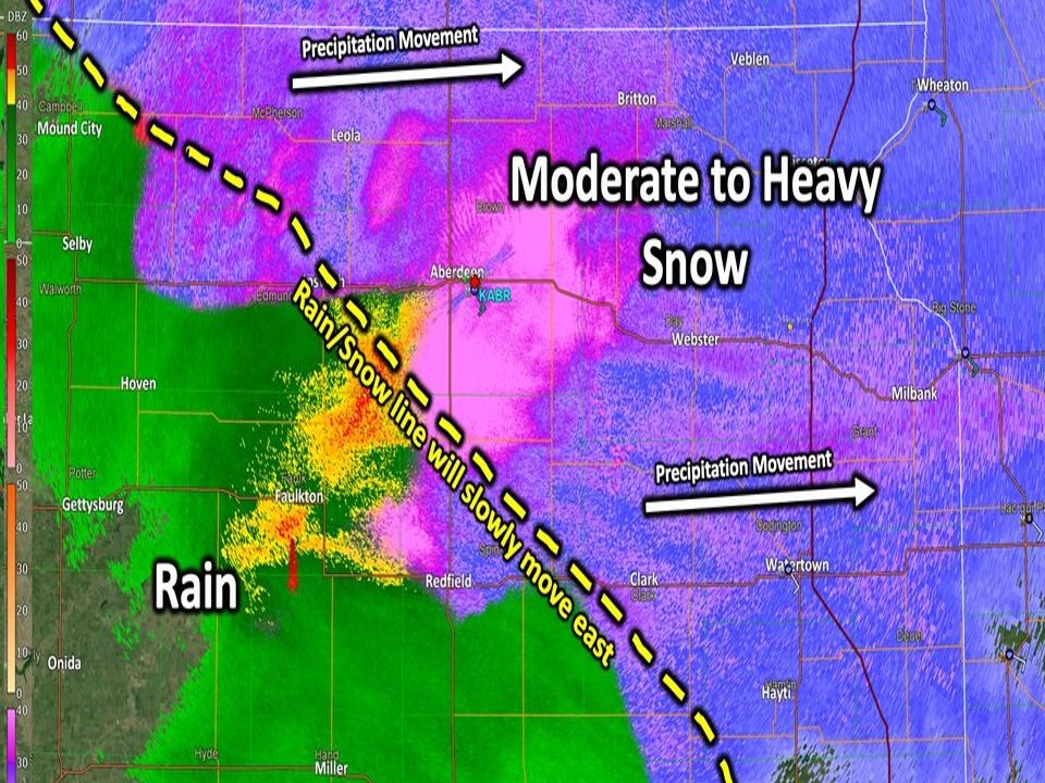
| Mixed Precip Donated on Radar Imagery 10 AM Tuesday |
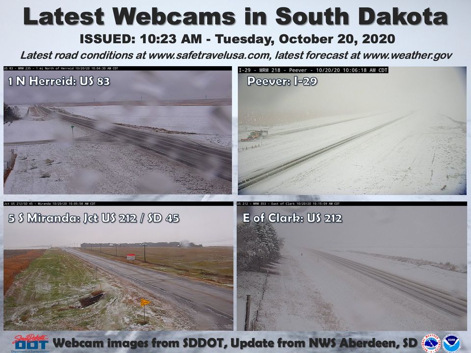
Webcam Images Tuesday Morning South Dakota Department of Transportation |
October 21-22, 2020
| Radar Loop 7 pm, Wednesday, October 21 through 7 am, Thursday, October 22 |
Radar Loop 7 am through 7 pm, Thursday, October 22 |
 |
 |
 |
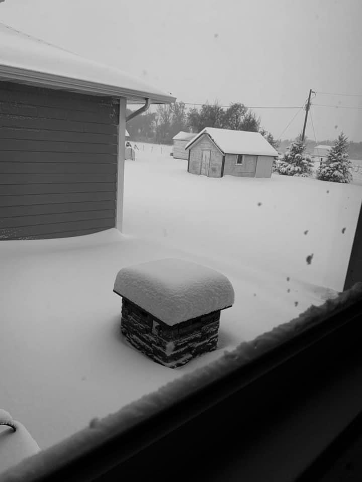 |
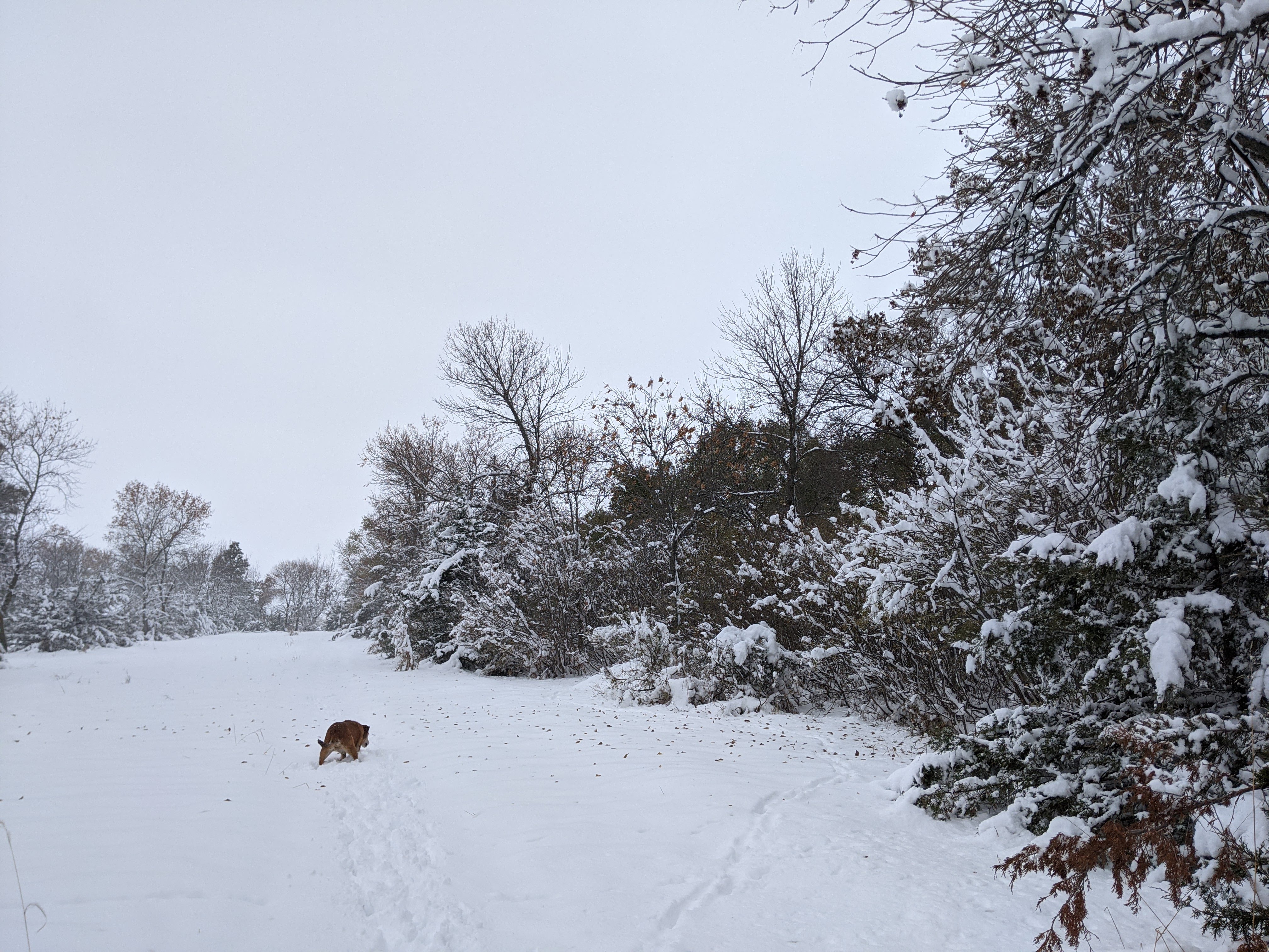
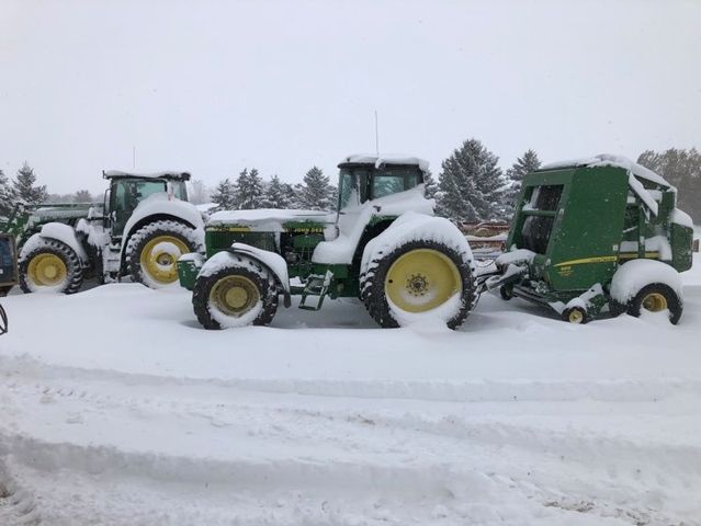
| 17 NNW Aberdeen, SD Photo Credit: Kelly Serr |
5 Miles NWS of Leola, SD Photo Credit: Colin Hofman |
5 Miles NWS of Leola, SD Photo Credit: Colin Hofman |
Near Eureka, SD Photo Credit: Patty Haupt |
 |
 |
||
| Snow accumulations by 1045 am on the 22nd in Pierre. Photo Credit: Anthony Lueck |
Tree limb damage in Pierre. Photo Credit: Anthony Lueck |
October 24-25, 2020
 |
 |
|
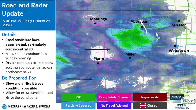
| Road conditions and radar on the evening of the 24th |
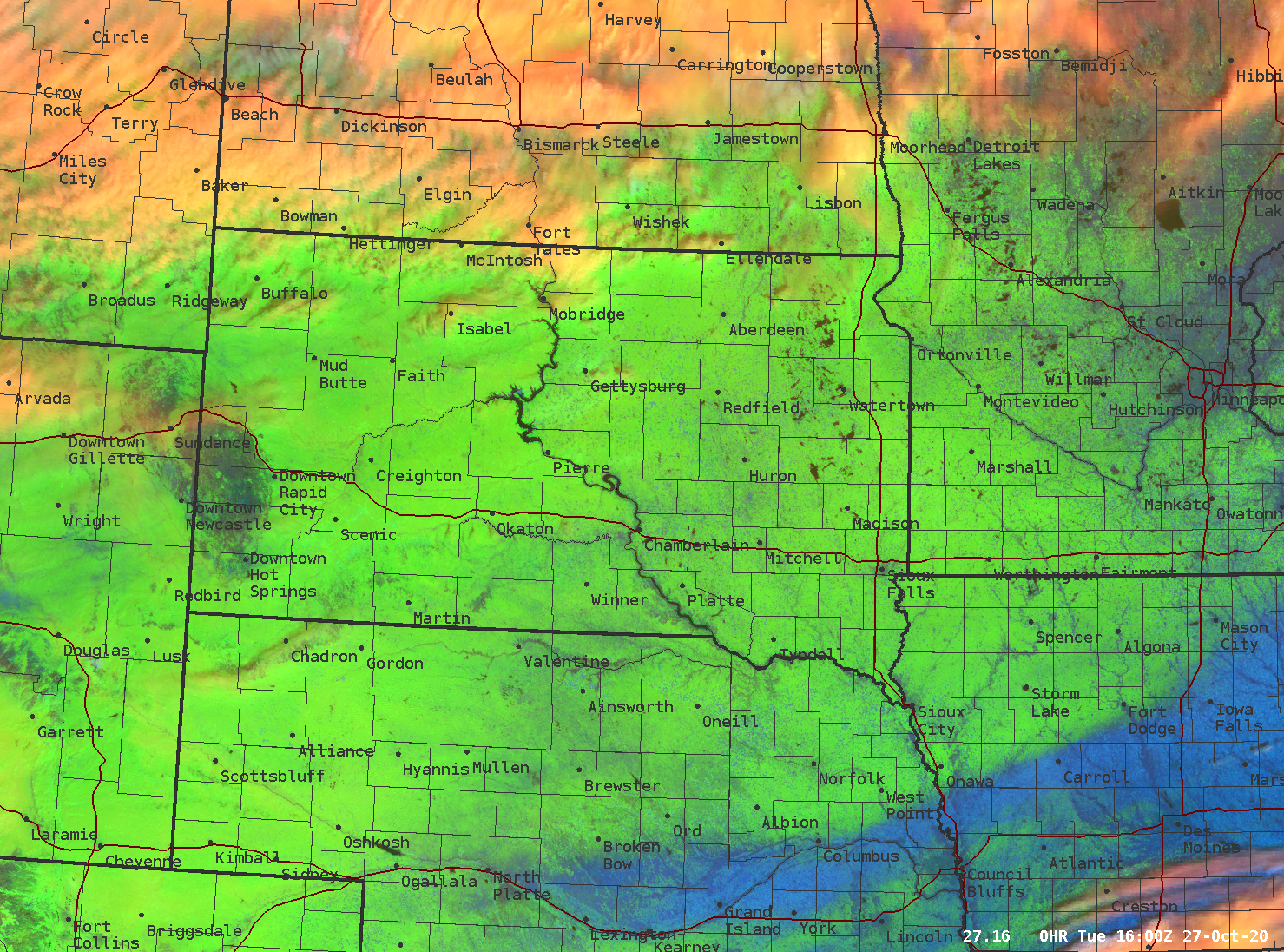
GOES-16 Satellite Imagery at 11am on October 27th. Green represents snow cover, orange is cloud cover, and blue is bare ground. |
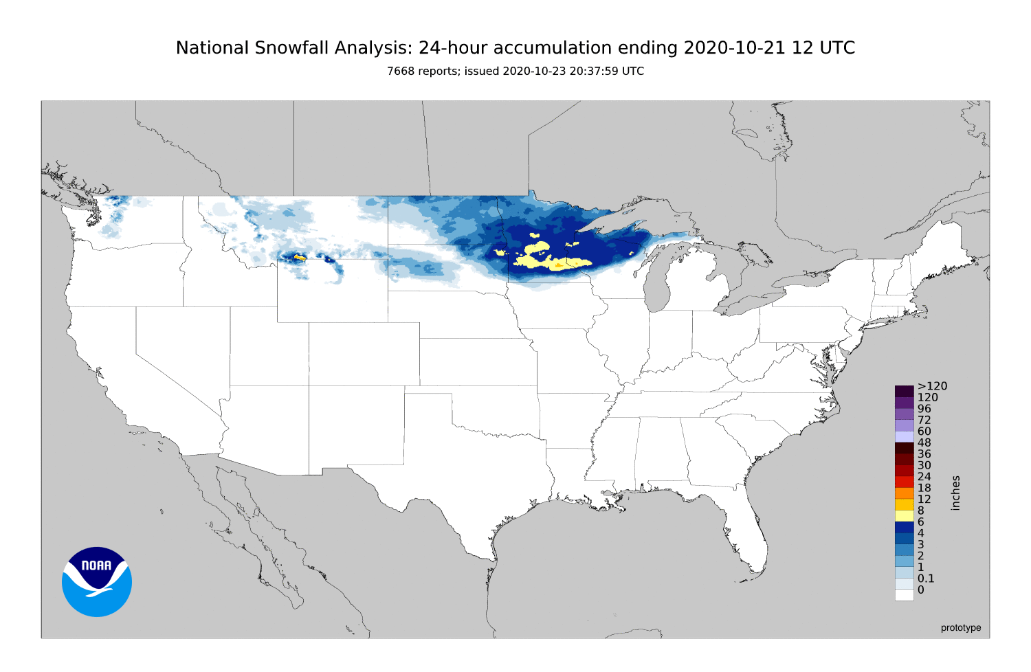
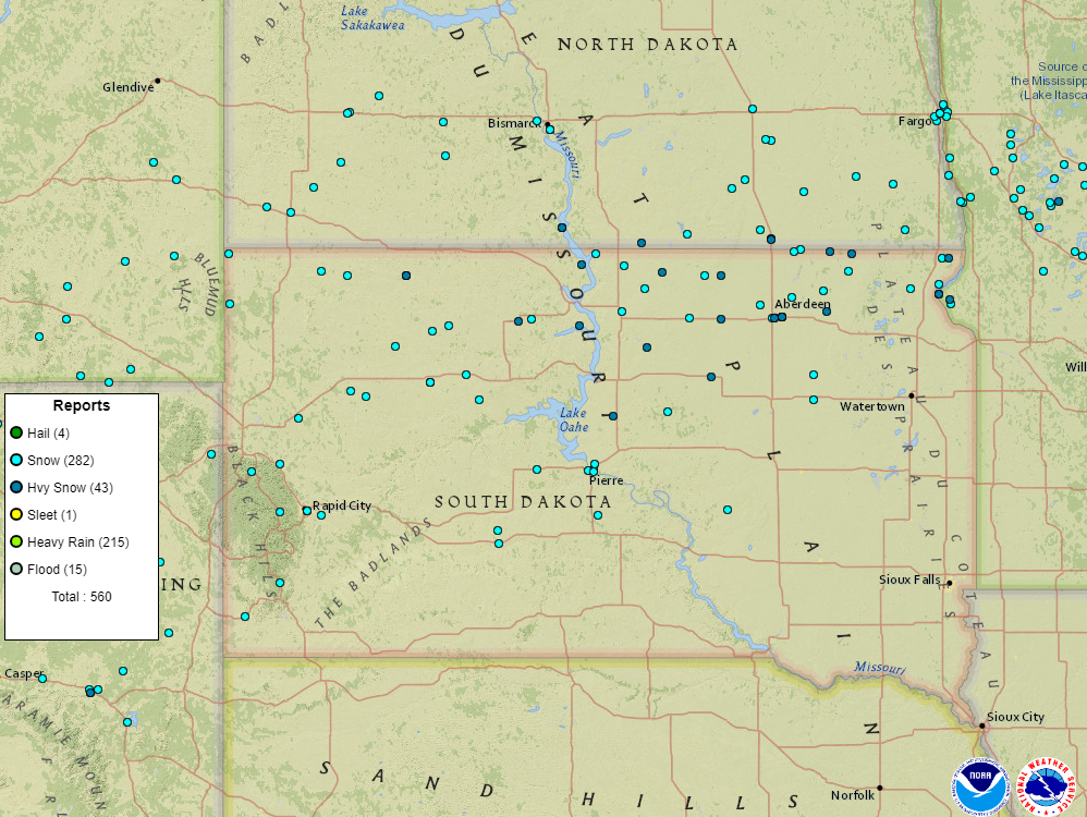
October 19-21, 2020 Storm Reports
|
|
October 21-22, 2020 Storm Reports
|
|
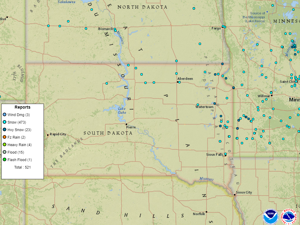
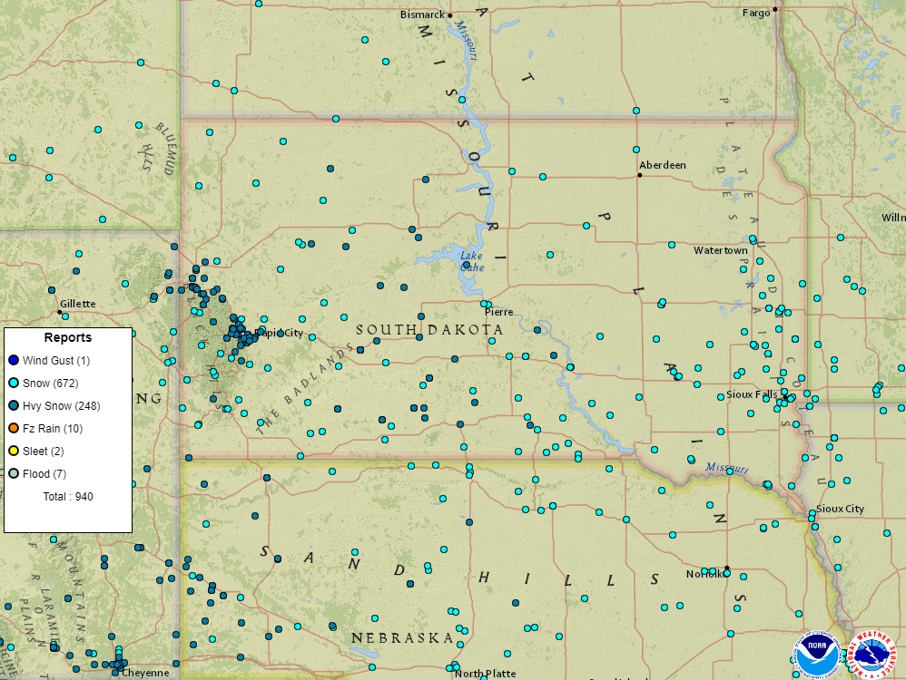
October 24-25, 2020 Storm Reports
|
|
 |
Media use of NWS Web News Stories is encouraged! Please acknowledge the NWS as the source of any news information accessed from this site. |
|


 ​
​ ​
​ ​
​ ​
​ ​
​ ​
​