Overview
|
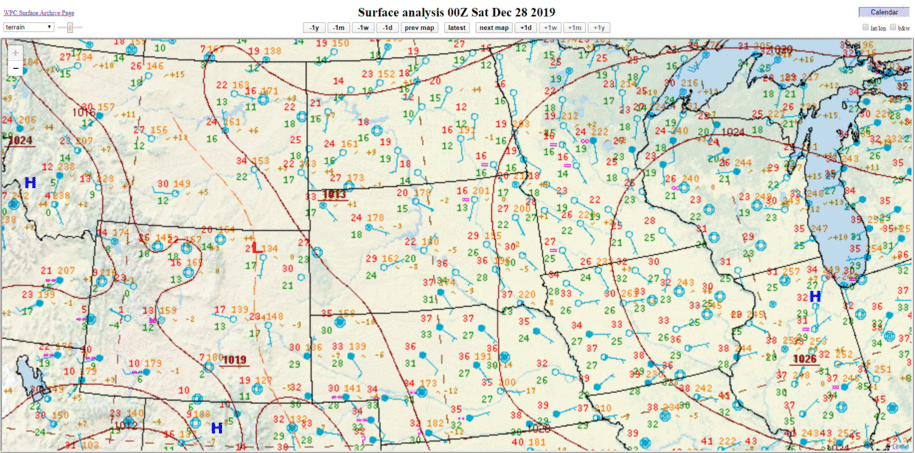
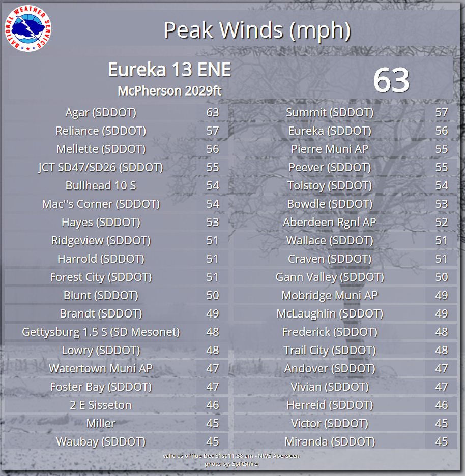
A strong winter storm created numerous impacts across eastern South Dakota and west central Minnesota on December 28-29, 2019. The heaviest precipitation came in two waves, with the first arriving on during the late evening of December 27th and continuing into December 28th. Behind the first wave of precipitation, there was a period of light snow, drizzle, and freezing drizzle on Saturday for areas of east central South Dakota and west central Minnesota. The second wave of precipitation arrived on the evening of December 28th and continued into December 29th. This second wave of precipitation fell as snow, and when combined with the first wave of snowfall, led to many locations experiencing over 10 inches of snow. In addition to the snow, strong winds developed on December 29th as an intensifying area of low pressure moved into the southern half of Minnesota. This led to wind gusts up to 62 mph in central South Dakota and blizzard conditions between the Missouri River and the western edge of the Prairie Coteau. The combination of the snow and blowing snow severely impacted road conditions and travel across the region, with "No Travel Advised" designated for many state and county roads and even the closure of I-90 and I-29 in parts of South Dakota. |
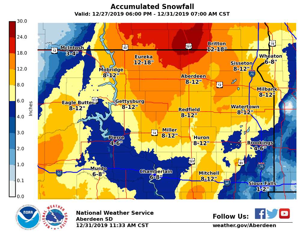 Storm total snowfall amounts from late on December 27th through the morning of December 31st, 2019. Amounts based off observations and local storm reports through 10 AM 12/31/2019. |
Photos & Video
 |
 |
 |
 |
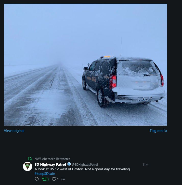
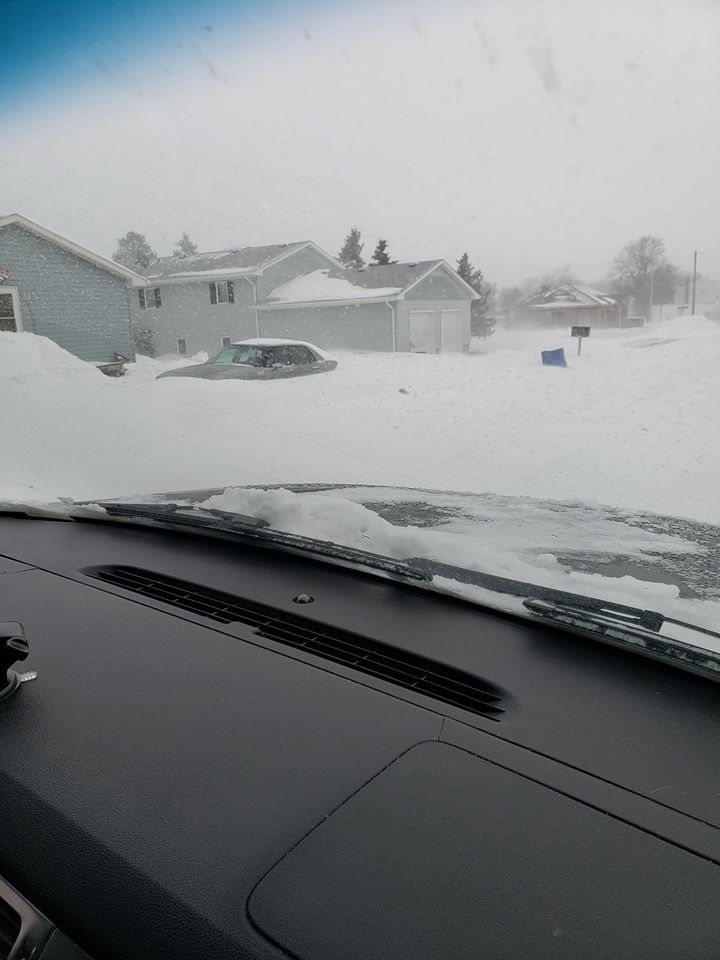
| US-12 West of Groton, SD on December 29, 2019 (SD Highway Patrol) |
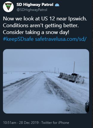
Poor travel conditions near Ipswich, SD on the morning of December 28, 2019 (SD Highway Patrol) |
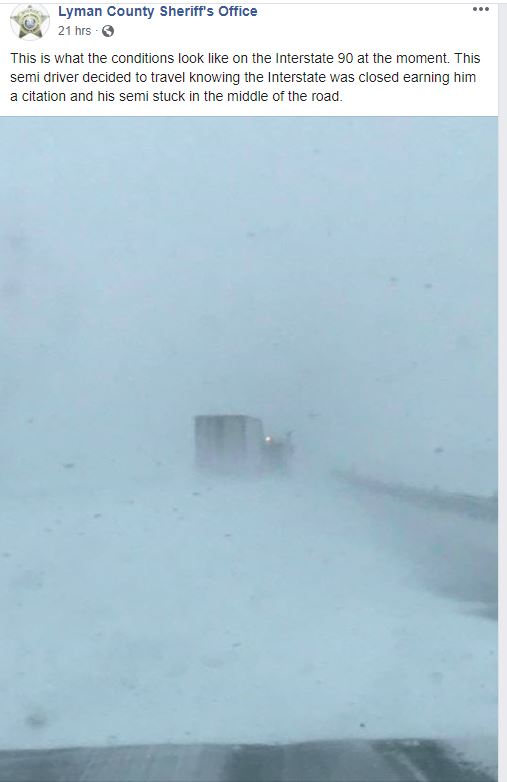
Semi stuck on a closed I-90 on December 29, 2019 (Lyman County Sheriff's Office) |
Road conditions across SD around midnight on December 29, 2019. Roads in red were either closed or "No Travel Advised". (SD DOT) |
 |
 |
 |
 |
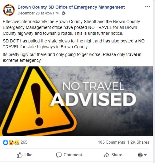
| Brown County, SD - No Travel Advised starting at 4:56 PM on Dec 28, 2019 (Brown County SD EM) |
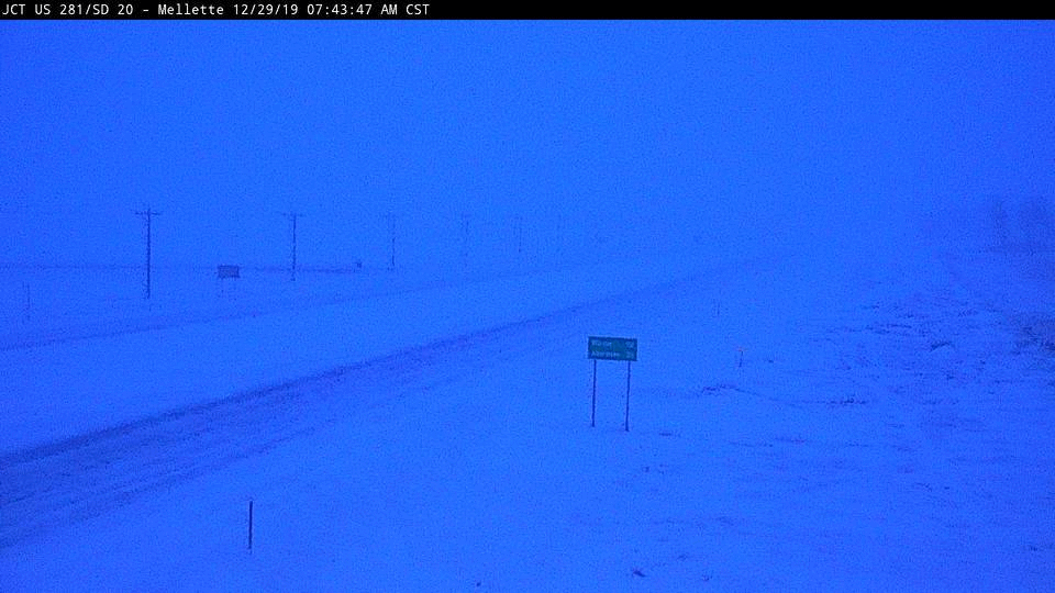
Webcam looking north on US-281 at Mellette, SD during the day on Dec 29, 2019 and highlighting blizzard conditions. (SD DOT) |
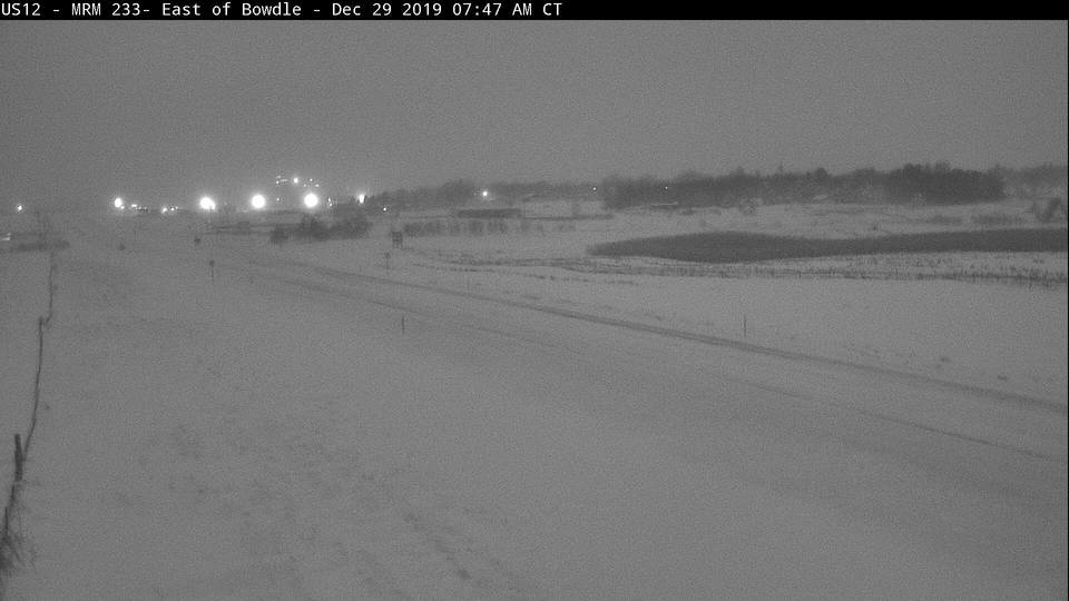
Webcam looking west on US-12 towards Bowdle, SD on December 29, 2019. Blizzard conditions develop around noon as a stronger band of snow moves in. (SD DOT) |
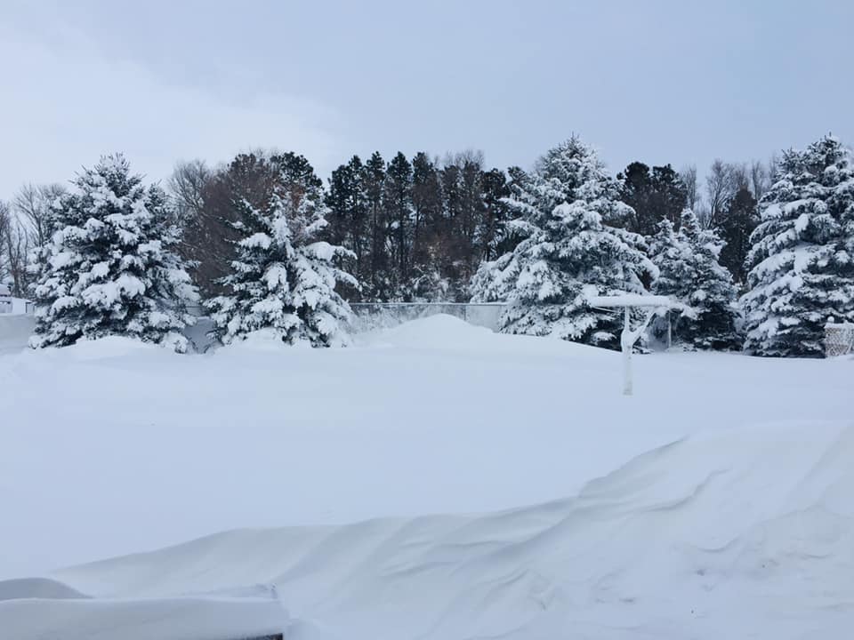
Deep snow in Gettysburg, SD. (Photo courtesy of Pamela Warner) |
 |
 |
 |
 |
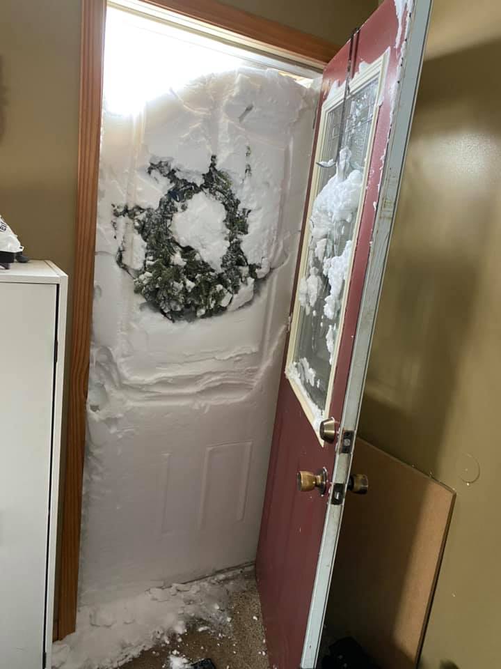
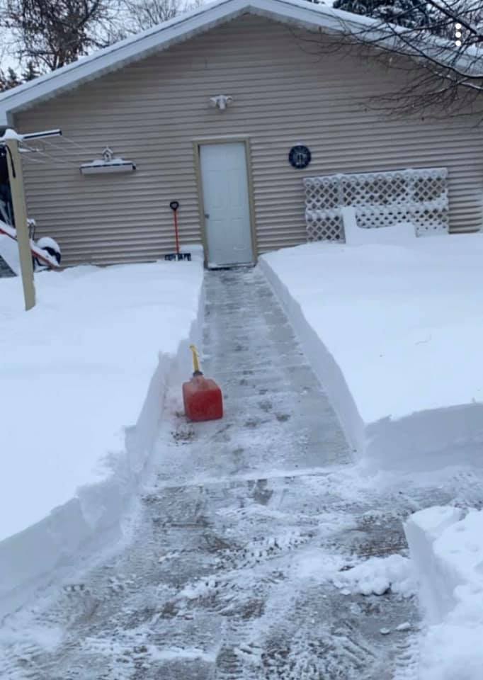
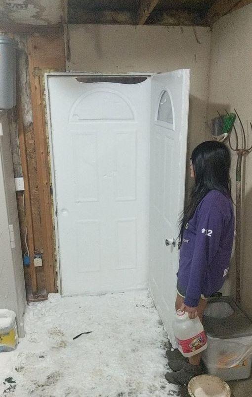
| Snow built up against a door in Ipswich, SD on the morning of December 29th. (Photo courtesy of Tracy Fries Loken) |
Deep snow in N. Eagle Butte, SD. (Photo courtesy of Mj Lamb) |
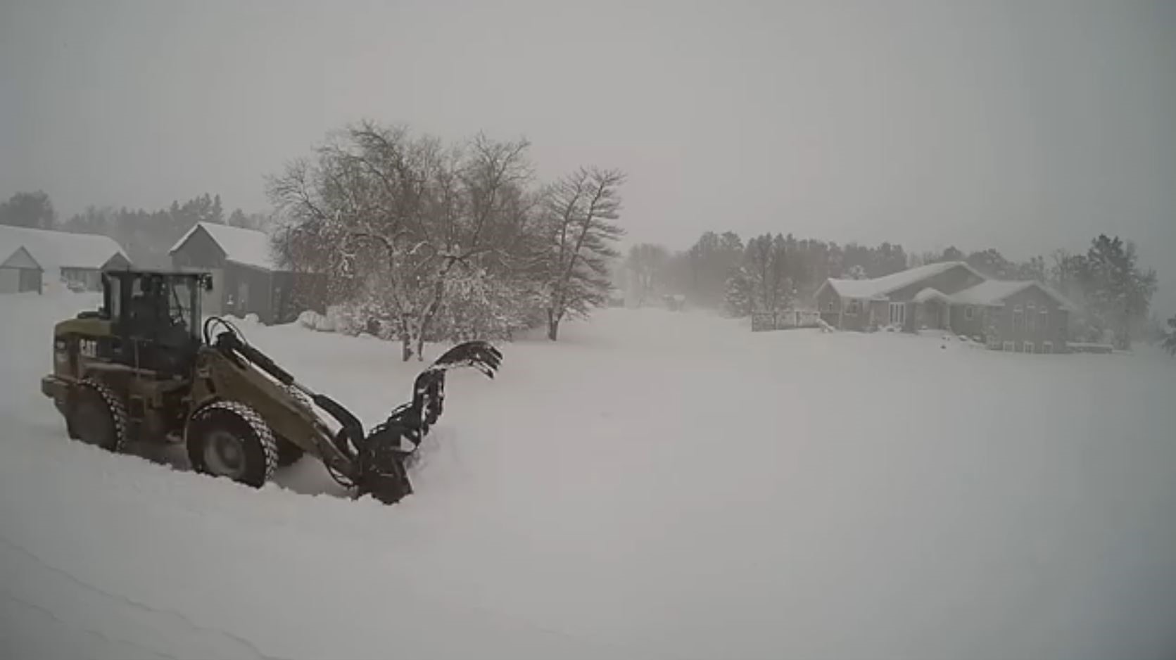
Front end loader moving snow 9N of Hoven, SD. (Photo courtesy of Angela Bieber) |
Deep snow drifts 9N of Hoven, SD. (Photo courtesy of Angela Bieber) |
 |
 |
 |
| Snow in Watertown after the storm.. (Photo courtesy of Abby Byer) |
Deep snow 9N of Hoven, SD. (Photo courtesy of Angela Bieber) |
Snow packed up against a door in Blunt, SD. (Photo courtesy of Dannale Norris) |
Radar and Observations
 |
 |
|
| Loop of the Surface Pressure from December 28-30th, 2019 | Radar loop during the event. Precipitation type is estimated and doesn't represent the exact precipitation type. | Peak wind gusts on December 29, 2019. |
Storm Reports
...SNOWFALL REPORTS...

Location                     Amount    Time/Date       Lat/Lon
Webster                      18.0 in   1100 PM 12/29   45.34N/97.52W
Herreid 3 ESE                18.0 in   0700 AM 12/30   45.82N/100.01W
Roscoe                       16.5 in   0700 AM 12/30   45.45N/99.33W
1 SSE Roy Lake State Park    15.0 in   1251 PM 12/30   45.69N/97.42W
7 NE Roscoe                  15.0 in   1200 PM 12/30   45.52N/99.23W
Hayes                        14.0 in   0700 AM 12/29   44.37N/101.02W
Gettysburg                   14.0 in   0750 PM 12/29   45.01N/99.95W
4 SE Highmore                14.0 in   1030 PM 12/29   44.48N/99.38W
Loyalton                     14.0 in   1050 PM 12/29   45.29N/99.28W
Eureka 11 WSW                13.6 in   0700 AM 12/30   45.66N/99.80W
6 ESE Sutton Bay Rec Area    13.0 in   0856 PM 12/29   44.84N/100.26W
Andover                      12.2 in   1200 PM 12/30   45.41N/97.91W
Clark                        12.2 in   0600 AM 12/30   44.88N/97.74W
Hoven                        12.0 in   0815 PM 12/29   45.24N/99.78W
7 ESE Long Lake              12.0 in   0400 PM 12/28   45.81N/99.07W
Britton                      12.0 in   0700 AM 12/30   45.78N/97.75W
Onaka                        12.0 in   1045 PM 12/29   45.19N/99.46W
4 N Cresbard                 12.0 in   0805 PM 12/29   45.23N/98.95W
4 S Garden City              12.0 in   0310 PM 12/30   44.90N/97.58W
LaBolt                       11.8 in   0700 AM 12/30   45.05N/96.68W
Browns Valley 6 N            11.5 in   0700 AM 12/30   45.69N/96.83W
Milbank                      11.3 in   0730 AM 12/30   45.22N/96.63W
4 SE Indian Creek Rec Area   11.0 in   0815 PM 12/29   45.48N/100.32W
2 W Doland                   11.0 in   0800 PM 12/29   44.89N/98.14W
Cresbard                     11.0 in   0800 PM 12/29   45.17N/98.95W
Roscoe                       11.0 in   0700 AM 12/29   45.45N/99.34W
Watertown 2 E                11.0 in   1000 AM 12/30   44.91N/97.11W
Clark                        11.0 in   0815 PM 12/29   44.88N/97.73W
Aberdeen 1 SSW               10.9 in   0700 AM 12/30   45.45N/98.49W
Claremont 2 SSE              10.7 in   0700 AM 12/30   45.64N/98.00W
Selby                        10.5 in   0700 AM 12/30   45.50N/100.03W
Sisseton 3 W                 10.1 in   0700 AM 12/30   45.66N/97.12W
Eureka 11 WSW                10.1 in   0700 AM 12/29   45.66N/99.80W
3 ESE Aberdeen               10.1 in   1200 PM 12/30   45.46N/98.41W
6 SSW Lowry                  10.0 in   0800 PM 12/29   45.24N/100.04W
6 NNW Plainview Colony       10.0 in   1020 PM 12/28   45.66N/99.04W
2.7 E Watertown              10.0 in   0900 AM 12/30   44.90N/97.11W
1 SE Crocker                 10.0 in   0830 PM 12/29   45.09N/97.76W
Herreid                      10.0 in   0850 PM 12/29   45.84N/100.08W
Herreid 3 ESE                10.0 in   0700 AM 12/29   45.82N/100.01W
Browns Valley                10.0 in   0630 AM 12/30   45.62N/96.83W
Aberdeen 3 E                 9.8 in    0600 AM 12/30   45.46N/98.41W
Watertown 2.3 E              9.6 in    0700 AM 12/30   44.92N/97.12W
3 ESE Aberdeen               9.6 in    1218 AM 12/30   45.46N/98.41W
Redfield                     9.5 in    0854 PM 12/29   44.87N/98.52W
Westport 2 NW                9.5 in    0712 AM 12/29   45.68N/98.53W
4 NW Onida                   9.0 in    0510 PM 12/28   44.75N/100.12W
2 E Conde                    9.0 in    0530 PM 12/29   45.16N/98.05W
Andover                      9.0 in    1200 PM 12/29   45.41N/97.91W
3 NW Henry                   9.0 in    0835 PM 12/29   44.91N/97.51W
3 NW Henry                   9.0 in    0830 PM 12/29   44.91N/97.51W
Pollock                      9.0 in    0940 PM 12/30   45.90N/100.29W
Doland 2 S                   8.8 in    0800 AM 12/30   44.87N/98.10W
Castlewood                   8.6 in    0600 AM 12/30   44.73N/97.03W
Selby                        8.5 in    0700 AM 12/29   45.50N/100.03W
2 W Milbank                  8.5 in    0645 PM 12/29   45.22N/96.68W
2 S Clear Lake               8.5 in    0900 AM 12/29   44.74N/96.68W
8 S Vayland                  8.3 in    0530 AM 12/30   44.38N/98.80W
Sisseton                     8.0 in    0500 PM 12/29   45.66N/97.05W
Wallace                      8.0 in    0500 PM 12/29   45.09N/97.48W
Watertown                    8.0 in    0230 PM 12/29   44.91N/97.17W
Watertown 2 E                8.0 in    1030 AM 12/29   44.91N/97.11W
Aberdeen 3 E                 8.0 in    1200 PM 12/29   45.46N/98.41W
Ortonville                   8.0 in    0153 PM 12/29   45.30N/96.44W
Willow Lake                  7.8 in    0745 PM 12/29   44.63N/97.64W
Clear Lake 7 ESE             7.6 in    0800 AM 12/29   44.73N/96.54W
Hayti 1 W                    7.4 in    0800 AM 12/30   44.66N/97.23W
11 SW Eureka                 7.1 in    0700 AM 12/29   45.66N/99.79W
7 E Okobojo Creek Rec Area   7.0 in    0830 PM 12/29   44.60N/100.32W
Britton                      7.0 in    0700 AM 12/29   45.78N/97.75W
Highmore                     7.0 in    1200 PM 12/29   44.52N/99.44W
Saint Lawrence               7.0 in    0925 PM 12/29   44.52N/98.94W
3 ESE Aberdeen               7.0 in    0554 AM 12/29   45.46N/98.41W
2 ESE Artichoke              7.0 in    0700 PM 12/29   45.39N/96.12W
Aberdeen 1 SSW               6.9 in    0700 AM 12/29   45.45N/98.49W
Timber Lake                  6.8 in    0600 PM 12/28   45.43N/101.07W
Claremont 2 SSE              6.7 in    0700 AM 12/29   45.64N/98.00W
Watertown 7.5 NNE            6.5 in    1130 AM 12/29   45.00N/97.09W
Castlewood                   6.1 in    0900 AM 12/29   44.73N/97.03W
2.7 E Watertown              6.1 in    0900 AM 12/29   44.90N/97.11W
Gann Valley 3 NNE            6.1 in    0715 AM 12/30   44.08N/98.97W
Browns Valley 6 N            6.0 in    0700 AM 12/29   45.69N/96.83W
2 W Milbank                  6.0 in    1200 PM 12/29   45.22N/96.68W
Pollock                      6.0 in    0700 PM 12/28   45.90N/100.29W
Sisseton 3 W                 5.7 in    0700 AM 12/29   45.66N/97.12W
Milbank                      5.3 in    0730 AM 12/29   45.22N/96.63W
Kennebec                     5.0 in    0600 PM 12/29   43.90N/99.86W
Mina                         5.0 in    0330 PM 12/28   45.44N/98.76W
Presho 0.3 SSW               4.9 in    0700 AM 12/30   43.90N/100.06W
Pierre 1 S                   4.7 in    0700 AM 12/30   44.35N/100.32W
Little Eagle                 4.5 in    0700 PM 12/28   45.68N/100.80W
Watertown 2.3 E              4.5 in    0700 AM 12/29   44.92N/97.12W
Wheaton                      4.4 in    0800 AM 12/29   45.80N/96.48W
Browns Valley                4.2 in    0645 AM 12/29   45.62N/96.83W
Fort Pierre 0.5 SE           4.0 in    0700 AM 12/30   44.36N/100.37W
Vivian 7 NNE                 4.0 in    0700 AM 12/30   44.04N/100.27W
Mclaughlin                   4.0 in    0445 PM 12/28   45.81N/100.81W
3 ESE Aberdeen               3.9 in    0600 PM 12/28   45.45N/98.43W
Faulkton                     3.5 in    0400 PM 12/28   45.03N/99.13W
Pierre 1 S                   3.2 in    0700 AM 12/29   44.35N/100.32W

Observations are collected from a variety of sources with varying
equipment and exposures. We thank all volunteer weather observers
for their dedication. Not all data listed are considered official.
Blizzard Reports
..TIME...   ...EVENT...      ...CITY LOCATION...     ...LAT.LON...
..DATE...   ....MAG....      ..COUNTY LOCATION..ST.. ...SOURCE....
            ..REMARKS..

1245 PM     Blizzard         4 ESE Akaska            45.31N 100.06W
12/29/2019                   Walworth           SD   Mesonet

            FROM LOWRY SD DOT RWIS AND WEBCAM. BLIZZARD
            CONDITIONS STARTED AT 1245 PM AND CONTINUED
            UNTIL 6 PM. GUSTS UP TO 48 MPH DURING THAT
            TIME.

0100 PM     Blizzard         2 S Gorman              44.90N 100.08W
12/29/2019                   Sully              SD   Mesonet

            FROM AGAR SD DOT RWIS AND WEBCAM. BLIZZARD
            STARTED AT 1 PM AND CONTINUED UNTIL 6 PM.
            GUSTS OF 50 to 60 MPH DURING THAT TIME.

0900 AM     Blizzard         1 WNW Mellette          45.16N 98.51W
12/29/2019                   Spink              SD   Mesonet

            FROM MELLETTE SD DOT RWIS AND WEBCAM.
            BLIZZARD CONDITIONS STARTED AT 9 AM AND
            CONTINUED UNTIL 9 PM. GUSTS OF 40 to 56 MPH
            DURING THAT TIME.

1245 PM     Blizzard         Tolstoy                 45.20N 99.61W
12/29/2019                   Potter             SD   Mesonet

            FROM TOLSTOY SD DOT RWIS and Webcam. Blizzard
            started at 1245 PM and continued until 11PM.
            Gusts of 40-50 mph during that time.

1000 AM     Blizzard         10 SW Long Lake         45.77N 99.37W
12/29/2019                   McPherson          SD   Mesonet

            FROM EUREKA 13E SD DOT RWIS AND WEBCAM.
            BLIZZARD CONDITIONS STARTED AT 10 AM AND
            CONTINUED UNTIL 11 PM. GUSTS OF 40 to 56 MPH
            DURING THAT TIME.

1230 PM     Blizzard         Roy Lake State Park     45.71N 97.44W
12/29/2019                   Marshall           SD   CO-OP Observer

            COOP Observer reported visibilities below a
            quarter of a mile between 12:30 PM and 5 PM.

1200 PM     Blizzard         17 W Polo               44.78N 99.45W
12/29/2019                   Hyde               SD   Mesonet

            FROM JCT SD47 AND SD26 SD DOT RWIS AND
            WEBCAM. BLIZZARD CONDITIONS STARTED AT 12 PM
            AND CONTINUED UNTIL 11 PM. GUSTS OF 40-55
            MPH DURING THAT TIME.

1230 PM     Blizzard         5 E Orient              44.90N 98.98W
12/29/2019                   Hand               SD   Mesonet

            FROM MIRANDA 5S SD DOT RWIS AND WEBCAM.
            BLIZZARD CONDITIONS STARTED AT 1230 PM AND
            CONTINUED UNTIL 10 PM. GUSTS OF 35 to 45 MPH
            DURING THAT TIME.

1200 PM     Blizzard         8 S Vayland             44.38N 98.80W
12/29/2019                   Hand               SD   Trained Spotter

            Visibility between 1/4 mile and 200 yards
            between Noon and 9 PM.

1230 PM     Blizzard         Faulkton                45.04N 99.13W
12/29/2019                   Faulk              SD   Mesonet

            Blizzard conditions across the county from
            1230 PM to 1030 PM. Winds gusted up to 50
            mph on weather stations across the county.

1230 PM     Blizzard         1 ESE Bowdle            45.45N 99.64W
12/29/2019                   Edmunds            SD   Mesonet

            FROM Bowdle SD DOT RWIS AND WEBCAM. BLIZZARD
            CONDITIONS STARTED AT 1230 PM AND CONTINUED
            UNTIL 1130 PM. GUSTS OF 40 to 53 MPH DURING
            THAT TIME.

0100 PM     Blizzard         Andover                 45.42N 97.90W
12/29/2019                   Day                SD   Mesonet

            FROM Andover SD DOT RWIS AND WEBCAM.
            BLIZZARD CONDITIONS STARTED AT 1 PM AND
            CONTINUED UNTIL 6 PM. GUSTS OF 35 to 47 MPH
            DURING THAT TIME.

1200 PM     Blizzard         Clark                   44.88N 97.74W
12/29/2019                   Clark              SD   CO-OP Observer

            COOP Observer reported visibilities below a
            quarter of a mile between 12 PM and 3 PM.
            Wind gusts were around 35 mph based off the
            Clark RWIS.

0130 PM     Blizzard         2 N Herreid             45.87N 100.07W
12/29/2019                   Campbell           SD   Mesonet

            FROM Herreid SD DOT RWIS AND WEBCAM.
            BLIZZARD CONDITIONS STARTED AT 130 PM AND
            CONTINUED UNTIL 6 PM. GUSTS up to 46 MPH
            DURING THAT TIME.

1030 AM     Blizzard         3 ESE Aberdeen          45.45N 98.42W
12/29/2019                   Brown              SD   ASOS

            FROM ASOS station KABR Aberdeen Rgnl AP.
            BLIZZARD CONDITIONS STARTED AT 1030 AM AND
            CONTINUED UNTIL 445 PM. GUSTS OF 40 to 52
            MPH DURING THAT TIME.
 |
Media use of NWS Web News Stories is encouraged! Please acknowledge the NWS as the source of any news information accessed from this site. |
|

