Overview
|
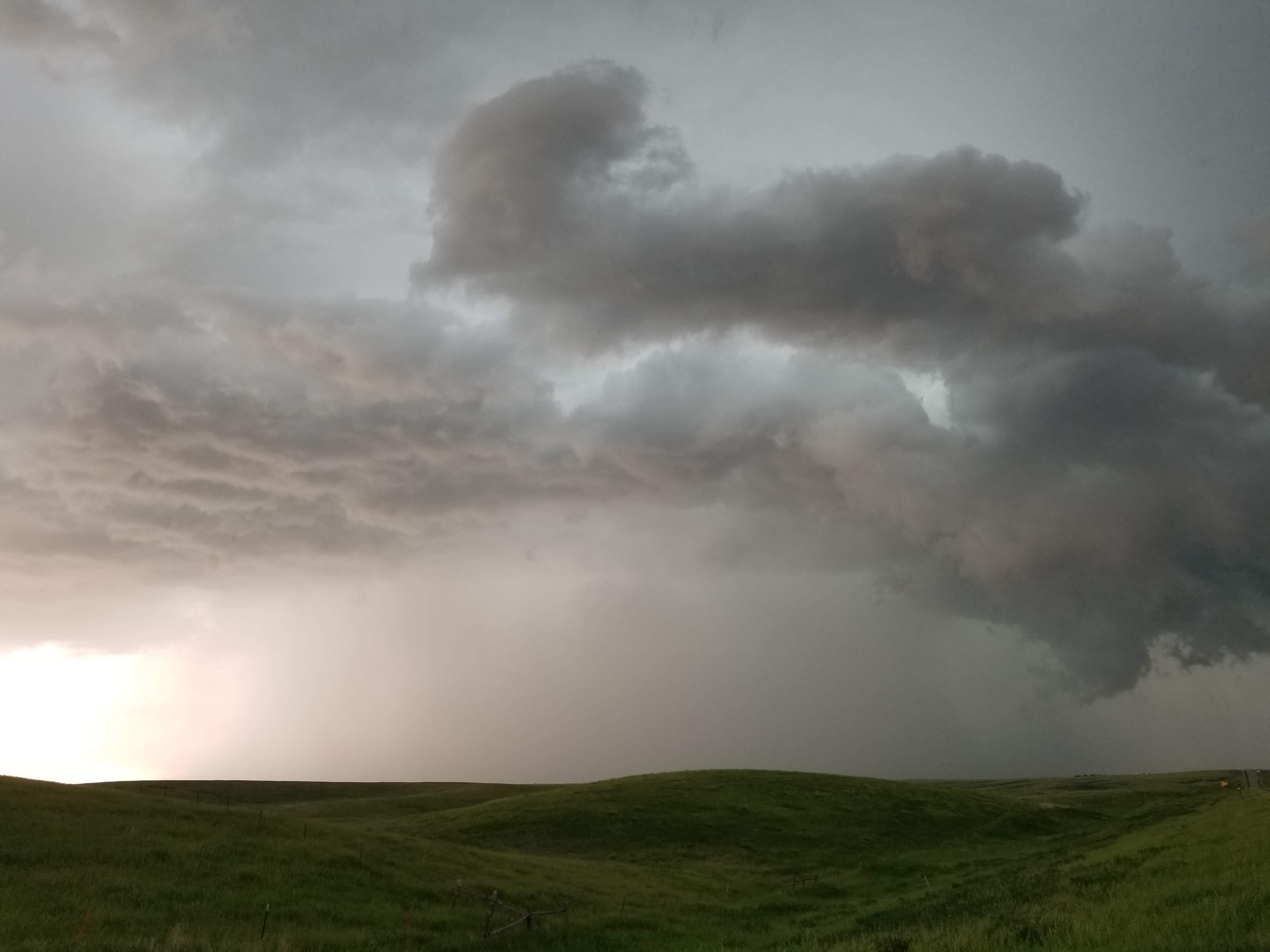
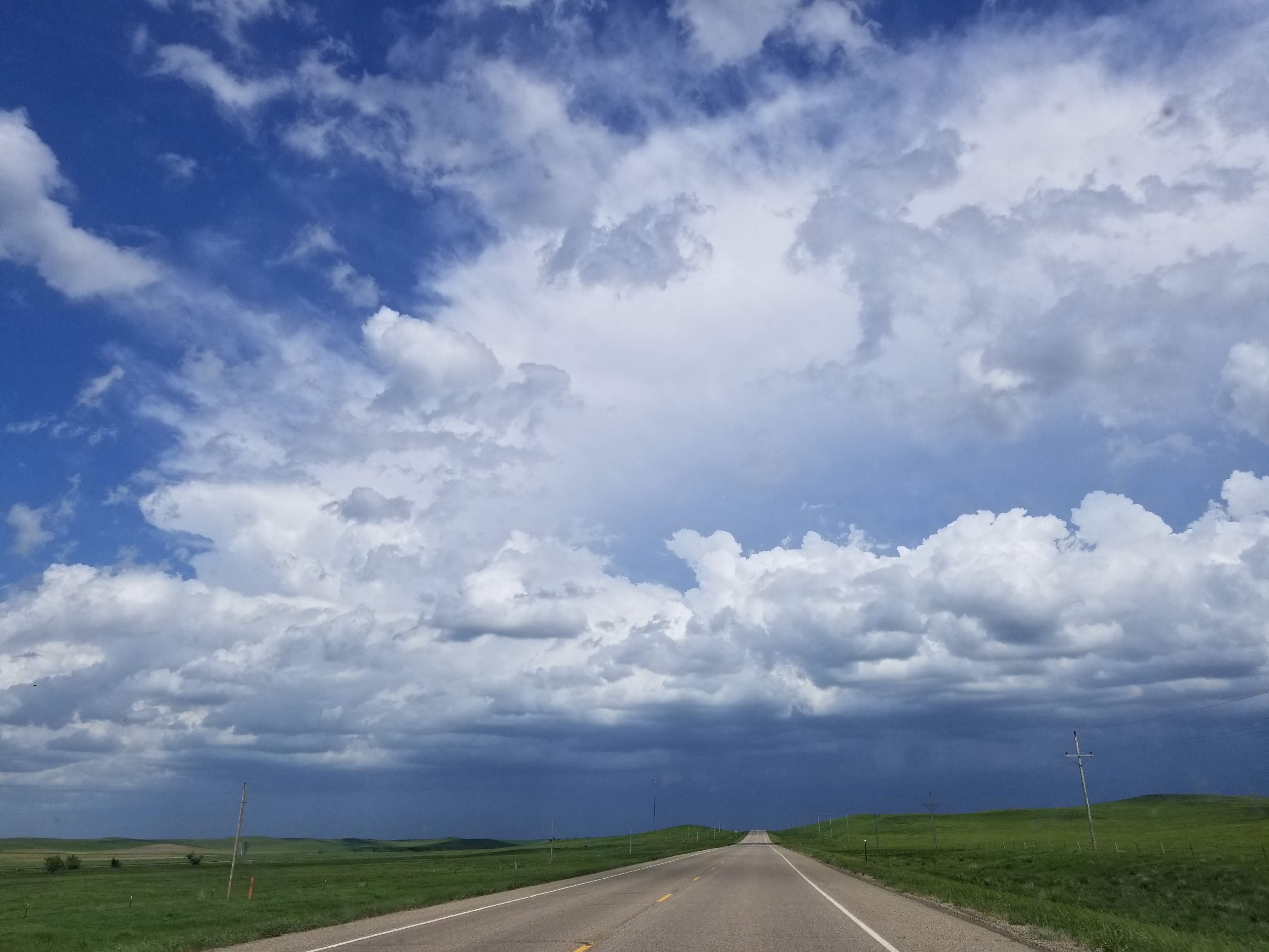
Conditions were favorable for severe thunderstorms during the afternoon of June 1st, 2018, as a warm and very unstable air mass over South Dakota interacted with a cold front. An area of low pressure in northwest South Dakota that morning moved northeast into central North Dakota, dragging a cold front east across South Dakota. Thunderstorms developed ahead of the front and to the west of the Missouri River, producing strong winds and very large hail. There were several reports of hail larger than golf balls around Timber Lake and between 1-1.5” hail in eastern Corson County. As the storms moved east, additional smaller reports of hail were reported in Walworth County, along with a brief tornado near Glenham. Leading up to the event, conditions were warm and generally dry in the James River Valley during May. Those conditions combined with strong winds from decaying thunderstorms in south central South Dakota to produce a dust storm. South winds of 50 to 80 mph kicked up a significant amount of dirt/dust as the winds moved north, leading to visibilities being reduced to below ¼ mile in many locations. The reduced visibilities caused a few traffic incidents and the winds knocked down trees, tree branches, and powerlines. |
 Surface Map from 7am June 1 to 7am June 2, 2018 |
|
|
|
Severe Storms:
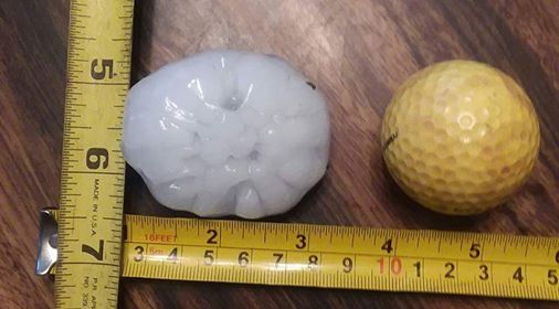
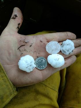
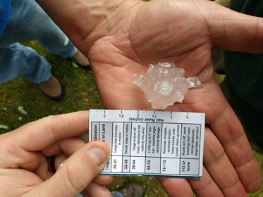
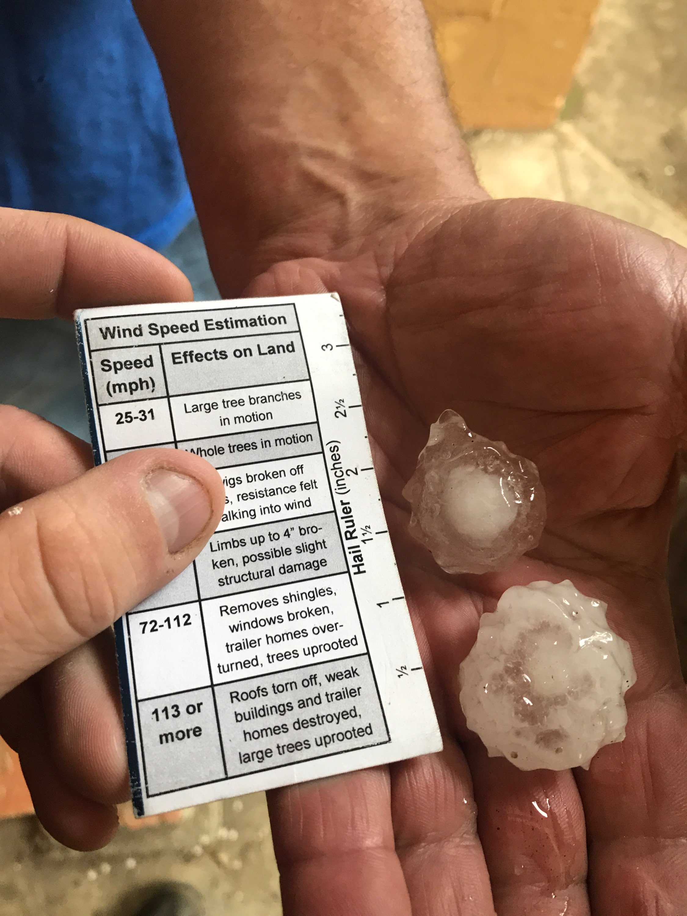
Large hail was produced in a storm over northern Dewey county. The largest measured stones were up to 2" in diameter.
 |
 |
 |
 |
|
Three miles south of Timber Lake, SD. Photo courtesy of Nina Schumacher |
Timber Lake, SD Photo courtesy of Grady Kraft |
Timber Lake, SD Photo courtesy of Austin Stover |
Timber Lake, SD Photo courtesy of Kyle Nilson |
 |
 |
 |
 |
|
Severe storm in Corson County. Photo from NWS Employee |
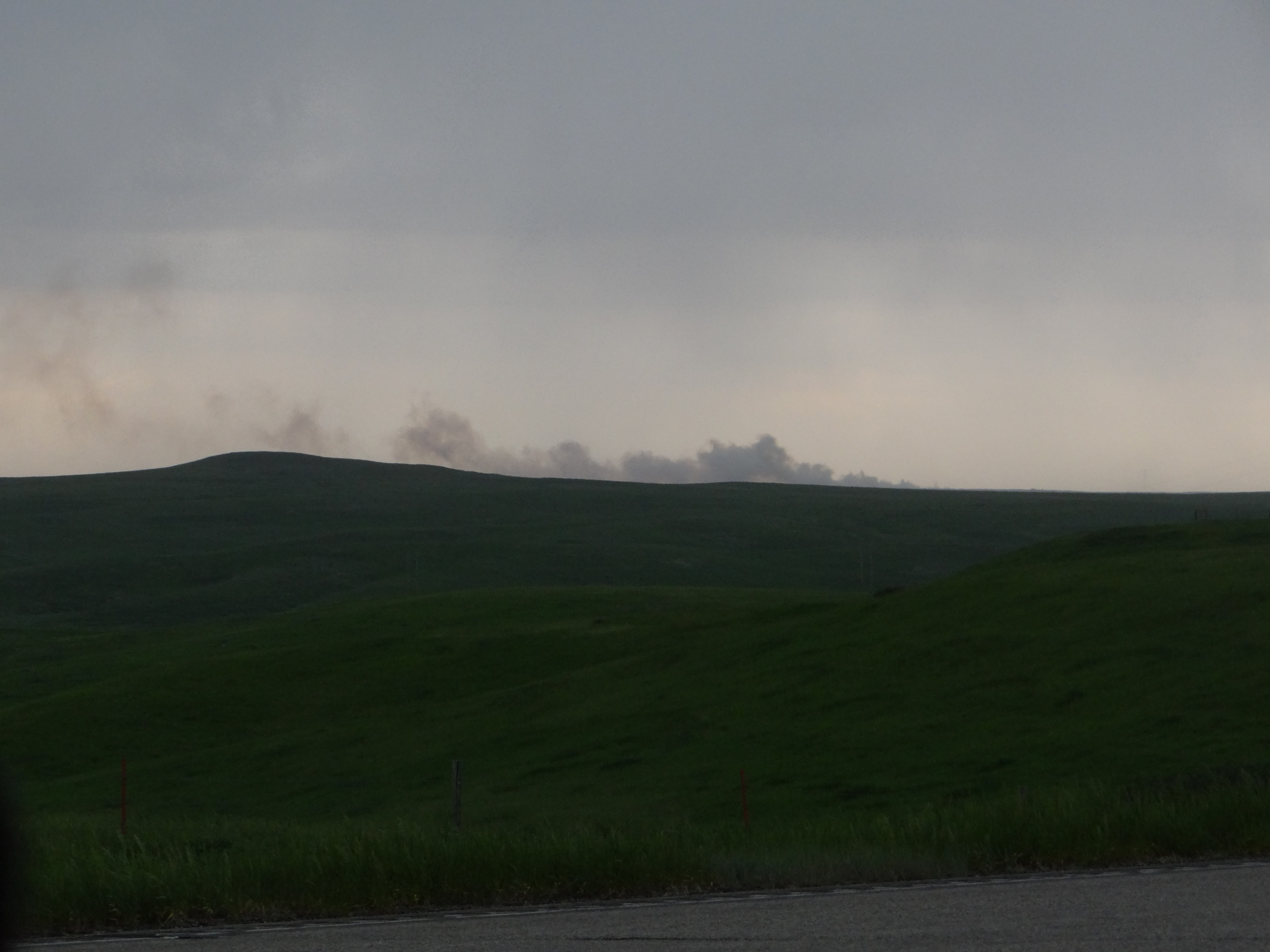
Smoke from a fire likely sparked by a lightning strike near Mobridge. Photo from NWS Employee |
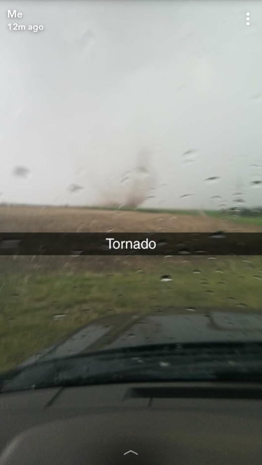
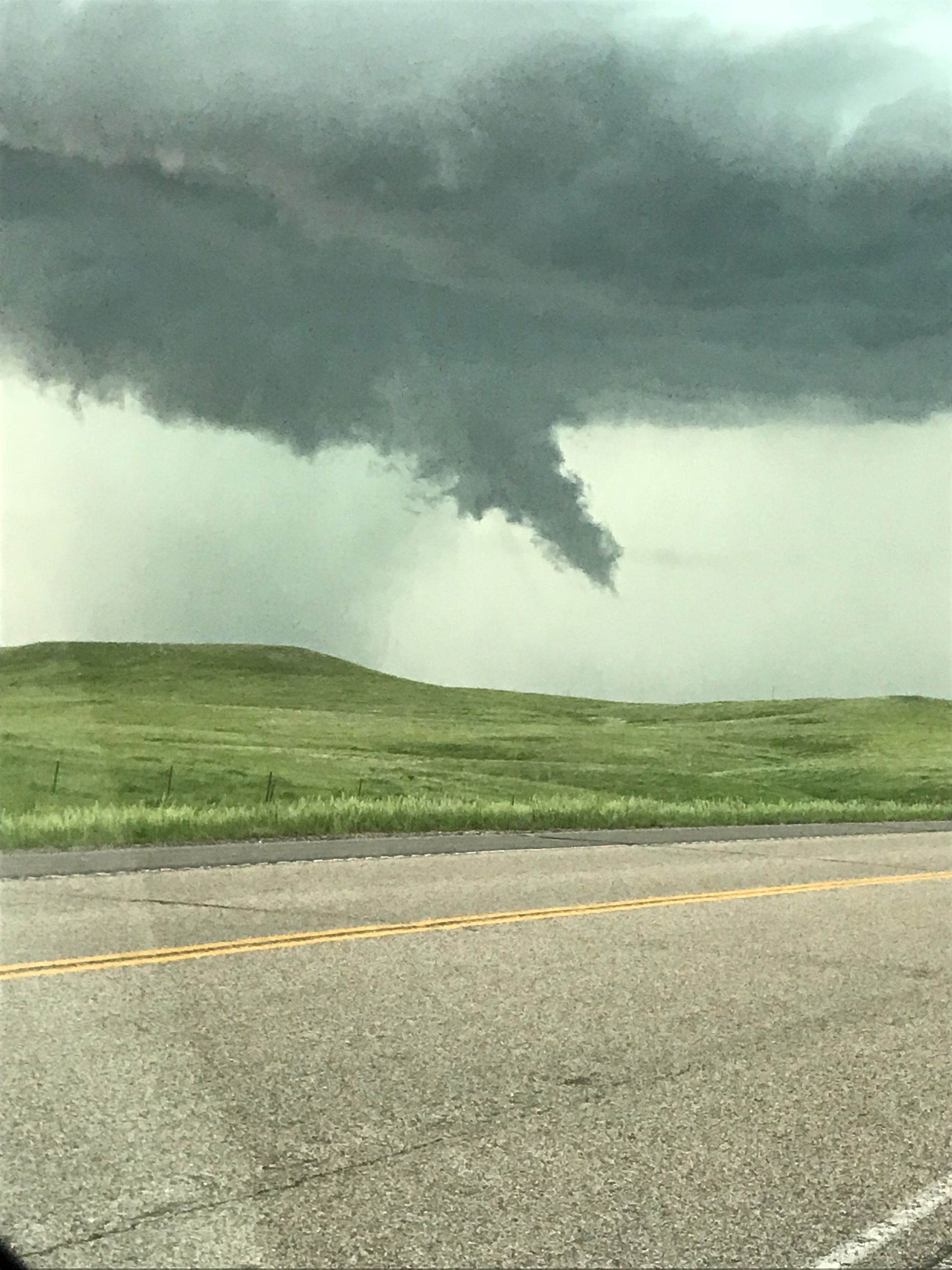
Tornado 5 miles southeast of Glenham Photo Courtesy of Spencer Gosh |
Scud cloud developing in the shape of a funnel in Corson County Photo from NWS Employee |
 |
|||
|
Cumulonimbus in Corson County. Photo from NWS Employee |
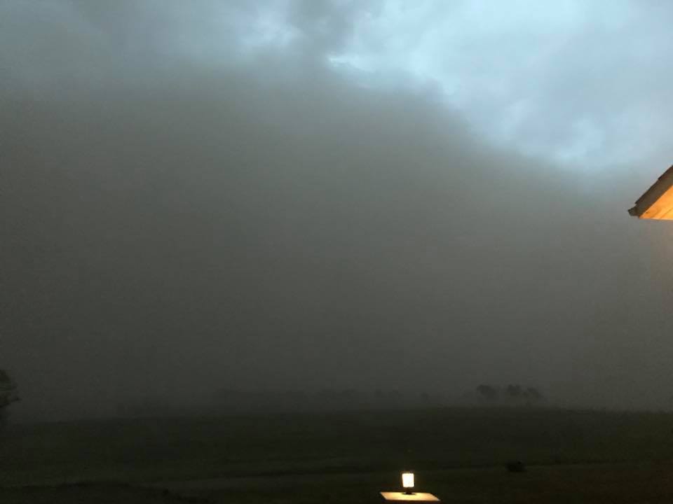
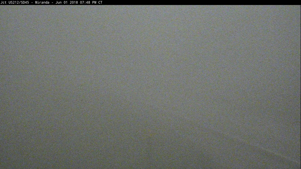
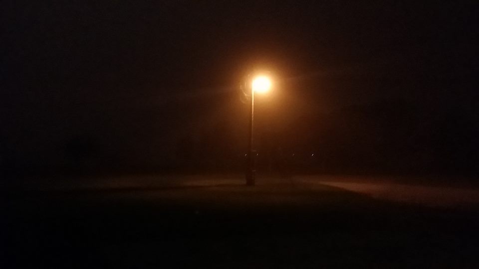
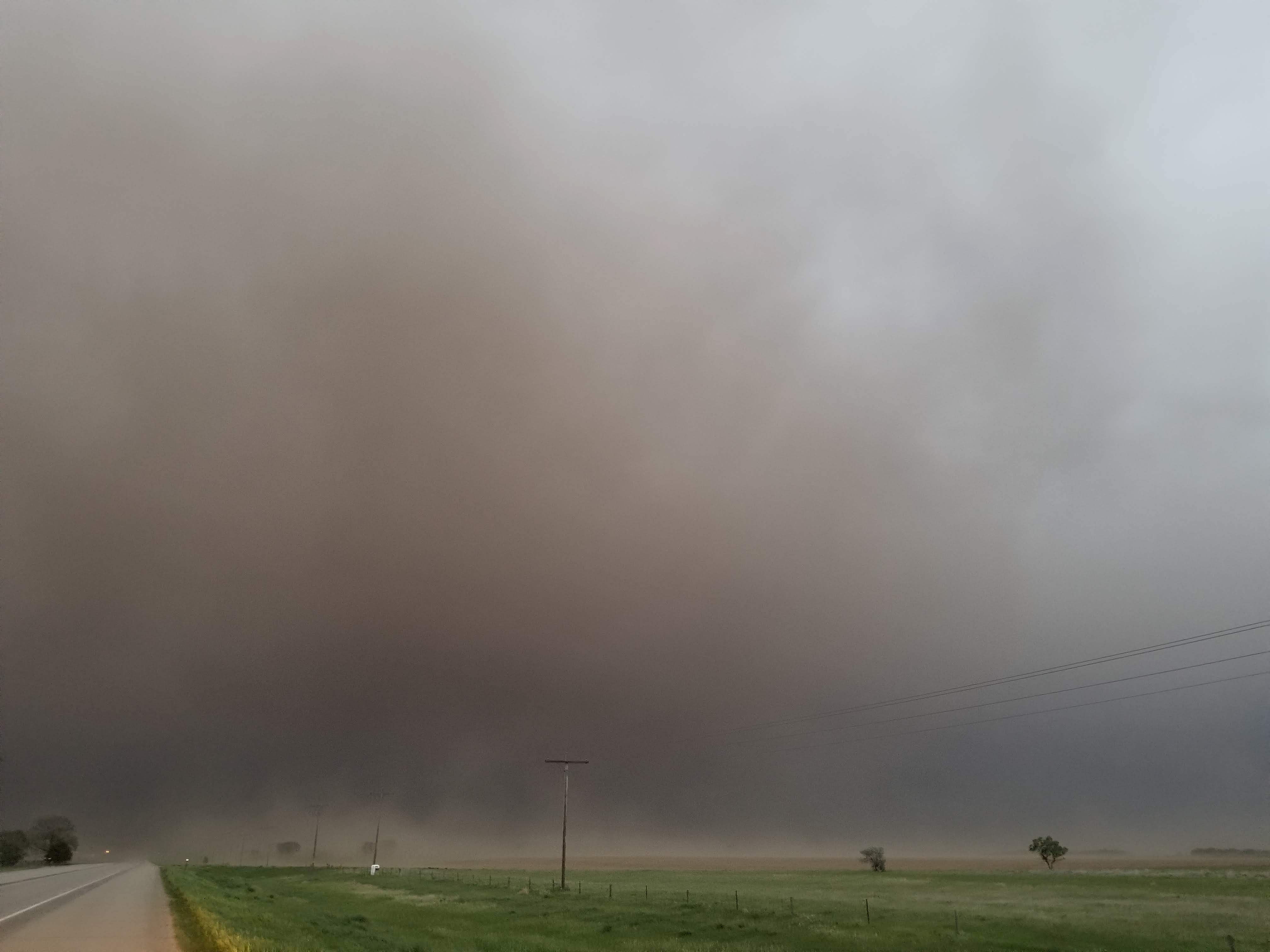
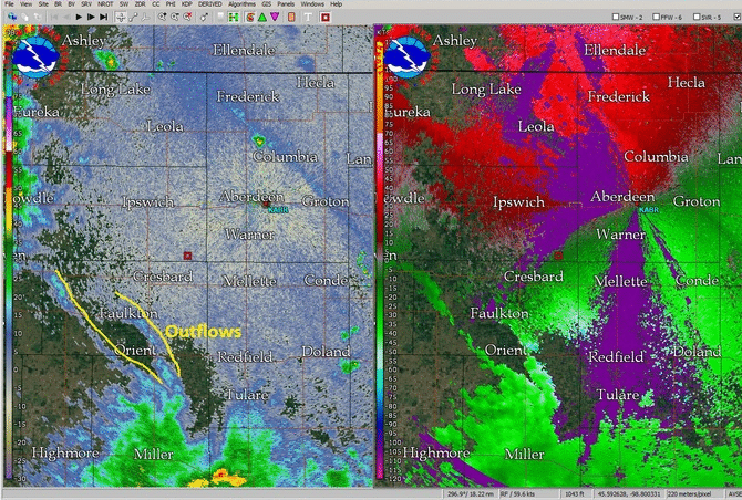
Dust Storm
An outflow boundary ahead of a line of thunderstorms led to winds gusting as high as 80 mph. Due to the high winds and very dry soils, dust storms were seen across parts of northeastern and north central South Dakota. Visibility was reduced to less than 1/4 mile in localized areas.
 |
 |
 |
 |
|
Five miles northwest of Aberdeen Photo courtesy of Maggie and Ryan Jett |
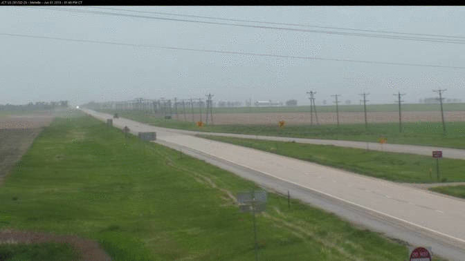
RWIS Site 1 mile west northwest of Mellette |
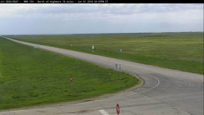
RWIS site 17 miles north of Polo |
RWIS site 5 miles south of Miranda at 7:53 pm |
 |
 |
 |
 |
|
4 miles north of Cresbard during the dust storm. Photo courtesy of John Batteen |
Near Ipswich Photo from NWS Employee |
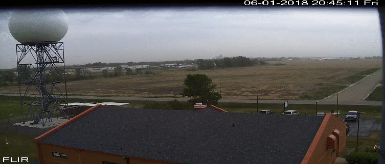
Time lapse of dust in at the NWS Aberdeen office from 8:40 to 9:30 pm |
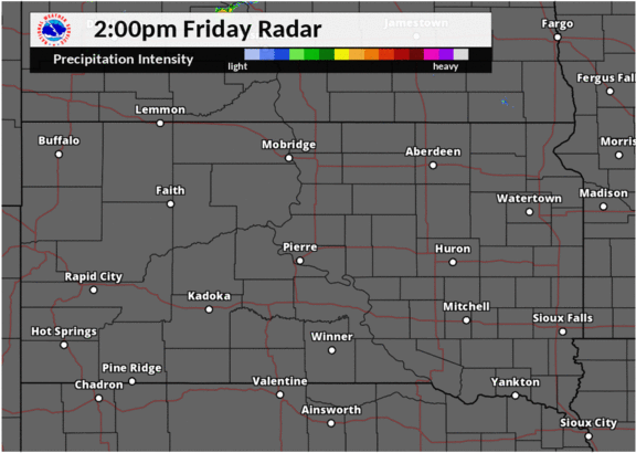
Detailed radar analysis of dust and other features on radar from 7-10 pm
|
Storm Reports
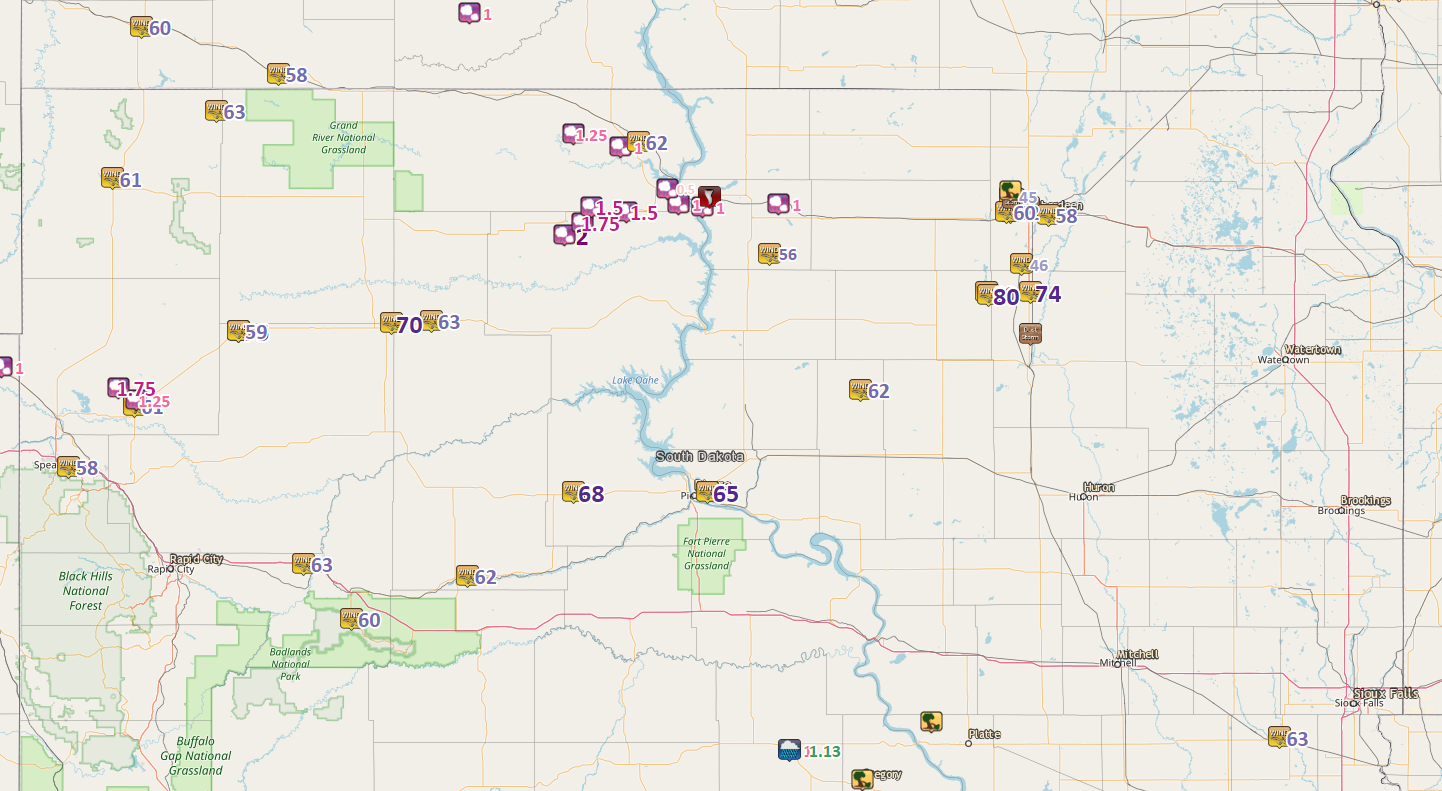
Local Storm Reports from evening of June 1, 2018

..TIME...   ...EVENT...      ...CITY LOCATION...     ...LAT.LON...
..DATE...   ....MAG....      ..COUNTY LOCATION..ST.. ...SOURCE....
            ..REMARKS..

0840 PM     Hail             Java                    45.50N 99.89W
06/01/2018  E1.00 inch       Walworth           SD   Law Enforcement


0759 PM     Tstm Wnd Gst     2 E Lowry               45.31N 99.94W
06/01/2018  M56 MPH          Walworth           SD   Mesonet


0730 PM     Hail             3 SW Glenham            45.49N 100.31W
06/01/2018  E1.00 inch       Walworth           SD   Public


0800 PM     Non-Tstm Wnd Gst Chelsea                 45.16N 98.75W
06/01/2018  E60 MPH          Faulk              SD   Trained Spotter

            Estimated 60 mph winds and blowing dust.
            Visibility reduced below a quarter mile.

0602 PM     Hail             9 ENE Timber Lake       45.49N 100.92W
06/01/2018  M1.50 inch       Corson             SD   Public

            LIKELY LARGER STONES IN YARD.

0630 PM     Hail             Trail City              45.47N 100.73W
06/01/2018  M1.50 inch       Corson             SD   Public


0552 PM     Hail             3 E Bullhead            45.77N 101.02W
06/01/2018  E1.25 inch       Corson             SD   Public

            Radar estimated time.

0640 PM     Tstm Wnd Gst     1 SSE Mahto             45.74N 100.66W
06/01/2018  E62 MPH          Corson             SD   Mesonet

            From SDSU mesonet site near Mahto.

0926 PM     Non-Tstm Wnd Gst Aberdeen Rgnl AP        45.46N 98.41W
06/01/2018  M58 MPH          Brown              SD   ASOS

            Blowing dust causing reduced visibility to a
            mile or less at times, ASOS station ABR,
            Aberdeen Rgnl AP.

0655 PM     Hail             3 WSW Indian Creek Rec  45.50N 100.44W
06/01/2018  E1.00 inch       Corson             SD   Law Enforcement


0704 PM     Non-Tstm Wnd Gst 1 NE Hayes              44.38N 101.02W
06/01/2018  M68 MPH          Stanley            SD   Mesonet

            Winds are from an outflow boundary.

0715 PM     Hail             1 SW Indian Memorial Re 45.56N 100.50W
06/01/2018  E0.50 inch       Corson             SD   Trained Spotter

            REPORTED AT GRAND RIVER CASINO & RESORT.

0736 PM     Tornado          Glenham                 45.53N 100.27W
06/01/2018                   Walworth           SD   Public

            Law enforcement relayed a public report of a
            brief tornado northeast of Glenham.

0744 PM     Tstm Wnd Gst     16 W Polo               44.78N 99.44W
06/01/2018  M62 MPH          Hyde               SD   Mesonet


0759 PM     Tstm Wnd Gst     2 ENE Pierre            44.38N 100.28W
06/01/2018  M65 MPH          Hughes             SD   ASOS


0635 PM     Hail             3 NNE Little Eagle      45.72N 100.76W
06/01/2018  E1.00 inch       Corson             SD   Public

            WINDS ESTIMATED AT 65 TO 70 MPH.

0520 PM     Hail             5 E Timber Lake         45.43N 100.97W
06/01/2018  E1.75 inch       Dewey              SD   Law Enforcement


0820 PM     Tstm Wnd Gst     2 N Mansfield           45.27N 98.56W
06/01/2018  E46 MPH          Brown              SD   Trained Spotter

            Visibility reduced to 1/2 mile.

0834 PM     Tstm Wnd Gst     1 WNW Mellette          45.16N 98.51W
06/01/2018  M74 MPH          Spink              SD   Mesonet


0510 PM     Hail             2 NNE Little Moreau Rec 45.38N 101.07W
06/01/2018  M2.00 inch       Dewey              SD   Public

            ACTUAL MEASUREMENT WAS TWO AND A QUARTER
            INCH.

0845 PM     Tstm Wnd Gst     1 S Chelsea             45.15N 98.74W
06/01/2018  E80 MPH          Faulk              SD   Trained Spotter

            1/8 mile visibility in blowing dust, tree
            toppled.

0900 PM     Dust Storm       1 WNW Ashton            45.00N 98.51W
06/01/2018                   Spink              SD   Law Enforcement

            Traffic accident due to reduced visibility
            from blowing dust.

0903 PM     Tstm Wnd Gst     1 SSW Richmond Lake Rec 45.53N 98.62W
06/01/2018  E45 MPH          Brown              SD   Public

            100 feet visibility in blowing dust.

0903 PM     Dust Storm       2 NW Aberdeen           45.49N 98.52W
06/01/2018                   Brown              SD   Public

            Reduced visibility due to blowing dust.

0912 PM     Non-Tstm Wnd Gst Aberdeen 6.5 W          45.47N 98.62W
06/01/2018  M62 MPH          Brown              SD   Mesonet

            Mesonet station E2245, Aberdeen 6.5 W.

0914 PM     Non-Tstm Wnd Gst Aberdeen 7 W            45.47N 98.64W
06/01/2018  M60 MPH          Brown              SD   Mesonet

            Mesonet station E5307, Aberdeen 7 W.

0917 PM     Dust Storm       2 SSE Richmond Lake Rec 45.52N 98.60W
06/01/2018                   Brown              SD   Trained Spotter

            Car in ditch due to reduced visibility from
            dust storm.

0944 PM     Non-Tstm Wnd Dmg Richmond Lake Rec Area  45.55N 98.62W
06/01/2018                   Brown              SD   Law Enforcement

            Downed power lines caused trees to start on
            fire.
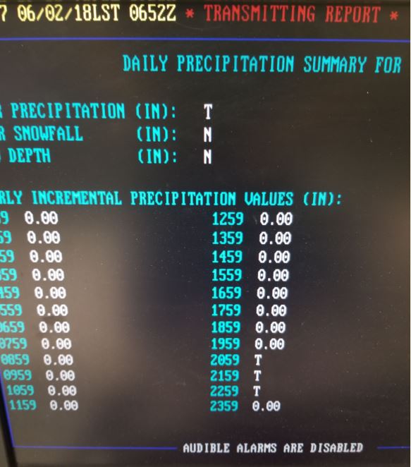
Rain Reports (Radar Estimated)
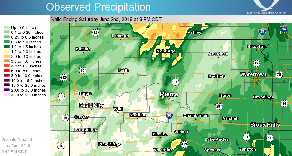
On the heals of the 7th driest May on record in Aberdeen (0.52"), only a trace of rain was measured at the airport on June 1st. Rain gauges had more dust than rain in/on them at Mina.
 |
Media use of NWS Web News Stories is encouraged! Please acknowledge the NWS as the source of any news information accessed from this site. |
|


.gif)