
A strong atmospheric river will continue heavy rain over southern California through Friday. The heaviest rainfall is ongoing today in the Los Angeles Basin. Flash and urban flooding is possible. A prolonged heavy snowfall has begun over the Sierra Nevada Mountains and will continue through Friday. Travel will become increasingly difficult over the passes due to snow and strong winds. Read More >
Overview
|
The afternoon of July 5th, storms developed along a boundary between very dry air and very moist air. This setup supported isolated storms and strong straightline winds. The most impressive storm produced a microburst (a very narrow area of strong winds within a thunderstorm) right over Mina Lake, causing structural damage, uprooted trees, and flipped boats and pontoons. This same storm tracked southeast and eventually produced hail and strong winds in the Northville/Mellette area. Large hail was also reported between Bath and Groton. A second area of storms further west produced large hail near Isabel and tracked southeast. Several strong wind reports from 58 to 65 mph were reported along the Missouri River Valley. |
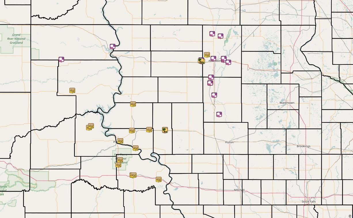 SPC Storm Reports from July 5, 2017. Interactive map here: http://www.spc.noaa.gov/climo/gmf.php?rpt=170705_rpts_filtered |
Wind & Hail:
Microburst
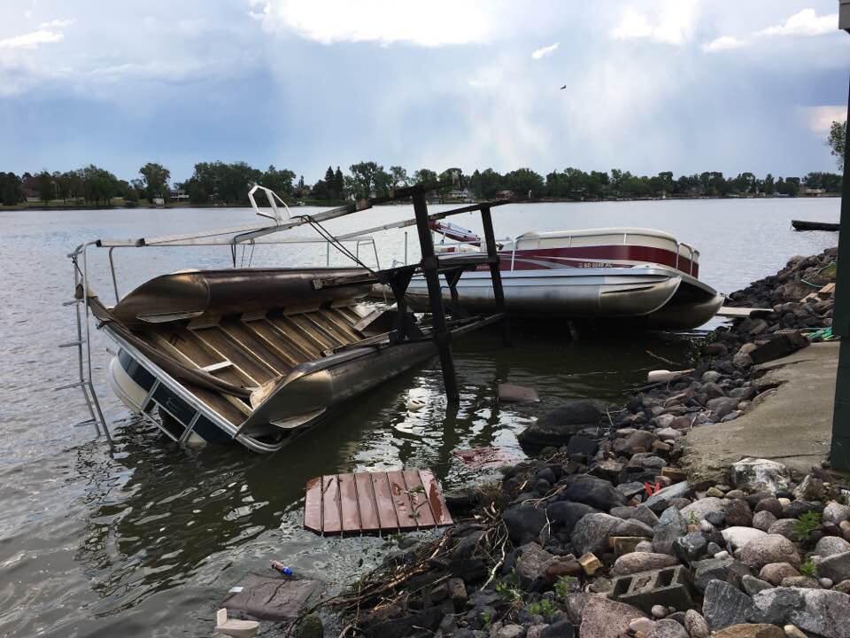
A microburst (a very narrow area of strong winds within a thunderstorm) developed over Mina Lake in Edmunds County. Winds were estimated around 80 mph.
 |
 |
 |
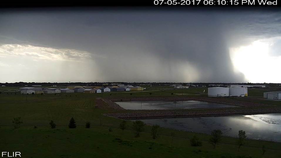 |
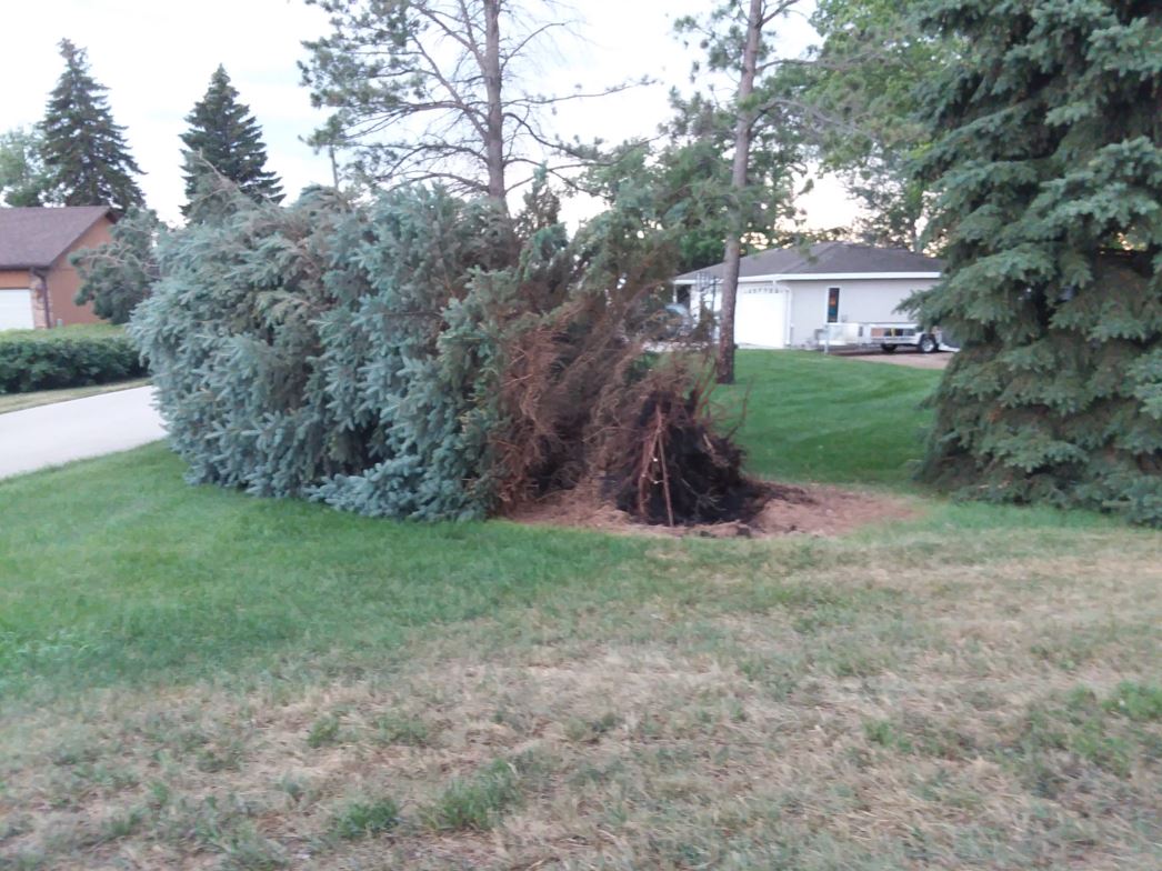
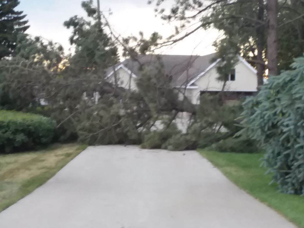
| Uprooted Tree at Mina Lake, Photo Credit Jennifer Pint | Downed Tree at Mina Lake, Photo Credit Jennifer Pint | Flipped Pontoon at Mina Lake, Photo Credit Sara Jo Bonn | Microburst seen from the NWS Aberdeen instrument tower cam at 6:10 pm CDT |
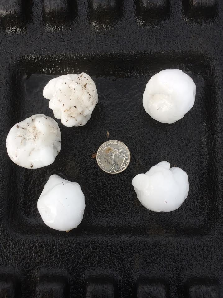
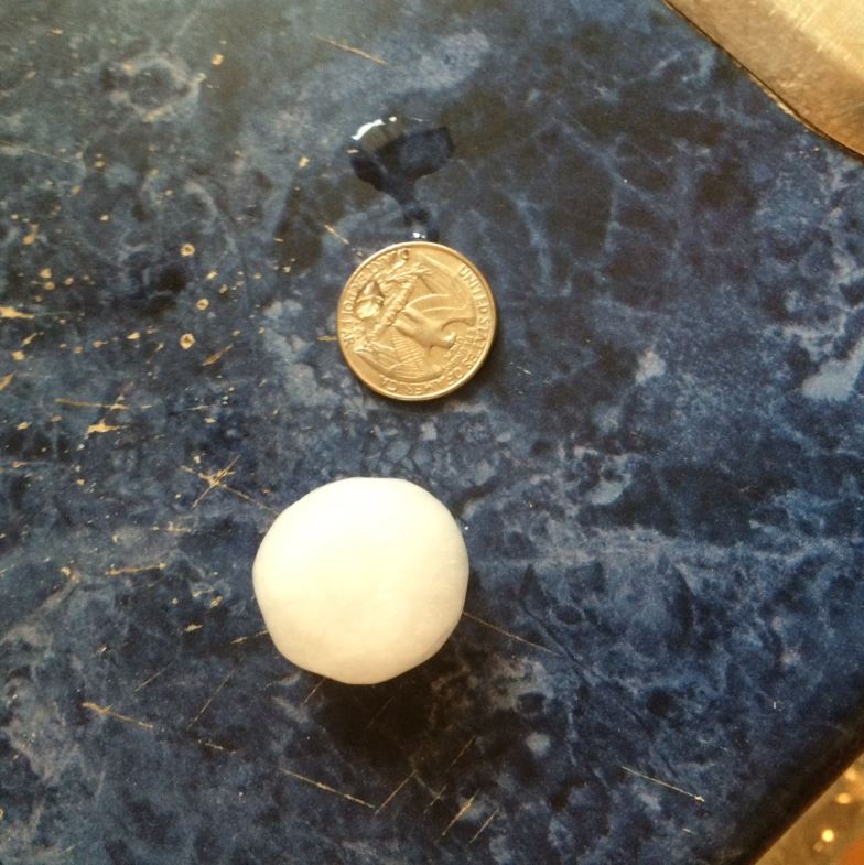
Wind & Hail
 |
 |
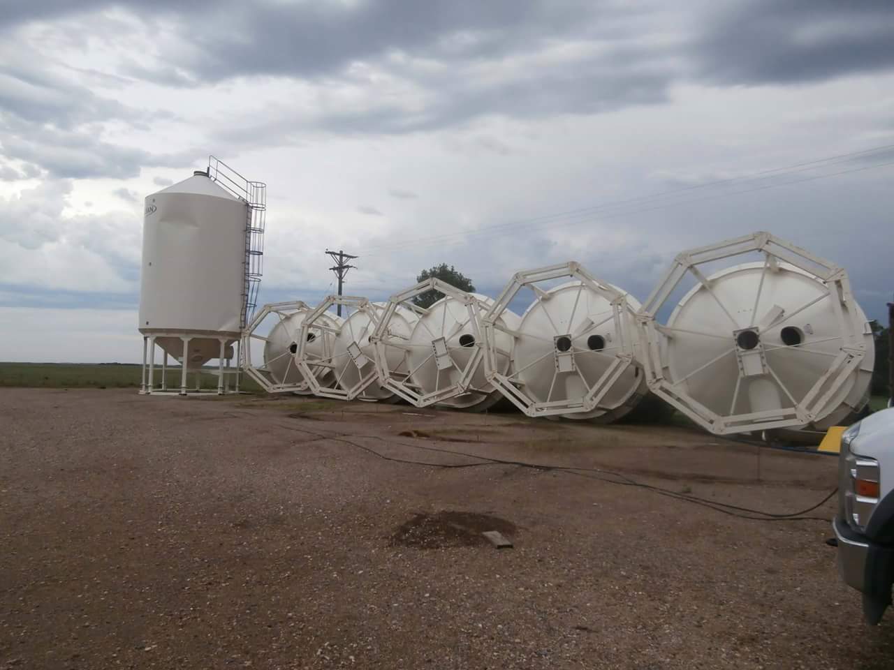 |
| Golfball Size Hail 6 W of Groton, Photo Credit: Joel | Quarter Size Hail Near Richmond Lake, Photo Credit: Gene Wolter | Grain Bins Knocked Over Near Northville, Photo Credit: Rondi Torrence |
Radar:
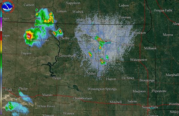 |
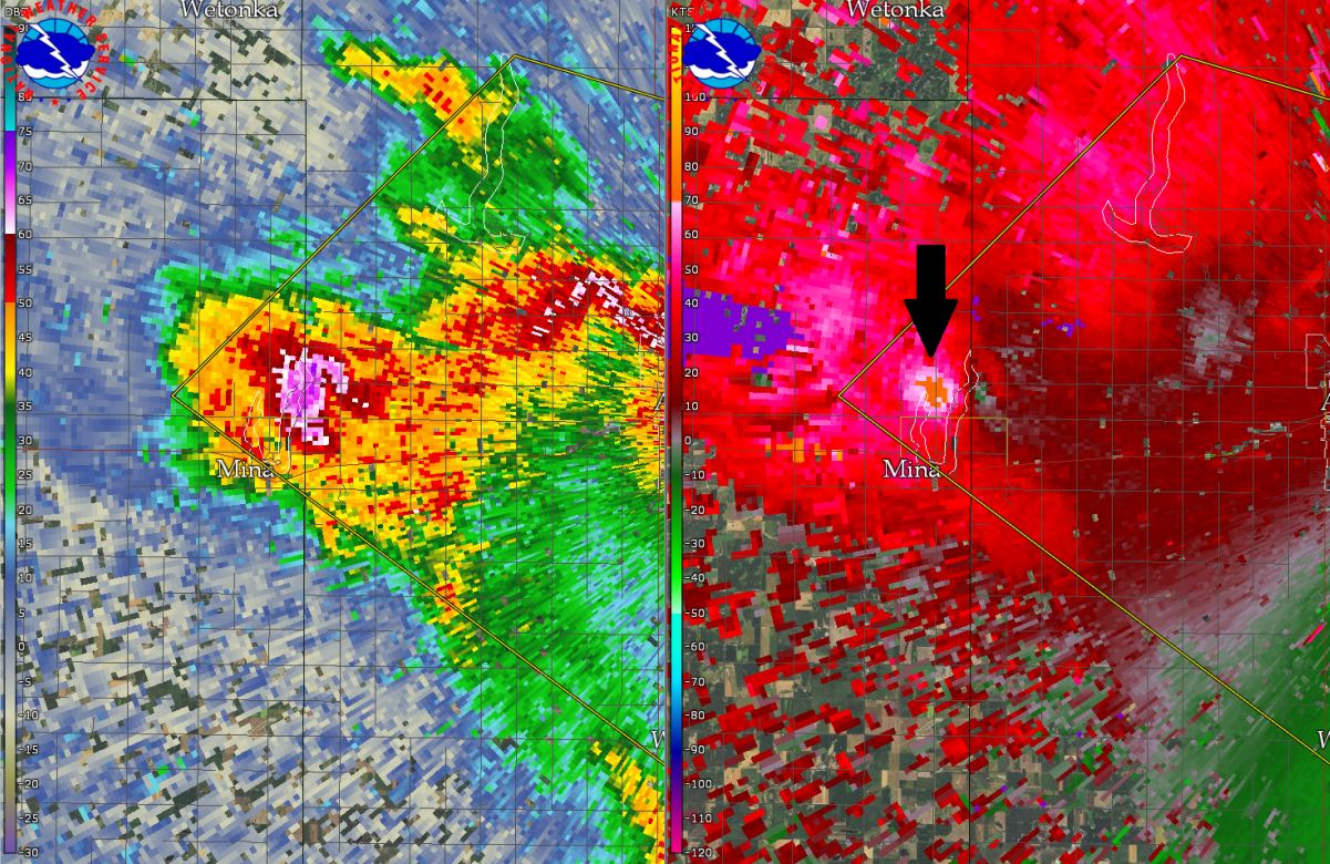 |
| Radar Reflectivity overview at around 6:30 pm CDT | Radar Reflectivity & Velocity at the time of the microburst over Mina Lake. The black arrow denotes the higher velocity values from the microburst |
 |
Media use of NWS Web News Stories is encouraged! Please acknowledge the NWS as the source of any news information accessed from this site. |
|

