Overview
|
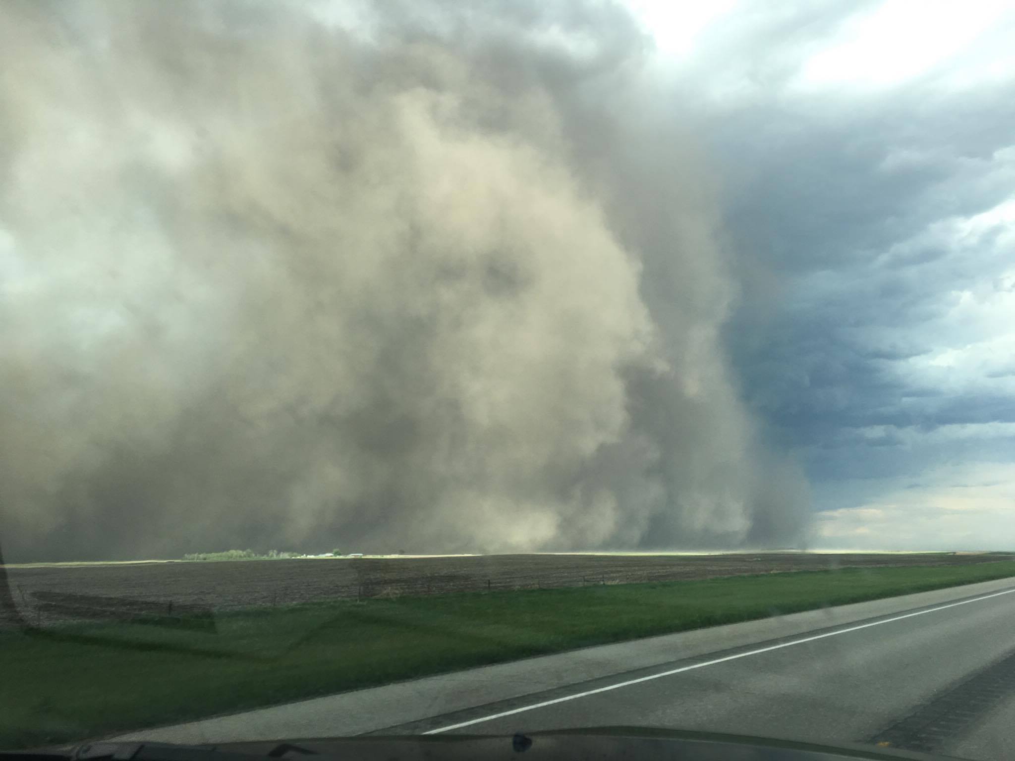
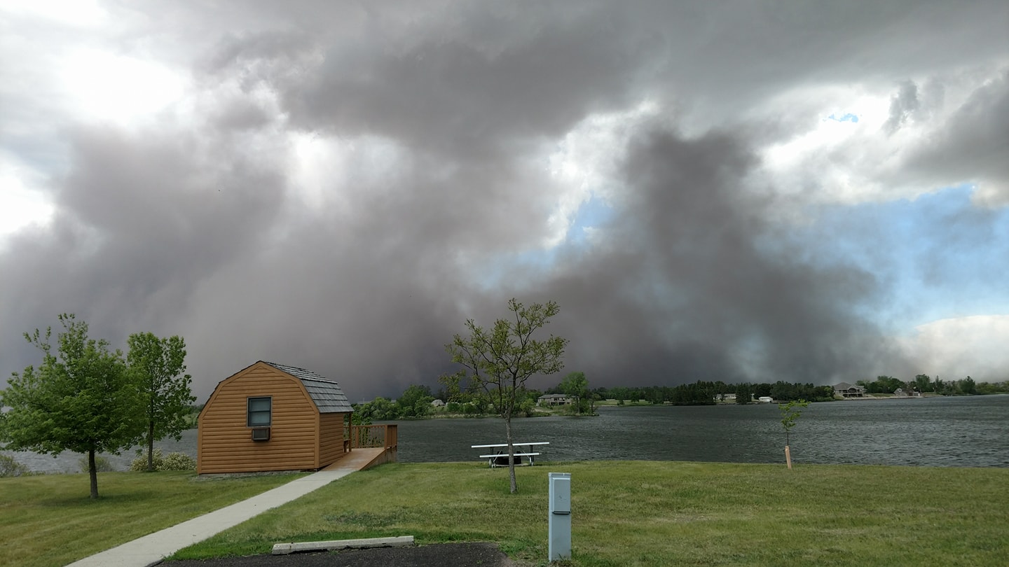
A broad area of rapidly moving showers and thunderstorms impacted central and northeastern South Dakota and west central Minnesota on the afternoon of Sunday, May 28th. Due to a favorable environment involving dry air near the surface and strong winds aloft, these storms were able to translate strong to severe winds to the surface. Due to a very dry May, in which moderate drought conditions developed across much of north central South Dakota, these winds kicked up large amounts of dust. These dust storms were fairly common and widely reported, drastically reducing visibility for minutes on end. While quite ominous looking, these storms did not have the potential to produce tornadoes. Sometimes dust can become lofted to heights that are normally associated with tornadoes. However, unless a rotating funnel cloud extends downward from the clouds above an area of rotating dust, the phenomenon is non-tornadic (not to say these storms weren't dangerous - there were reports of damage). Unfortunately, not much precipitation fell with this activity as the storms were fast moving and some rainfall evaporated before reaching the ground.
|
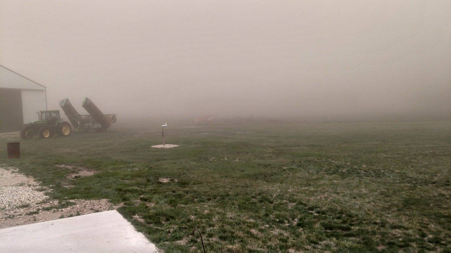
Photo courtesy of Jes Hart |
Photos & Video:
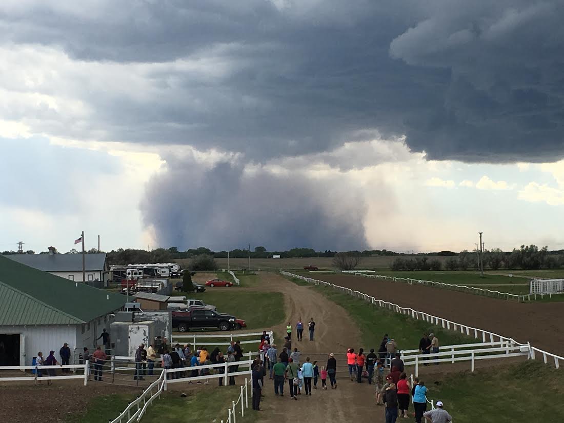
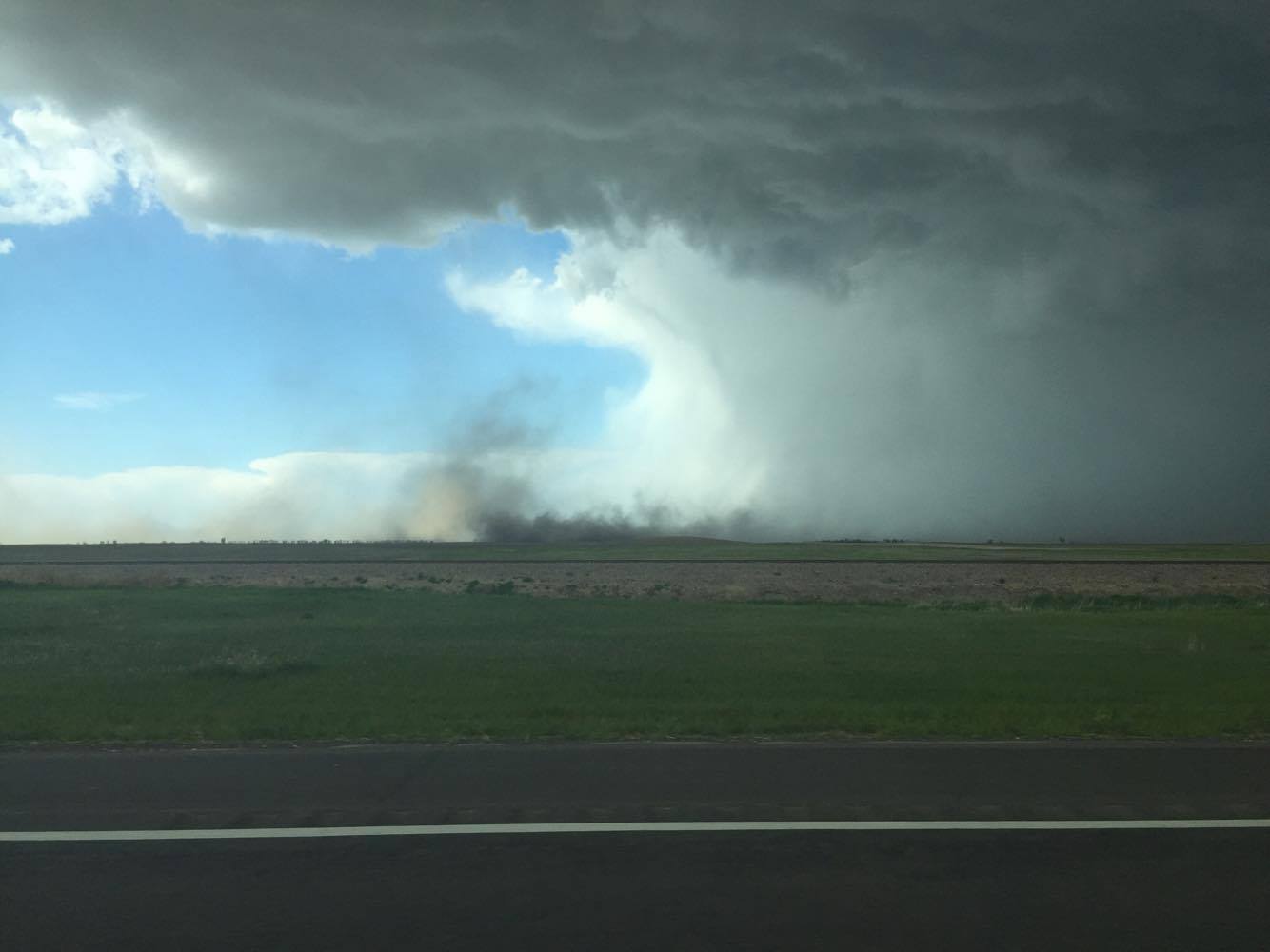
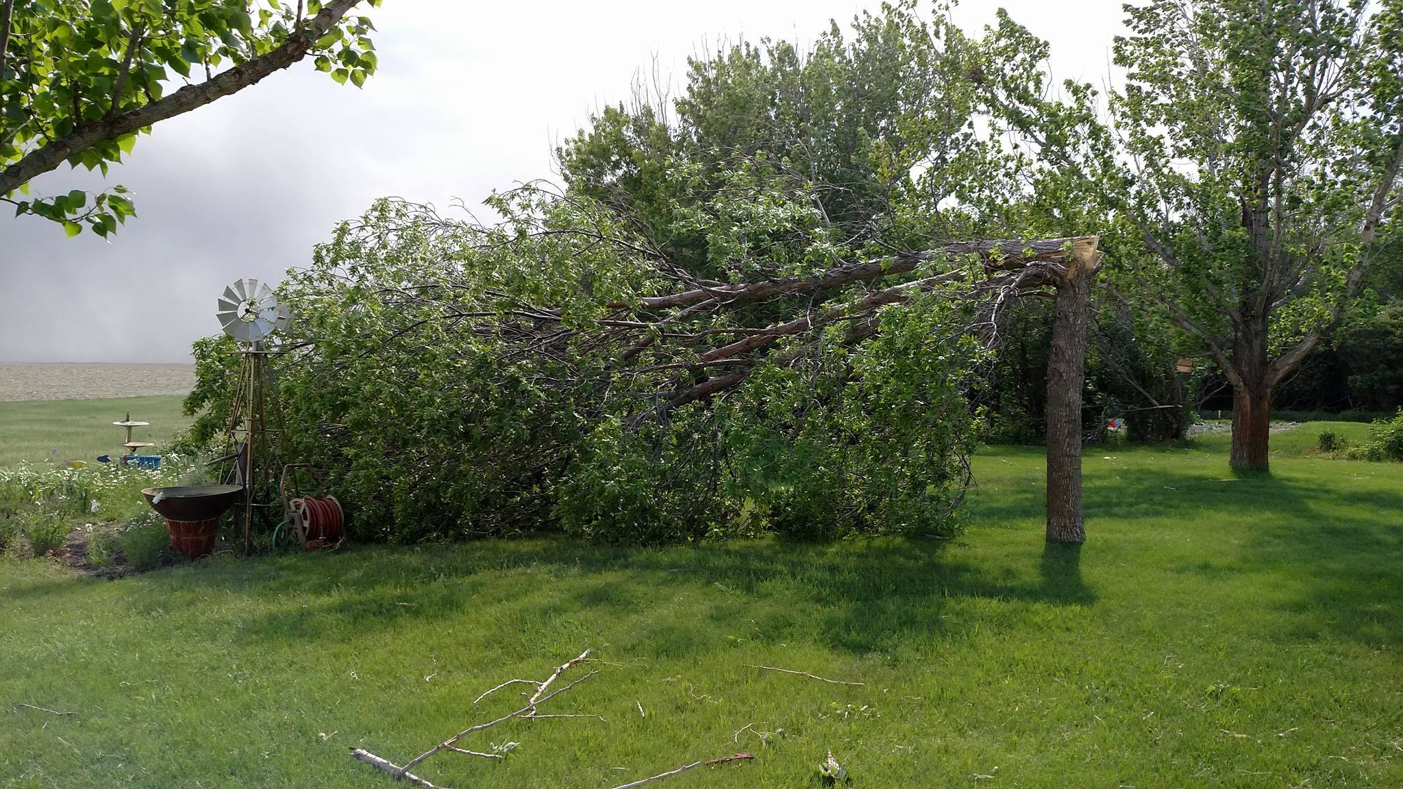
Microburst Photos and Damage. Thanks for all the reports!
 |
 |
 |
 |
| Brown County Fairgrounds Photo courtesy of Jim Scarlett |
Between Mina and Aberdeen. Photo courtesy of Sheila Anderson |
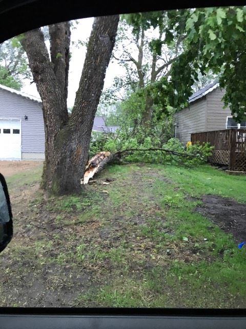
Tree Damage Near Mina Lake Photo courtesy of Taylor Whitney |
Tree Damage Near Graceville, MN Photo courtesy of Andrew O'Neill |
 |
 |
 |
 |
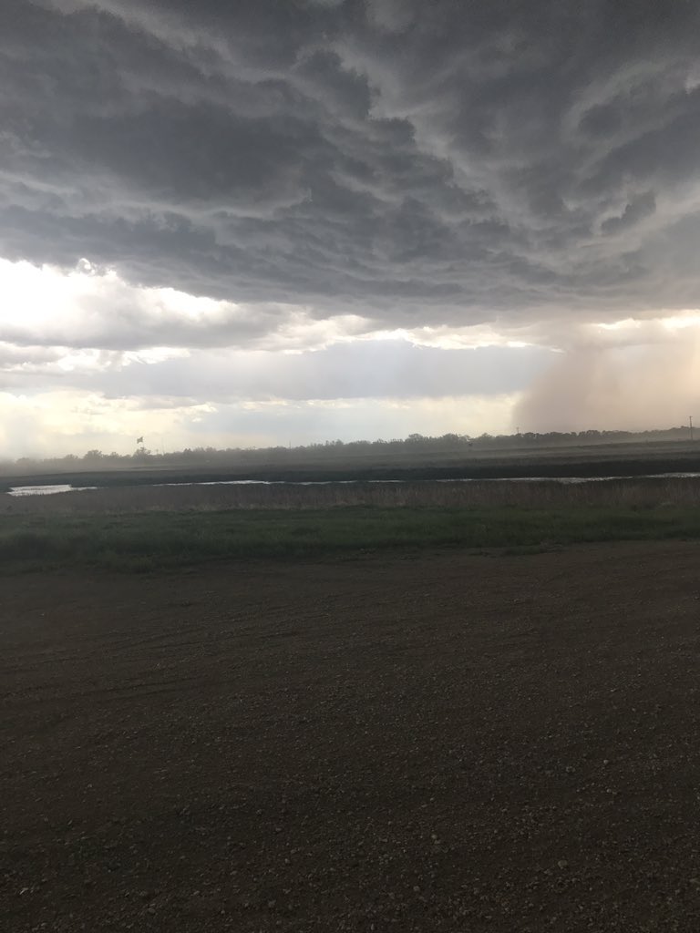
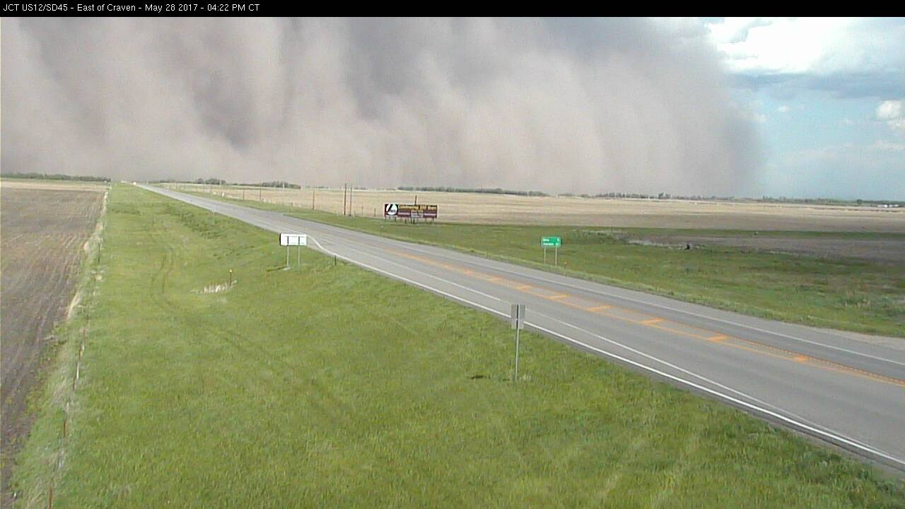
| Near Craven at 4:20 pm. Photo courtesy of Gerald Ray Noble | Looking towards Wylie Park in Aberdeen. Photo: @605Jess | Near Craven Corner. Photo courtesy of SD DOT | Mina Lake. Photo courtesy of Eric Garrett |
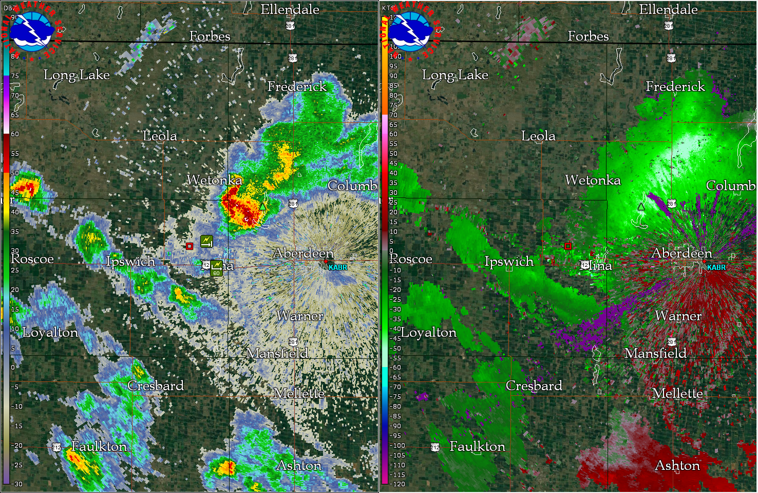
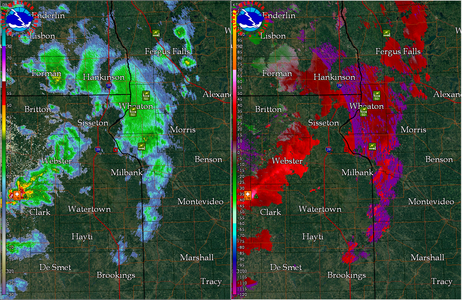
Radar:
Many showers/storms on radar produced wind gusts of at least 50 mph Sunday afternoon.
 |
 |
|
| Radar Imagery at 4:20 pm CDT | Radar Imagery at 5:09 pm CDT |
Storm Reports
Find a map version of reports here
PRELIMINARY LOCAL STORM REPORT...SUMMARY
NATIONAL WEATHER SERVICE ABERDEEN SD
918 PM CDT SUN MAY 28 2017

..TIME...   ...EVENT...      ...CITY LOCATION...     ...LAT.LON...
..DATE...   ....MAG....      ..COUNTY LOCATION..ST.. ...SOURCE....
            ..REMARKS..

0548 PM     TSTM WND GST     MAYFIELD COLONY         44.69N 97.56W
05/28/2017  E50 MPH          CLARK              SD   PUBLIC


0441 PM     TSTM WND GST     2 N MANSFIELD           45.28N 98.56W
05/28/2017  M61 MPH          BROWN              SD   TRAINED SPOTTER


0533 PM     TSTM WND GST     9 NW WILLOW LAKE        44.73N 97.74W
05/28/2017  E60 MPH          CLARK              SD   TRAINED SPOTTER

            SLUSHY HAIL LESS THAN 1" AND A DUST STORM AS
            WELL.

0510 PM     TSTM WND GST     GRACEVILLE              45.57N 96.44W
05/28/2017  M62 MPH          BIG STONE          MN   MESONET

            GRACEVILLE RWIS.

0505 PM     TSTM WND DMG     CLINTON                 45.47N 96.44W
05/28/2017                   BIG STONE          MN   PUBLIC

            SOME TREES DOWNED.

0505 PM     HAIL             4 E TURTON              45.05N 98.02W
05/28/2017  E1.75 INCH       SPINK              SD   TRAINED SPOTTER

            SOME GOLF BALL, BUT RELATIVELY SLUSHY,
            HAILSTONES. 50-60 MPH WINDS AS WELL. RADAR
            ESTIMATED TIME.

0456 PM     TSTM WND GST     5 WSW CHARLESVILLE      45.92N 96.37W
05/28/2017  E54 MPH          TRAVERSE           MN   MESONET


0456 PM     TSTM WND GST     3 SW WHEATON            45.78N 96.54W
05/28/2017  M52 MPH          TRAVERSE           MN   AWOS

            AWOS STATION ETH, WHEATON.

0615 PM     TSTM WND GST     5 E ORIENT              44.90N 98.98W
05/28/2017  M57 MPH          HAND               SD   MESONET


0430 PM     TSTM WND GST     5 S RICHMOND LAKE REC A 45.47N 98.62W
05/28/2017  M52 MPH          BROWN              SD   MESONET

            MESONET STATION E2245, ABERDEEN 6.5 W.

0429 PM     TSTM WND GST     5 SSW RICHMOND LAKE REC 45.47N 98.64W
05/28/2017  M53 MPH          BROWN              SD   MESONET

            MESONET STATION E5307, ABERDEEN 7 W.

0420 PM     TSTM WND GST     MINA                    45.44N 98.76W
05/28/2017  E60 MPH          EDMUNDS            SD   EMERGENCY MNGR


0420 PM     TSTM WND GST     2 N HOVEN               45.27N 99.78W
05/28/2017  E50 MPH          WALWORTH           SD   PUBLIC


0420 PM     TSTM WND DMG     4 NNW MINA              45.50N 98.79W
05/28/2017                   EDMUNDS            SD   PUBLIC

            TREE SNAPPED.

0330 PM     TSTM WND GST     PIERPONT                45.50N 97.83W
05/28/2017  E50 MPH          DAY                SD   LAW ENFORCEMENT


0240 PM     TSTM WND GST     11 S BULLHEAD           45.61N 101.06W
05/28/2017  M57 MPH          CORSON             SD   MESONET

            RADAR ESTIMATED TIME.

0213 PM     TSTM WND GST     2 NW SHAMBO RANCH       45.55N 101.87W
05/28/2017  M56 MPH          CORSON             SD   MESONET
 |
Media use of NWS Web News Stories is encouraged! Please acknowledge the NWS as the source of any news information accessed from this site. |
|