Overview
|
Severe thunderstorms moved east across northern South Dakota during the evening of August 9th and early morning hours of August 10th. These storms produced wind gusts up to 90 mph, large hail and heavy rainfall from Corson County eastward through Roberts County, SD and Traverse County, MN. |
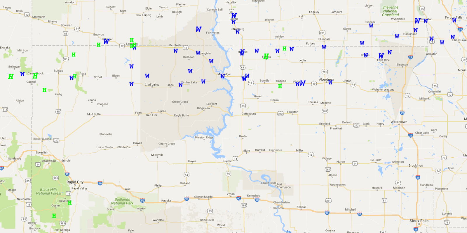 Locations of Hail (H) and Wind (W) Reports across the region during the evening of August 9 into the early morning hours of August 10. |
Wind:
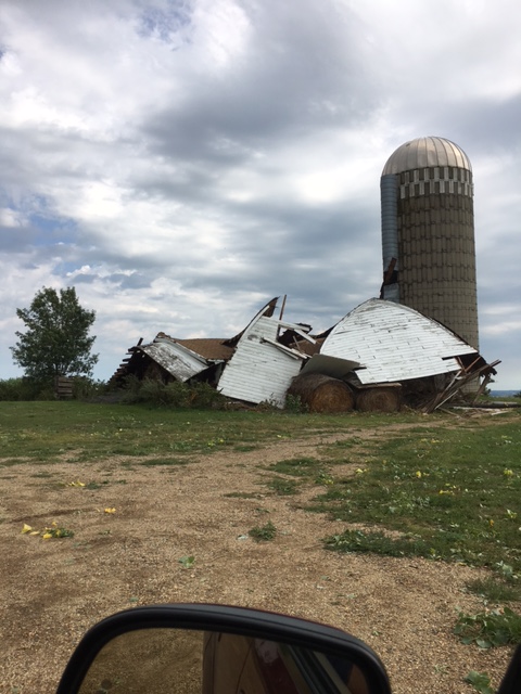
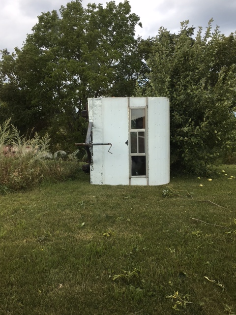
While 60+ mph winds were reported in numerous locations across northern SD, the strongest winds were experienced in Marshall and Edmunds Counties. Here are some pictures from the Hillshead and Ipswich areas.
Hillshead
There was a measured gust of 92 mph at 2:41 AM CDT (8/10) 3 miles to the WSW of Hillshead.
 |
 |
 |
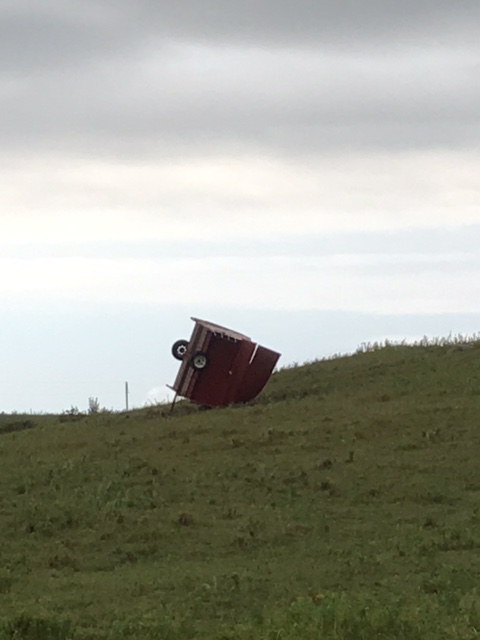 |
| Damage in Veblen (Photo from Marshall County EM) | A barn was destroyed near Hillhead (Photo from Marshall County EM) | Camper flipped near Hillhead (Photo from Marshall County EM) | Farm Equipment flipped near Hillhead (Photo from Marshall County EM) |
 |
 |
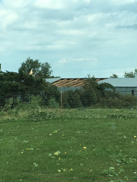 |
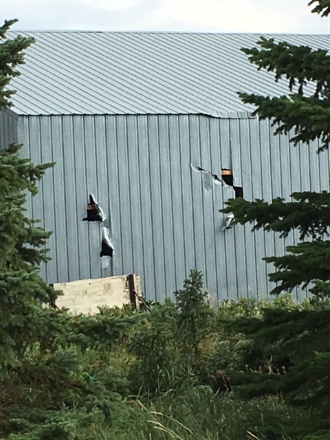
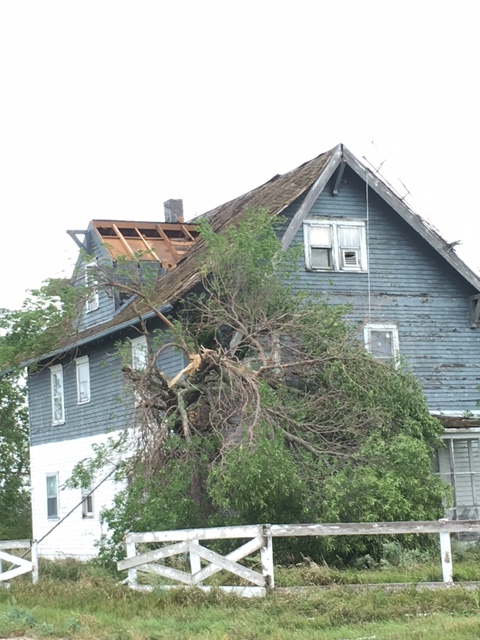
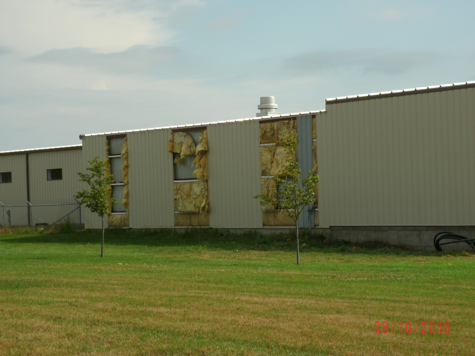
| Holes in building near Hillhead (Photo from Marshall County EM) | Roof damage to metal building near Hillhead (Photo from Marshall County EM) | Roof damage to a house near Hillhead (Photo from Marshall County EM) |
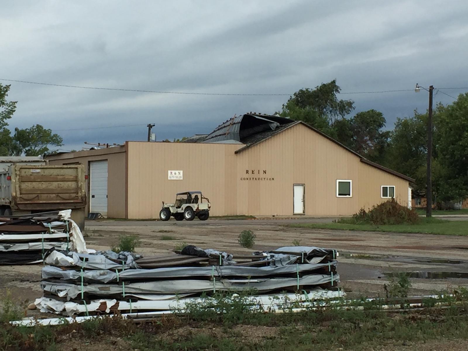
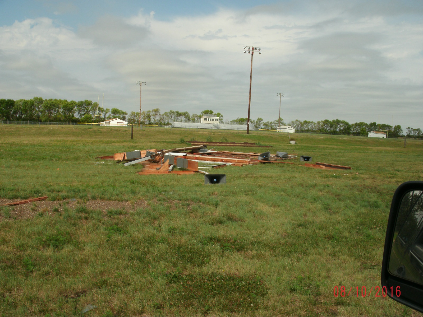
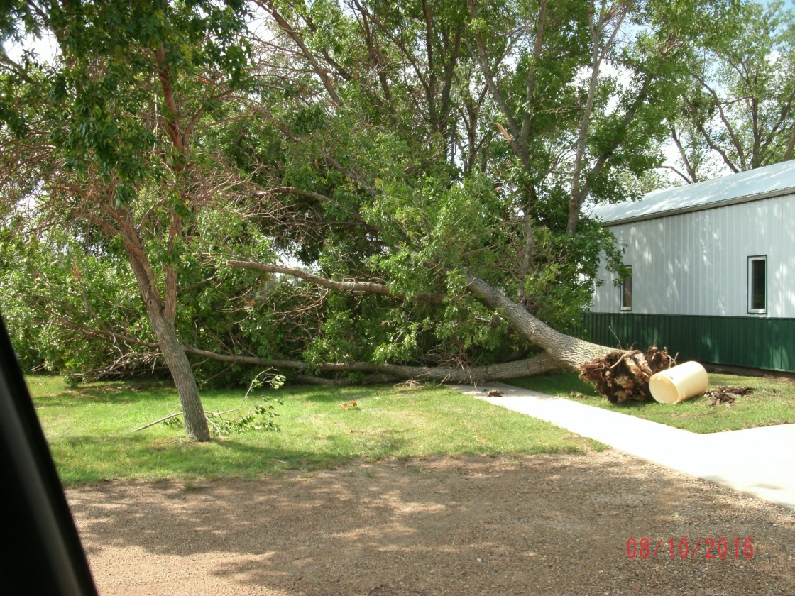
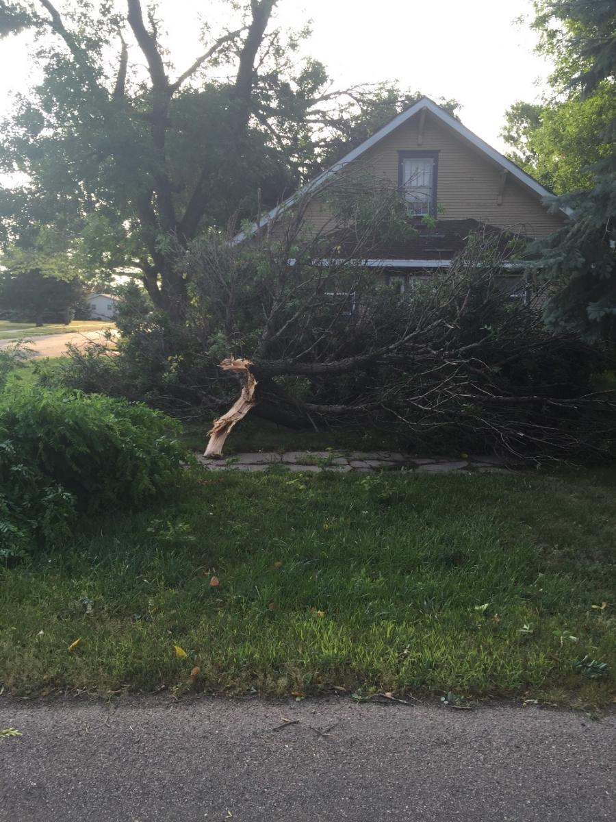
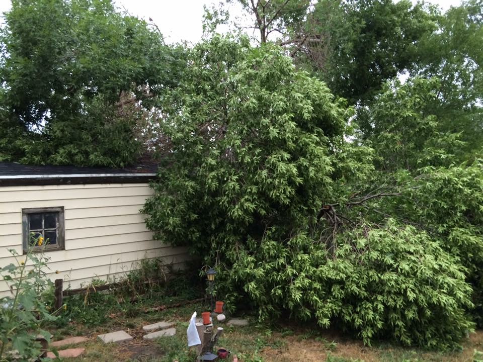
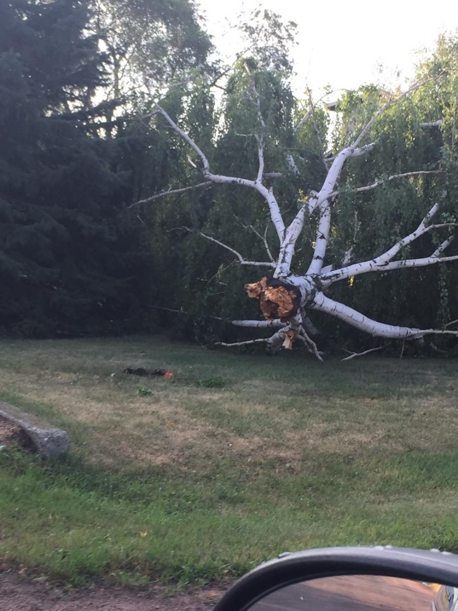
Ipswich
At 1:55 AM CDT (8/10), an 83 mph gust was reported on Highway 12 at Cravens Corner, or 5 miles east of Ipswich.
 |
 |
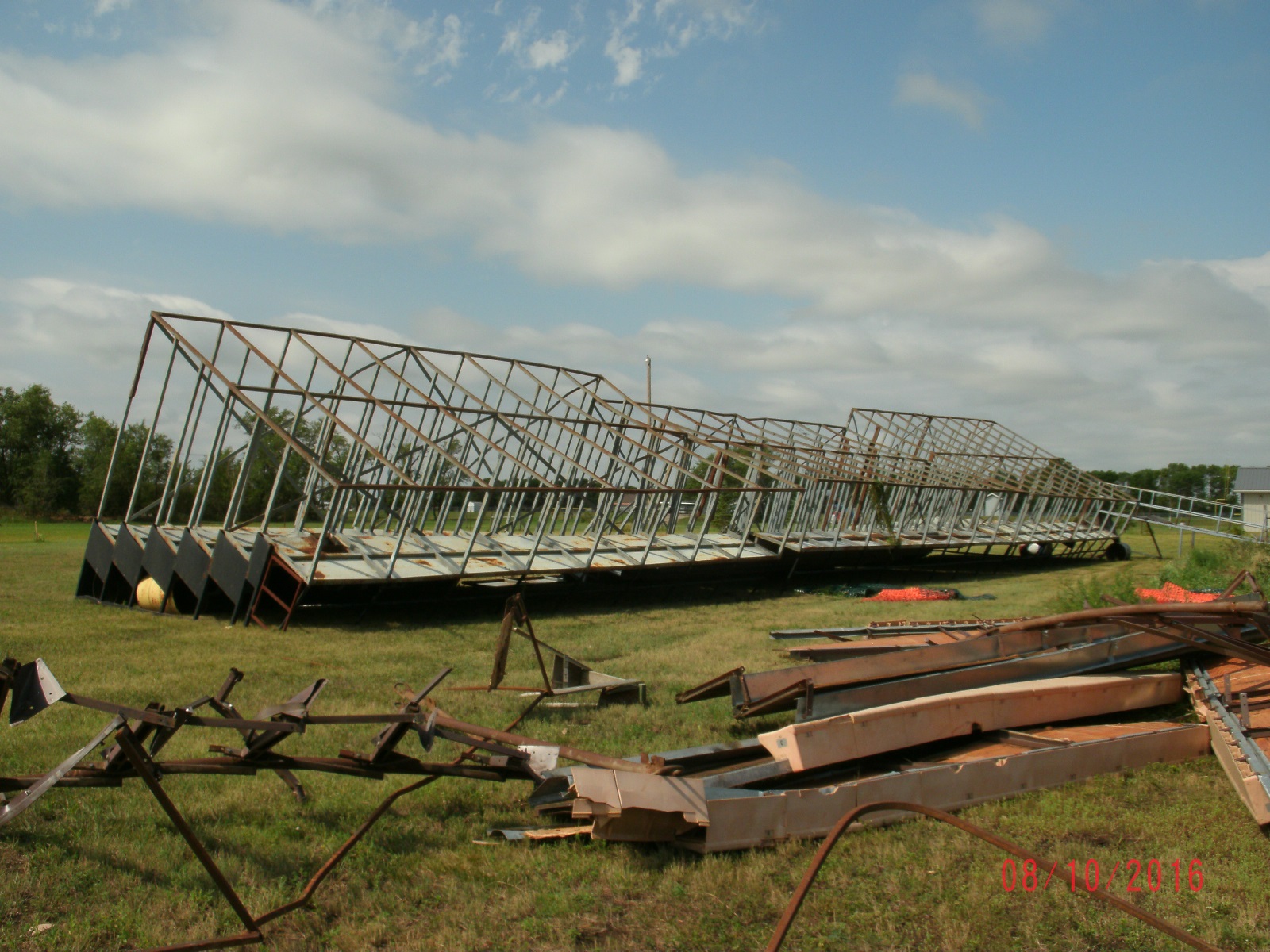 |
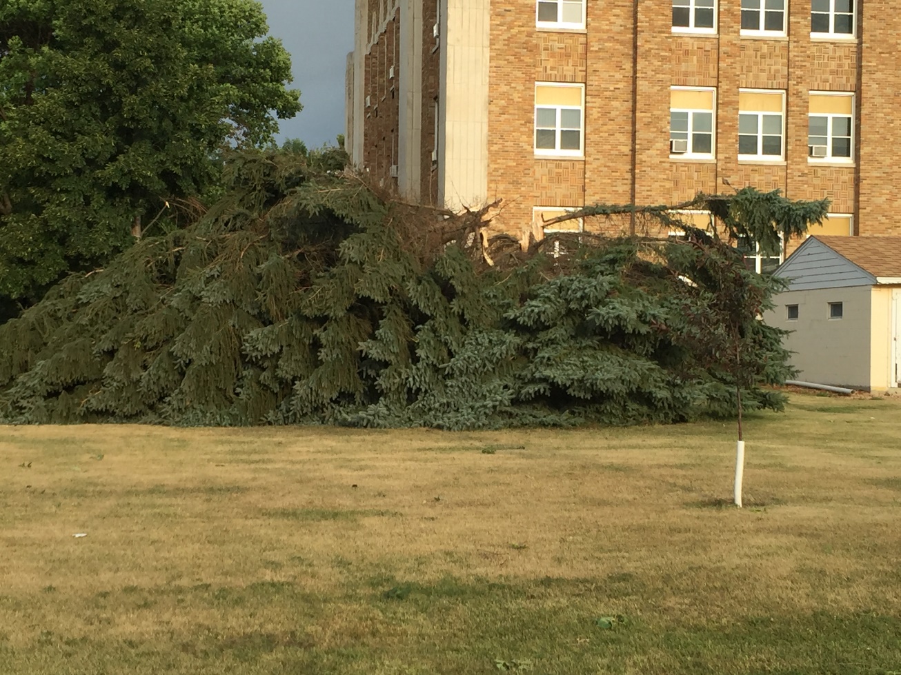 |
| Damage to the State Shop building in Ipswich (Photo from Edmunds County EM) | Damage at Trail Days site (Photo from Edmunds County EM) | Bleachers flipped at Trail Days site (Photo from Edmunds County EM) | Tree snapped at County Courthouse (Photo from Edmunds County EM) |
 |
 |
 |
 |
| Tree uprooted near the 4H building (Photo from Edmunds County EM) | Tree damage around Ipswich (Photo from Edmunds County EM) | Tree damage around Ipswich (Photo from Edmunds County EM) | Tree damage around Ipswich (Photo from Edmunds County EM) |
Radar:
Radar imagery between 11 PM CDT on August 9, 2016 and 4 AM CDT August 10, 2016
 |
 |
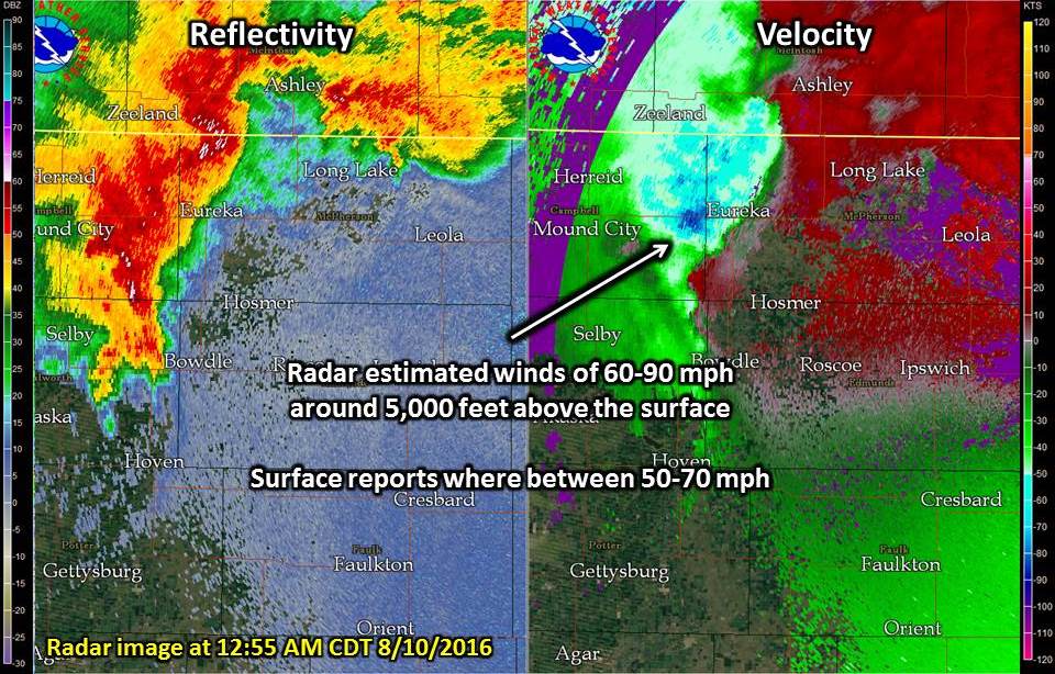 |
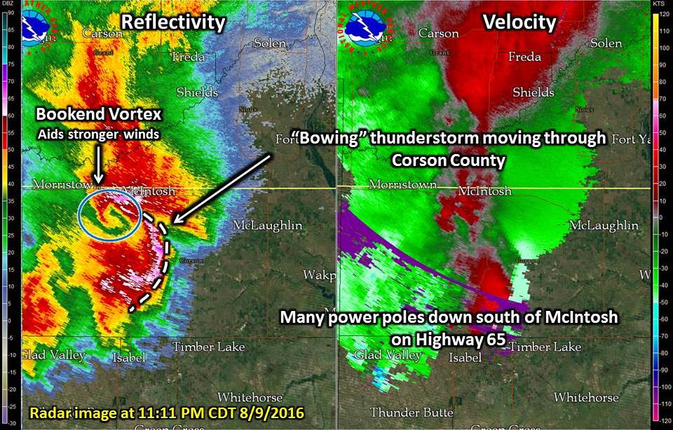
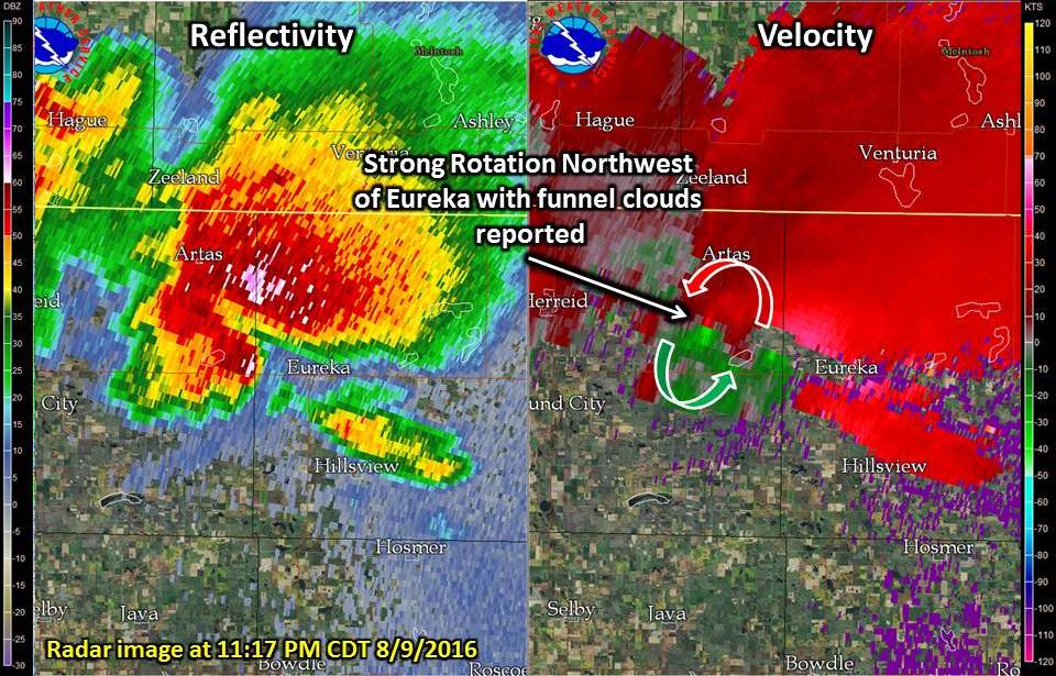
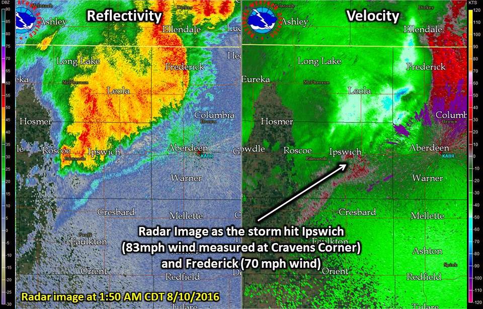
| Bowing storm near McIntosh, with a bookend vortex on the north side of the storm. | A slow moving Supercell to the northwest of Eureka. There were radar indications of a tornado, but only funnel clouds were reported. | The bowing thunderstorm continuing to move east across northern SD and producing 50-70+ mph winds. |
 |
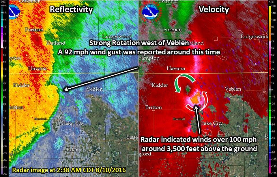 |
| Radar image of the storm as it moved through Ipswich (83 mph wind measured) and Frederick (70 mph). | Strong rotation and radar estimates of 100+ mph winds around 3,500 feet above the ground near Veblen. |
Storm Reports
PRELIMINARY LOCAL STORM REPORT...SUMMARY
NATIONAL WEATHER SERVICE ABERDEEN SD
134 PM CDT WED AUG 10 2016

..TIME...   ...EVENT...      ...CITY LOCATION...     ...LAT.LON...
..DATE...   ....MAG....      ..COUNTY LOCATION..ST.. ...SOURCE....
            ..REMARKS..

0947 PM     HAIL             5 SSE POLLOCK           45.84N 100.24W
08/09/2016  E0.88 INCH       CAMPBELL           SD   TRAINED SPOTTER

            .

1030 PM     TSTM WND DMG     HERREID                 45.84N 100.08W
08/09/2016                   CAMPBELL           SD   LAW ENFORCEMENT

            REPORTS OF CAMPERS FLIPPED WITH MINOR
            INJURIES. 1 TRANSPORTED TO HOSPITAL. TIME
            ESTIMATED.

1030 PM     TSTM WND GST     2 N HERREID             45.87N 100.07W
08/09/2016  M56 MPH          CAMPBELL           SD   MESONET

            HERREID RWIS.

1046 PM     TSTM WND GST     2 NW SHAMBO RANCH       45.55N 101.87W
08/09/2016  M74 MPH          CORSON             SD   MESONET

            MESONET STATION SHAMBO RANCH 2 NWN /E4353/.

1046 PM     NON-TSTM WND GST 2 NW SHAMBO RANCH       45.55N 101.87W
08/09/2016  M74 MPH          CORSON             SD   MESONET

            MESONET STATION SHAMBO RANCH 2 NWN /E4353/.

1050 PM     TSTM WND GST     2 N HERREID             45.87N 100.07W
08/09/2016  M61 MPH          CAMPBELL           SD   MESONET

            .

1100 PM     TSTM WND DMG     3 SSE MCINTOSH          45.88N 101.33W
08/09/2016                   CORSON             SD   LAW ENFORCEMENT

            MANY POWER POLES DOWN FROM MCINTOSH AND FOR
            SEVERAL MILES SOUTH ON HIGHWAY 65. A QUONSET
            WAS BLOWN ACROSS HIGHWAY 65. TIME ESTIMATED
            VIA RADAR.

1109 PM     TSTM WND GST     1 SSE ARTAS             45.88N 99.80W
08/09/2016  E70 MPH          CAMPBELL           SD   PUBLIC

            PEA SIZED HAIL.

1120 PM     TSTM WND GST     11 S BULLHEAD           45.61N 101.06W
08/09/2016  M64 MPH          CORSON             SD   MESONET

            TIME ESTIMATED.

1140 PM     TSTM WND GST     4 W TRAIL CITY          45.47N 100.81W
08/09/2016  M62 MPH          DEWEY              SD   MESONET

            .

1140 PM     TSTM WND GST     5 WNW MCLAUGHLIN        45.85N 100.91W
08/09/2016  M68 MPH          CORSON             SD   MESONET

            MEASURED AT MCLAUGHLIN RWIS.

1145 PM     TSTM WND GST     5 WNW MCLAUGHLIN        45.85N 100.91W
08/09/2016  M68 MPH          CORSON             SD   MESONET

            MEASURED AT MCLAUGHLIN RWIS.

1150 PM     TSTM WND GST     LITTLE EAGLE            45.68N 100.80W
08/09/2016  E60 MPH          CORSON             SD   TRAINED SPOTTER

            ESTIMATED 50 TO 60 MPH WIND GUST AND PEA
            HAIL.

1155 PM     TSTM WND GST     1 SSE MAHTO             45.74N 100.66W
08/09/2016  M71 MPH          CORSON             SD   MESONET

            .

1200 AM     HAIL             3 N EUREKA              45.81N 99.62W
08/10/2016  E2.00 INCH       MCPHERSON          SD   PUBLIC

            VIA SOCIAL MEDIA. TIME ESTIMATED.

1205 AM     TSTM WND GST     2 ENE FIRESTEEL         45.43N 101.24W
08/10/2016  E60 MPH          DEWEY              SD   PUBLIC

            PEA SIZED HAIL.

1216 AM     TSTM WND GST     1 ENE MOBRIDGE          45.55N 100.41W
08/10/2016  M54 MPH          WALWORTH           SD   ASOS

            ASOS STATION MOBRIDGE MUNICIPAL AIRPORT
            /MBG/.

1220 AM     TSTM WND GST     MOBRIDGE                45.54N 100.44W
08/10/2016  E65 MPH          WALWORTH           SD   TRAINED SPOTTER

            .

1230 AM     HAIL             5 NW LONG LAKE          45.91N 99.28W
08/10/2016  M1.50 INCH       MCPHERSON          SD   PUBLIC

            TIME ESTIMATED. VIA SOCIAL MEDIA.

1235 AM     TSTM WND GST     4 NE LONG LAKE          45.90N 99.14W
08/10/2016  E60 MPH          MCPHERSON          SD   PUBLIC

            FEW QUARTER-SIZED HAILSTONES.

1242 AM     TSTM WND GST     SELBY                   45.51N 100.03W
08/10/2016  E70 MPH          WALWORTH           SD   LAW ENFORCEMENT

            .

1247 AM     TSTM WND DMG     4 NE SELBY              45.55N 99.98W
08/10/2016                   WALWORTH           SD   LAW ENFORCEMENT

            TREES AND TREE BRANCHES DOWN AT LAKE
            HIDDENWOOD. TIME ESTIMATED VIA RADAR.

0100 AM     TSTM WND GST     10 W LONG LAKE          45.88N 99.41W
08/10/2016  M59 MPH          MCPHERSON          SD   MESONET

            TIME ESTIMATED.

0110 AM     TSTM WND GST     10 SW LONG LAKE         45.77N 99.36W
08/10/2016  M54 MPH          MCPHERSON          SD   MESONET

            MEASURED AT EUREKA RWIS...13 MILES TO THE
            EAST.

0130 AM     TSTM WND GST     SELBY                   45.51N 100.04W
08/10/2016  E60 MPH          WALWORTH           SD   TRAINED SPOTTER

            .

0153 AM     TSTM WND DMG     IPSWICH                 45.44N 99.03W
08/10/2016                   EDMUNDS            SD   EMERGENCY MNGR

            WIDESPREAD TREE DAMAGE IN IPSWICH.

0155 AM     TSTM WND GST     CRAVENS CORNER          45.45N 98.93W
08/10/2016  M83 MPH          EDMUNDS            SD   MESONET

            CRAVEN CORNER RWIS.

0200 AM     TSTM WND GST     7 N FREDERICK           45.93N 98.53W
08/10/2016  M70 MPH          BROWN              SD   MESONET

            FREDRICK RWIS.

0212 AM     TSTM WND GST     3 ESE ABERDEEN          45.46N 98.41W
08/10/2016  M58 MPH          BROWN              SD   OFFICIAL NWS OBS

            MEASURED AT THE NWS ABERDEEN OFFICE.

0212 AM     TSTM WND GST     3 ESE ABERDEEN          45.46N 98.41W
08/10/2016  M53 MPH          BROWN              SD   ASOS

            ASOS STATION ABERDEEN REGIONAL AIRPORT
            /ABR/.

0224 AM     HAIL             3 SSW ROSCOE            45.41N 99.36W
08/10/2016  U1.25 INCH       EDMUNDS            SD   LAW ENFORCEMENT

            .

0235 AM     TSTM WND GST     2 N BRITTON             45.82N 97.74W
08/10/2016  M72 MPH          MARSHALL           SD   MESONET

            MESONET STATION BRITTON 1 NNE /KBTN/.

0240 AM     TSTM WND DMG     1 W HILLHEAD            45.84N 97.41W
08/10/2016                   MARSHALL           SD   EMERGENCY MNGR

            9 POWER POLLS BLOWN DOWN. RADAR ESTIMATED
            TIME. .

0241 AM     TSTM WND GST     3 WSW HILLHEAD          45.81N 97.45W
08/10/2016  M92 MPH          MARSHALL           SD   MESONET

            MARSHALL COUNTY RAWS - MRLS2. TIME ESTIMATED
            VIA RADAR.

0242 AM     TSTM WND DMG     1 E HILLHEAD            45.84N 97.37W
08/10/2016                   MARSHALL           SD   EMERGENCY MNGR

            BARN COLLAPSE AND TREES BROKEN OFF. RADAR
            ESTIMATED TIME. .

0249 AM     TSTM WND DMG     VEBLEN                  45.86N 97.29W
08/10/2016                   MARSHALL           SD   TRAINED SPOTTER

            A FEW 3 TO 4 INCH DIAMETER TREE BRANCHES
            DOWN IN TOWN. SEVERAL SMALL BRANCHES DOWN.

0309 AM     TSTM WND GST     2 ENE SISSETON          45.67N 97.00W
08/10/2016  M56 MPH          ROBERTS            SD   ASOS

            ASOS STATION SISSETON MUNICIPAL AIRPORT
            /8D3/.

0313 AM     TSTM WND GST     4 NNW VICTOR            45.93N 96.85W
08/10/2016  M52 MPH          ROBERTS            SD   MESONET

            VICTOR RWIS.

0342 AM     TSTM WND DMG     2 SE TINTAH             45.99N 96.30W
08/10/2016                   TRAVERSE           MN   PUBLIC

            5-6" DIAMETER BRANCHES DOWN.
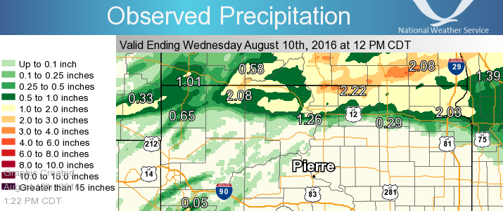
Rain Reports
24 Hour Rainfall Amounts ending at Noon on August 10, 2016
 |
Media use of NWS Web News Stories is encouraged! Please acknowledge the NWS as the source of any news information accessed from this site. |
|

