Albuquerque, NM
Weather Forecast Office

New Mexico's Winter Cloud
|
||||||||||||
|
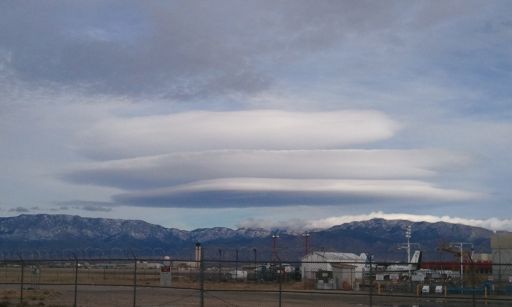
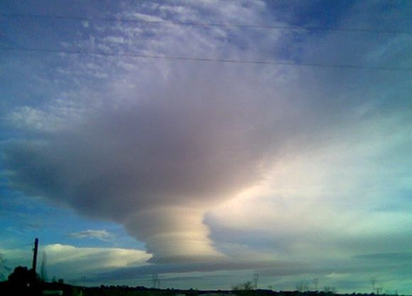
You have no doubt seen them in the sky this winter, perhaps snapped a photo or two and used terms like "flying saucer" or "stack of pancakes" to describe them. So what exactly are those mysterious looking clouds and why do they form? |
||||||||||||
 Picture taken December 21, 2010 by Ethan Nelson |
 Picture taken February 11, 2008 by Todd Shoemake |
|||||||||||
|
Known as Altocumulus Standing Lenticular (ACSL) or Altocumulus Standing Lenticularis clouds, they are associated with waves in the atmosphere that develop when relatively stable, fast moving air is forced up and over a topographic barrier that is oriented more or less perpendicular to the direction from which the upper-level wind is blowing. This deflection creates a gravity wave downwind of the topographic barrier not unlike a wave you might generate by throwing a pebble into a pond. When sufficient moisture is present above mountain-top level, ACSL clouds develop within the crest of these mountain waves where the air is rising. ACSL clouds are continually developing and dissipating in the vicinity of the wave's crest and immediately downwind of the crest, respectively. That is why they appear to remain stationary (hence the name) even though winds are swiftly (sometimes very swiftly) moving through the entire cloud. They are most often seen in the winter or spring when winds aloft are typically the strongest. A more thorough discussion of mountain waves is available here. When aircraft encounter a mountain wave, severe turbulence is often the result. The most telling clue that a mountain wave exists is the presence of ACSL clouds. But when the air is too dry to support cloud development, pilots and others may be unaware that a mountain wave and potentially severe turbulence exists. So while visually striking and appealing to photographers, ACSL may not be a welcome sight to those in the aviation community. Additionally, strong and gusty surface winds may be encountered particularly in the lee of the mountain barrier. |
||||||||||||
Current Hazards
Outlooks
Submit A Storm Report
Severe and Hazardous Weather Info
Current Conditions
Surface Observations
Observed Precipitation
Satellite
Local Satellite Page
Local Observations Page
Map of Latest Wind and Precipitation Reports
Radar
National Radar
ABX Albuquerque Radar
FDX Cannon Air Force Base Radar
Forecasts
Fire Weather Forecasts
Area Forecast Discussion
Hourly View Forecast
Activity Planner
Aviation Forecasts
Local Forecast Page
Graphical Forecasts
Hydrology
Local Hydrology Products
Advanced Hydrologic Prediction Services
Climate and Past Weather
Local Data
Winter Climatology for NM
NOAA Climate Center
Climate Prediction Center
Climate Graphs
Drought
Severe T-Storm Climatology for NM
Local Programs
About Our Office
SKYWARN
NOAA Weather Radio
Local Studies and Features
Winter Weather Info, Safety Tips, and Climo
Severe Weather Info, Safety Tips, and Climo
Center Weather Service Unit
US Dept of Commerce
National Oceanic and Atmospheric Administration
National Weather Service
Albuquerque, NM
2341 Clark Carr Loop SE
Albuquerque, NM 87106-5633
(505) 243-0702
Comments? Questions? Please Contact Us.


