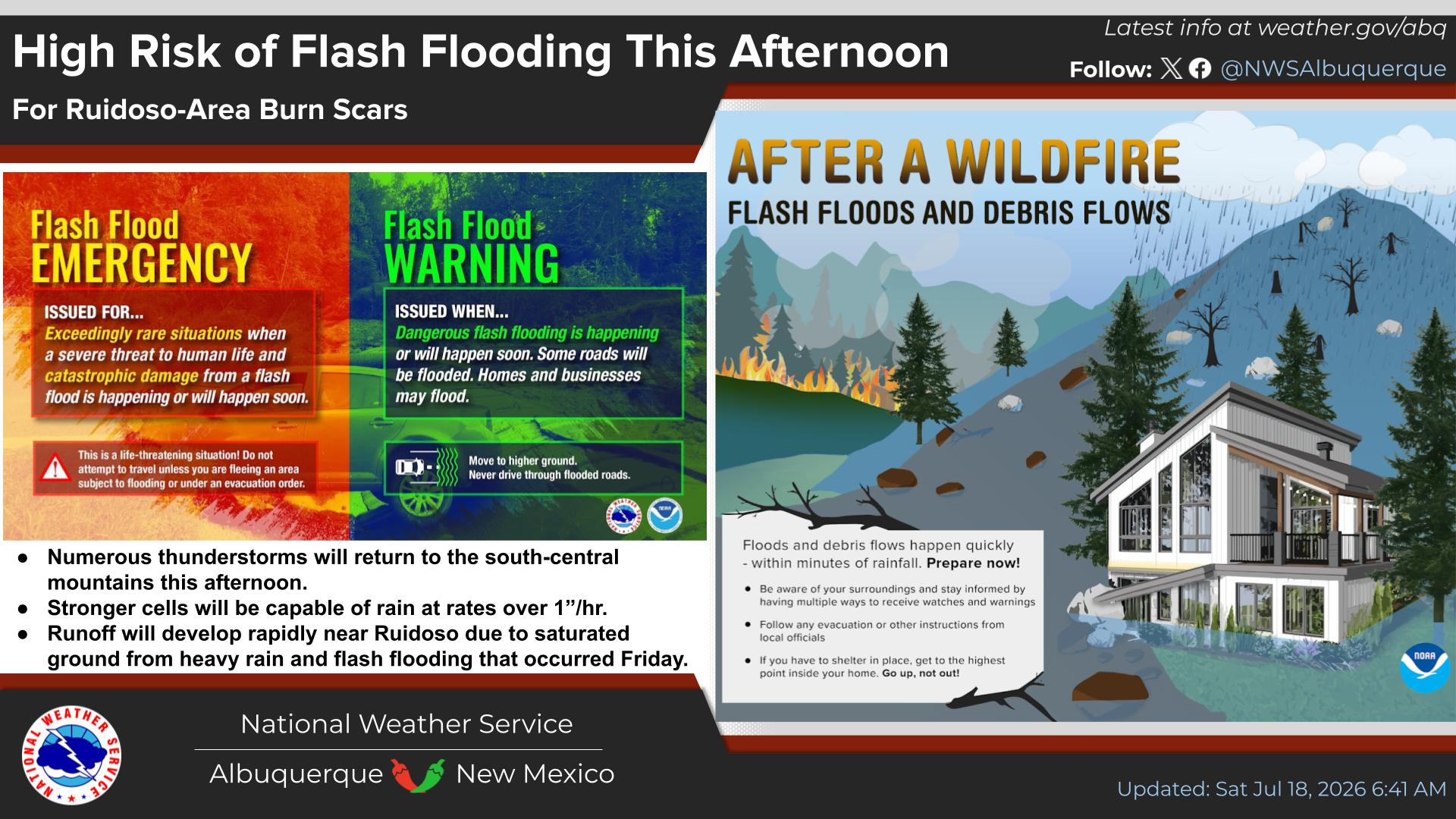
National Weather Service United States Department of Commerce
Click a location below for detailed forecast.

Last Map Update: Mon, Dec 15, 2025 at 2:54:22 pm MST

West winds will strengthen Wednesday afternoon and evening. There is a low chance (10-20%) of very strong crosswinds along the I-25 corridor between Las Vegas and Raton Wednesday evening and overnight and a high chance of peak gusts topping 50 mph over the peaks of the Sangre de Cristo Mountains.
Drier than average weather is likely through at least Christmas Eve.
Unseasonably warm temperatures will be the rule for the next week. Record to near record heat will be in store mainly Tuesday through Saturday. No precipitation is forecast through the next week.


Text Product Selector (Selected product opens in current window)


Submit Storm Report Icon

Submit Storm Report

Key Impacts Icon

Key Impacts

Observations Icon

Local Observations

Webcams Icon

Office Webcams

Satellite Icon

Satellite Imagery

Are You Prepared Icon

Are You Prepared?

Weekly Weather Briefing Icon

Weekly Weather Briefing

Area Forecast Discussion Icon

Area Forecast Discussion

Fire Weather Icon

Fire Weather

Aviation Weather Icon

Aviation Weather

Snow Probabilities Icon

Snow Probabilities

SKYWARN Icon

SKYWARN Spotters

On This Date in Weather History Icon

On This Date

Climate Graphs Icon

Climate Graphs

Drought Monitor Icon

Drought Monitor

Severe Weather Info and Climatology Icon

Severe Weather Climatology

Monsoon Awareness Icon

Monsoon Awareness

Winter Climatology Icon

Winter Climatology