The growing season across New Mexico varies considerably due to the large variation in elevation. The lowest elevations are near 3,000 feet in the far southeast plains (around Jal), while the highest elevations tower above 13,000 feet (Wheeler Peak). The San Juan, Rio Grande, Canadian and Pecos river valleys also affect the growing season, as cold air sinks into the valleys on many winter and spring nights. To complicate matters, there is often what is called a 'thermal belt', or thermal inversion, above the cold pool of air in the valley. This is a layer of air that is considerably warmer than farther down in the valley. This thermal belt is usually located near the mid slope of a mountain or more gently sloping terrain. A good example exists around Albuquerque. At the valley floor, temperatures can be 10 or more degrees colder than at the Albuquerque Sunport, while the Sunport will generally be several degrees warmer than the foothills. However, on nights with very strong thermal inversions, the foothills can actually be several degrees warmer than the Sunport and over 20 degrees warmer than the valley.
A 'freeze' is considered to have occurred whenever the temperature drops to 32 degrees or lower. A growing season is calculated by taking the number of days between the last freeze in the spring and the first freeze in the fall. However, plants or crops do not necessarily follow this rule. A low temperature of 31 or 32 degrees for a short period of time, say less than two hours, probably will not harm most plants or crops. But if the temperature drops to 28 or 29 degrees for a few hours, most vegetation will be damaged. As a side note, frost can form when a solid surface (like a car or plants) is in contact with the air and the solid surface's temperature drops to 32 degrees or colder. The extent of the frost depends on how much moisture is in the air. If the temperature is above 32 degrees and there is enough moisture in the air, then dew (a liquid) forms instead of frost (a solid).
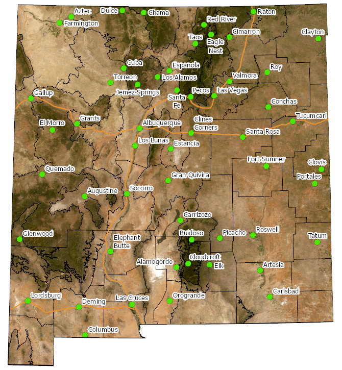
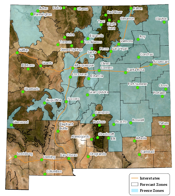
Place your cursor over a green circle on the map below to view probabilistic freeze data for locations across New Mexico, including the 90th, 50th (median), and 10th percentiles for 32° and 28°.
An interactive map of average last freeze dates is also available at climate.gov.
An extensive list of spring freeze data for select locations in New Mexico has been compiled using the NCEI summary of annual agricultural normals for the period 1991-2020.