.png) |
| Several Events - Ute Park Burn Scar |
|
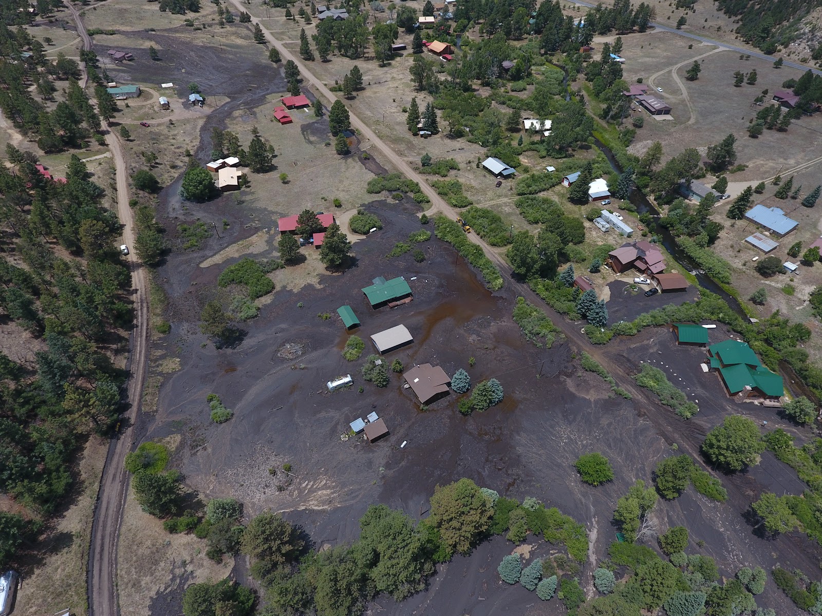
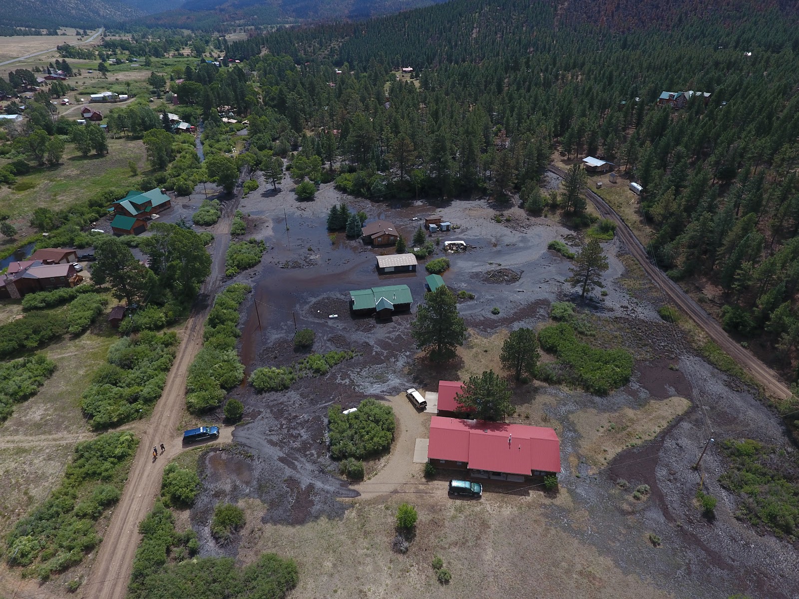
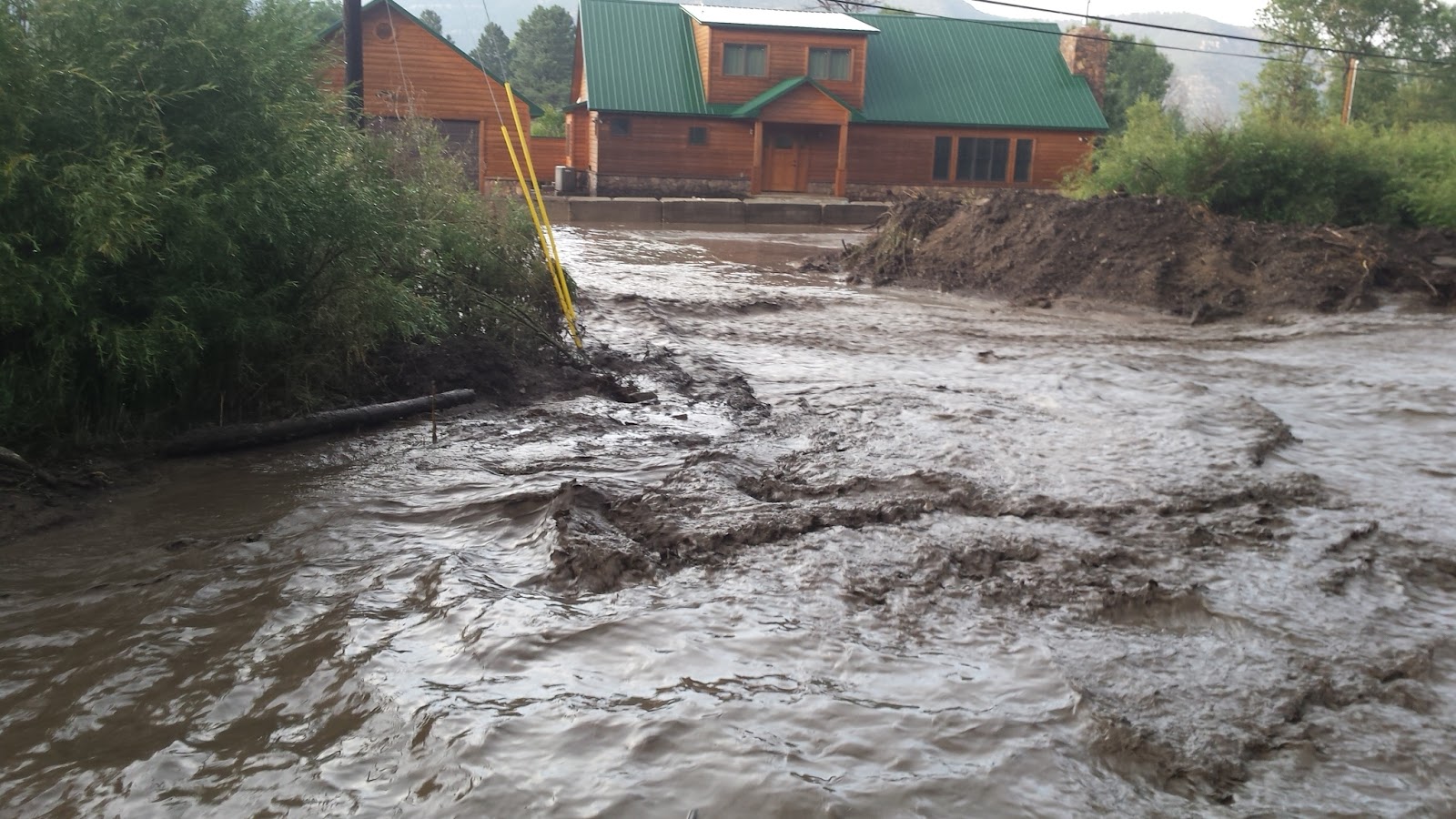
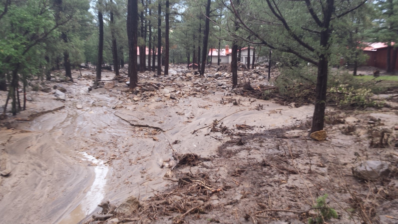
Several rainfall events during the monsoon season resulted in impacts near the Ute Park wildfire burnscar. On Thursday, July 5, moderate rainfall over the UtePark burn scar generated a mudslide and the closure of U.S. Highway 64. A motorcyclist traveling along the route hit a muddy area and crashed (minor injuries). On Friday, July 13, rainfall from a cluster of thunderstorms over the Ute Park burn scar produced flash flooding and a debris flow through the village of Ute Park. Floodwaters and a debris flow traveled down a drainage along Turkey Roost Lane and pushed through the center of the village, depositing ashy mud, fire debris, and small boulders through residential lots before draining into the Cimarron River. The debris flow deposited approximately two feet of debris and mud along impacted roads, making roads impassable and cutting off several homes. Approximately 12 homes were impacted with four receiving moderate damage. Several vehicles were damaged or displaced from debris. Of the homes moderately damaged, most were damaged directly from debris/water or were in low-lying areas. Photos courtesy of SWC Environmental Consultants.
Another round of moderate to heavy rainfall impacted the area on Thursday, August 2. There was an unconfirmed rainfall total of 1.6" near Ute Park, but most areas received under one inch -- amplifying how A total of 28 homes were impacted from floodwaters and debris flows, including six that were nearly cut-off from access. This is the same area that was impacted during the July 13 flash flood, but this flood event was much more impactful. Photos are courtesy of Tom Vigil.
|
| July 5 Belen Flash Flood |
|
The first significant surge of monsoon moisture of the 2018 season generated numerous showers and thunderstorms with locally heavy rainfall across New Mexico on July 5th. A torrential downpour (1.62 inches in 45 minutes) resulted in a levee breach in Belen near Hansen Road. This flooded a large section of town near the Belen High School. Shelters were open for those affected by flooding in Belen. The image below is a reflectivity image around 5:40 p.m. MDT as the storms moved through the Belen area. Belen Flash Flooding on July 5, 2018 - Courtesy of Jason Brousseau
|
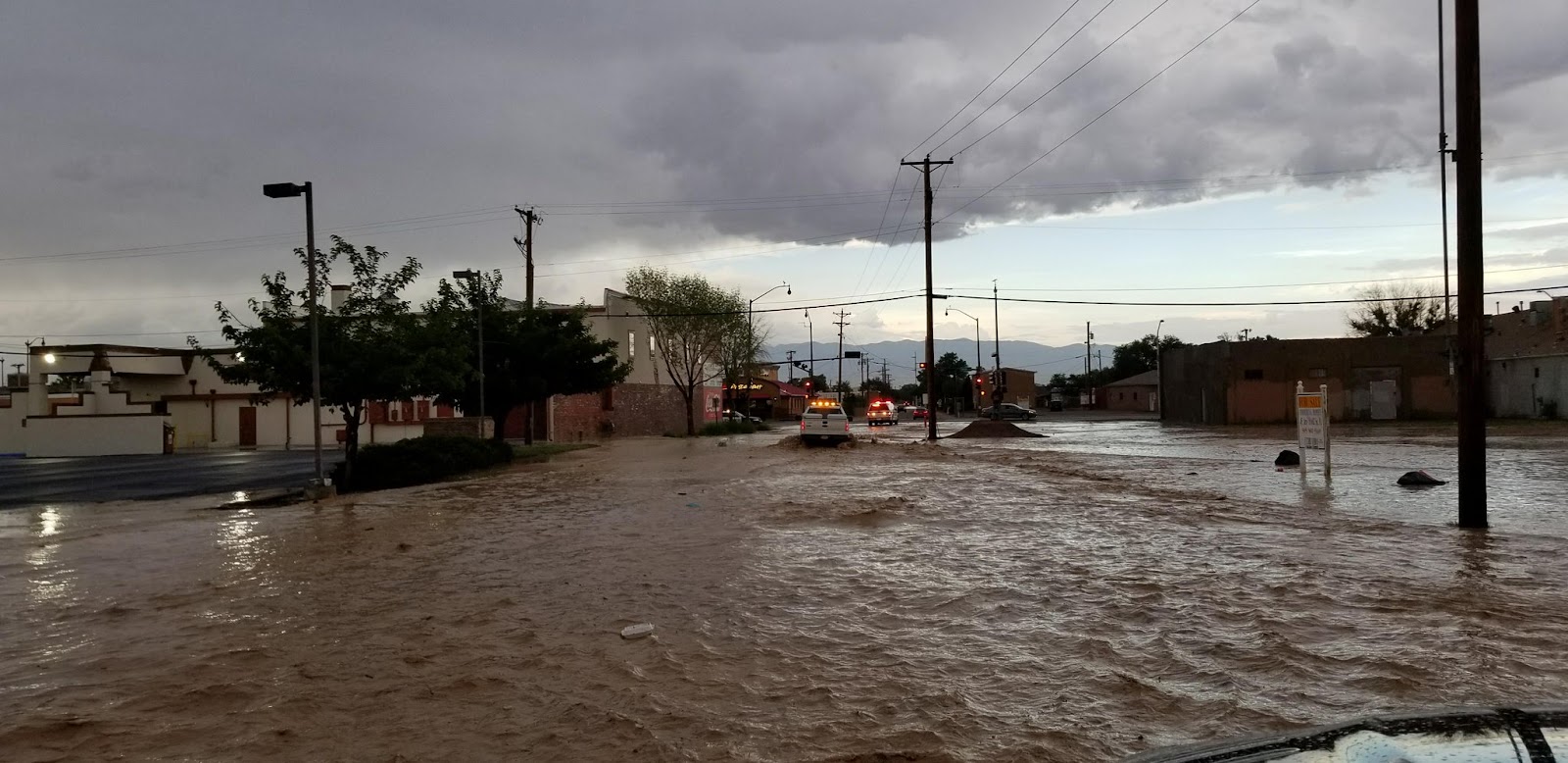
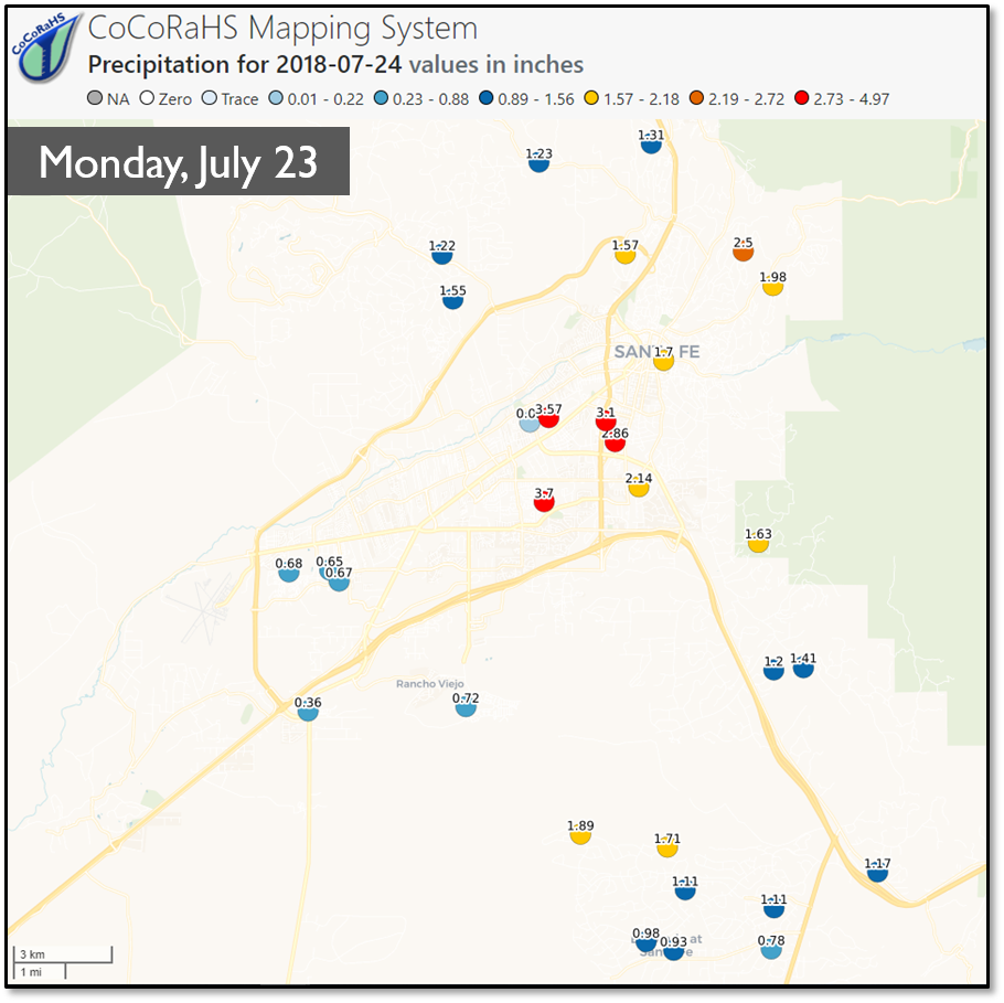
| July 23 Flash Flooding in Santa Fe |
|
Torrential rainfall resulted in devastating flash flooding in and around Santa Fe, NM. A CoCoRaHS observer measured 3.70 inches of rain in less than one hour, which equated to a 500- or 1000-year precipitation event. A total of 10 roadways were closed due to flood debris and high water. Local emergency services responded to five swift water rescues. A total of 100 homes experienced damage from flood waters, of which 33 saw major damage and 6 were completely destroyed. Flood waters inundated the basement of the county courthouse. Flash flooding also occurred along Cienega Creek resulting in damage to several homes in La Cienega. A shelter was set up at the Genoveva Chavez Community Center.
|
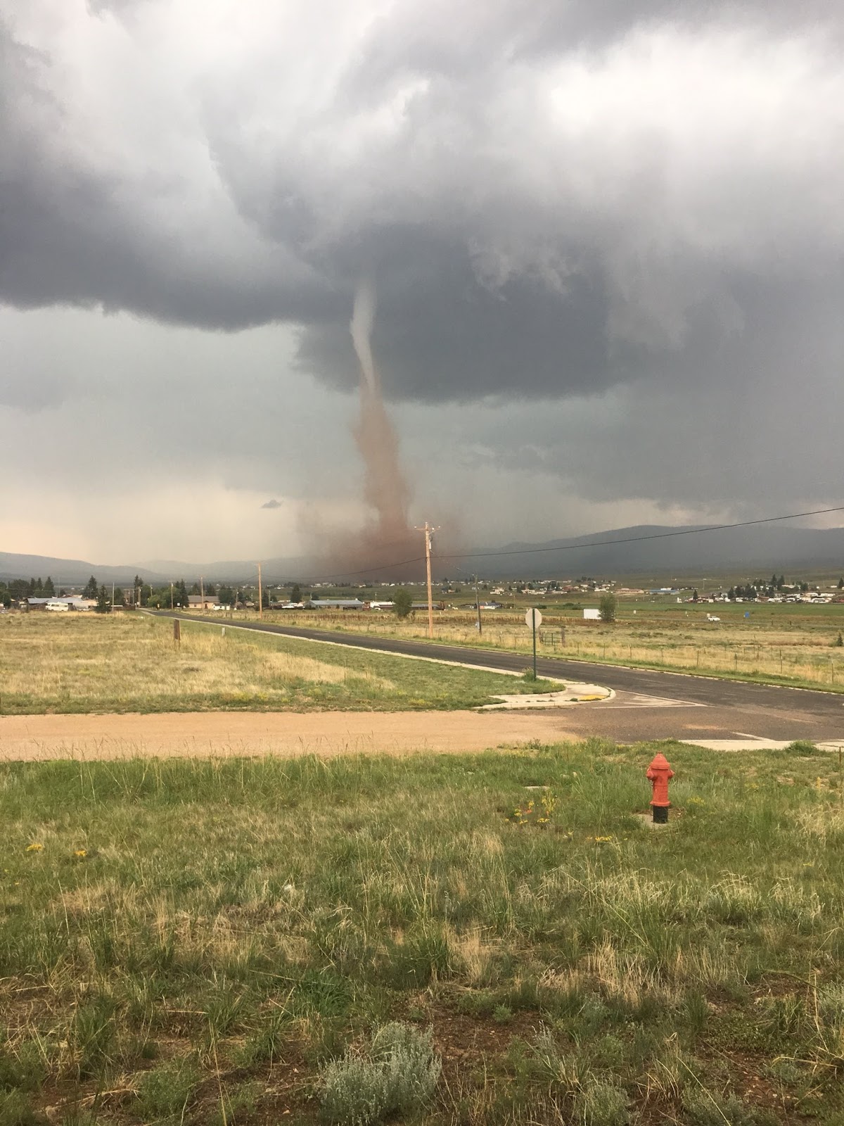
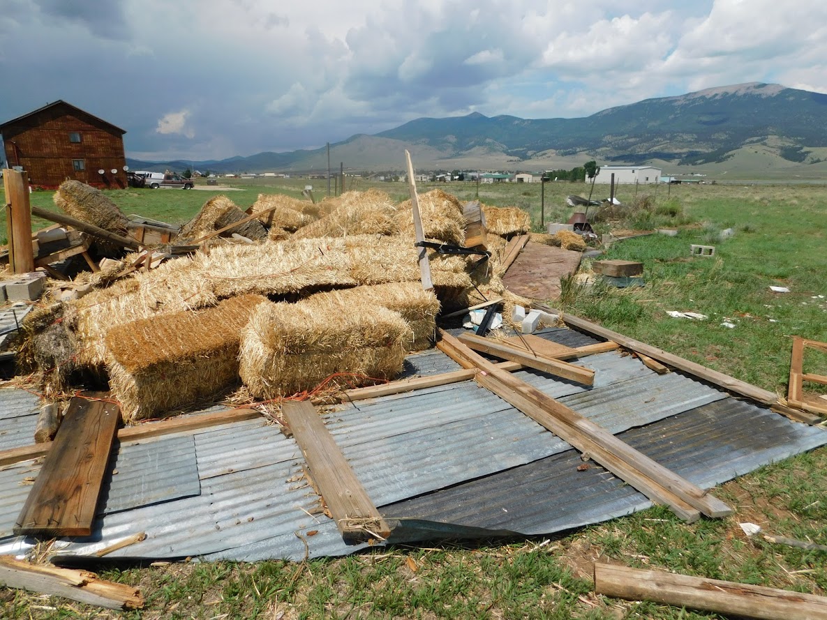
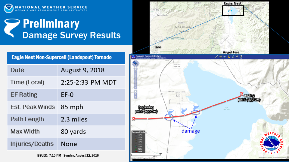
| August 9 Eagle Nest Non-Supercell (Landspout) Tornado |
|
A relatively short-lived, non-supercell tornado impacted areas in and near the community of Eagle Nest, NM, (elevation 8,200 feet MSL) located in the Moreno Valley shortly after 2:30 p.m. MDT on Thursday, August 9. Emergency Management and DOT officials reported one cabin rental business with six structures had minor external damage as well as two dozen windows busted out, one hay barn destroyed, one RV knocked over and an unknown number of transformers damaged as well as downed power lines. This is the first reported tornado since at least 1950 in the Moreno Valley, which is surrounded by mountains that rise to 10,000 feet or higher. NWS officials surveyed the impacted area and rated the tornado an EF-0 on the Enhanced Fujita Scale with estimated peak winds of 85 mph. The tornado was estimated to be on the ground for eight minutes and travelled over two miles.
|
| October 22-24 Widespread Precipitation |
|
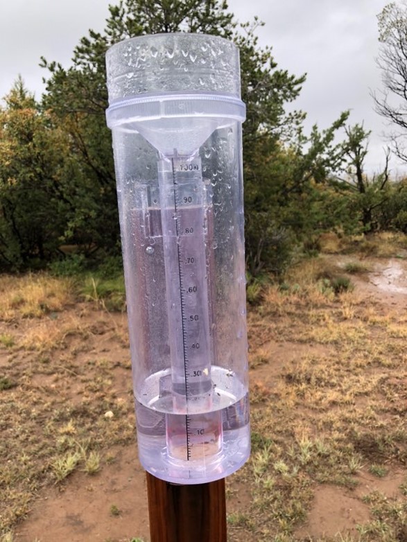
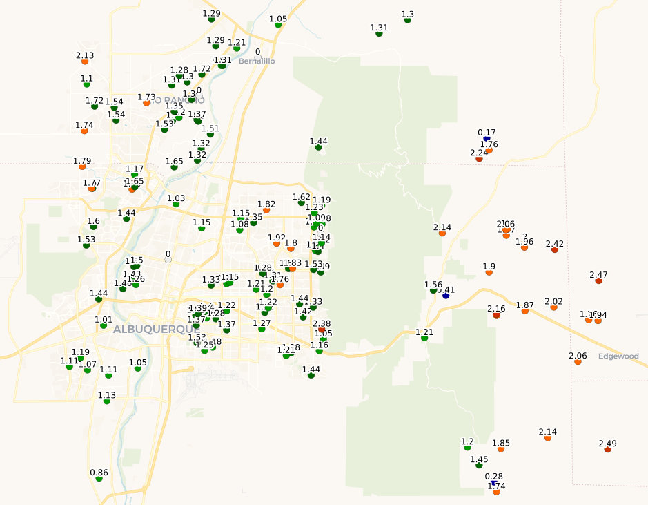
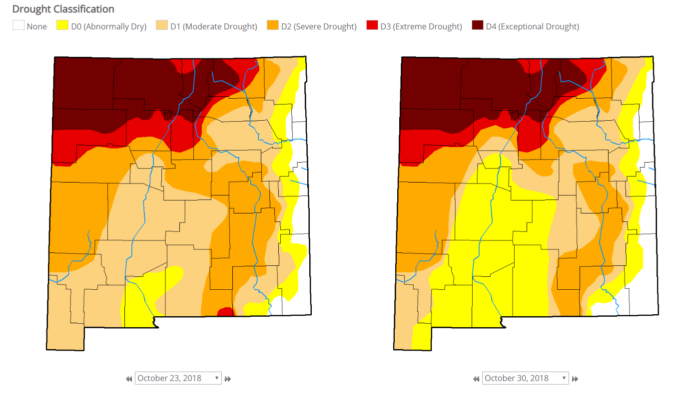
A storm system in the upper levels of the atmosphere moved across northern Arizona during the afternoon and evening hours of Monday, October 22. This brought scattered showers and thunderstorms to western and central New Mexico. This system slowly tracked across New Mexico on Tuesday into Wednesday, October 23-24, bringing abundant subtropical moisture to the region. Widespread moderate to locally heavy rainfall was observed, especially across central and eastern New Mexico. Some of the heaviest rainfall totals for this event included 2.75 inches southeast of Corona, 2.69 inches at Jemez Springs, 2.64 inches near Sedillo, 2.47 inches near Sandia Park, 2.41 in northwest Albuquerque, 1.94 inches in Roswell and 1.85 inches near Las Vegas. Click here for a full list of precipitation reports. The image to the right, courtesy of Bill Simms, depicts a CoCoRaHS rain gauge near Chilili, NM, with precipitation overflowing the inner tube. This favorable weather pattern helped to alleviate long-term drought conditions over parts of southern and eastern New Mexico. The unusual nature of the steady rainfall over an extended period of time allowed the moisture to soak into the ground more efficiently -- versus immediately running off into arroyos, streams, rivers as normally experienced during the monsoon season.
|


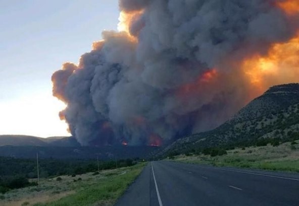 The Ute Park wildfire began on the afternoon of Thursday, May 31, south of U.S. Highway 64. Strong southwest winds steered the fire northeast and its jumped the highway. The fire consumed approximately 36,740 acres before it was fully contained on June 19. Th