National Weather Service United States Department of Commerce
Click a location below for detailed forecast.

Last Map Update: Tue, Jul 15, 2025 at 3:50:09 pm MDT

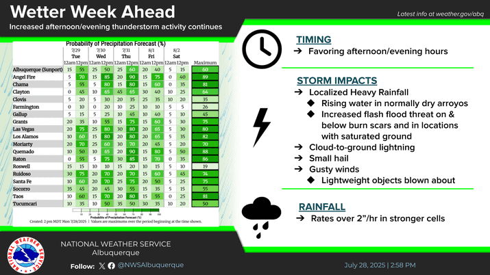
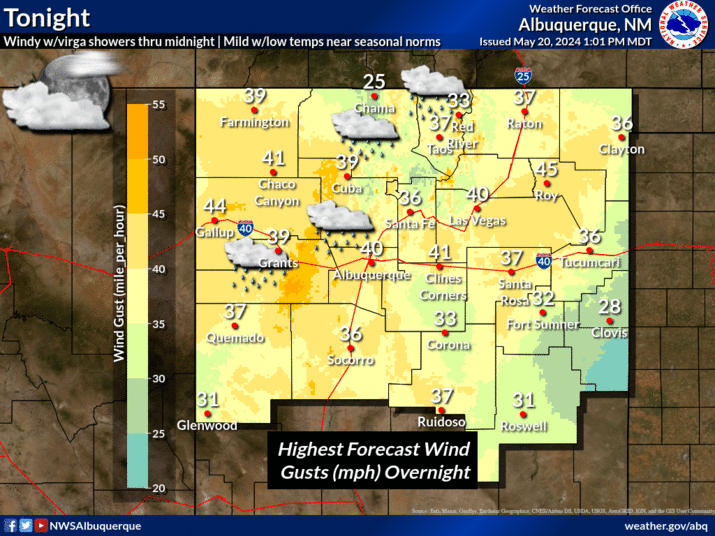
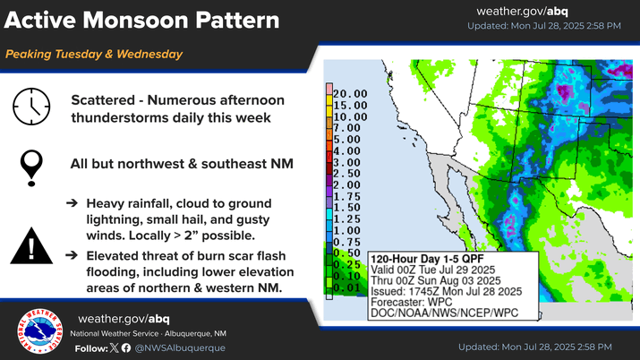
Scattered showers and storms Tuesday and Wednesday will favor central and western NM. Typical monsoon hazards of small hail, gusty outflow winds, and locally heavy rainfall are possible with any storms.
Near normal temperatures through mid week will trend below normal by late week.
The graphic shows the most likely and high-end rainfall amounts for the Tuesday through Thursday afternoon time period. Most of this rain will fall on Thursday as weather will trend wetter mid-week. Localized areas of 1"+ in the mountains may create flash flooding, particularly on Thursday.
The thunderstorm threat matrix indicates the probability of thunderstorms over wildfire burn areas.


Text Product Selector (Selected product opens in current window)


Submit Storm Report Icon

Submit Storm Report

Key Impacts Icon

Key Impacts

Observations Icon

Local Observations

Webcams Icon

Office Webcams

Satellite Icon

Satellite Imagery

Are You Prepared Icon

Are You Prepared?

Weekly Weather Briefing Icon

Weekly Weather Briefing

Area Forecast Discussion Icon

Area Forecast Discussion

Fire Weather Icon

Fire Weather

Aviation Weather Icon

Aviation Weather

Snow Probabilities Icon

Snow Probabilities

SKYWARN Icon

SKYWARN Spotters

On This Date in Weather History Icon

On This Date

Climate Graphs Icon

Climate Graphs

Drought Monitor Icon

Drought Monitor

Severe Weather Info and Climatology Icon

Severe Weather Climatology

Monsoon Awareness Icon

Monsoon Awareness

Winter Climatology Icon

Winter Climatology