
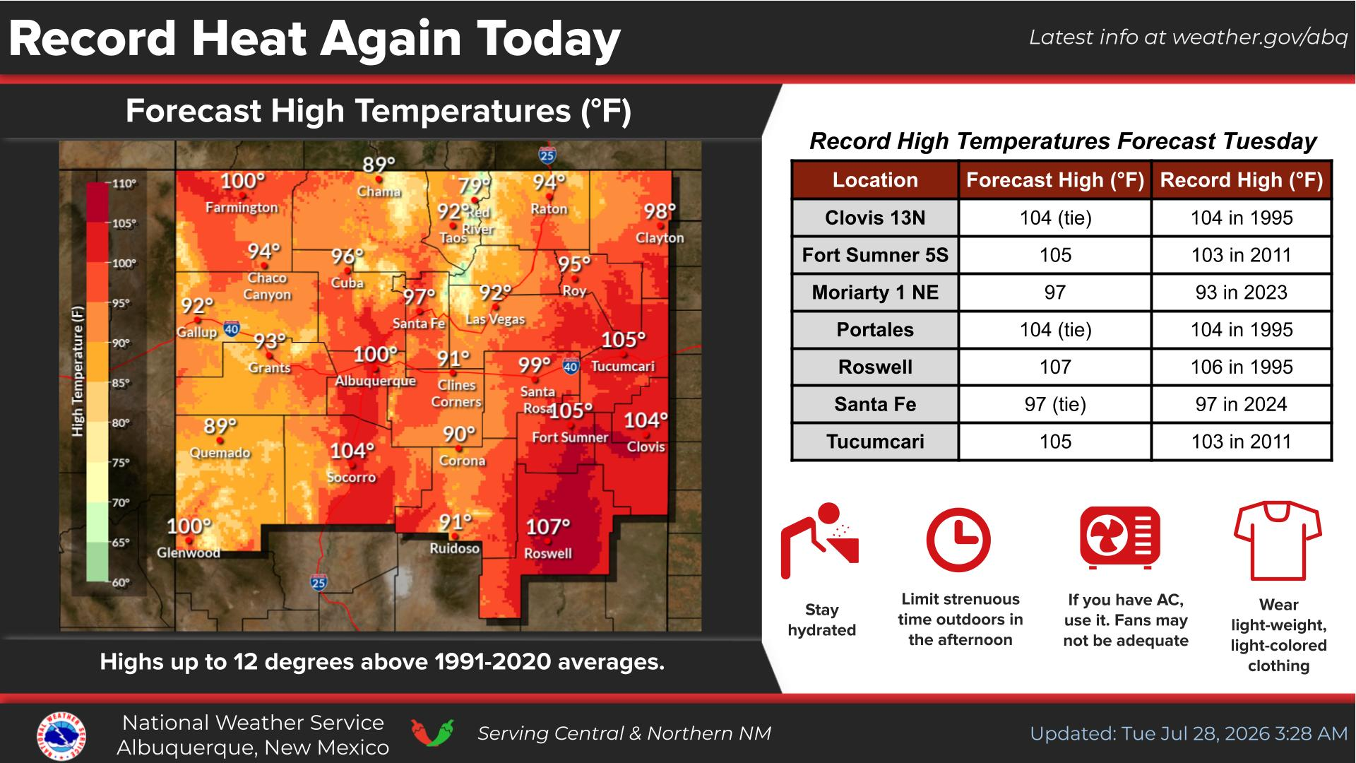
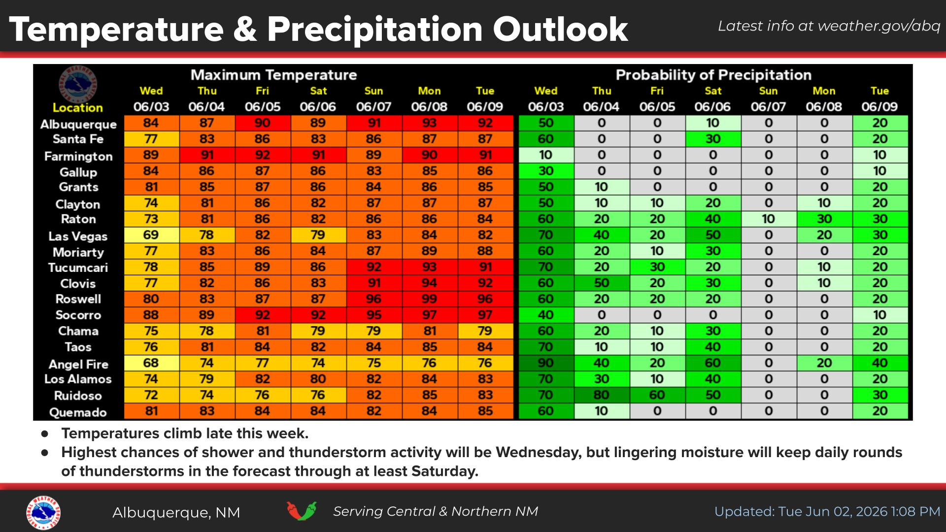
Extreme heat continues across the Southwest as temperatures may top 120 degrees. The heat may expand across the West and south-central U.S. into the middle of the month. Severe thunderstorms capable of severe wind gusts and large hail will be the primary hazards today across the northern Plains into the upper Midwest. Rainfall could be locally heavy across the Eastern U.S. today. Read More >
Last Map Update: Mon, Aug 3, 2026 at 8:36:26 am MDT


|
Text Product Selector (Selected product opens in current window)
|
|
|
|
|
|
|
|
|
|
|
|
|
|
|
|
|
|
|
|
|
|
|
|
|


 Office Webcam
 Weather Map
 Satellite Imagery