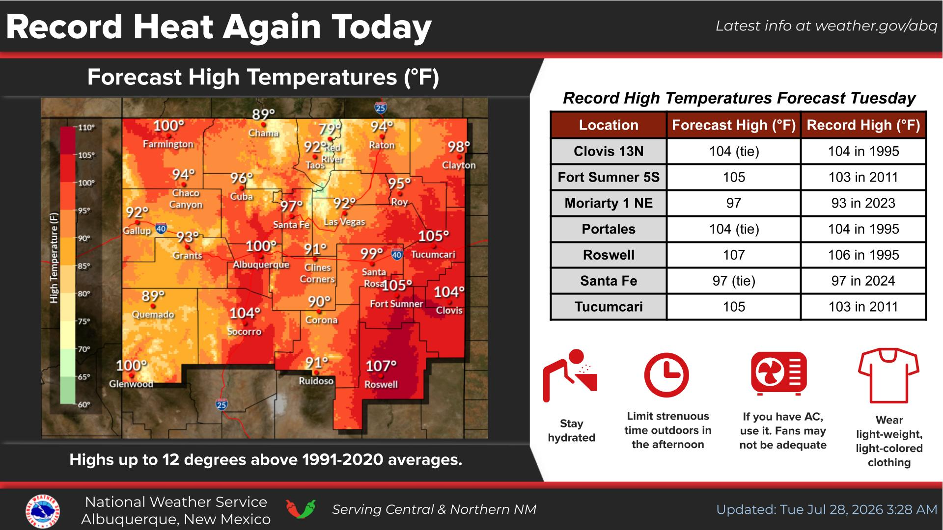
Very dry air will spread over the entire area today along with hot temperatures. Moderate heat-risk will elevate the threat for heat-related illnesses in sensitive individuals.
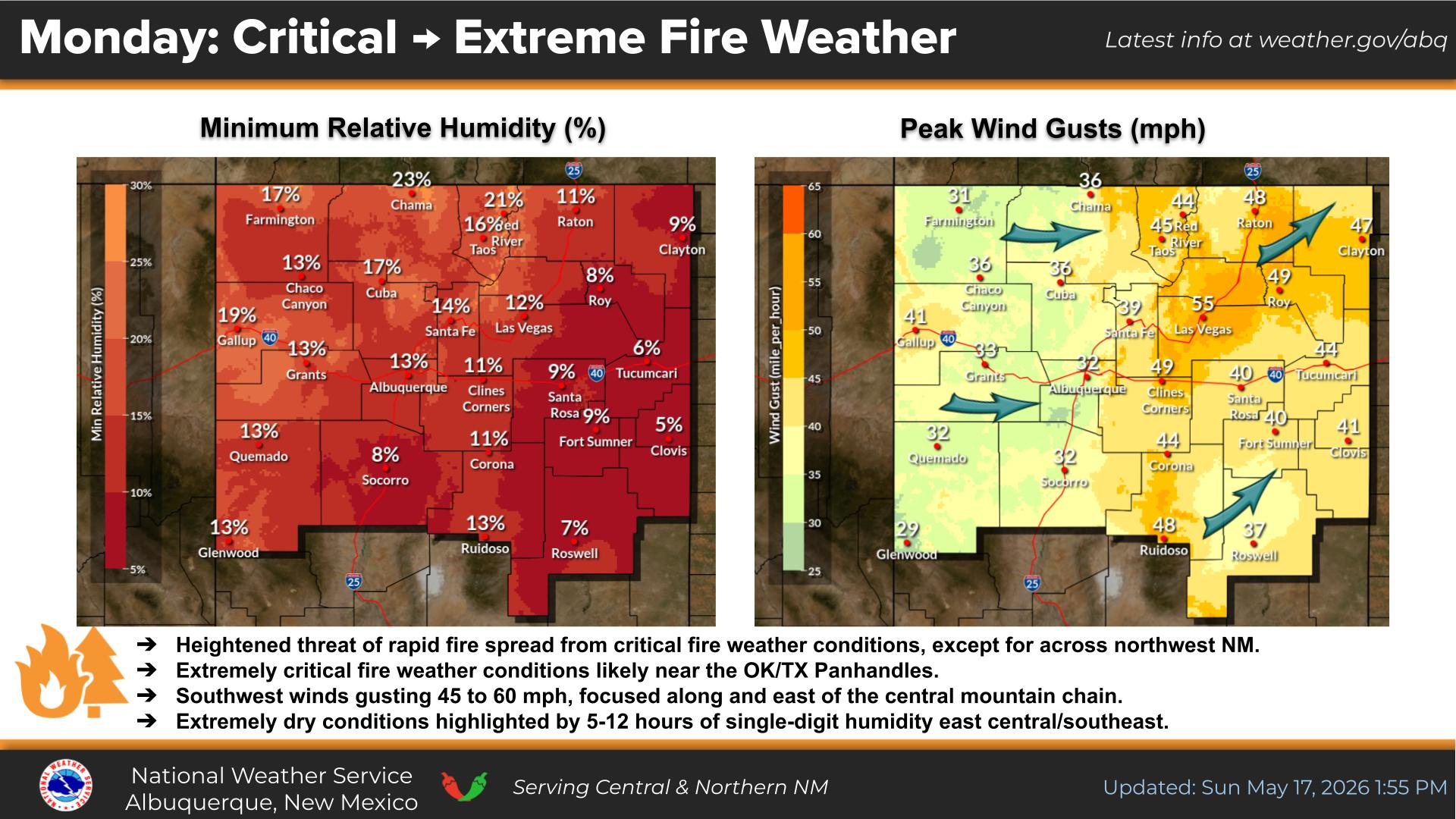
Hot temperatures will continue but with increasing coverage of gusty showers and dry storms. Stronger virga showers will be capable of producing downburst wind gusts greater than 50 mph with areas of blowing dust and low visibility. Moderate heat-risk will continue with an elevated threat for heat-related illnesses in sensitive individuals.
Virga showers or sprinkles will develop across much of western and central NM on Monday. While these showers will produce little, if any, rainfall, gusty and erratic winds will be common.
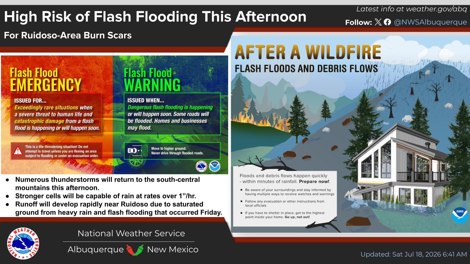
Showers and thunderstorms will return on Tuesday, favoring areas along and east of the Central Mountain Chain. Some storm may be severe with large hail and damaging wind gusts. Expect dangerous lightning, erratic wind gusts, and wet or slick roads.
Temperatures will rise over the next week with minor to moderate heat- related impacts likely. Moderate heat risk affects those who are sensitive to heat, especially those without cooling/hydration, and some health systems and industries.


 Office Webcam
 Weather Map
 Satellite Imagery