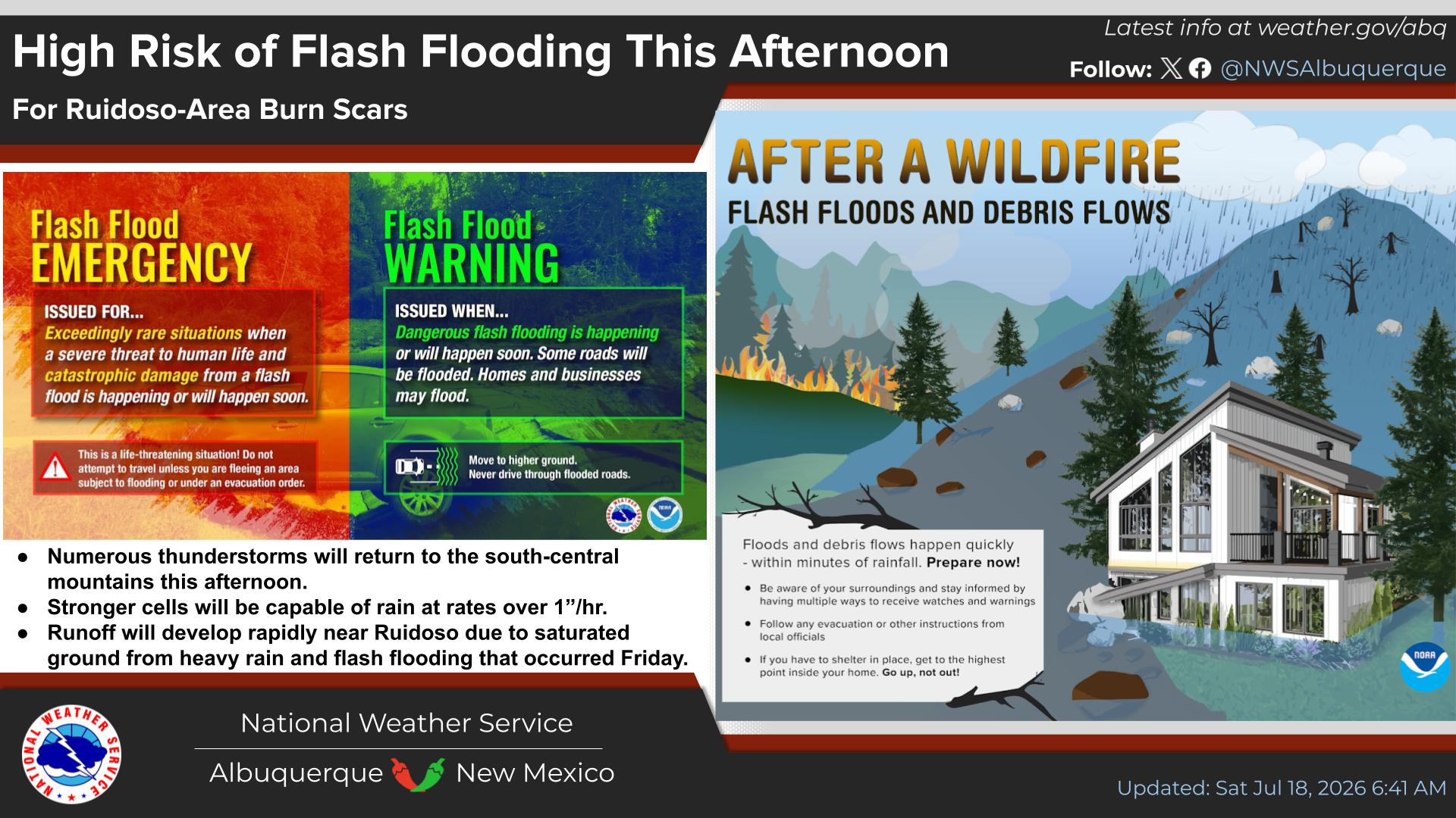
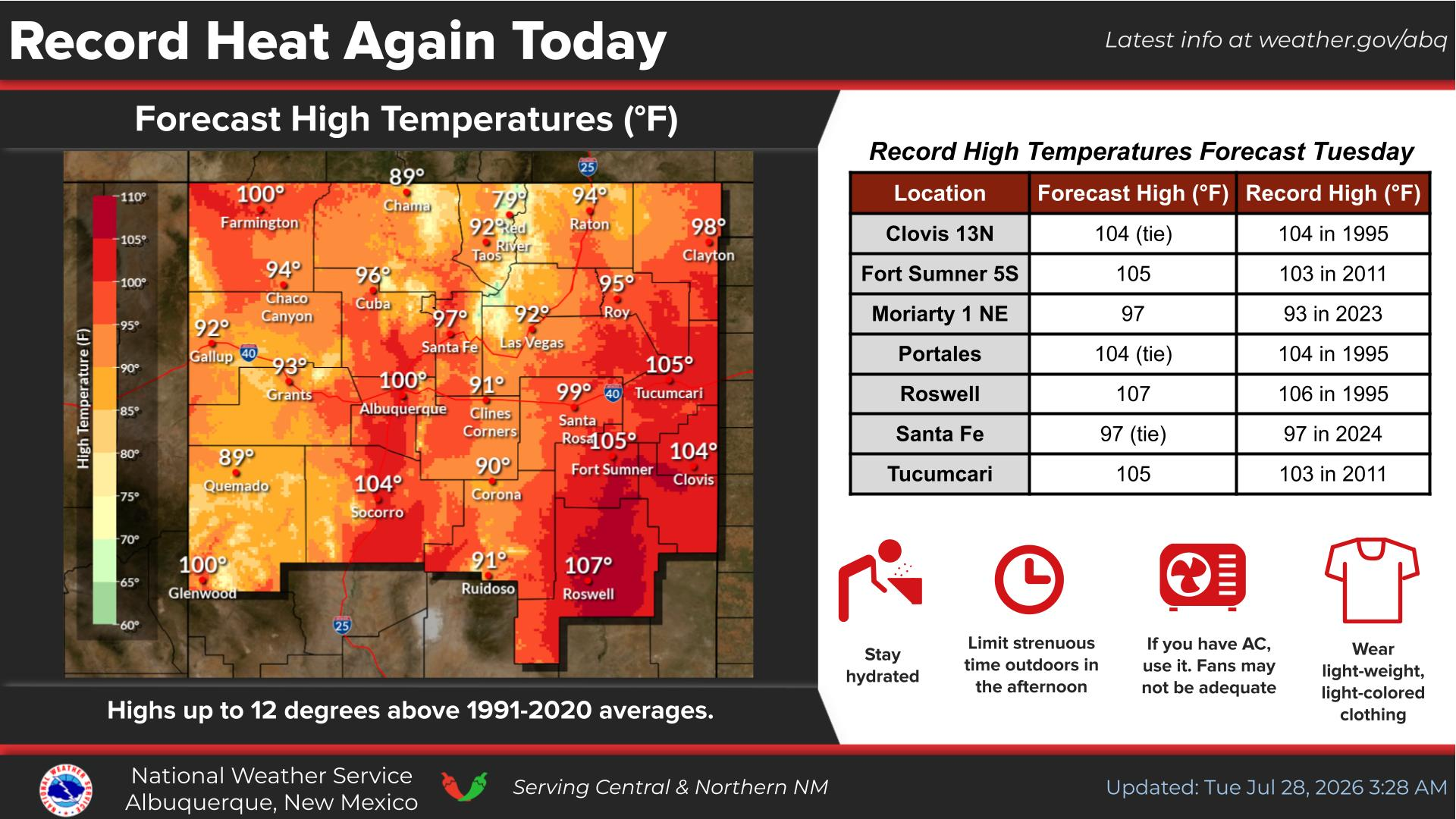
National Weather Service United States Department of Commerce
Click a location below for detailed forecast.

Last Map Update: Mon, Jul 21, 2025 at 5:48:29 am MDT

There is a high risk of burn scar flash flooding today near Ruidoso where a Flood Watch is in effect today 12pm to 8pm MDT. Have multiple ways of receiving warnings and a plan in place ready to execute when flash flooding occurs.
Scattered to numerous afternoon thunderstorms will threaten locally heavy rainfall and flash flooding in low-lying and poorly drained areas thru the Gila NF and areas along the central mountain chain and eastern NM. Storms along the Continental Divide thru west- central NM and into portions of the Rio Grande Valley will mainly threaten cloud-to-ground lightning and strong and erratic gusty winds.
Scattered to numerous showers and thunderstorms are forecast daily thru Wednesday. Some will produce locally heavy rainfall with a risk of flooding. Cooler temperatures will occur Tuesday and Wednesday, when precipitation will be most widespread. Hotter and drier Thursday into next weekend.
The thunderstorm threat matrix indicates the probability of thunderstorms over wildfire burn areas.


Text Product Selector (Selected product opens in current window)


Submit Storm Report Icon

Submit Storm Report

Key Impacts Icon

Key Impacts

Observations Icon

Local Observations

Webcams Icon

Office Webcams

Satellite Icon

Satellite Imagery

Are You Prepared Icon

Are You Prepared?

Weekly Weather Briefing Icon

Weekly Weather Briefing

Area Forecast Discussion Icon

Area Forecast Discussion

Fire Weather Icon

Fire Weather

Aviation Weather Icon

Aviation Weather

Snow Probabilities Icon

Snow Probabilities

SKYWARN Icon

SKYWARN Spotters

On This Date in Weather History Icon

On This Date

Climate Graphs Icon

Climate Graphs

Drought Monitor Icon

Drought Monitor

Severe Weather Info and Climatology Icon

Severe Weather Climatology

Monsoon Awareness Icon

Monsoon Awareness

Winter Climatology Icon

Winter Climatology