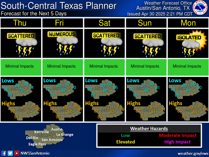
Recent rainfall will keep humid conditions in place over South Central Texas. Temperatures will increase late week into the weekend with heat index values approaching or exceeding 100 degrees into early next week. Practicing heat safety will be important this weekend for those outdoors.
Cloudy skies and areas of fog this morning will give way to a partly cloudy afternoon. Temperatures will be warmer with highs ranging from the mid 70s to the low 90s.
This training is sponsored by the National Weather Service and City of Schertz Office of Emergency Management. This will be an in person training session and is free and open to the public. No registration is required.
Time: 630 PM - 830 PM.
Training Overview: The training provides a basic overview of severe weather hazards and flooding. The training will include severe weather information specific to South Central Texas, procedures for spotting and reporting severe weather and flooding to local NWS forecasters, and how to stay weather aware and prepared.
Location:
Schertz Civic Center - Bluebonnet Hall
Building 5
1400 Schertz Parkway
Schertz, TX 78154


 Austin/San Antonio Radar
 Weather Map
 Satellite Imagery
 Del Rio Radar
 Digital Forecast Map
 Tropical Outlook
 Drought Status
 Air Quality
 Fire Weather Forecasts
 Observed Rainfall
 Observed Temperatures
 Daily Climate Graphs