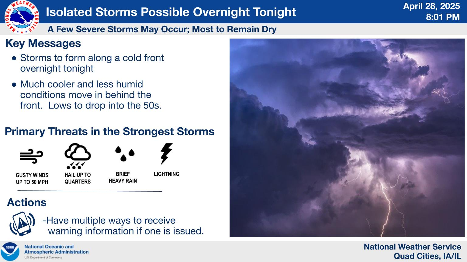
National Weather Service United States Department of Commerce

Tracking Weekend Storm Impacts

A storm and trailing cold front will continue to slowly move through the Gulf Coast and Southeast U.S. through this weekend with widespread rain showers and isolated thunderstorms. A fast-moving clipper storm may bring several inches of snow to the north-central Plains, Midwest, eastern Great Lakes, and Northeast regions this weekend. Read More >

Moderate to heavy snow is spreading east towards eastern Iowa, and will arrive into Cedar Rapids and Iowa City through 6 PM. Expect roads to quickly become snow covered and slick, and visibilities to drop under 1 mile in snow.
A fast moving clipper system is expected to bring a swath of accumulating snow to much of the area tonight into early Sunday leading to travel impacts. The higher snow amounts of 3-5+ inches are expected north of I-80, and a narrow swath of 5-8 near Highway 30. Expect lesser amounts to the south where a wintry mix is possible. Stay up to date on the forecast!
A wintry mix of snow, freezing rain, and even rain is likely tonight near and especially south of Highway 34. A light glaze of ice in addition to any snow covered roads will lead to slippery travel conditions.
Accumulating snow and a wintry mix is expected tonight and early Sunday. Here's a look at the forecast of precipitation type and also timing for a handful of cities throughout the region.
With accumulating snow and a wintry mix likely across the region tonight and early Sunday it serves as a good reminder that when there's ice & snow please take it slow!