
Dangerous, record-breaking heat will intensify across most of the central and eastern U.S this week. Heat indices will likely exceed 100 degrees. Heat is likely to continue across the eastern U.S. through the Independence Day holiday weekend. Critical fire weather conditions will continue Tuesday across portions of the Four Corners and Great Basin, as dry conditions and gusty winds persist. Read More >
Western and Central Wyoming
Weather Forecast Office
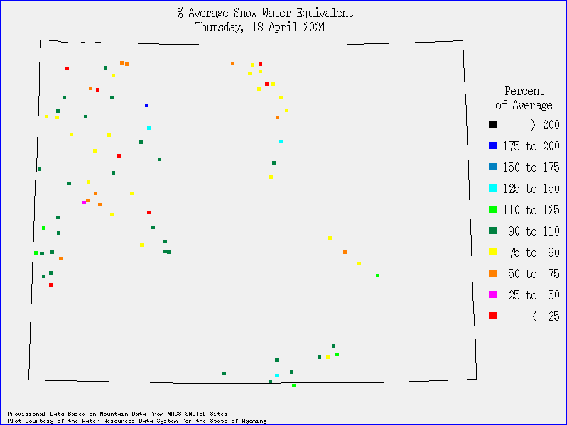
Click on SnoTel site on map above or on left menu to display individual site's graph in frame below
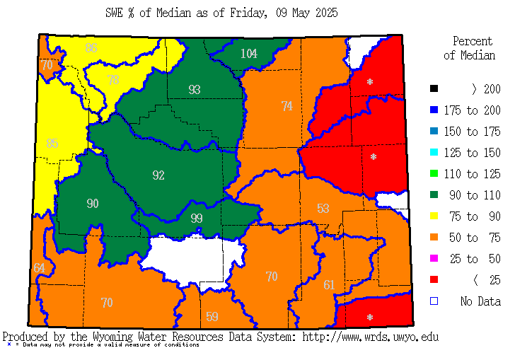
Click on a river basin on the map below or on left menu
to display basin-wide snowpack projection graphs in the frame above
(User's Guide for the Interpretation of the Basinwide Snowpack Projection Graphs .pdf file)
|
||||||||||||||||||||
Forecasts
Severe Weather
Forecast Discussion
User Defined Forecast
Fire Weather
Activity Planner
Hourly Forecasts
Snow and Avalanche
Aviation Weather Decision Support
Hydrology
Rivers and Lakes
SnoTel Page
Weather Safety
StormReady
NOAA Weather Radio
Preparedness
SkyWarn
US Dept of Commerce
National Oceanic and Atmospheric Administration
National Weather Service
Western and Central Wyoming
12744 West U.S. Hwy 26
Riverton, WY 82501
307-857-3898
Comments? Questions? Please Contact Us.


