
Dangerous and extreme heat will remain across portions of the Central U.S. this week, persisting across the Mid to Lower Mississippi Valleys, Gulf Coast, Southern Plains and portions of Texas. A heat wave over the Southwest will intensify late this week. Severe thunderstorms and flash flooding will spread from the Great Lakes/Ohio Valley to the Mid-Atlantic and Northeast the next few days. Read More >
Last Map Update: Tue, Jul 28, 2026 at 5:48:26 am PDT
|
Text Product Selector (Selected product opens in current window)
|
|


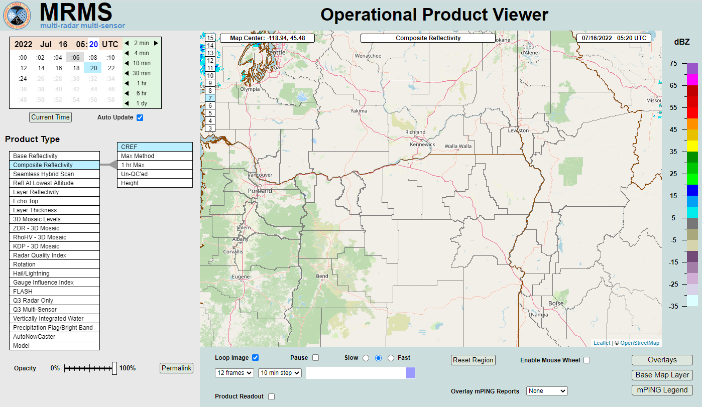 MRMS Radar Imagery
 Radar
Radar Satellite
 Graphical Forecasts
 Forecast Discussion
 Current Weather
 Climate
 Recent Weather
 Hour by Hour Forecast
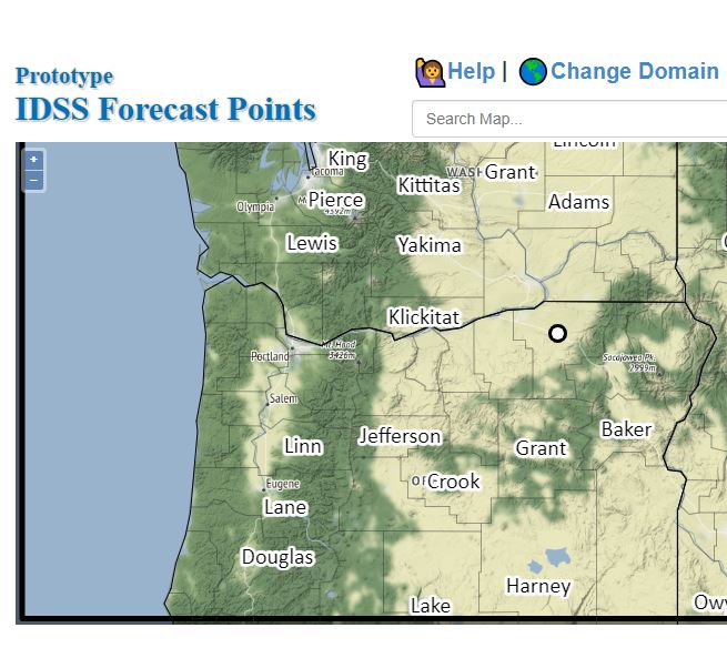 Alternate Point Forecast
 Forecast Maps
 Fire Weather
 Precipitation Amount Potential
 Rivers & Lakes
 Drought
 Air Quality
 Weather Stats