***This page is intended as a tool to help pilots better visualize weather and weather-related hazards. It is not intended as a substitute for a weather briefing obtained from a Flight Service Station (1-800-WXBRIEF). Currently, the information contained here does not meet the FAA requirements for a pre-flight weather brief. Therefore, it's important that pilots still call and obtain a briefing from an FAA Flight Service Specialist. You may also visit the Aviation Weather Center or the Minneapolis CWSU.
 |
 |
 |
 |
 |
| Geocolor Satellite | Water Vapor | IR | National Surface | Regional Surface |
| Minneapolis | Duluth | |
 |
 |
|
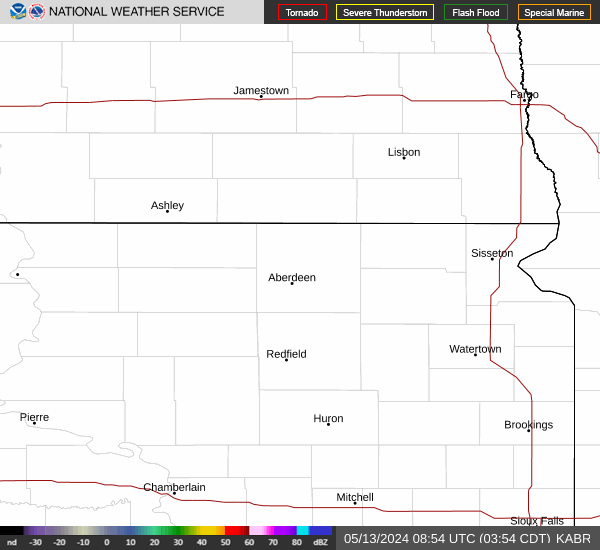
| Reflectivity | Reflectivity | |
| La Crosse | Sioux Falls | |
 |
 |
|
| Reflectivity | Reflectivity | |
| Grand Forks | Aberdeen | |
 |
 |
|
| Reflectivity | Reflectivity |
 |
 |
 |
 |
 |
 |
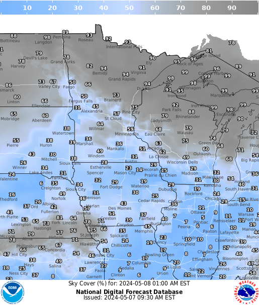 |
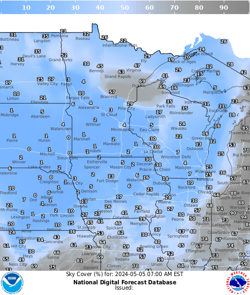
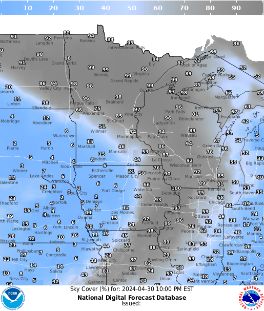
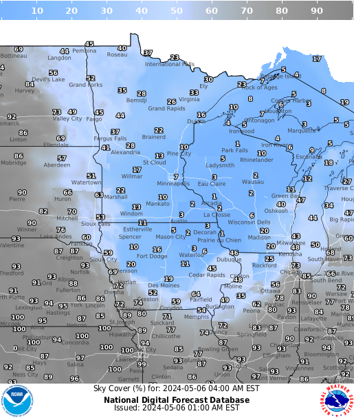
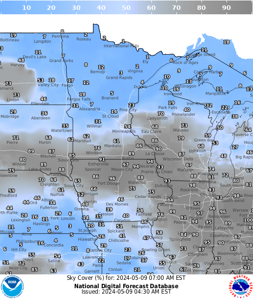
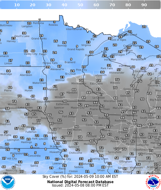
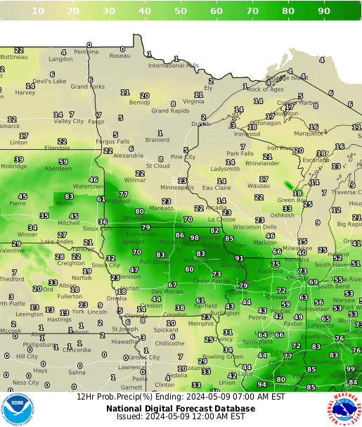
| Current | 3 hrs | 6 hrs | 9 hrs | 12 hrs | 15 hrs | 18 hrs |
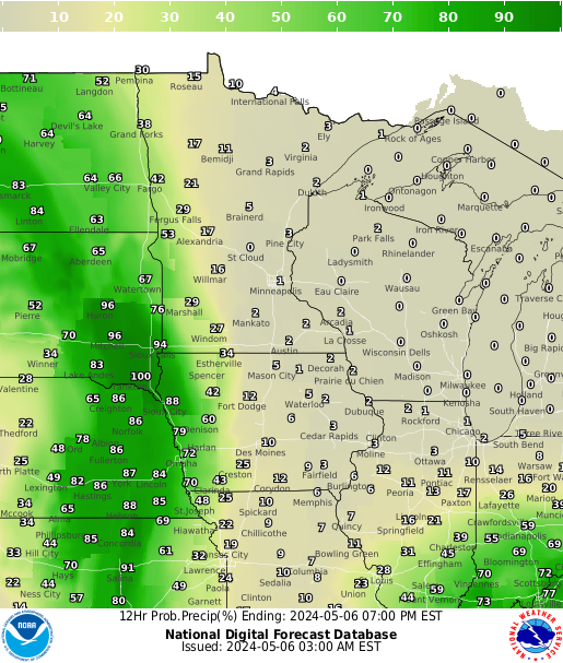
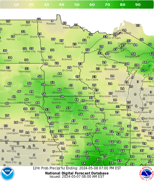
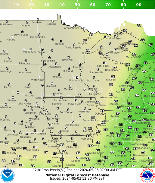
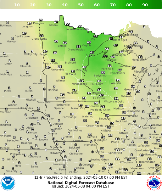
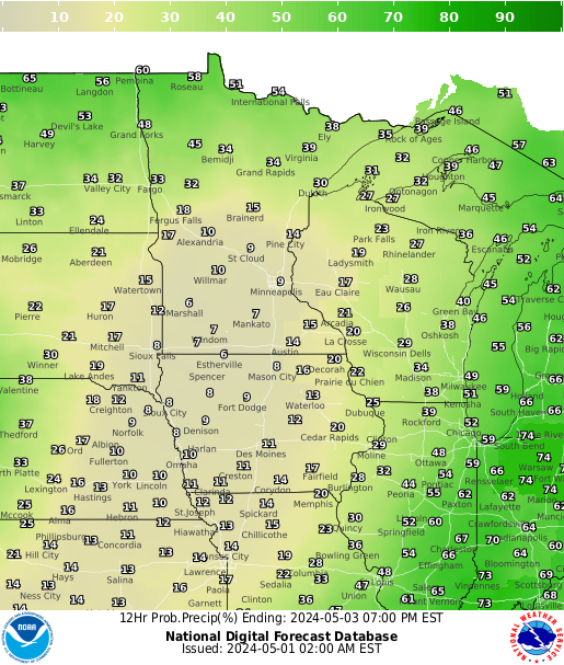
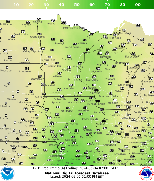
Precipitation Chances
 |
 |
 |
 |
 |
 |
 |
| 12 hrs | 24 hrs | 36 hrs | 48 hrs | 60 hrs | 72 hrs | 84 hrs |
 |
 |
 |
 |
 |
 |
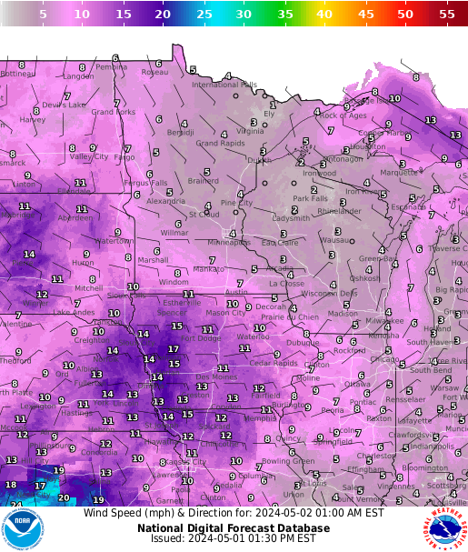 |
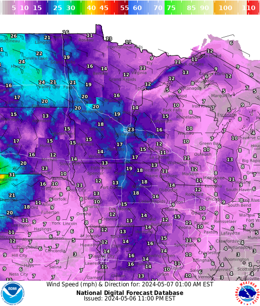
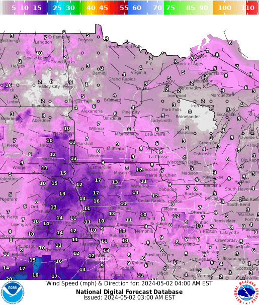
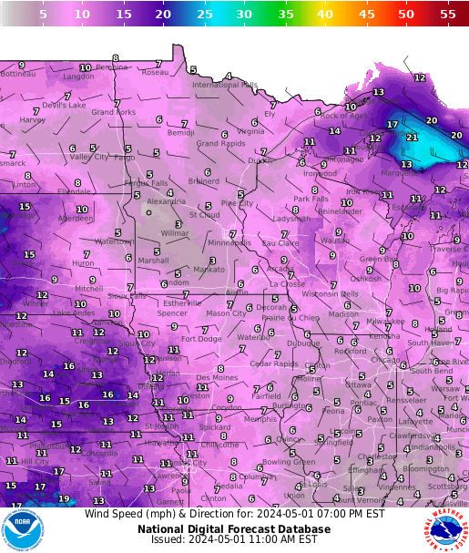
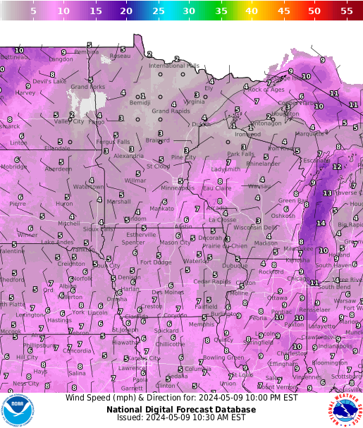
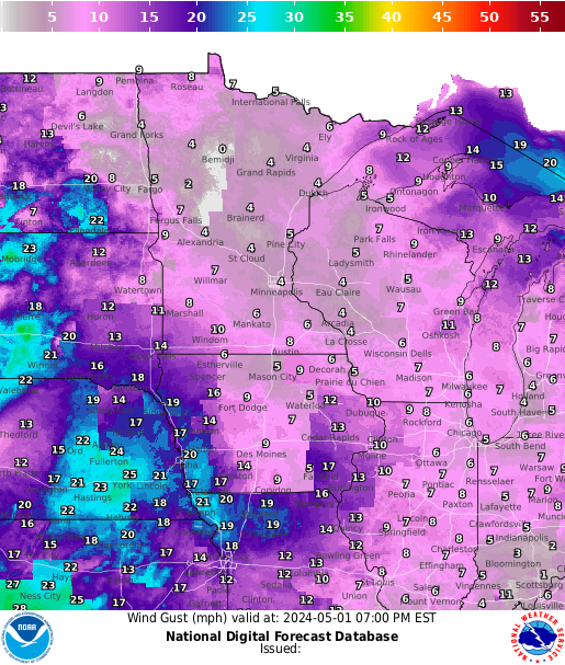
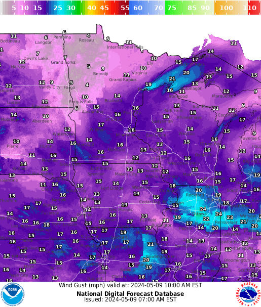
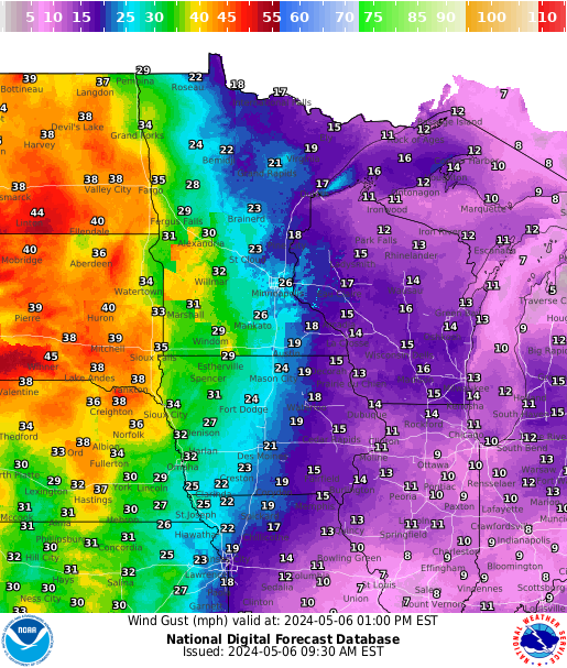
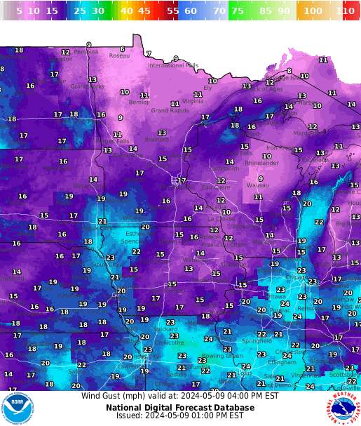
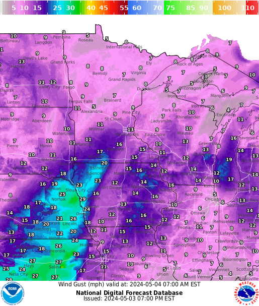
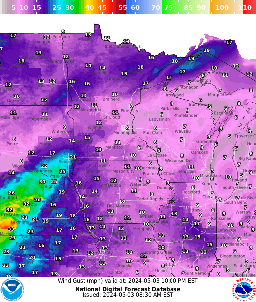
| Current | 3 hrs | 6 hrs | 9 hrs | 12 hrs | 15 hrs | 18 hrs |
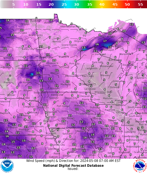
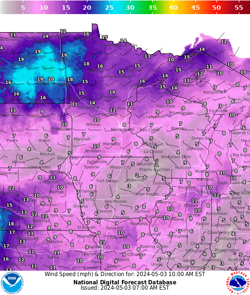
Surface Gusts
 |
 |
 |
 |
 |
 |
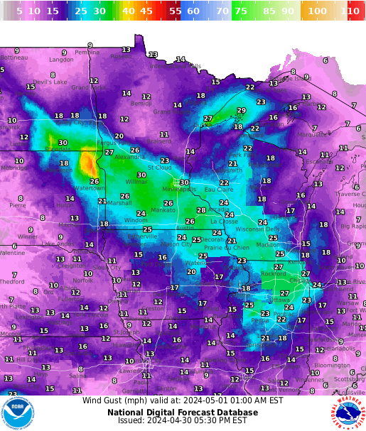 |
| Current | 3 hrs | 6 hrs | 9 hrs | 12 hrs | 15 hrs | 18 hrs |
For upper level winds, visit https://aviationweather.gov/gfa/#winds
Twin Cities area forecast for Hot Air Balloonists
Twin Cities area forecast for Soaring Pilots
Interactive Center Weather Advisory Page
 |
 |
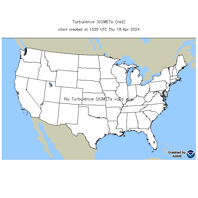 |
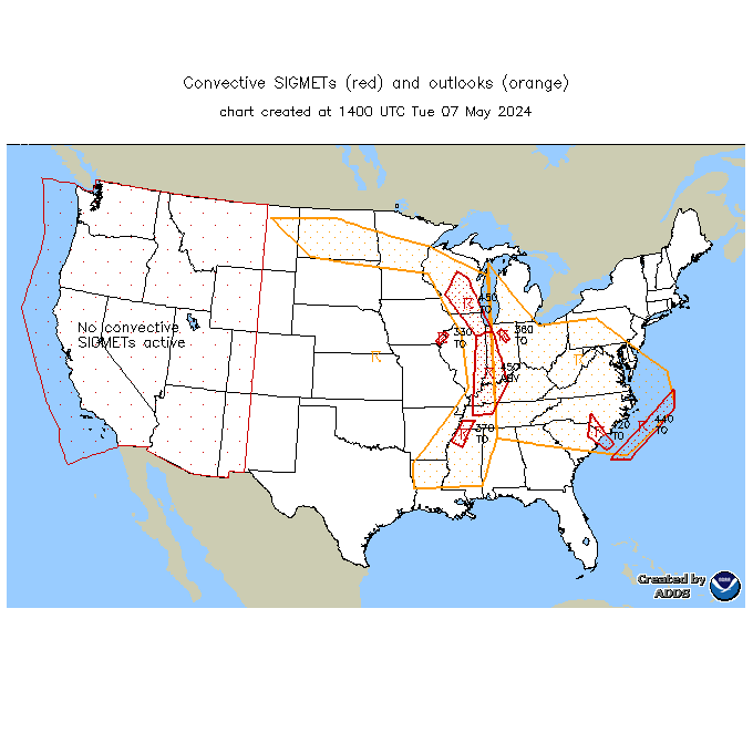
| SIGMET-Convective | SIGMET-Icing | SIGMET-Turbulence
|
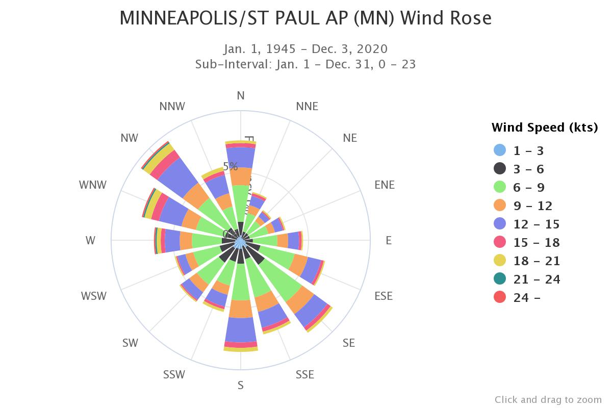
Wind Rose for Selected Airports
| MSP | STC | EAU | RNH | AXN | RWF | MKT |
|---|---|---|---|---|---|---|


 Follow us on YouTube