EF-2 Tornado Hits Emerald Isle, November 24, 2018
EF-0 Tornado Touches Down in Cape Carteret.
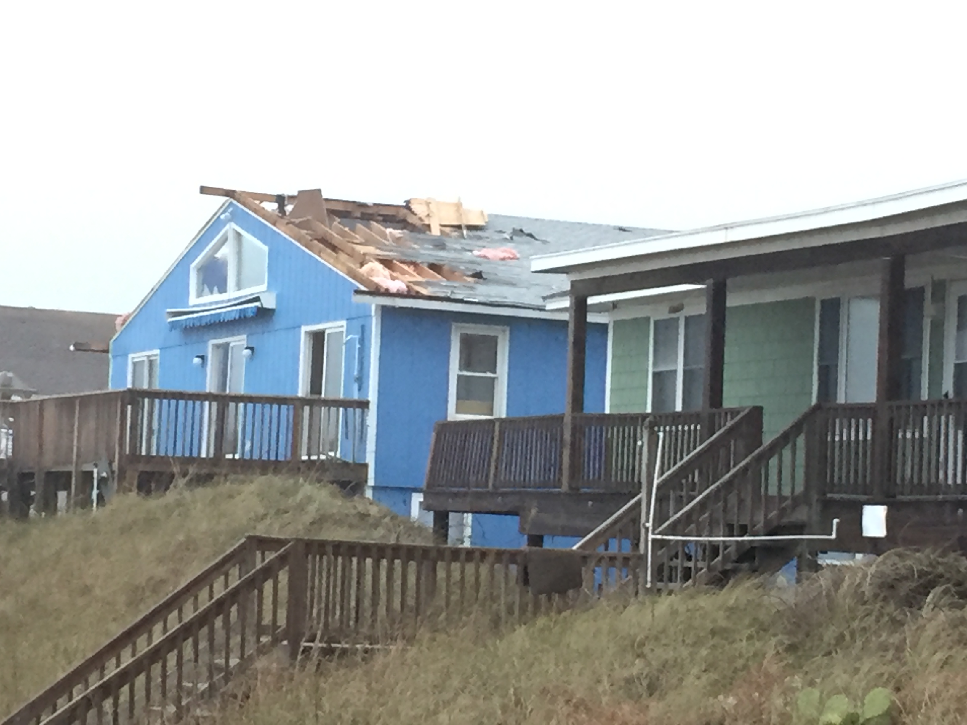
Roof Damage in Emerald Isle, November 24, 2018.
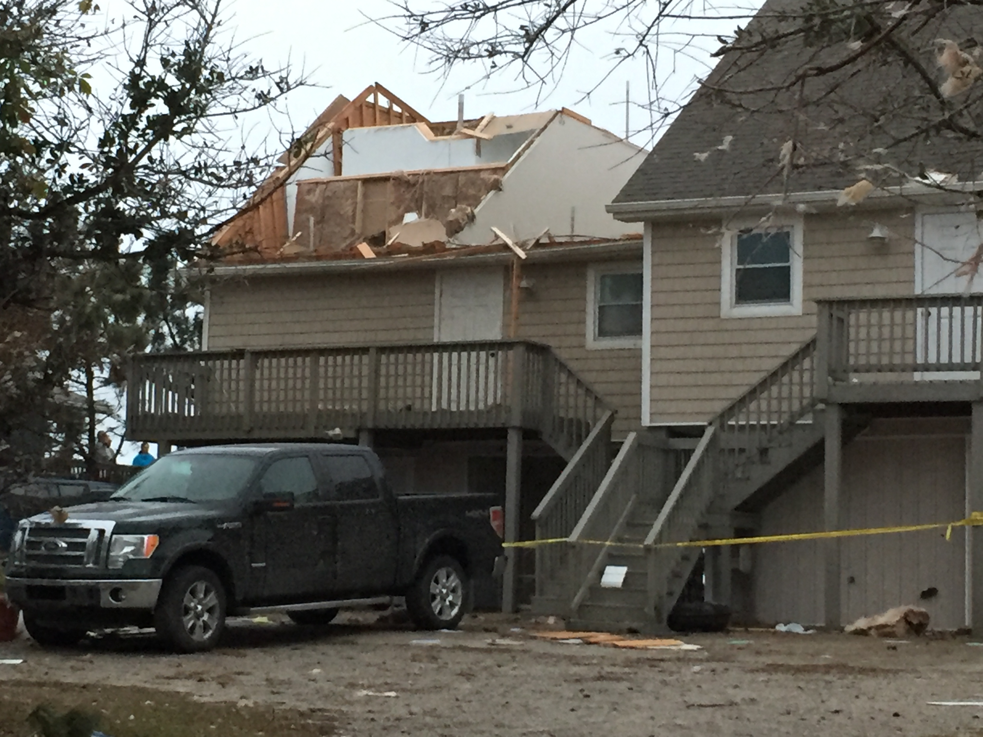
Damage to Home, Emerald Isle, November 24, 2018
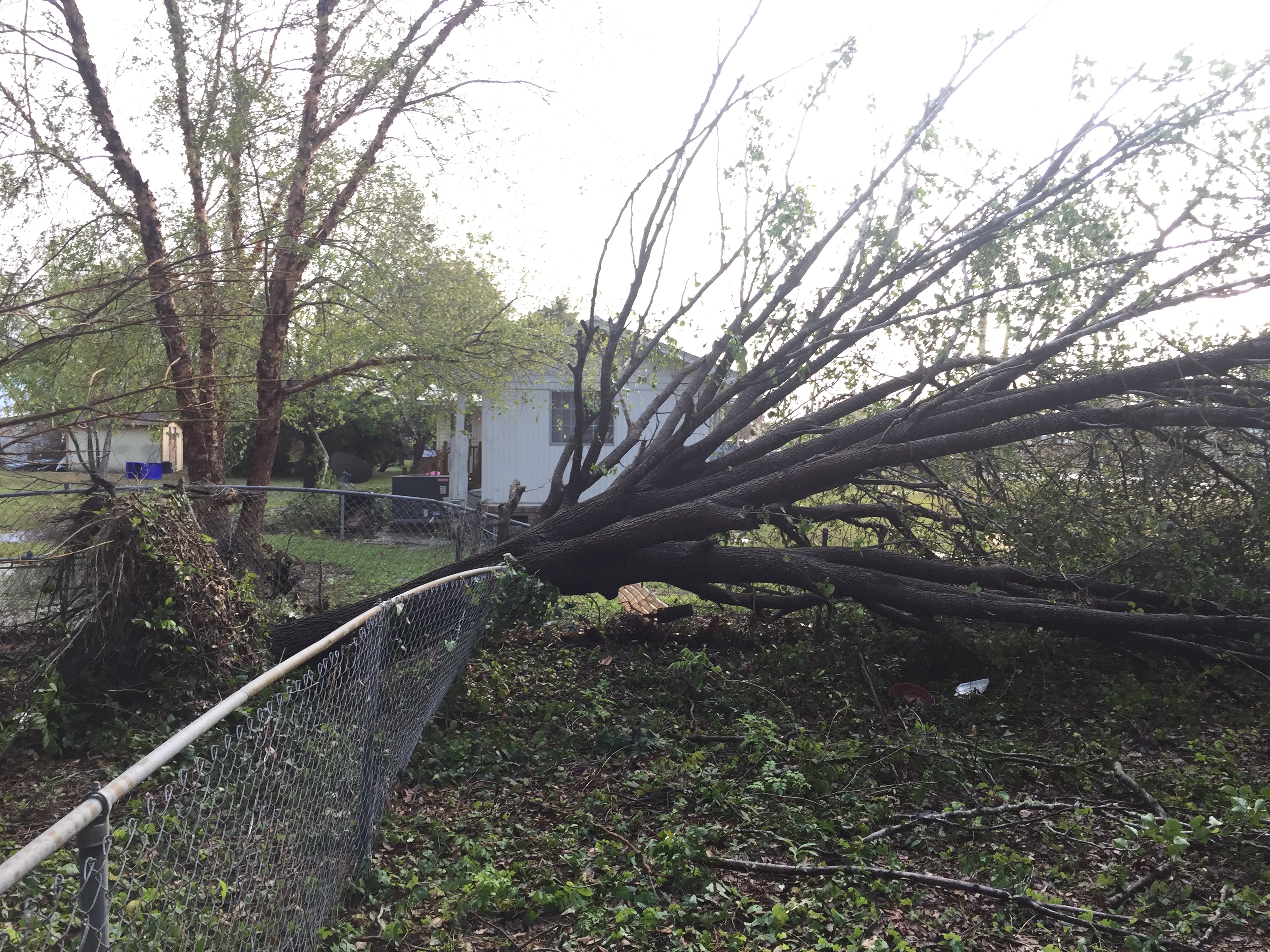
Tree Damage in Cape Carteret, November 24, 2018.
Public Information Statement National Weather Service Newport/Morehead City NC 956 PM EST Sat Nov 24 2018 ...TORNADO CONFIRMED NEAR EMERALD ISLE IN CARTERET COUNTY NORTH CAROLINA... Location...Emerald Isle in Carteret County North Carolina Date...November 24th 2018 Estimated Time...210 PM TO 216 pm est Maximum EF-Scale Rating...EF-2 Estimated Maximum Wind Speed...120 MPH Maximum Path Width...75 yards Path Length...2.8 Miles Beginning Lat/Lon...34.680850/-76.922613 Ending lat/Lon...34.720773/-76.926037 * Fatalities...0 * Injuries...0 * The information in this statement is preliminary and subject to change pending final review of the event(s) and publication in NWS Storm Data. ...Summary... The National Weather Service in Newport/Morehead City NC has confirmed a tornado near Emerald Isle in Carteret County North Carolina on November 24th 2018. The tornado began near the intersection of 8th street and Ocean Drive in Emerald Isle with two houses sustaining uplift of the roof deck and significant loss of roof covering material. Some utility lines were also damaged along Ocean Drive. The path crossed Ocean drive through a row of houses between 8th and 7th street. Multiple homes had siding damage with one large work trailer turned over. It was here the worst damage occured with one house losing large sections of the roof but the walls were still standing. Part of the roofing material was found across Highway 58, where damage to a boat dock occurred along Bogue Sound. As the tornado became a waterspout over Bogue Sound it likely weakened significantly as it crossed back over land as a tornado near Adams Lane and Broad Creek Loop Road. Here some very minor siding damage occurred along with some trampolines blown into a tree. Here the winds were likely closer to an EF-0 or closer to around 80 MPH. Eyewitness accounts of the tornado in Emerald Isle mentioned more of a rolling feature coming on land versus a circulation. Due to the radar signature, narrow path and significant, intense damage just east of 8th street the evidence pointed toward tornadic versus straight line damage. This information can also be found on our website at weather.gov/Newport. For reference: the Enhanced Fujita Scale classifies tornadoes into the following categories: EF0...Wind speeds 65 to 85 mph EF1...Wind speeds 86 to 110 mph EF2...Wind speeds 111 to 135 mph EF3...Wind speeds 136 to 165 mph EF4...Wind speeds 166 to 200 mph EF5...Wind speeds greater than 200 mph |
Public Information Statement National Weather Service Newport/Morehead City NC 1028 PM EST Sat Nov 24 2018 ...TORNADO CONFIRMED NEAR CAPE CARTERET IN CARTERET COUNTY NORTH CAROLINA... Location...Cape Carteret in Carteret County North Carolina Date...November 24th 2018 Estimated Time...206 to 207 PM EST Maximum EF-Scale Rating...EF0 Estimated Maximum Wind Speed...80 MPH Maximum Path Width...70 yards Path Length....0.35 miles Beginning Lat/Lon...34.686687/-77.049330 Ending lat/Lon...34.690640/-77.045575 * Fatalities...0 * Injuries...0 * The information in this statement is preliminary and subject to change pending final review of the event(s) and publication in NWS Storm Data. ...Summary... The National Weather Service in Newport/Morehead City NC has confirmed a tornado near Cape Carteret in Carteret County North Carolina on November 24th 2018. The tornado path started along the shores of Bogue Sound near Bayshore Drive and quickly moved north-northeast across Live Oak Drive. An eyewitness here saw the tornado move down the street. Damage included minor uplift of a porch, along with some siding and a uprooted tree. More damage occurred along Park Avenue from near Live Oak Drive to Easy Street. Most of the significant damage was blown toward the north (southerly wind) and included large limbs down, along with damage to a power line. In addition some shingles were blown off of a new roof. Of interest was a tremendous amount of leaf debris that was along the north and east sides of the houses along both Live Oak Drive and Park Avenue. Although very subtle, this leaf debris could only occur on those sides of the homes with a north to northeast wind, which was in the opposite direction of most of the storm damage and therefore indicated likely rotation. The damage path ended near the corner of Park Avenue and Easy Street. Overall damage along the path was relatively minor with 1 tree uprooted that was already leaning due to Florence, and minor shingle loss of another structure. Top winds were estimated to be around 80 mph or an EF0 tornado. This information can also be found on our website at weather.gov/Newport. For reference: the Enhanced Fujita Scale classifies tornadoes into the following categories: EF0...Wind speeds 65 to 85 mph EF1...Wind speeds 86 to 110 mph EF2...Wind speeds 111 to 135 mph EF3...Wind speeds 136 to 165 mph EF4...Wind speeds 166 to 200 mph EF5...Wind speeds greater than 200 mph |


 Tropical Weather
 Map View
 Weather Hazard Briefing (when applicable)
 Forecaster Discussion
 Marine
 Text Products
.png) Skywarn
Skywarn Submit Storm Reports
 Coastal Flood