|
Graphic Forecasts
for Hawaiian Islands and surrounding coastal waters Oceanic Graphic Forecasts
for Pacific from 120W to 160E south of the equator and from 140W to 160E north of the equator NW Hawaiian Islands Graphic Forecasts
for Pacific from 150W to 178E from 15N to 30N |
|||||||||||||||||||||||||
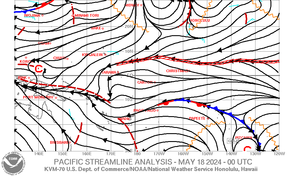
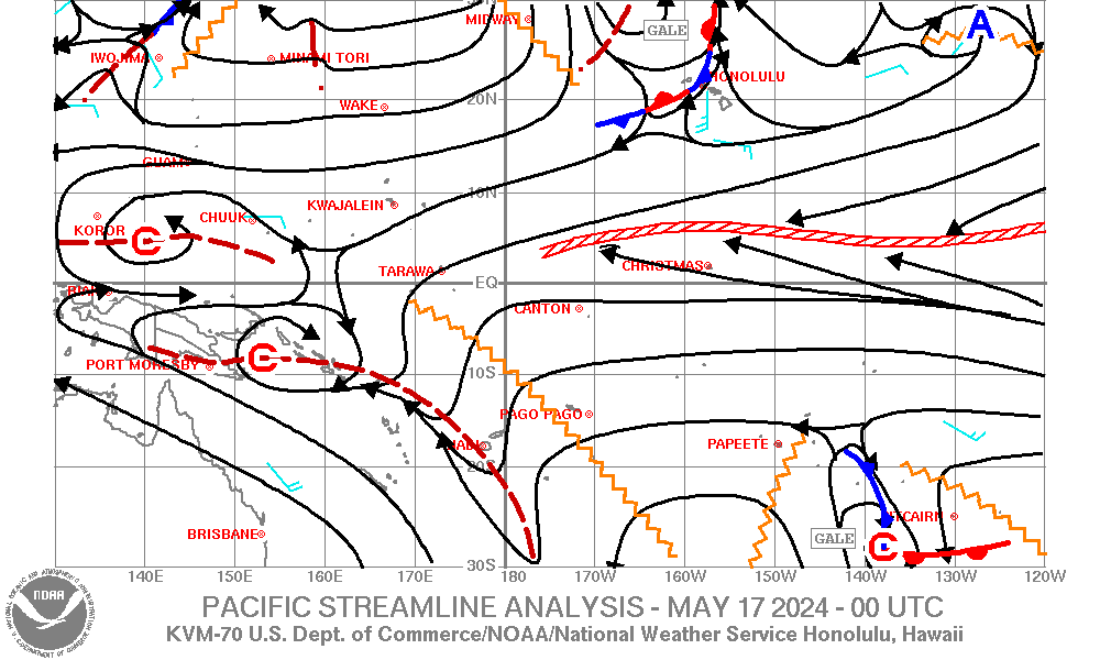
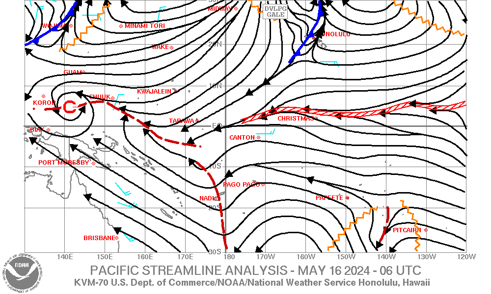
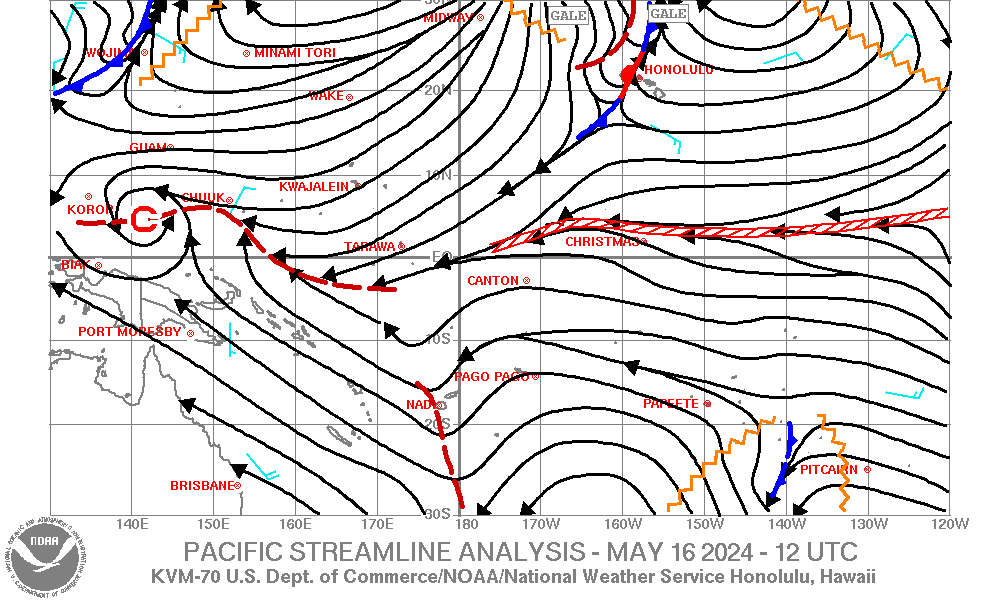
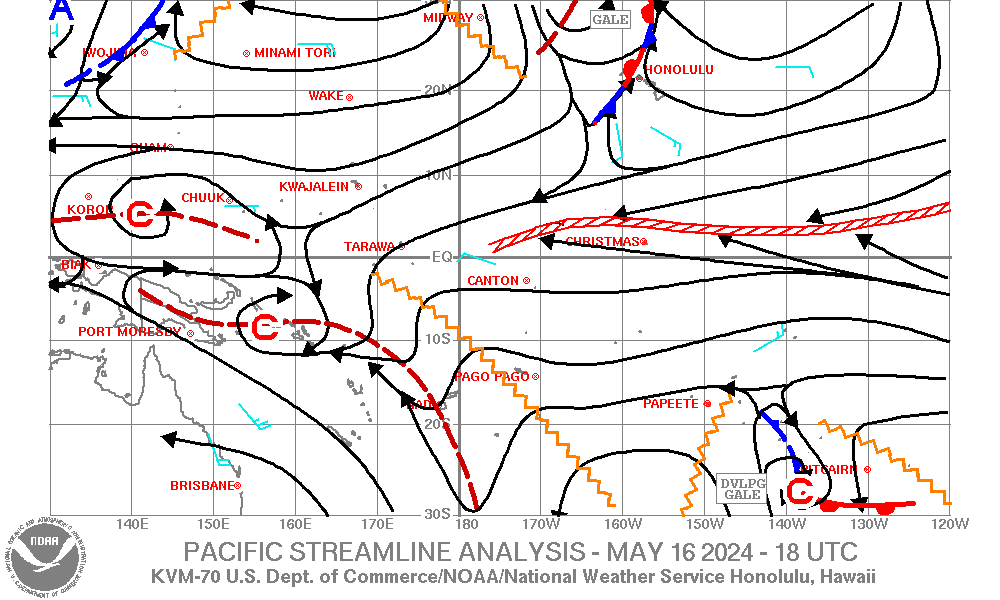
| Pacific Streamline Analysis (130E-120W, 30S-30N) |
|
||||||||||||||||||||||||
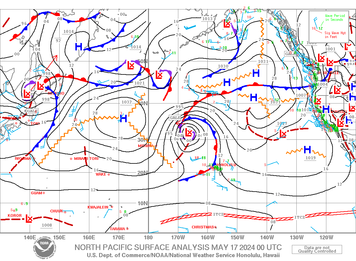
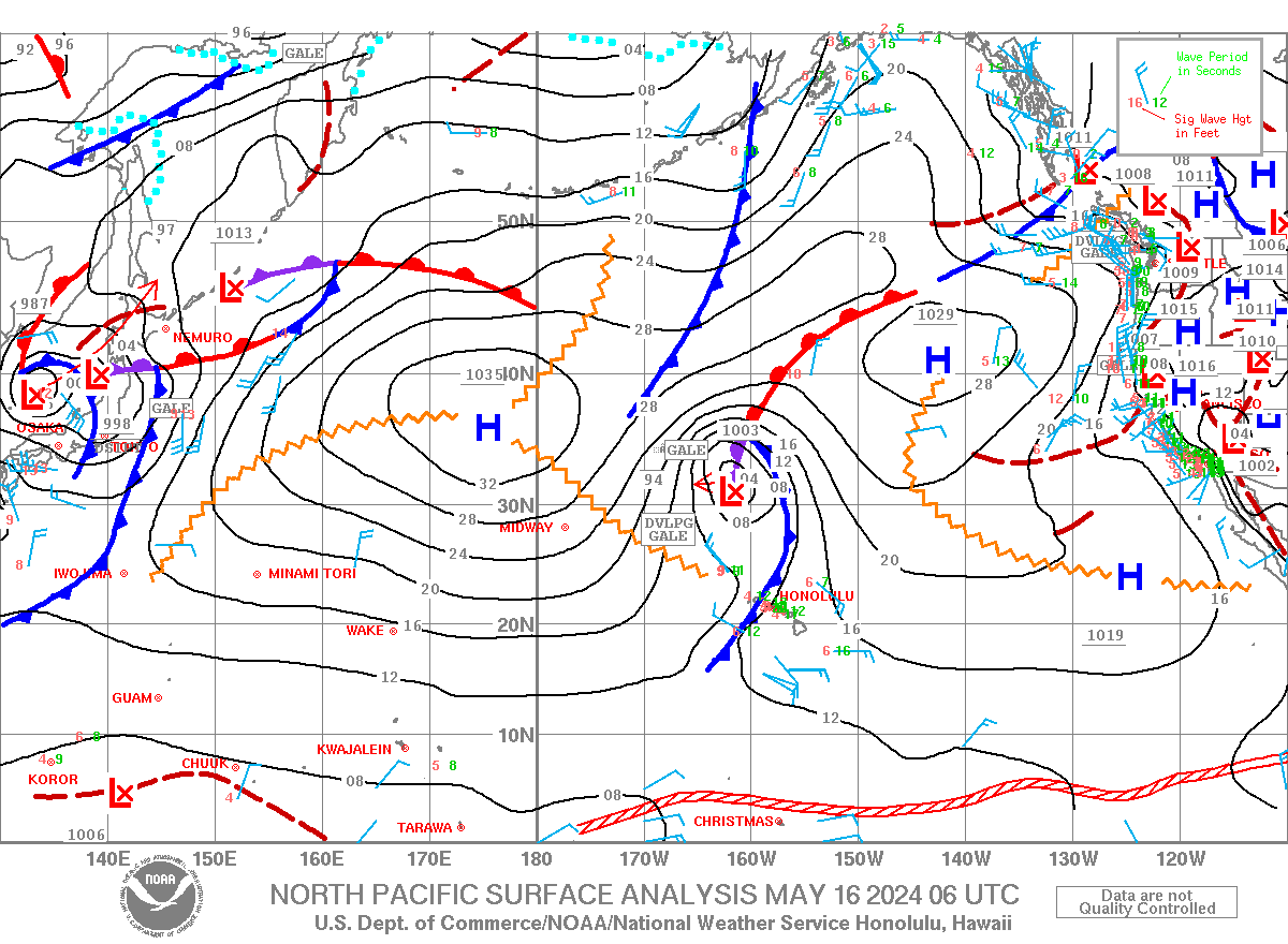
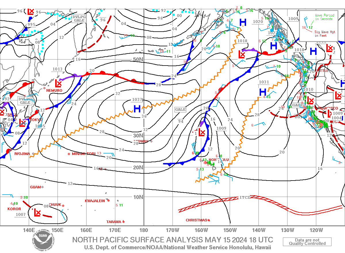
| North Pacific Surface Analysis (130E-110W,EQ-60N) From the Unified Surface Analysis |
|
||||||||||||||||||||||||
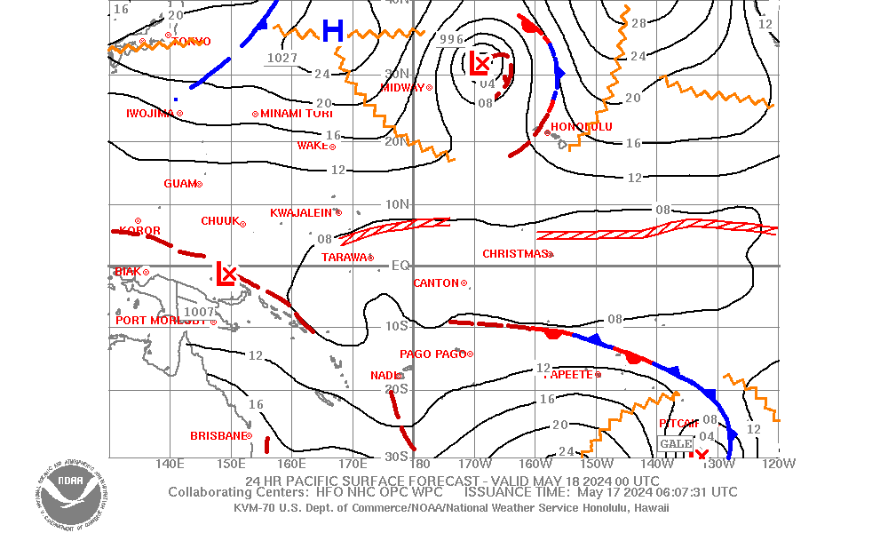
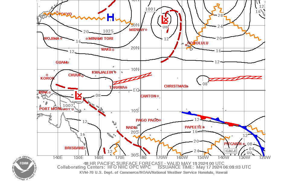
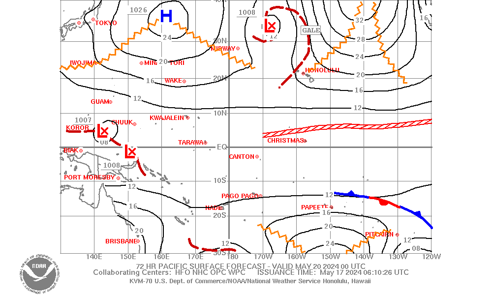
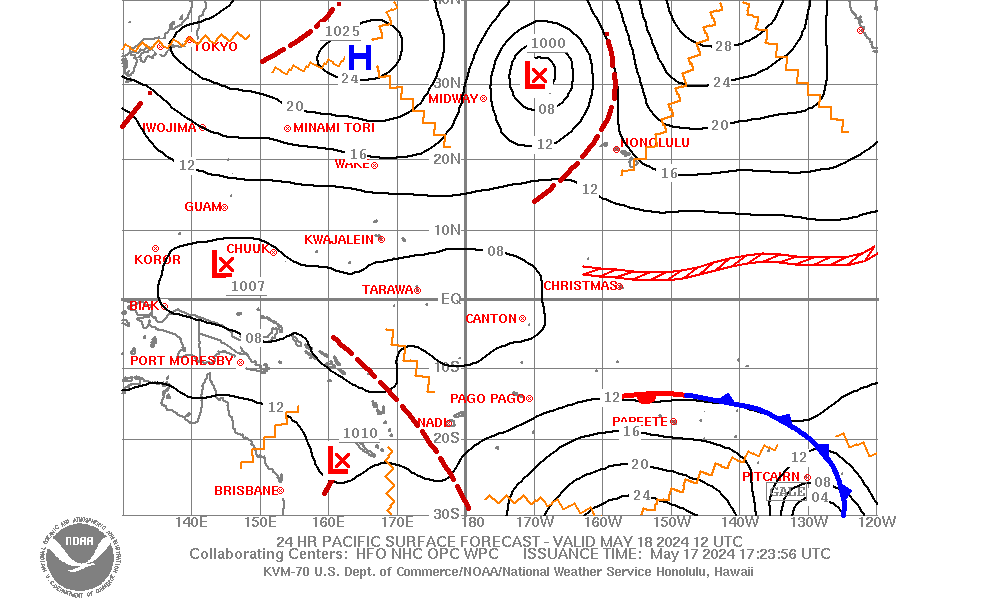
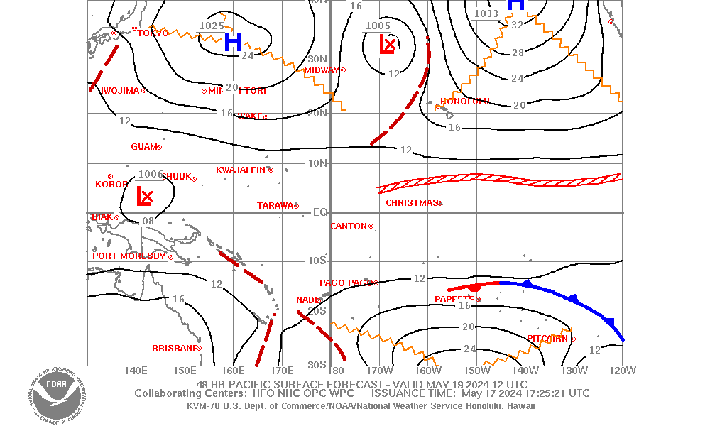
| Pacific Surface Forecast (130E-120W, 30S-40N) |
|
||||||||||||||||||||||||
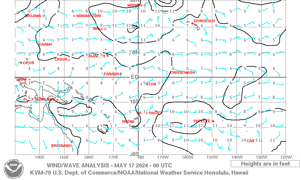
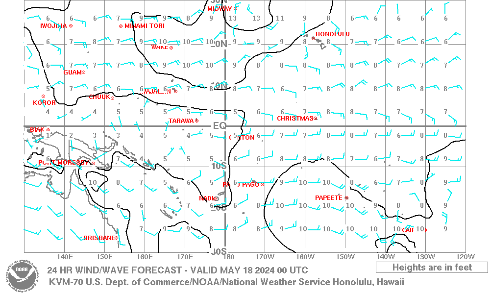
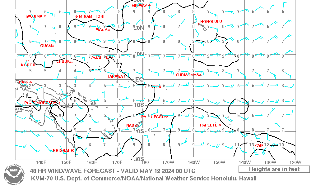
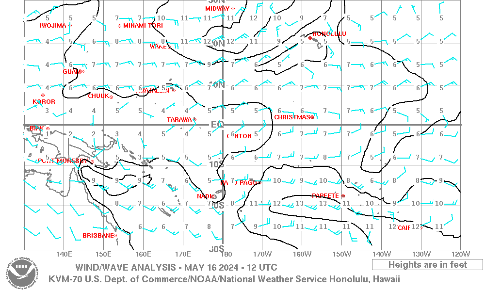
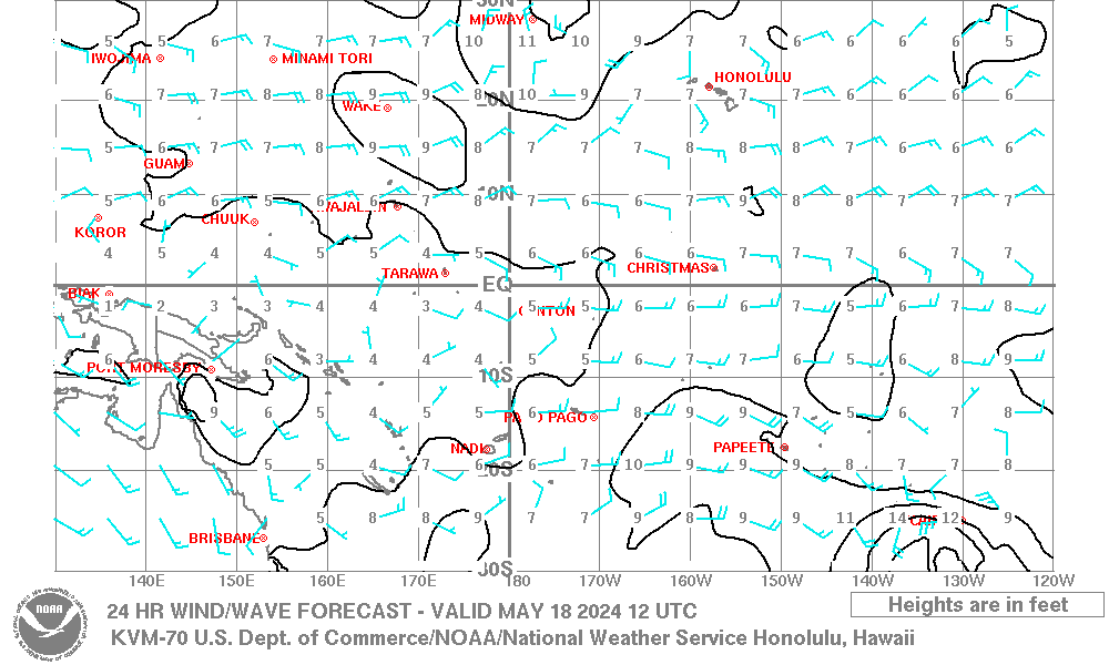
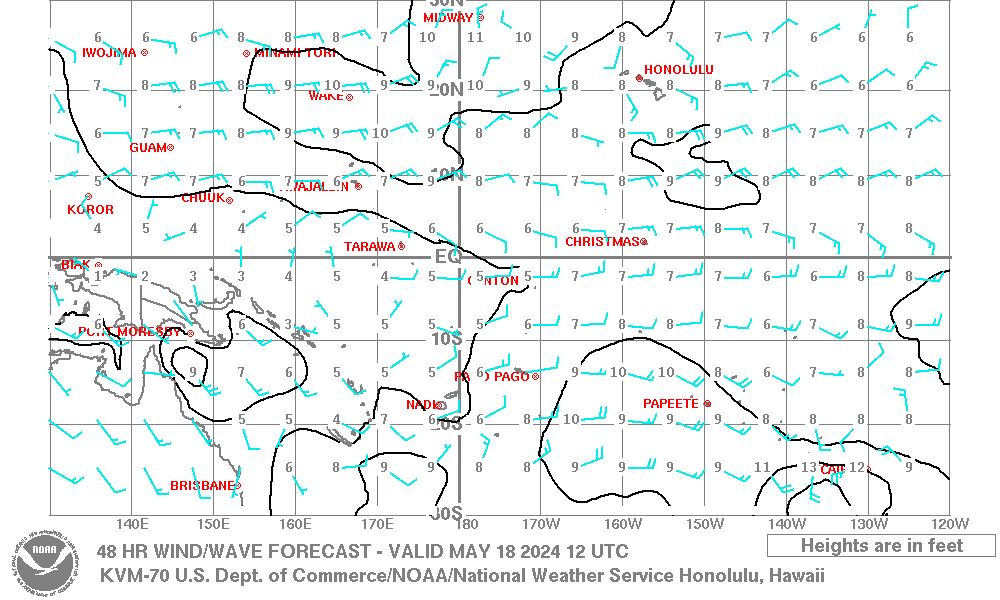
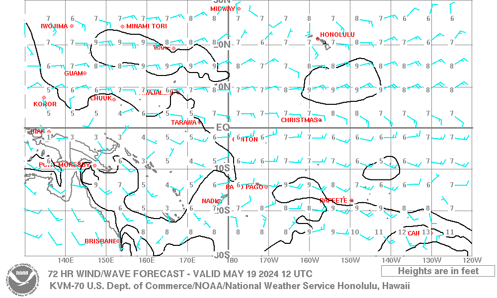
| Pacific Wind Wave Analysis and Forecasts |
|
||||||||||||||||||||||||
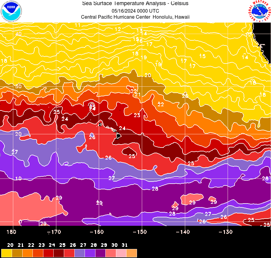
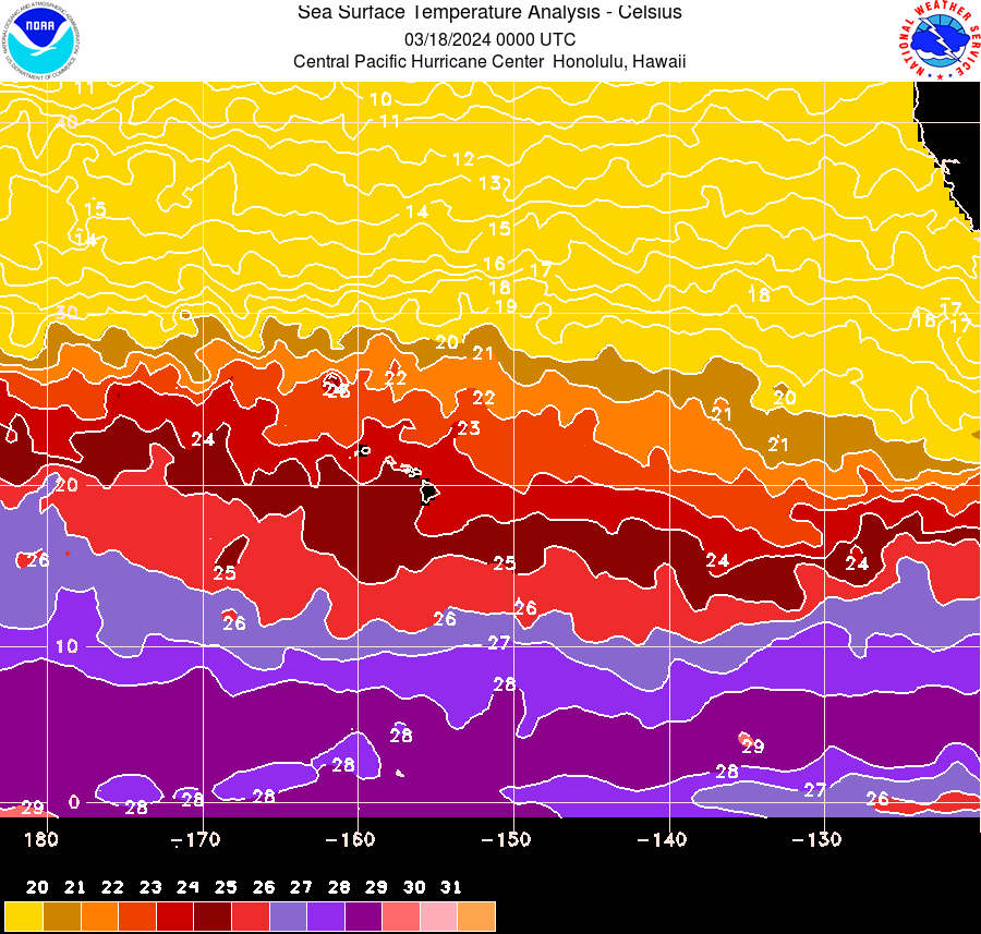
| Pacific Sea Surface Temperature Analysis satellite-derived (updated twice weekly) CPHC centric Sea Surface Temperature Analysis satellite-derived (updated daily) CPHC centric Sea Surface Temperature Analysis Loop satellite-derived (updated twice a week, with loop of Monday data) |
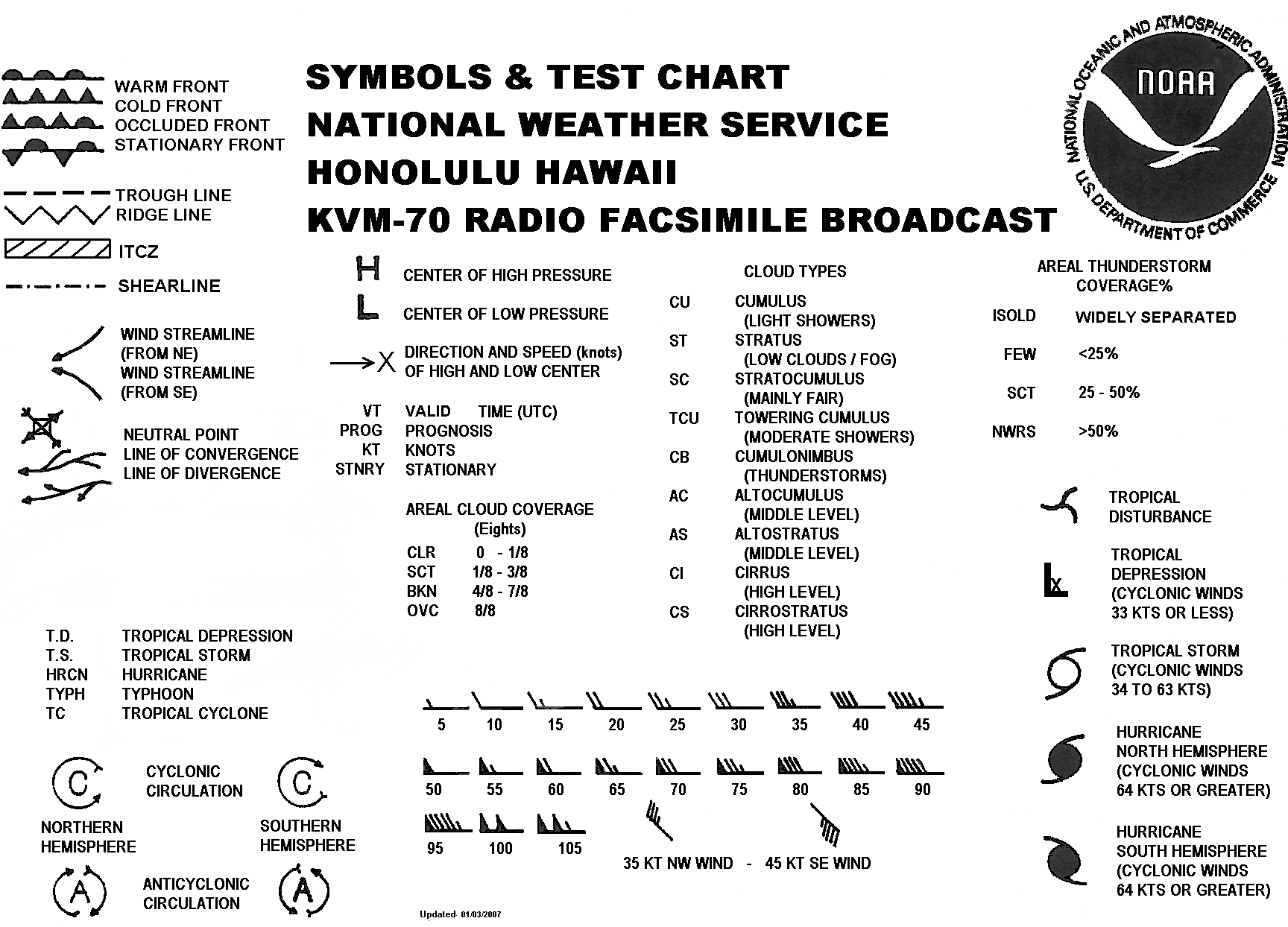
Symbols & Test Chart (gif)
|
||||||||||||||||||||||||


 Follow us on YouTube