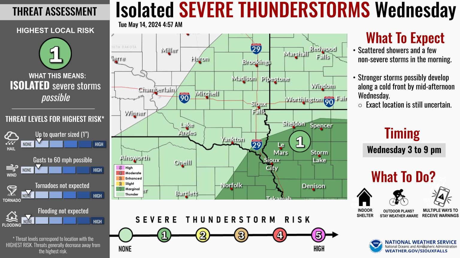
The Level 2 of 5 risk for severe storms on Tuesday has expanded in coverage, and now includes portions of far southeast South Dakota, southern Minnesota, and all of northeast Nebraska and western Iowa. The primary threats will be hail up to golf ball size with initial storm development, transitioning to wind gusts up to 70 mph as the storms move east through the late afternoon and early evening. A few tornadoes and isolated flash flooding are also possible. If you have outdoor plans Tuesday afternoon and evening, please stay weather aware and have multiple ways to receive warnings.


 Weather Story
 Weather Map
 Local Radar
 Follow us on YouTube