Overview
|
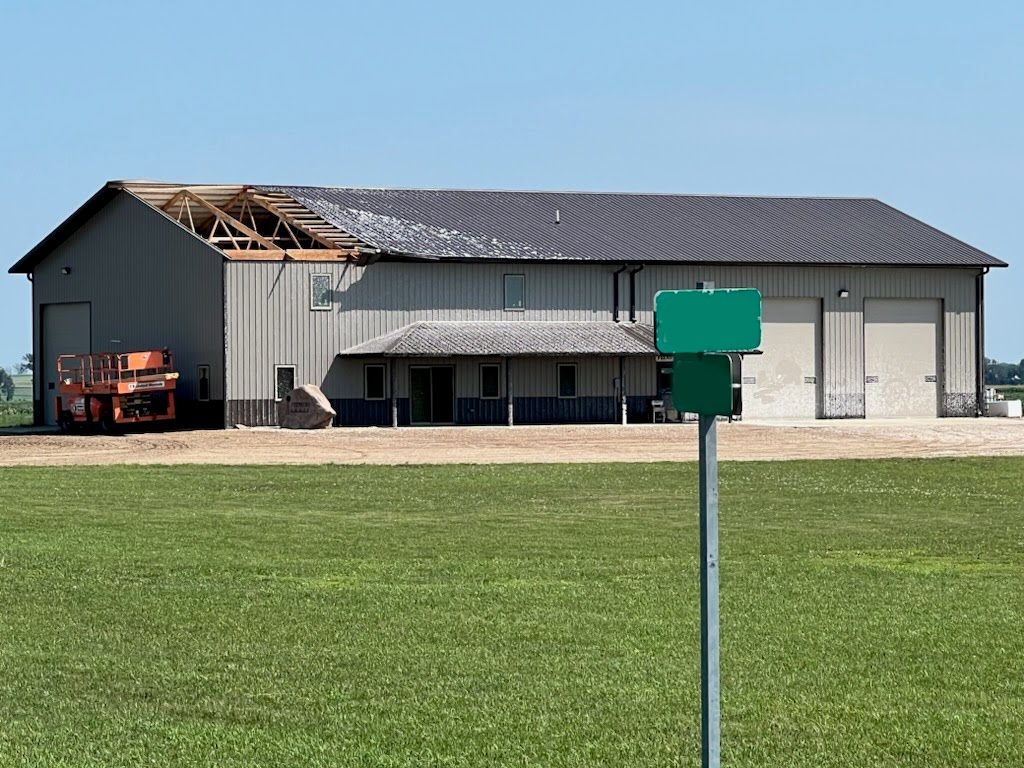
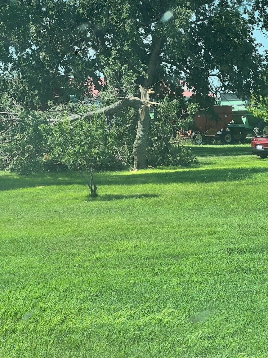
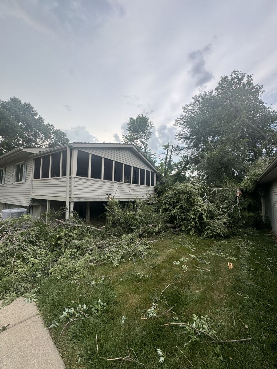
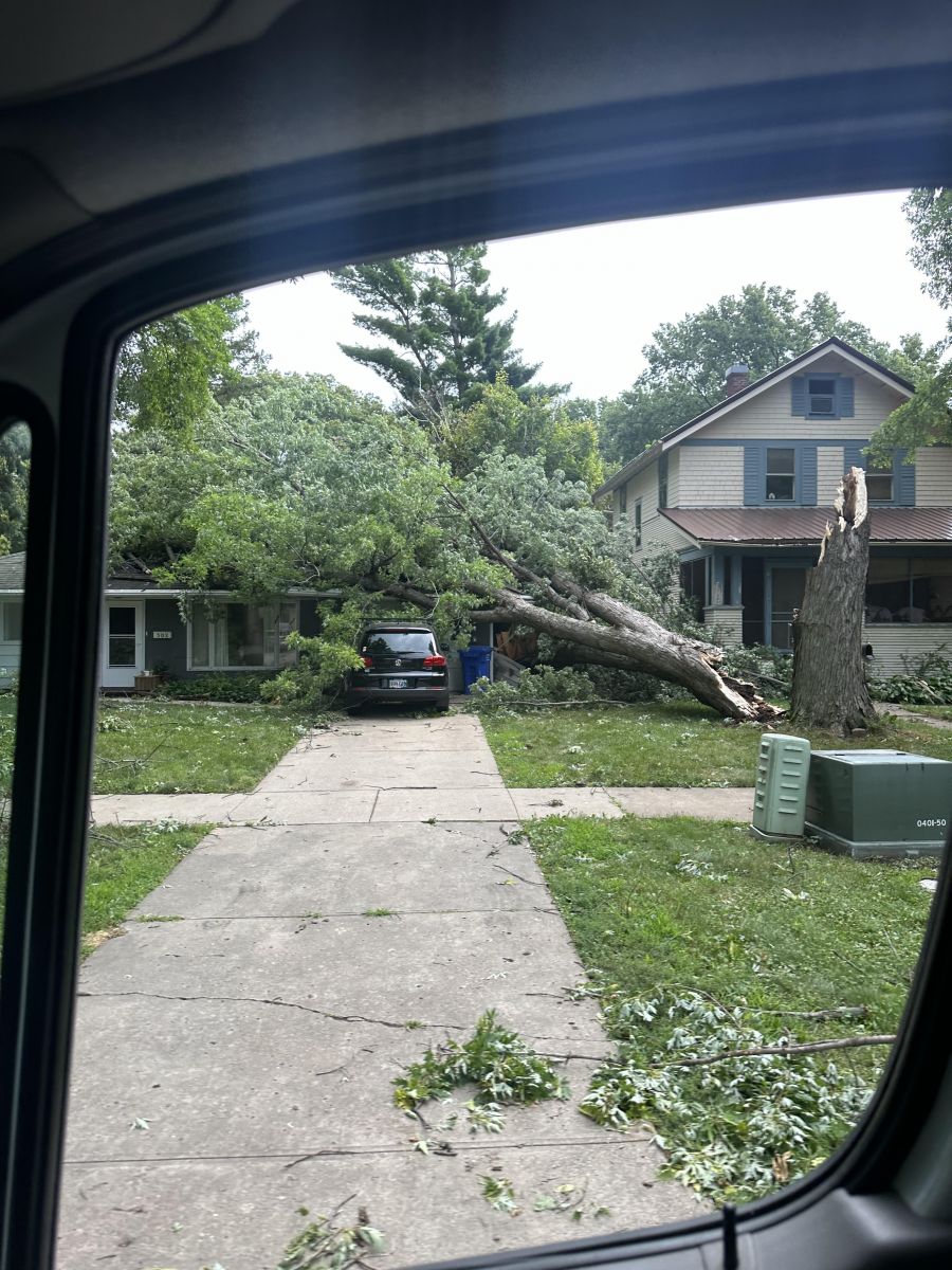
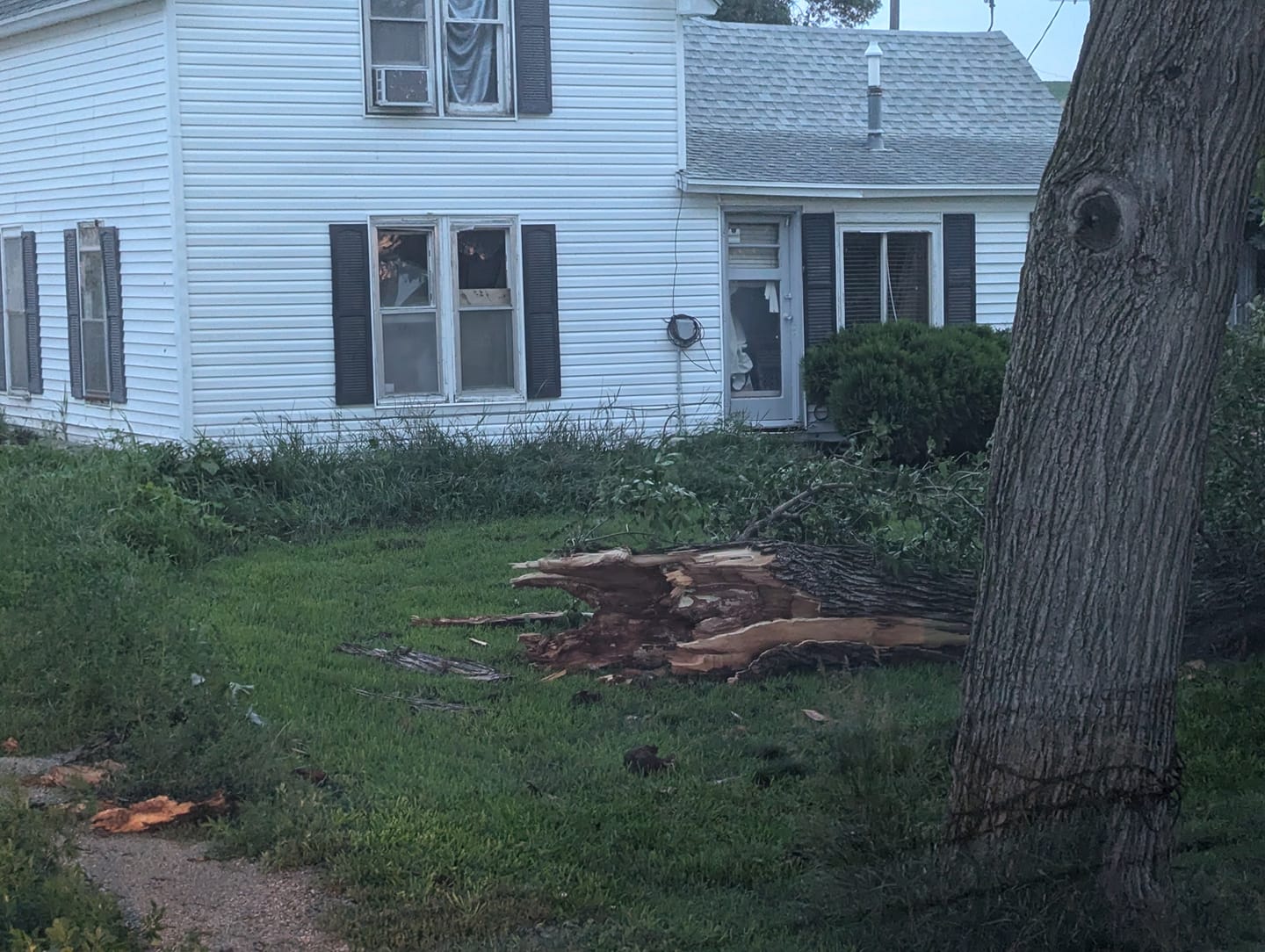
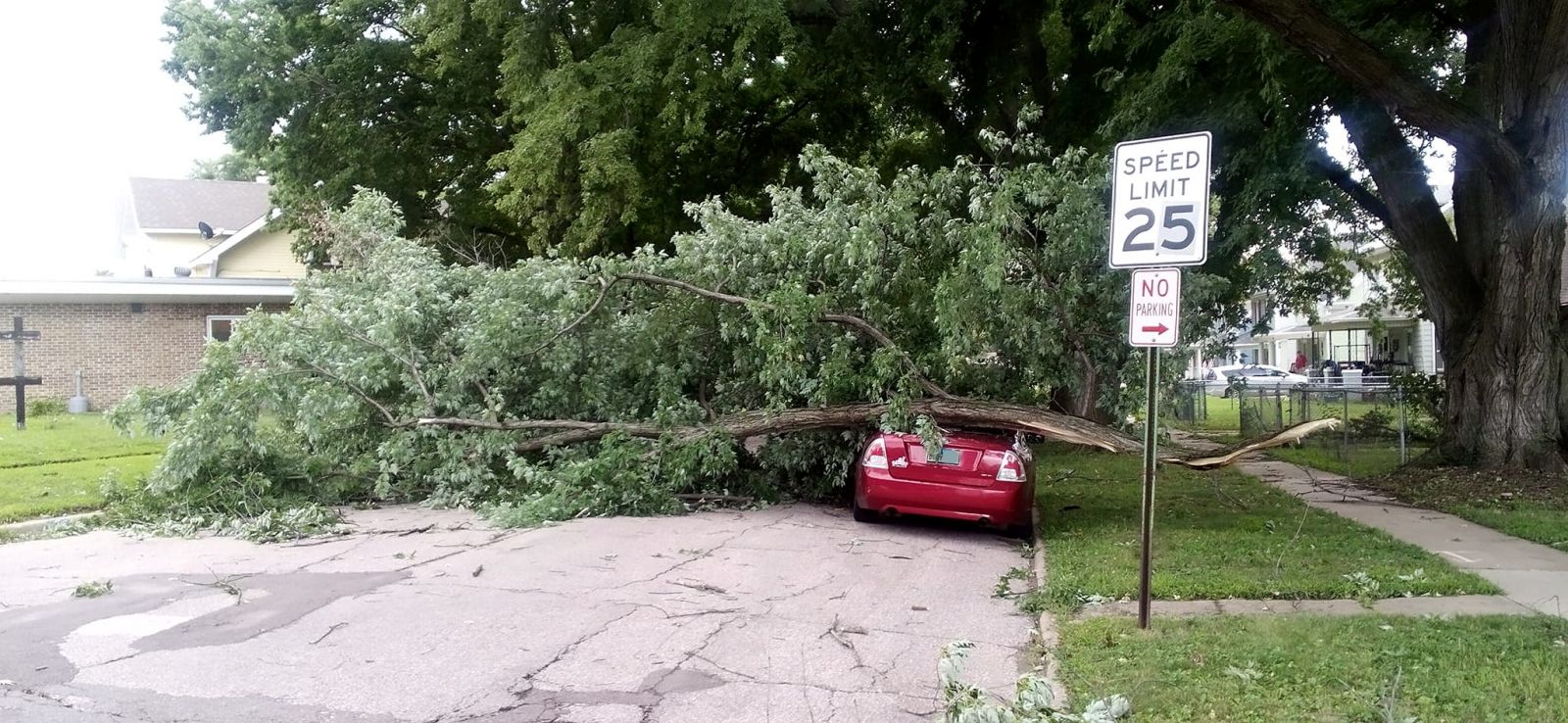
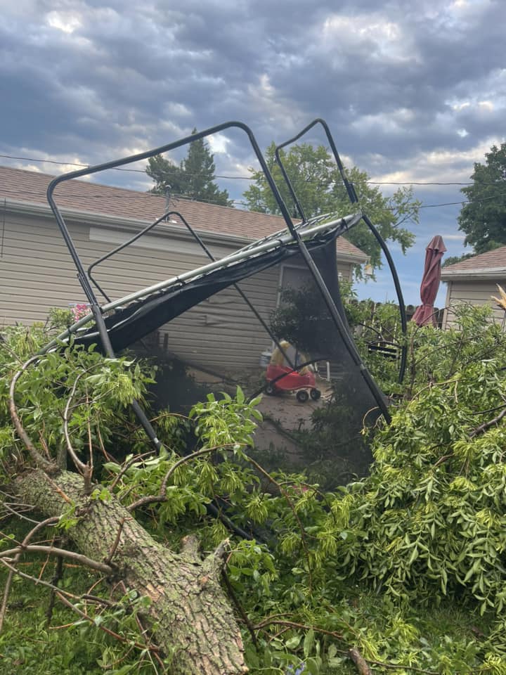
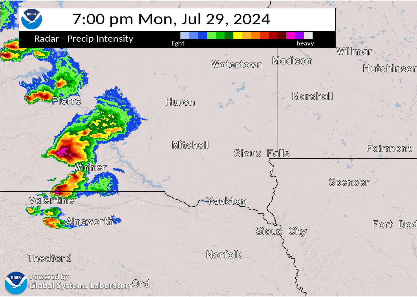
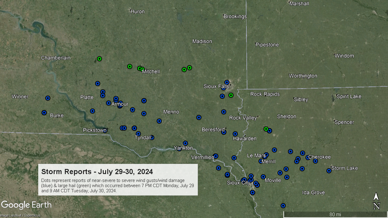
A bowing cluster of thunderstorms produced damaging winds from south central South Dakota, down the Missouri River Valley and into northwest Iowa around Sioux City, Le Mars and Cherokee, during the evening of Monday, July 29th into the early morning of Tuesday, July 30th. Measured wind gusts were generally in the 50-70 mph range, though isolated stronger gusts were reported around Corsica and Armour, South Dakota. Damage was primarily confined to broken tree branches and/or snapped trees, some of which fell on houses or vehicles and caused some property damage. The damaging winds also caused an evacuation of the Woodbury County Fairgrounds in Moville, Iowa, during the overnight hours on the first night of the county fair. |
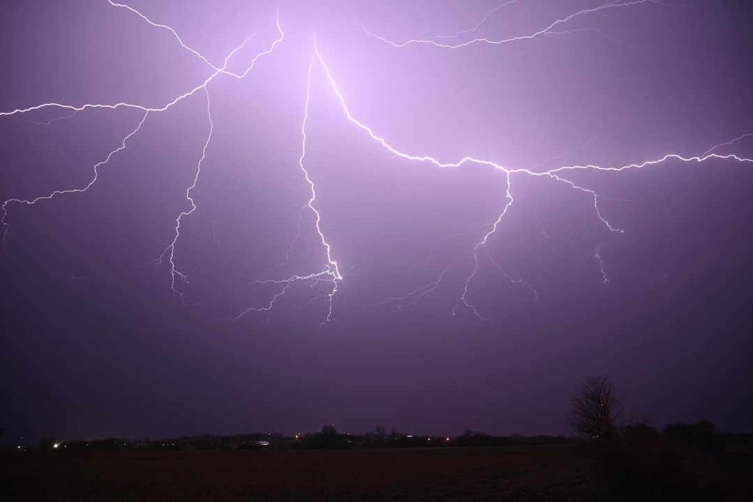
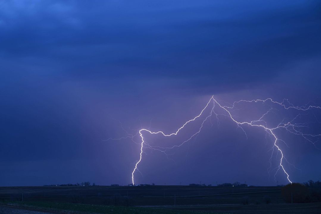
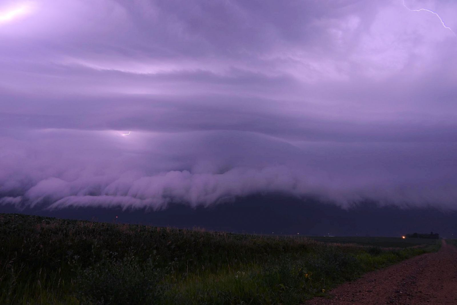 Shelf cloud, dimly lit by in-cloud lightning, approaching Le Mars, Iowa, on the night of July 29-30, 2024 |
Photos & Video
Header
 |
 |
 |
 |
| north of New Holland, SD (Douglas County EM) |
Harrison, SD (Douglas County EM) |
Vermillion, SD (Kendra Rich) |
Vermillion, SD (Steven Comstock) |
 |
 |
 |
 |
| Ponca, NE (Brian Nelson) |
Sioux City, IA (Tiff L Cash) |
Merrill, IA (Kristie Foreman) |
Salem, SD (Alison Klimkhammer) |
 |
 |
||
| Le Mars, IA (Wyatt Luschen) |
Le Mars, IA (Wyatt Luschen) |
Caption (source) |
Caption (source) |
Radar & Warnings
 |
 |
 |
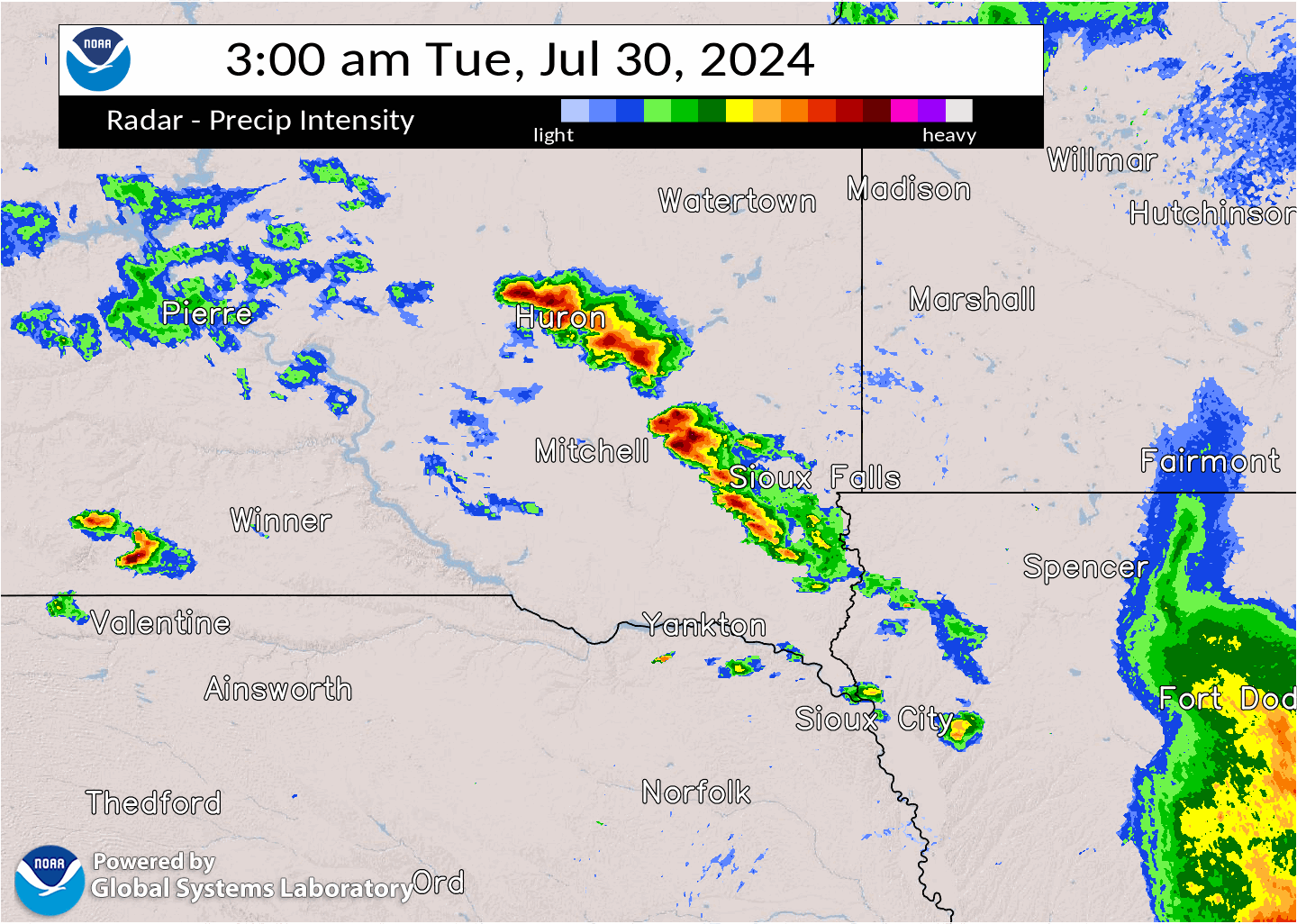
| Radar Loop: 7 PM Monday, July 29, through 1 AM CDT Tuesday, July 30th |
Radar Loop: 3 AM through 9 AM CDT Tuesday, July 30th |
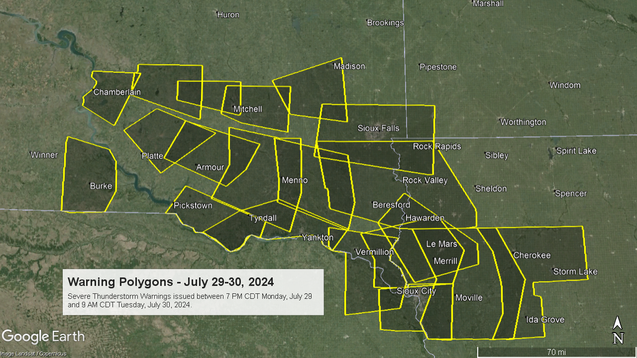
Plot of Severe Thunderstorm Warnings |
Storm Reports
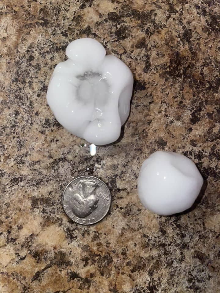
..TIME... ...EVENT... ...CITY LOCATION... ...LAT.LON... ..DATE... ....MAG.... ..COUNTY LOCATION..ST.. ...SOURCE.... ..REMARKS.. 0811 PM Tstm Wnd Gst 1 ESE Dallas 43.23N 99.49W 07/29/2024 M53 MPH Gregory SD Mesonet Corrects time of previous tstm wnd gst report from 1 ESE Dallas. Mesonet station 307 SD RWIS Dallas. 0821 PM Tstm Wnd Gst 2 E Dixon 43.39N 99.44W 07/29/2024 M50 MPH Gregory SD Mesonet Mesonet station 283 SD RWIS Dixon. 0829 PM Tstm Wnd Dmg 11 S White Lake 43.56N 98.69W 07/29/2024 Aurora SD Trained Spotter Large cottonwood tree fell on pickup and numerous large branches down around the yard. Time estimated based on radar. 0840 PM Tstm Wnd Dmg 5 WNW Harrison 43.47N 98.61W 07/29/2024 Douglas SD Emergency Mngr Roof decking removed on the southwest corner of a shouse and tossed one quarter mile to the southeast. Time estimated from radar. 0847 PM Tstm Wnd Gst 6 S Harrison 43.35N 98.52W 07/29/2024 M63 MPH Douglas SD Public Personal weather station. 0849 PM Tstm Wnd Gst 4 W Harrison 43.43N 98.61W 07/29/2024 M50 MPH Douglas SD Public Personal weather station. 0850 PM Tstm Wnd Dmg Armour 43.33N 98.34W 07/29/2024 Douglas SD Emergency Mngr Numerous trees down on the north side of Armour. 0856 PM Tstm Wnd Gst 3 S Corsica 43.38N 98.41W 07/29/2024 M71 MPH Douglas SD Mesonet Mesonet station 304 SD RWIS Corsica. 0900 PM Tstm Wnd Gst 2 N Armour 43.35N 98.34W 07/29/2024 M56 MPH Douglas SD Public Personal weather station. 0901 PM Tstm Wnd Dmg 2 S Corsica 43.40N 98.41W 07/29/2024 Douglas SD Emergency Mngr Uprooted cottonwood tree. 0901 PM Tstm Wnd Gst 3 S Corsica 43.38N 98.41W 07/29/2024 M87 MPH Douglas SD Mesonet Mesonet station 304 SD RWIS Corsica. 0901 PM Tstm Wnd Gst Armour 43.32N 98.35W 07/29/2024 M68 MPH Douglas SD Public Personal weather station. 0905 PM Tstm Wnd Gst Armour 43.32N 98.35W 07/29/2024 M63 MPH Douglas SD Mesonet Mesonet station DVI09260 Armour. 0907 PM Tstm Wnd Gst 2 WSW Pickstown 43.05N 98.57W 07/29/2024 M64 MPH Gregory SD Mesonet Mesonet station 244 SD RWIS Ft. Randall Dam. 0913 PM Tstm Wnd Gst 1 N Delmont 43.28N 98.16W 07/29/2024 M52 MPH Douglas SD Public Personal weather station. 0916 PM Tstm Wnd Gst 4 NE Dante 43.08N 98.13W 07/29/2024 M52 MPH Charles Mix SD Mesonet Mesonet station 324 SD RWIS WAGNER. 0921 PM Tstm Wnd Gst 2 NW Tripp 43.24N 97.99W 07/29/2024 M74 MPH Hutchinson SD Mesonet Mesonet station 26 SD RWIS Tripp. 0924 PM Tstm Wnd Gst Wagner 43.08N 98.31W 07/29/2024 M53 MPH Charles Mix SD Public Personal weather station. 0925 PM Tstm Wnd Gst 1 SSW Parkston 43.38N 97.99W 07/29/2024 M58 MPH Hutchinson SD Mesonet Mesonet station PSTS2 Parkston (SD Mesonet). 0930 PM Tstm Wnd Gst 1 ENE Wagner 43.08N 98.28W 07/29/2024 M57 MPH Charles Mix SD Public Personal weather station. 0930 PM Tstm Wnd Gst 1 SSW Parkston 43.38N 97.99W 07/29/2024 M60 MPH Hutchinson SD Mesonet Mesonet station PSTS2 Parkston (SD Mesonet). 0937 PM Tstm Wnd Gst 2 WNW Scotland 43.16N 97.76W 07/29/2024 M58 MPH Bon Homme SD Public Personal weather station. 0941 PM Non-Tstm Wnd Gst 3 W Geddes 43.26N 98.76W 07/29/2024 M55 MPH Charles Mix SD Mesonet Northeast wind behind the line of thunderstorms. Mesonet station RLAS2 Lake Andes RAWS. 0941 PM Tstm Wnd Gst 4 NE Dante 43.08N 98.13W 07/29/2024 M54 MPH Charles Mix SD Mesonet Mesonet station 324 SD RWIS WAGNER. 0945 PM Tstm Wnd Gst 1 NW Avon 43.02N 98.07W 07/29/2024 M54 MPH Bon Homme SD Public Personal weather station. 0954 PM Tstm Wnd Gst 1 SW Tyndall 42.98N 97.87W 07/29/2024 M54 MPH Bon Homme SD Public Personal weather station. 1026 PM Tstm Wnd Gst 5 WNW Viborg 43.20N 97.17W 07/29/2024 M55 MPH Turner SD Public Personal weather station. 1029 PM Tstm Wnd Gst 4 WSW Yankton 42.86N 97.46W 07/29/2024 M52 MPH Yankton SD Public Personal weather station. 1036 PM Tstm Wnd Gst 2 NE Yankton 42.92N 97.37W 07/29/2024 M59 MPH Yankton SD AWOS AWOS station KYKN Yankton Municipal Airport. 1100 PM Tstm Wnd Dmg Newcastle 42.65N 96.88W 07/29/2024 Dixon NE Public Report via social media of large tree down across back deck. 1103 PM Tstm Wnd Dmg Vermillion 42.78N 96.93W 07/29/2024 Clay SD Public Tree downed in Vermillion. Time estimated from radar. 1110 PM Tstm Wnd Dmg 2 W Ponca 42.57N 96.75W 07/29/2024 Dixon NE Public A layer of shingles was peeled off the roof of a single family home. Time estimated from radar. 1114 PM Tstm Wnd Dmg 2 WNW Ponca 42.58N 96.75W 07/29/2024 Dixon NE Trained Spotter 10 to 12 inch diameter tree branches broken out of trees, some maybe bigger. Estimates 70 mph or higher wind gusts. 1122 PM Tstm Wnd Dmg 6 NNE Elk Point 42.76N 96.65W 07/29/2024 Union SD Public Large tree branch downed in Richland. Time estimated from radar. 1124 PM Tstm Wnd Gst 2 SSW North Sioux City 42.51N 96.52W 07/29/2024 M59 MPH Union SD Public Personal Weather Station. 1134 PM Tstm Wnd Gst 1 SSE North Sioux City 42.52N 96.50W 07/29/2024 M60 MPH Union SD Public Personal Weather Station. 1136 PM Tstm Wnd Dmg South Sioux City 42.47N 96.41W 07/29/2024 Dakota NE Emergency Mngr Several large tree branches downed around South Sioux City, with some laying on vehicles or residential structures. 1139 PM Tstm Wnd Gst 4 NNE Sergeant Bluff 42.46N 96.31W 07/29/2024 M66 MPH Woodbury IA Public Personal Weather Station. 1139 PM Tstm Wnd Gst 4 NNE Sergeant Bluff 42.46N 96.31W 07/29/2024 M60 MPH Woodbury IA Public Personal Weather Station. 1140 PM Tstm Wnd Dmg 2 WNW Sioux City 42.51N 96.42W 07/29/2024 Woodbury IA Public Picture via social media of a large tree split near 18th and Myrtle Street. Aside from this, have seen numerous pictures of trees and branches down across Sioux City. 1144 PM Tstm Wnd Gst 4 N Sioux City 42.56N 96.40W 07/29/2024 M71 MPH Woodbury IA Mesonet Mesonet station AP032 Sioux City. 1146 PM Tstm Wnd Dmg Merrill 42.72N 96.25W 07/29/2024 Plymouth IA Public Large tree branches down in Merrill. Time estimated from radar. 1146 PM Tstm Wnd Gst 4 ESE Sioux City 42.48N 96.33W 07/29/2024 M59 MPH Woodbury IA Public Personal Weather Station. 1152 PM Tstm Wnd Dmg 2 SW Le Mars 42.77N 96.19W 07/29/2024 Plymouth IA Public Semi truck trailer overturned in parking lot. Time estimated from radar. 1152 PM Tstm Wnd Gst 2 SW Sergeant Bluff 42.38N 96.38W 07/29/2024 M69 MPH Woodbury IA ASOS Corrects previous tstm wnd gst report from 2 SW Sergeant Bluff. ASOS station KSUX Sioux Gateway Airport. 1155 PM Tstm Wnd Dmg Le Mars 42.79N 96.17W 07/29/2024 Plymouth IA Trained Spotter Lots of tree damage in town. Northwest side of Le Mars without power. Time estimated via radar. 1155 PM Tstm Wnd Dmg 1 NNW Sioux City 42.52N 96.40W 07/29/2024 Woodbury IA Public Picture via social media of a large tree down across the intersection of 24th and Jones Street. Time estimated via radar. 1155 PM Tstm Wnd Gst 2 SW Le Mars 42.77N 96.20W 07/29/2024 M62 MPH Plymouth IA AWOS AWOS station KLRJ Le Mars Airport. 1200 AM Tstm Wnd Dmg Kingsley 42.59N 95.97W 07/30/2024 Plymouth IA Public Trees and some power lines downed in Kingsley. Time estimated from radar. 1202 AM Tstm Wnd Gst 5 NNW Lawton 42.55N 96.22W 07/30/2024 M59 MPH Woodbury IA Public Personal Weather Station. 1206 AM Tstm Wnd Dmg Pierson 42.54N 95.87W 07/30/2024 Woodbury IA Public Large tree branch downed in Pierson. Time estimated from radar. 1208 AM Tstm Wnd Dmg 6 NE Kingsley 42.63N 95.88W 07/30/2024 Plymouth IA Public Several snapped trees at C60 and Tamarack Avenue. Time estimated from radar. 1208 AM Tstm Wnd Dmg Smithland 42.23N 95.93W 07/30/2024 Woodbury IA Public Large tree branch downed in Smithland. Time estimated from radar. 1221 AM Tstm Wnd Dmg Quimby 42.63N 95.64W 07/30/2024 Cherokee IA Public Tree branches downed in Quimby. Time estimated from radar. 1221 AM Tstm Wnd Gst 7 NW Quimby 42.71N 95.72W 07/30/2024 M57 MPH Cherokee IA Public Personal weather station. 1222 AM Tstm Wnd Dmg Marcus 42.82N 95.81W 07/30/2024 Cherokee IA Public Large evergreen tree downed in Marcus. Time estimated from radar. 1229 AM Tstm Wnd Gst Meriden 42.80N 95.63W 07/30/2024 M57 MPH Cherokee IA Public Personal Weather Station. 1235 AM Tstm Wnd Gst 5 S Cleghorn 42.74N 95.70W 07/30/2024 M53 MPH Cherokee IA Public Personal weather station. 1237 AM Tstm Wnd Dmg Cherokee 42.75N 95.55W 07/30/2024 Cherokee IA Public Large tree branches downed in Cherokee. Time estimated from radar. 1245 AM Tstm Wnd Dmg Aurelia 42.71N 95.44W 07/30/2024 Cherokee IA Fire Dept/Rescue Multiple large tree branches downed in Aurelia. Time estimated from radar. 1255 AM Tstm Wnd Gst 4 WSW Lakeside 42.60N 95.24W 07/30/2024 M56 MPH Buena Vista IA AWOS KSLB AWOS. 0312 AM Hail Salem 43.72N 97.39W 07/30/2024 E1.75 Inch McCook SD Public Reports of ping pong ball to golf ball size hail in Salem. Time estimated from radar. 0325 AM Hail 4 ENE Salem 43.74N 97.31W 07/30/2024 E0.88 Inch McCook SD CO-OP Observer Lots of half inch to nickel sized hail. 0434 AM Tstm Wnd Gst 3 NNW Sioux Falls 43.58N 96.75W 07/30/2024 M52 MPH Minnehaha SD ASOS ASOS station KFSD Sioux Falls Airport. 0446 AM Tstm Wnd Dmg 4 WSW Sioux Falls 43.52N 96.80W 07/30/2024 Minnehaha SD NWS Employee 8-12 inch diameter branch snapped off. Time estimated based on radar. 0452 AM Tstm Wnd Dmg 1 SE Tea 43.43N 96.82W 07/30/2024 Lincoln SD Trained Spotter 3 to 6 inches branches down. 0504 AM Hail 1 NE Harrisburg 43.44N 96.69W 07/30/2024 E0.75 Inch Lincoln SD Public Report from mPING: Dime (0.75 in.). 0514 AM Tstm Wnd Gst 5 SSW Worthing 43.26N 96.80W 07/30/2024 M54 MPH Lincoln SD Mesonet Measured at Davis SD SDDOT site. 0540 AM Tstm Wnd Gst 3 SSW Beresford 43.04N 96.80W 07/30/2024 M51 MPH Union SD Mesonet 51 mph wind gust measured at the Beresford, SD SDDOT site. 0549 AM Tstm Wnd Gst 3 ESE Sioux Center 43.05N 96.12W 07/30/2024 M57 MPH Sioux IA Public Personal weather station. 0550 AM Hail Sioux Center 43.07N 96.17W 07/30/2024 E0.75 Inch Sioux IA Public Report from mPING: Dime (0.75 in.). 0605 AM Tstm Wnd Gst 1 N Oyens 42.84N 96.05W 07/30/2024 E57 MPH Plymouth IA Public Personal weather station. 0712 AM Hail 8 NNE White Lake 43.83N 98.67W 07/30/2024 E1.00 Inch Aurora SD Trained Spotter Hail started out like ice cubes, but then got smaller as the rain got heavier. Rainfall up to 710 am was 0.14 inch, but it was still raining. 0739 AM Hail 4 NE Mount Vernon 43.75N 98.21W 07/30/2024 E1.00 Inch Davison SD Public Hail up to the size of quarters. Small hail would break up when hitting the ground or deck, but larger stones would not. 0741 AM Hail 1 W Mitchell 43.73N 98.06W 07/30/2024 E0.88 Inch Davison SD Trained Spotter In addition to hail up to the size of nickels, wind gusts around 50 mph stripped a lots of leaves off elm trees. 0746 AM Hail 1 SE Mitchell 43.72N 98.02W 07/30/2024 M1.25 Inch Davison SD Public 0755 AM Tstm Wnd Gst 3 SSW Beresford 43.04N 96.80W 07/30/2024 M59 MPH Union SD Mesonet Mesonet station 16 SD RWIS Beresford. 0800 AM Tstm Wnd Dmg Alcester 43.02N 96.63W 07/30/2024 Union SD Public Tree downed in Alcester. 0905 AM Tstm Wnd Gst 3 ESE Sioux Center 43.05N 96.12W 07/30/2024 M57 MPH Sioux IA Public Personal weather station. &&
 |
Media use of NWS Web News Stories is encouraged! Please acknowledge the NWS as the source of any news information accessed from this site. |
|


 Weather Story
 Weather Map
 Local Radar