Overview
|
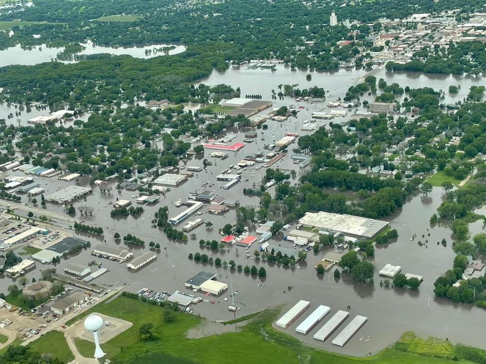
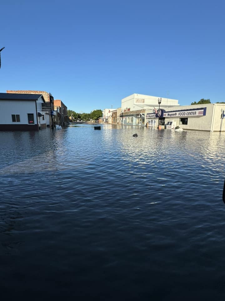
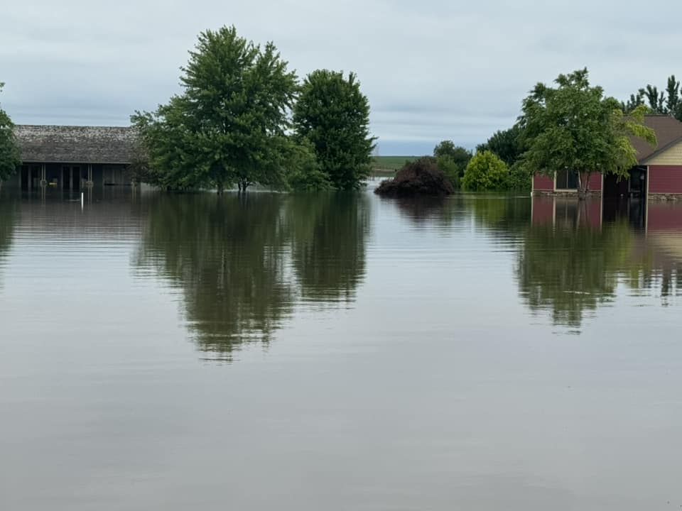
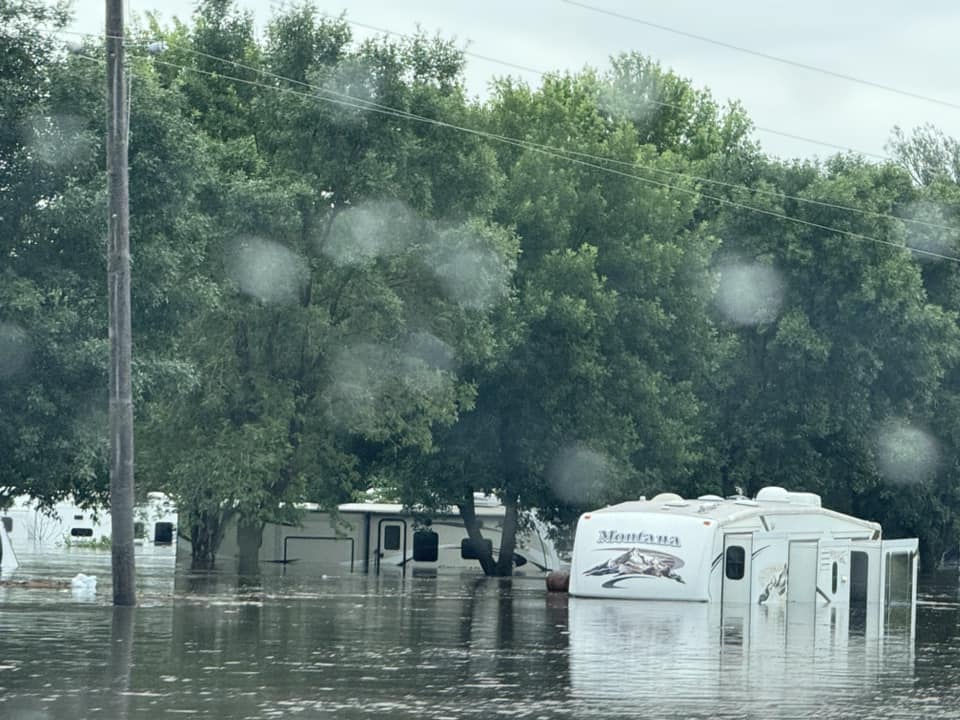
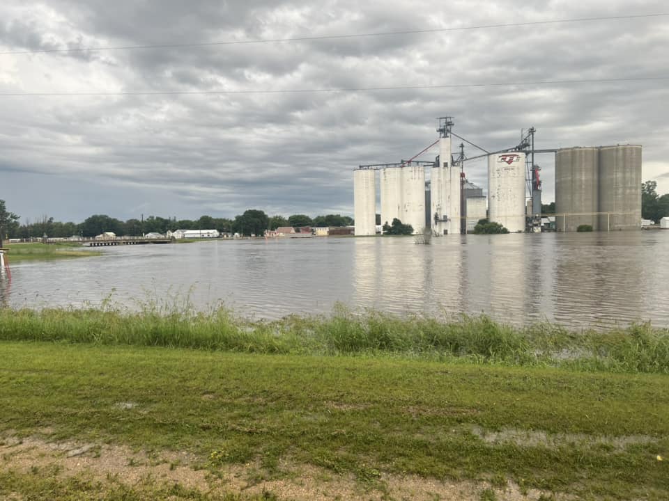
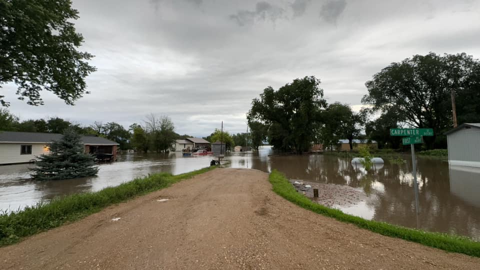
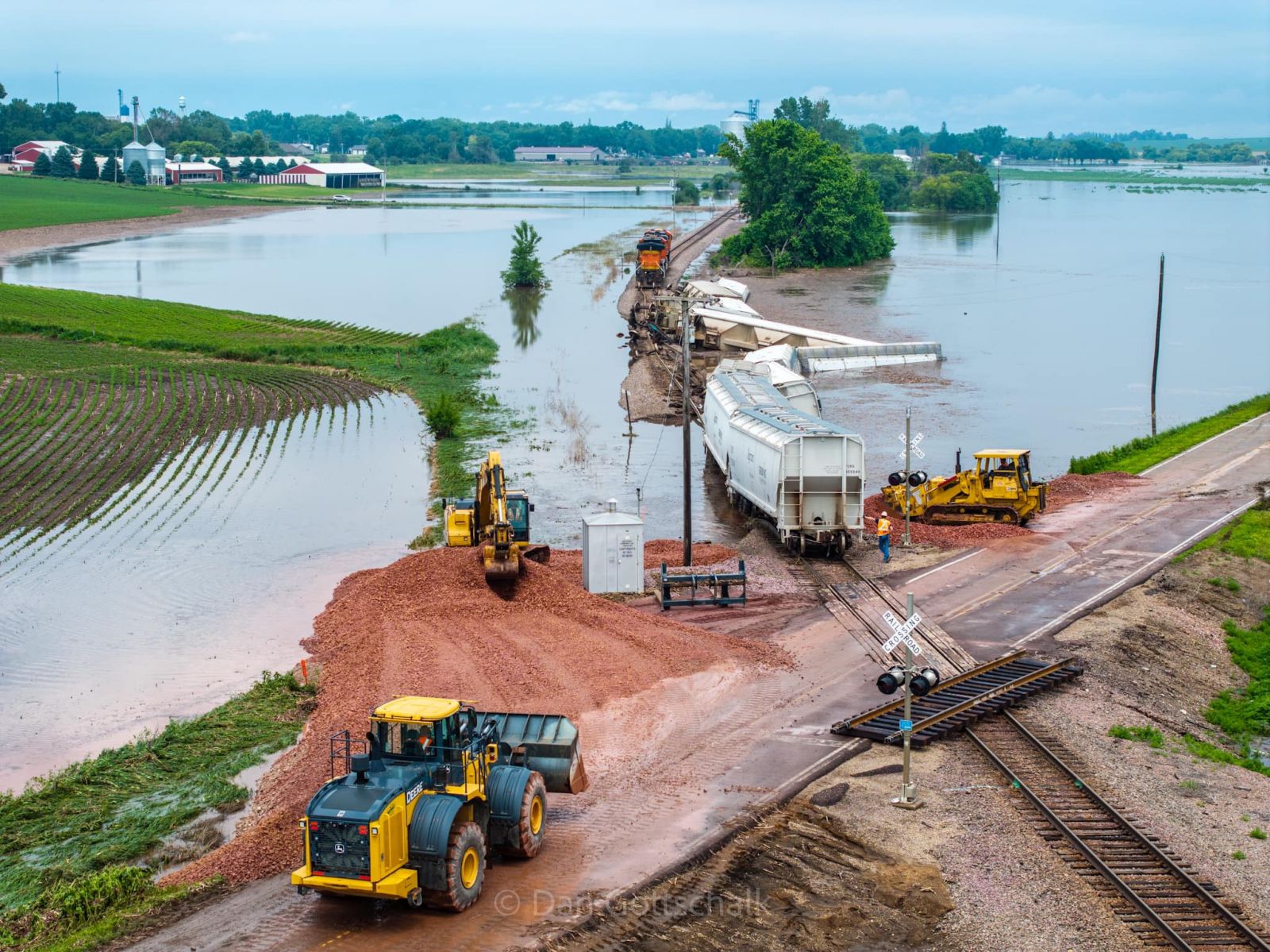
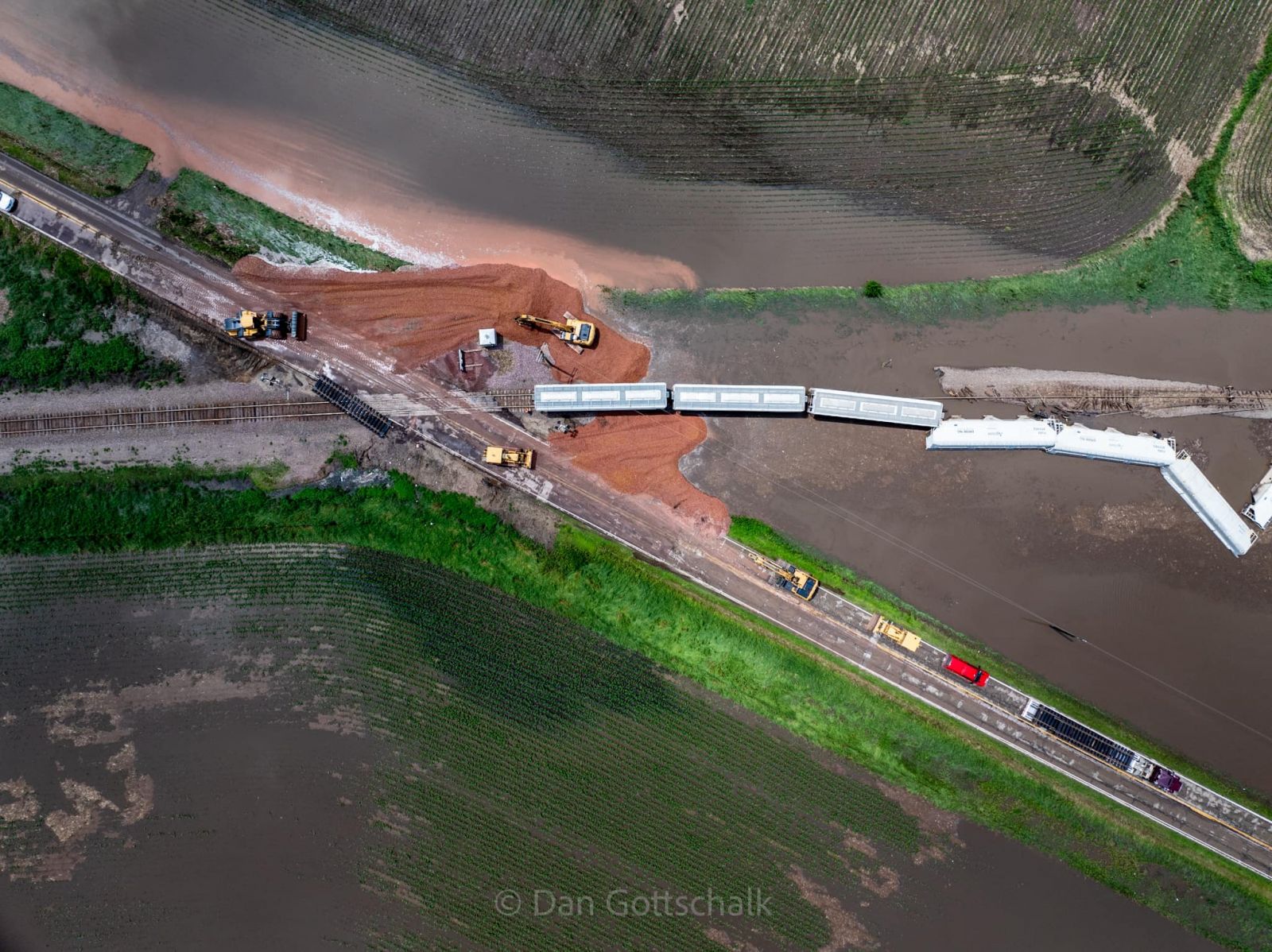
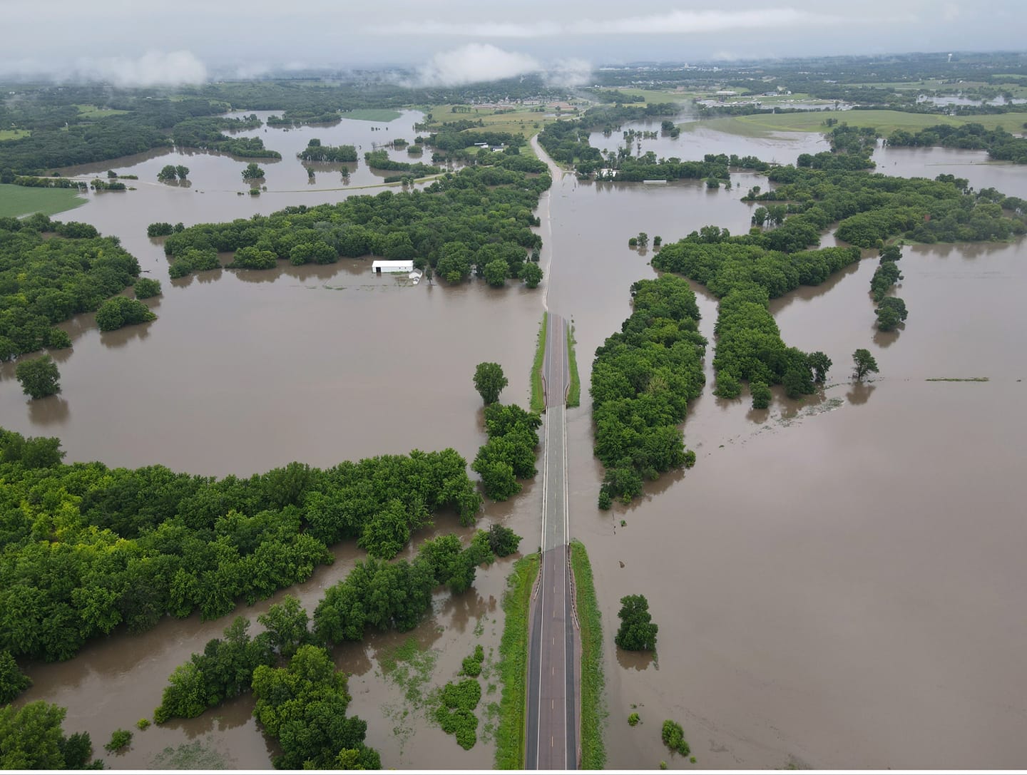
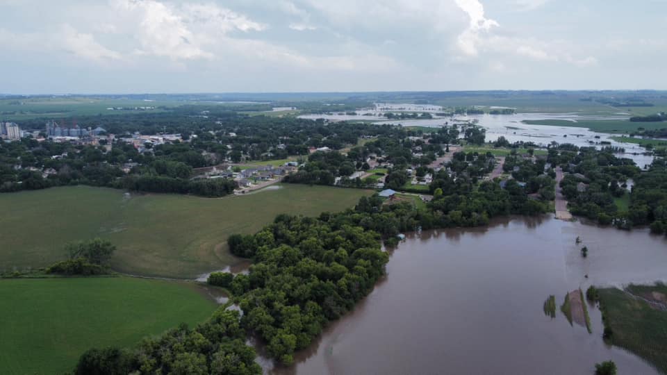
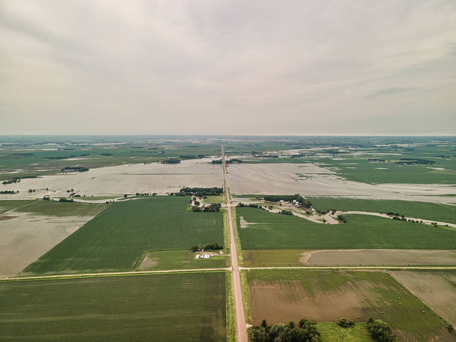
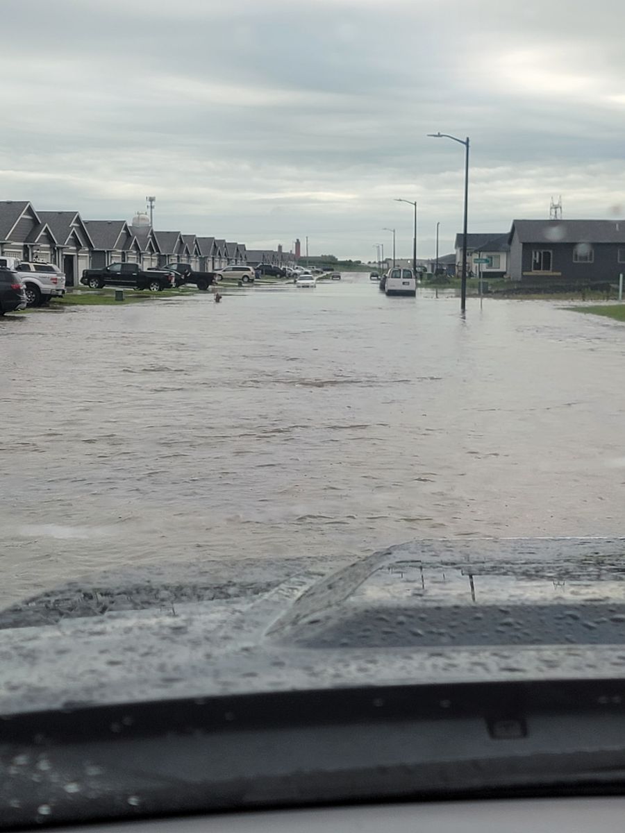
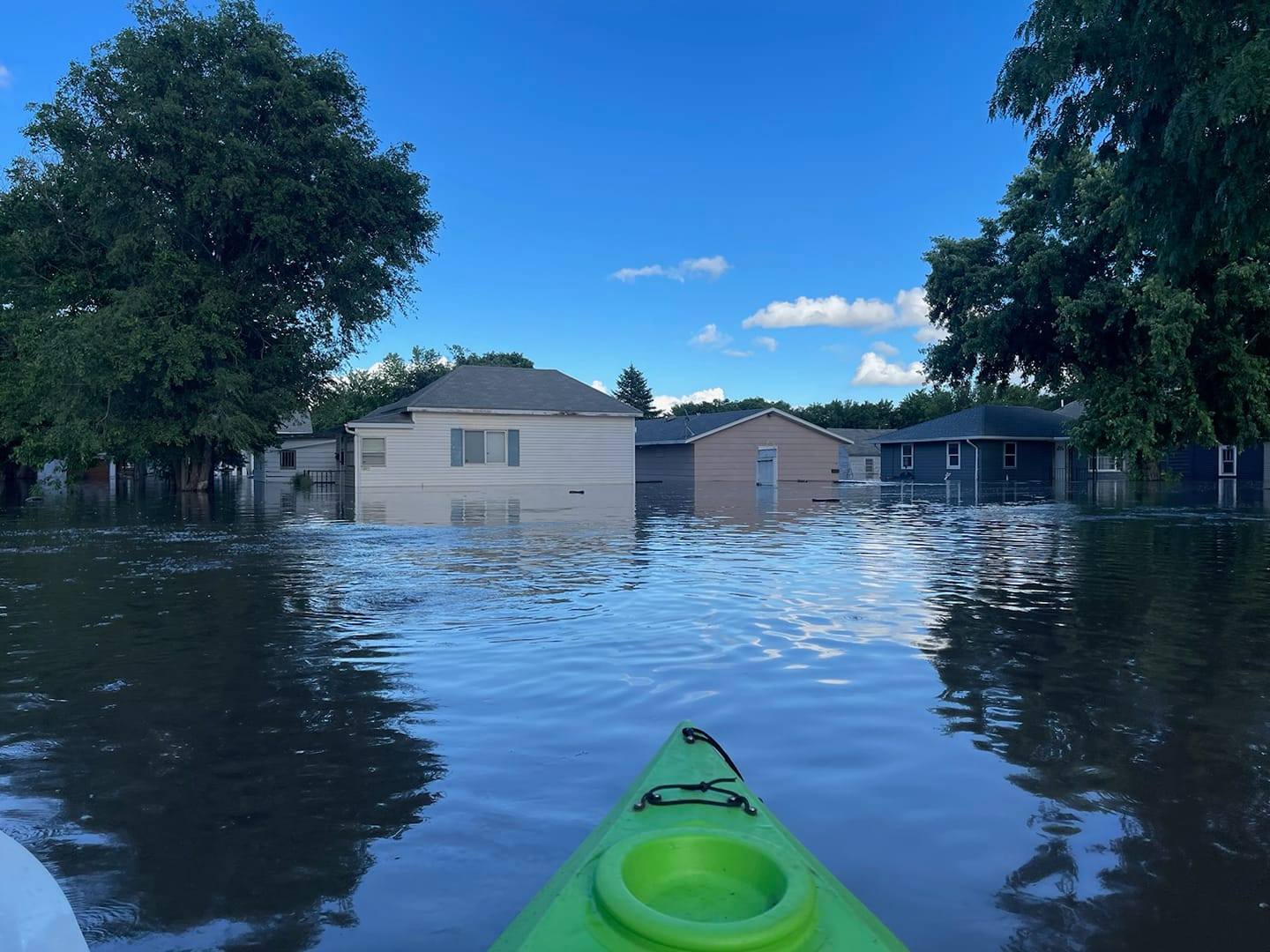
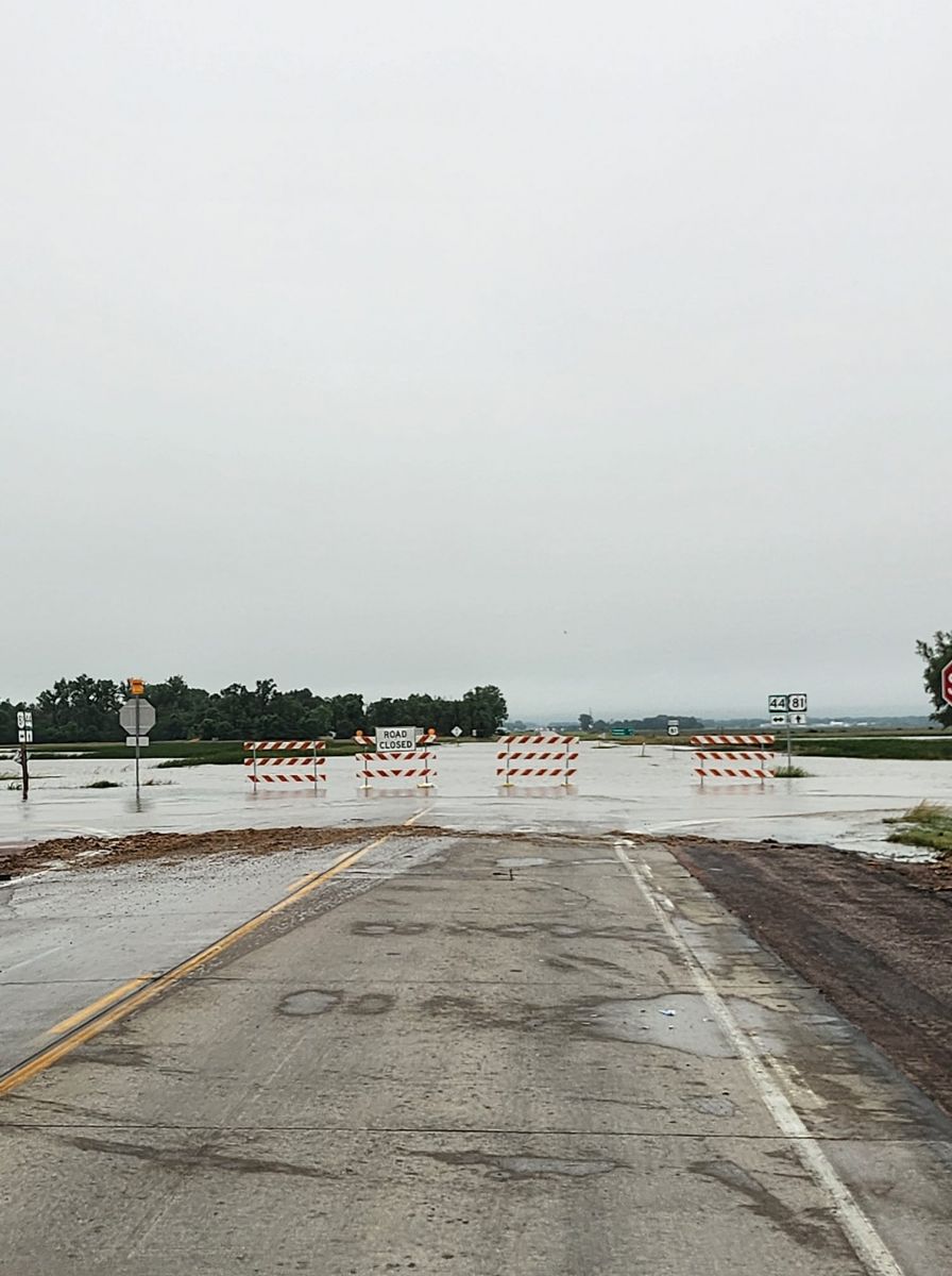
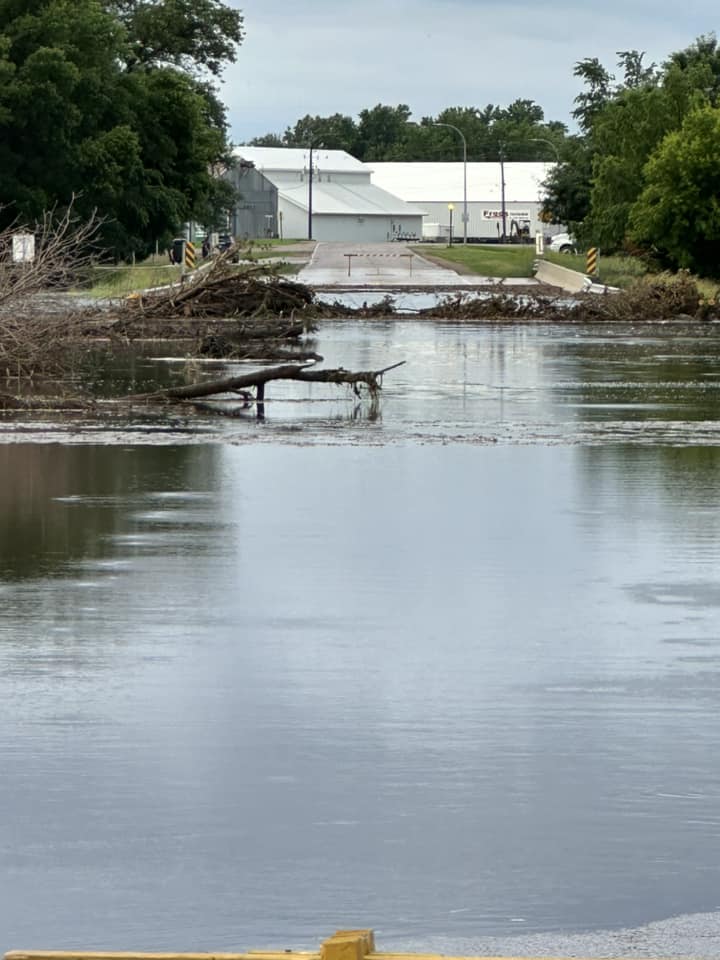
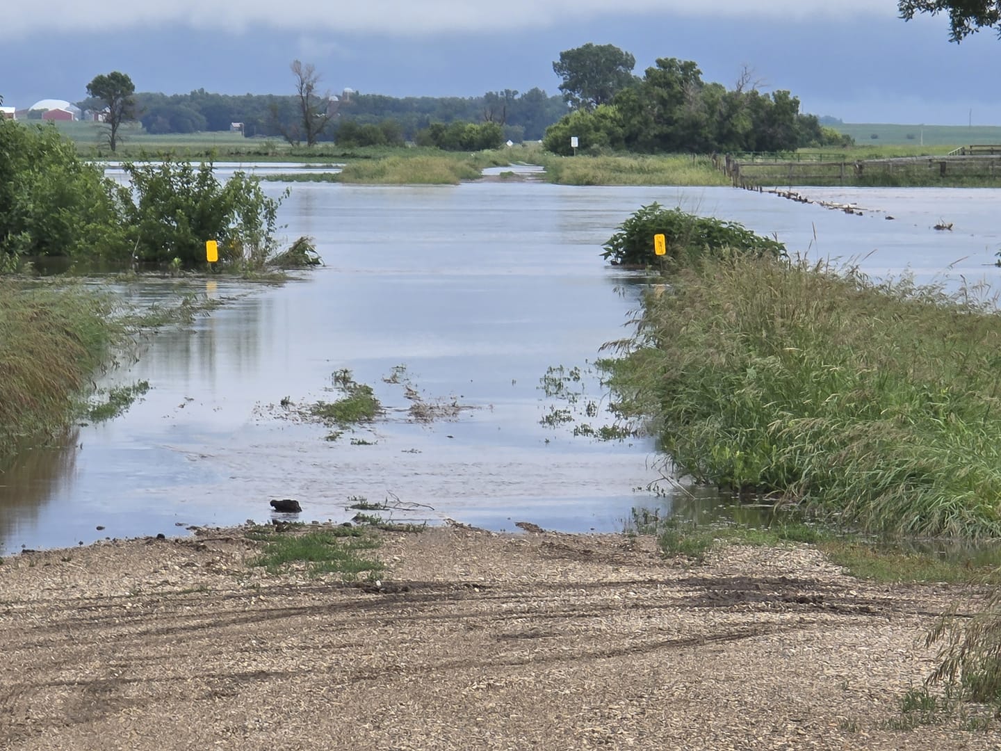
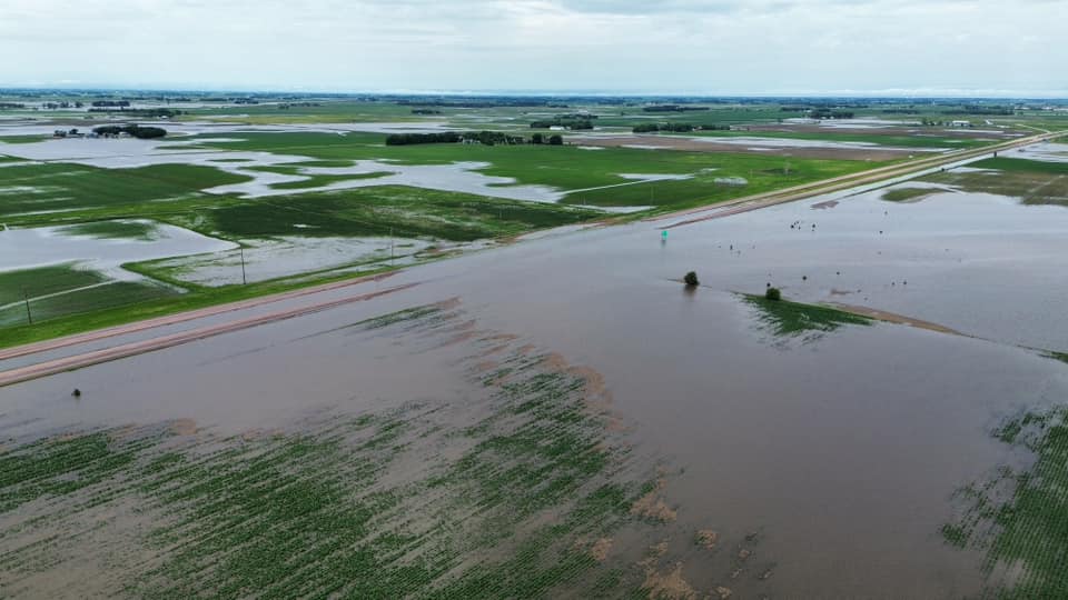
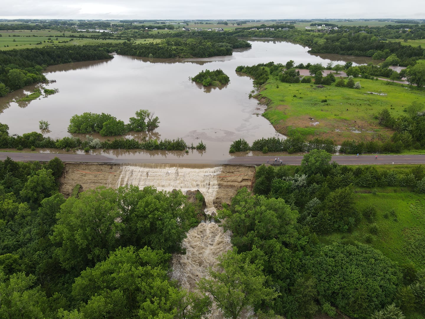
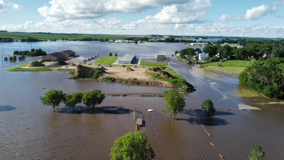
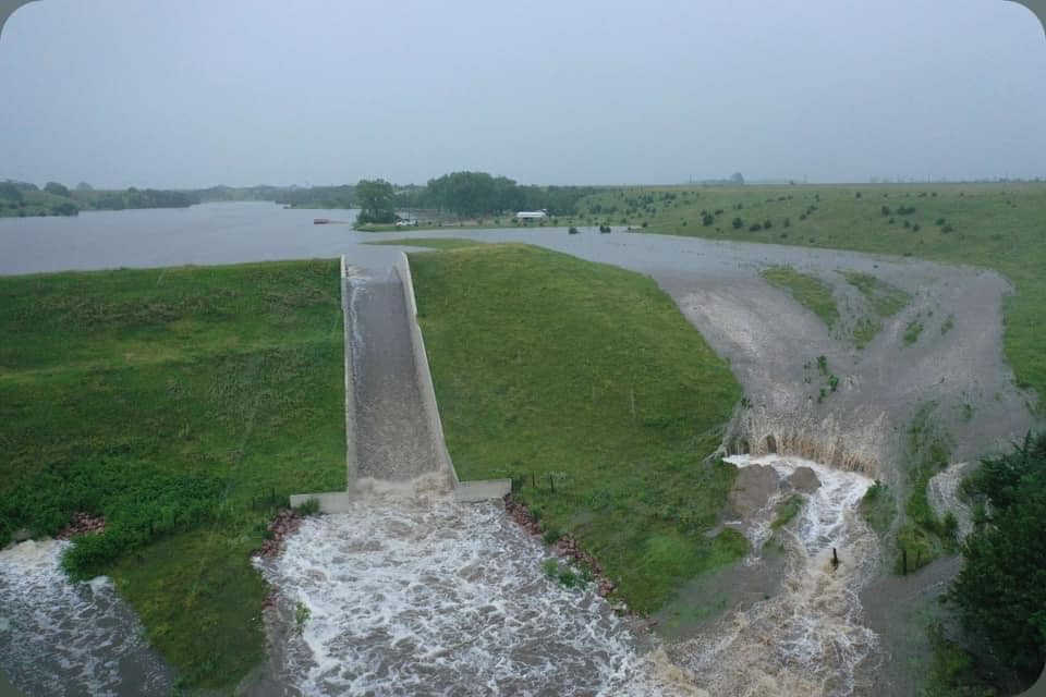
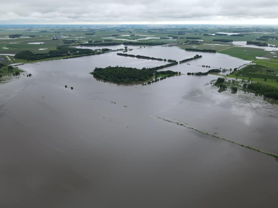
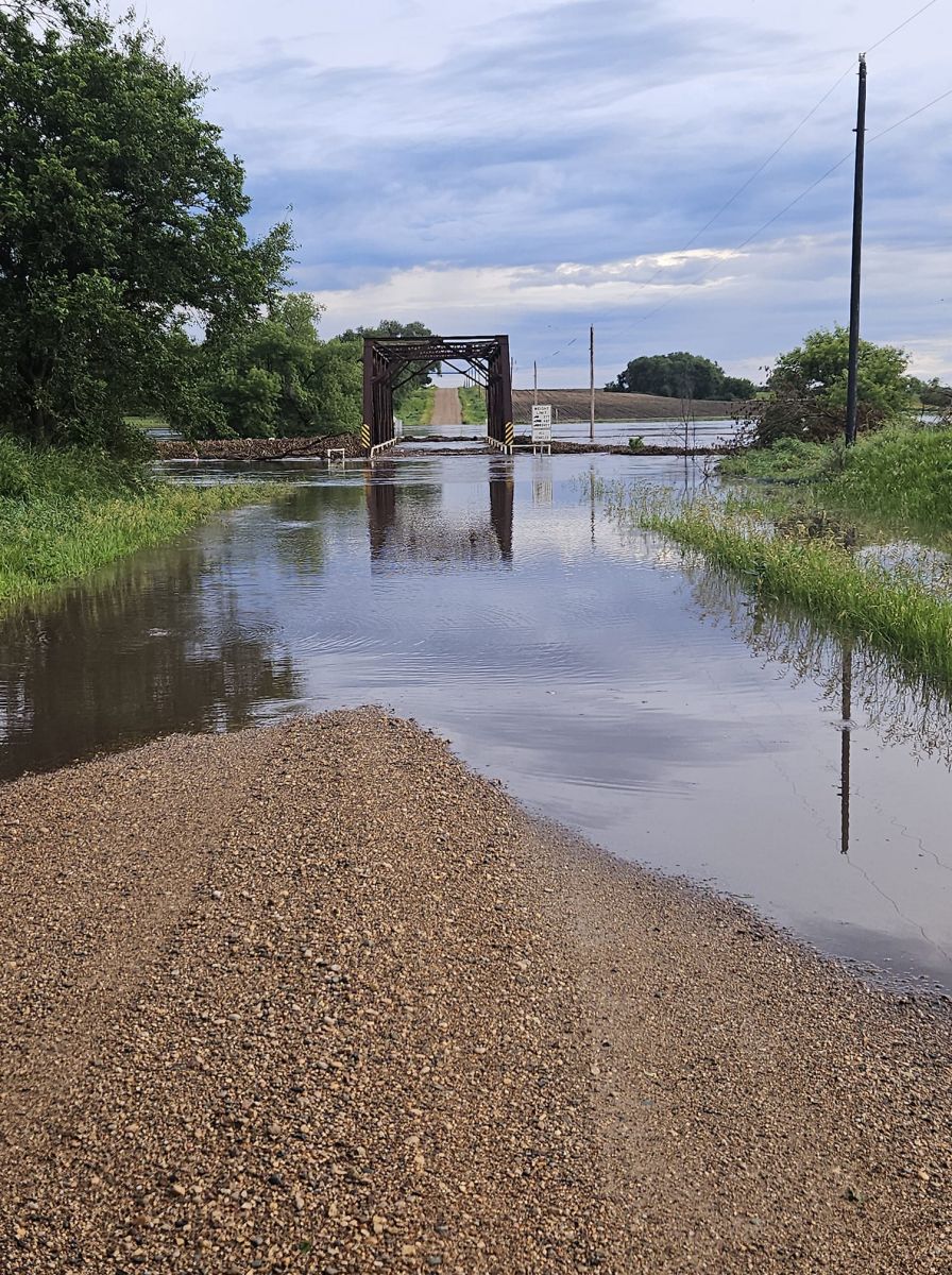
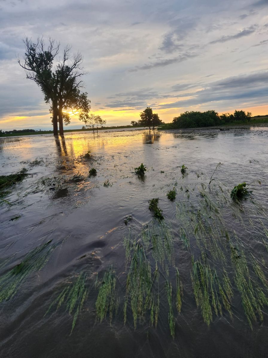
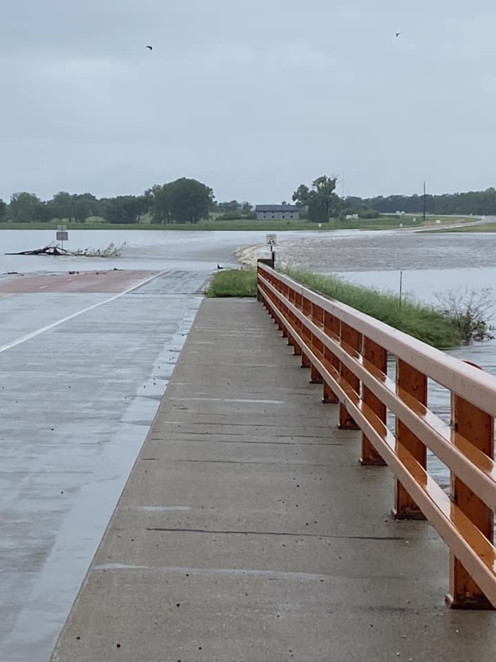
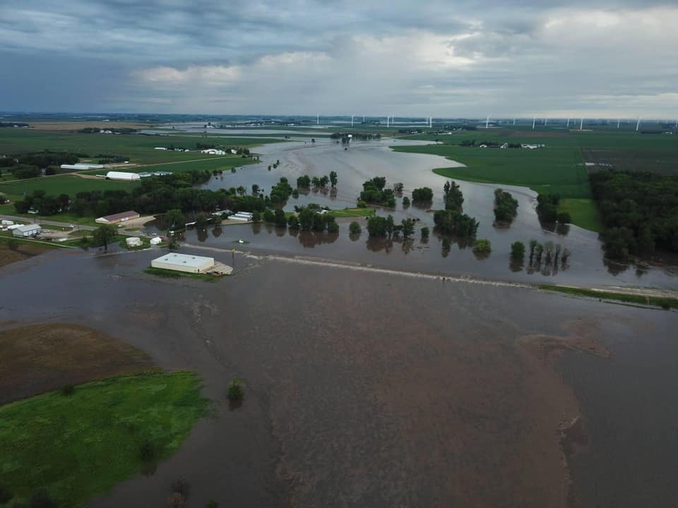
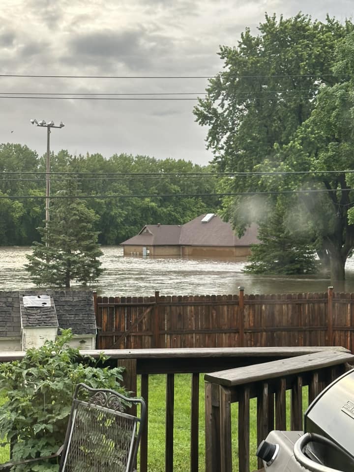
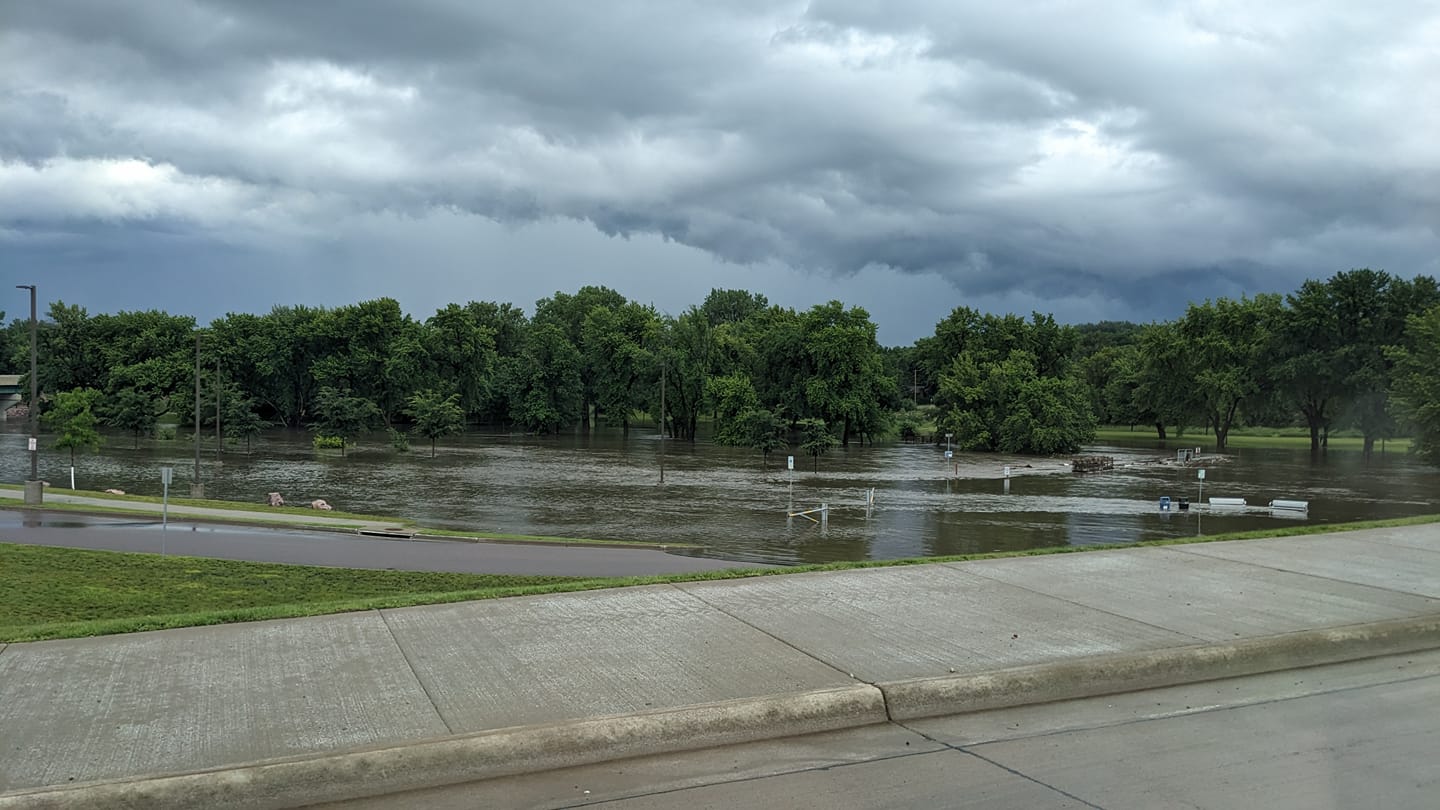
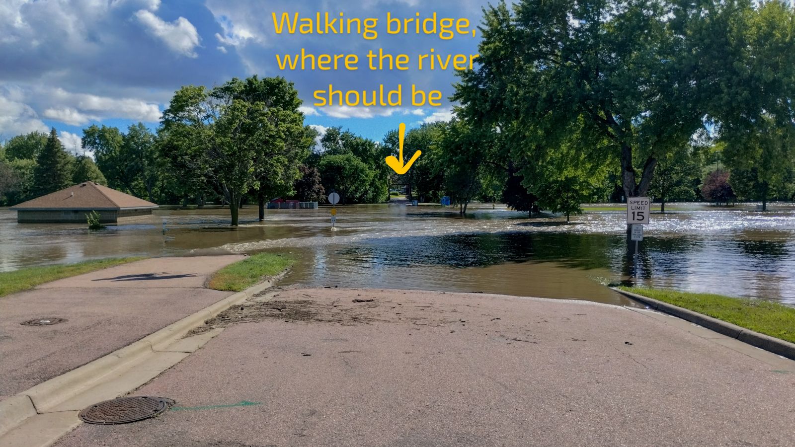
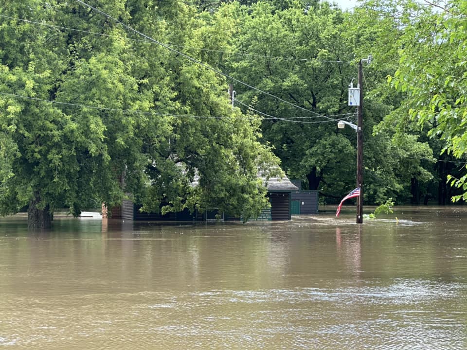
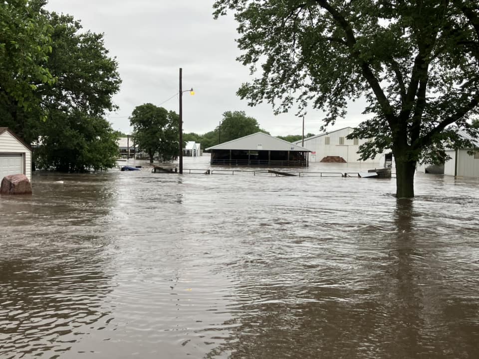
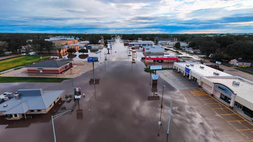
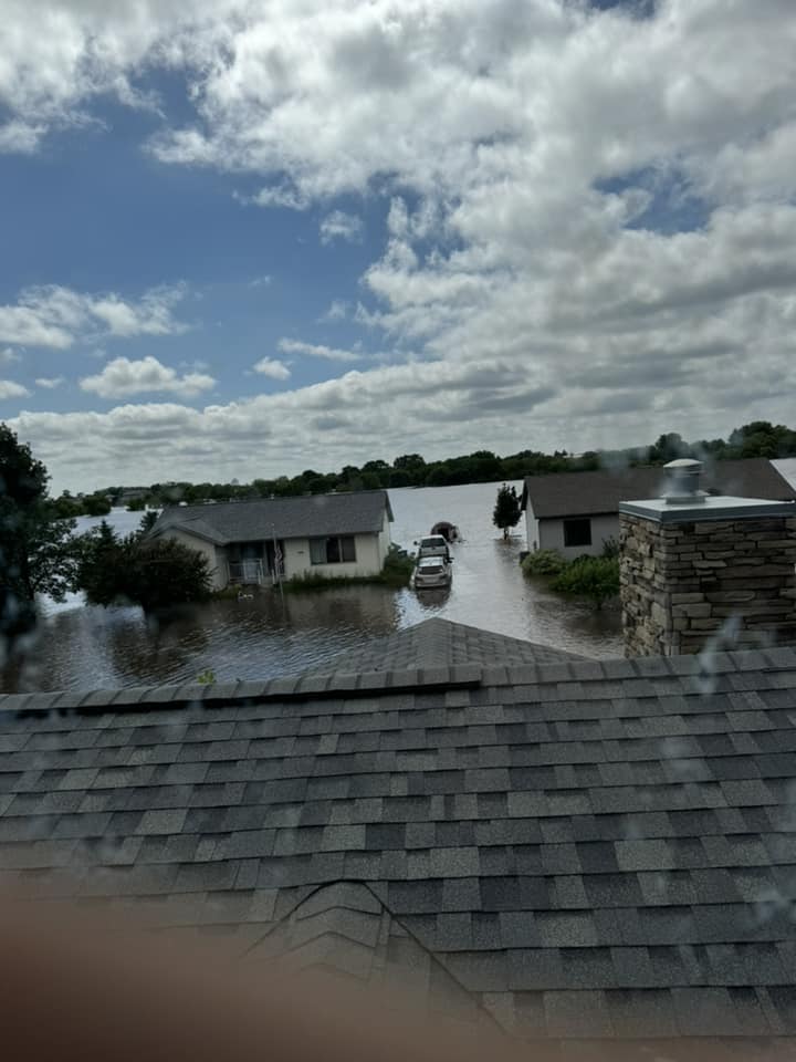
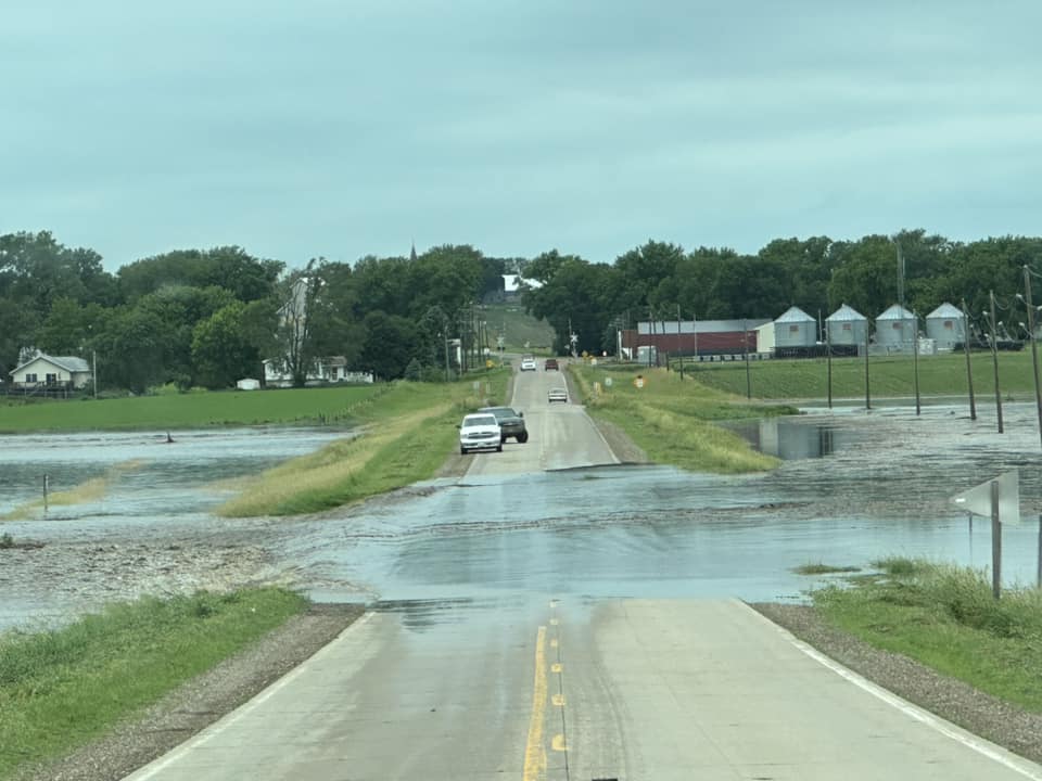
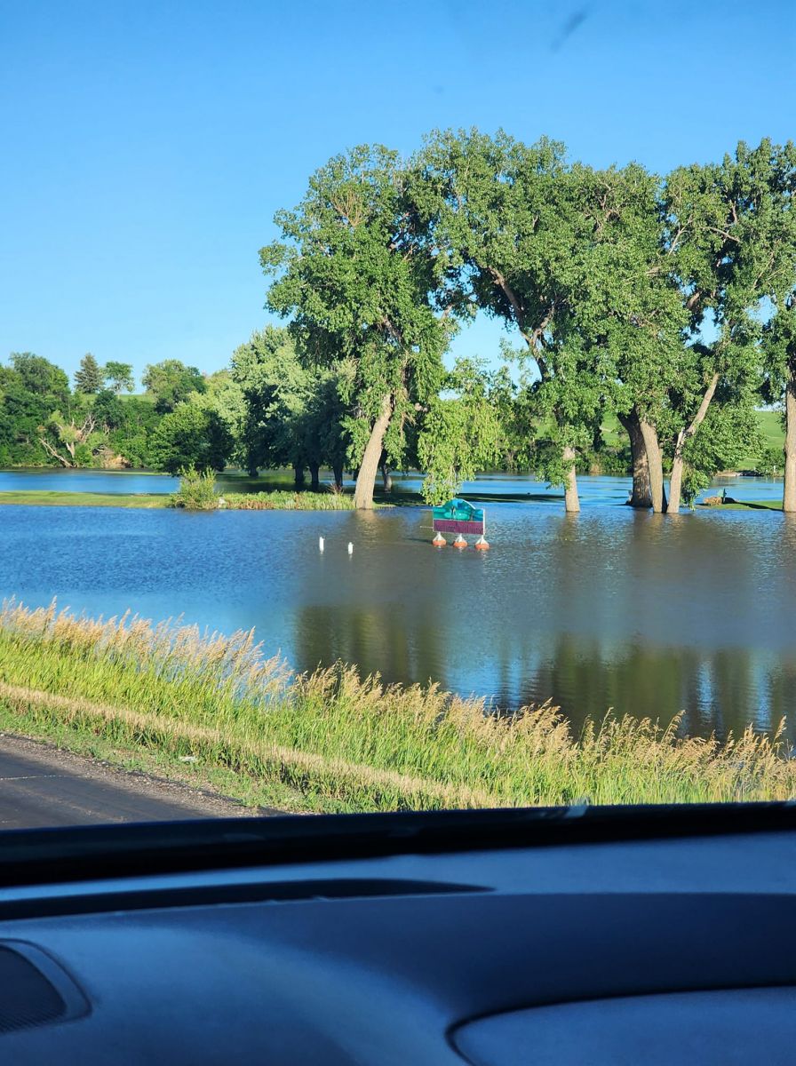
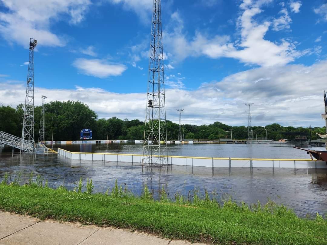
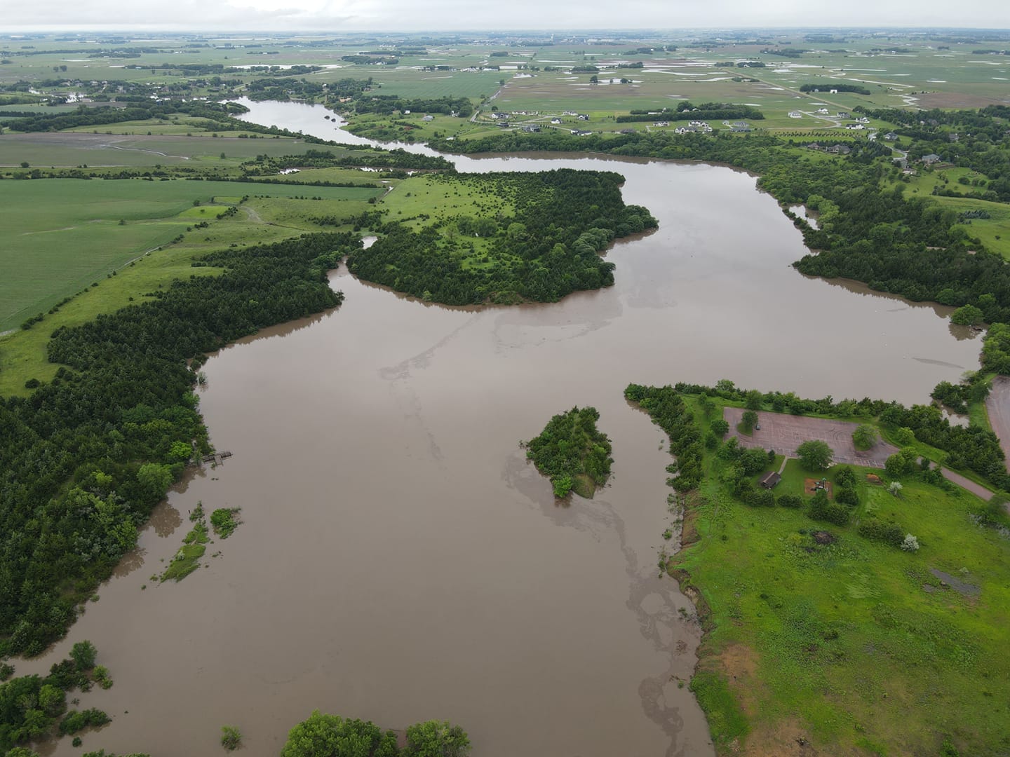
A multi-day heavy rainfall event led to widespread heavy rain across the region. Rainfall totals over a three-day period exceeded 2 inches in nearly all areas, with widespread totals between 5 and 10". In pockets of southeastern South Dakota and northwest Iowa, rain totals between 10 and 20" were reported. The rapid onset of heavy rainfall created numerous flash flooding events on June 20th, which repeated themselves during the evening of June 21. As rainfall reached area streams and rivers, record flooding was observed at numerous river points, leading to widespread devastating flooding in the towns along the rivers. While many cities were impacted, more widespread flooding took place in Luverne, Jackson, Windom and Adrian, Minnesota; Rock Valley, Akron, Hawarden, Spencer, Milford, Cherokee and Correctionville, Iowa; and portions of the Sioux City and Sioux Falls metros. This page will continue to be updated through the next week as more pictures are added and historical and environmental data can be retrieved.
|
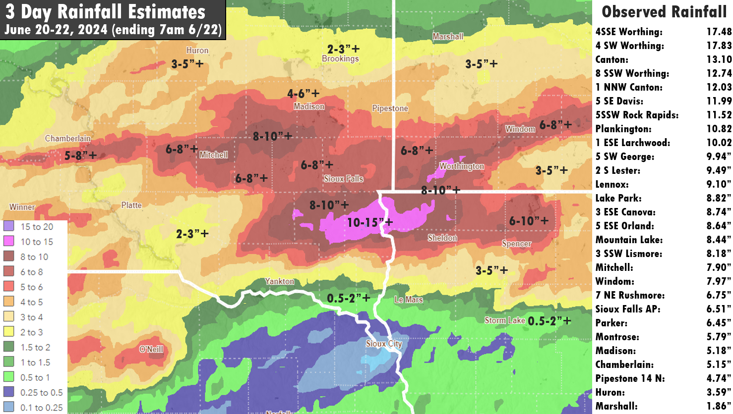 Three Day Rainfall - June 20-22, 2024 |
 |
 |
 |
| Rock Valley (Credit: Warrior Sports Photography) | Spencer, IA (Credit: Shawn Steemke) | Hawarden, IA (Credit: Glenda Hemmelrick) |
Flooding
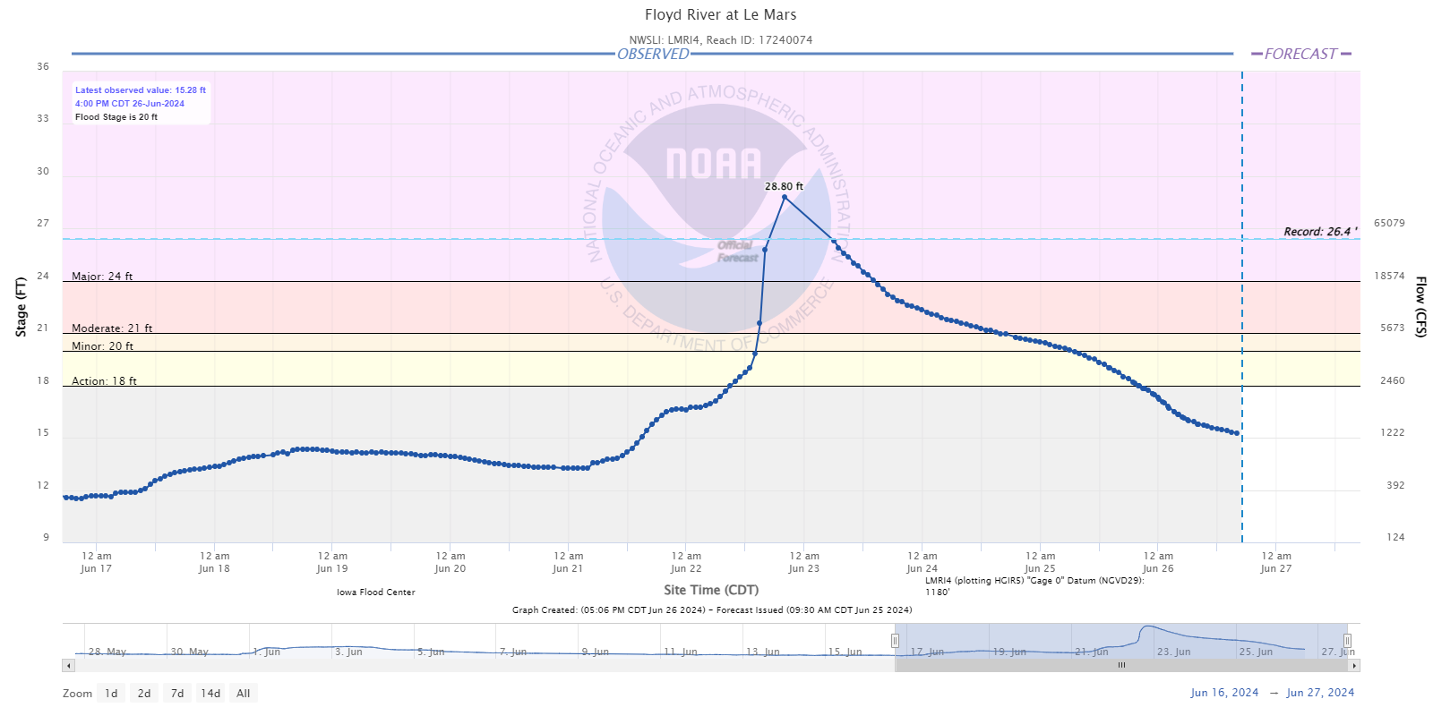
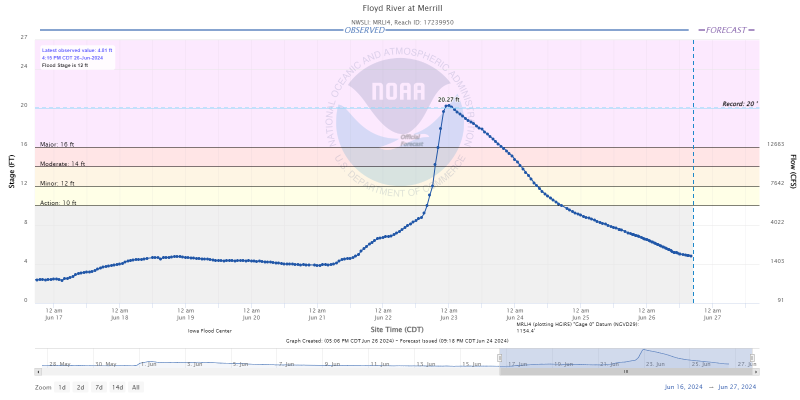
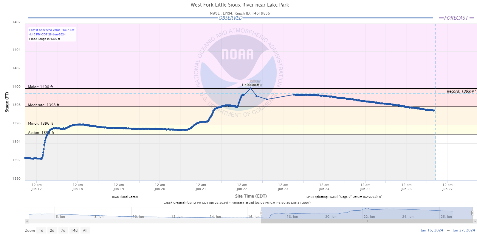
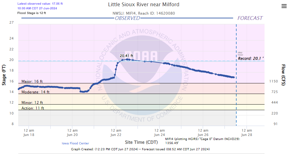
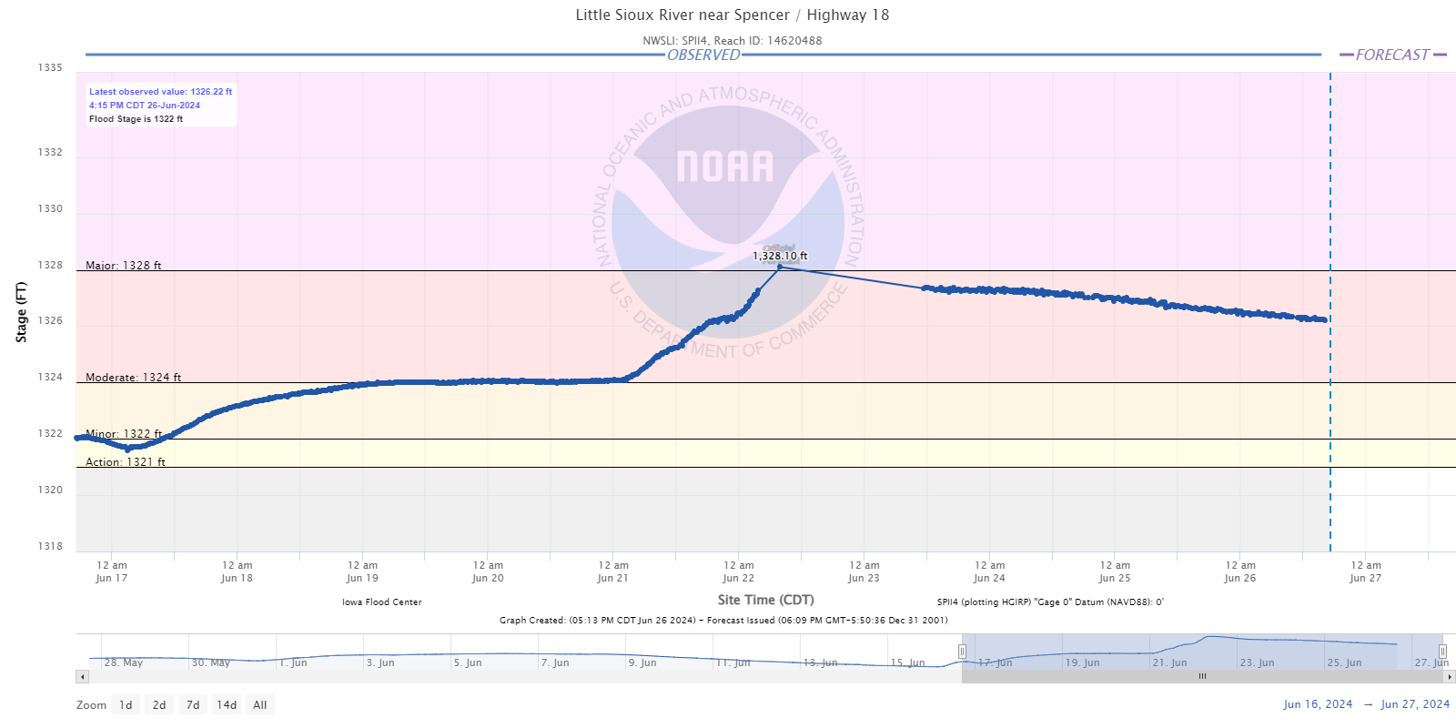
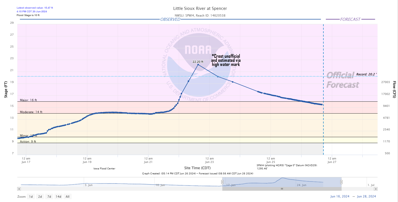
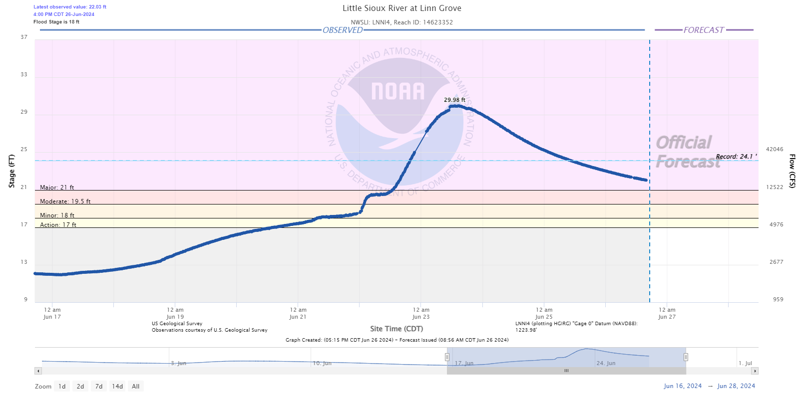
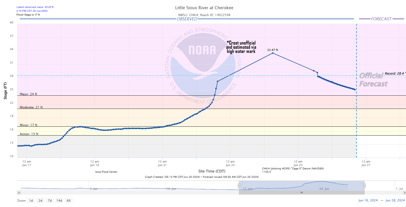
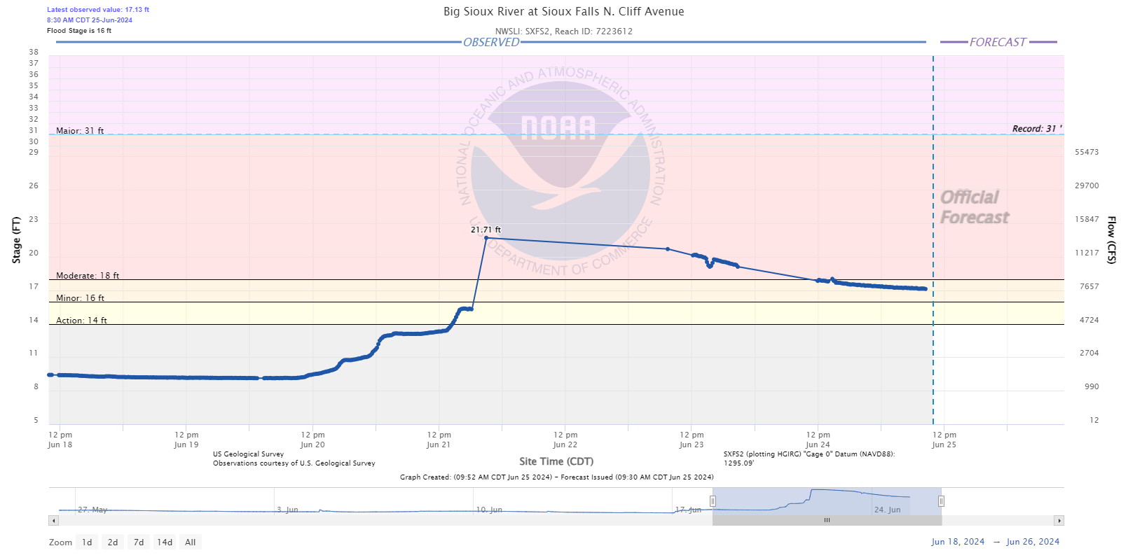
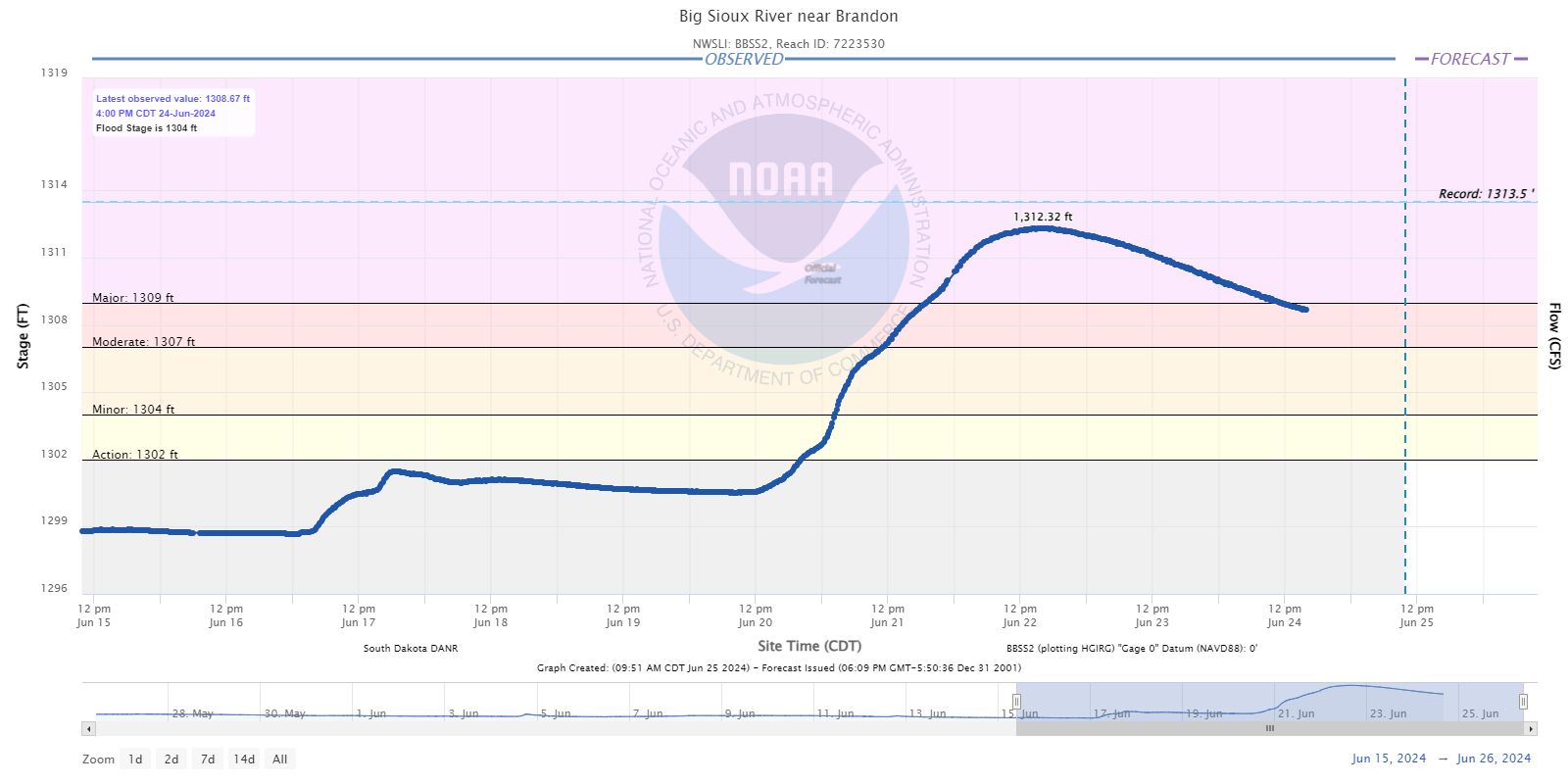
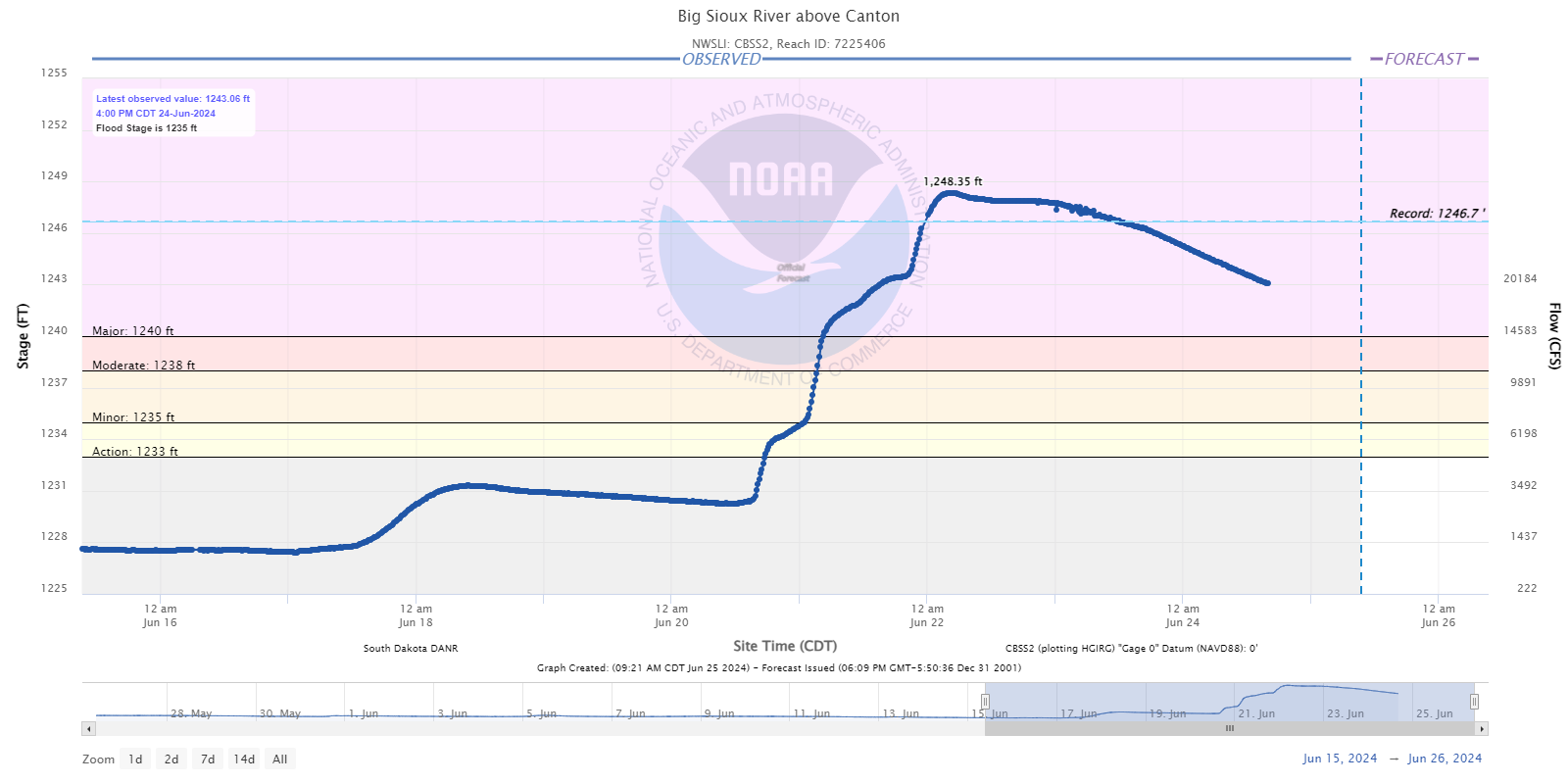
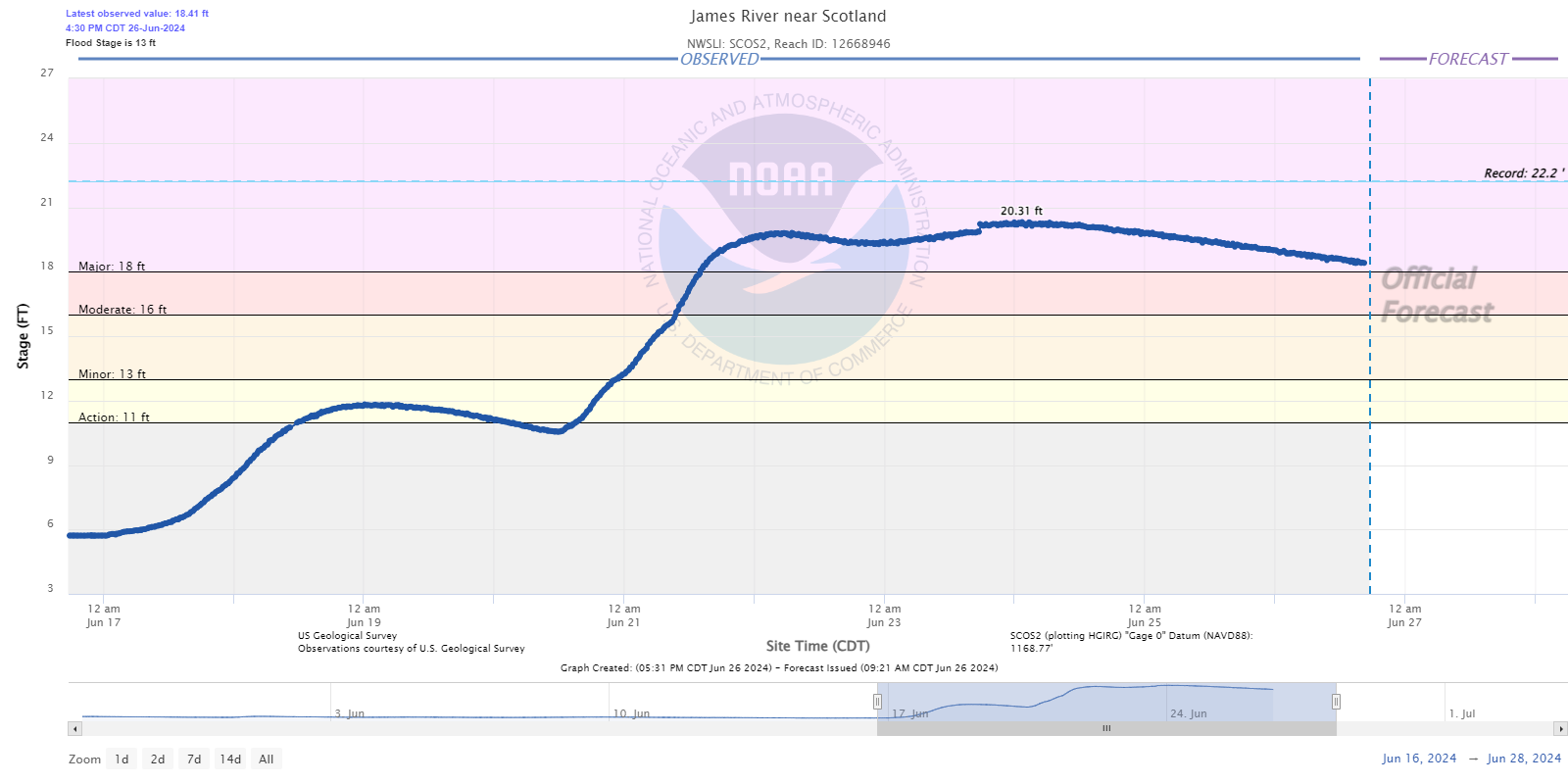
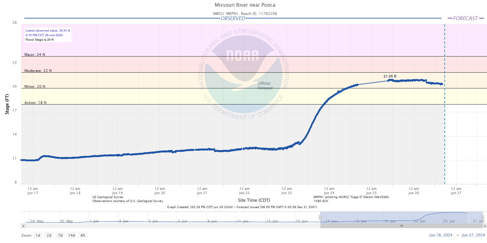
Moderate to Major river flooding was widespread as a result of the heavy rainfall, with several locations reaching record high river stages. Unfortunately, sporadic data outages at some gages led to incomplete hydrograph traces, but we will be working with local officials to determine the peak crest at these locations.
 |
 |
|
New River Flood Records *All data preliminary and subject to change. Spencer and Cherokee crest values via high water mark survey and estimated. |
|
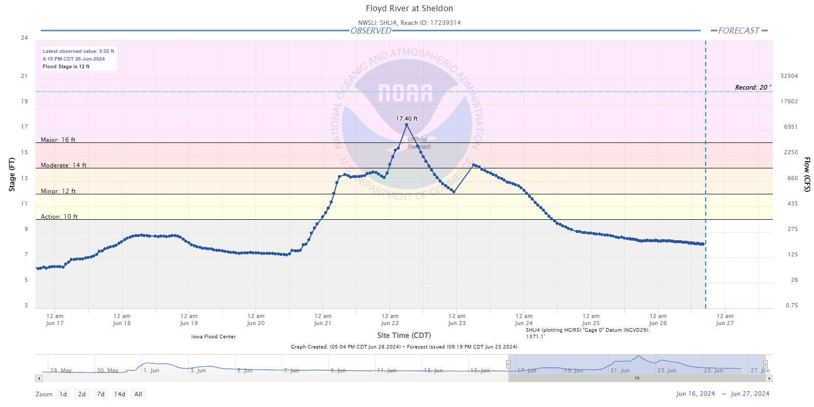
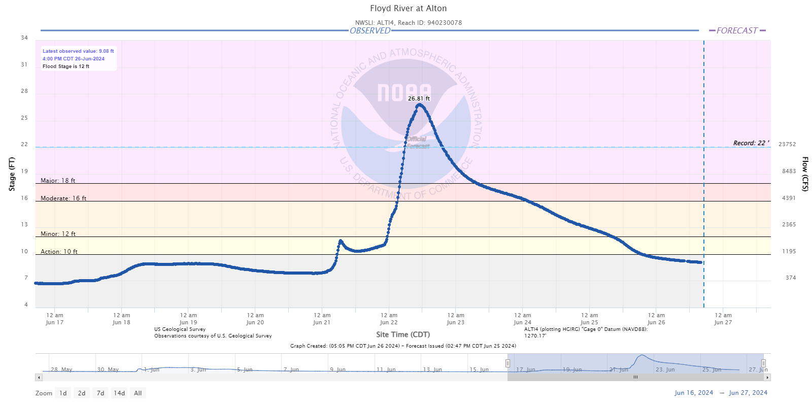
Hydrographs - Floyd River
 |
 |
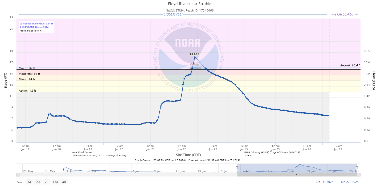 |
| Sheldon, IA | Alton, IA | near Struble, IA |
 |
 |
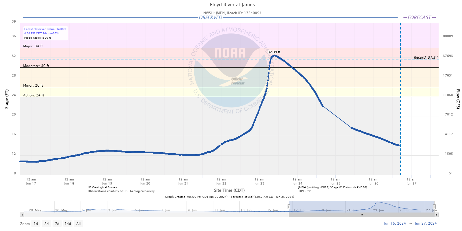 |
| Le Mars, IA | Merrill, IA | James, IA |
Hydrographs - Little Sioux River
 |
 |
 |
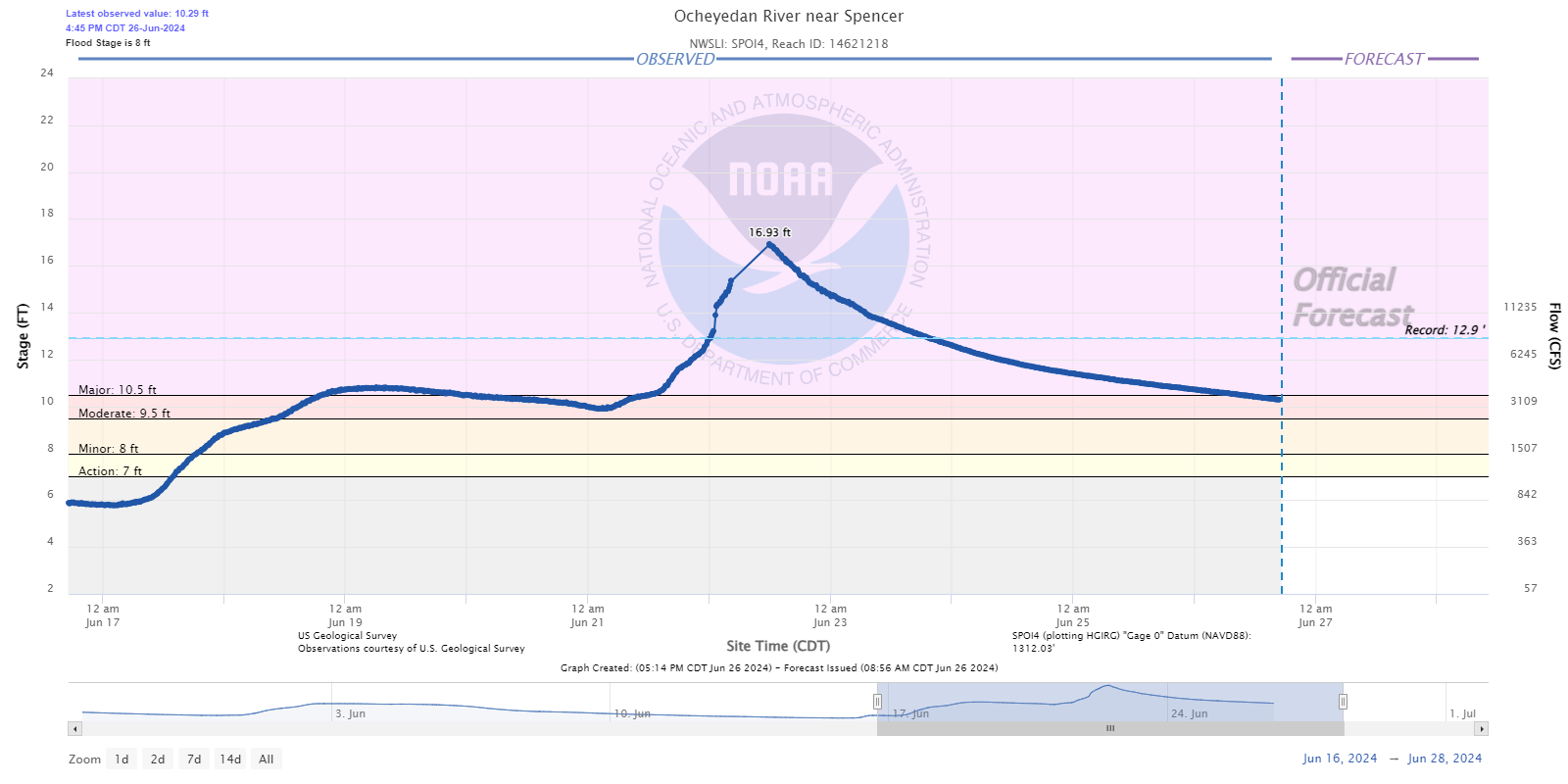 |
| West Fork near Lake Park, IA | Milford, IA | near Spencer, IA / Hwy 18 | Ocheyedan near Spencer, IA |
 |
 |
 |
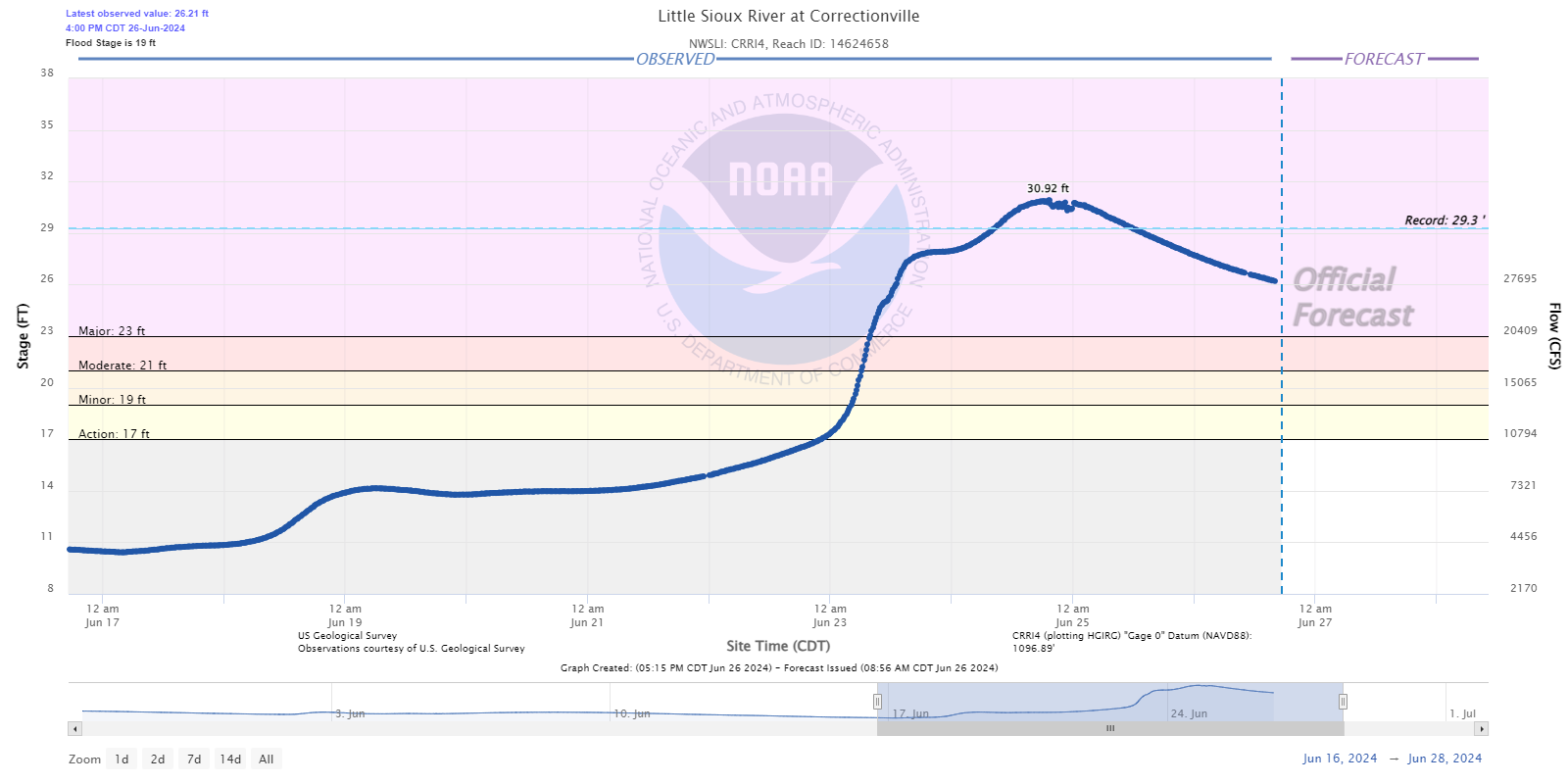 |
| Spencer, IA | Linn Grove, IA | Cherokee, IA | Correctionville, IA |
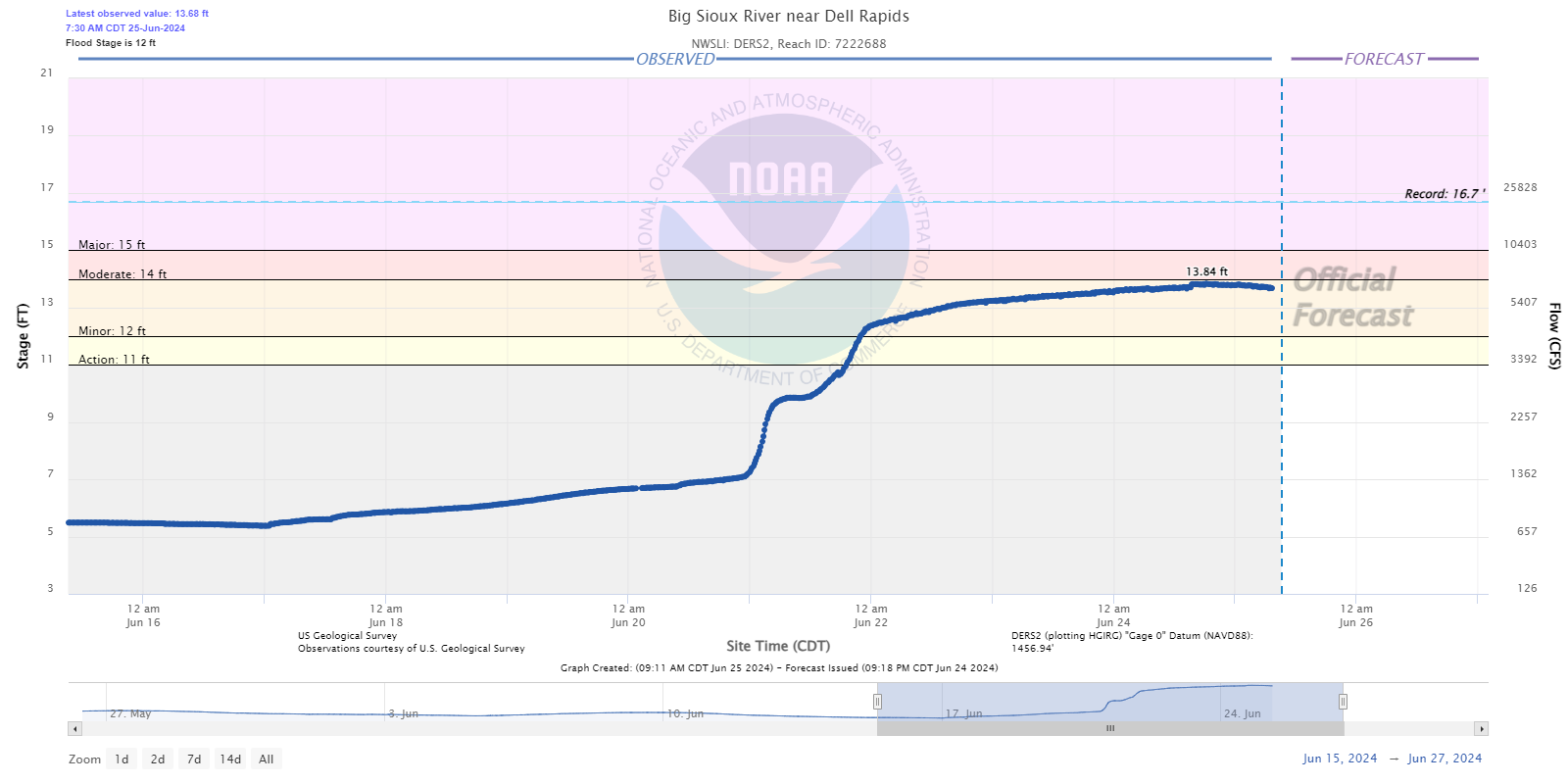
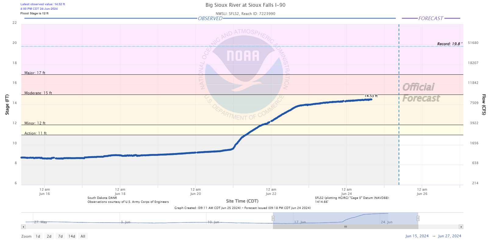
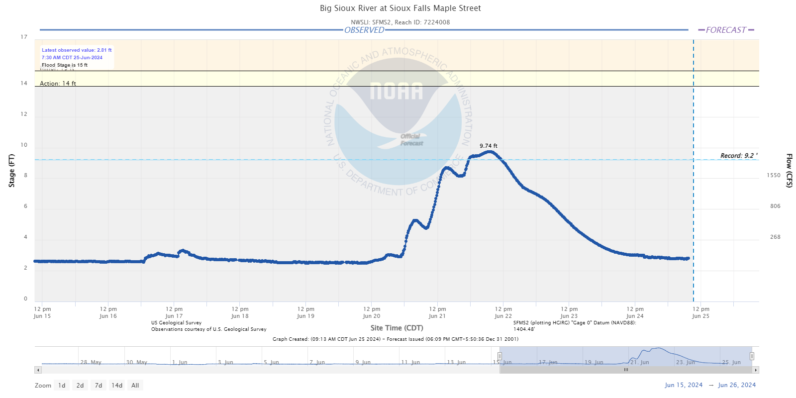
Hydrographs - Big Sioux River
 |
 |
 |
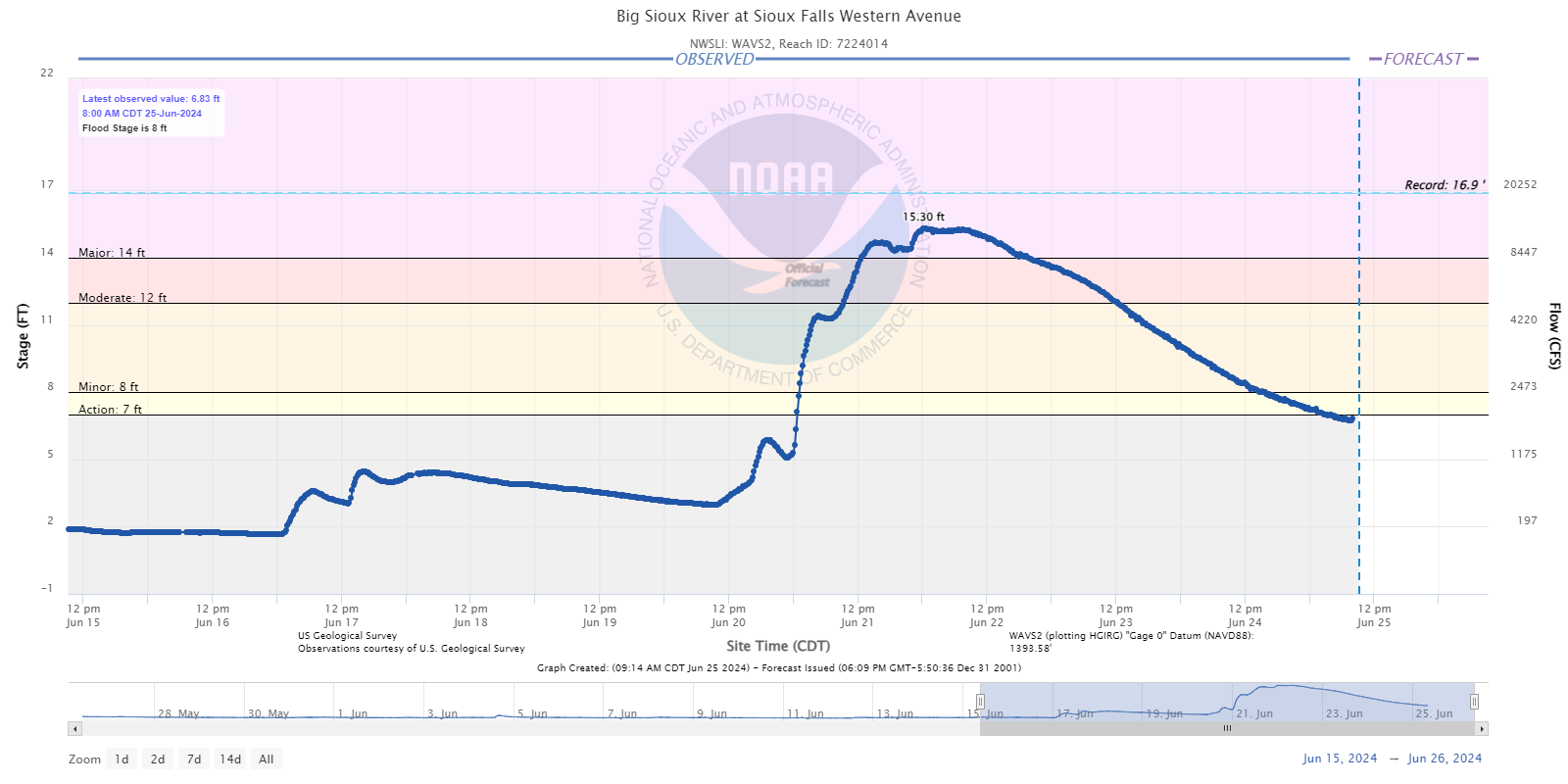 |
| Dell Rapids, SD | Sioux Falls at I-90 | Sioux Falls at Maple Street | Sioux Falls at Western Ave |
 |
 |
 |
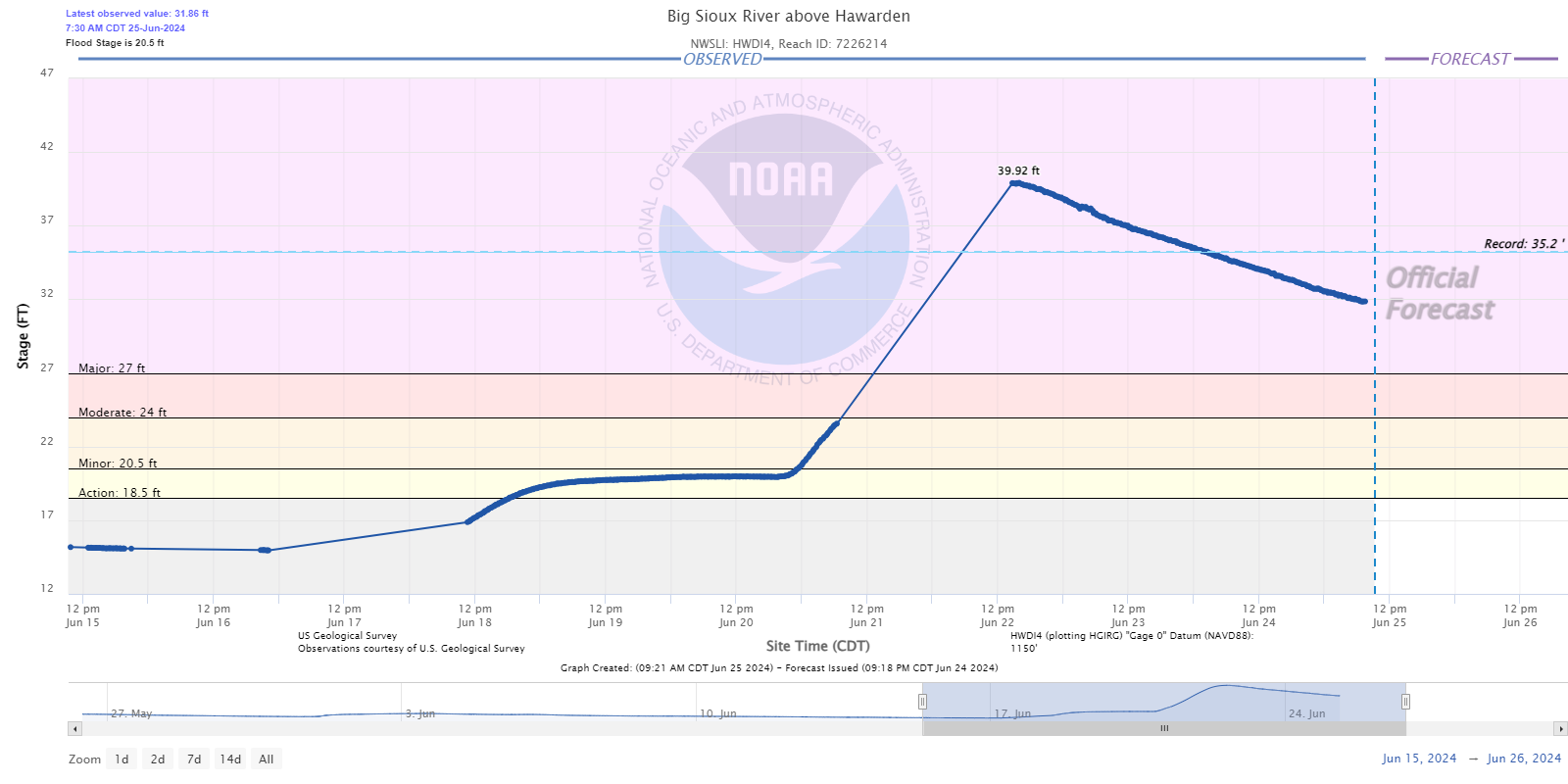 |
| Sioux Falls at North Cliff Ave | Brandon, SD | above Canton, SD | near Hawarden, IA |
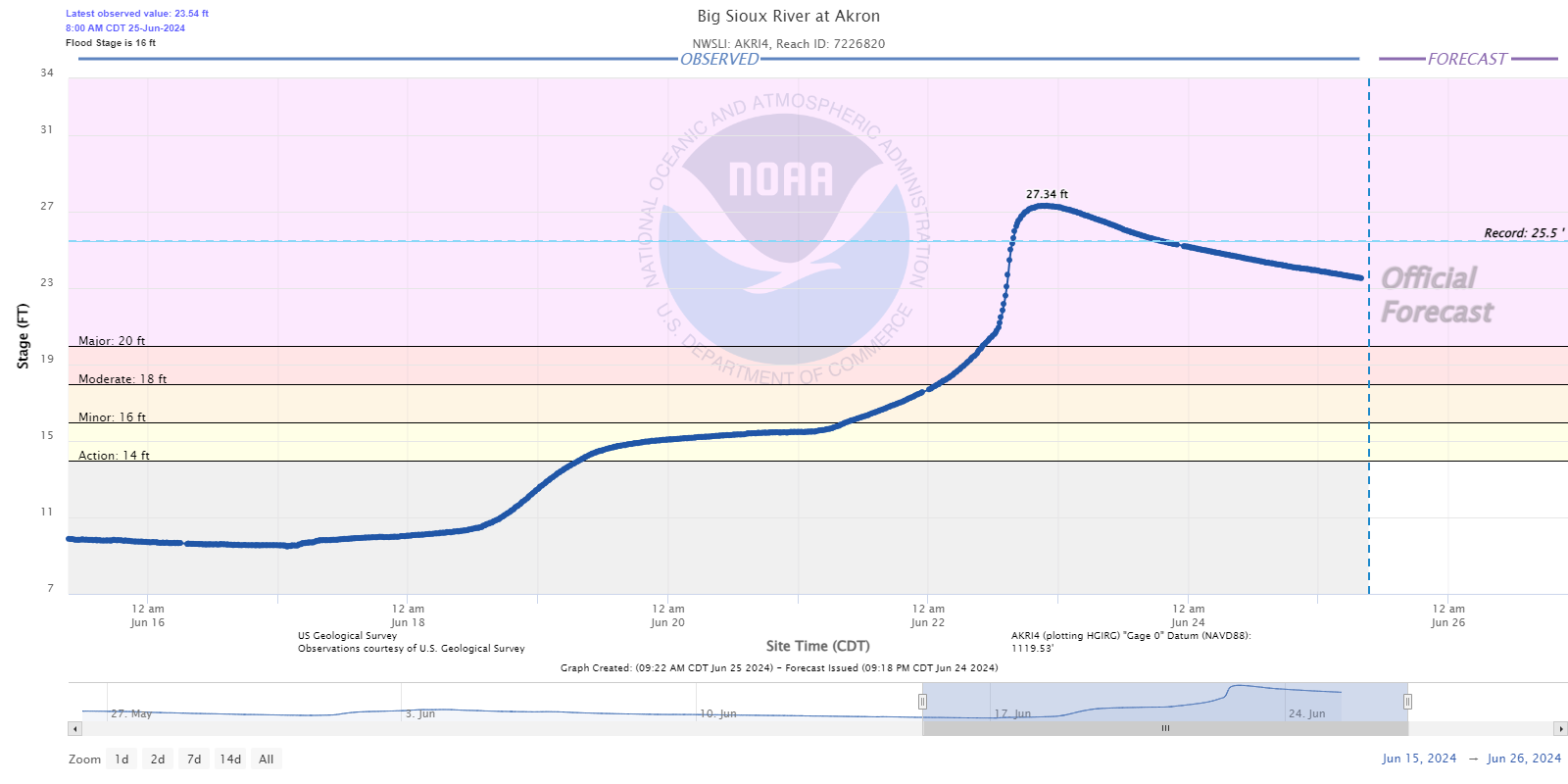 |
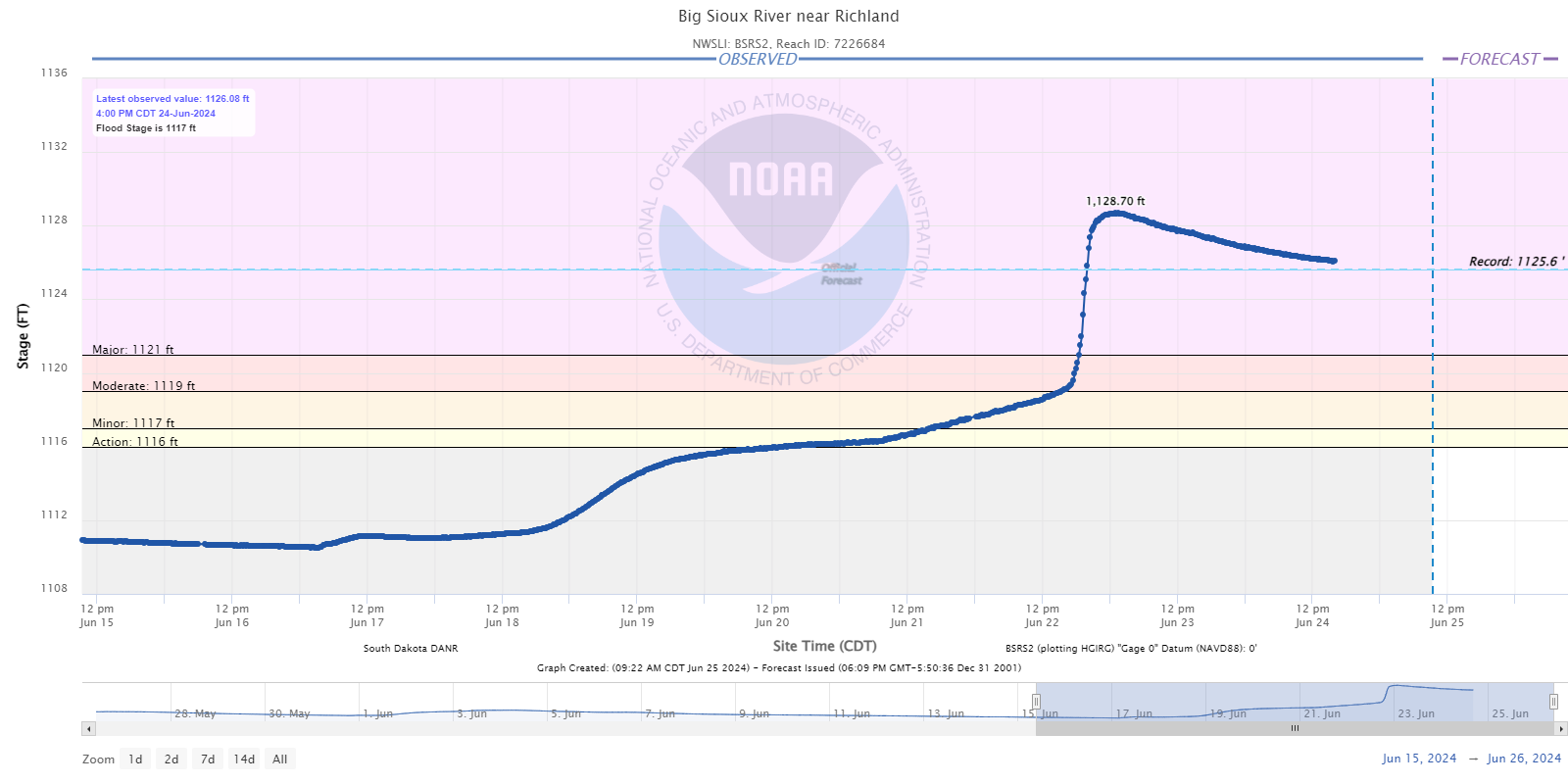 |
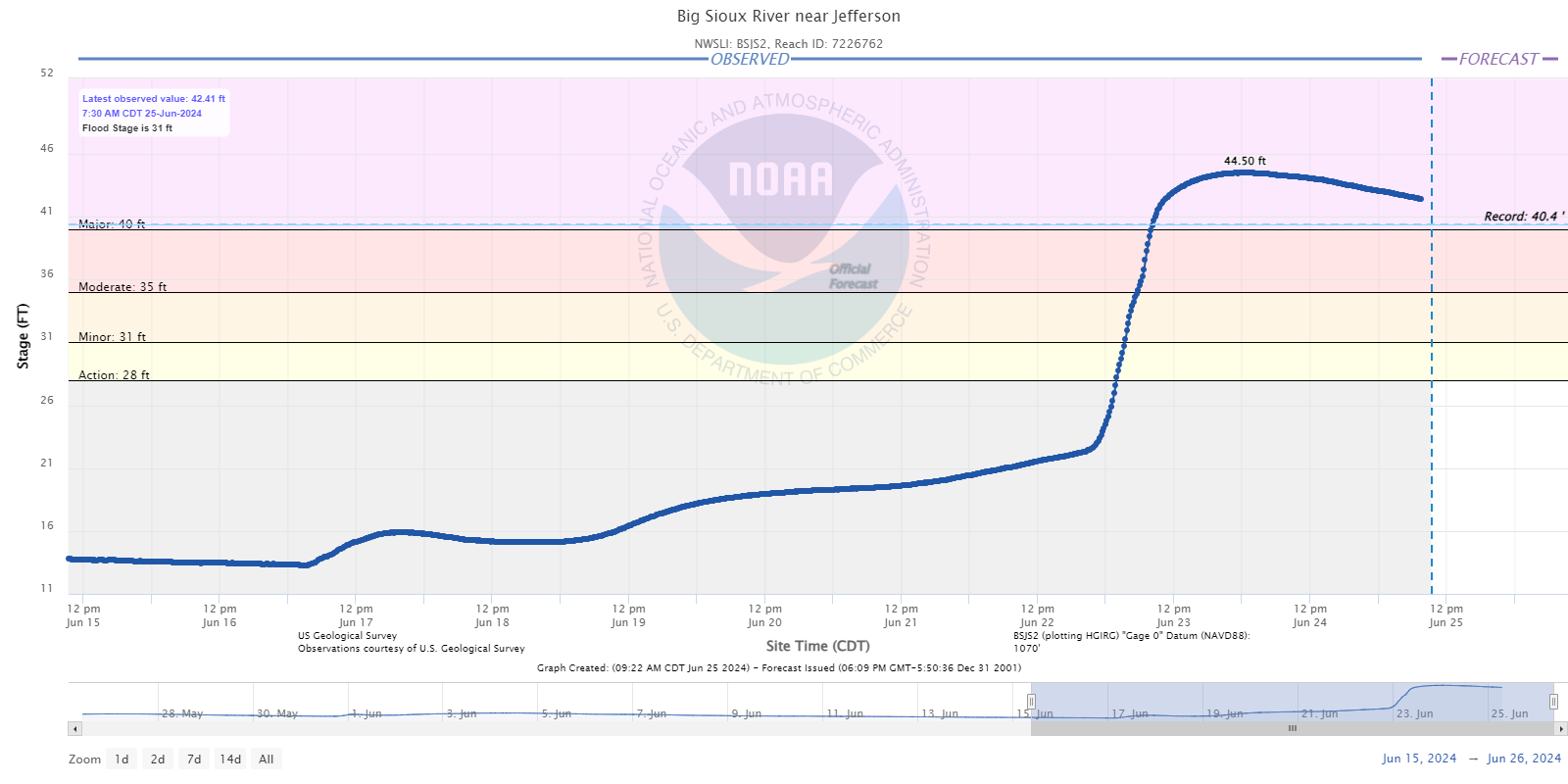 |
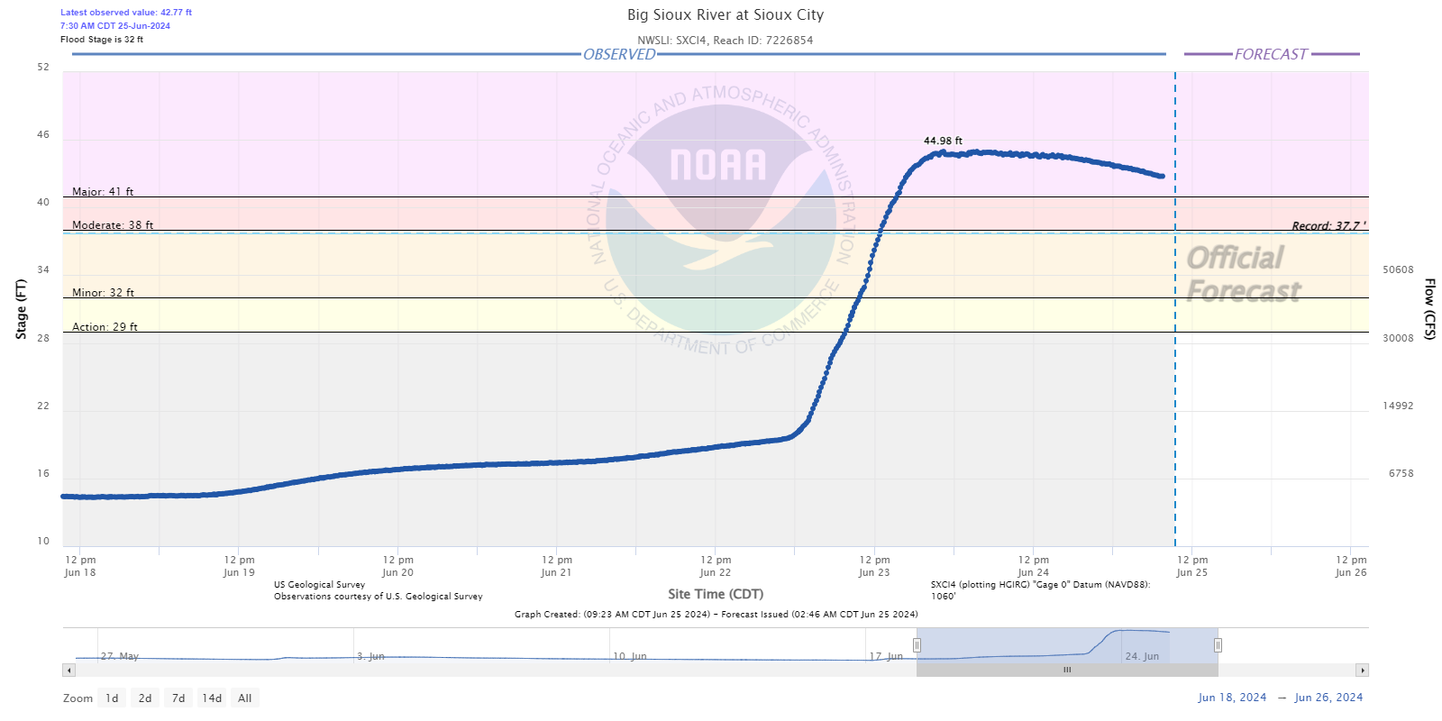 |
| Akron, IA | Richland, SD | Jefferson, SD | Sioux City, IA |
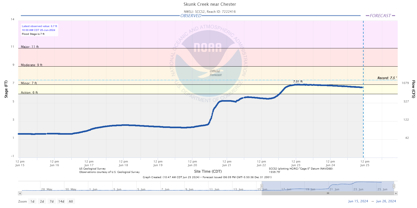
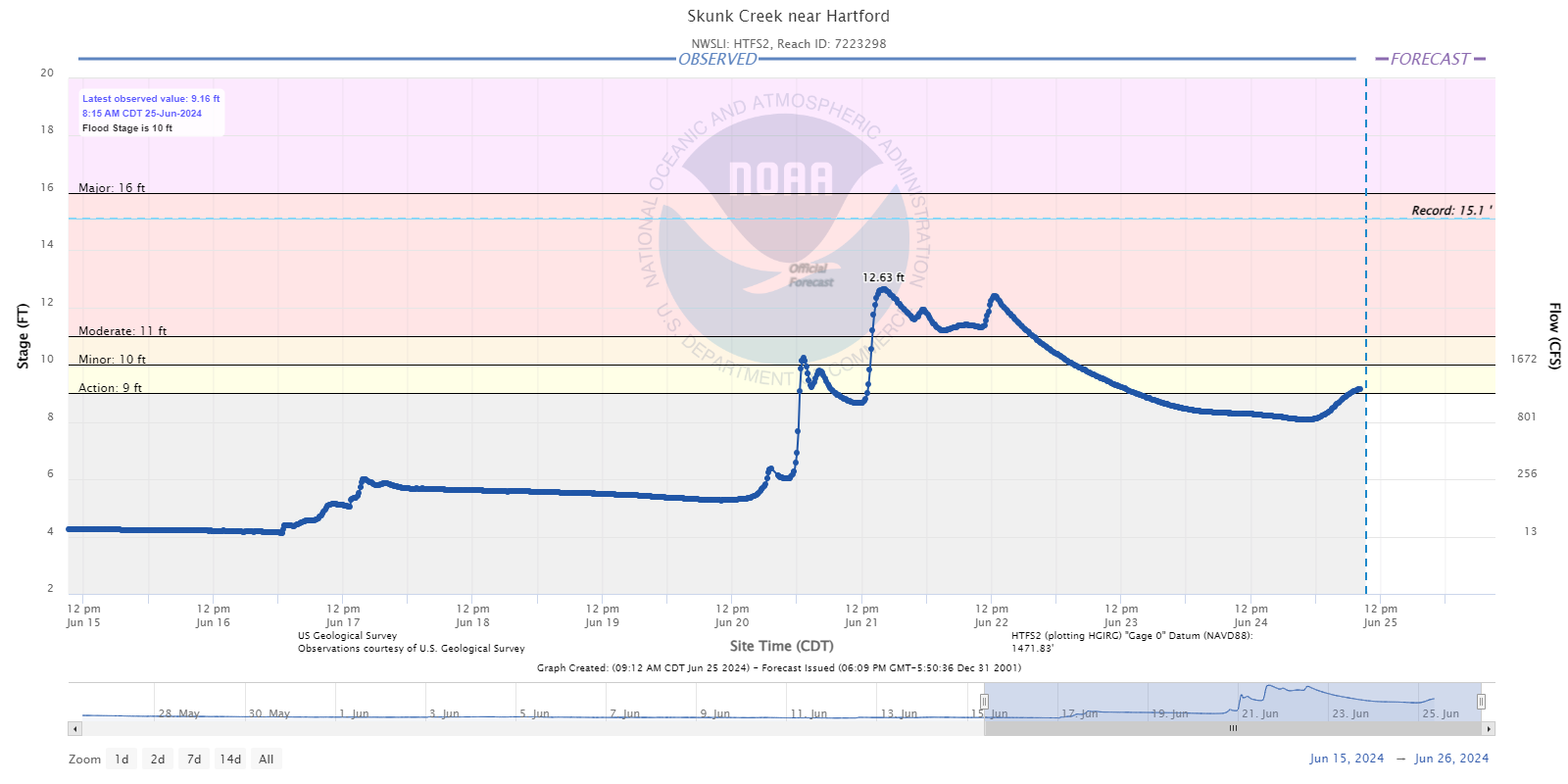
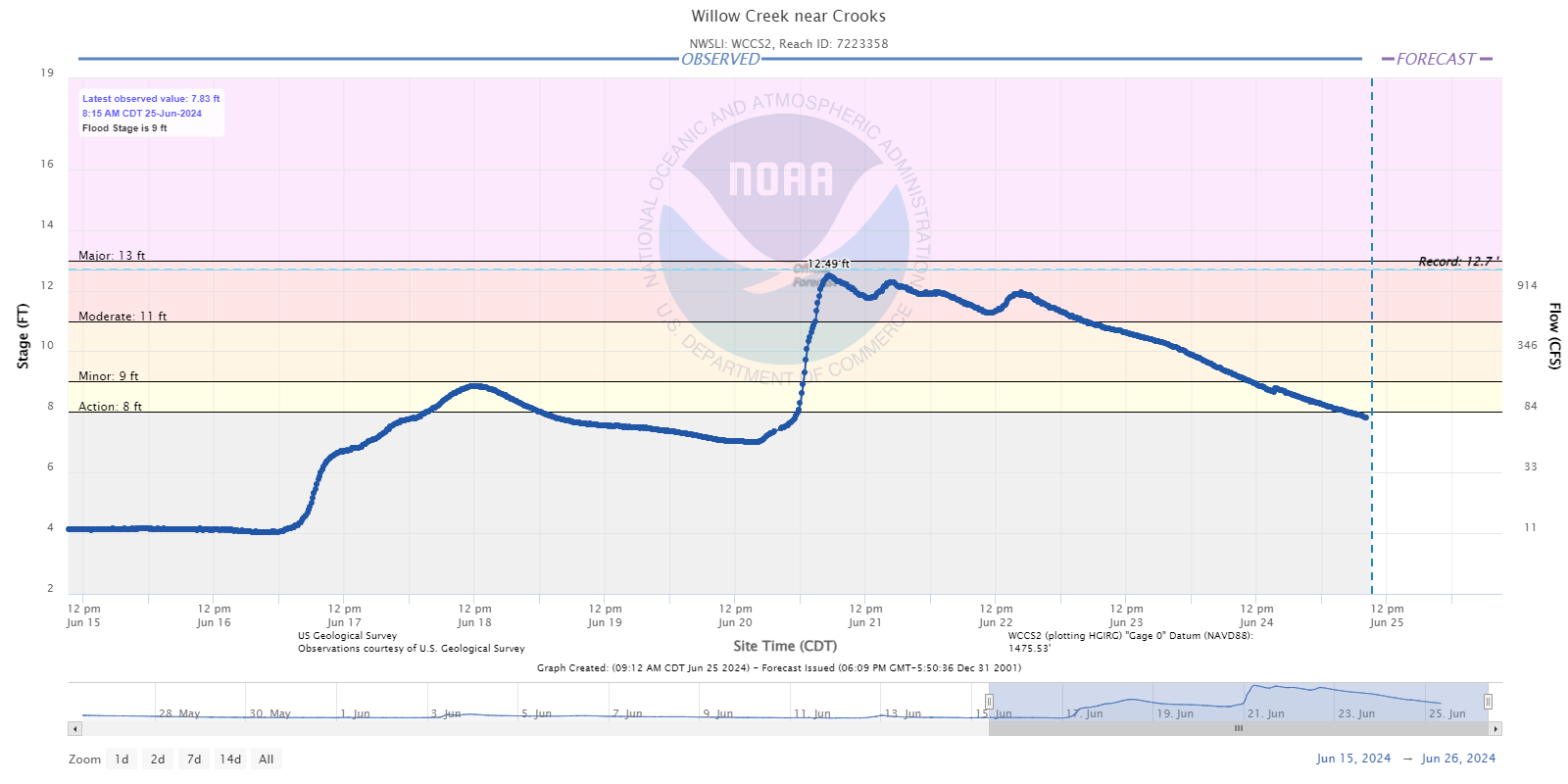
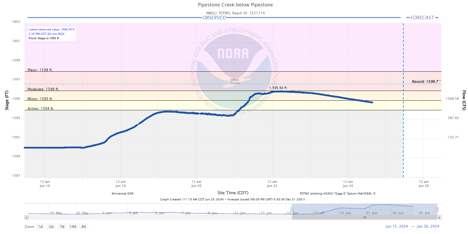
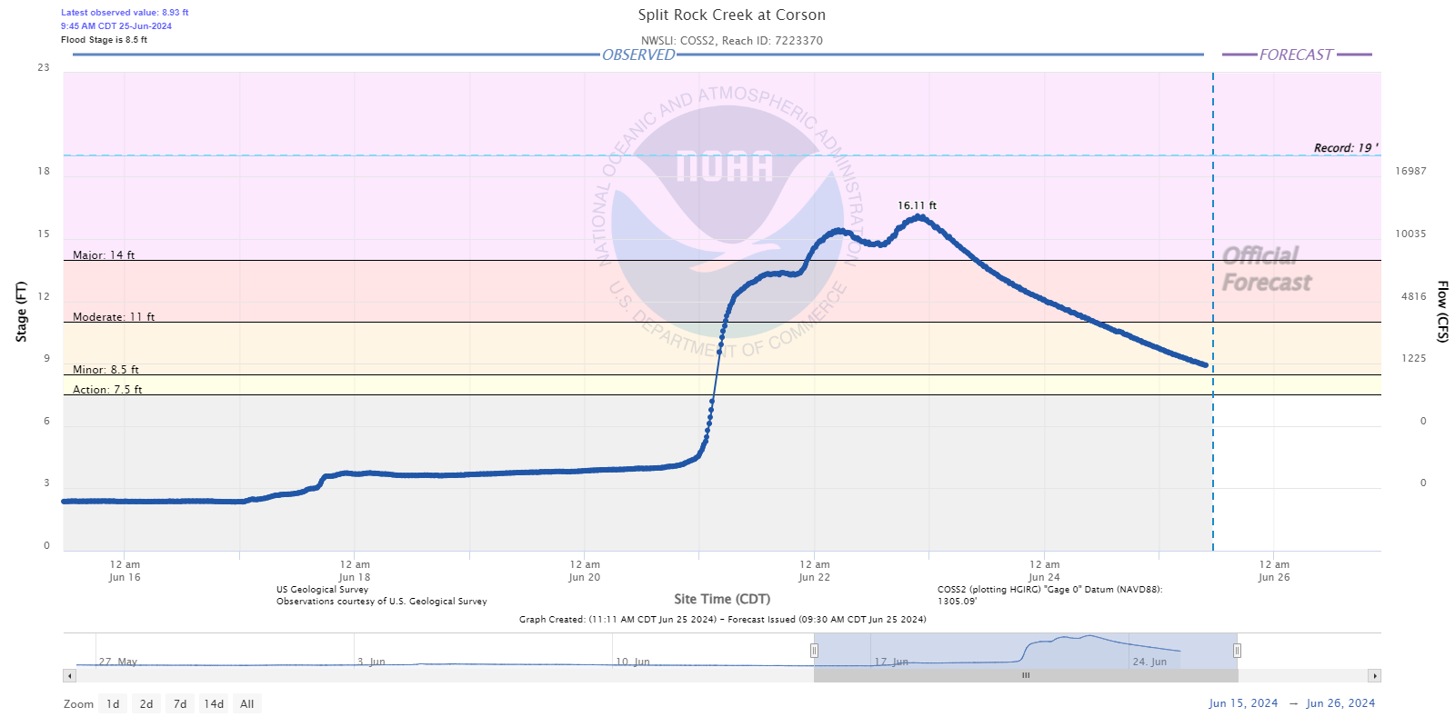
Hydrographs - Tributary Creeks to the Big Sioux River (Skunk/Willow/Pipestone/Split Rock)
 |
 |
 |
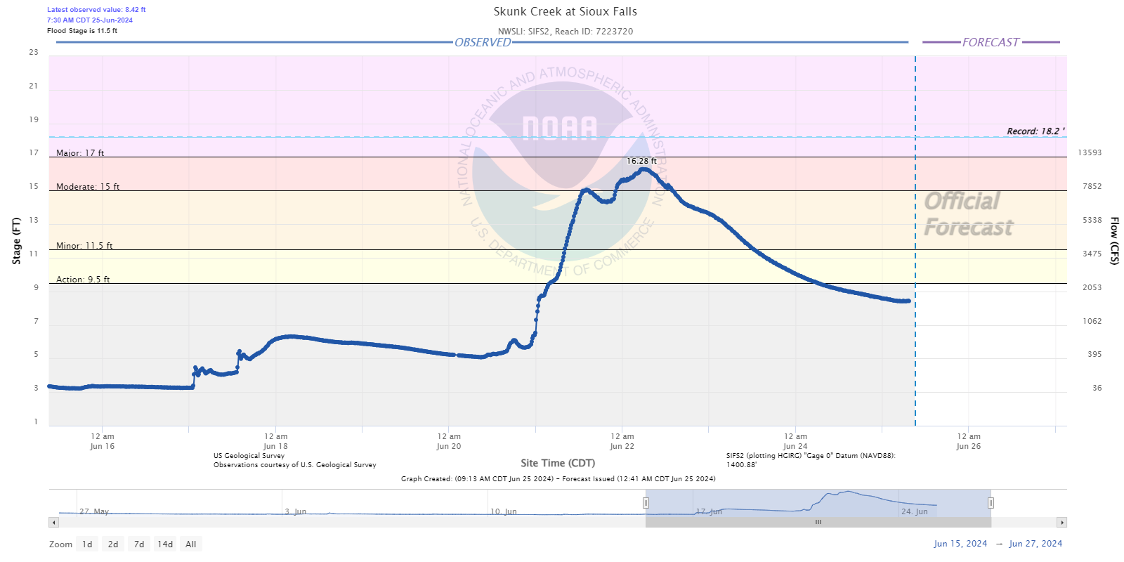 |
| Skunk Creek near Chester, SD | Skunk Creek near Hartford, SD | Willow Creek near Crooks, SD | Sioux Falls, SD |
 |
 |
%20at%20Canton.png) |
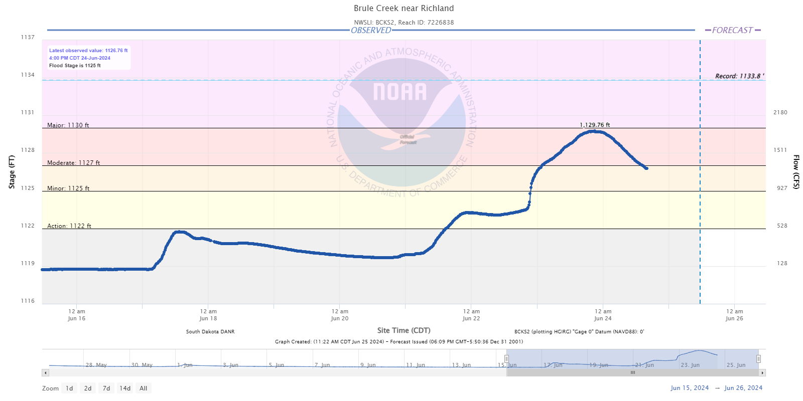 |
| Pipestone Creek below Pipestone, MN | Split Rock Creek at Corson, SD | Beaver Creek at Canton, SD | Brule Creek near Richland, SD |
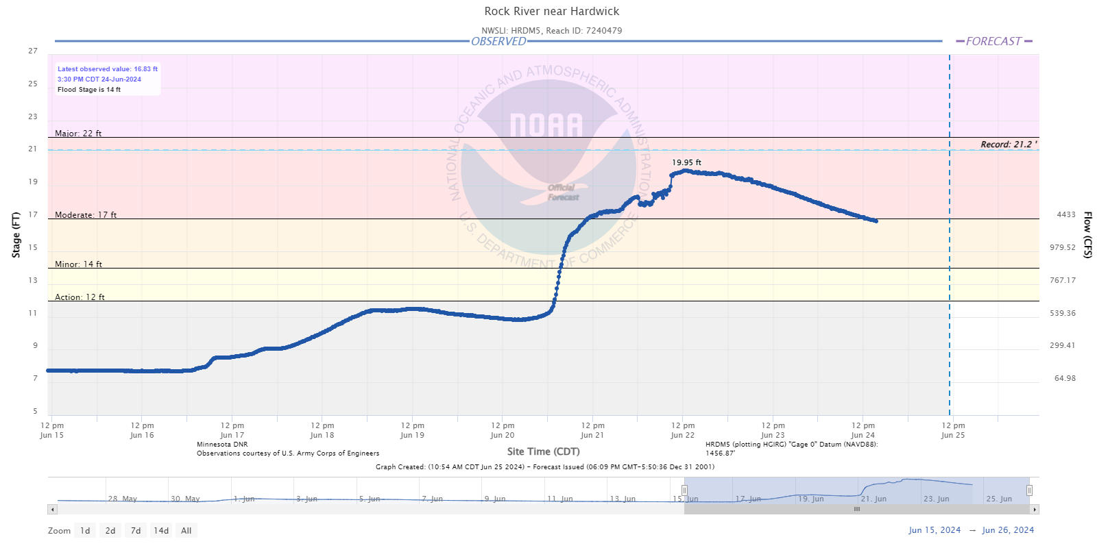
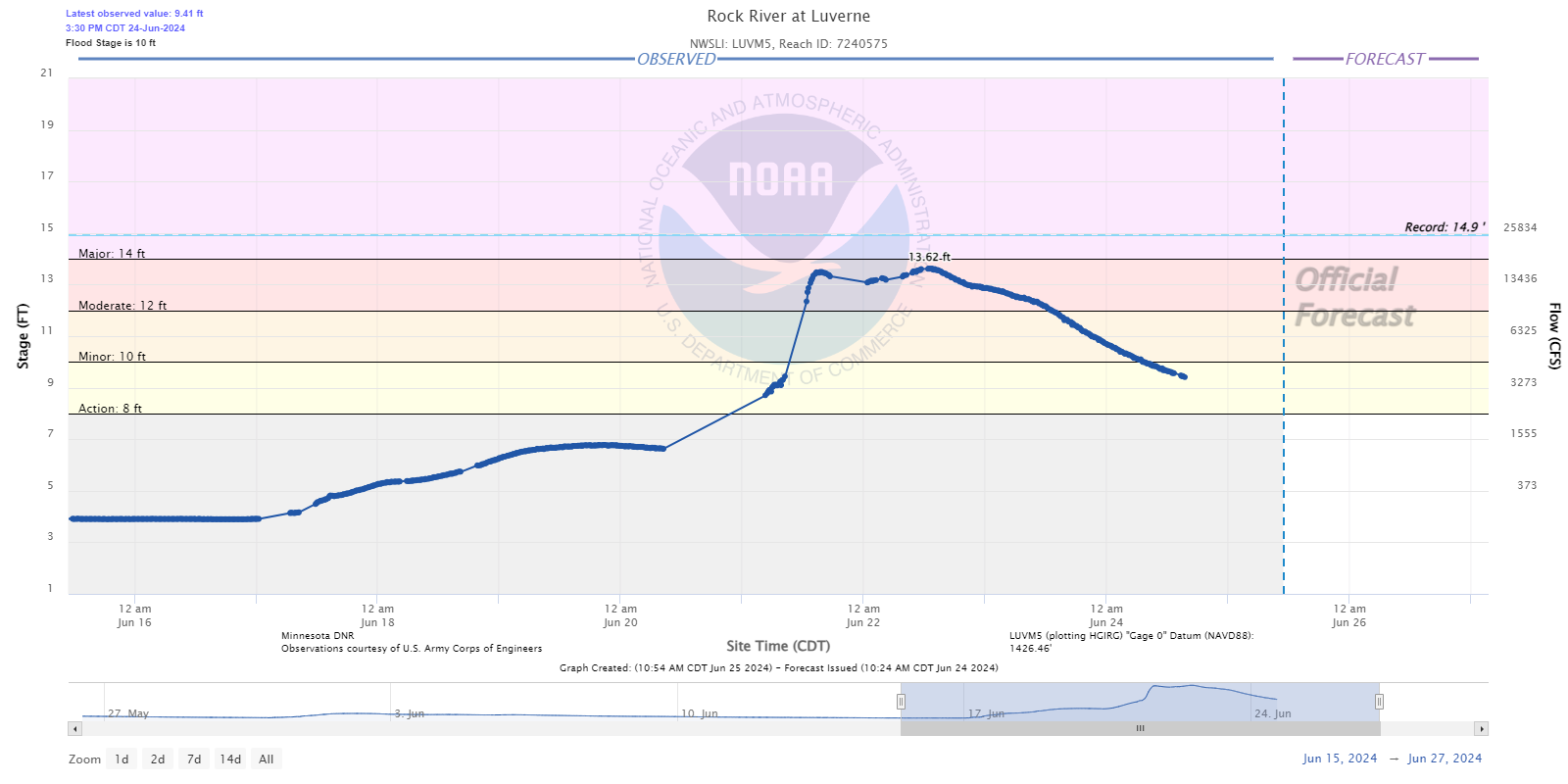
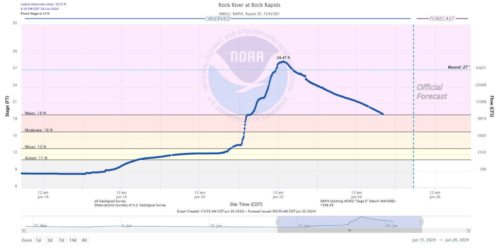
Hydrographs - Rock River
 |
 |
 |
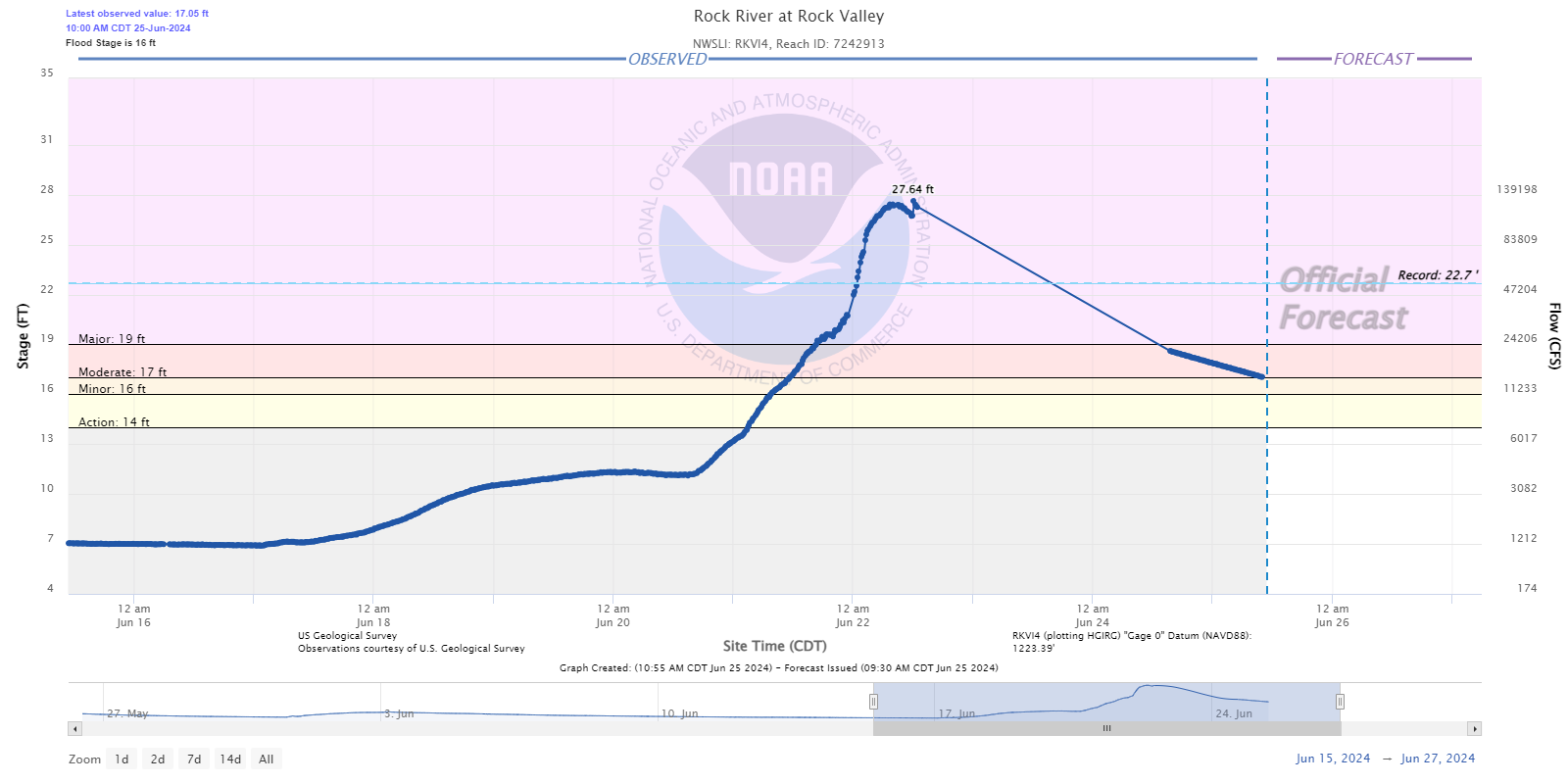 |
| Hardwick, MN | Luverne, MN | Rock Rapids, IA | Rock Valley, IA |
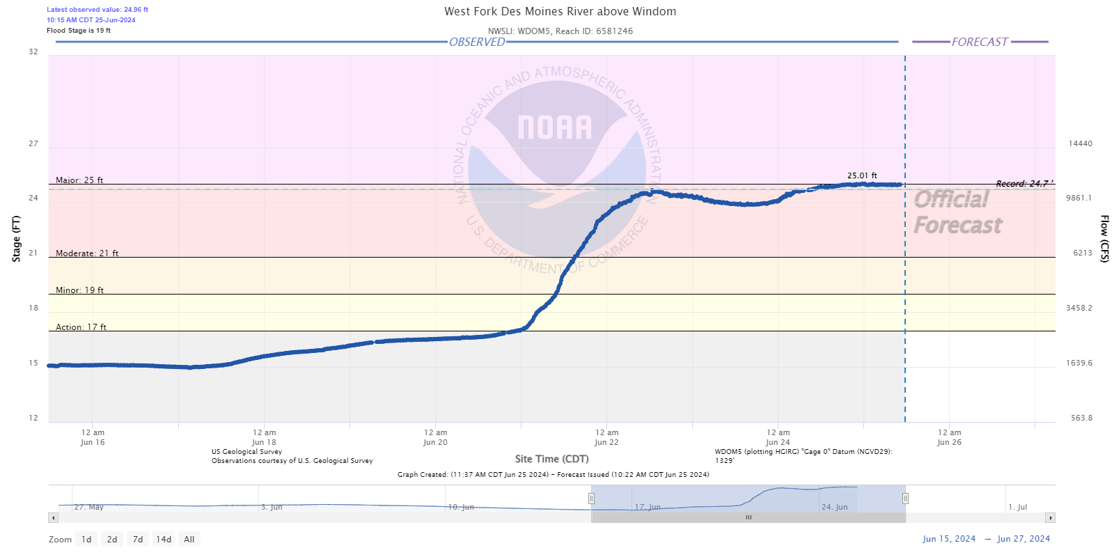
Hydrographs - West Fork Des Moines River
 |
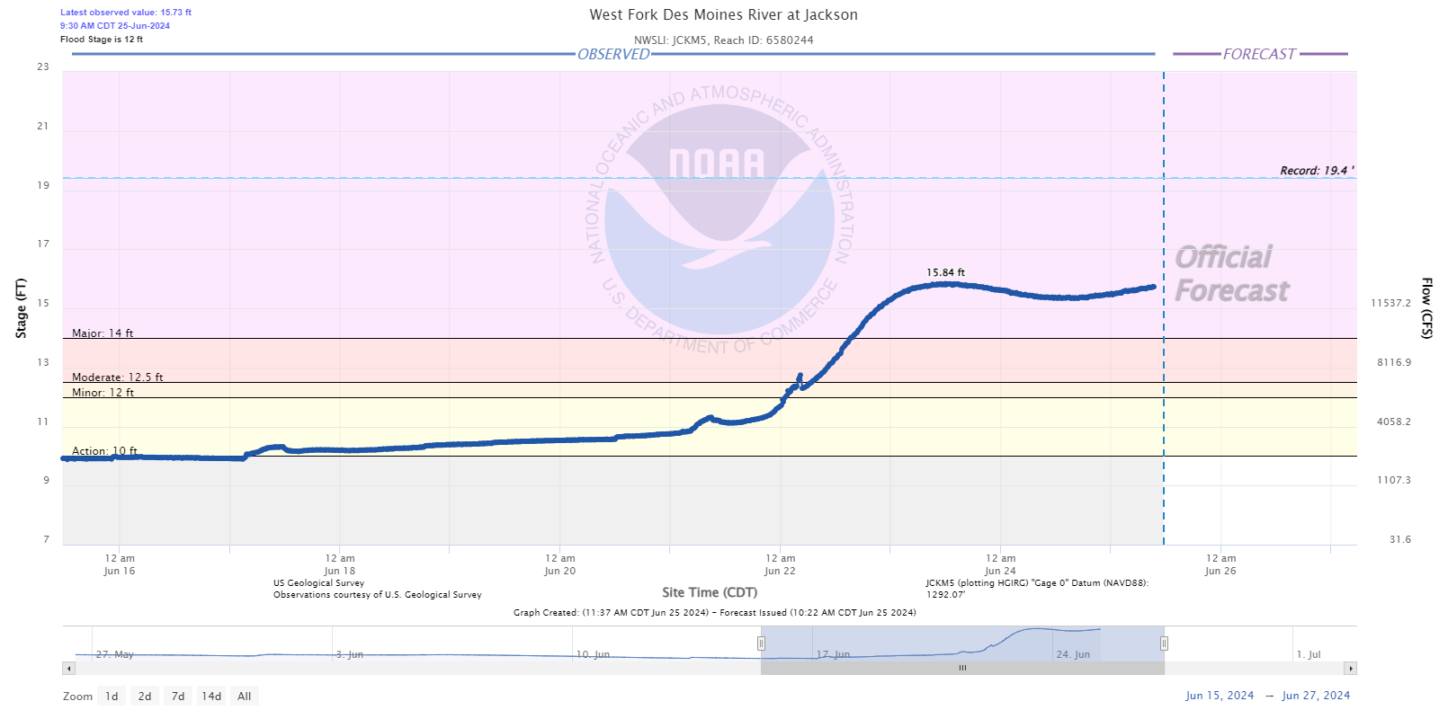 |
| Windom, MN | Jackson, MN |
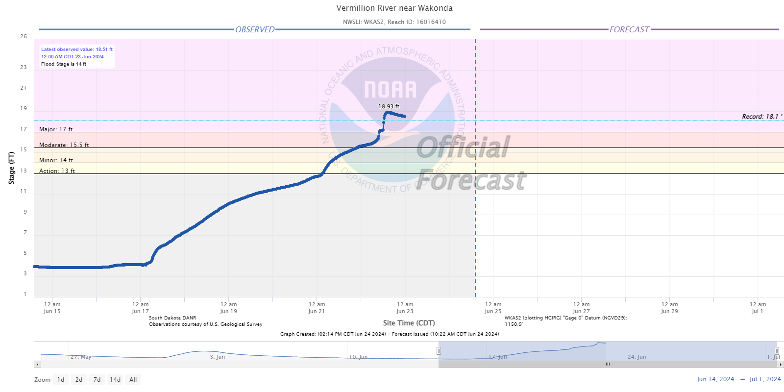
Hydrographs - Vermillion River
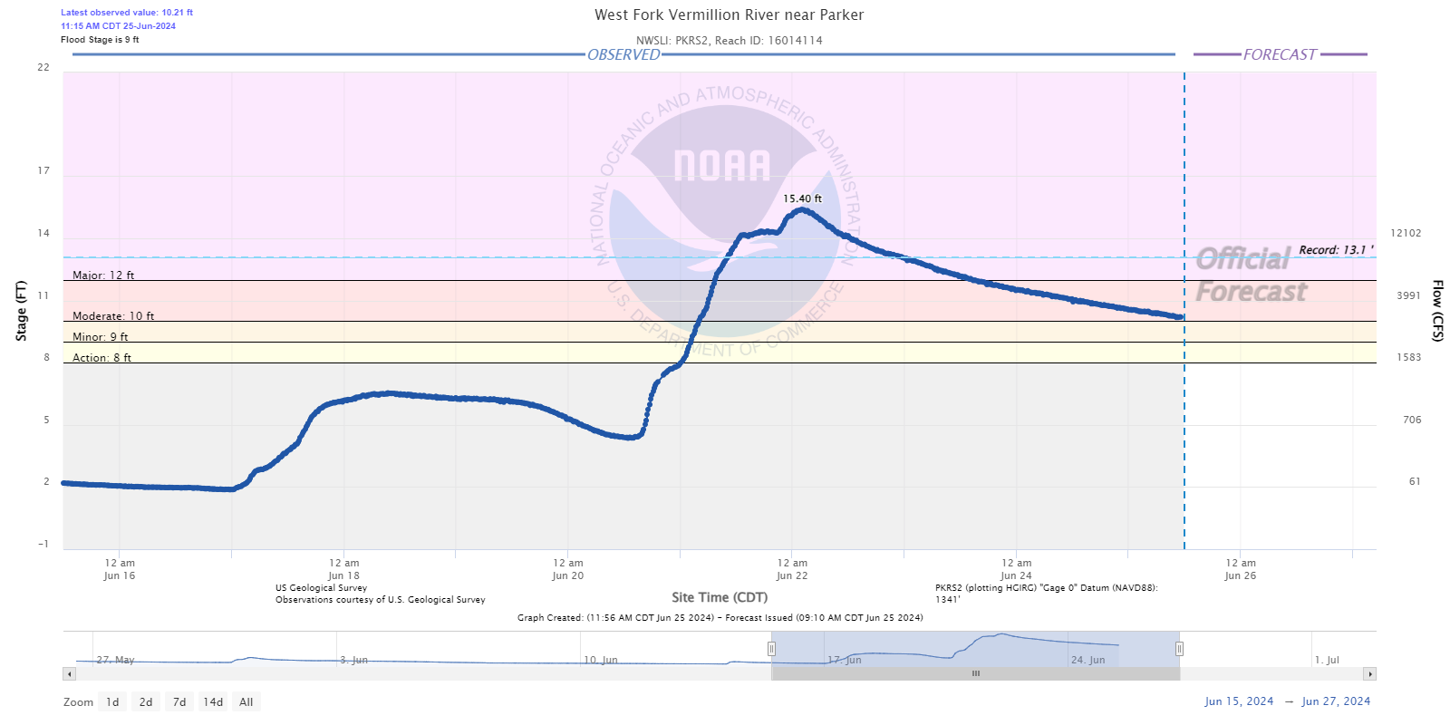 |
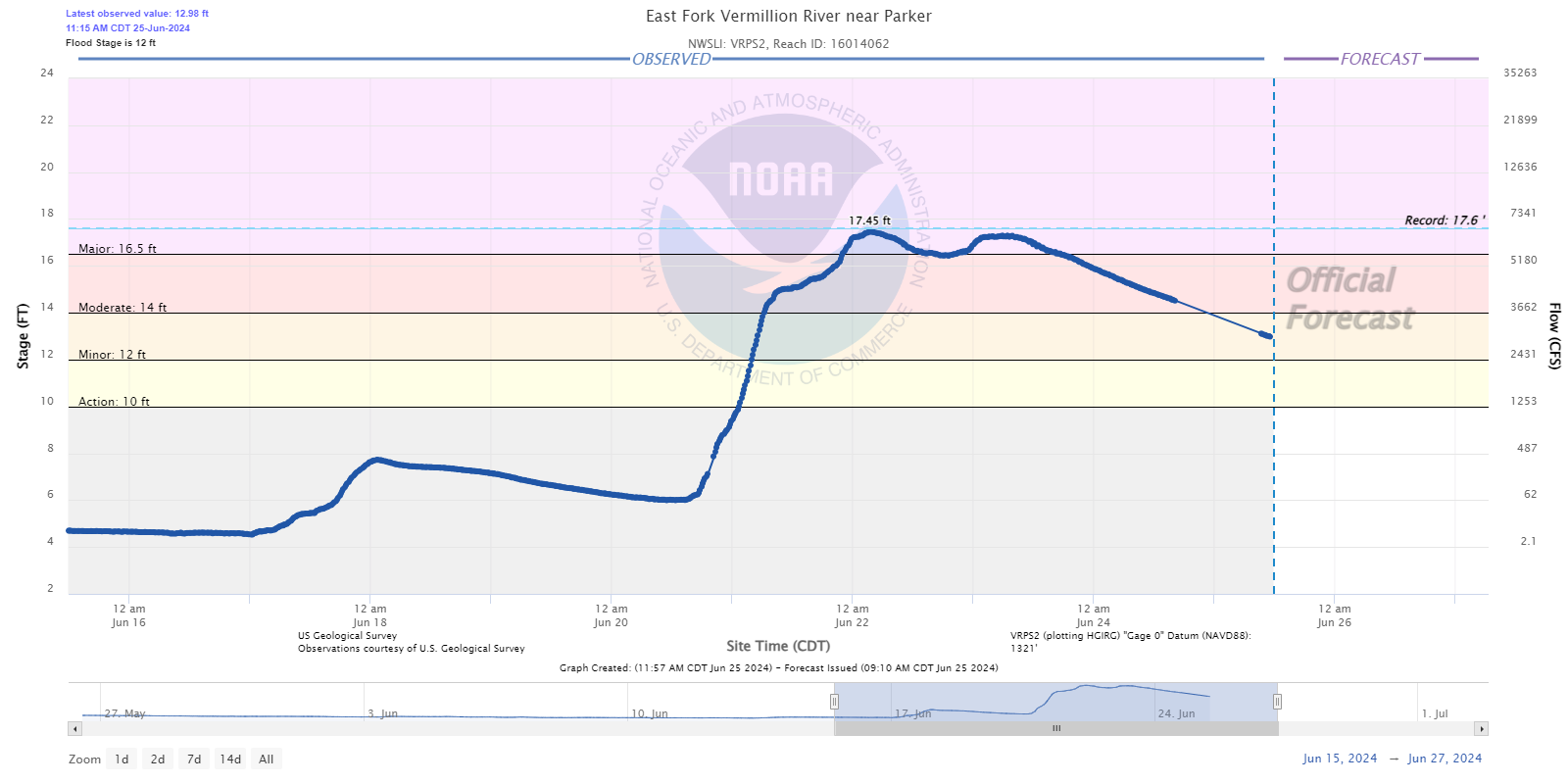 |
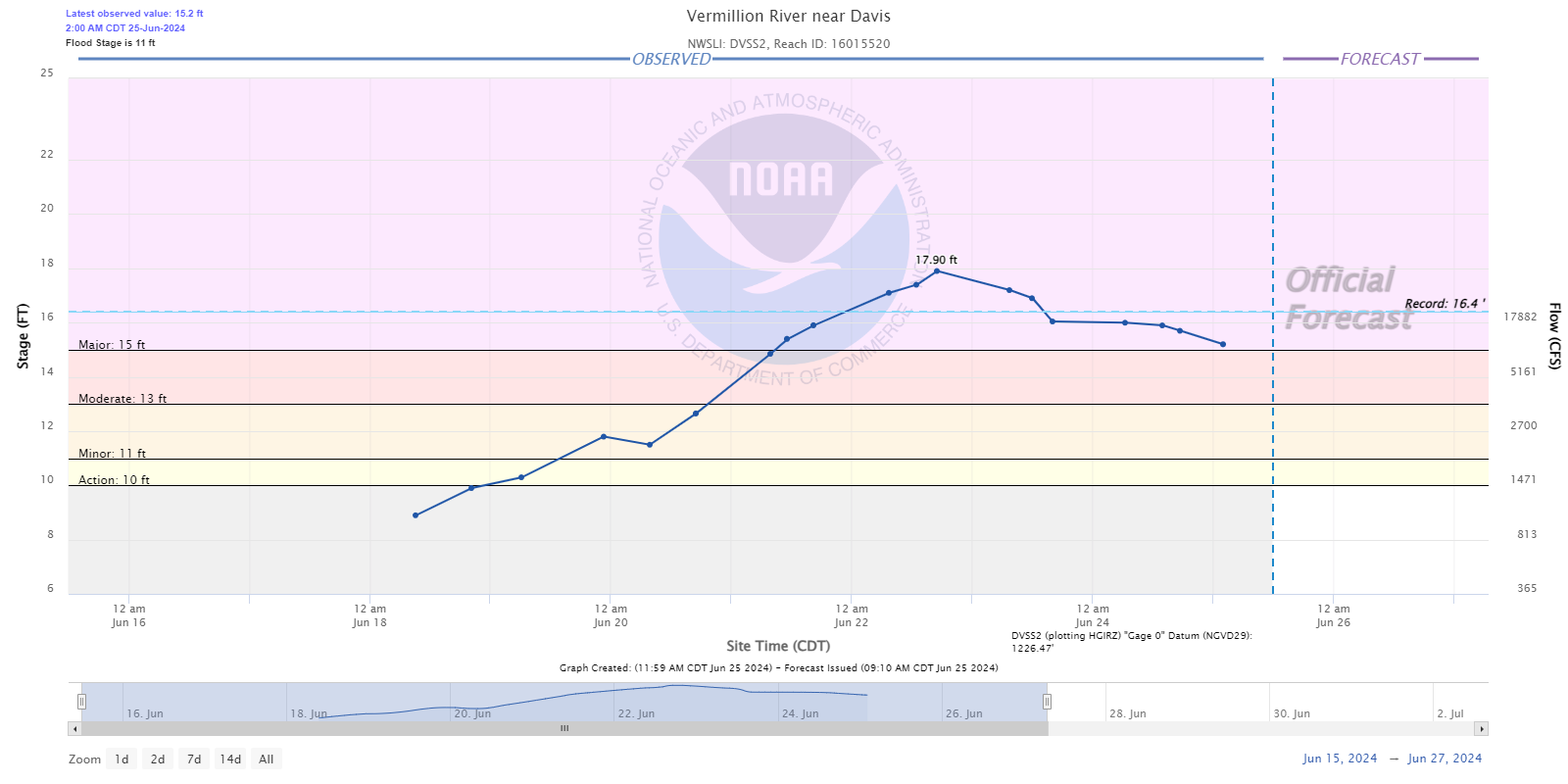 |
 |
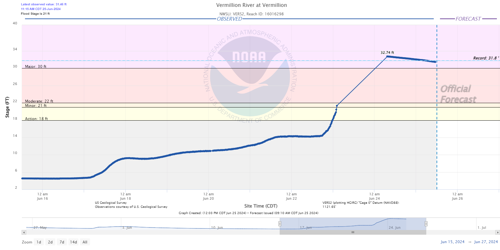 |
| West Fork near Parker, SD | East Fork near Parker, SD | Davis, SD | Wakonda, SD | Vermillion, SD |
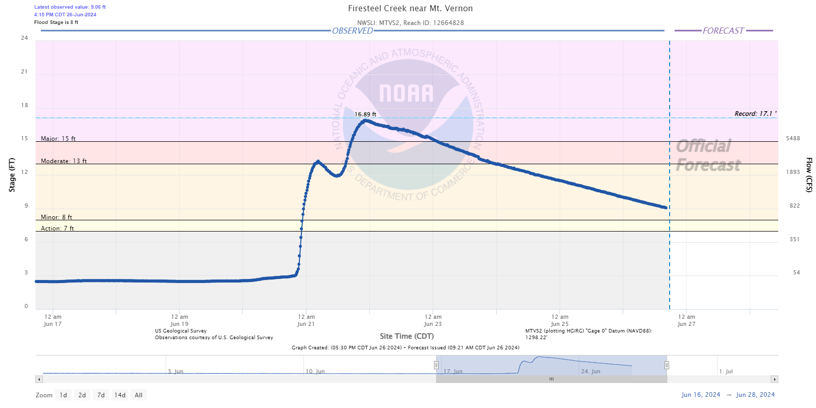
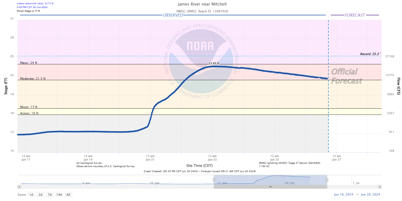
Hydrographs - James River
 |
 |
%20near%20Freeman.png) |
 |
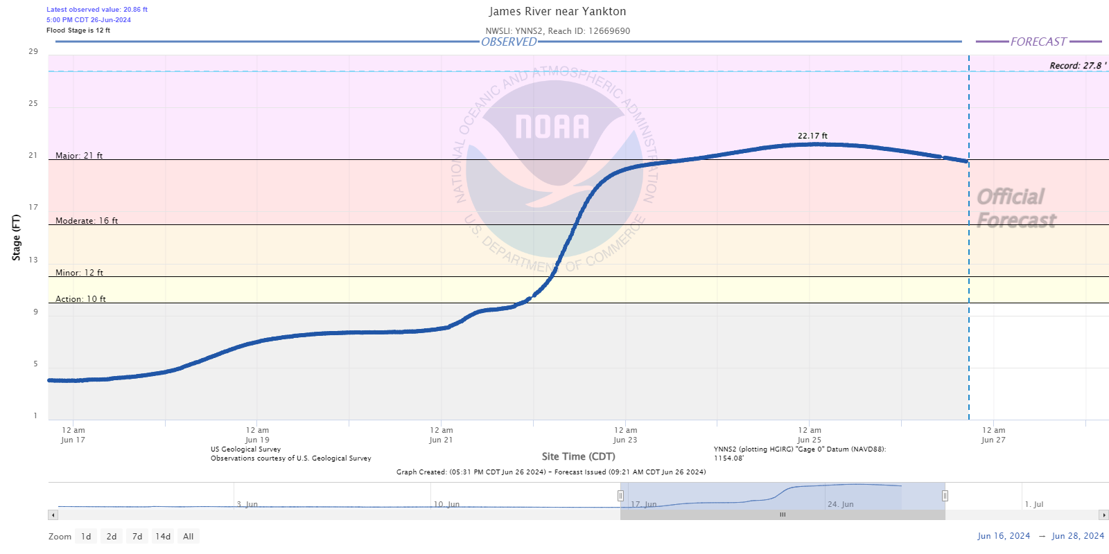 |
| Firesteel Creek - Mt. Vernon, SD | Mitchell, SD | Wolf Creek - Freeman, SD | Scotland, SD | Yankton, SD |
Hydrographs - Missouri River
 |
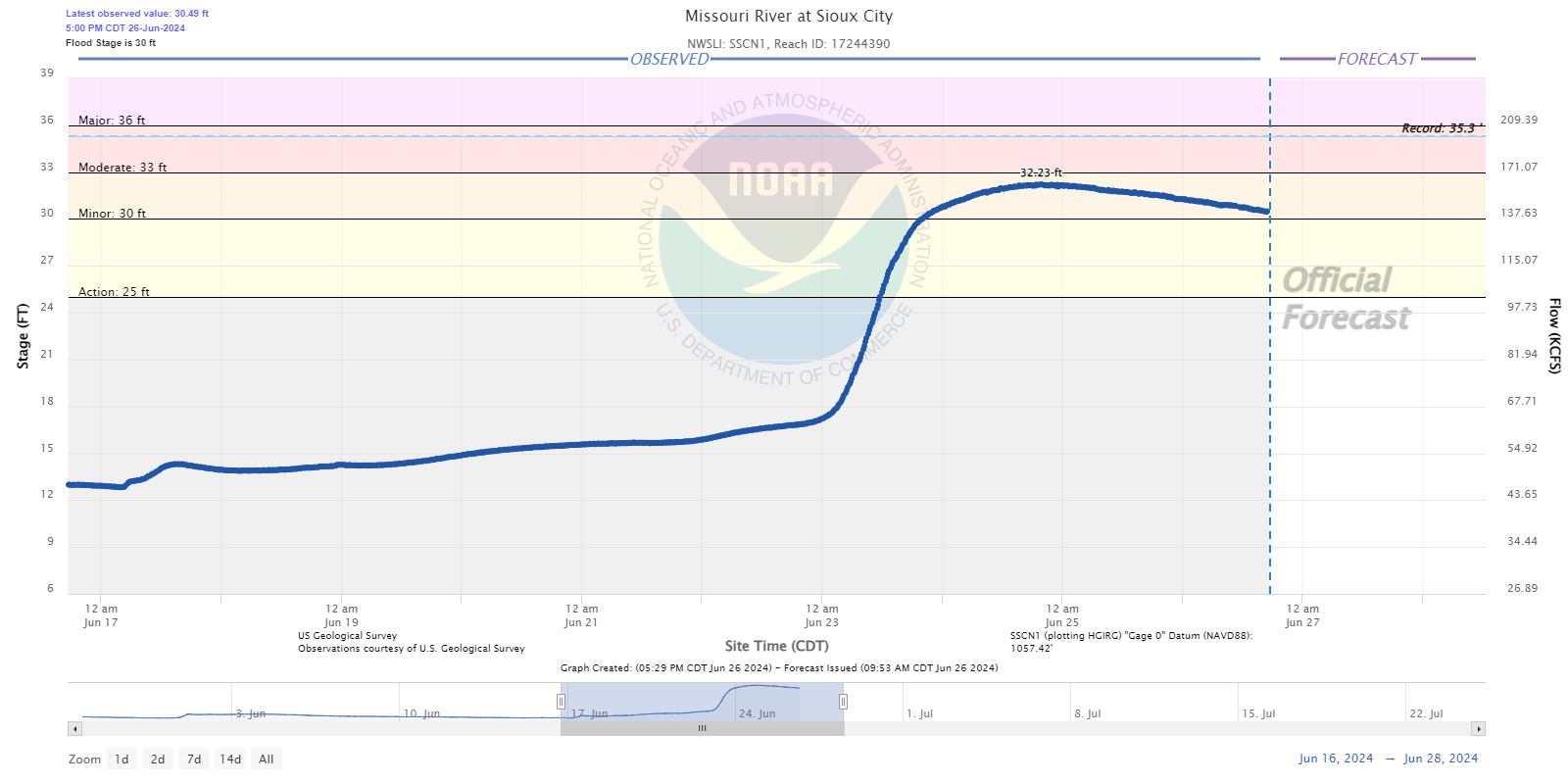 |
| Ponca, NE | South Sioux City, NE |
Photos & Video
Flooding Photos
 |
 |
 |
 |
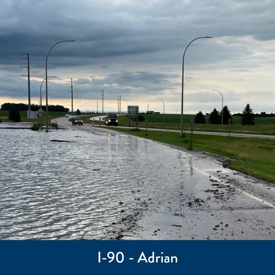
| I-90 At Adrian (Credit: MNDOT) |
Akron, IA (Credit: Chris Pierce) |
Akron, IA (Credit: Megan Hulleman) |
Alton, IA (Credit: Ashley Rothmeier) |
 |
 |
 |
 |
| I-90 At Alton, IA (Credit: Michelle Coacher Bostinelos) |
Ashton, IA (Credit:Caitlin Thong Vanh) |
Beliot, IA (Credit: Morgan Koerselman) |
Sioux Falls Arch (Credit: Cody Popke) |
 |
 |
 |
 |
| South of Alvord, IA (Credit: Dan Gottschalk) |
South of Alvord, IA (Credit: Dan Gottschalk) |
South of Alvord, IA (Credit: Dan Gottschalk) |
Brewster (Credit: Dawn Haberman) |
 |
 |
 |
 |
| Brandon, SD (Credit: Eric Van Donge) |
Beaver Creek near Canton, SD (Credit: Byron Ostrom) |
Davis, SD (Credit: Lukas Potgieter) |
east of Lake Alvin (near Sioux Falls) (Credit: Eric Van Donge) |
 |
 |
 |
 |
| near Magnolia MN exit on I-90 (Credit: MNDoT webcam) |
Harrisburg, SD (Credit: Evan Jones) |
Hawarden, IA (Credit: Glenda Hemmelrick) |
Hawarden, IA (Credit: Sarah Topete) |
 |
 |
 |
 |
| Intersection of Hwys 44 & 81 (Credit: Kelly Schmidt Blair) |
Hospers, IA (Credit: Susan Budden) |
southwest of Hurley, SD (Credit: Shawn Oaks) |
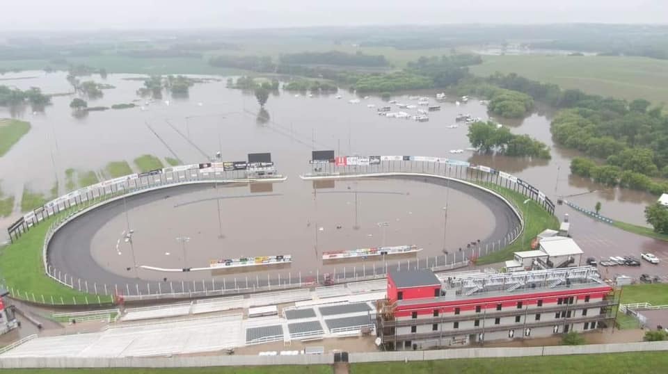
Huset's Speedway - Brandon, SD (Credit: djonesfilmz) |
 |
 |
 |
 |
| I-29 near Mile Marker 60 (Credit: Ryan Oswald) |
Klondike Bridge at Iowa/South Dakota border (Credit: Katie Stricker) |
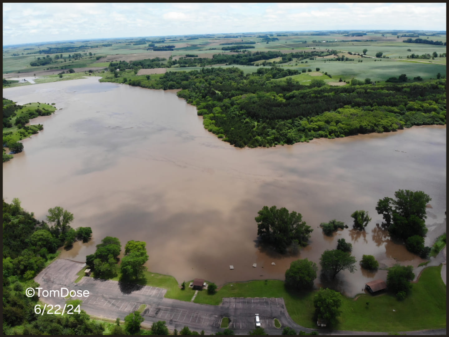
Lake Lakota south of Canton, SD (Credit: Tom & Brianna Dose) |
Lake Alvin near Sioux Falls, SD (Credit: Eric Van Donge) |
 |
 |
 |
 |
| Legacy Park in Sioux Falls, SD (Credit: Winny Tink) |
Le Mars, IA (Credit: Nathan Vrieze) |
12th Street in western Sioux Falls, SD (Credit: Marilyn Murray) | near Menno, SD (Credit: Michele Huber) |
 |
 |
 |
 |
| Montrose, SD (Credit: Sierra Rae) |
Mountain Lake, MN (Credit" Mountain View Drones) |
O'Brien/Cherokee County Line (Credit: Shane Whitney) |
near Parker, SD (Credit: Carrie Forrest) |
 |
 |
 |
 |
| Hwy 44 near Parker, SD (Credit: Emily Houska) |
Spencer, IA (Credit: Russ Mitchell) |
Paullina, IA (Credit: Cristie Tewes) |
Riverdale Park in Sioux Falls, SD (Credit: Donna Murphy) |
 |
 |
 |
 |
| Rotary Park in Sioux Falls, SD (Credit: Cierra Dirkson-Chapin) |
Cherry Rock Park entrance in eastern Sioux Falls, SD | Cherry Rock Park ball field in eastern Sioux Falls, SD |
Spencer Dog Park entrance in southern Sioux Falls, SD |
 |
 |
 |
 |
| Falls Park (below the walking bridge) in Sioux Falls, SD (Credit: Heather Sargent Kroontje) |
Leif Erikson Camp in Sioux Falls, SD (Credit: Heather Sargent Kroontje) |
Rock Rapids, IA (Credit: Hailey Olson) |
Rock Valley, IA (Credit: Warrior Sports Photography) |
 |
 |
 |
 |
| Slayton, MN (Credit: Kate Harmsen) |
Spencer, IA (Credit: Eric Johannsen) |
Spencer, IA (Credit: Kianna Seidel) |
Struble, IA (Credit: Brooke Berkenpas) |
 |
 |
 |
 |
| Chandler, MN (Credit: Faith Prins) |
Kaylor, SD (Credit: Sheryl Frey) |
Tyndall, SD (Credit: Marcia Tallman) |
Windom, MN (Credit: Laurie Murphy) |
 |
 |
 |
|
| Cherokee, IA (Credit: Kasha Cords Shear) |
Sioux Falls, SD (Credit: Cody Papke) |
Lake Alvin (Credit:Eric Van Donge) |
Caption |
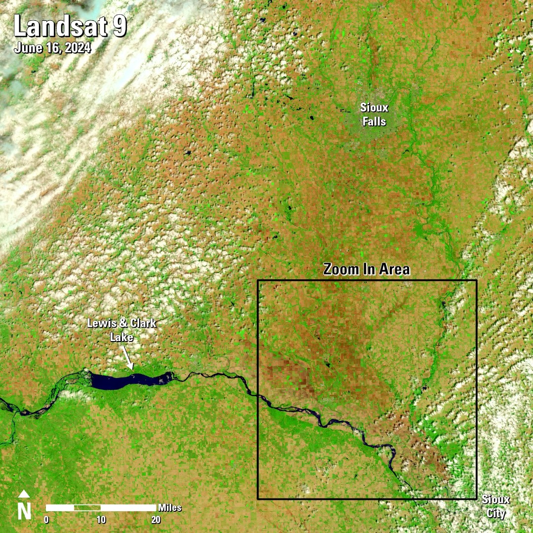
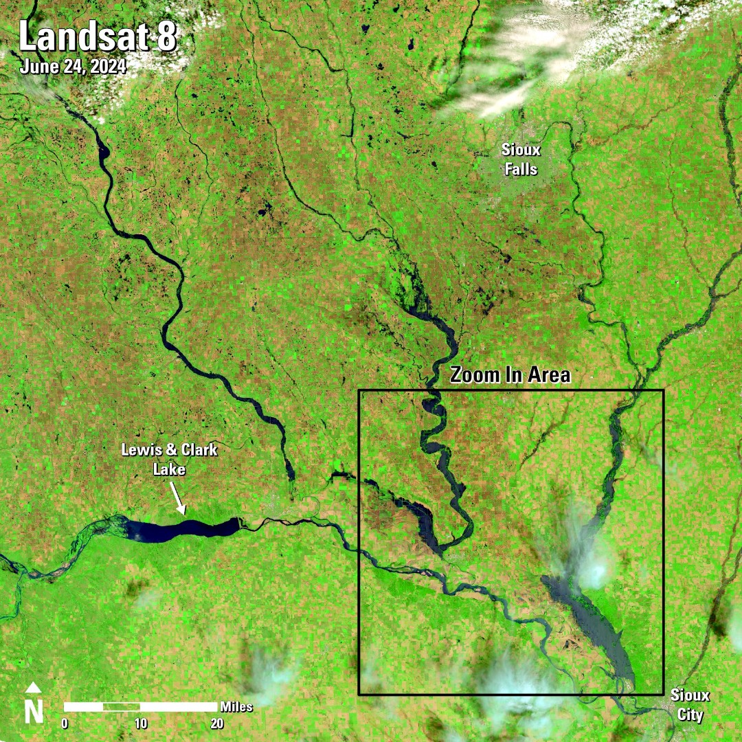
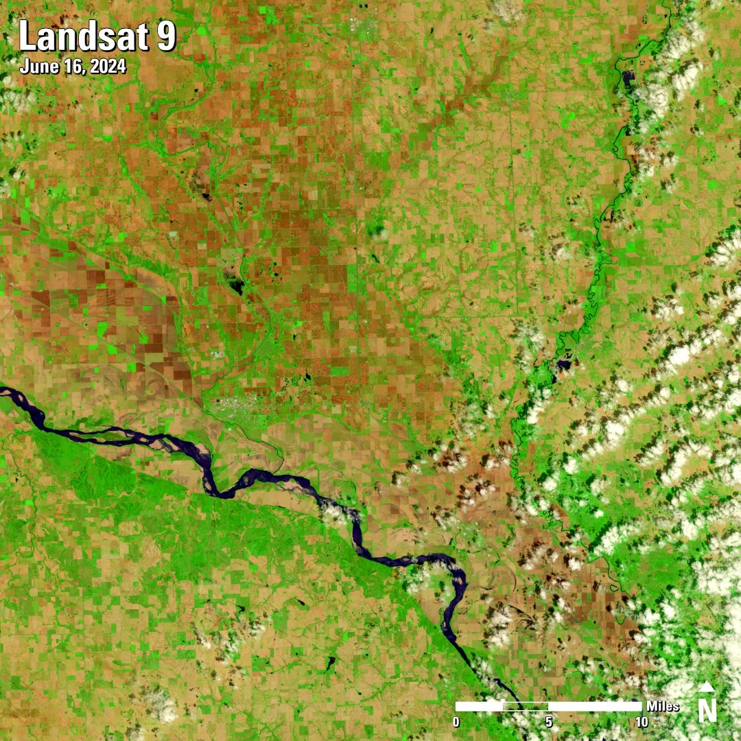
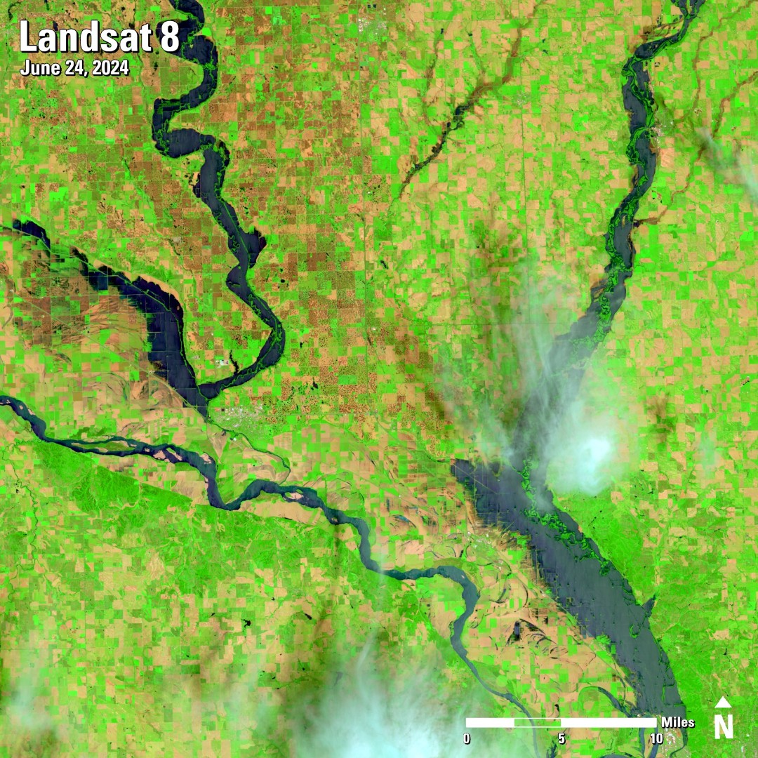
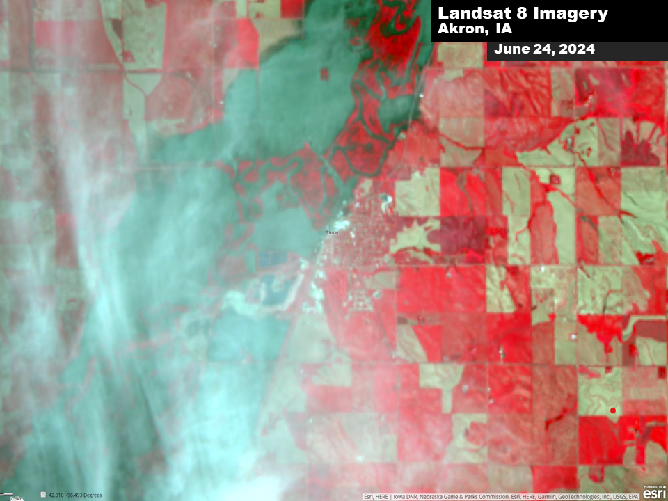
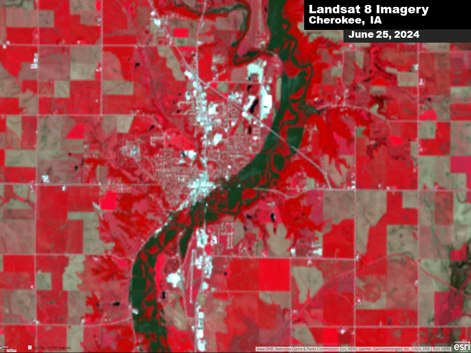
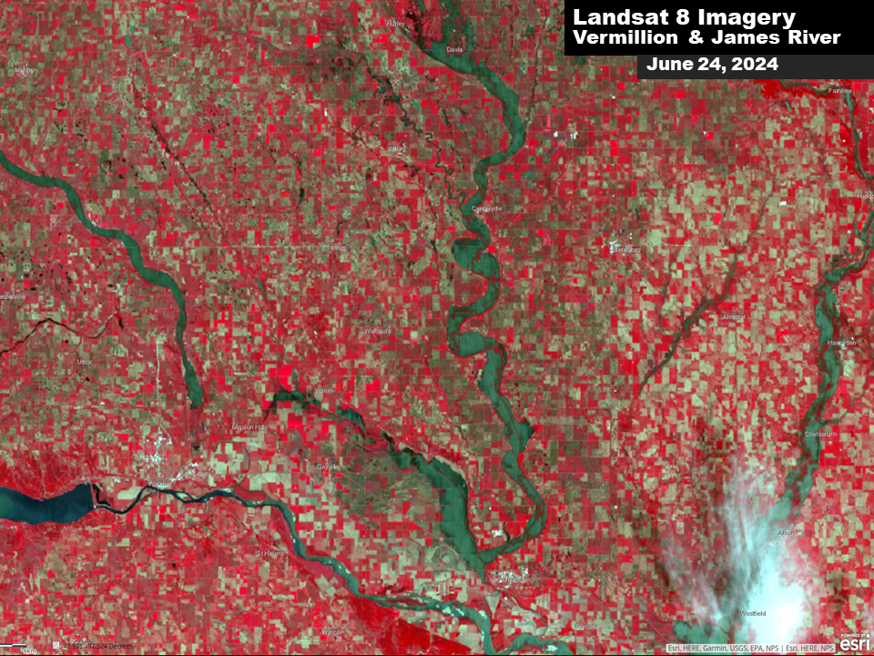
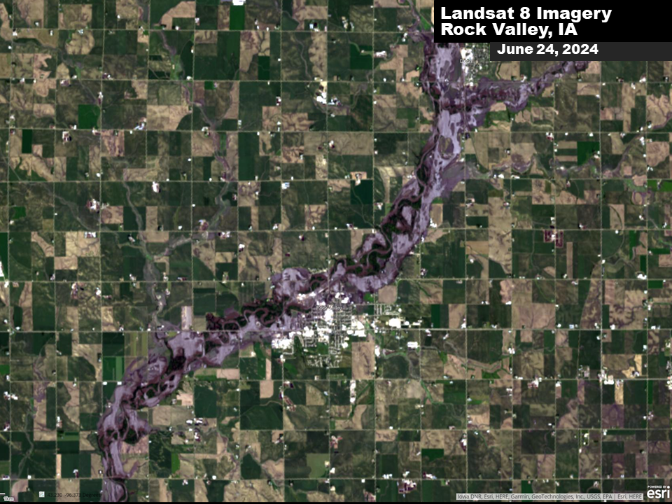
Before and After Comparison Photos from Landsat Satellite
| Before Flooding (Date of image below photo) | After Flooding (Date of image below photo) |
 |
 |
 |
 |
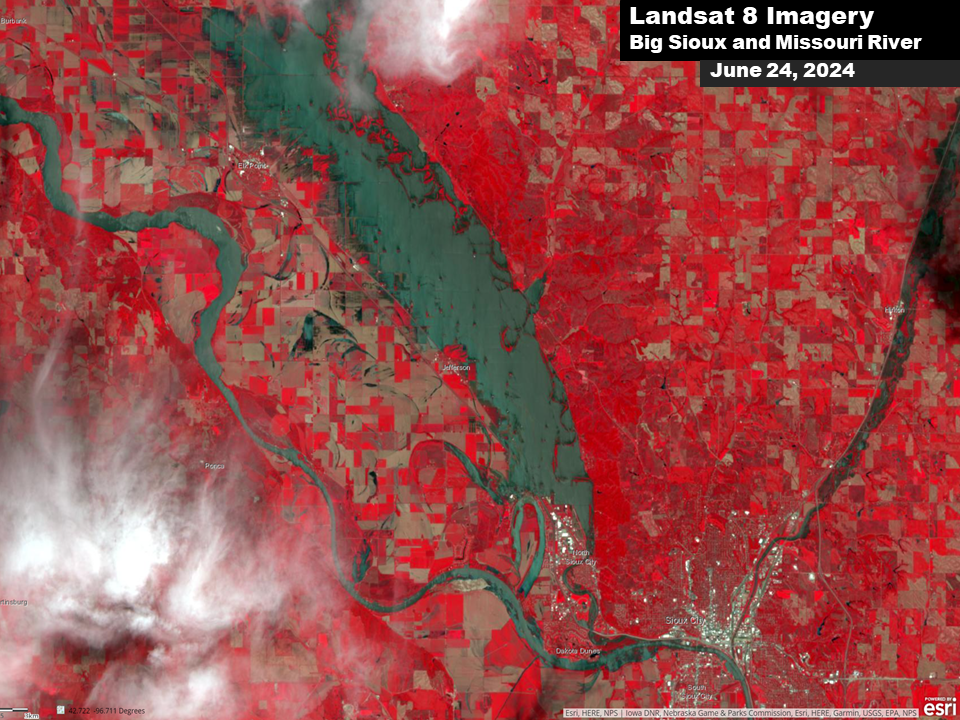
Before and After Comparison Photos from the Landsat 8 Satellite
 |
 |
 |
 |
| Landsat 8 View SE McCook Lake (Credit: USGS Landsat 8) |
Landsat 8 View Akron, IA (Credit: USGS Landsat 8) |
Landsat 8 View Cherokee, IA (Credit: USGS Landsat 8) |
Landsat 8 View SE South Dakota (Credit: USGS Landsat 8) |
 |
 |
 |
 |
| Landsat 8 View Rock Valley (Credit: USGS Landsat 8) |
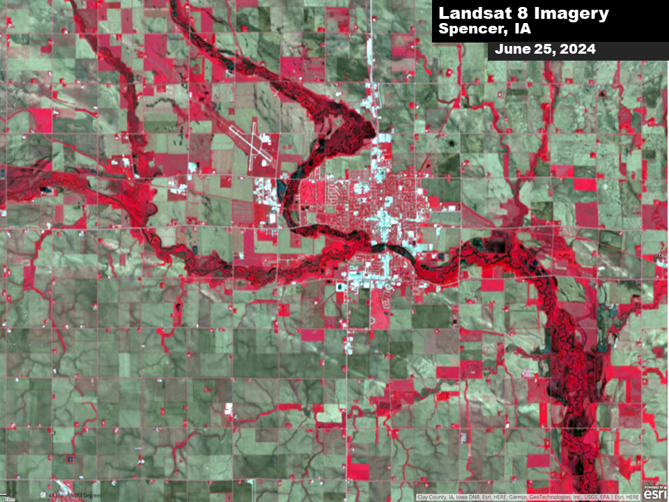
Landsat 8 View Spencer, IA (Credit: USGS Landsat 8) |
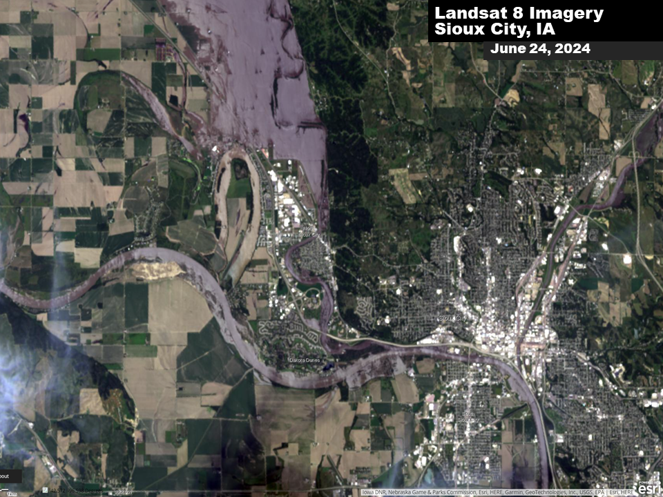
Landsat 8 View Sioux City Area (Credit: USGS Landsat 8) |
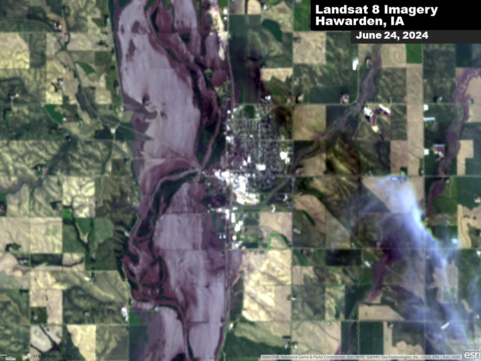
Landsat 8 View Hawarden, IA (Credit: USGS Landsat 8) |
Radar
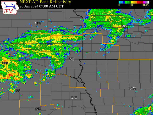
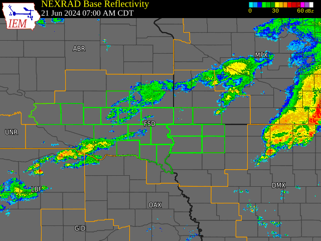
Radar Loops Across the Event
 |
 |
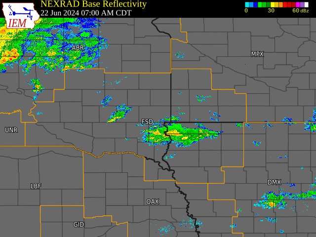 |
| Radar Loop - June 20-21, 2024 | Radar Loop - June 21-22, 2024 | Radar Loop - June 22, 2024 |
Rain Reports
| Station: | 3-day Rainfall 6/20-6/22 | Historic Rank | Record 3-day Rainfall | Probability of Occurrence in any given year* | Normal Monthly June Rainfall | June 2024 MTD Rainfall (as of 6/24) |
| Canton SD 4WNW | 12.02” | 2nd | 13.16” June 14-16, 2014 |
<0.10% | 4.66” | 15.64” |
| Mitchell SD | 8.55” | 1st | Previous 7.08” Sept 10-12, 2019 |
0.20% | 3.51” | 12.07” |
| Menno SD | 7.33” | 1st | Previous 7.06” Aug 18-20, 1937 |
0.50% | 3.64” | 10.59” |
| Sioux Falls SD | 6.70” | 2nd | 7.71” June 14-16, 2014 |
1% | 4.23” | 10.80” |
| Windom MN | 9.16” | 2nd | 9.36” Sept 23-25, 2010 |
0.50% | 4.73” | 13.68” |
| Rock Valley IA | 8.70” | 1st | Previous 7.05” Sept 18-20, 2018 |
0.50% | 4.60” | 12.86” |
| Sibley IA | 8.61” | 3rd | 9.34” June 18-20, 1954 |
1% | 4.88” | 14.15” |
| Sheldon IA | 7.22” | 4th | 10.05” July 14-16, 1900 |
2% | 4.67” | 12.24” |
| Spirit Lake IA | 6.69” | 4th | 8.09” Sept 13-15, 2004 |
n/a | 4.77” | 15.57” |
| Sanborn IA | 6.85” | 3rd | 7.80” Sept 19-21, 2018 |
3% | 4.86” | 12.06” |
| Spencer IA | 6.49” | 4th | 7.29” Sept 13-15, 2004 |
4% | 4.60” | 10.45” |
* Probability of Occurrence based roughly on 3-day ARI from Precipitation Frequency Estimates
|
||||||||||||||||||||||||||||||||||||||||||||||||||||||||||||||||||||||||||||||||||||||||||||||||||||||||||||||||||||||||||||||||||||||||||||||||||||||||||||||||||||||||||||||||||||||||||||||||||||||||||||||||||||||||||||||||||||||||||||||||||||||||||||||||||||||||||||||||||||||||||||||||||||||||||||||||||||||||||||||||||||||||||||||||||||||||||||||||||||||||||||||||||||||||||||||||||||||||||||||||||||||||||||||||||||||||||||||||||||||||||||||||||||||||||||||||||||||||||||||||||||||||||||||||||||||||||||||||||||||||||||||||||||||||||||||||||||||||||||||||||||||||||||||||||||||||||||||||||||||||
| Three Day Rainfall Totals - June 20-22, 2024 | ||||||||||||||||||||||||||||||||||||||||||||||||||||||||||||||||||||||||||||||||||||||||||||||||||||||||||||||||||||||||||||||||||||||||||||||||||||||||||||||||||||||||||||||||||||||||||||||||||||||||||||||||||||||||||||||||||||||||||||||||||||||||||||||||||||||||||||||||||||||||||||||||||||||||||||||||||||||||||||||||||||||||||||||||||||||||||||||||||||||||||||||||||||||||||||||||||||||||||||||||||||||||||||||||||||||||||||||||||||||||||||||||||||||||||||||||||||||||||||||||||||||||||||||||||||||||||||||||||||||||||||||||||||||||||||||||||||||||||||||||||||||||||||||||||||||||||||||||||||||||
|
Environment
Insert synoptic summary.
| Figure 1: Caption | Figure 2: Caption | Figure 3: Caption |
Near-storm environment summary.
| Figure 4: Caption | Figure 5: Caption | Figure 6: Caption |
Additional environmental data.
| Figure 7: Caption | Figure 8: Caption | Figure 9: Caption |
Additional Information
The Forecast
 |
 |
 |
|
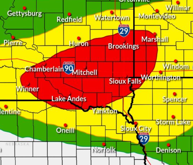
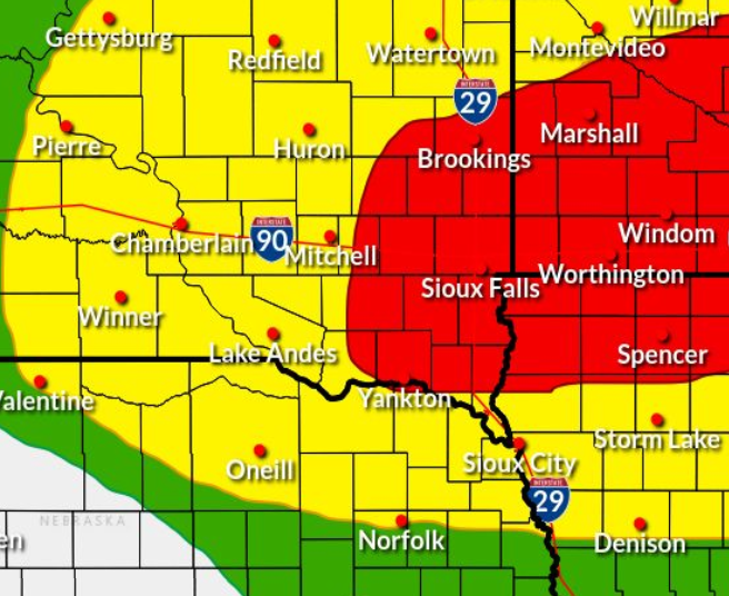
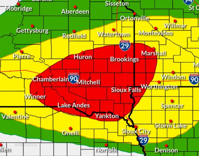
WPC Day 1 Excessive Rainfall Outlook [Red shaded area indicates a Moderate- level 3 out of 4 risk] |
WPC Day 2 Excessive Rainfall Outlook [Red shaded area indicates a Moderate- level 3 out of 4 risk] |
WPC Day 1 Excessive Rainfall Outlook UPDATE Issued 6/20 pm [Red shaded area indicates a Moderate- level 3 out of 4 risk] |
 |
 |
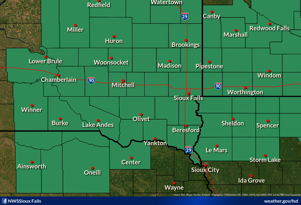 |
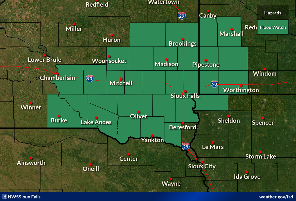
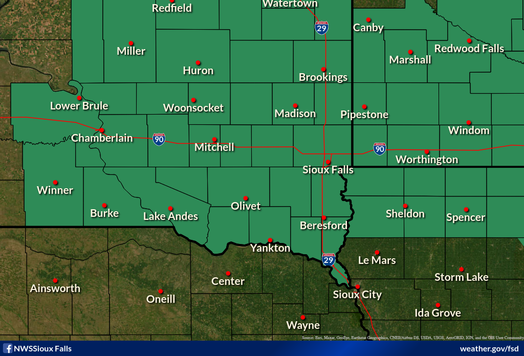
| Flood Watch for Flash Flooding Issued 6/20 am (valid 8am 6/20 through 8am 6/21) |
Flood Watch for Flash Flooding Issued 6/20 pm (valid time extended through 7am 6/21) |
Flood Watch for Flash Flooding Issued 6/21 am (continues through 7am 6/22) |
 |
 |
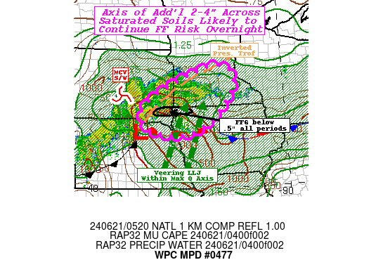 |
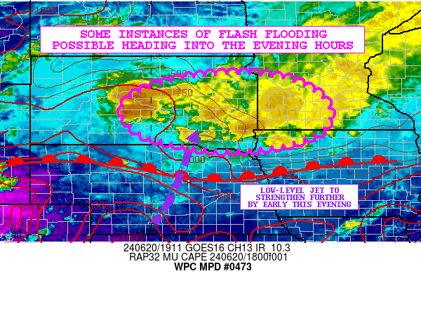
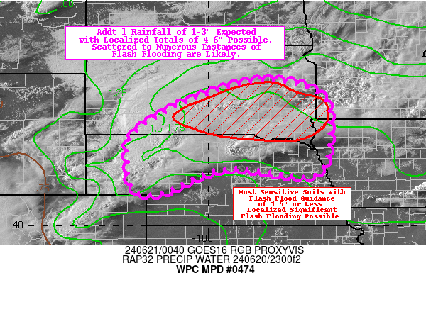
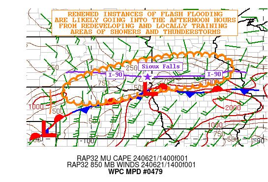
| Mesoscale Precipitation Discusion Issued 216 pm June 20. 2024 |
Mesoscale Precipitation Discusion Issued 800 pm June 20. 2024 |
Mesoscale Precipitation Discusion Issued 1223 am June 21. 2024 |
 |
 |
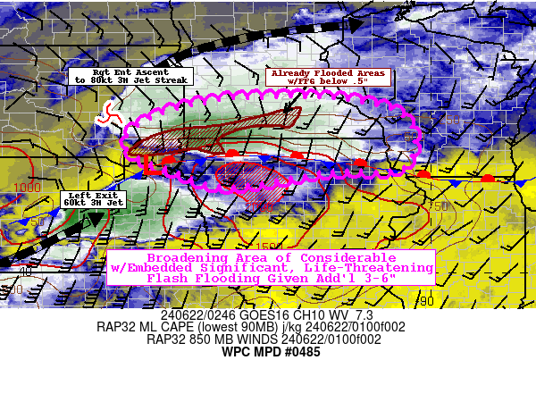 |
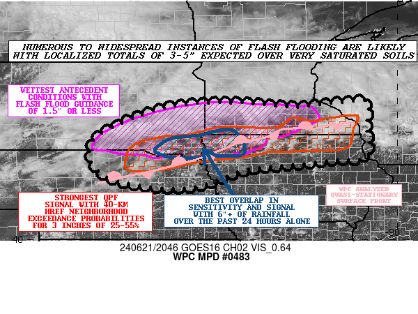
| Mesoscale Precipitation Discusion Issued 1005 am June 21. 2024 |
Mesoscale Precipitation Discusion Issued 352 pm June 21. 2024 |
Mesoscale Precipitation Discusion Issued 953 pm June 21. 2024 |
Summaries from other NWS Offices
 |
Media use of NWS Web News Stories is encouraged! Please acknowledge the NWS as the source of any news information accessed from this site. |
|


 Weather Story
 Weather Map
 Local Radar