Overview
|
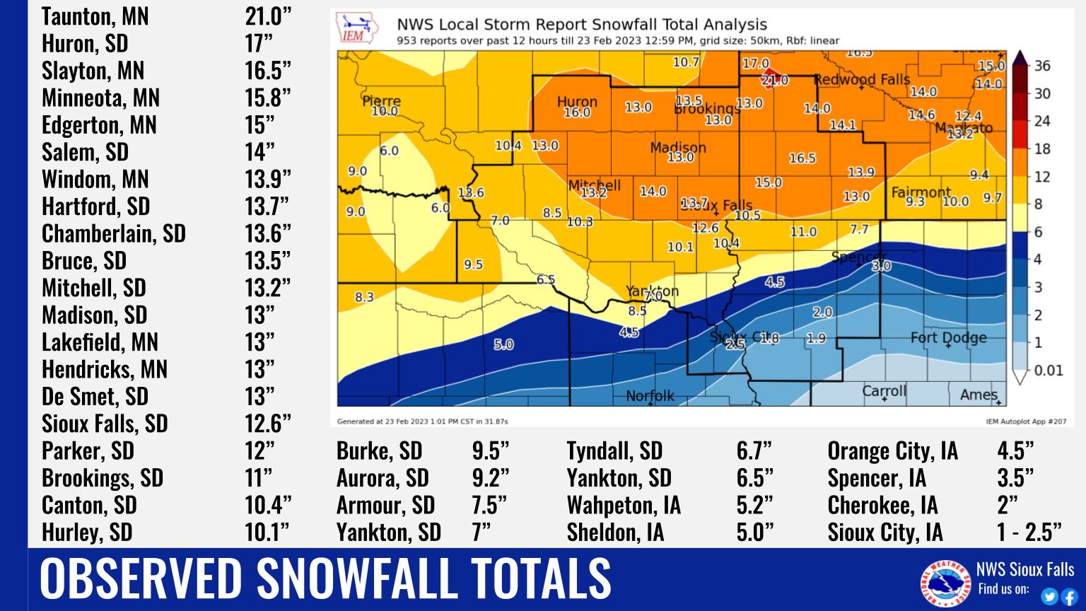
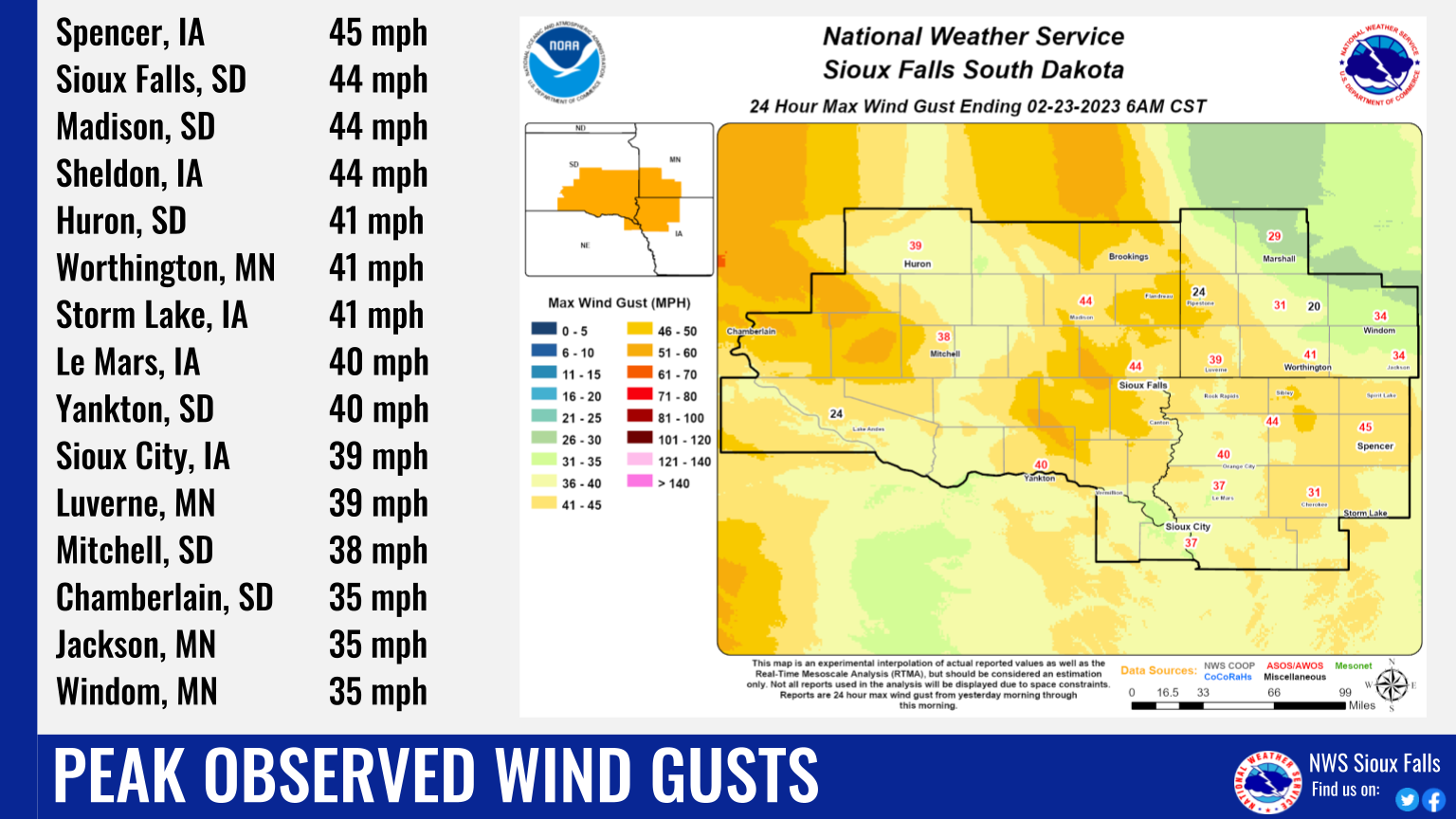
A significant winter storm impacted much of the region from February 21st through the morning of February 23rd, 2023. Waves of moderate to heavy snow produced over a foot of snow in many locations, especially near and north of Interstate 90, while wind gusts up to 40-45 mph produced blizzard conditions and significant drifting. Interstate highways west, north and east of Sioux Falls were all closed at some point during the storm, as were some state highways in southwest Minnesota. |
|
 |
 |
 |
| Snowfall Totals February 21-23, 2023 | Peak Wind Gusts February 21-23, 2023 | Radar Loop Summary |
Snow/Ice
PUBLIC INFORMATION STATEMENT
NATIONAL WEATHER SERVICE SIOUX FALLS SD
225 PM CST THU FEB 23 2023

...SNOWFALL REPORTS FOR FEBRUARY 21ST-23RD 2023 BLIZZARD...

LOCATION                     AMOUNT    TIME/DATE
TAUNTON                      21.0 IN   0800 AM 02/23
2 S HURON                    17.0 IN   1200 PM 02/23
SLAYTON 0.8 SSW              16.5 IN   0700 AM 02/23
2 NE WORTHINGTON             15.5 IN   0800 AM 02/23
EDGERTON                     15.0 IN   0648 AM 02/23
4 ENE HARDWICK               15.0 IN   0813 AM 02/23
1 N MARSHALL                 15.0 IN   0800 AM 02/23
SALEM                        14.0 IN   0800 AM 02/23
WINDOM                       13.9 IN   0800 AM 02/23
HARTFORD 0.5 N               13.7 IN   0600 AM 02/23
CHAMBERLAIN 7.5 SSW          13.6 IN   0700 AM 02/23
BRUCE 5.3 W                  13.5 IN   0800 AM 02/23
MITCHELL                     13.2 IN   0800 AM 02/23
AURORA                       13.0 IN   0800 AM 02/23
DE SMET 0.2 SSE              13.0 IN   0700 AM 02/23
HENDRICKS 8.0 SE             13.0 IN   0700 AM 02/23
LAKEFIELD                    13.0 IN   0800 AM 02/23
1 SSE MADISON                13.0 IN   0800 AM 02/23
WESSINGTON SPRINGS           13.0 IN   0800 AM 02/23
SIOUX FALLS 5.2 E            12.9 IN   0700 AM 02/23
3 N SIOUX FALLS              12.6 IN   0538 AM 02/23
1 SE TEA                     12.6 IN   0800 AM 02/23
MOUNT VERNON                 12.0 IN   0800 AM 02/23
PARKER 7.2 N                 12.0 IN   0700 AM 02/23
BROOKINGS 1.6 S              11.0 IN   0700 AM 02/23
SIBLEY                       11.0 IN   0800 AM 02/23
2 NNE LAKEFIELD              10.9 IN   0800 AM 02/23
BROOKINGS 6.5 NNW            10.5 IN   0700 AM 02/23
HILLS 0.2 NW                 10.5 IN   0700 AM 02/23
1 NNW CANTON                 10.4 IN   0800 AM 02/23
10 W DIMOCK                  10.3 IN   1121 AM 02/23
HURLEY 0.2 S                 10.1 IN   0600 AM 02/23
4 SW BURKE                   9.5 IN    1119 AM 02/23
9 S DALLAS                   9.5 IN    1115 AM 02/23
1 W ALEXANDRIA               9.0 IN    0800 AM 02/23
5 SSW HERRICK                9.0 IN    1119 AM 02/23
4 SW STICKNEY                8.5 IN    1120 AM 02/23
ROCK RAPIDS                  8.0 IN    0800 AM 02/23
1 W SPIRIT LAKE              7.7 IN    0800 AM 02/23
2 S ARMOUR                   7.5 IN    0759 AM 02/23
13 WNW PLATTE                7.0 IN    0800 AM 02/23
YANKTON                      7.0 IN    0520 AM 02/23
TYNDALL                      6.7 IN    0800 AM 02/23
4 SSW PICKSTOWN              6.5 IN    0800 AM 02/23
2 ESE YANKTON                6.5 IN    0800 AM 02/23
HULL                         6.0 IN    0815 AM 02/23
1 WNW VERMILLION             5.5 IN    0800 AM 02/23
SHELDON                      5.0 IN    0800 AM 02/23
ORANGE CITY                  4.5 IN    0800 AM 02/23
1 N SPENCER                  3.5 IN    0707 AM 02/23
LE MARS 1.0 E                3.0 IN    0530 AM 02/23
3 SSE NORTH SIOUX CITY       2.5 IN    0434 AM 02/23
3 NNE SIOUX CITY             2.0 IN    0506 AM 02/23
5 NW HOLSTEIN                1.9 IN    0800 AM 02/23
5 NW MOVILLE                 1.8 IN    0800 AM 02/23
REMSEN                       1.8 IN    1100 AM 02/23
SERGEANT BLUFF               1.3 IN    1118 AM 02/23

OBSERVATIONS ARE COLLECTED FROM A VARIETY OF SOURCES WITH VARYING
EQUIPMENT AND EXPOSURES. WE THANK ALL VOLUNTEER WEATHER OBSERVERS
FOR THEIR DEDICATION. NOT ALL DATA LISTED ARE CONSIDERED OFFICIAL.

$$
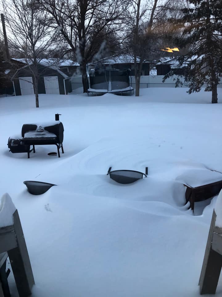
Photos & Video
Header
 |
 |
 |
 |
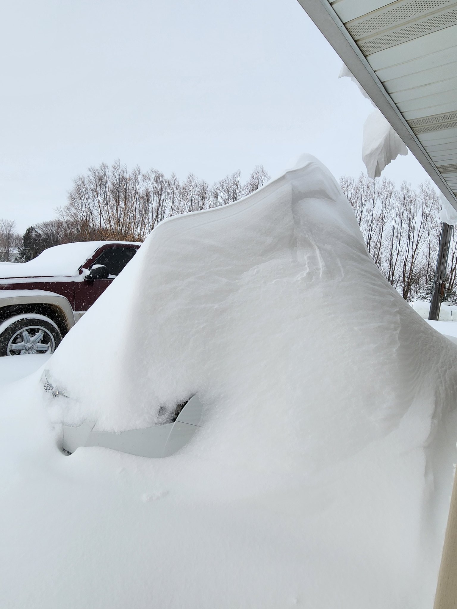
| Mitchell, SD (Dani Hansen) |
Near Tracy, MN (Chris Olson) |
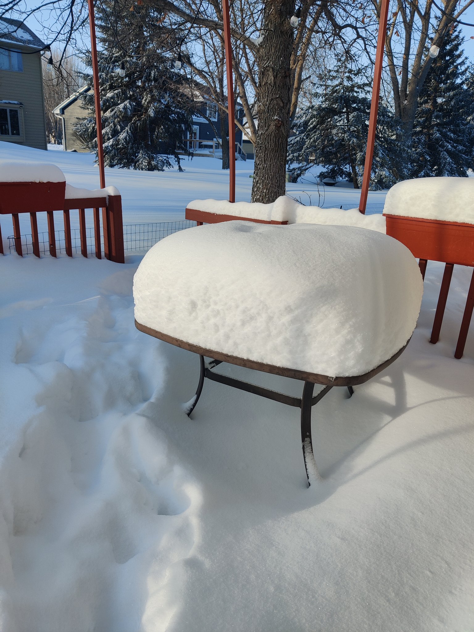
Brookings, SD (Ashley Anguiano) |
Sioux Falls, SD (Sam Cotter) |
 |
 |
 |
 |
| Madison, SD (Wendy Romero) |
Douglas County, SD (Pat Harrington) |
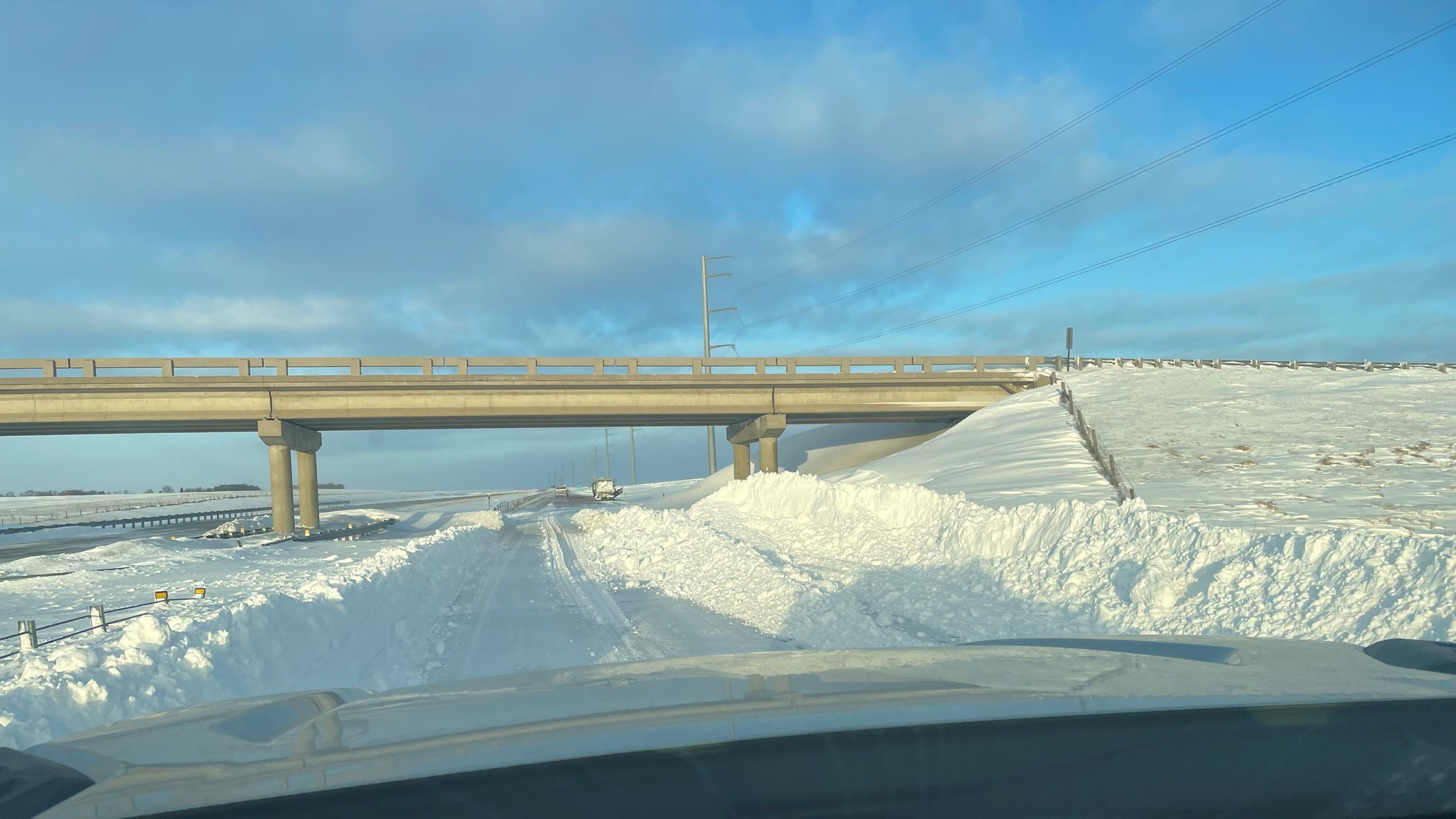
Near Worthington, MN (MNDOT) |
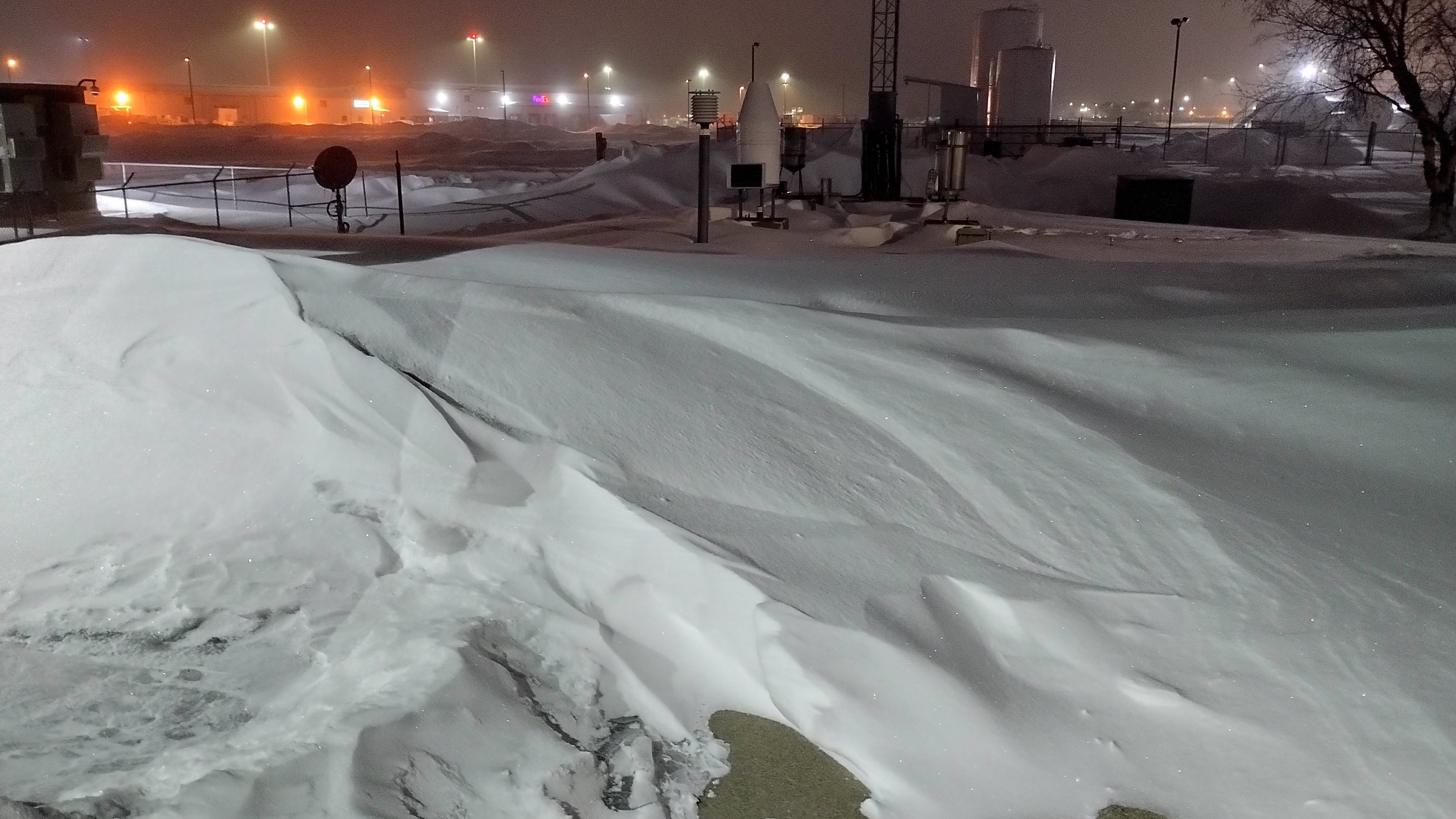
Deep drifts impede access to our observation equipment at NWS Sioux Falls |
Other Information
 |
 |
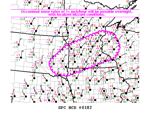 |
| National Watches, Warnings, Advisories | Surface Observations Loop | Mesoscale Discussion from SPC |
 |
Media use of NWS Web News Stories is encouraged! Please acknowledge the NWS as the source of any news information accessed from this site. |
|


 Weather Story
 Weather Map
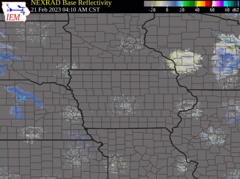
 Local Radar
 Follow us on YouTube