Overview
|
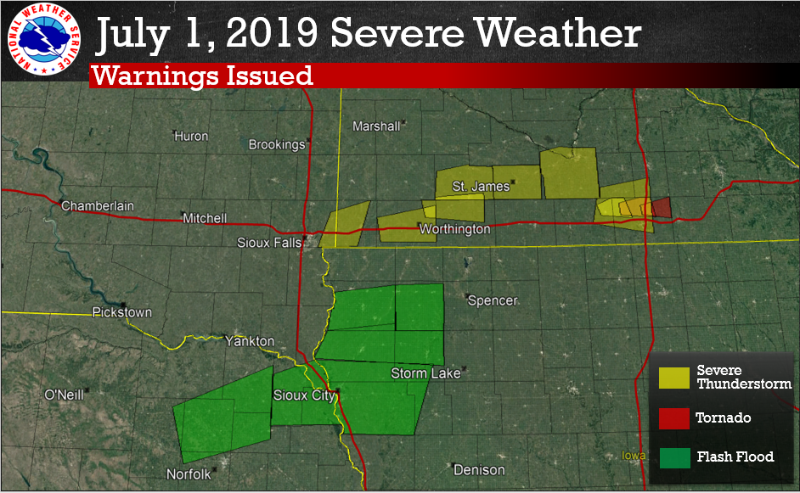
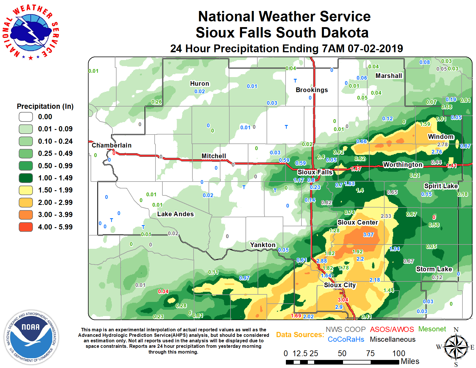
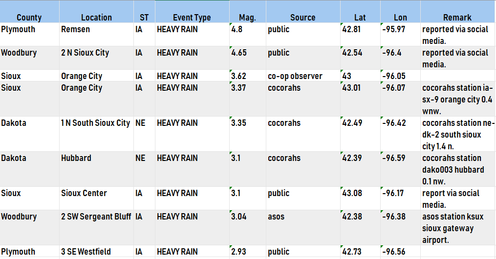
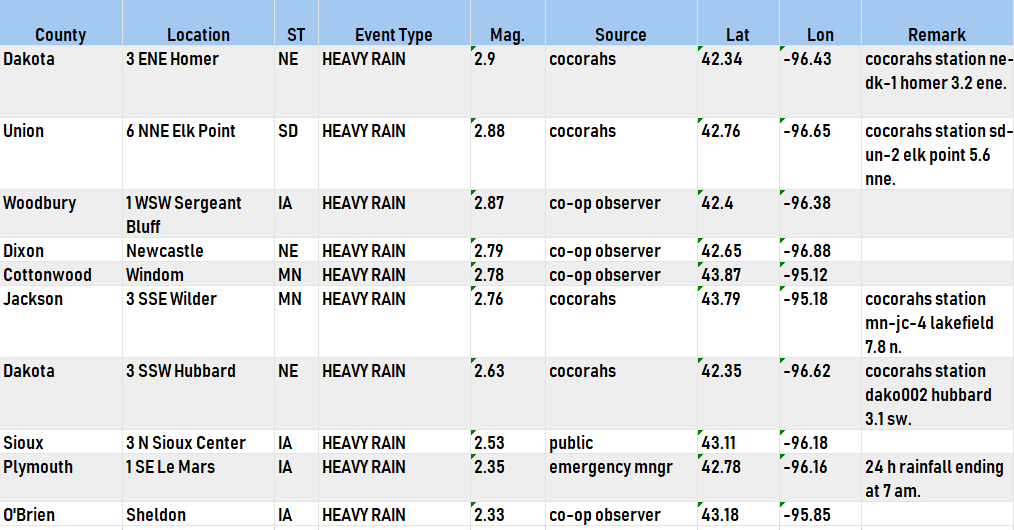
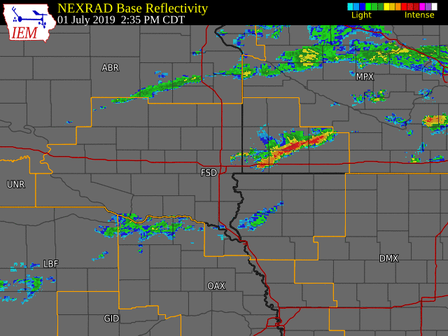
Scattered thunderstorms moved over the region during the afternoon and evening of July 1st, producing heavy rainfall and isolated hail over southwest Minnesota. Hours later, a line of thunderstorms developed along and east of a line from Yankton to Hartford, SD, before slowly moving southeast into northwest Iowa. These storms produced total rainfall amounts as high as 4+ inches in portions of northwest Iowa. |
July 1 - 2, 2019 |
 |
 |
 |
| All warnings issued during the event. | Oberved precipitation over the past 24 hours. | Some preliminary rainfall totals. Highest rainfall amounts were reported in northwest Iowa. |
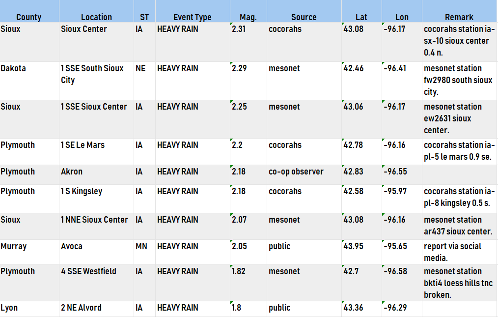
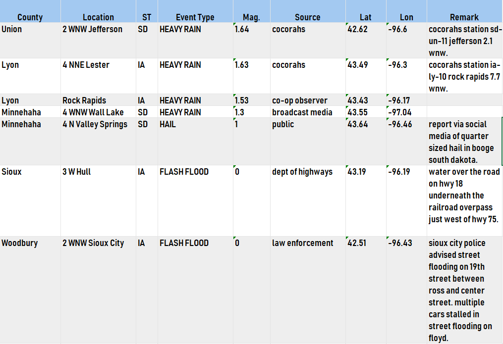
Storm Reports
 |
Media use of NWS Web News Stories is encouraged! Please acknowledge the NWS as the source of any news information accessed from this site. |
|


 Weather Story
 Weather Map
 Local Radar
 Follow us on YouTube