Overview
|
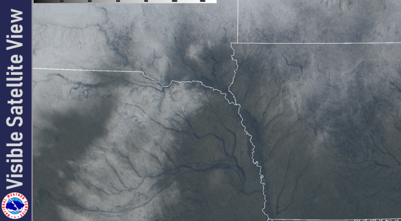
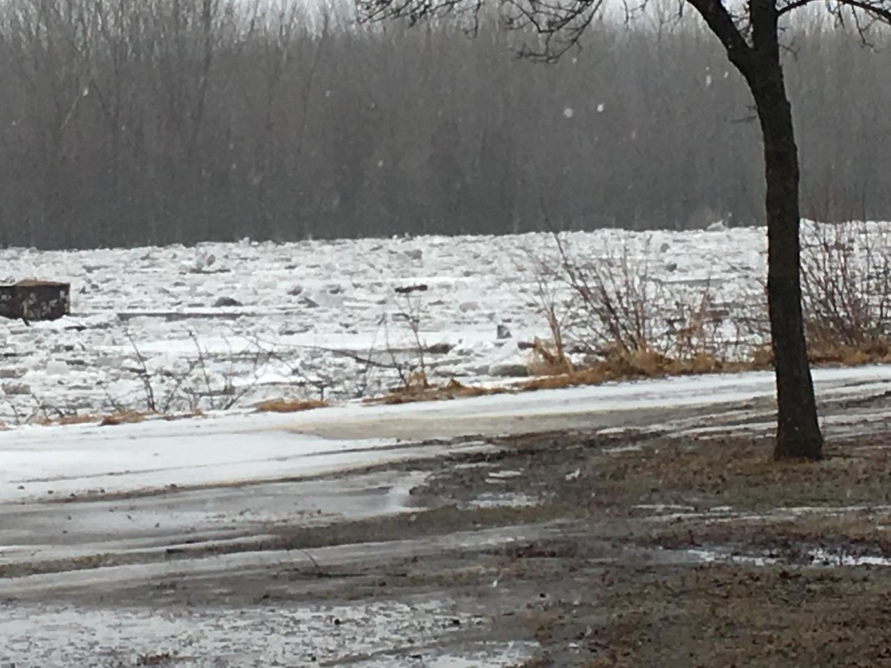
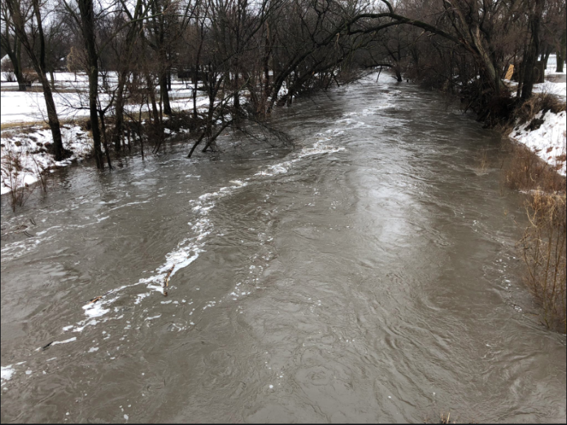
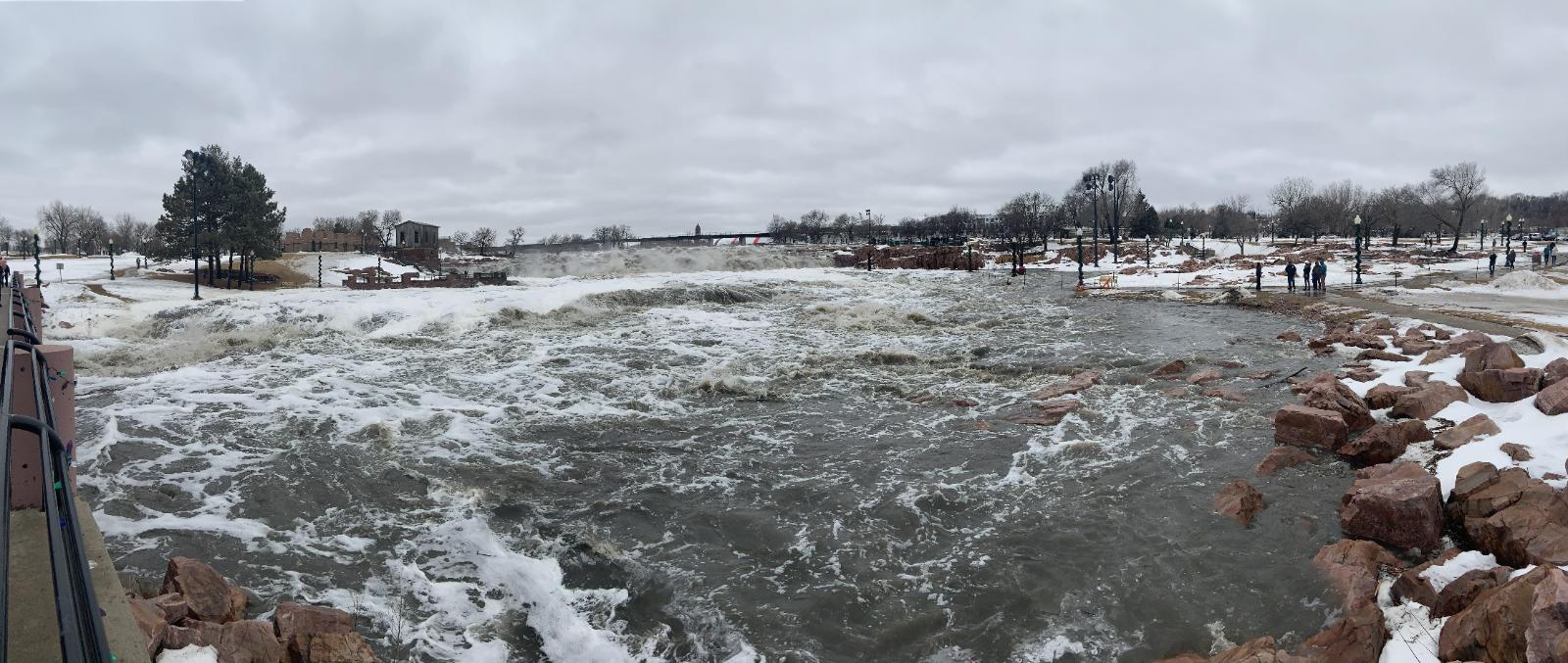
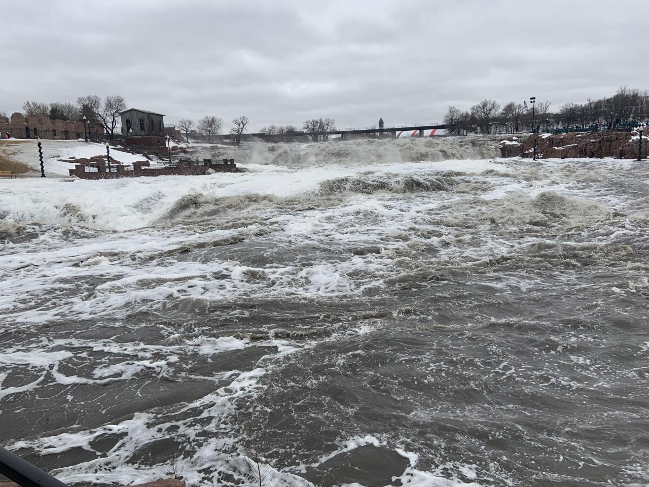
A historic storm system moved across the central United States March 12-14, 2019. This storm system produced blizzard conditions, heavy rainfall, and severe storms. The rapid northward movement of warm air with this system led to extended periods of fog, but also rapid snow melt in the region. Snow melt and heavy rains have led to historic flooding in many portions of South Dakota, Iowa, and Nebraska. Over 15 new crest level records were reported on rivers in the Sioux Falls forecast area from this event. |
Radar Loop Of March Storm |
 |
 |
 |
 |
| Two Day Precipitation Totals | Peak Wind Gusts | Total Snowfall | Satellite View |
Wind:
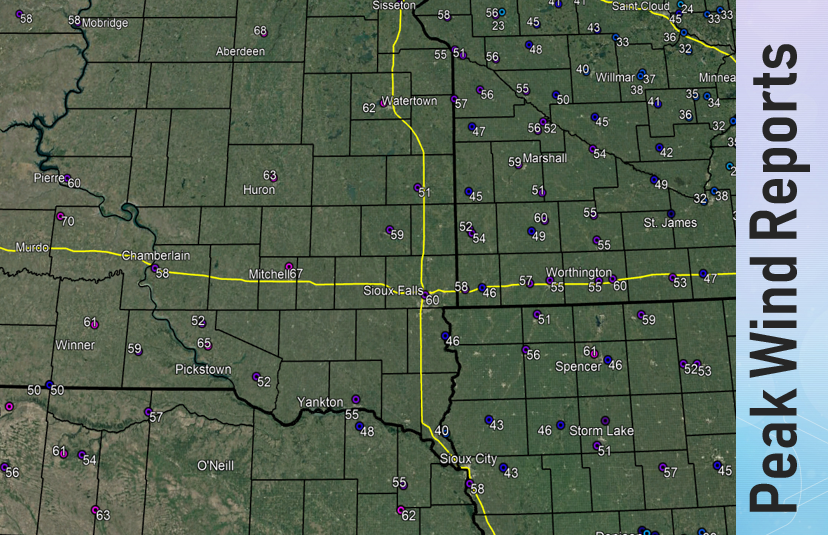
Here's a look at the peak wind gusts across the region during the March 12-14, 2019 blizzard. Average sustained winds were between 25 and 35 mph, with peak gusts between 50 and 60+ mph reported. Minor damage was reported in a few locations
 |
|||||||||||||||||||||||||||||||||||||||||||||||||||||||||||||||||||||||||||||||||||||||||||||||||||||||||||||||||||||||||
| Peak Wind Gusts | |||||||||||||||||||||||||||||||||||||||||||||||||||||||||||||||||||||||||||||||||||||||||||||||||||||||||||||||||||||||||
|
Flooding
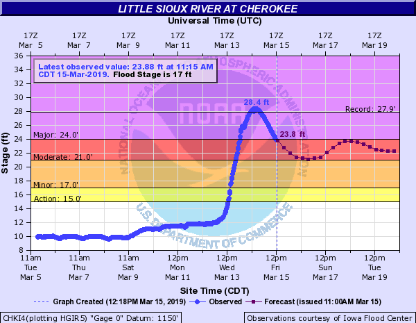
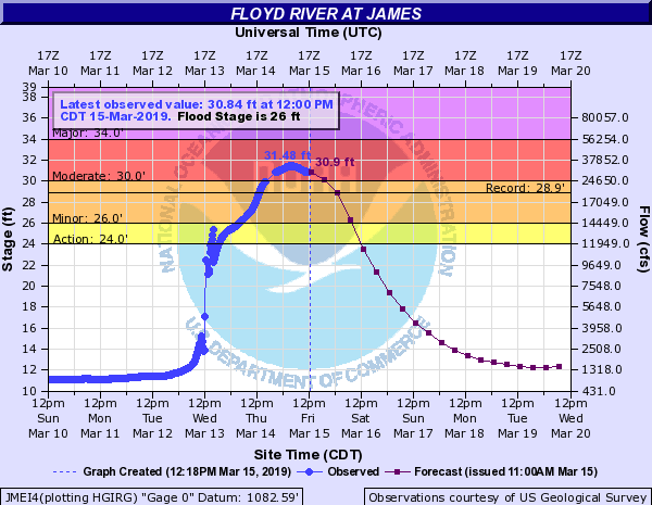
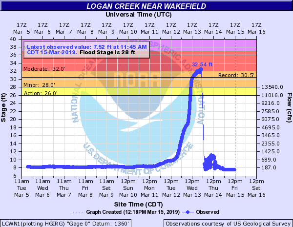
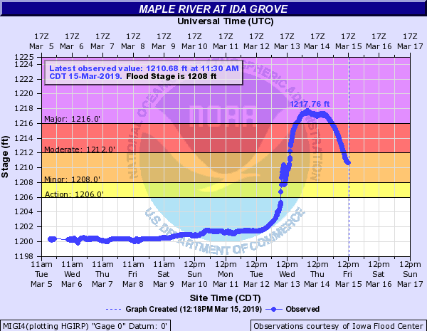
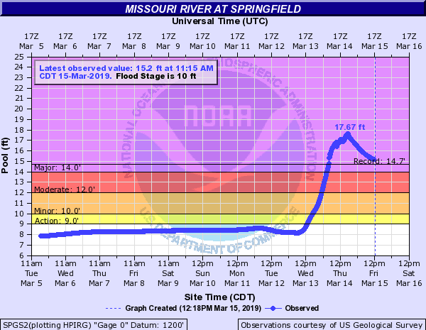
Heavy rainfall and rapid snow melt led to new preliminary record crests on several rivers across the region.
.PNG) |
 |
| Local River Records | Peak River Forecast Stage |
 |
|
Hydrographs
 |
 |
 |
 |
| Big Sioux Near Brandon | Little Sioux at Cherokee | West Fork Ditch at Hornick | Skunk Creek near Hartfod |
 |
 |
 |
 |
| Floyd River at James | Logan Creek Near Wakefield | Maple River at Ida Grove | Ocheyedan River at Everly |
 |
 |
 |
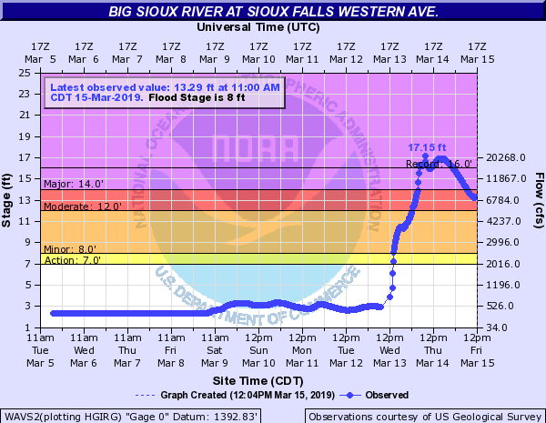 |
| Skunk Creek at Sioux Falls | Missouri River at Springfield | Vermillion River at Parker | Big Sioux at Western |
 |
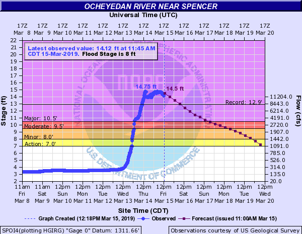 |
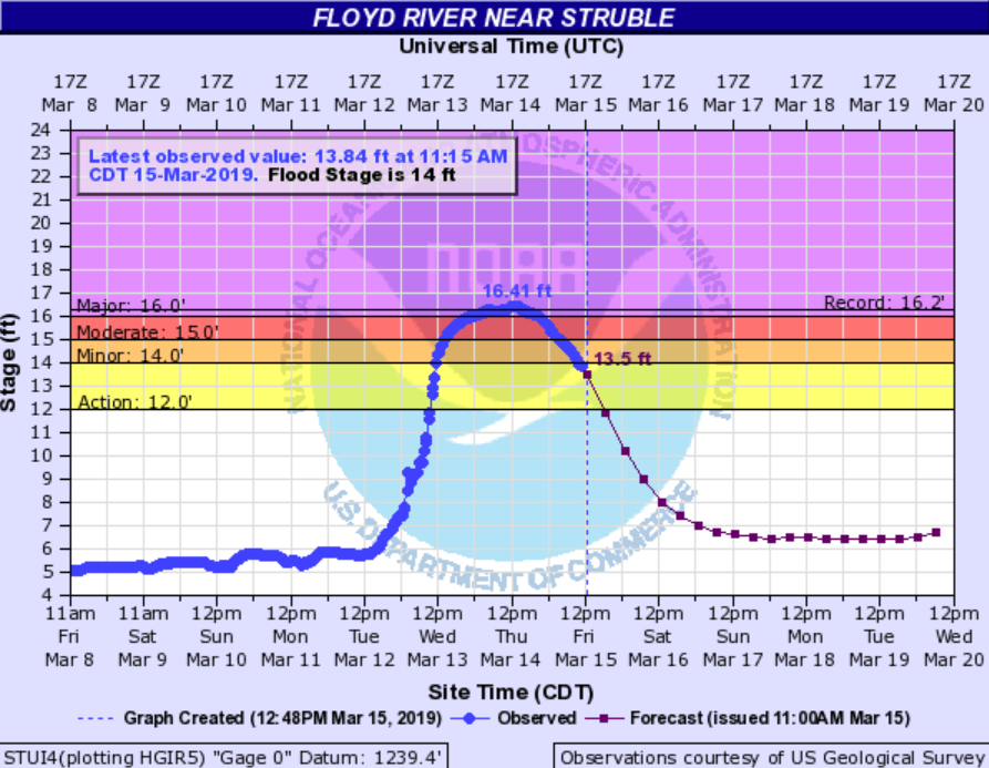 |
|
| Willow Creek Near Crooks | Ocheyedan River at Spencer | Floyd River Near Struble |
Photos & Video
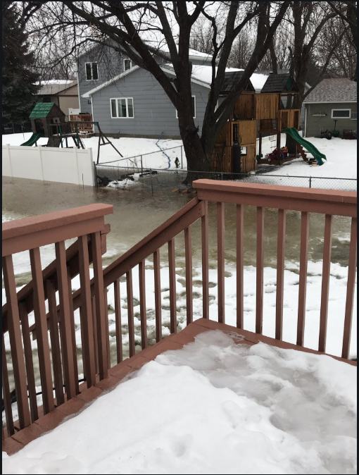 |
 |
 |
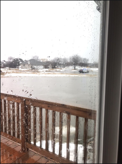 |
| 61st and Marion in Sioux Falls | Downtown Sioux Falls (Sheila Anderson) |
Yankton (Drew Lawrence) |
|
 |
 |
 |
 |
| Hawarden, IA (Andy Minihan) |
Hawarden, IA (Andy Minihan) |
Perry Creek |
Tyndall, SD |
 |
 |
 |
 |
| Yankton, SD (WNAX) |
Downtown Sioux Falls (Sheila Anderson) |
Falls Park Panorama (Matthew Dux) |
Falls Park, in Sioux Falls (Matthew Dux) |
Radar
| Regional Radar Loop |
Rain Reports
Widespread heavy rains moved across the region, producing 1 to 3 inches of rain in many locations. Here's an overview of rainfall totals from this storm system.
 |
 |
 |
| 2 Day Precipitation Totals |
72 Hour Precipitation Totals |
Record Rainfall Amounts |
|
 |
Media use of NWS Web News Stories is encouraged! Please acknowledge the NWS as the source of any news information accessed from this site. |
 |