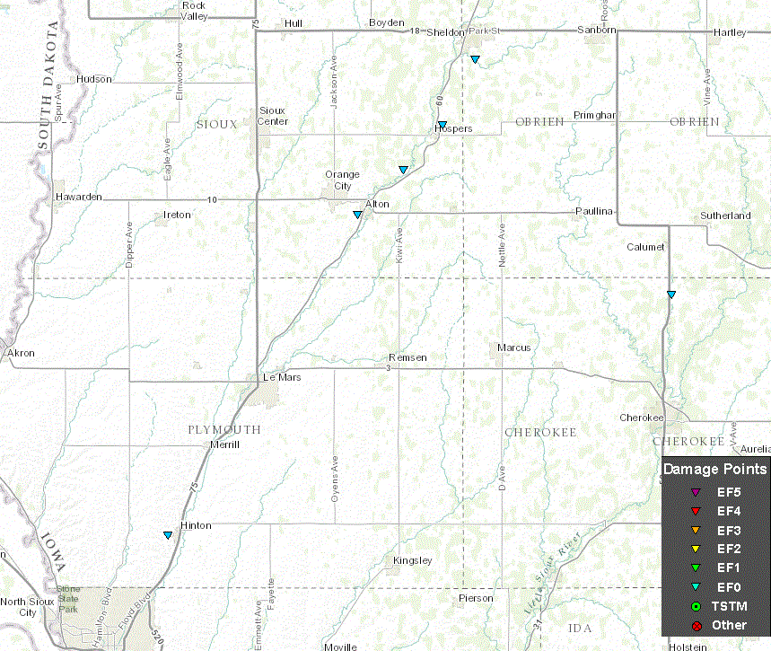
On the evening of Friday, October 23rd, 2015, a series of low topped super cells formed along a cold front in northwest Iowa. These storms produced numerous funnel clouds as well as 6 confirmed tornadoes between 4 pm and 7 pm. The tornadoes moved through largely rural areas and produced minimal damage. No deaths or injuries were reported.
All tornadoes were rated EF-0 on the Enhanced Fujita (EF) tornado damage rating scale. An EF-0 tornado has damage indicative of wind speeds of 65 to 86 mph.
See the image below depicting where all of the tornadoes touched down.
The occurrence of tornadoes is highly unusual for the month of October. Even more unusual was the fact that this year saw 6 tornados in northwest Iowa in October, while zero tornadoes occurred in our peak tornadic month of June. Here is a graph showing which months saw the greatest number of tornado warnings since 1986.

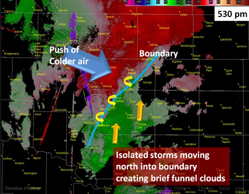
Below is a graphical representation of where the frontal boundary was located at 5:30 pm. Storms forming along this boundary developed enhanced rotation. The atmosphere was particularly moist ahead of the frontal boundary and clashed with the cooler and drier air behind the front. While these storms were unusually low topped, there was enough rotation along the front to create funnel clouds and tornadoes.
The first supercell thunderstorm formed southeast of Hinton, Iowa, with a brief tornado touchdown just outside of Hinton around 4:10 pm. Several large hardwood tree branches were damaged.

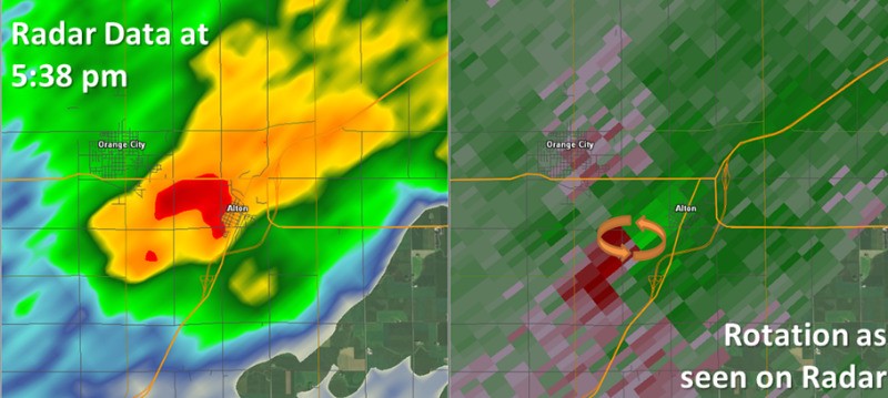
A second supercell thunderstorm formed after 5 pm and moved northeast along the Highway 60 corridor. This storm produced 3 brief tornadoes over the course of a half hour. The first of these tornadoes briefly touched down over farmland just outside of Alton, Iowa around 5:38 pm. No significant damage was reported.
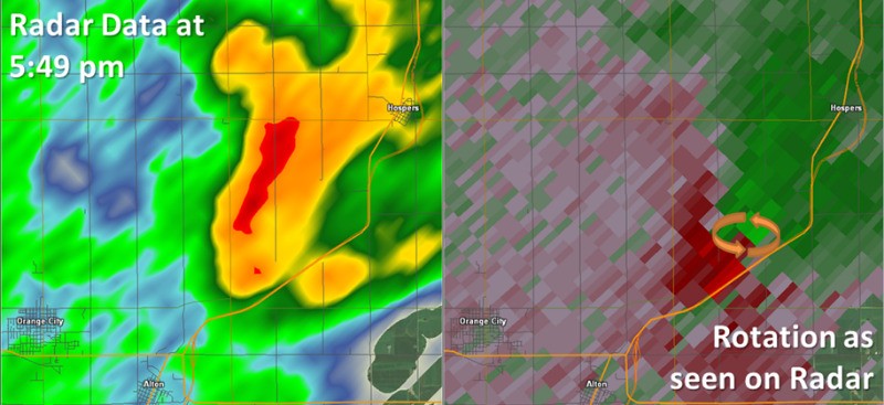
The second tornado quickly followed at 5:49 pm. The brief touchdown occurred northeast of Alton and Orange City, Iowa, around 4 miles southwest of Hospers, Iowa. Again, no reports of significant damage were received.
At 6:01 pm, a tornado was reported on the ground for 4 minutes, just outside of Hospers, Iowa. Some minor damage to cropland was reported.

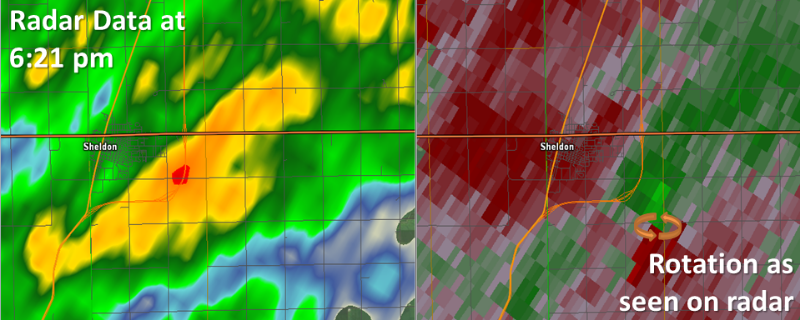
A new supercell thunderstorm developed along the front after 6 pm and quickly became tornadic. At 6:21 pm, it produced a tornado around 2 miles southeast of Sheldon, Iowa, which was on the ground for 3 minutes. Minor damage to fields was reported.
The sixth tornado of the day formed in a supercell located in the warm and moist air mass well ahead of the front. This storm tracked northeast towards Larrabee, Iowa and dropped a brief tornado 2 miles north of Larrabee at 6:39 pm. As seen in the radar images below, the radar reflectivity was very weak at the time of the tornado, however it managed to damage the roof of a home before lifting again.


 Weather Story
 Weather Map
 Local Radar