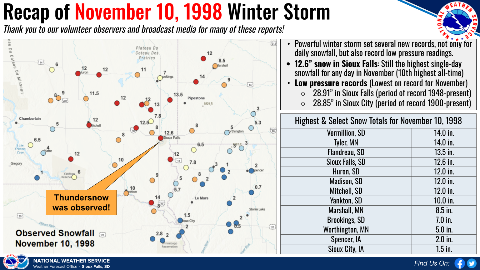
On November 10, 1998, we saw a powerful winter storm move across the Upper Midwest. Records for daily snowfall & lowest pressure for the month of November were set in Sioux Falls & Sioux City (among many other locations), and some of those records still stand 25 years later!
Below is a map of snowfall amounts for November 10, 1998, along with a listing of select totals. A broad swath of 8-12 inches blanketed southwest South Dakota and parts of southwest Minnesota, with isolated amounts up to 14 inches (Vermillion, SD and Tyler, MN). A record-setting 12.6 inches was reported in Sioux Falls. Low pressure records for the month of November were also set in Sioux Falls (28.91") and Sioux City (28.85") with this storm.
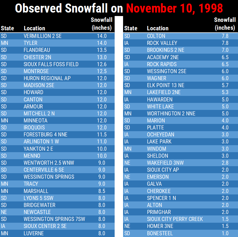
Below is a more complete listing of snowfall reports for the powerful winter storm which impacted the region on November 10, 1998. Totals ranged from 8 to 14 inches across much of southeast SD and parts of southwest MN. Lesser amounts of 2 to 5 inches were more common across in much of northwest IA.


 Weather Story
 Weather Map
 Local Radar
 Follow us on YouTube