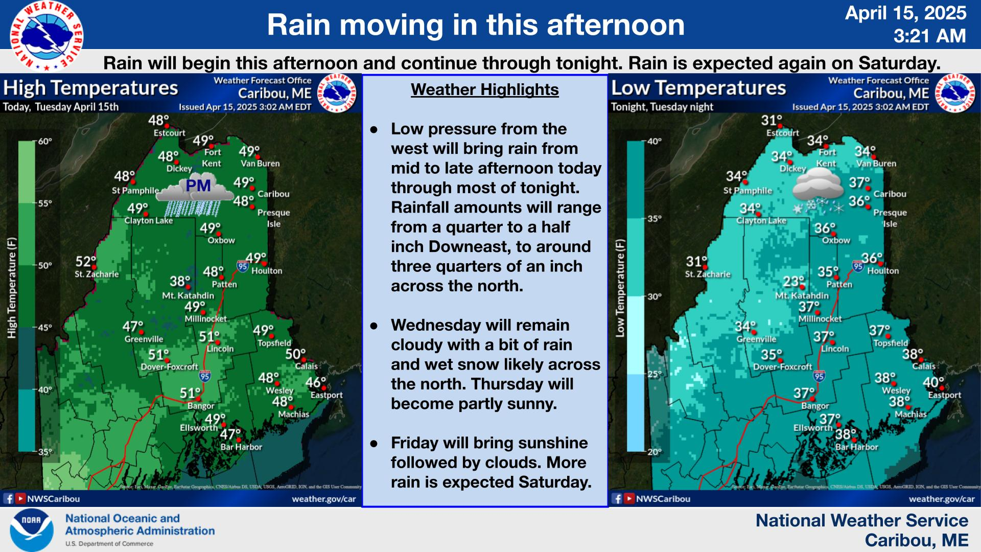
Increasing clouds today with high temperatures in the 50s north and highs in the 60s south. Showers develop tonight and end by daybreak Friday. High temperatures Friday similar to today. This weekend will be a washout with widespread rainfall. Heaviest soaking rain Saturday into early Sunday AM. Widespread rain showers on Sunday.
***Maine Severe Weather Preparedness Week...Flash Flooding***
In addition to lightning, high winds, hail, and tornadoes, summertime thunderstorms can also cause flash flooding. Most flash floods are caused by heavy, slow-moving thunderstorms which produce excessive rainfall over a small area in just a short period of time. Other factors such as topography, soil conditions, and ground cover help determine how much of the rainfall soaks into the ground and how much of the rainfall will run off into streams and rivers.
Nationwide, floods and flash floods are the greatest storm-related killer, claiming the lives of about 85 people every year. Similar to the rest of the nation, floods and flash floods are the number one storm-related killer in New England. In addition, floods and flash floods are responsible for a considerable amount of public and private property damage.
To alert the public to the threat of flooding, the National Weather Service issues FLOOD WATCHES and WARNINGS. A FLOOD WATCH indicates flooding/flash flooding is possible, and is usually issued in anticipation of heavy rainfall. A FLOOD/FLASH FLOOD WARNING indicates that flooding is imminent or is already occurring. If you hear that a FLOOD/FLASH FLOOD WARNING has been issued for your area, move immediately to higher ground if flood waters threaten.
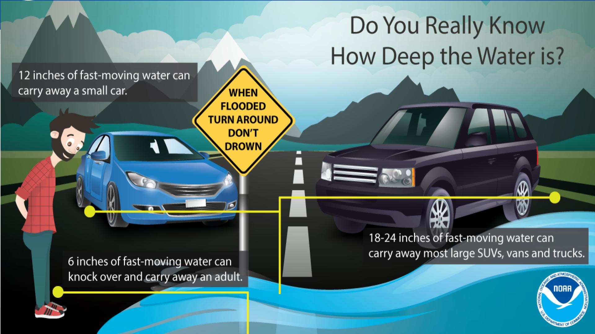
Watch out for water of an unknown depth! It only takes 6 inches of flowing water to knock over a person, and 18 inches to carry away most vehicles. If you can’t see the road, Turn Around Don’t Drown! https://www.weather.gov/safety/flood
This general weather briefing slide is updated daily in the early AM hours before 7am (slide update time at bottom right of slide). It may not be updated as conditions change.For high-impact events, more detailed information will be provided via traditional decision support services.
This is the home page for emergency managers to do a self briefing. For information on a particular hazard, just click on the appropriate orange link above.


 Coastal Flood