
Lake effect snow will continue downwind of the Lower Great Lakes through Wednesday, with accumulations of 4 to 8 inches possible for portions of Upstate New York and the Adirondacks. Gusty winds and dry conditions will result in critical fire weather conditions in the Southwest and Southern Plains Wednesday through Friday. Red Flag Warnings have been issued. Read More >
For Moderate/High/Extreme hazard risk, more detailed information will be provided via emailed briefings to core partners.
 |
2 Day Total Snow ForecastShows forecasted snowfall accumulations for the first two days of the forecast. |
|
Probablistic Snow GuidanceProbabilistic snow forecasts. Good for discerning uncertainty. |
 |
24 Hour Total Precipitation ForecastShows forecasted precipitation for the first day of the forecast. |
|
2.5 Day Total Precipitation ForecastShows forecasted precipitation for the first 2.5 days of the forecast. |
 |
Minimum Temperature Day 1Shows forecasted minimum temperature for the first day of the forecast. |
 |
Minimum Temperature Day 2Shows forecasted minimum temperature for the second day of the forecast. |
|
|
3-Day Minimum Wind Chill TemperatureShows forecasted minimum wind chill temperatures for the first three days of the forecast.
|
|
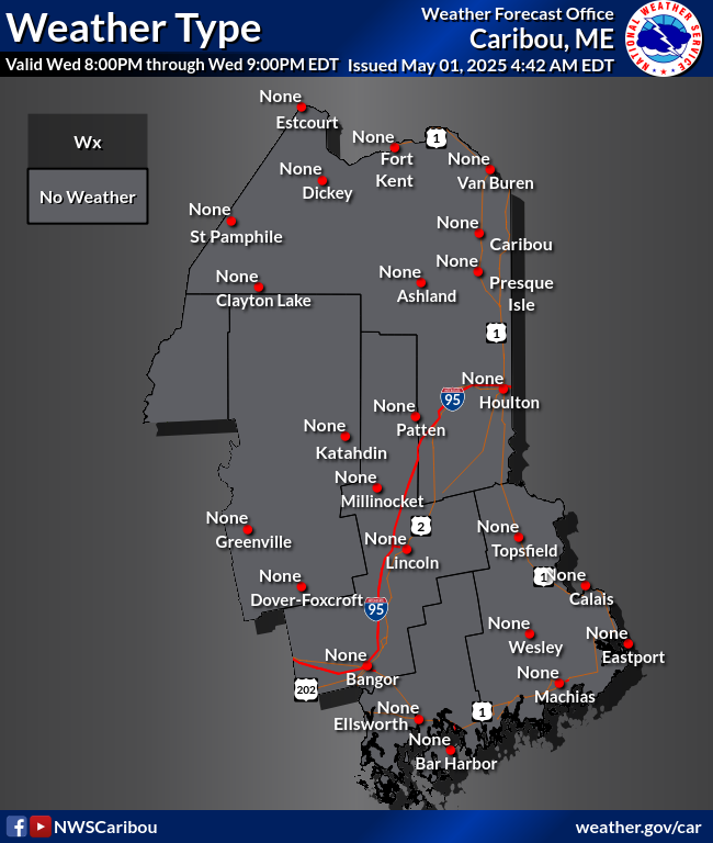
Weather Type GraphicsDisplays areas where mixed precipitation types are expected during winter weather events. |
|
|
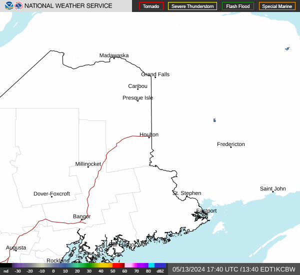
RadarWSR-88D Doppler Radar |
 |
Hourly Weather GraphShows hourly forecast information for any location in Maine. |
 |
Latest Post-Storm Snowfall GraphicsShows snowfall from the latest snowfall events across Maine. |
|
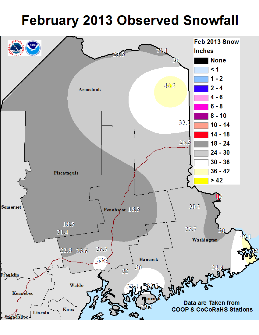
Monthly and Seasonal Snowfall MapsShows monthly and seasonal snowfall totals and departure from average.
|
|
|
Snow Analyses
|
|
Radial/Line Ice Forecast GraphicThis graphic shows the expected radial or line ice forecast. Radial or line ice is the amount of ice that accumulates on a branch or powerline. If 1" accumulates on the top of a branch and 1/2" accumulates on the bottom, averaging the two gives 3/4" radial/line ice. This amount is the elevated flat surface ice accumulation multiplied by 0.394. NWS's traditional ice accumulation forecast is elevated flat surface, not the radial/line ice you see here. For more info, click here. |


 Coastal Flood