Severe thunderstorms are forecast through this weekend along a slow moving cold front and secondary storm system that will impact areas from the southern Plains to the Great Lakes. Large hail and isolated damaging wind gusts are the main threats with these storms along with a risk for heavy to excessive rainfall which could bring flooding. Read More >
![]() |
Forecasts | ![]() |
![]() |
Observations | ![]() |
![]() |
Warnings & Advisories | ![]() |
![]() |
Forecast Guidance | ![]() |
![]() |
Education & References |
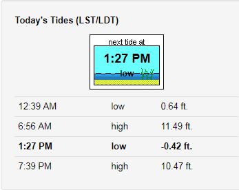
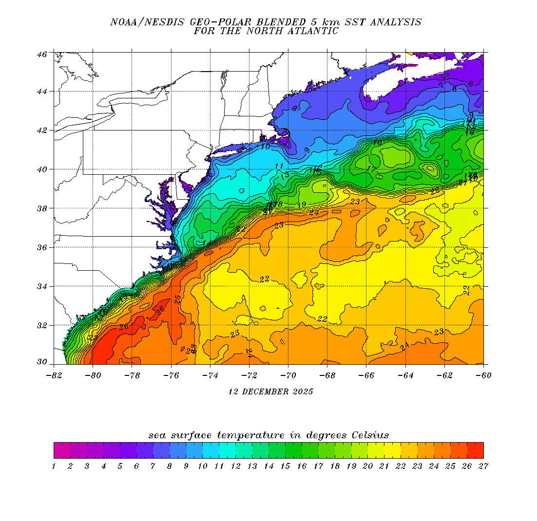
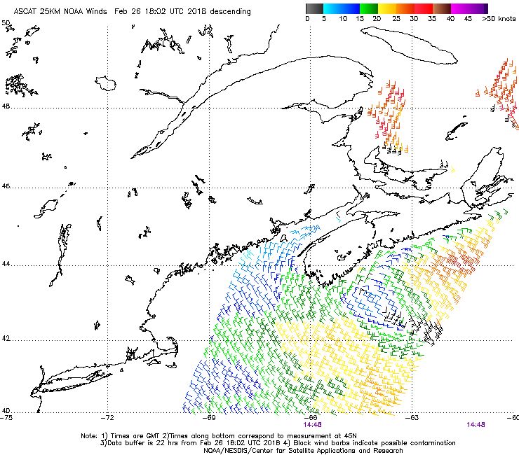
Buoy Data Tides Sea Surface Temps Wind Analysis |
Buoy Data | Tide Data |
Winds/Waves Analysis & Lightning Data | Sea Surface Temperatures |
|