Under the right atmospheric conditions, thunderstorms can be accompanied by strong downward rushing air that, if strong enough, can cause substantial damage when they reach the earth's surface. In these situations, air within the thunderstorm is rapidly cooled by evaporating raindrops. Since cold air is more dense than warm air, this rain-cooled air begins to descend toward the ground. If the winds in the middle and upper levels of the thunderstorm are strong, some of that momentum is also transported downward. As this air moves down, it can continue to accelerate toward the ground as more rain falls into it. As this cold downward moving bubble of air reaches the ground, it moves out in all directions much like a glass of water that is spilled on pavement. However, thunderstorms are rarely stationary. Therefore, the downward rushing air tends to surge outward fastest in the direction the storm is moving -- often at much faster speeds than the storm motion. This was the case on the evening of August 9, 2000, when a thunderstorm with a downburst moved across southern Tompkins, northern Tioga, and northern Broome counties.
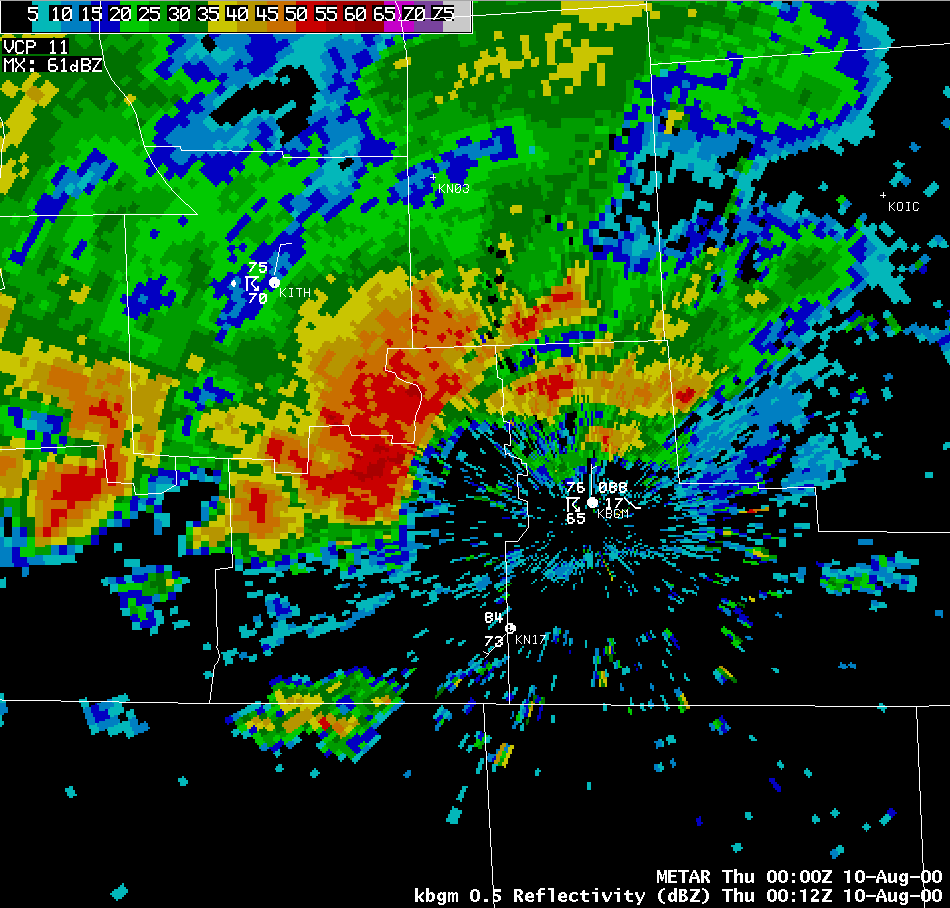
Below is a reflectivity image from the Binghamton WSR-88D Doppler radar from 8:12 pm on August 9, 2000. Notice the strong thunderstorm moving across southeastern Tompkins and northern Tioga counties. (Click on all images for a larger version.)
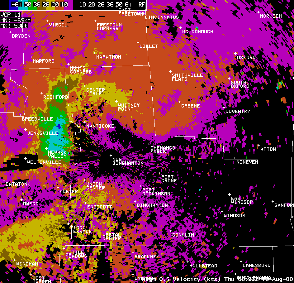
Here are reflectivity and Doppler velocity images from 8:22 pm. The Doppler velocity image depicts winds blowing toward or away from the radar (located at the NWS Binghamton label). In this image, only winds toward the radar are being shown. The light blue are winds toward the radar (from the west-northwest) of 50 to 64 knots (58 to 74 mph), while the dark blue are winds greater than 64 knots ( > 74 mph). Note, the radar points at an angle of 0.5 degrees above the horizon, so it is measuring the winds quite a bit above the ground. Over this area of northeast Tioga county, the radar beam is looking at an altitude of 2200 to 2500 feet above seal level (typically about 1000 to 1500 feet above the ground). Notice how the eastern edge of the strong winds at this time are at, and even a little ahead of the edge of the heavy rain. Numerous trees and wires were blown down across Speedsville, Berkshire, and Newark Valley between 8:00 and 8:20 pm.
 |
 |
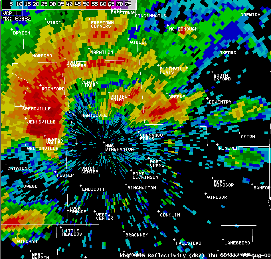
This next image is a reflectivity image from 8:27 pm. The storm has now moved into northwestern Broome county. Notice how the storm appears to be surging forward with a characteristic arc, or bow shape typical of storms producing strong and potentially damaging winds. In addition to the strong winds, ping-pong to golf ball size hail is being reported in Newark Valley, Nanticoke, and Maine between 8:25 and 8:45 pm.

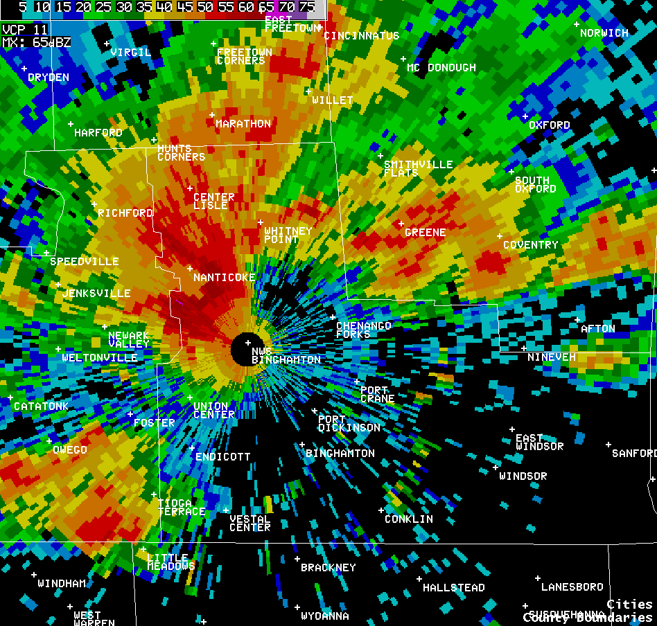
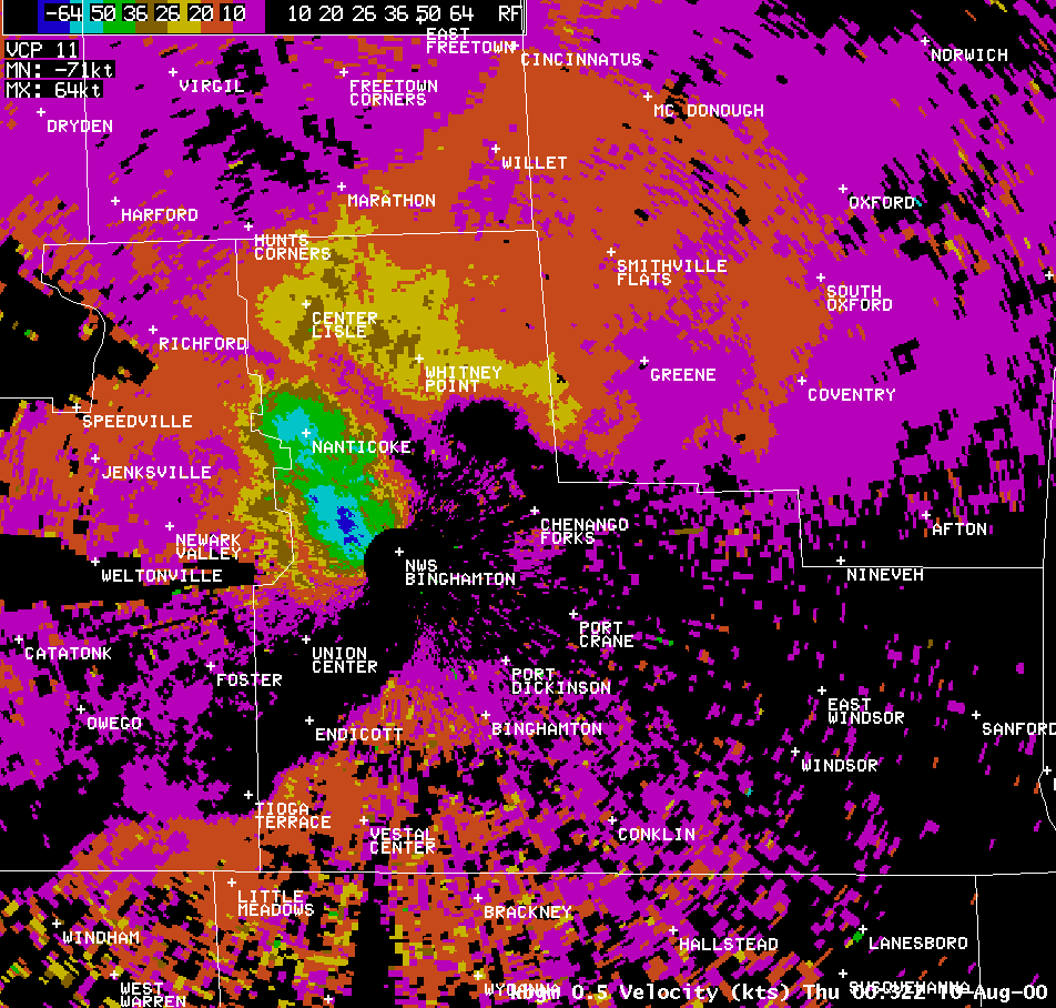
Here are the reflectivity and velocity images at 8:32 pm, only 5 minutes later. Notice how the storm has continued to surge forward, and the strong winds continue to move out ahead of the strongest part of the storm (strongest from the heavy rainfall/hail perspective presented in the reflectivity image). Winds gusted to 55 knots (63 mph) at the Binghamton Regional Airport at 8:37 pm.
 |
 |

