
Thunderstorms, some severe, may produce heavy to excessive rainfall over portions of the Central/Southern Plains, Mississippi Valley and Southeast. Dry and windy conditions will pose an elevated fire weather risk over parts of western Florida. Read More >
| Snow Amount Potential
Experimental - Leave feedback
|
|
| Expected Snowfall - Official NWS Forecast
What's this? |
High End Amount 1 in 10 Chance (10%) of Higher Snowfall What's this? |
| Low End Amount 9 in 10 Chance (90%) of Higher Snowfall What's this? |
|
| Percent Chance That Snow Amounts Will Be Greater Than...
Experimental - Leave feedback
What's this?
|
||||||||||||||||
|
||||||||||||||||
| Snowfall Totals by Location
Experimental - Leave feedback
What's this?
|
|
|
| Snow Amount Potential
Experimental - Leave feedback
|
|
| Expected Snowfall - Official NWS Forecast
What's this? |
High End Amount 1 in 10 Chance (10%) of Higher Snowfall What's this? |
| Low End Amount 9 in 10 Chance (90%) of Higher Snowfall What's this? |
|
| Percent Chance That Snow Amounts Will Be Greater Than...
Experimental - Leave feedback
What's this?
|
||||||||||||||||
|
||||||||||||||||
| Ice Accumulation Potential |
|
Expected Ice Accumulation - Official NWS Forecast This is the elevated flat surface ice accumulation. It is not radial/line ice. Radial/line ice is typically 39% of the elevated flat surface ice. For more information on this, see this module. |
|---|
 What's this? |
| Ice Accumulation Potential
|
|
Expected Ice Accumulation - Official NWS Forecast This is the elevated flat surface ice accumulation. It is not radial/line ice. Radial/line ice is typically 39% of the elevated flat surface ice. For more information on this, see this module. |
|---|
 What's this? |
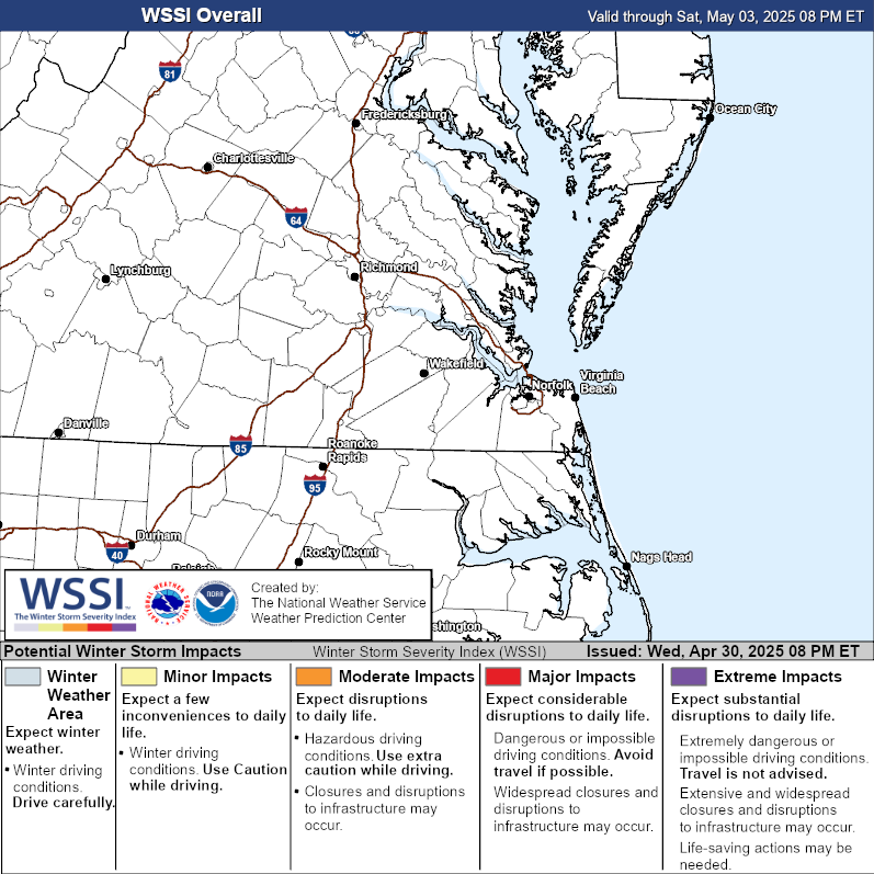
| Winter Storm Severity Index (WSSI) | Winter Storm Outlook (WSO) |
|---|---|
 |
 |
| National Snow Reports | National Snowfall Analysis |
|---|---|
 |
 |
| Local Snow Reports | |
 |
|
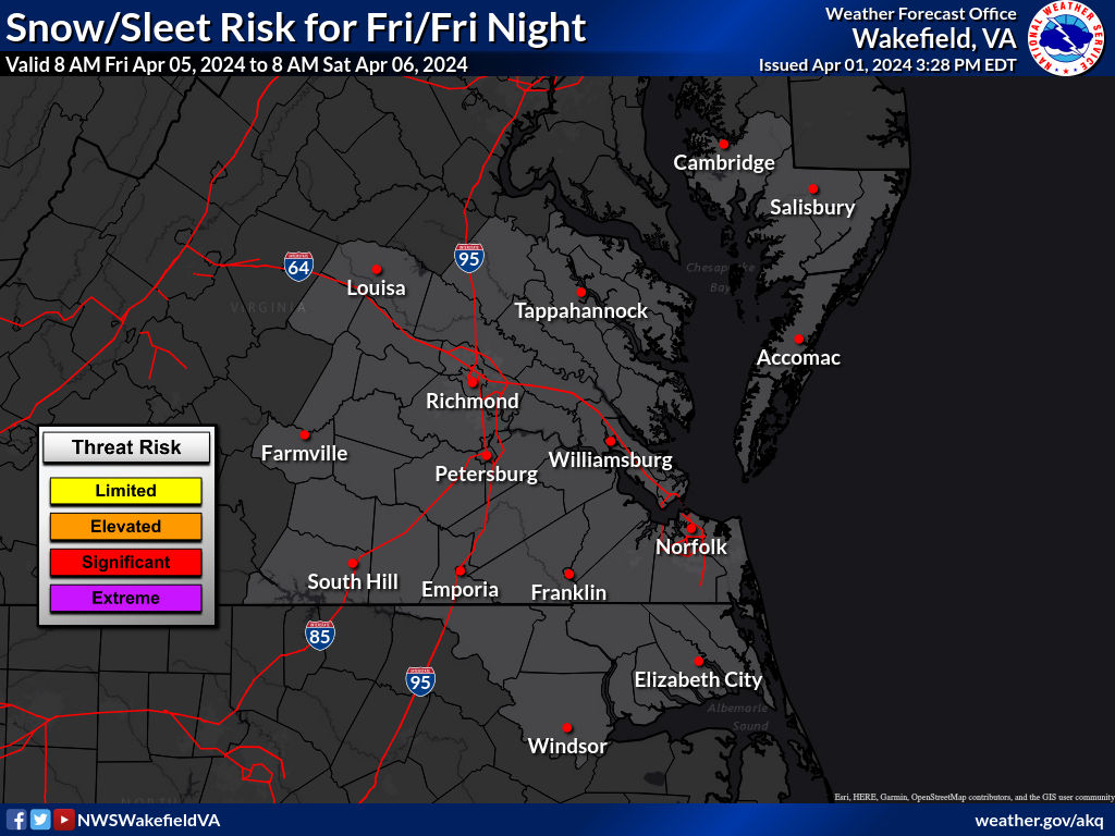
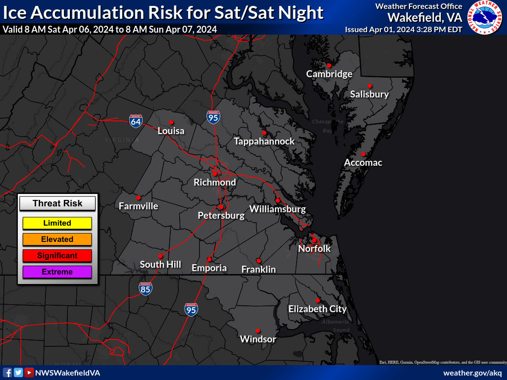
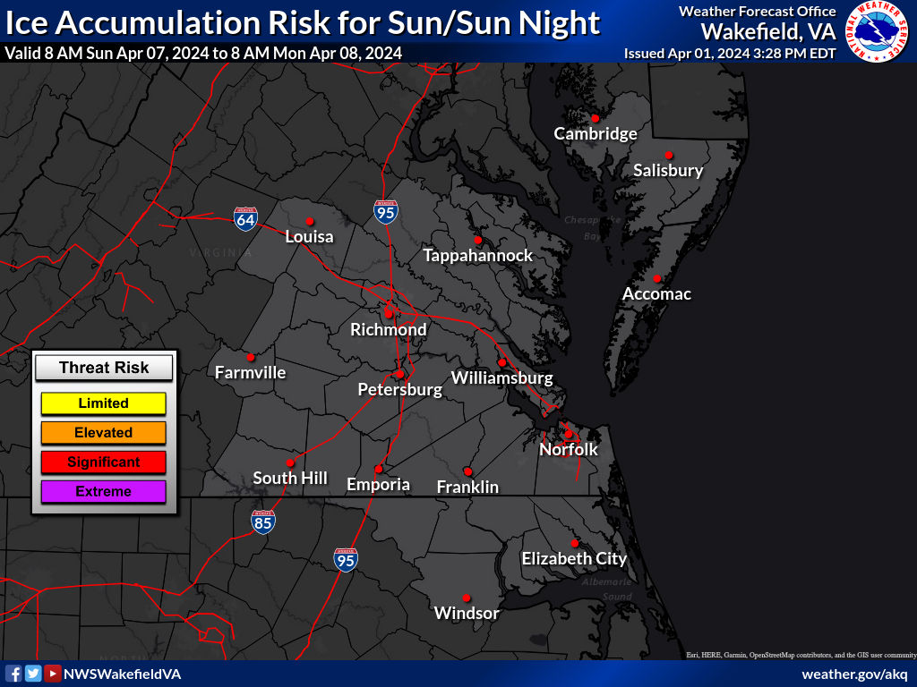
| Snow and Ice Threat: 3-7 Days From Now |
|
Hover over (or click) Days 3-7 thumbnails to see full-size maps showing Snow or Ice Threats. |
| Day 3 | Day 4 | Day 5 | Day 6 | Day 7 | ||
|---|---|---|---|---|---|---|
| Snow |  |
 |
 |
 |
 |
|
| Ice |  |
 |
 |
 |
 |
|
|
||||||
| High | High threat of high impact winter storm. Potential impacts include significant travel delays, closures, and threats to life and property. Plan ahead to minimize impact on you and your family. |
|---|---|
| Moderate | Moderate winter storm threat. Potential impacts include significant travel delays and closures. Plan ahead to minimize impact on you and your family. |
| Enhanced | Enhanced winter storm threat. Primary threat is disruption to travel. |
| Slight | Slight winter storm threat. If threat materializes, may cause travel disruptions. |
| None | No significant winter storm threat is currently expected. However, light wintry precipitation may still be possible. |
| Days 4-7 Winter Weather Outlook | |
| Day 4 Winter Weather Outlook | Day 5 Winter Weather Outlook |
 |
 |
| Day 6 Winter Weather Outlook | Day 7 Winter Weather Outlook |
 |
 |
|
|
|
| CPC Week-2 Experimental Heavy Snow Risk | |
 |
|
| CPC Temperature & Precipitation Maps | |
|
Days 6-10 |
|
| Temperature | Precipitation |
 |
 |
|
Days 8-14 |
|
| TEMPERATURE | PRECIPITATION |
 |
 |
|
Week 3-4 |
|
|
TEMPERATURE |
PRECIPITATION |
 |
 |


 Coastal Flood
 Heat
Heat