
Scattered damaging winds and a couple tornadoes are possible on Saturday from parts of Ohio into northern West Virginia/Maryland, central and western Pennsylvania, and western New York. The thunderstorm threat will move into the Northeast on Sunday. Prolonged heat will continue across the Southern Plains this weekend and into next week. Read More >
Overview
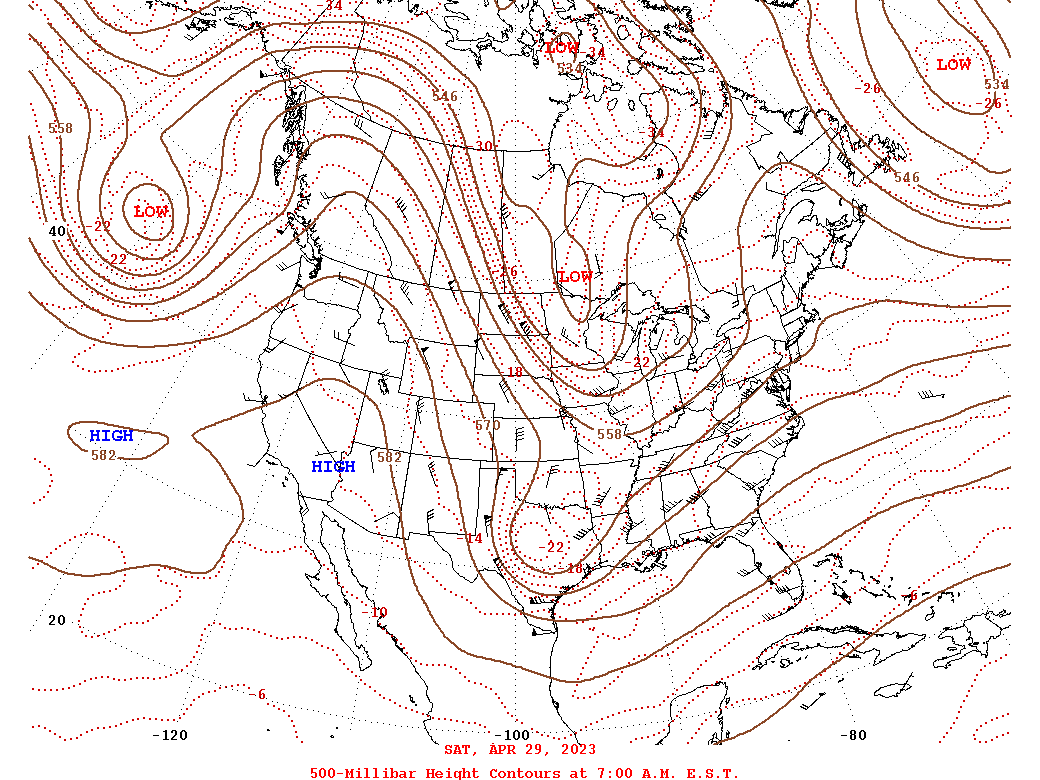
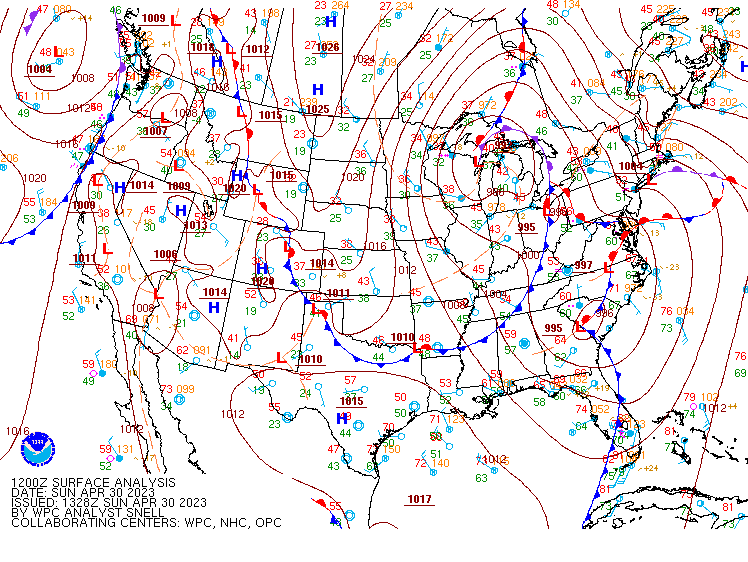
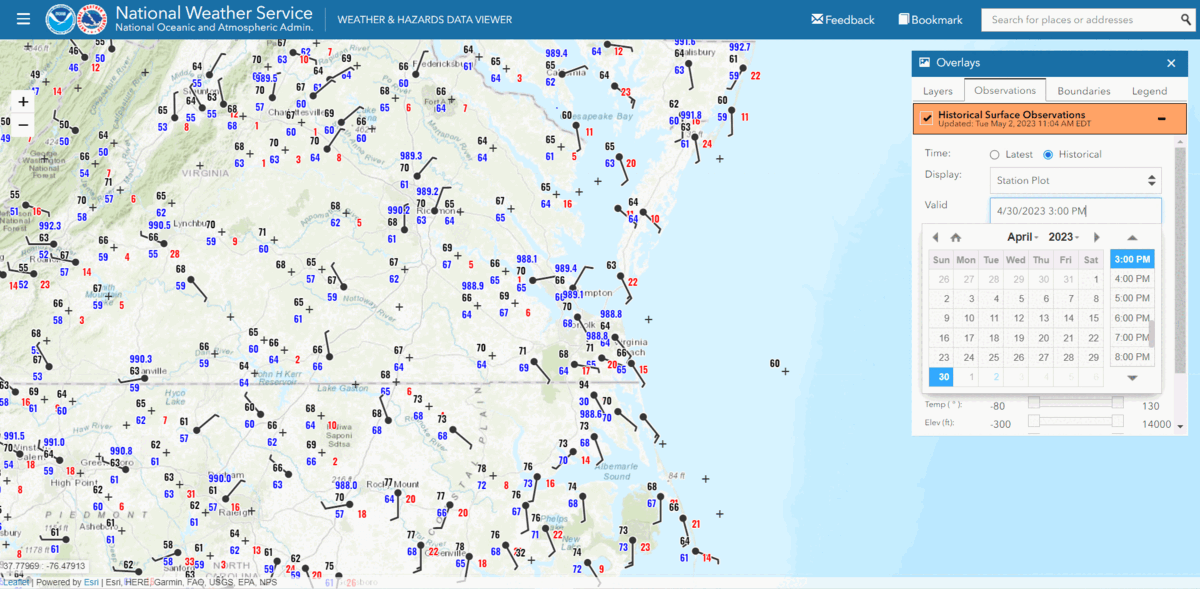
During the morning of April 30, low pressure was strengthening over South Carolina. Meanwhile, a potent, negatively tilted southern stream shortwave trough was lifting northeast over Georgia. Showers and a few thunderstorms were ongoing across the forecast area, with a quasi-stationary frontal boundary positioned from east-central NC to eastern VA. The morning convection was elevated and thus did not pose a severe threat. By early afternoon, another round of convection had overspread eastern VA and NE NC and the surface low deepened to ~988-990mb as it tracked across east-central NC during the early-mid afternoon. The atmosphere did not have time to recover from the morning storms and there was still not much in the way of instability across the area. The aforementioned boundary remained in place, and temperatures were stuck in the mid to upper 60s in central/northern/western portions of the Wakefield forecast area. This second round of convection did not produce severe weather. However, the main low pressure system at the surface and aloft was still to our southwest, and there was a zone of mid-level dry air and partly sunny skies immediately behind the convection (which exited SE VA/NE NC by 2-2:30 pm).
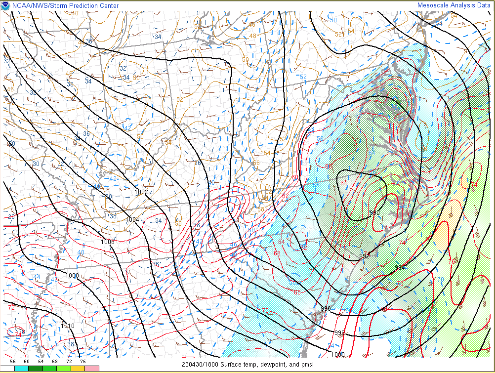
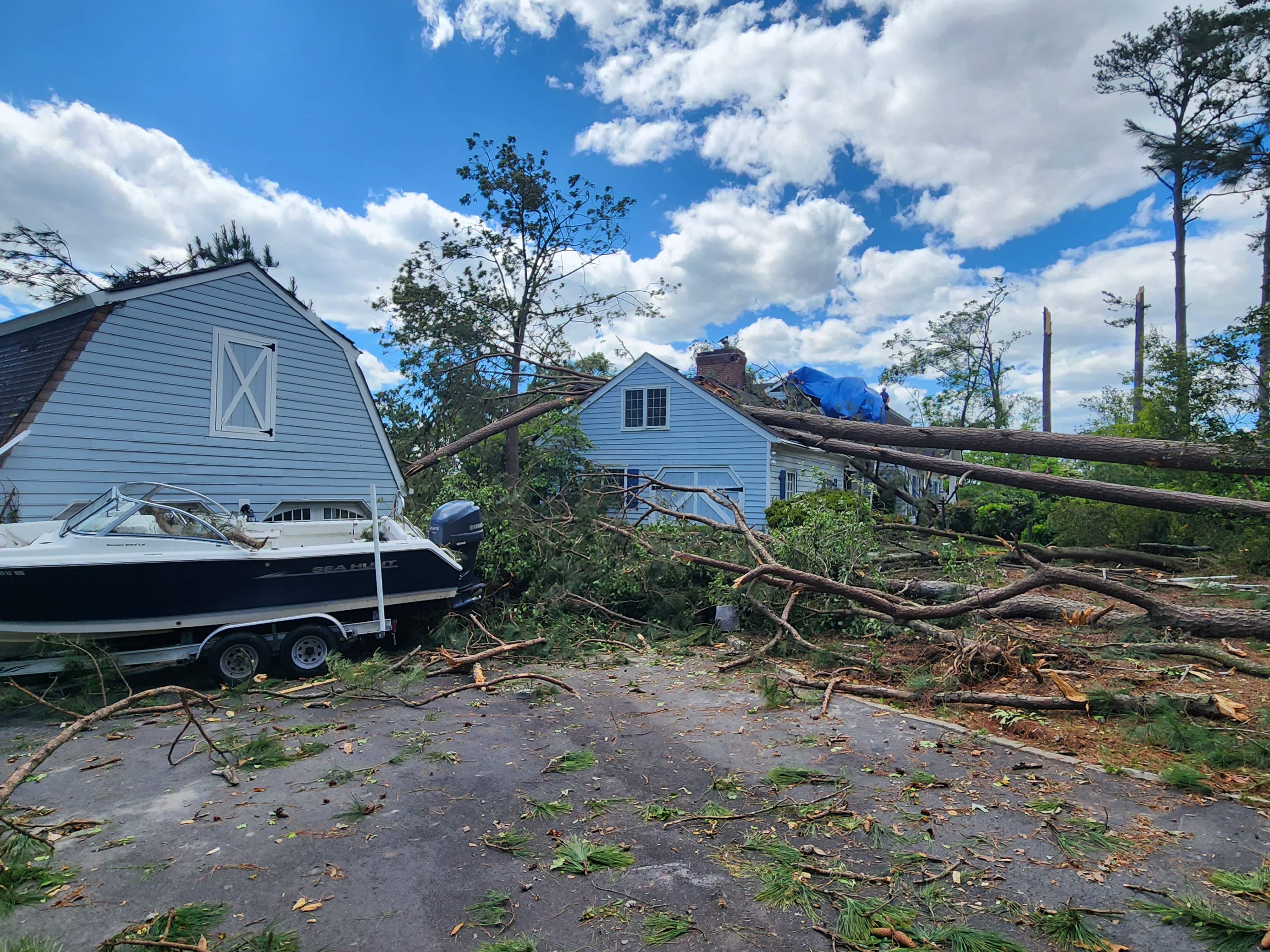
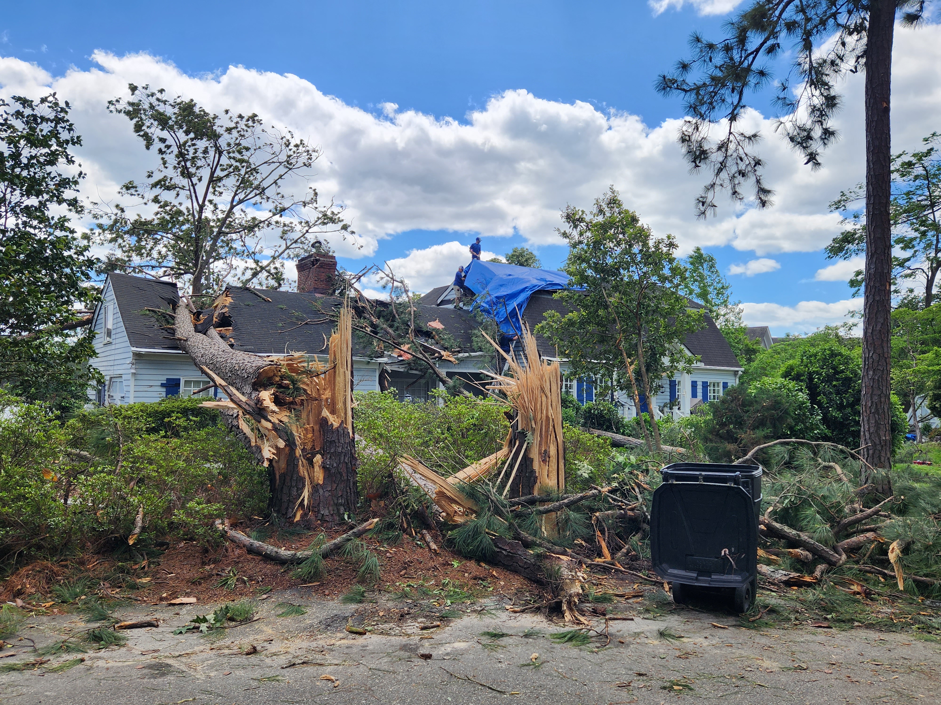
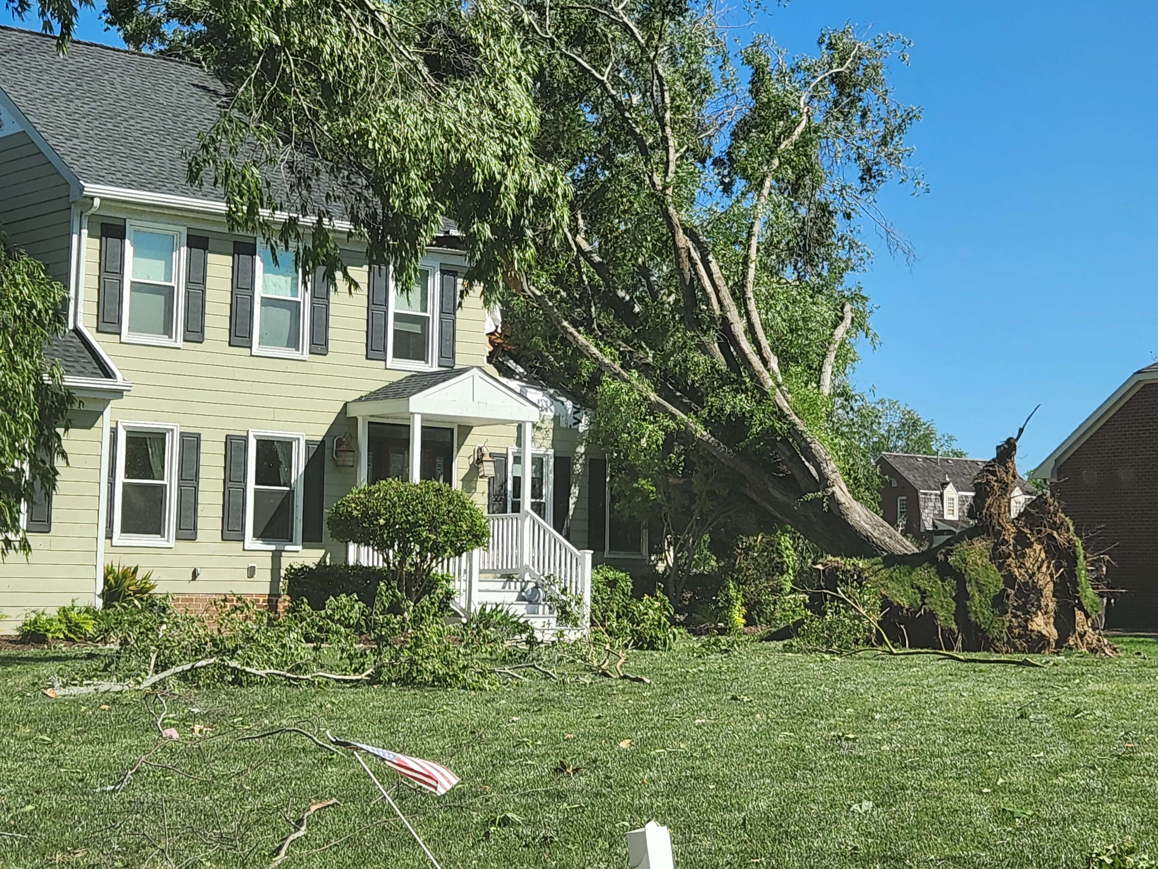
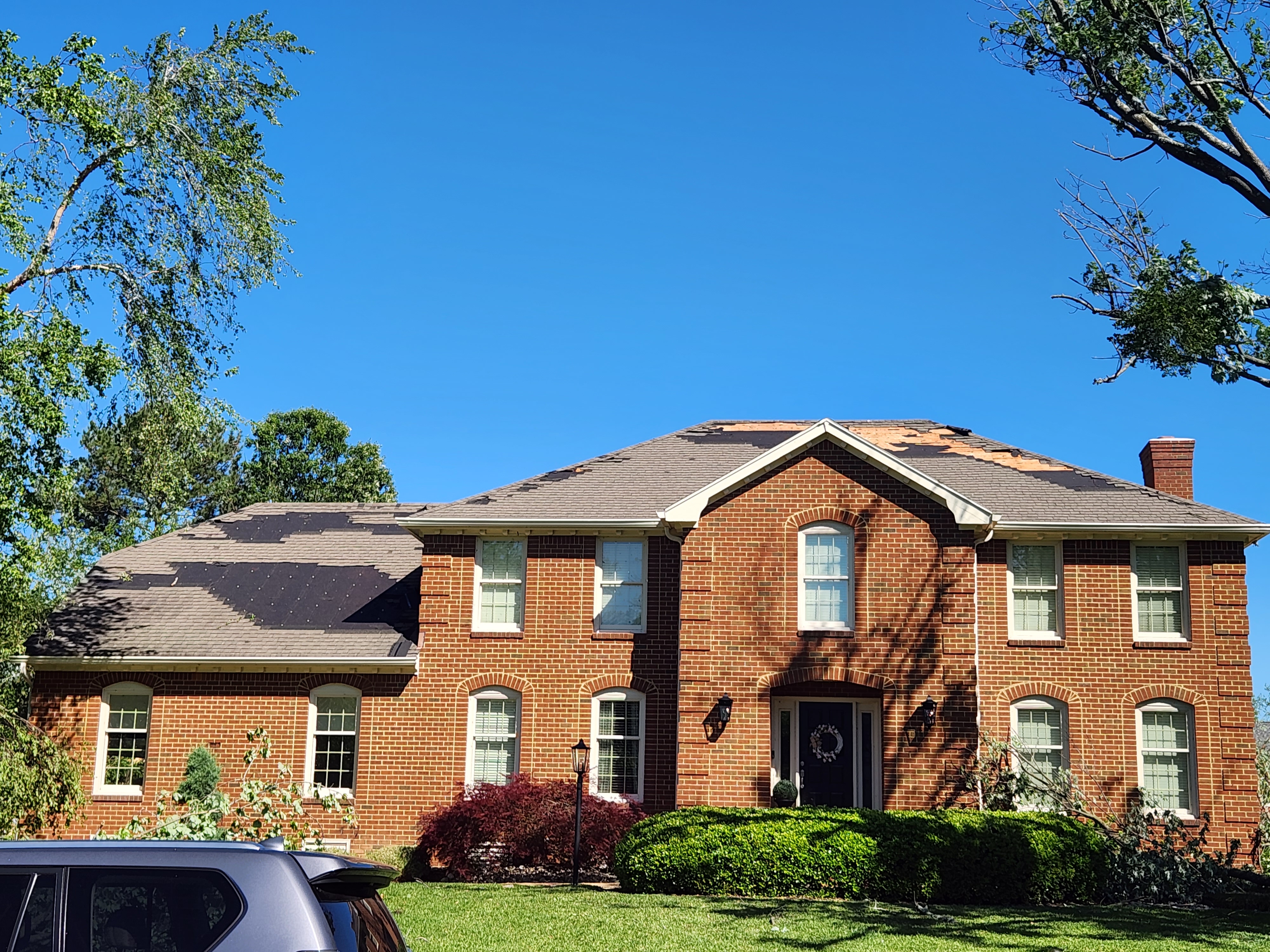
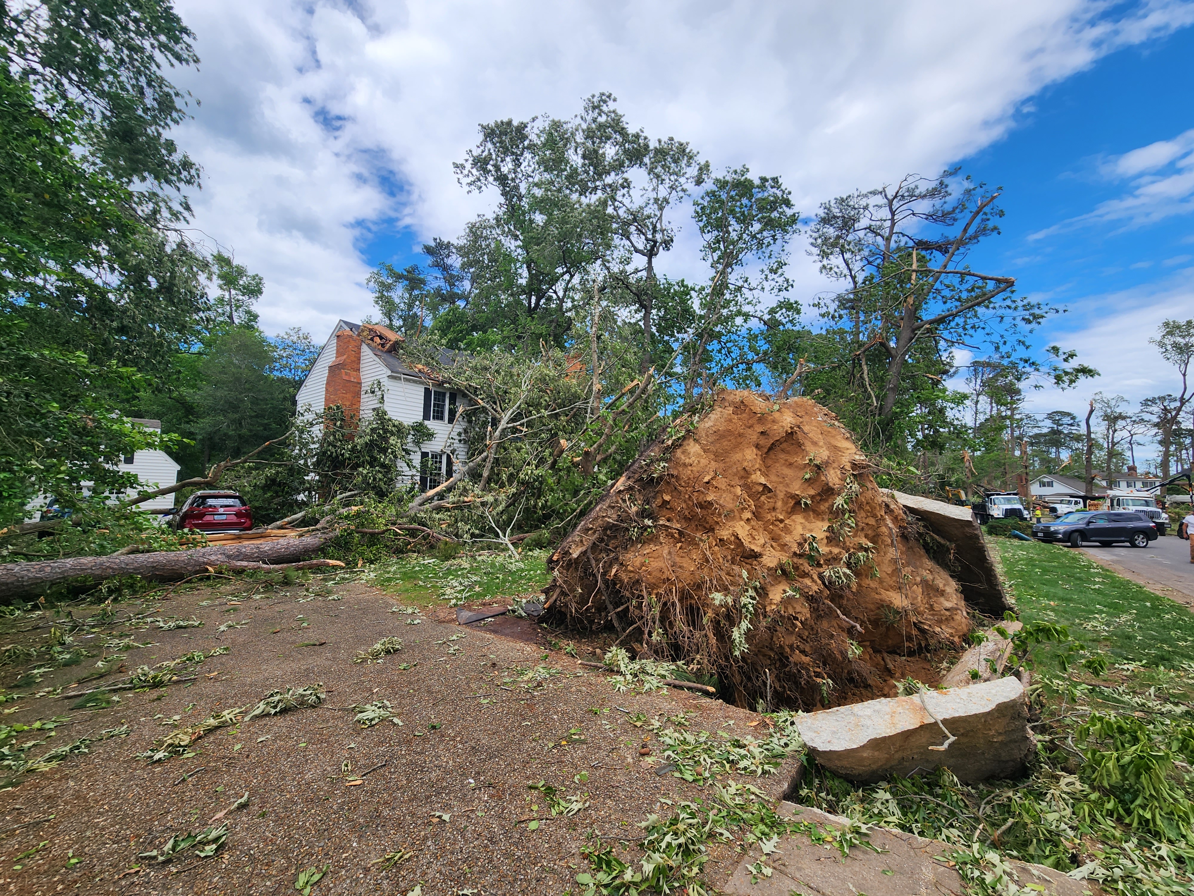
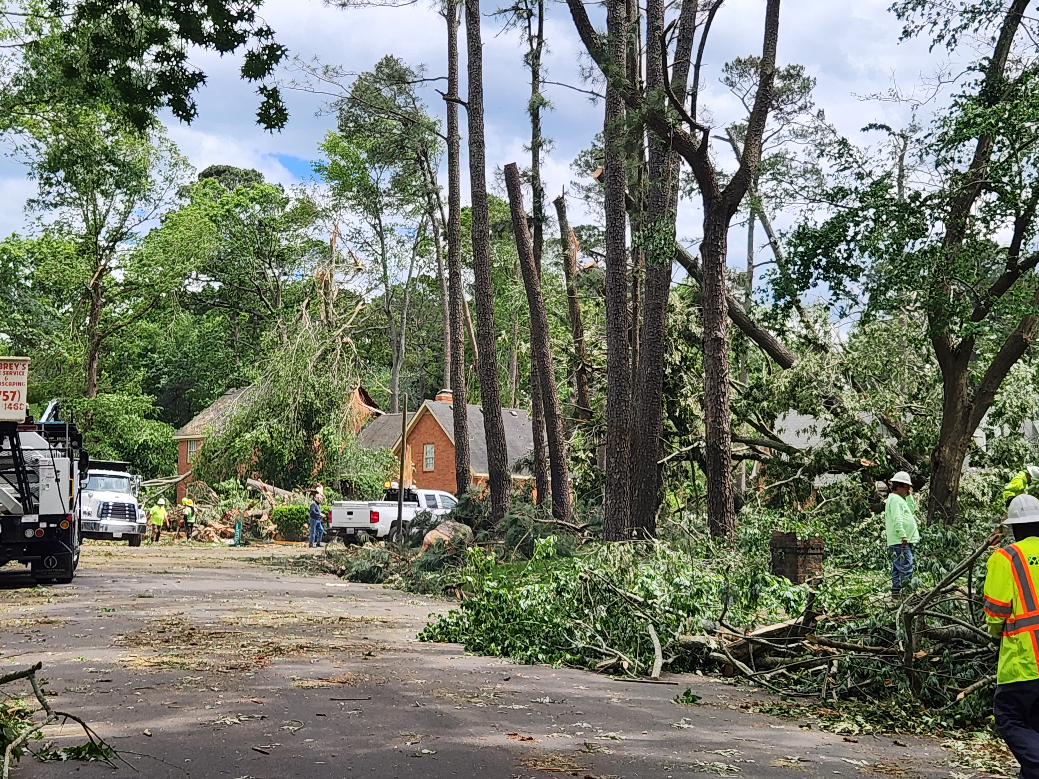
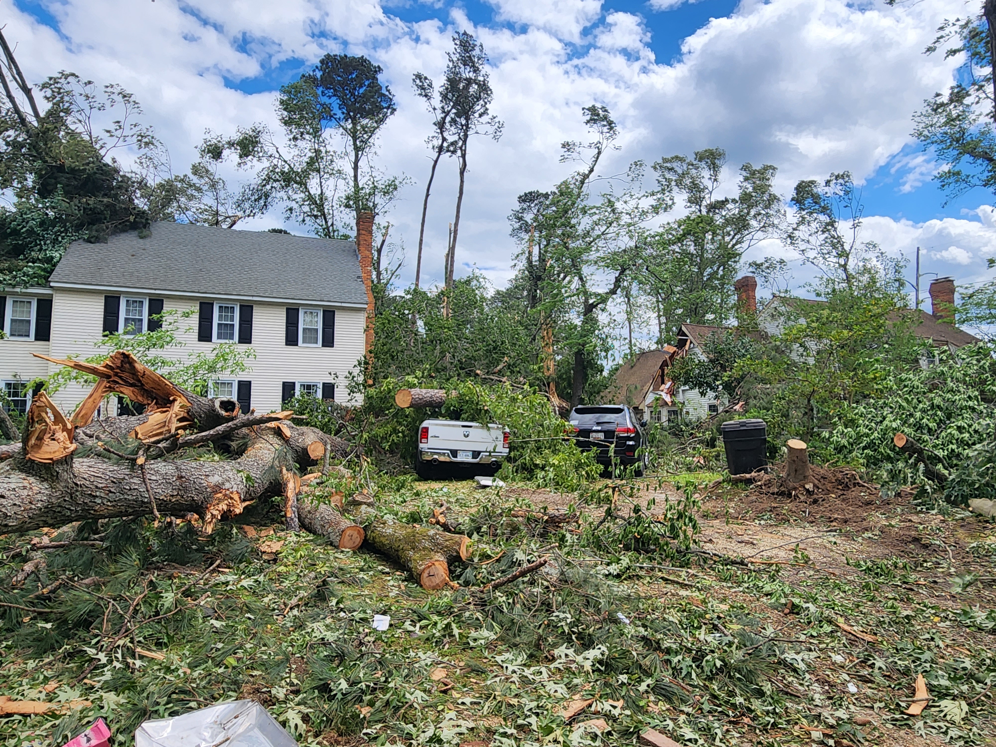
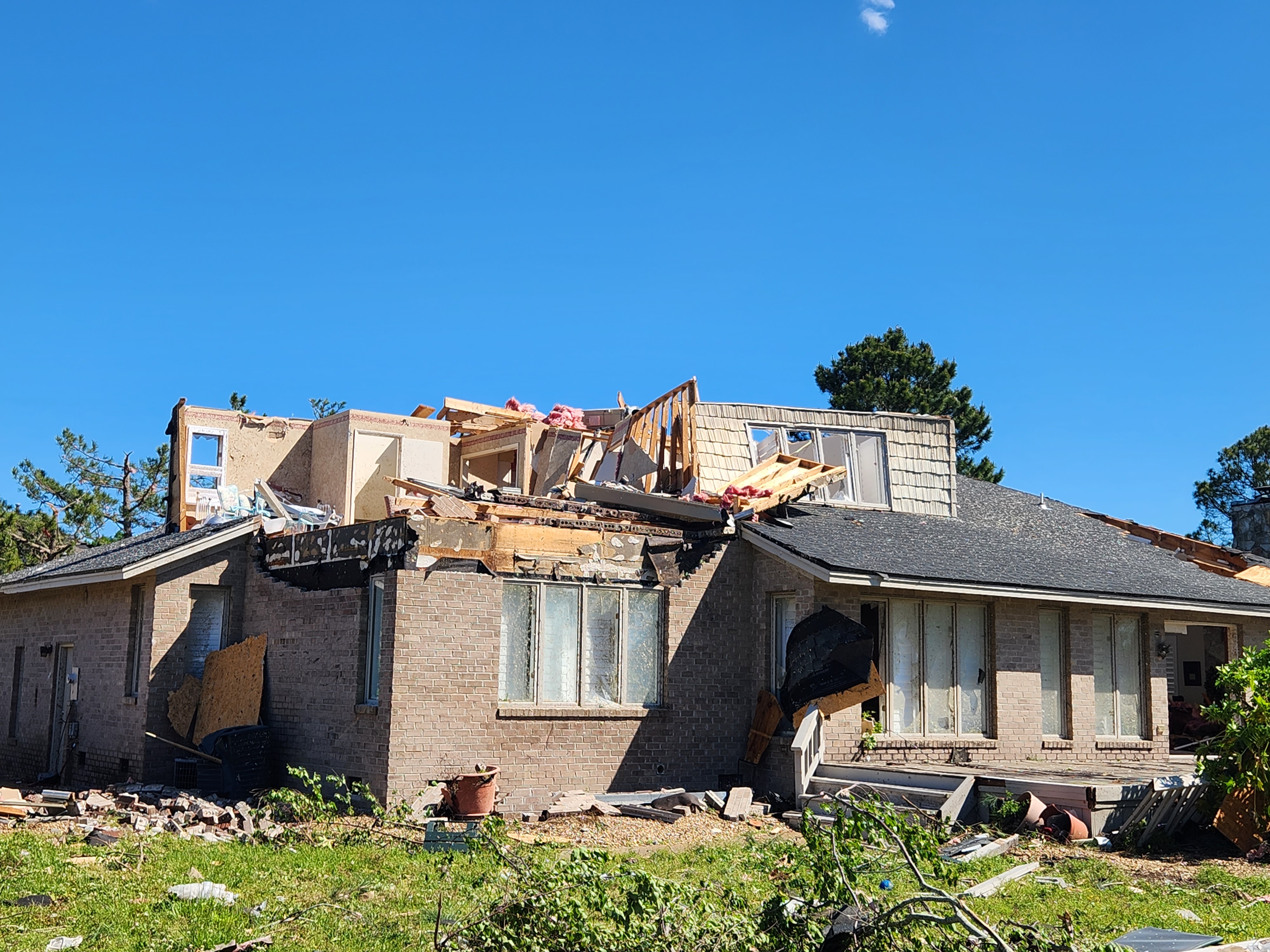
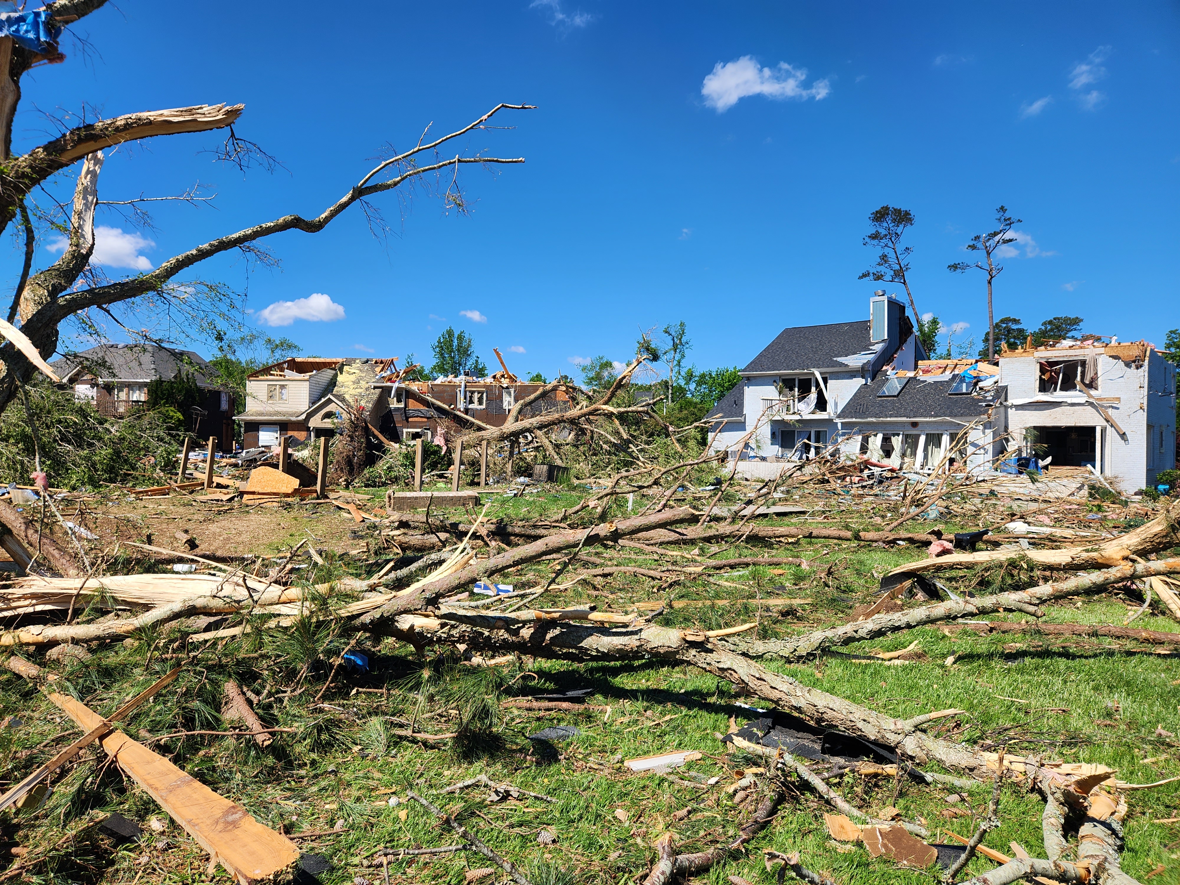
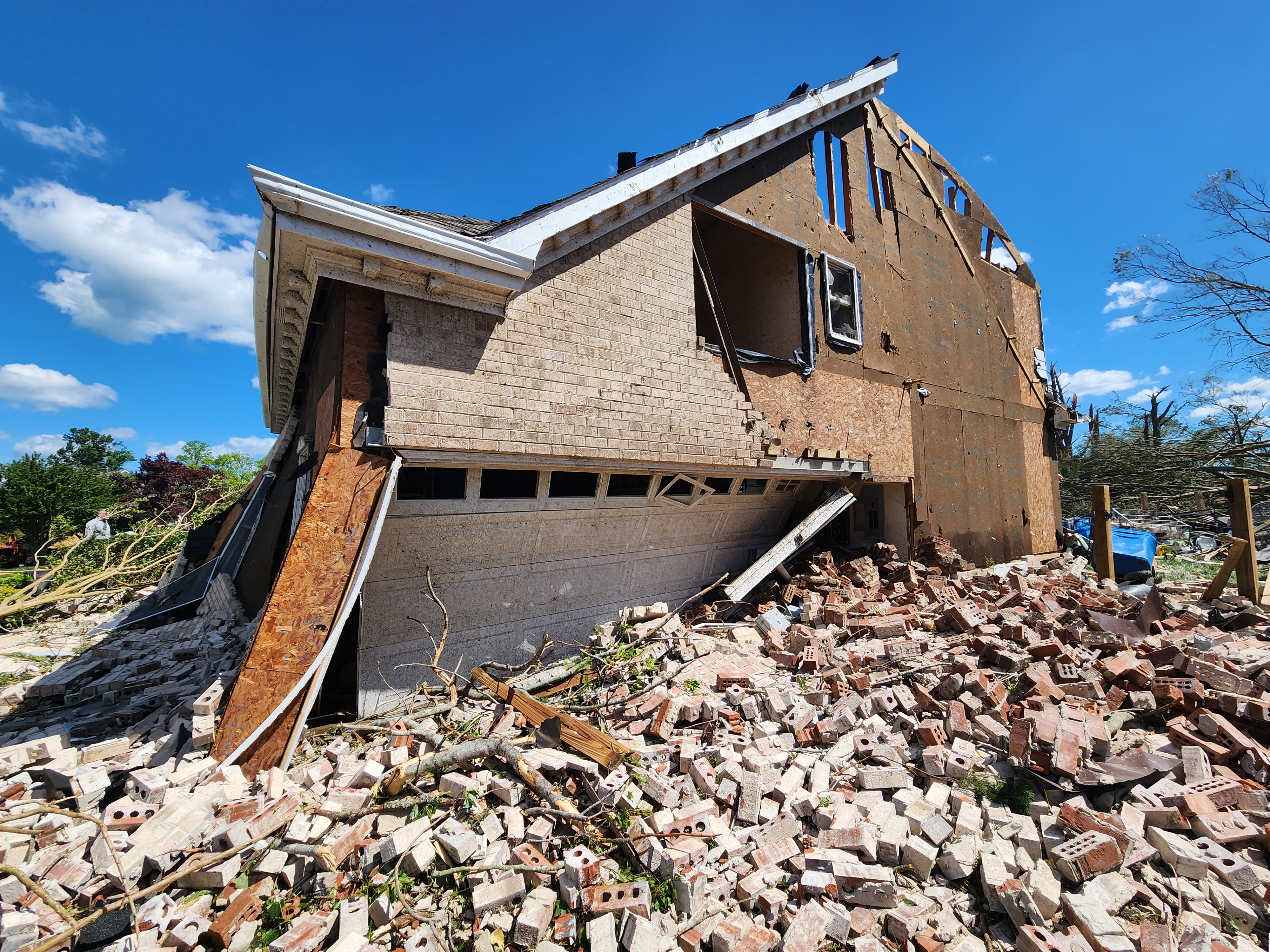
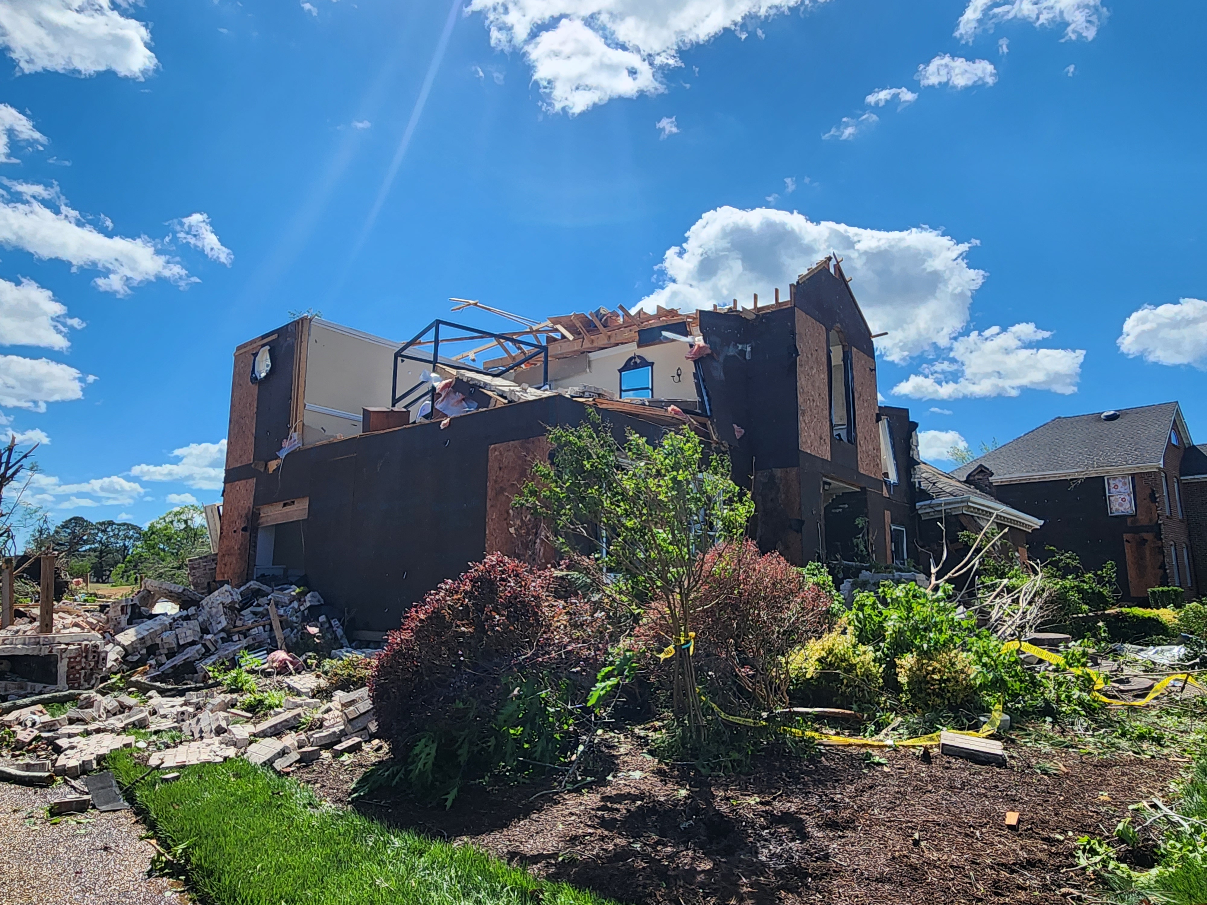
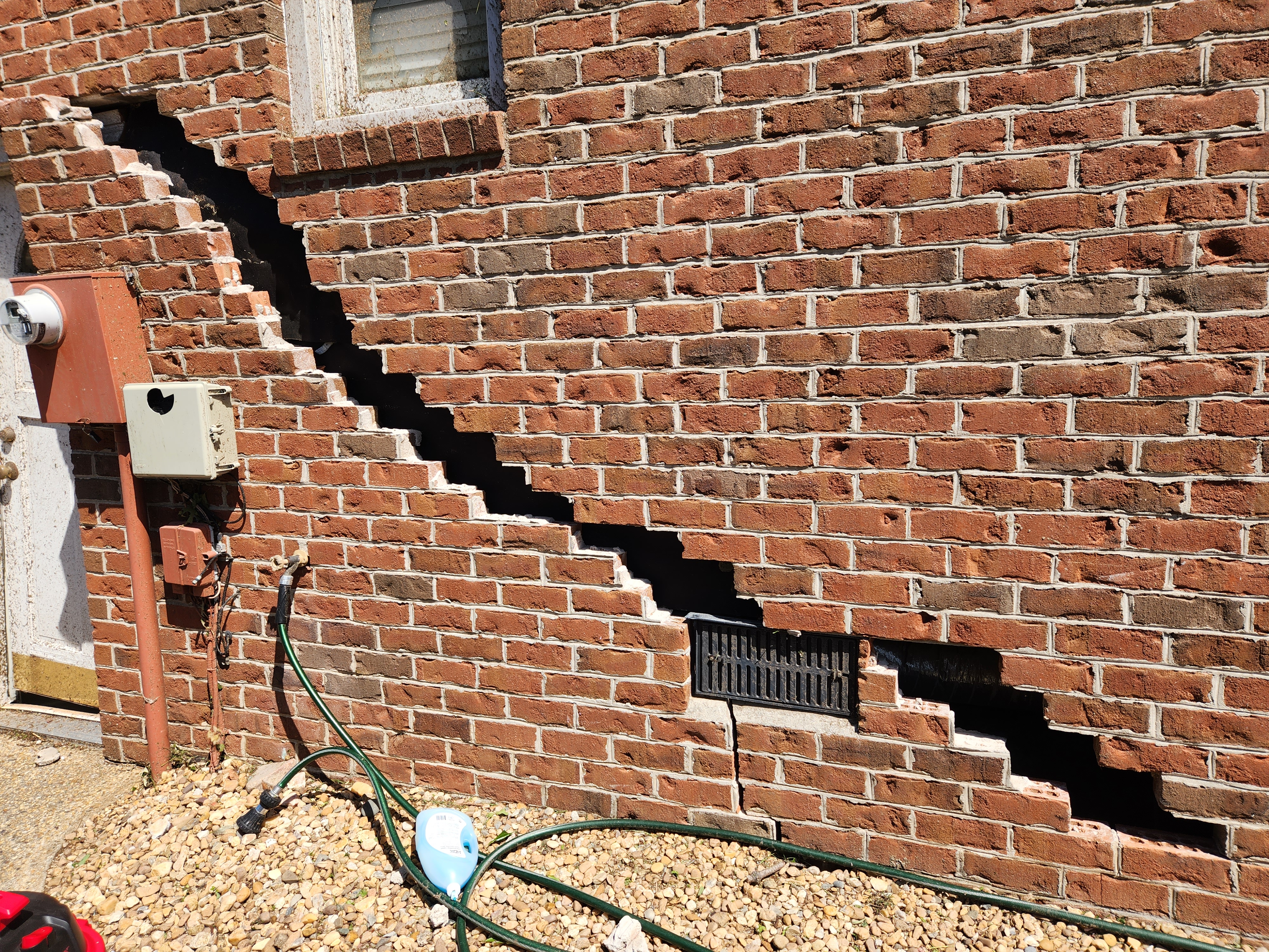
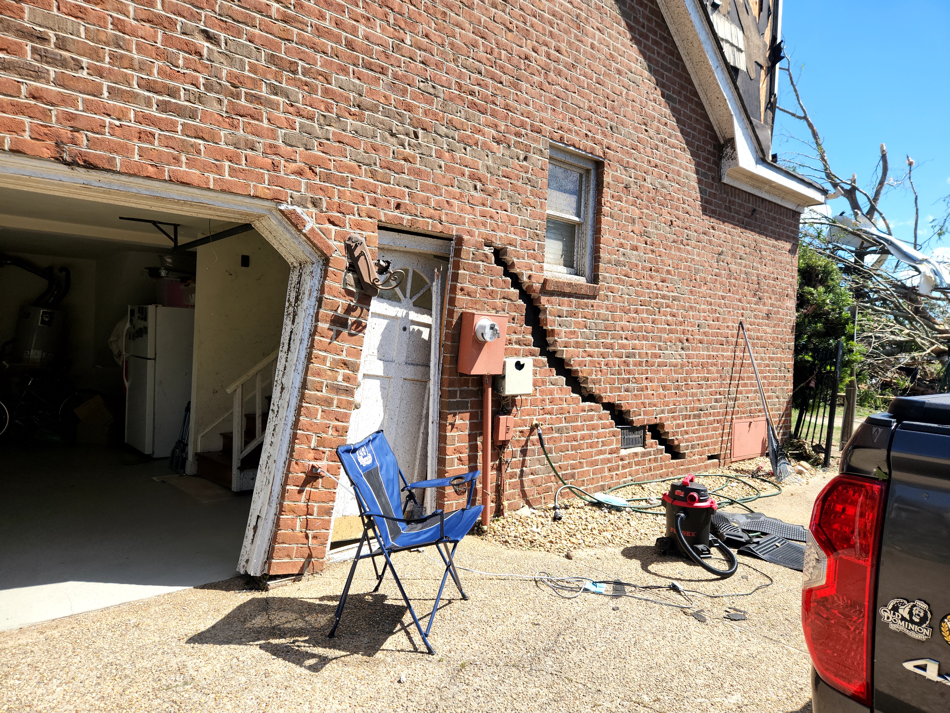
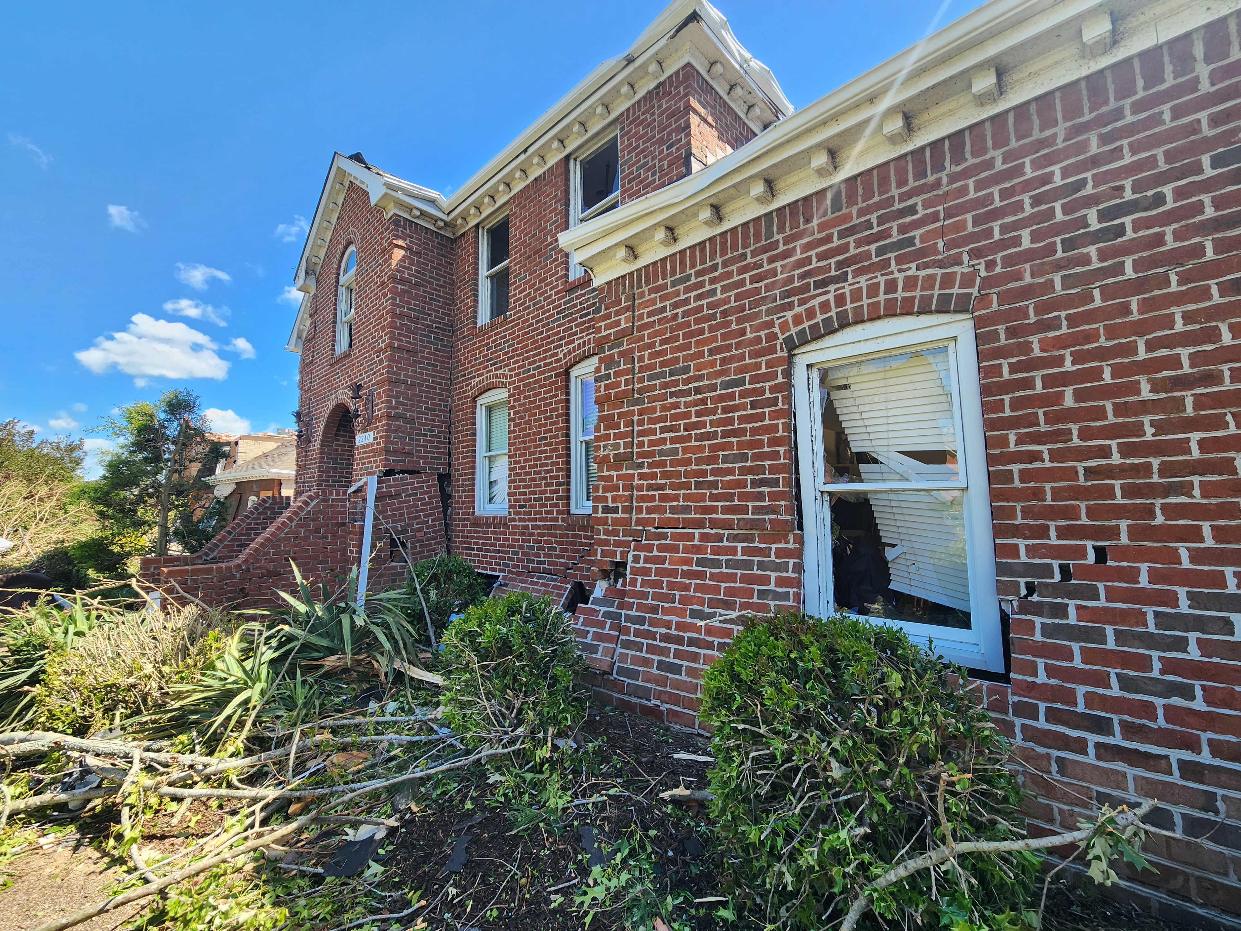
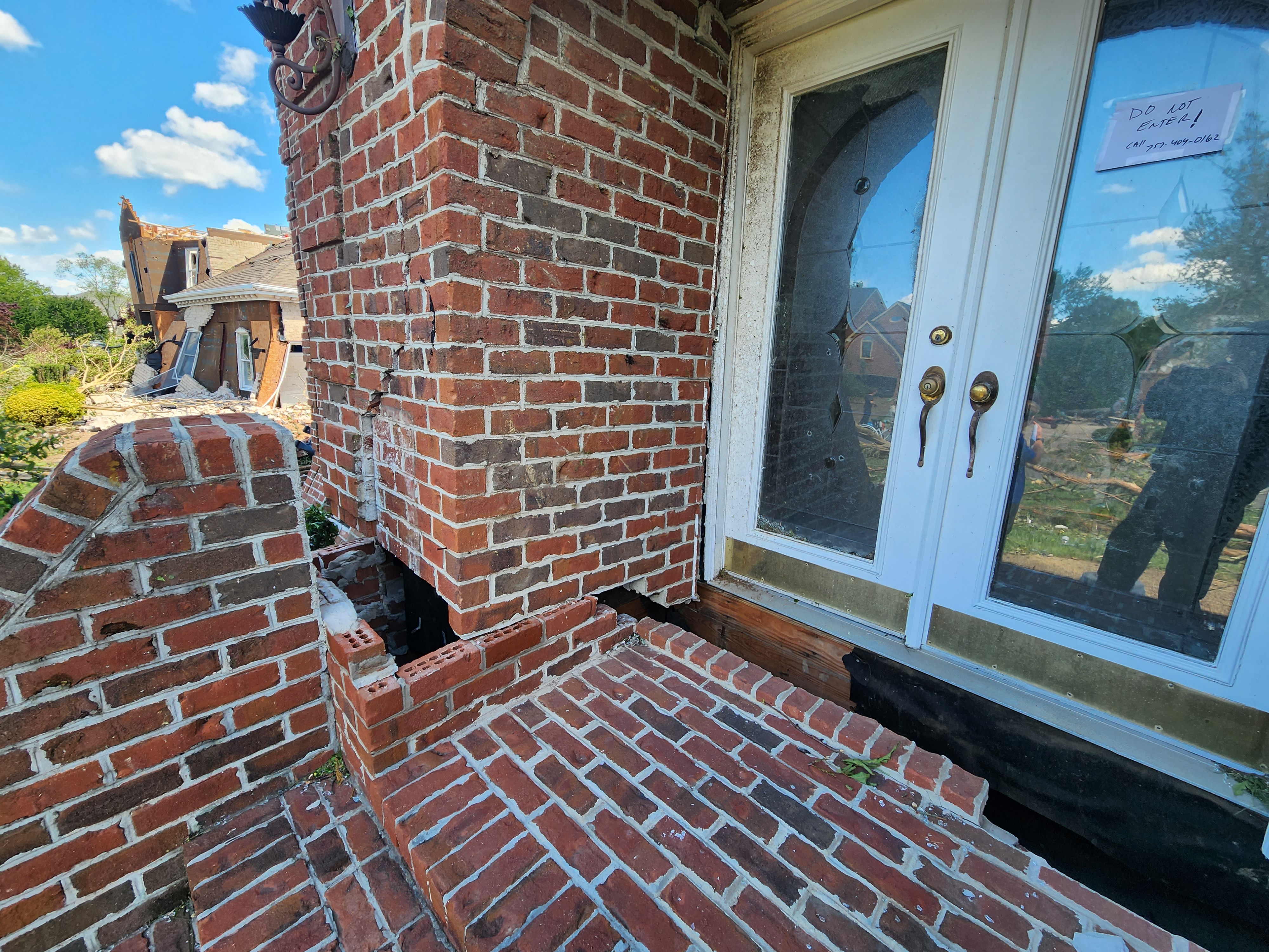
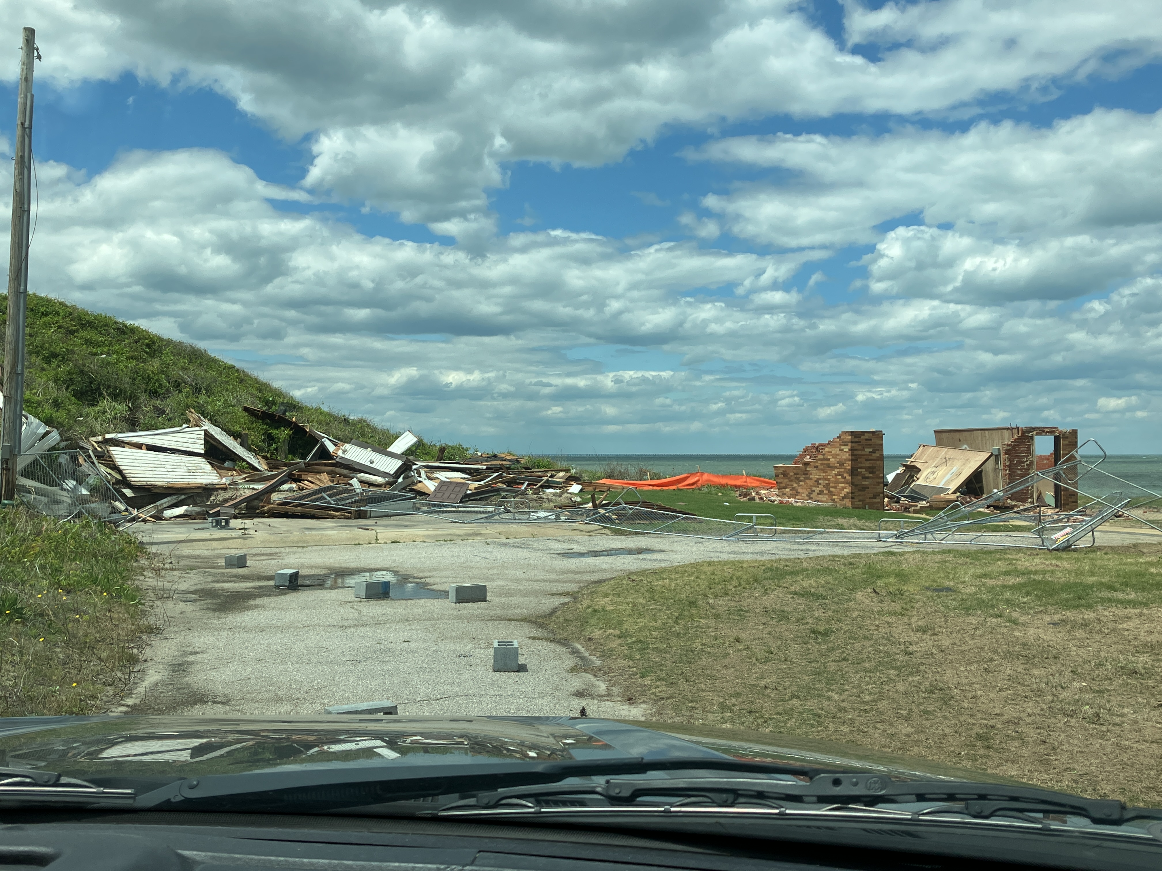
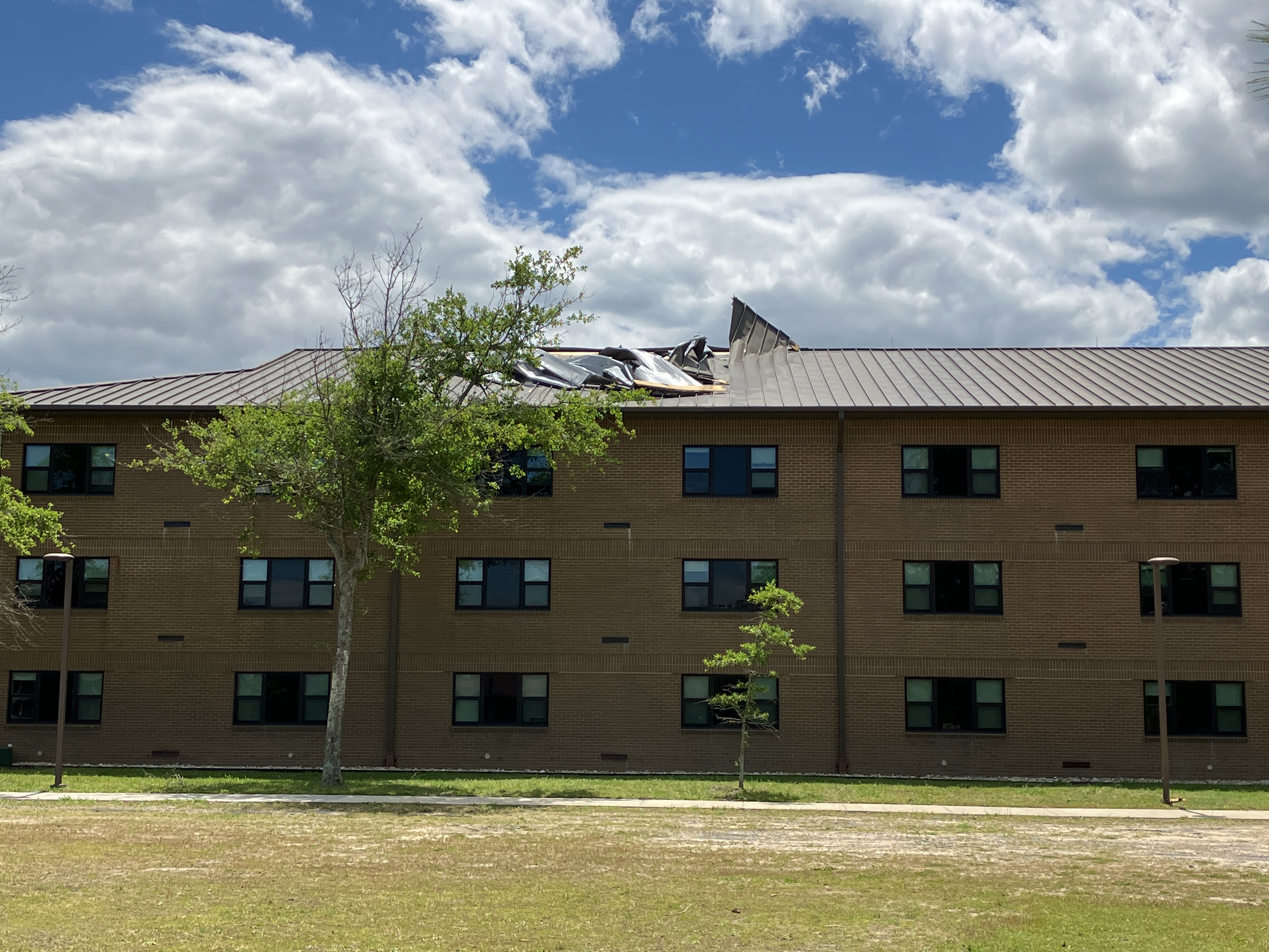
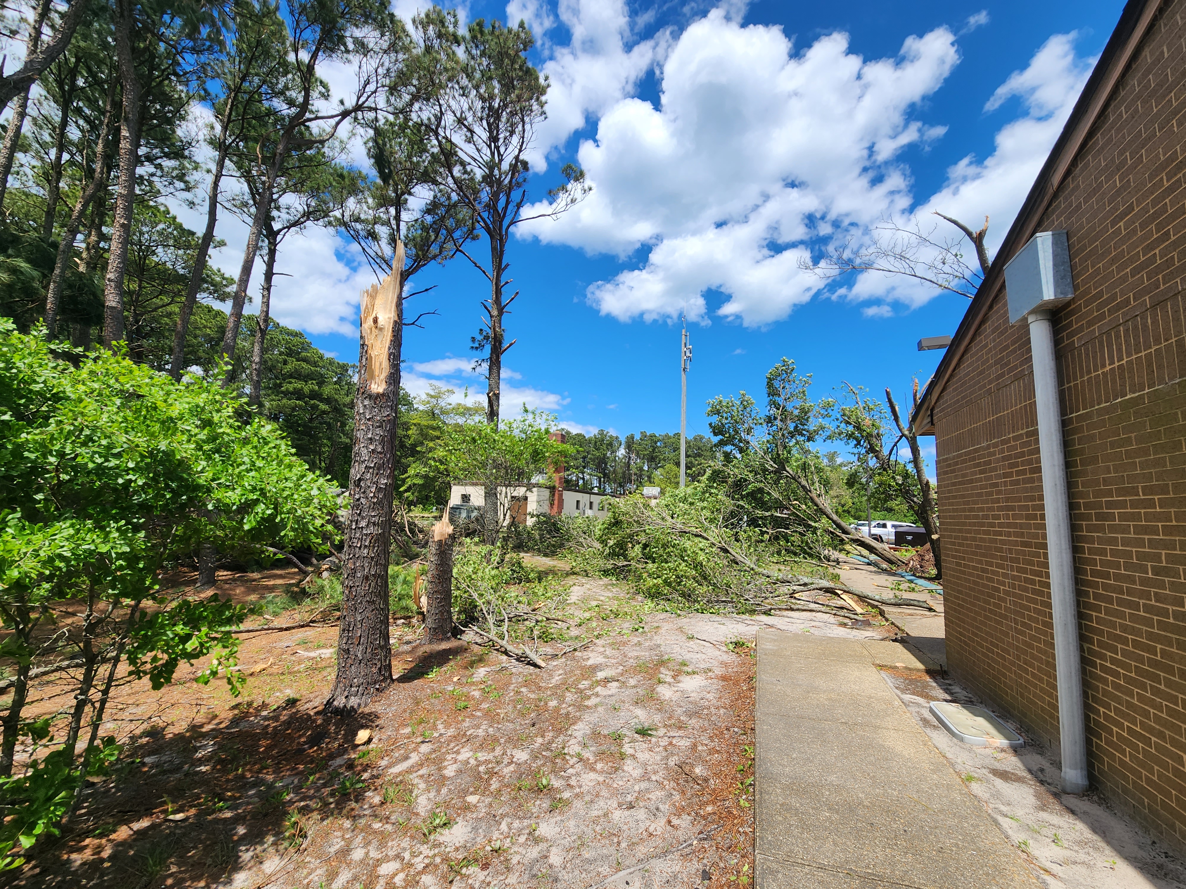
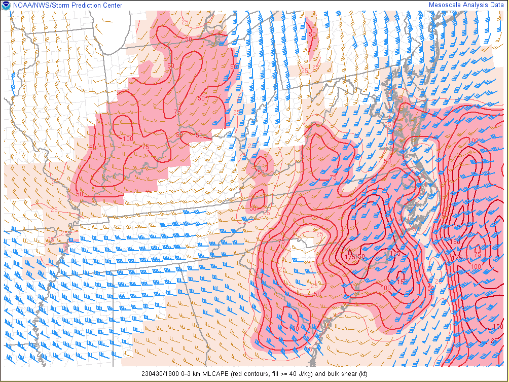
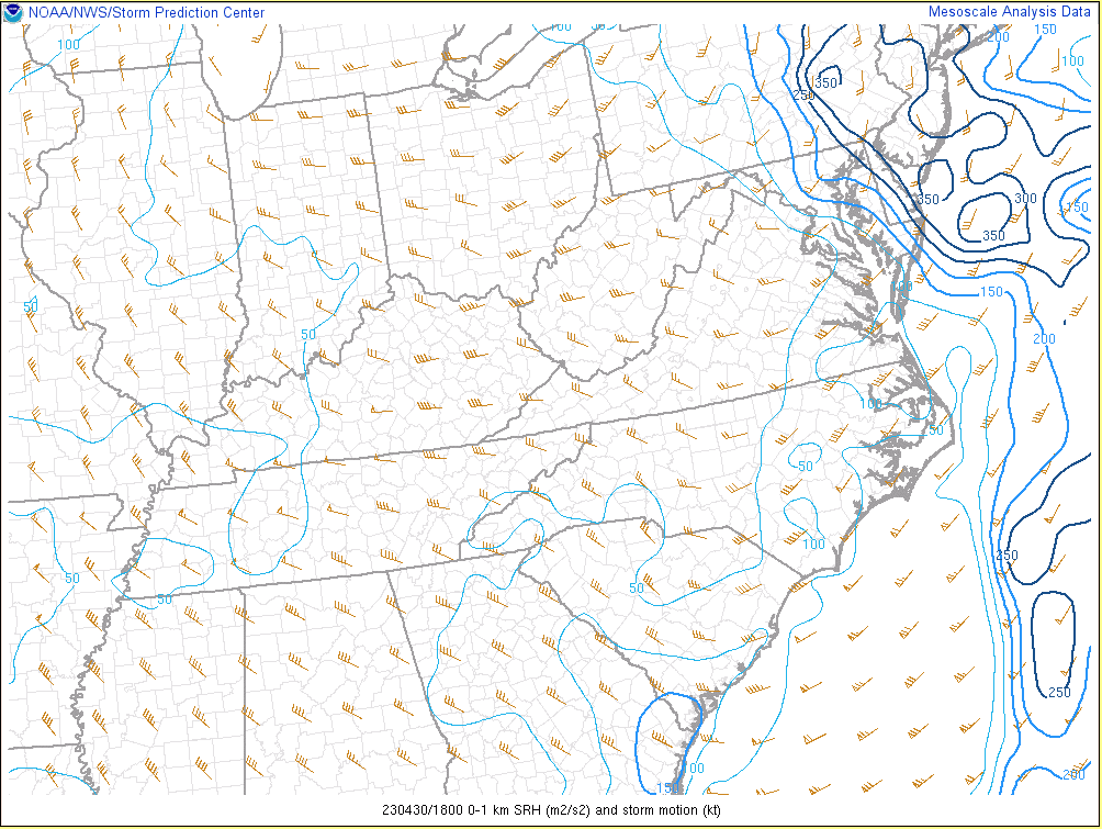
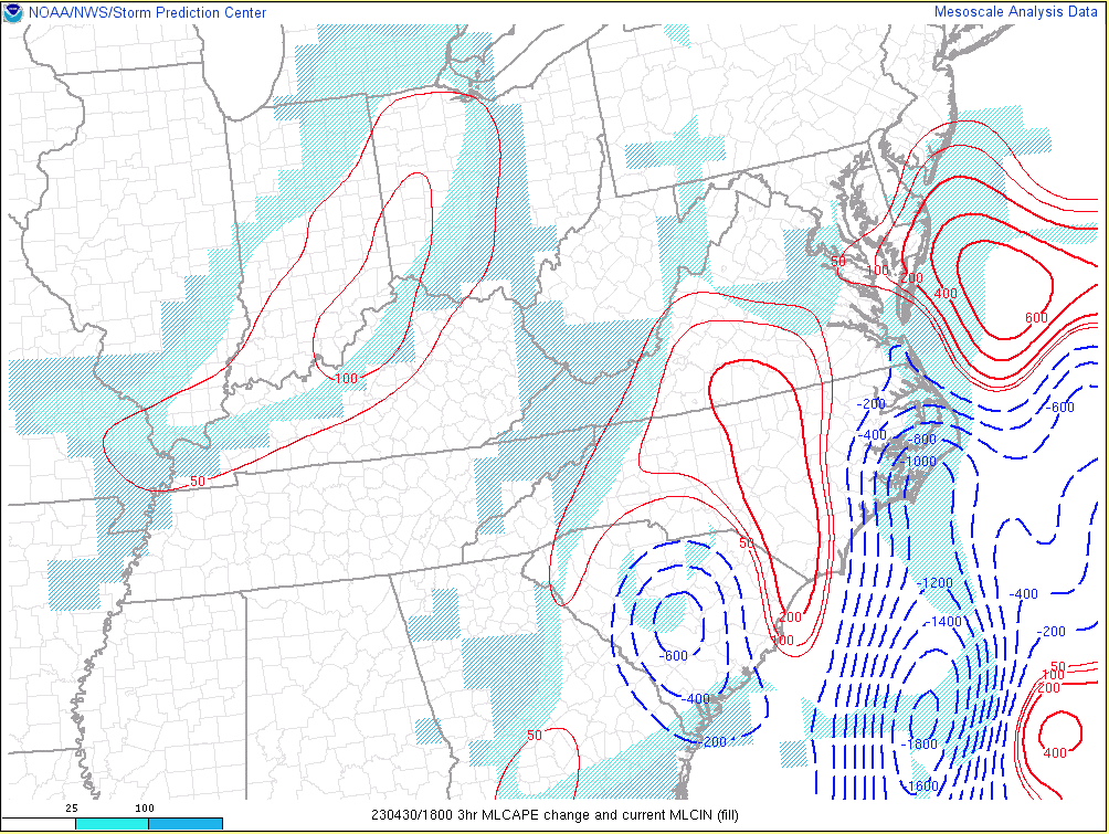
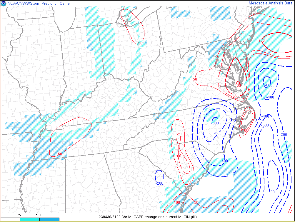
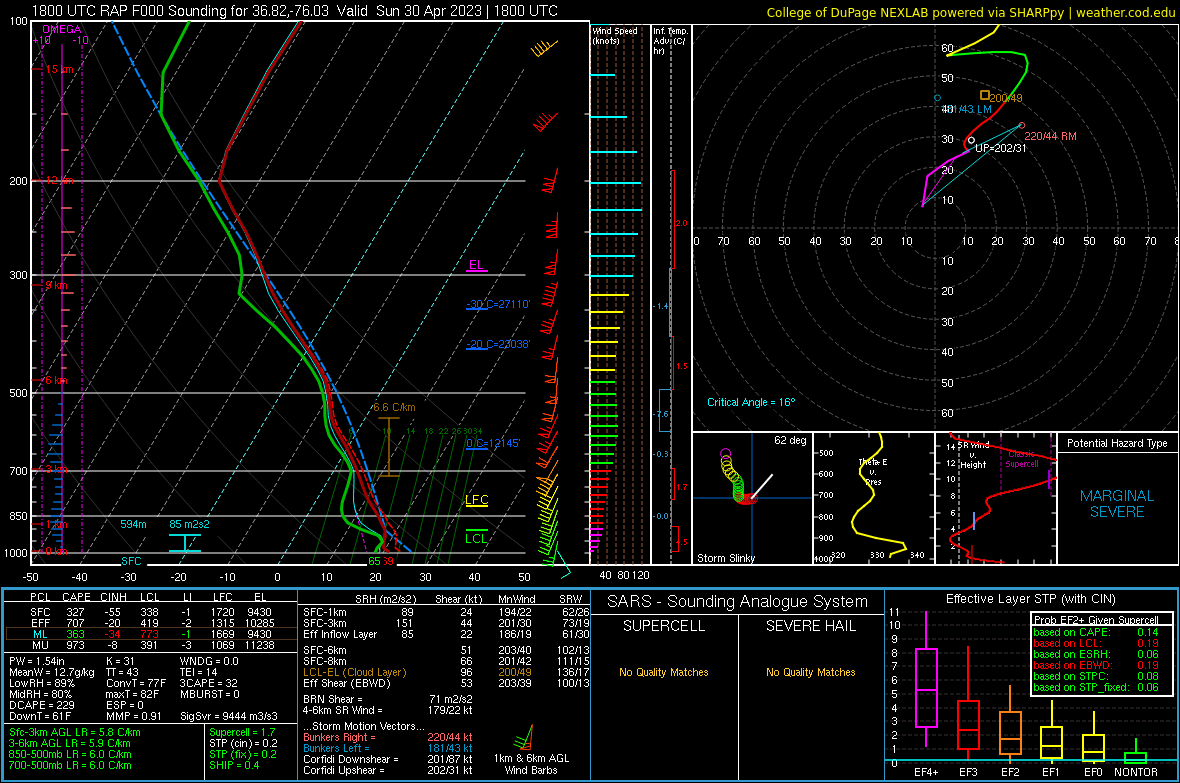
With 2 to 3 hours of clearing (and the fact that the low track was just to the northwest of Hampton Roads), the environment changed rapidly between 2 and 5 pm. Deep-layer shear was sufficient for supercells throughout the day. However, instability (especially in the 0-3km layer) increased significantly during the late afternoon before the arrival of the final round of thunderstorms (which were coincident with the upper shortwave itself). In fact, 0-3 km MLCAPE was 150+ J/kg in SE VA by 5 PM. Note that the instability was much less over the eastern shore and cool Atlantic waters, creating a tight CAPE gradient near the coast (in the past, we have seen tornadoes form along instability gradients). Despite the cool water, the dew point at KNTU was 67° at 5 PM. In addition, low-level directional shear increased significantly by that time. In fact, RAP analysis showed close to 150 m2/s2 of 0-1km SRH and 100 m2/s2 0-500m SRH at VA Beach before the storms moved in. Given that the wind at KNTU was from 150° (as per the 2056z/456 PM observation) instead of 170-180° like the RAP analysis showed, the actual 0-1km SRH values were likely even higher. Finally, the low deepened to 985-986mb and was centered over the Peninsula at around 5 PM (see regional surface observations for more details). The final round of convection produced wind gusts in excess of 50 knots as it moved through eastern NC and far SE VA (although most of the severe wind reports were south of our area). The cell that produced the EF-3 tornado in VA Beach turned to the right as it merged with a weaker cell just to its east about 10 minutes before the tornado touched down. The circulation moved over the Lynnhaven River right before the tornado touched down. It was on the ground for 5 minutes, tracking from the eastern branch of the Lynnhaven River to Fort Story before moving over the bay and dissipating. This was the first EF-3 tornado in the AKQ CWA since Tropical Storm Isaias (August 2020), and the first EF-3 in the state of Virginia since April 2019. While over 100 homes were damaged (the worst damage was observed in the Chelsea neighborhood and on Haversham Close) and damage was in the millions of dollars, there was not a single injury or fatality.
Tornado:
|
Eastern Branch of Lynnhaven River to Fort Story
Track Map 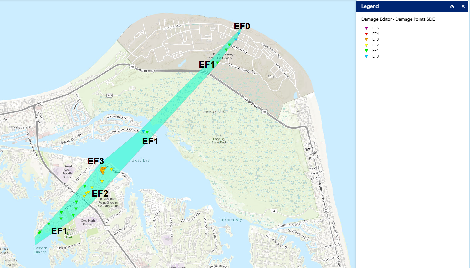 
|
||||||||||||||||
The Enhanced Fujita (EF) Scale classifies tornadoes into the following categories:
| EF0 Weak 65-85 mph |
EF1 Moderate 86-110 mph |
EF2 Significant 111-135 mph |
EF3 Severe 136-165 mph |
EF4 Extreme 166-200 mph |
EF5 Catastrophic 200+ mph |
 |
|||||
Upper Air and Surface Maps
Synoptic and Mesoscale Maps
 |
 |
 |
 |
| Loop of WPC 500mb Analysis from 12z/8 AM on 4/29 to 12z/8 AM on 5/1 in 24 hour increments | Loop of WPC Surface Analysis from 12z/8 AM to 00z/8 PM on 4/30 in 3 hour increments | Loop of Regional MSLP/T/Td from 18z/2 PM to 21z/5 PM in 1 hour increments | Loop of Regional Surface Observations from 3 PM to 6 PM in 1 hour increments |
NWS Storm Survey Photos
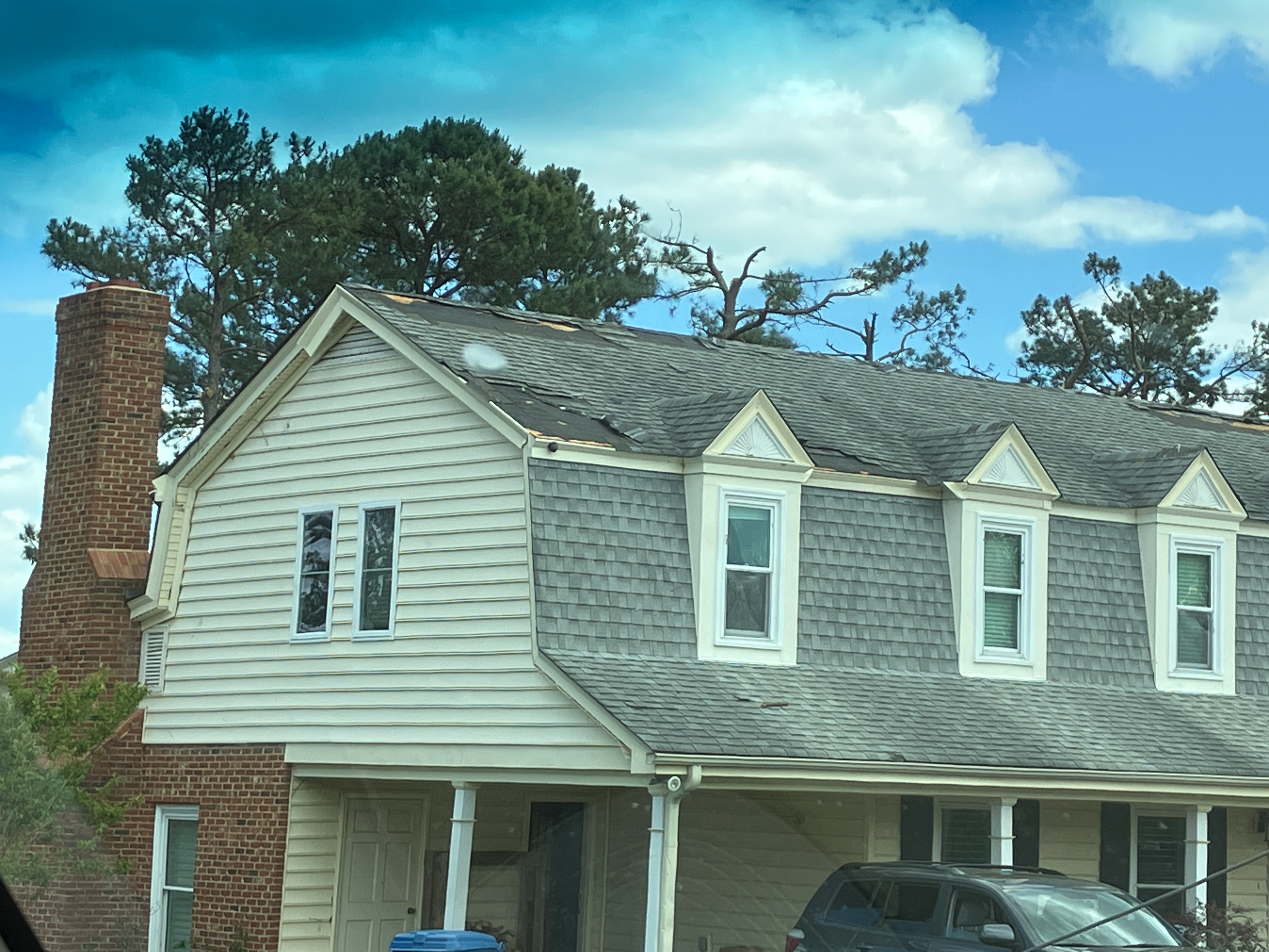
River Road
 |
 |
 |
 |
Chelsea/Queens Elm
 |
 |
 |
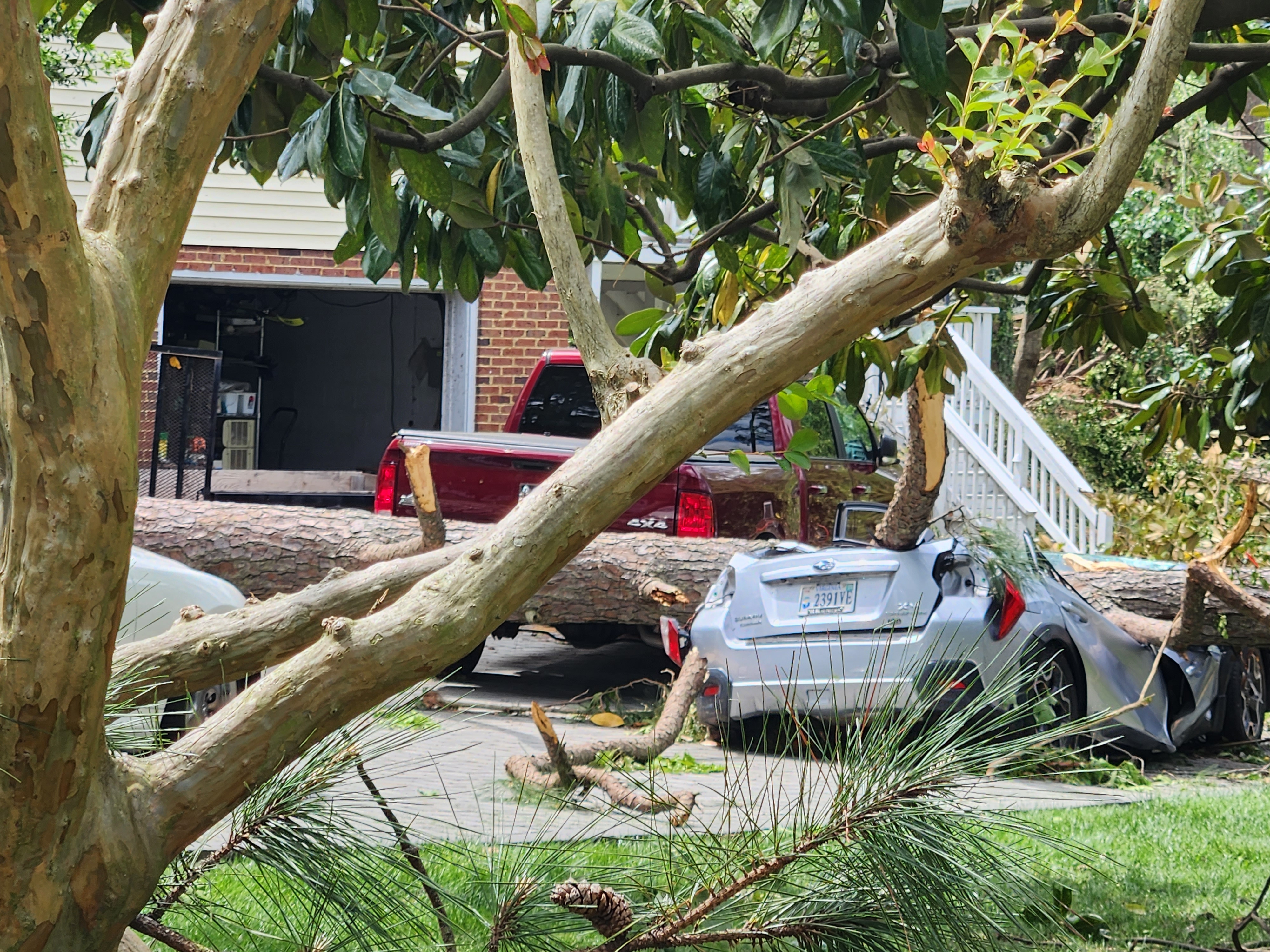 |
Haversham Close (this is where the EF-3 damage occurred)
 |
 |
 |
 |
 |
 |
 |
 |
Bay Island/Fort Story
 |
 |
 |
 |
Radar and Satellite
Selected Radar and Satellite Images/Loops
 |
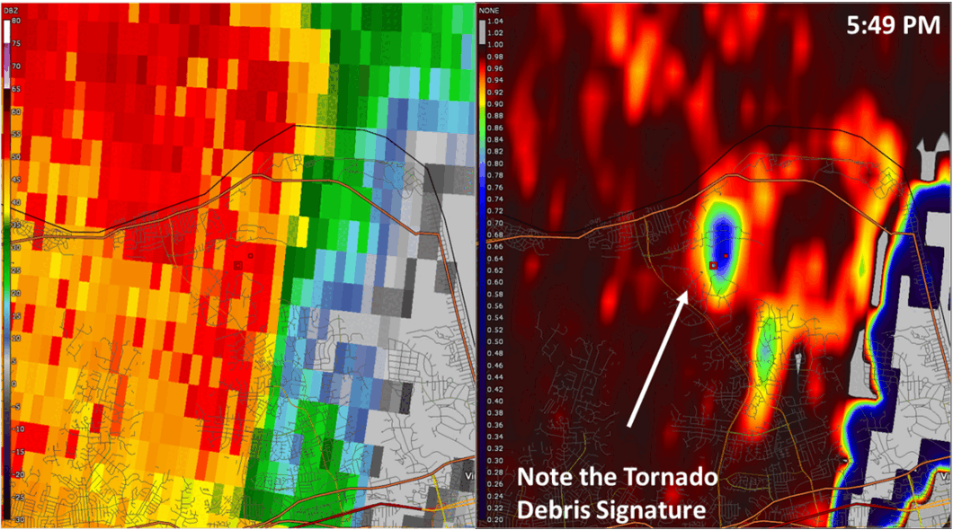 |
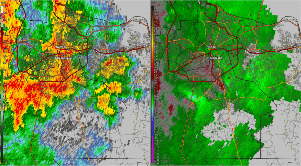
| Loop of 0.5° Reflectivity and Storm Relative Velocity (right) from ~5:20 to 5:55 PM. | Loop of 0.5° Reflectivity (left) and Correlation Coefficient (right) from 5:49 to 5:55 PM. |
 |
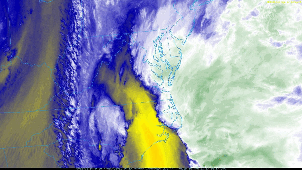 |
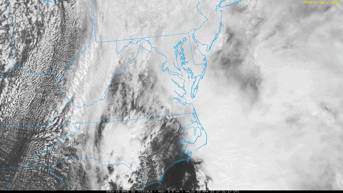
| Visible Satellite Loop from 1730z/130 PM to 2200z/600 PM in ~5 minute increments. Note the clearing that overspread SE VA for a couple hours prior to the arrival of the final thunderstorms (which produced the EF-3 tornado) | Mid Level Water Vapor Satellite Loop from 1800z/200 PM to 2200z/600 PM in ~5 minute increments. Note the mid level dry air (yellow) evident across eastern portions of the area. |
Storm Reports
0415 PM     TSTM WND DMG     2 WNW MURFREESBORO      36.45N 77.12W
04/30/2023                   HERTFORD           NC   UTILITY COMPANY

            TREE DOWNED ALONG WISE STORE RD. POWER IS
            OUT IN THE AREA.
0450 PM     TSTM WND GST     1 ESE CAPE COLONY       36.02N 76.57W
04/30/2023  M55 MPH          CHOWAN             NC   AWOS

            AWOS STATION KEDE EDENTON.
0525 PM     TSTM WND DMG     1 S PORTLOCK            36.78N 76.28W
04/30/2023                   CITY OF CHESAPEAKE VA   NWS STORM SURVEY

            NWS STORM SURVEY CREW REPORTS TREES DOWNED
            AT MILITARY HIGHWAY NEAR I-464. REPORTED
            TIME IS RADAR ESTIMATED.
0526 PM     TSTM WND DMG     OCEAN VIEW              36.95N 76.25W
04/30/2023                   CITY OF NORFOLK    VA   BROADCAST MEDIA

            UPDATED STORM REPORT. NWS STORM SURVEY CREW
            FOUND DAMAGE CONSISTENT WITH 70-80 MPH
            STRAIGHT LINE WINDS IN THE WILLOUGHBY SPIT
            AREA NEAR OCEAN VIEW. DAMAGE. BRICK SIDING
            TORN OFF SIDE OF AN APARTMENT BUILDING WITH
            SEVERAL LARGE TREE LIMBS DOWNED. TIME
            ESTIMATED FROM RADAR.
0530 PM     TSTM WND DMG     2 ENE MAPLE             36.43N 75.97W
04/30/2023                   CURRITUCK          NC   PUBLIC

            GARAGE DOOR BENT IN AT A RESIDENCE ON BELLS
            ISLAND.
0550 PM     TSTM WND GST     3 E KNOTTS ISLAND       36.52N 75.87W
04/30/2023  M59 MPH          CURRITUCK          NC   MESONET

            MESONET STATION 1329W 3.0 E KNOTTS ISLAND
            (WEATHERSTEM).
0550 PM     TSTM WND DMG     1 NNE NORVIEW           36.91N 76.24W
04/30/2023                   CITY OF NORFOLK    VA   MESONET

            REPORT FROM MPING: TREES UPROOTED OR
            SNAPPED; ROOF BLOWN OFF A HOME ON JOHNSTONS
            ROAD AT VA-194.
0550 PM     TORNADO          3 SW CAPE HENRY         36.90N 76.06W
04/30/2023                   CITY OF VIRGINIA BEVA   NWS EMPLOYEE

            TREES DOWNED ONTO VEHICLE NEAR GREAT NECK
            MIDDLE SCHOOL. AT LEAST 1 PERSON REPORTED
            TRAPPED IN A VEHICLE. A TORNADO DEBRIS
            SIGNATURE (TDS) WAS DETECTED ON AKQ RADAR.
0555 PM     TORNADO          3 SW CAPE HENRY         36.90N 76.05W
04/30/2023                   CITY OF VIRGINIA BEVA   NWS EMPLOYEE

            MULTIPLE HOMES SEVERELY DAMAGED ON HAVERSHAM
            CLOS. TIME ESTIMATED BY RADAR.
Environment
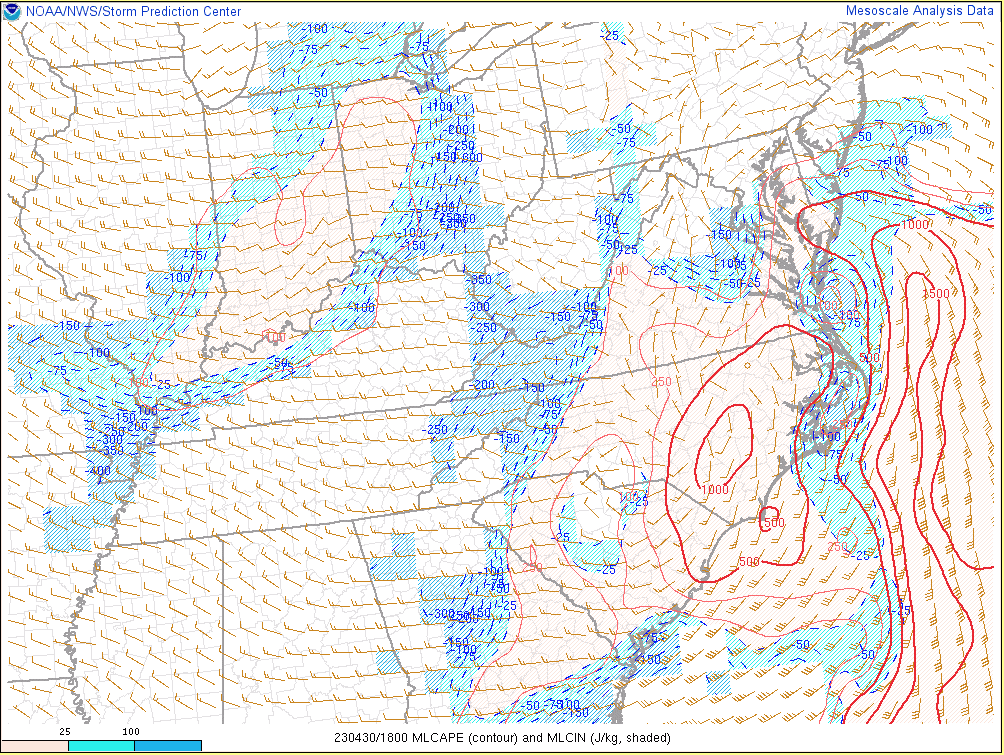
Loops of Instability/Shear Parameters from 18z/2 PM to 21z/5 PM in 1 hour increments
 |
 |
 |
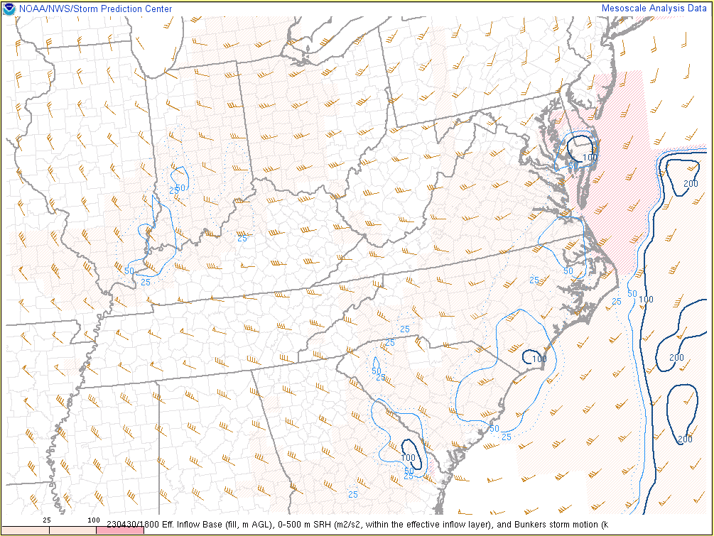 |
| MLCAPE/MLCIN | 0-3km MLCAPE/Effective Shear | 0-1km SRH | 0-500m SRH |
Additional environmental data.
 |
 |
 |
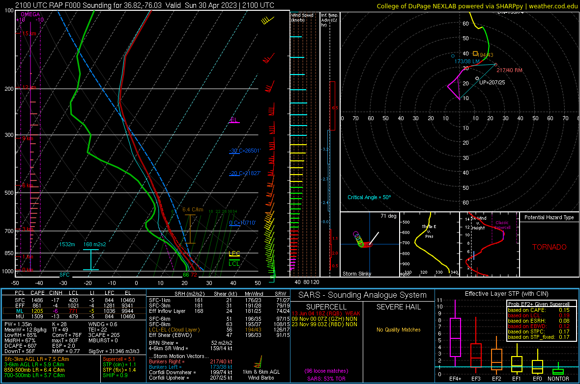 |
| 15z/11 AM-18z/2 PM MLCAPE Change | 18z/2 PM-21z/5 PM MLCAPE Change | 18z/2 PM RAP Analysis Sounding at KNTU (VA Beach) | 21z/5 PM RAP Analysis Sounding at KNTU (VA Beach). Note that the RAP shows the surface wind close to due south. However, the actual observation had a SE wind (150°). Therefore, the SRH values shown here are lower than they actually were. |
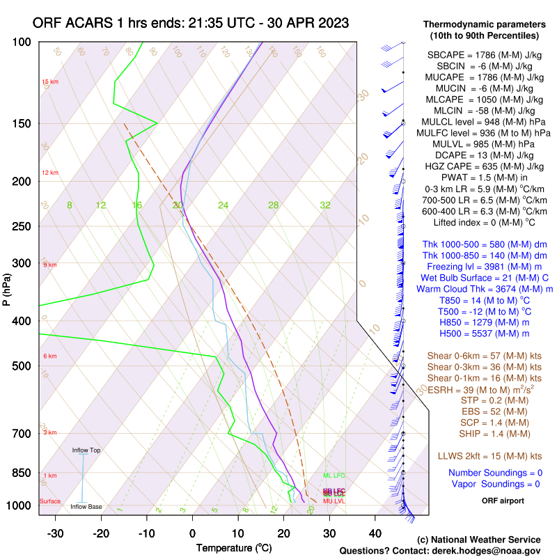 |
| 2135z/535 PM ACARS Sounding from KORF. Note the strong low-level directional shear and deep-layer shear. In addition, while a specific value is not shows, there is quite a bit of instability in the first 3 km AGL. |
 |
Media use of NWS Web News Stories is encouraged! Please acknowledge the NWS as the source of any news information accessed from this site. |
|


 Coastal Flood
 Heat
Heat