Excessive rainfall may produce locally considerable flash flooding over parts of the northwestern Gulf Coast, lower Mississippi River Valley, and Deep South through Thursday. Potential Tropical Cyclone One is forecast to become a tropical storm (Arthur) as it moves along or just off the northwestern Gulf coast through Wednesday. An outbreak of severe weather is forecast in the Midwest Wednesday. Read More >

AM SWAP Statement PIREP Solicitation PIREPs SIGMETs AIRMETs ZNY CWA/MIS Local Forecast
Click on images below to enlarge
|
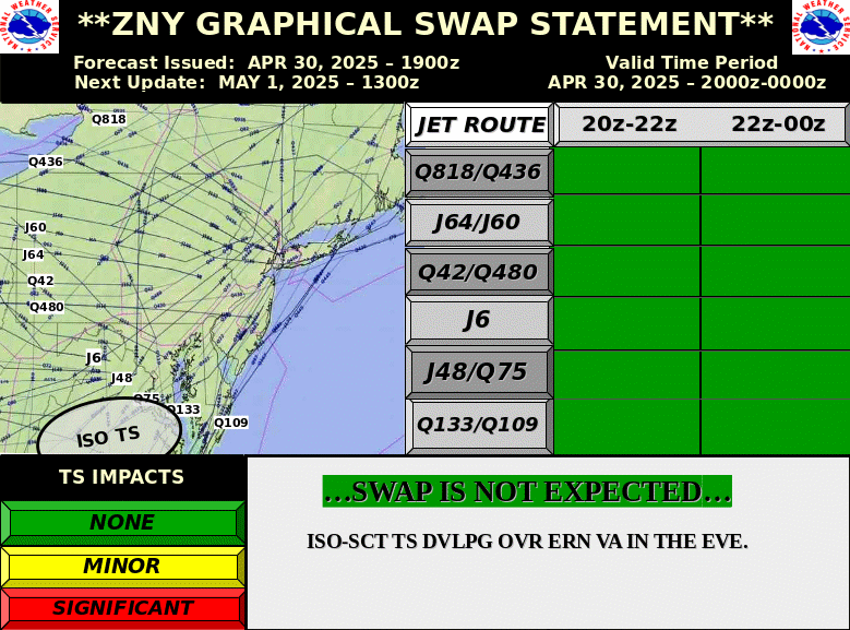
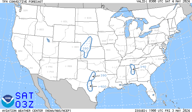
Day 1 SWAP Forecast
|
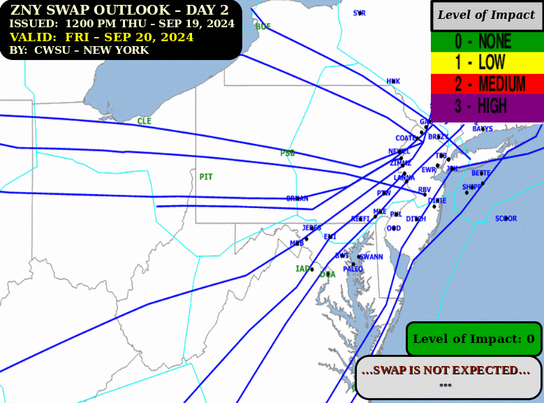
Day 2 SWAP Outlook
|
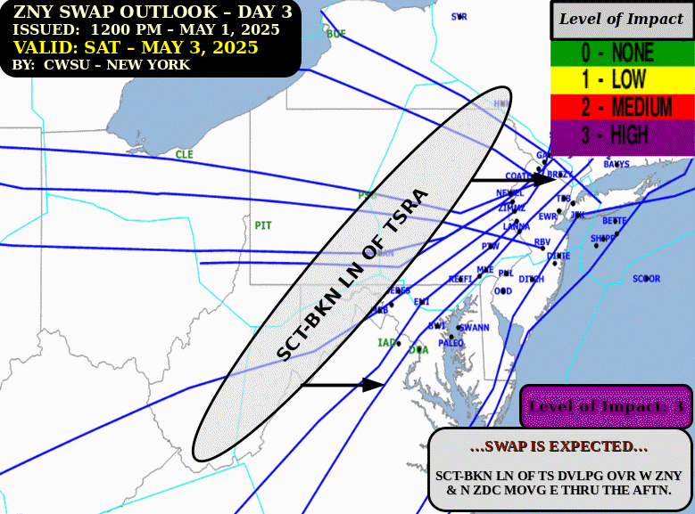
Day 3 SWAP Outlook
|
|
N90 Thunderstorm TDA
|
PHL-PCT Thunderstorm TDA
|
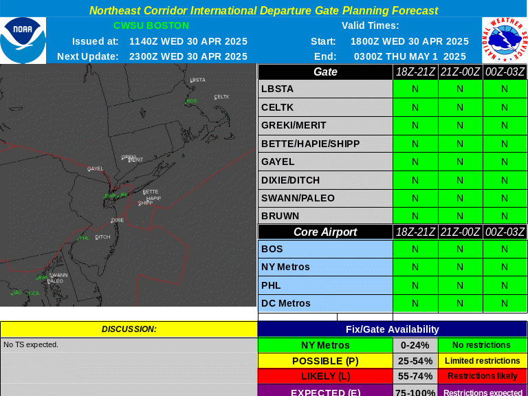
International Departure Gate Forecast
|
|
Convective Watches
|
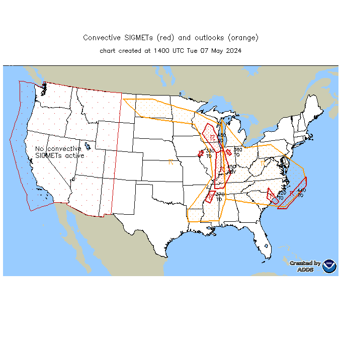
Convective SIGMETs
|
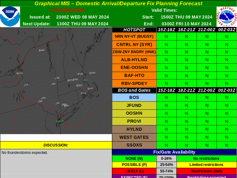
Domestic Arrival/Departure Fix Forecast
|
|
4-hr TCF
|
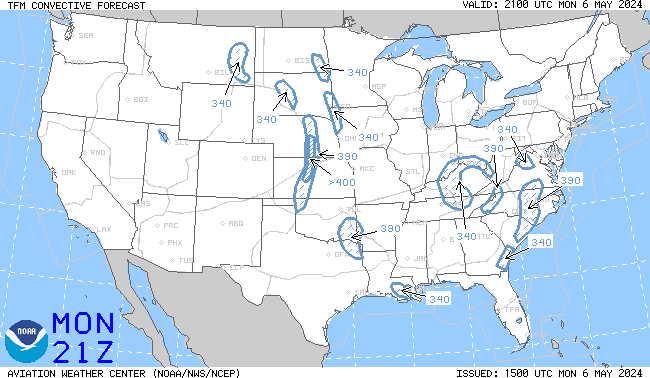
6-hr TCF
|
8-hr TCF
|
|
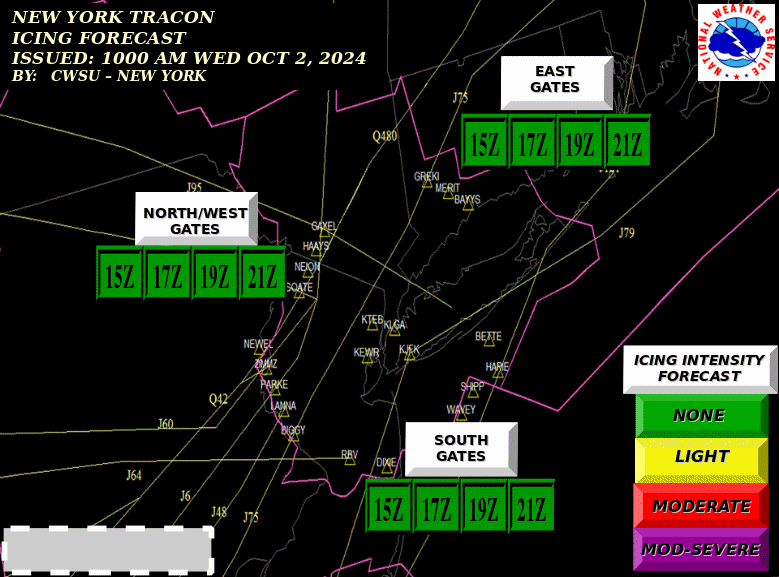
N90 Icing TDA
|
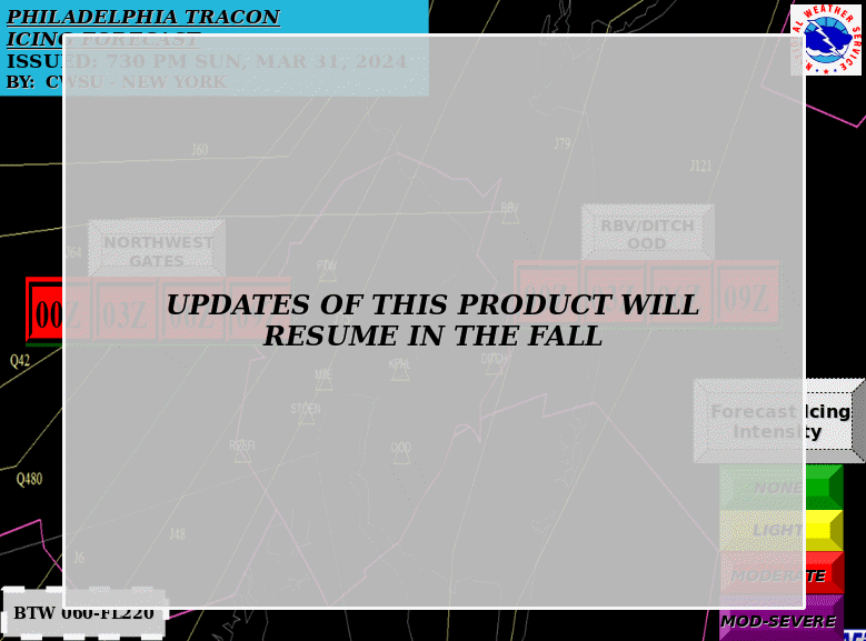
PHL Icing TDA
|
Current Icing SIGMETs
|
Current Icing PIREPs
|
|
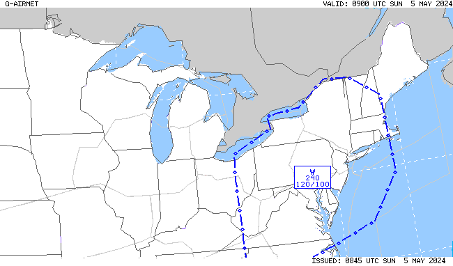
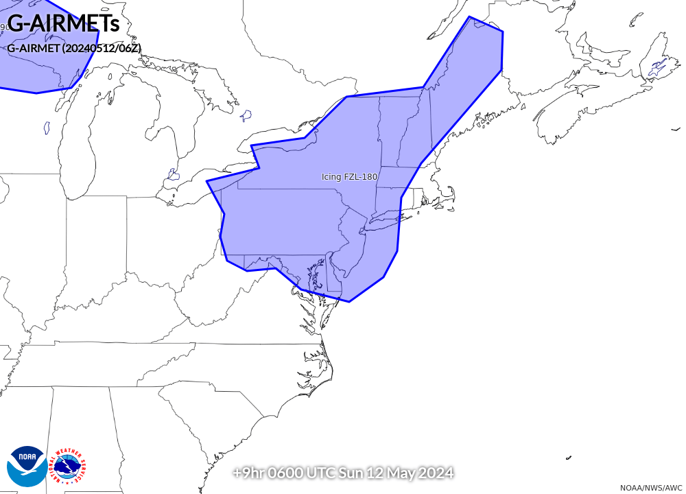
00-03 hr Icing AIRMETs
|
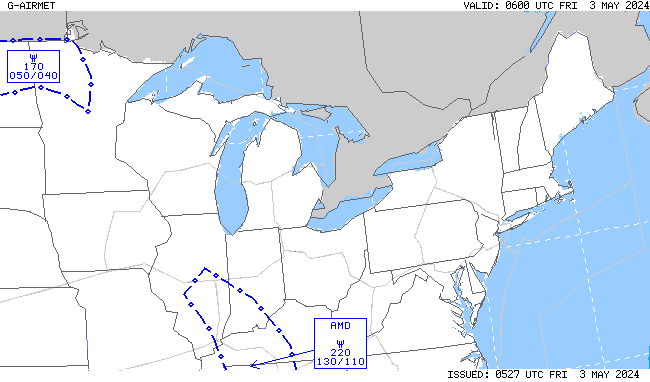
03-06 hr Icing AIRMETs
|
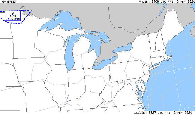
06-09 hr Icing AIRMETs
|
09-12 hr Icing AIRMETs
|
|
Also see: CIP/FIP Icing Guidance |
|||
|
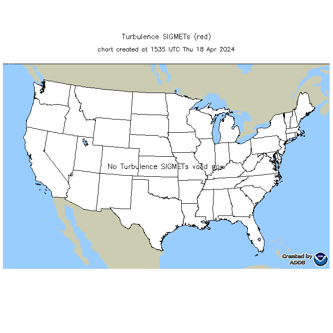
Current Turb SIGMETs
|
Current Turb PIREPs
|
||
|
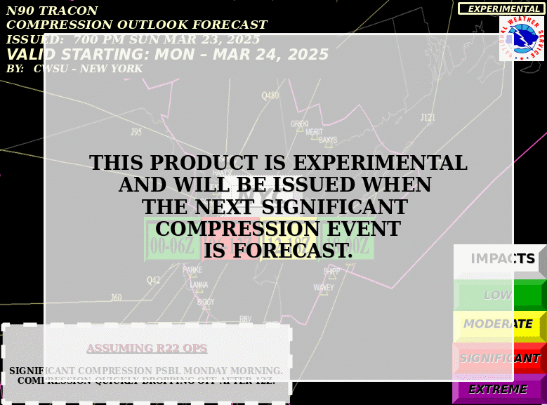
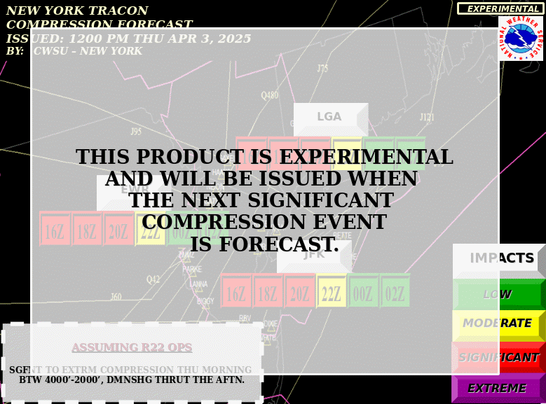
N90 Compression Outlook
|
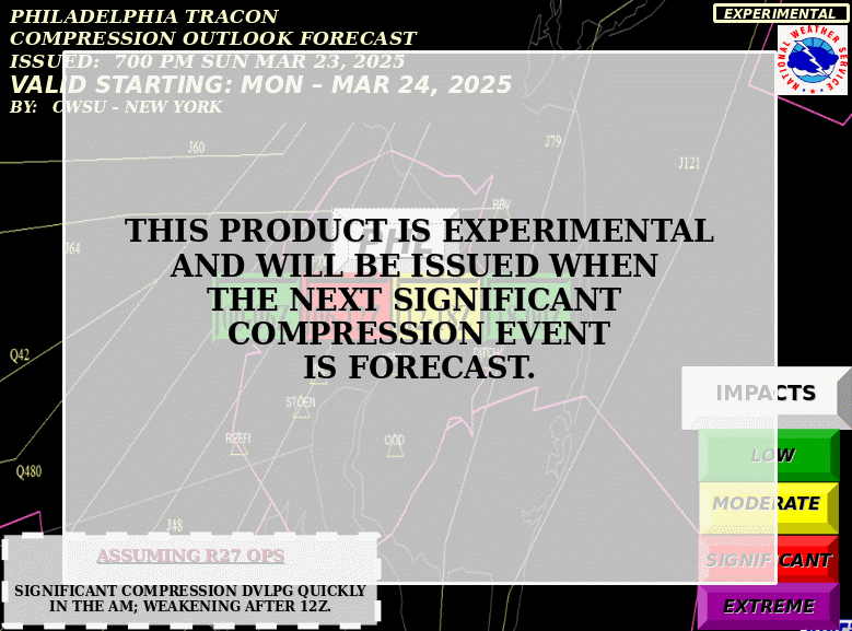
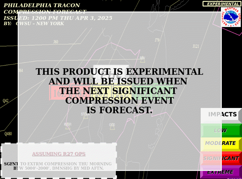
PHL Compression Outlook
|
N90 Compression TDA
|
PHL Compression TDA
|
|
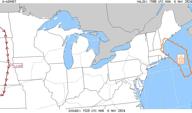
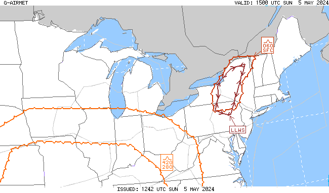
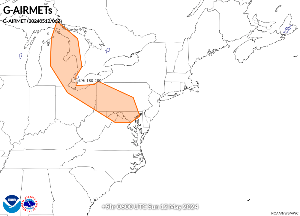
00-03 hr Turb/LLWS AIRMETs
|
03-06 hr Turb/LLWS AIRMETs
|
06-09 hr Turb/LLWS AIRMETs
|
09-12 hr Turb/LLWS AIRMETs
|
|
Also see: Graphical Turbulence Guidance (GTG) |
|||
| TAF Impact Boards: | Area A | Area B/N90 | Area C | Area D | PHL Metro | All Airports |
| TAFs/METARs: | Area A | Area B/N90 | Area C | Area D | PHL Metro |
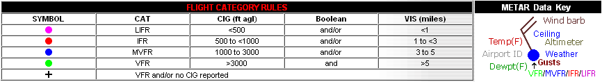
Default display includes all SIGMETs, CWAs, IR satellite imagery, and satellite detected lightning density