
A heat wave over the Southwest will intensify this week, peaking and expanding into the Intermountain West and northern High Plains this weekend. Critical to extremely critical fire weather conditions are forecast from the Northwest and the northern Great Basin this weekend. Particularly Dangerous Situation Red Flag Warnings have been issued. Read More >
Overview
|
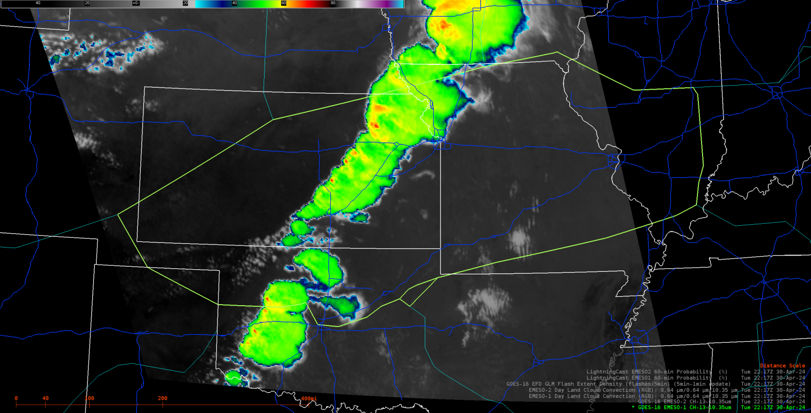
On the afternoon of April 30, 2024, a line of thunderstorms rapidly developed from western Iowa southwestward through far southeast Nebraska, northeast Kansas and into western Oklahoma. This line of thunderstorms blocked air travel considerably during the afternoon and evening hours across ZKC airspace. As the majority of the line was solid and tops soared above FL450, the only hole was in far southwest Kansas into far northwest Oklahoma. The majority of air traffic filed through the break in the line resulting in "organized" chaos in the skies. |
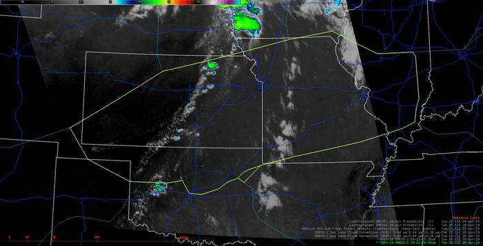
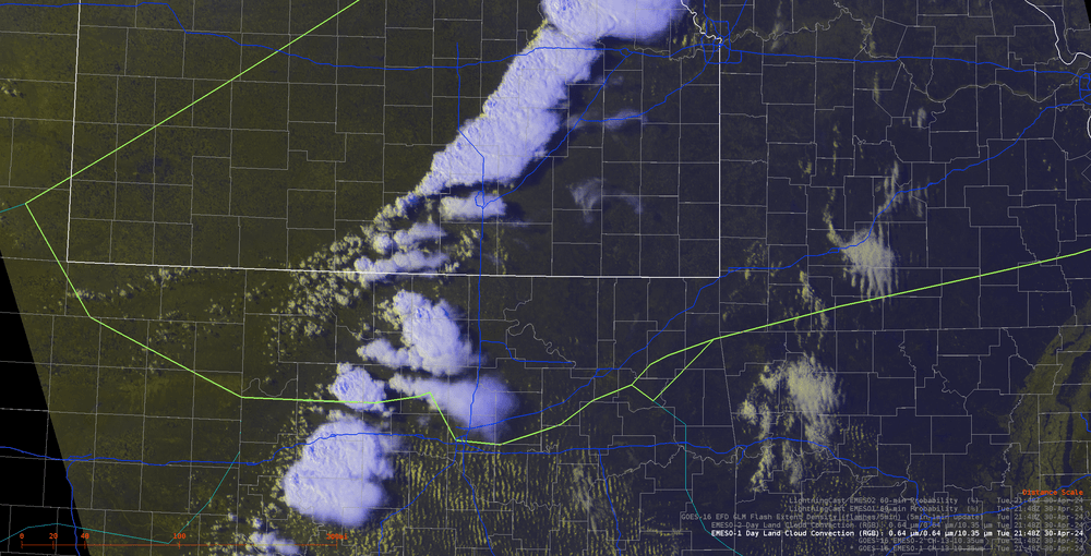 Visible satellite imagery depicting the break in the line of storms in southwest Kansas into northwest Oklahoma at around 22 UTC. |
Satellite/Radar
 |
 |
 |
 |
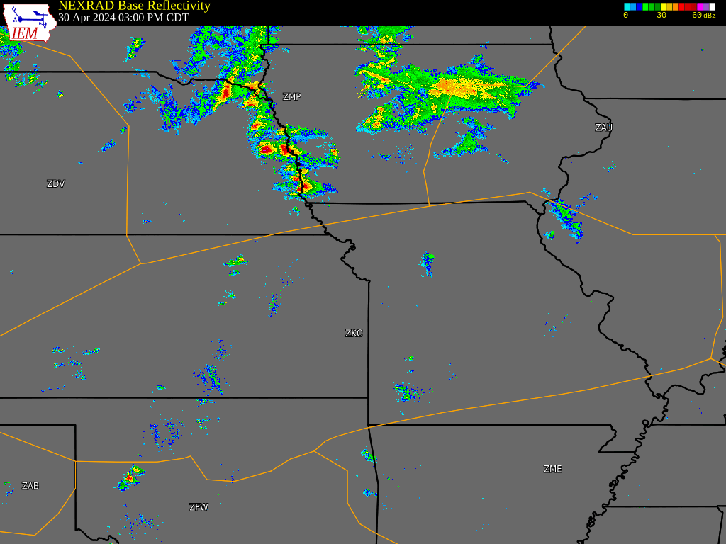
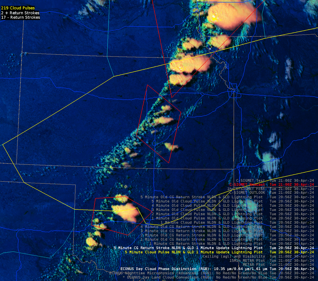
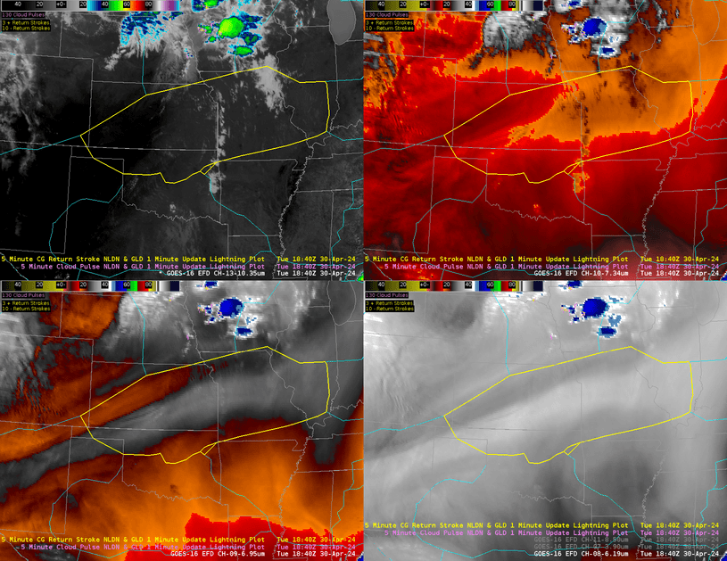
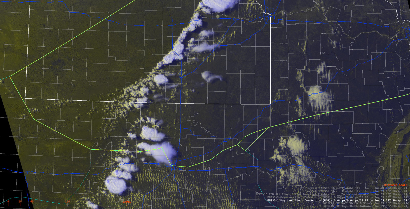
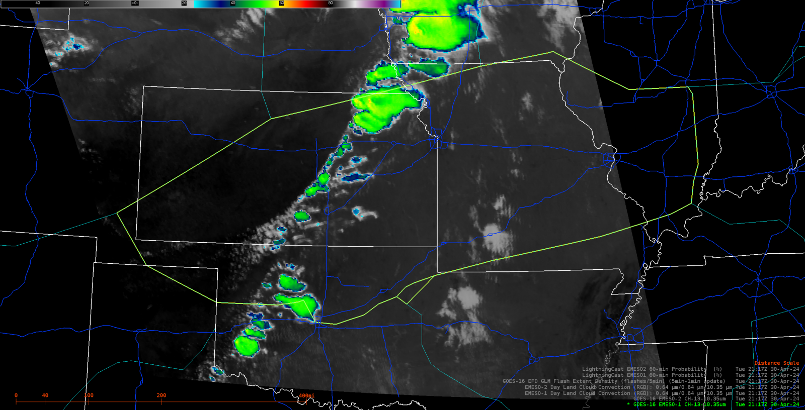
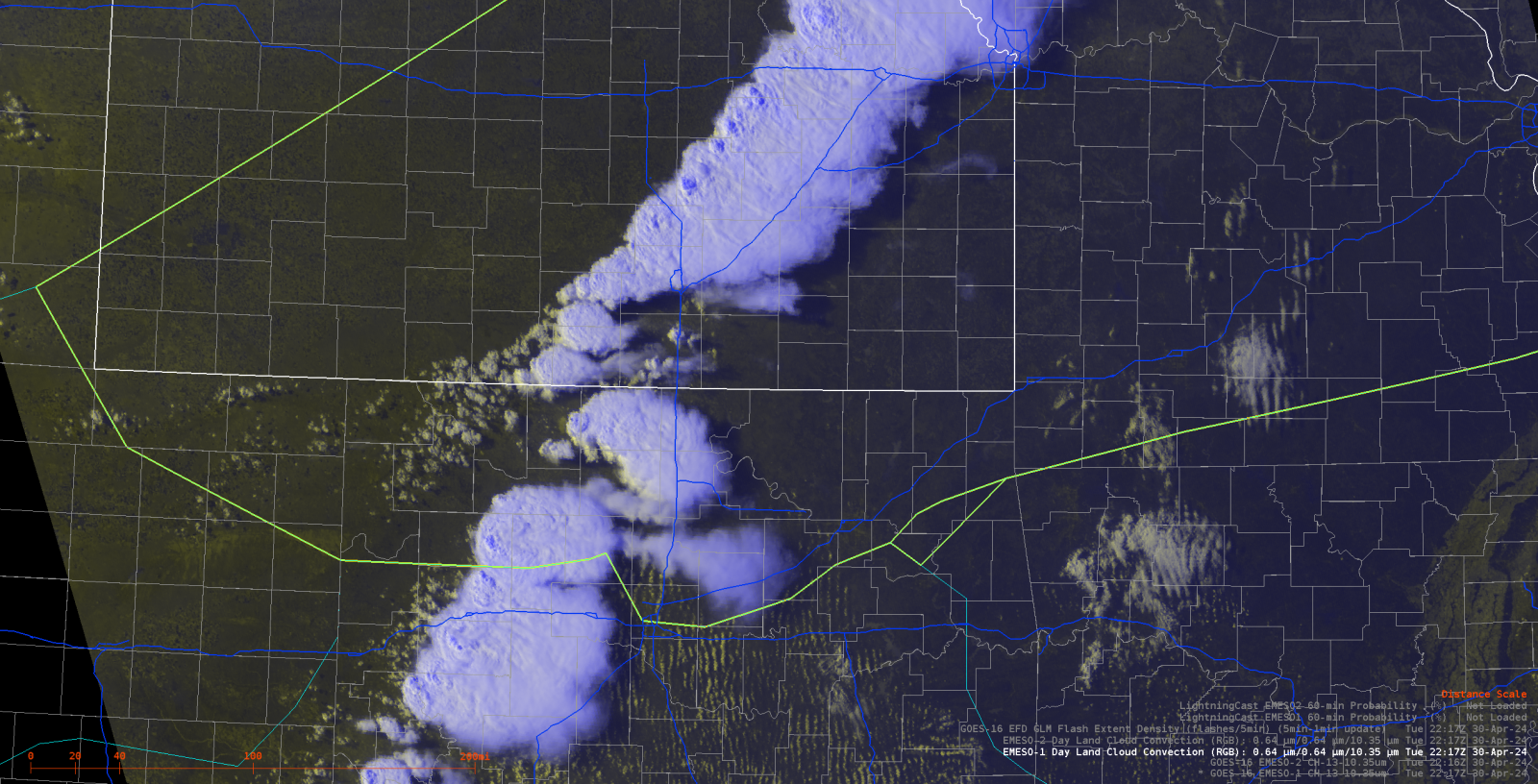
| Radar Loop from 3 p.m. CT (22 UTC) to 10 p.m. CT (04 UTC) | This is a one-hour loop of the Day Cloudy Phase Distinction RGB from 21-22 UTC. The loop depicts the rapid development of the line of storms over central Kansas into northwest Oklahoma. | 4-panel IR loop overlaid with 5-minute NLDN lightning data. Top left is Channel 13 (10.35um); Top right is Channel 10 (7.34um); Bottom left is Channel 9 (6.95um); Bottom right is Channel 8 (6.19um). | Mesoscale loop of the Clean Window Infrared. 1-minute frames from 20 UTC to 00 UTC. |
 |
 |
 |
 |
| At 2118 UTC: Still Visible Image at storm initiation. The gap is already showing up in the line. | At 2117 UTC: Still Clean IR Image | At 2218 UTC: One hour later showing how quickly the gap shrunk. | At 2218 UTC: One hour later showing the gap quickly shrinking. |
 |
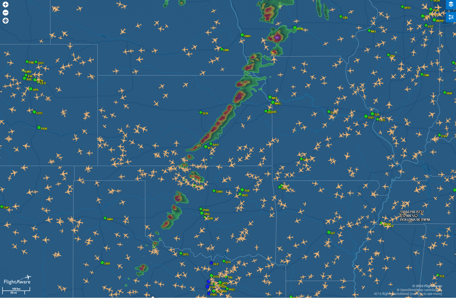 |
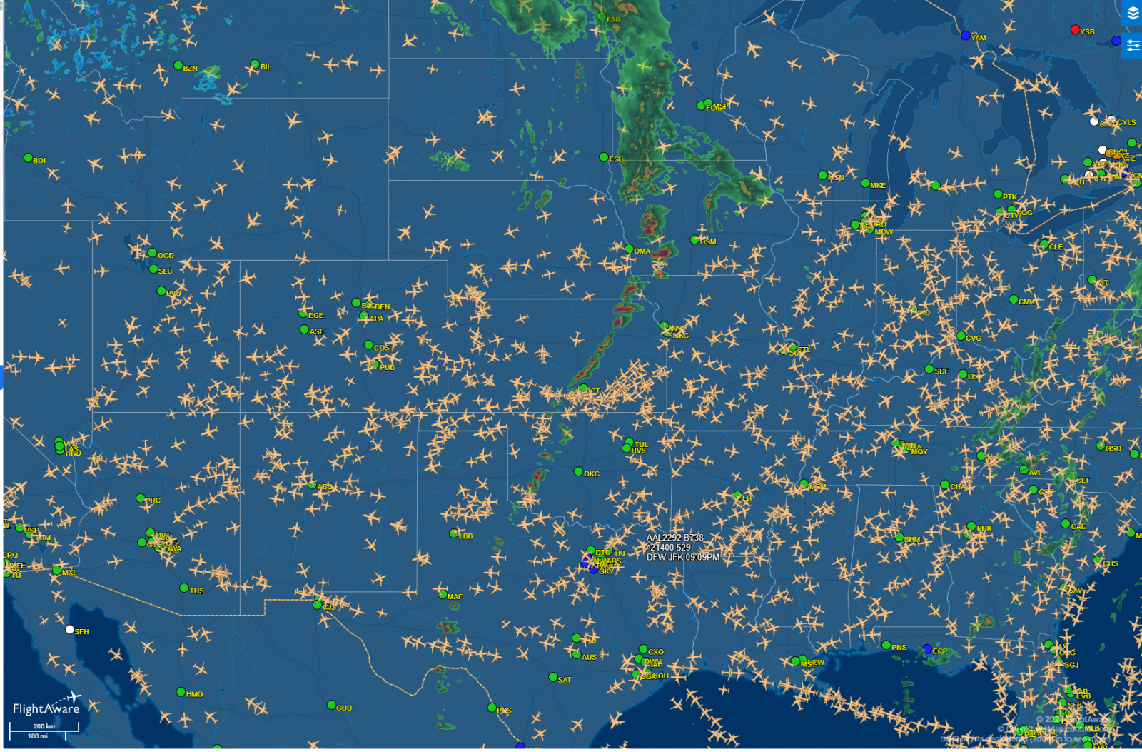
| At 2218 UTC: Flight Aware screen capture. | At 2242 UTC: Flight Aware screen capture roughly 20 minutes later showing the gap in the line being utilized to the fullest. |
Environment and Forecast
A few products covering thunderstorm development.
 |
 |
 |
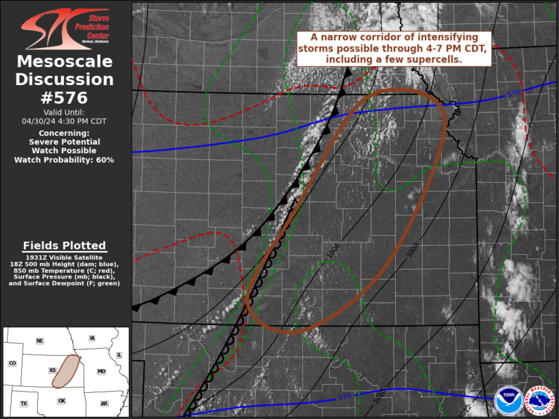
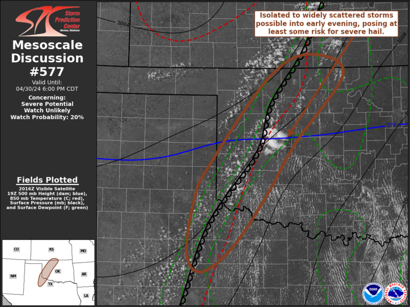
| Figure 1: SPC Mesoscale Discussion #576 issued at 2035z. You can find the full MD here: https://www.spc.noaa.gov/exper/archive/event.php?date=20240430 | Figure 2: SPC Mesoscale Discussion #577 issued at 2124z. You can find the full MD here: https://www.spc.noaa.gov/exper/archive/event.php?date=20240430 | Figure 3: Center Weather Advisory 101 issued at 2015z for developing thunderstorms. |
Upper Air Analysis.
 |
 |
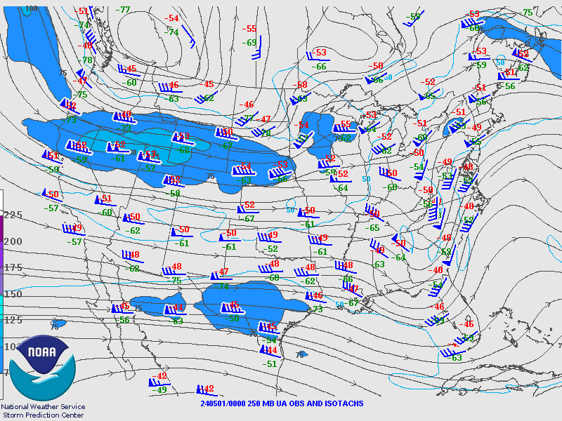 |
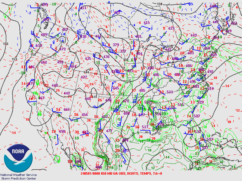
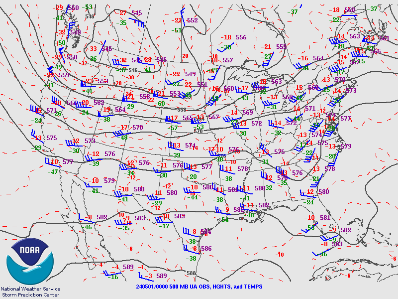
| Figure 4: 850mb chart | Figure 5: 500mb chart | Figure 6: 250mb chart |
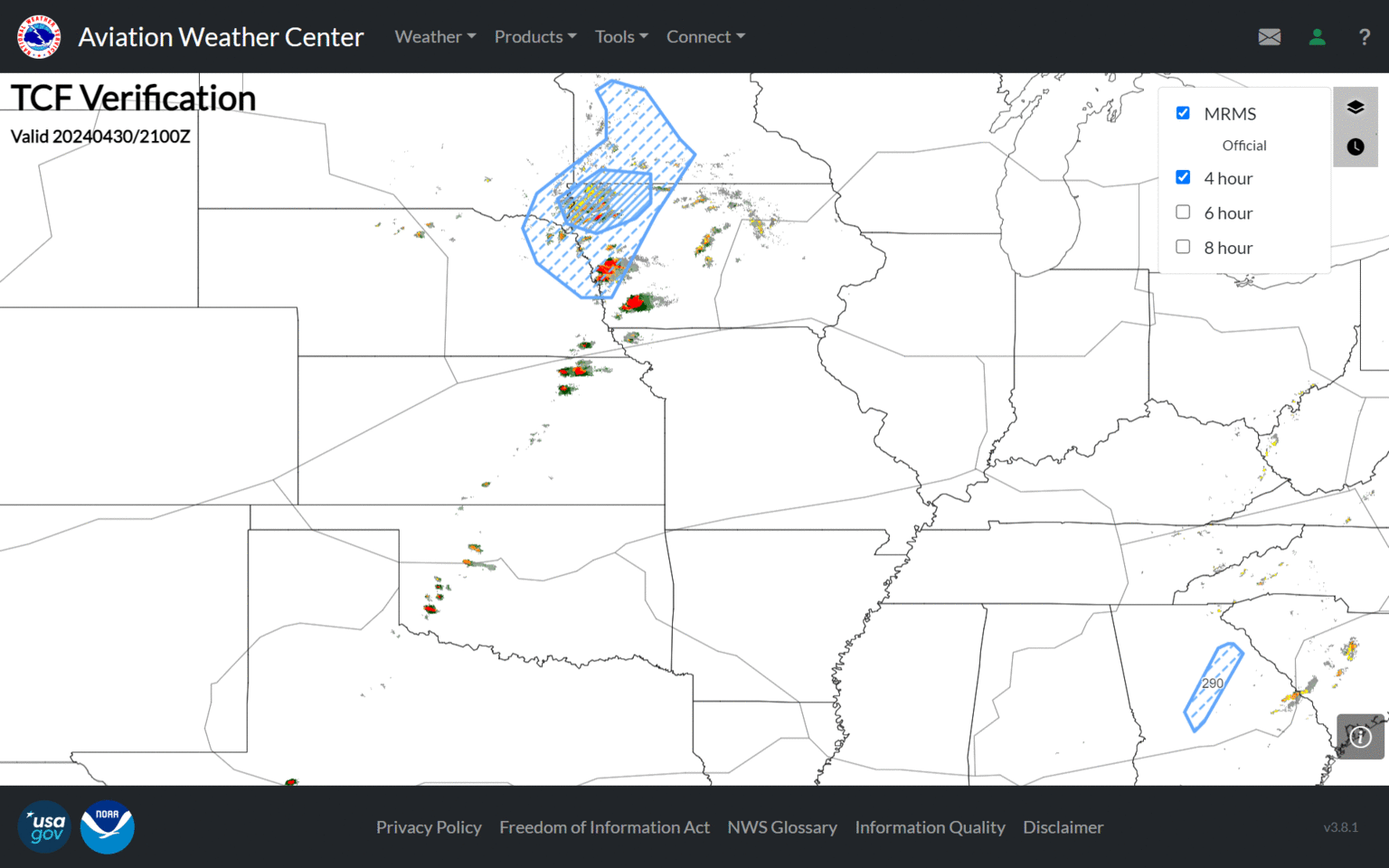
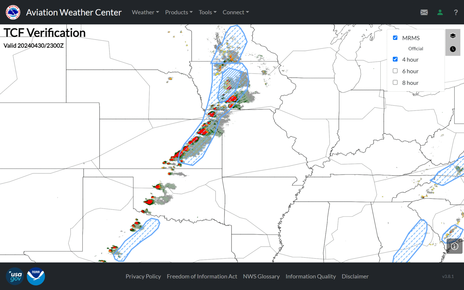
TCF Verification. Traffic Flow Management (TFM) Forecast Help
 |
 |
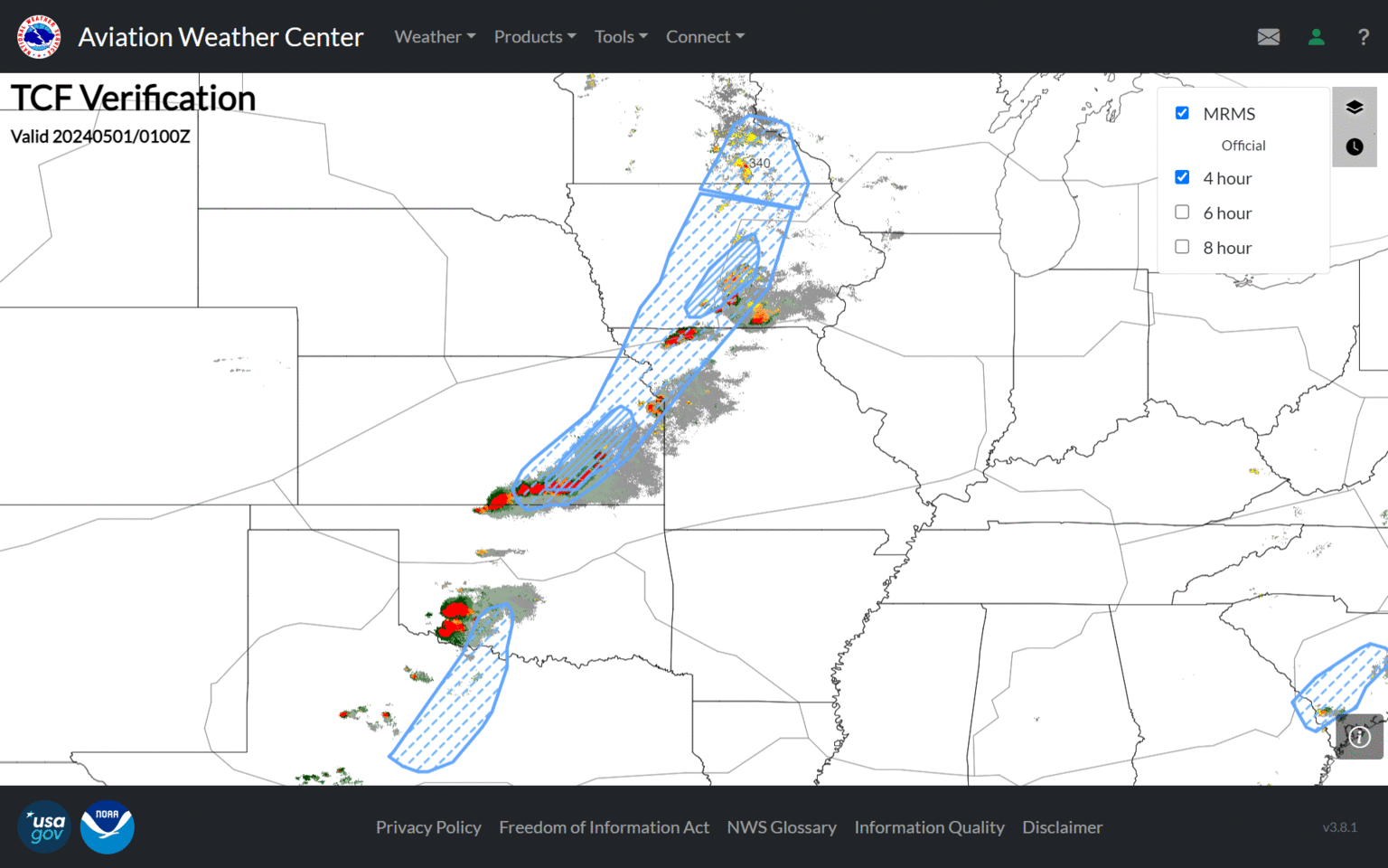 |
| Figure 7: 21z TCF Verification. All three issuances...4-hour, 6-hour, 8-hour. | Figure 8: 23z TCF Verification. All three issuances...4-hour, 6-hour, 8-hour. | Figure 9: 01z TCF Verification. All three issuances...4-hour, 6-hour, 8-hour. |
 |
Media use of NWS Web News Stories is encouraged! Please acknowledge the NWS as the source of any news information accessed from this site. |
|

