Please help the National Weather Service spread these important safety messages on social media! Everyone is welcome to use the text and images provided below to help the NWS build a Weather-Ready Nation.
Facebook
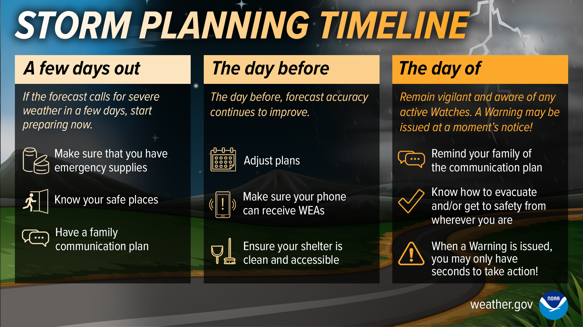
Don’t wait until the day of the storm to begin protecting yourself. If the forecast calls for severe weather, begin preparing NOW. Stay Weather-Ready.
weather.gov/safety/tornado
Twitter
Don’t wait until the day of the storm to begin protecting yourself. If the forecast calls for severe weather, begin preparing NOW. Stay #WeatherReady.
weather.gov/safety/tornado

Facebook
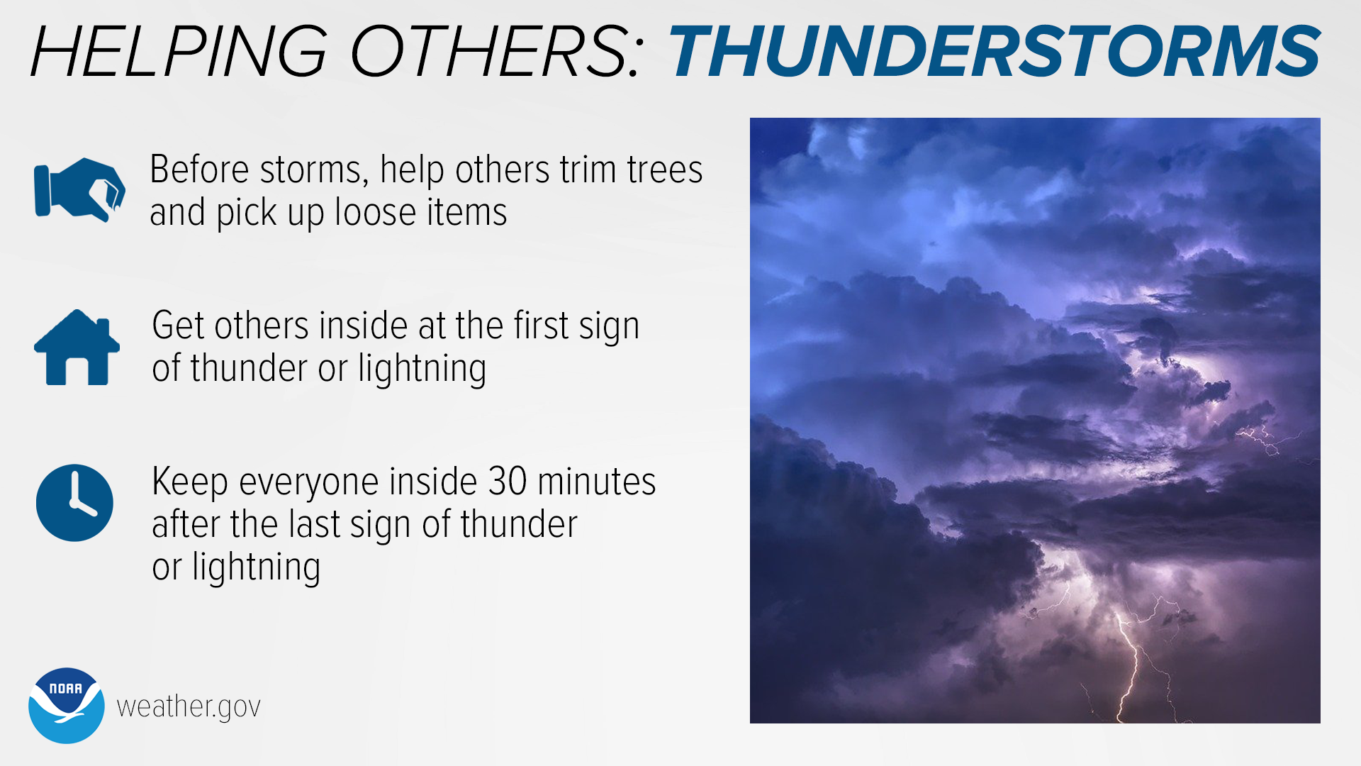
Thunderstorms are sometimes underestimated as a serious weather threat, but they can be deadly. Strong winds can turn tree branches and ordinary loose objects into dangerous projectiles — help your community stay safe by trimming trees and picking up loose items.
Lightning can strike up to 10 miles away from a storm. Make sure to get everyone inside at the first sign of thunder or lightning, and keep them inside until at least 30 minutes after the last sign of thunder or lightning.
weather.gov/safety/thunderstorm
Twitter
Thunderstorms are sometimes underestimated as a serious weather threat, but they can be deadly. Strong winds can turn ordinary objects into dangerous projectiles, and lightning can strike up to 10 miles away from a storm. #WeatherReady
weather.gov/safety/thunderstorm

Facebook
Thunderstorms and squall lines can quickly turn clear skies dark. Stay Weather-Ready by having a way to get weather alerts on your phone, and stay safe by immediately going inside when the skies turn threatening. weather.gov/safety/thunderstorm
Twitter
Thunderstorms and squall lines can quickly turn clear skies dark. Stay #WeatherReady by having a way to get weather alerts on your phone, and stay safe by immediately going inside when the skies turn threatening. weather.gov/safety/thunderstorm

Facebook
A Severe Thunderstorm WATCH means Be Prepared. Stay informed and be ready to act, because severe thunderstorms are possible.
A Severe Thunderstorm WARNING means Take Action! Take shelter in a strong building, because severe weather is occurring or will occur shortly.
weather.gov/safety/thunderstorm-ww
Twitter
A Severe Thunderstorm WATCH means Be Prepared.
A Severe Thunderstorm WARNING means Take Action!
weather.gov/safety/thunderstorm-ww #WeatherReady

Facebook
During high winds, tree damage is expected, and loose objects can become airborne and dangerous. You are safest indoors, away from windows, in an interior room. Stay Weather-Ready and learn more about wind safety: weather.gov/safety/wind
Twitter
During high winds, tree damage is expected, and loose objects can become airborne and dangerous. You are safest indoors, away from windows, in an interior room. Stay #WeatherReady and learn more about wind safety: weather.gov/safety/wind

Facebook
Chunks of ice that fall from the sky can cause serious damage to people, animals, and property. But what exactly causes hail to form? Watch this video for some hail science! youtu.be/w1g0TToHTIA
Twitter
Chunks of ice that fall from the sky can cause serious damage to people, animals, and property. But what exactly causes hail to form? Watch this video for some hail #science! youtu.be/w1g0TToHTIA
Facebook
Going camping? Watch out for thunderstorms! Know your weather forecast and notify your family or friends of your plans. Have an evacuation plan and know where you can find shelter. Make sure to pack a safety kit and a radio for forecast updates. weather.gov/safety/thunderstorm
Twitter
Going camping? Watch out for thunderstorms! weather.gov/safety/thunderstorm #WeatherReady

Facebook
Do you know the risk categories for severe weather? Learn the severe weather outlooks issued by the Storm Prediction Center @NWSSPC spc.noaa.gov
Twitter
Know your risk for severe weather? See the Storm Prediction Center @NWSSPC spc.noaa.gov #WeatherReady

Facebook
Tornadoes, large hail, strong winds, heavy rain, and lightning are all hazards associated with severe weather. Severe weather has been reported in all 50 states, so no matter where you are, make sure you are prepared! weather.gov/safety/thunderstorm
Twitter
Severe weather can occur anywhere. Wherever you are, be prepared! weather.gov/safety/thunderstorm #WeatherReady

Facebook
Did you know there are different types of thunderstorms? Watch this video and learn what they are: youtu.be/NNrb0hI5JD4
Twitter
Did you know there are different types of thunderstorms? Watch this video and learn what they are: youtu.be/NNrb0hI5JD4
Facebook
"Dry thunderstorms" are thunderstorms that produce little or no precipitation at the surface. In combination with dry fuels (i.e. vegetation), dry thunderstorms can ignite fires with lightning but won’t provide much rain to put the fires out. Therefore, dry thunderstorms are a factor in fire weather forecasts. weather.gov/abq/clifeature2010drythunderstorms
Twitter
"Dry thunderstorms" (which produce little or no precipitation at the surface), when combined with dry vegetation, can ignite wildfires. weather.gov/abq/clifeature2010drythunderstorms
Please remember to stay #WeatherReady!

Facebook
Hail forms when updrafts (or rising air) in thunderstorms carry raindrops upward into extremely cold areas of the atmosphere, allowing the raindrops to freeze. The stronger the updraft, the bigger the hailstone can become before falling out of the storm (typically when the hailstone becomes too heavy for the updraft). The largest hailstone in diameter was 8 inches, which fell in Vivian, South Dakota on July 23, 2010. noaa.gov/jetstream/hail
Twitter
Hail is precipitation that forms when thunderstorm updrafts (or rising air) carry raindrops upward into extremely cold areas of the atmosphere, where the raindrops freeze into hailstones. Big updrafts result in big hail. noaa.gov/jetstream/hail #WeatherReady

Facebook
Thunderstorms can be a mariner's worst nightmare. They can develop quickly and can produce strong wind, pounding rain, deadly lightning, and damaging hail with very few places for shelter. Even marginal thunderstorm winds can capsize certain boats and other floating vessels. If you are out on the open water and see clouds quickly growing in the distance, thunderstorms may be developing. Don’t wait until you can hear thunder or see lightning. It is best to head to port or safe shelter at the first sign of a developing storm. weather.gov/safety/safeboating-during
Twitter
Boaters: When storms start to form, head to port or safe shelter immediately! weather.gov/safety/safeboating-during #WeatherReady

Facebook
Heading out for a day of fun on the lake? Pay attention to thunderstorm development! Make sure to check the forecast before heading out, and have a portable radio in the boat to get the latest forecasts. If the skies turn threatening, head to shore! weather.gov/safety/thunderstorm
Twitter
Heading out for a day of fun on the lake? Be mindful of developing thunderstorms! weather.gov/safety/thunderstorm #WeatherReady
Facebook
Spending time outdoors? Be on the lookout for thunderstorms! Keep up with the latest NWS forecast before you head out, and know how you will receive a thunderstorm warning if one is issued. Identify where the nearest shelter is located, and if the skies turn threatening, seek shelter immediately. weather.gov/safety/thunderstorm
Twitter
Spending time outdoors? Keep a look out for thunderstorms! weather.gov/safety/thunderstorm #WeatherReady

Facebook
Thunderstorms can produce heavy rain, which may lead to flooding. Watch out for water of an unknown depth - it only takes 6 inches of flowing water to knock over a person and 12 inches to carry away a car. If you can’t see the road: Turn Around, Don’t Drown! weather.gov/safety/thunderstorm
Twitter
Thunderstorms can lead to flooding. Never drive through flood waters. Turn Around, Don’t Drown! weather.gov/safety/thunderstorm #WeatherReady

Facebook
Did you know that a 3-inch hailstone can fall to the ground as fast as 107 mph? The largest hailstone on record in the US measured 8 inches in diameter! Find shelter, stay indoors, and stay away from windows when severe weather strikes. weather.gov/safety/thunderstorm
Twitter
Did you know that a 3-inch hailstone can fall to the ground as fast as 107 mph? The largest hailstone on record in the US measured 8 inches in diameter! Find shelter, stay indoors, and stay away from windows when severe weather strikes. weather.gov/safety/thunderstorm

Facebook
It is extremely important to have a disaster supply kit ready before severe weather strikes. Pack food and water, a battery-powered radio, flashlights and batteries, a cell phone with a spare battery pack (or a portable charger/power bank), a first aid kit, a pair of shoes/socks, a list of emergency contacts, and a whistle (to signal for help). weather.gov/safety/thunderstorm
Twitter
It is important to have a disaster supply kit ready in case of thunderstorms. weather.gov/safety/thunderstorm #WeatherReady
