NWS All NOAA
Las Vegas, NV
Weather Forecast Office
Last Map Update: Fri, Mar 20, 2026 at 6:20:32 am PDT
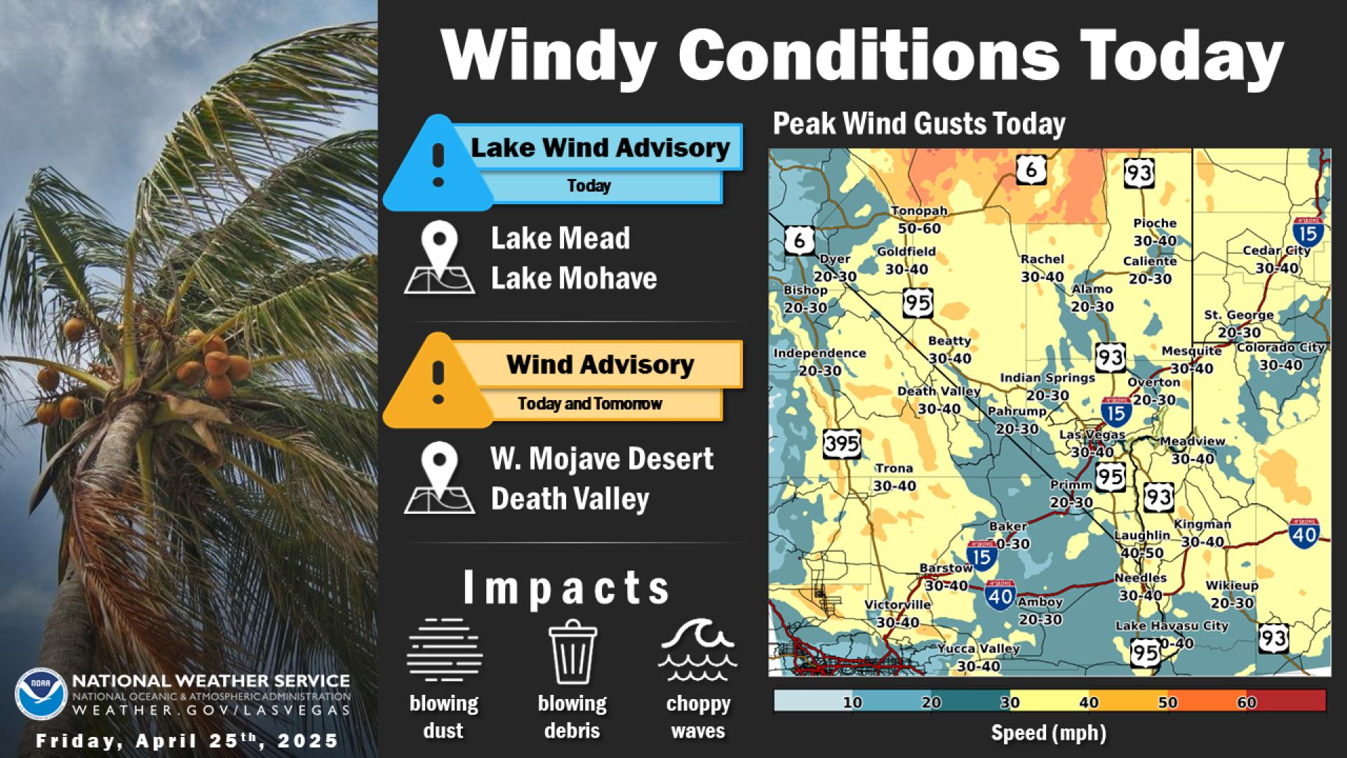
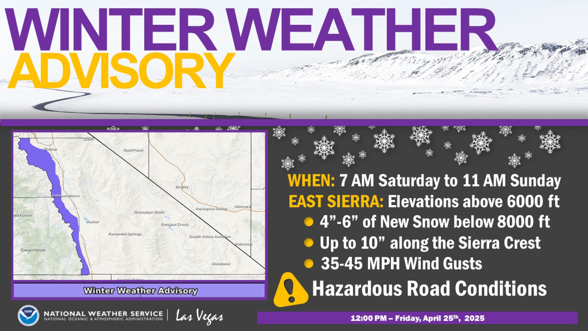


 Current Weather Map