
Multiple corridors of severe thunderstorms are expected across the Upper Midwest on Monday into Monday night, with a regional severe weather outbreak possible. The most dangerous period is likely during the late afternoon and evening when strong tornado potential should be maximized. Scattered large to very large hail and damaging winds are likely as well. Read More >
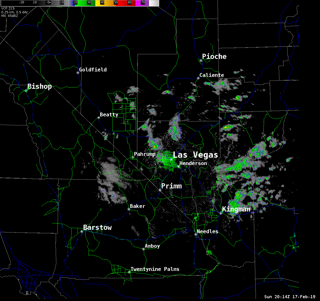
Loop of KESX radar from 12PM 2/17 - 4AM 2/18
GOES17 Visible Satellite Loop:
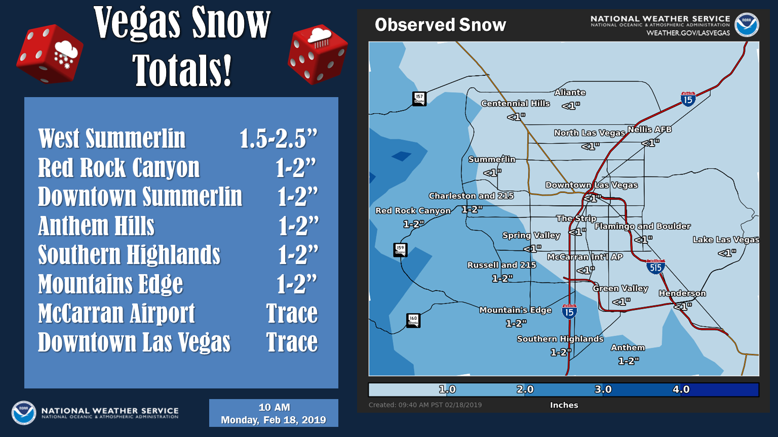
Snowpack on Ground Monday, February 19th
Yes and no. We had been seeing very small chances for snow in the valley for a few days, but it wasn't until Sunday afternoon that the high-resolution models were consistently indicating that western parts of the valley could see up to 3 inches and up to an inch elsewhere. That's when the decision was made to issue the Winter Weather Advisory. This is uncommon for the models but it happens, and for a number of different reasons, models often overdo the snowfall in the valley. This can be because models struggle with the very dry desert climate in the low levels of the atmosphere, they can have a difficult time because snow levels can fluctuate up and down depending on which direction the wind is originating from, or they can just completely miss some things. The models aren't perfect, and they are one of the most important guides we have for making a forecast.
Surface temperatures, snow levels, and the intensity of the precipitation coming down. All three of these things complicated the forecast and thus, what ended up happening. Surface temperatures in the valley were above freezing much of the night, but the temperatures were much closer to freezing in the west side of the valley where elevations are a bit higher. Also, the temperatures were fluctuating up and down a few degrees resulting in rain, then snow, then back to rain in some cases. This happens often when heavier precipitation falls. The atmosphere is trying to evaporate the precipitation as it falls and this cools the atmosphere to its wet bulb temperature. Temperatures can fall over 10 degrees in an hour depending on the intensity of the precipitation. This is known as the web-bulb effect, and while we can approximate the potential of this effect, it's notoriously difficult to accurately forecast. So while most areas were above freezing as far as the air temperature goes, accumulations occurred where heavier precipitation could push these temperatures down further. These areas included Goodsprings, Sandy Valley, I-15 between Primm and Las Vegas, Boulder City. Basically, where the colors are brighter on the radar loop above.
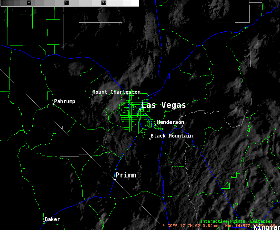
You can see the extent of the snowpack as seen on satellite from Monday on the loop above as well.
Loop of KESX radar from 1PM 2/20 - 10PM 2/21

GOES17 Visible Satellite Loop:
Snowpack still on ground Friday, February 22nd

This event was similar, but some key aspects were different. Again, a closed low pressure system had moved over the region resulting in very cold temperatures aloft (high in the atmosphere). This causes the atmosphere to become rather unstable which means it doesn't take a whole lot of help to get precipitation to form. This was the case a few days prior that led to snow as well, but this low was quite a bit colder resulting in more widespread potential for snow. The main difference was how much lift the low created on it's east side (northwestern Arizona on the radar loop). This enhanced upper level lifting, in addition to the cold temperatures aloft, resulted in some rare snowfall totals for places like Kingman, Colorado City, and the Hualapai Mountains. Parts of I-40 east of Kingman saw 6-10" of snow! If this system was shifted just a little bit to the west, we could have seen some pretty significant snow in the Vegas area!
The atmosphere is incredibly complex to forecast. The right ingredients need to come together in the right place at the right time to become major. With this event, a few different things played in favor of Vegas missing out on significant accumulations. The first thing was where the upper low was positioned as it tapped into the good moisture from the Pacific. You can see on the radar loop, the bulk of the precipitation generation occurred south and east of Las Vegas, especially as we moved into the overnight hours on Wednesday. Vegas starting seeing rain transition to snowfall in the western outskirts shortly after 5PM with accumulations beginning shortly after. Overnight, a surge of moisture arrived as temperatures were at their coldest, but it stayed just to the south and east of the valley. We still had precip in the vicinity of Las Vegas Thursday, but the daytime heating allowed snow levels to rise enough for everything in the valley to transition back to rain. That eliminated the snow accumulation on the ground from the night before. We did get a brief return of snowfall later in the day as snow levels decreased again, but by that point, the system had begun shifting east and taking the moisture with it.
Clark County, Nevada 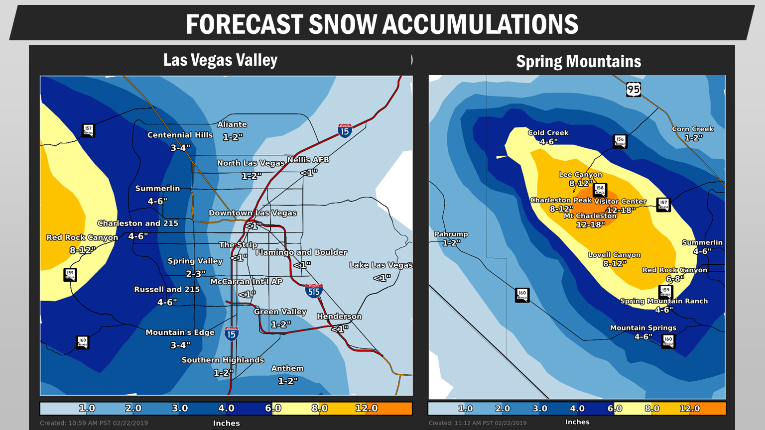

Mohave County, Arizona

Morongo Basin Area, California


