
Readout:
Hover Over Chart
Lightning Chart Information:
These charts show the number of (cloud-to-ground) lightning strikes in the selected region. Lightning strikes are a unique method to track the monsoon as the data do not suffer from issues more common to rain gauges (low spatial coverage across the region outside of population centers) and can therefore give a more complete picture of thunderstorm activity. The bar chart displays total strikes to date for each year, as well as the total for the entire season ending September 30th. The charts are updated around 5pm daily. Data source: VAISALA NLDN.
Learn more about hourly/daily lightning climatology with SPC's Data Viewer.
Readout:
Hover Over Chart
Zoom:
CTRL + Mouse Wheel or
Left-Click & Drag
Pan:
ALT + Left-Click & Drag

Readout:
Hover Over Point
Zoom:
CTRL + Mouse Wheel or
Left-Click & Drag
Pan:
ALT + Left-Click & Drag


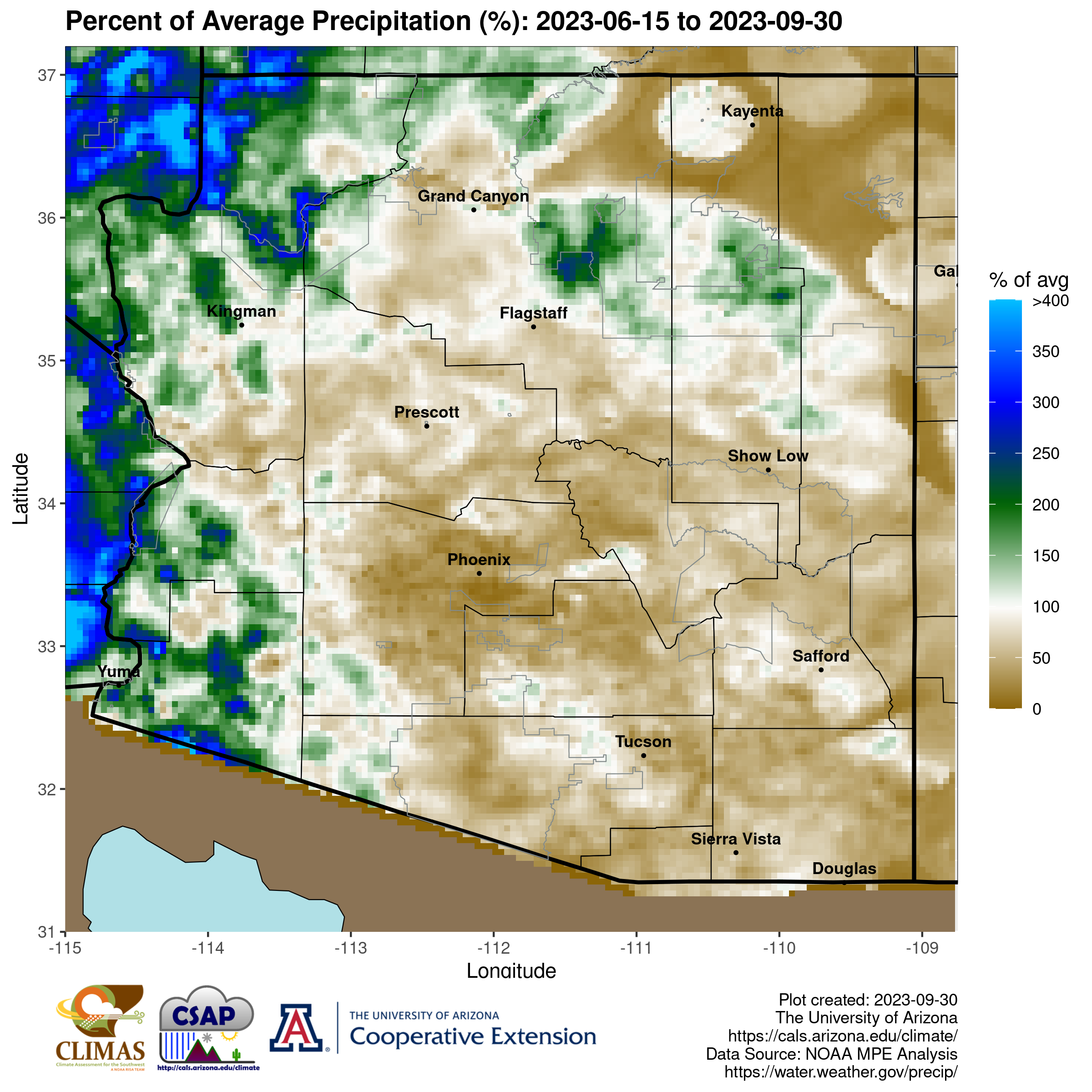
These resources are provided by University of Arizona Cooperative Extension and the Climate Assessment for the Southwest.

