Changes to Southeast Arizona Fire Weather Forecast Zones Effective Nov 10, 2020
NWS Tucson, in conjunction with fire partners, has redrawn the zone boundaries to align with the Fire Danger Rating Areas (FDRA) to better reflect the topographic, climatic and vegetative characteristics of southeast Arizona. Changes also took into account several administrative boundaries within the forecast area.
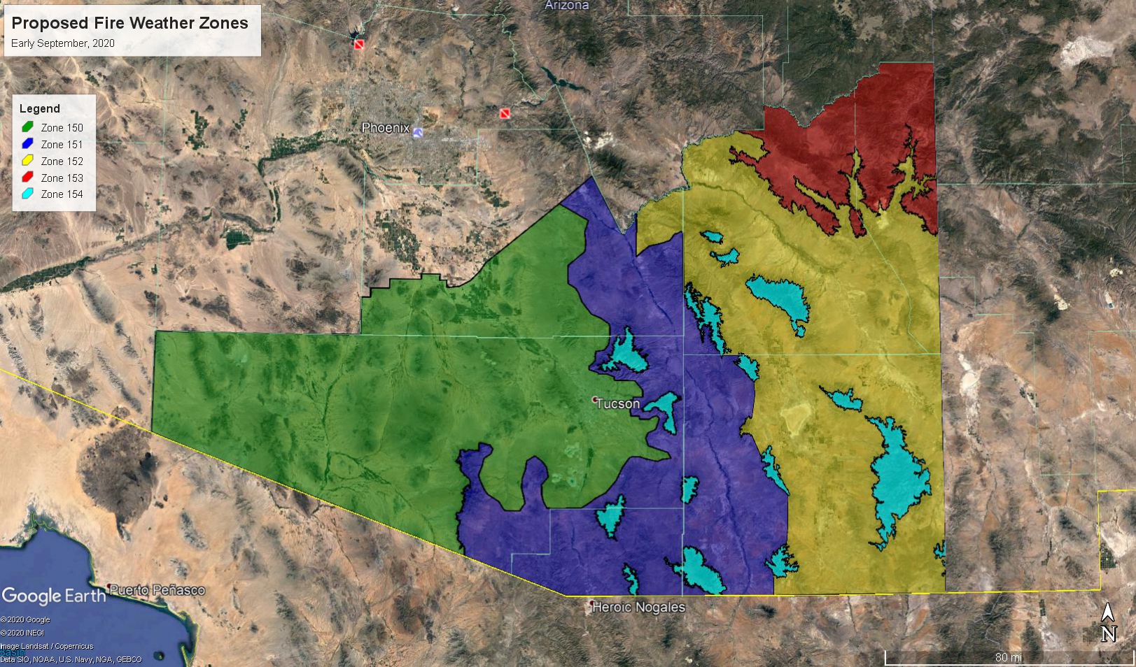
New Fire Weather Forecast Zones
- Zone 150 - Sonoran FDRA, Most of Pima County, South Central Pinal County, Tohono O’odham Nation, Tucson Metropolitan Area, TDC
- Zone 151 - Western Half Desert Grasslands FDRA, Including Elevations up to 5,500 feet in Southeast Corner of Pinal County, Extreme Eastern Pima County, Western Third of Cochise County, Santa Cruz County, TDC
- Zone 152 - Eastern Half Desert Grasslands FDRA, Including Elevations up to 5,500 feet in Southwest Graham County and Eastern Two Thirds of Cochise County, Southern San Carlos Reservation and Southern Greenlee County Below 5,000 feet, TDC
- Zone 153 - Northern Graham County, Northern Greenlee County, White and Gila Mountains, Apache Sitgreaves NF, Southern San Carlos Reservation Above 5,000 feet, SDC
- Zone 154 - Forest Woodlands FDRA, Includes the Sky Islands of Southeast Arizona Above 5,500 feet, Coronado NF, TDC​
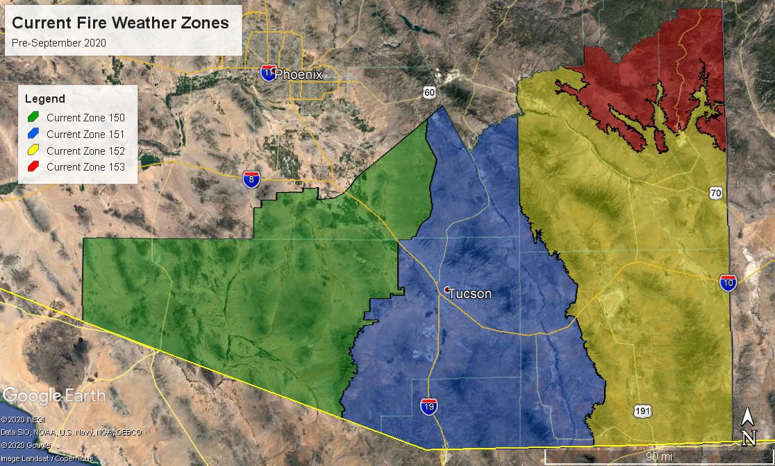
Old Fire Weather Forecast Zones, prior to November 10, 2020
- Zone 150 - Western Pima County-South Central Pinal County-Tohono O’odham Nation-TDC-
- Zone 151 - Eastern Pima County-Southeastern Pinal County-Santa Cruz County-Western Cochise County-Coronado NF-TDC-
- Zone 152 - Southern Greenlee County-Central and Eastern Cochise County-Southern Graham County-Southern San Carlos Apache Nation-
- Zone 153 - Northern Graham County-Northern Greenlee County-White and Gila Mountains-Apache Sitgreaves NF-SDC