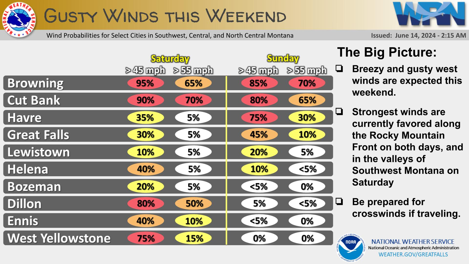
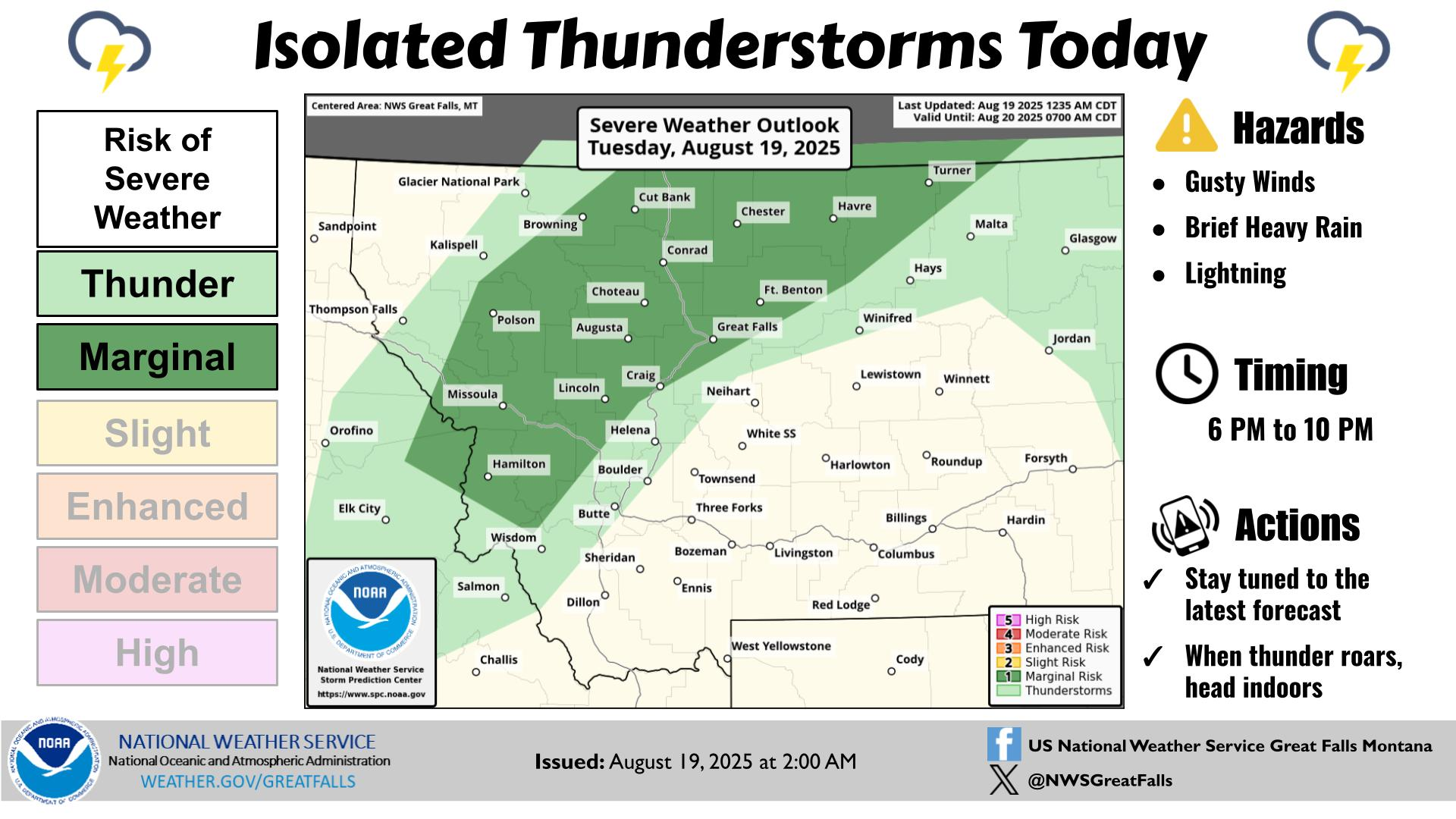
Looking ahead to the July 4th weekend, temperatures across the state will warm up with daily chances for afternoon showers and thunderstorms. If spending time outdoors be aware of rapidly changing conditions and be prepared to take shelter if thunderstorms develop in your area. Always stay hydrated and regularly apply sunscreen.


 Great Falls Radar
 Satellite
 Current Observations
 Forecast Discussion
 Montana Weather
 Fire Weather
 Winter Weather Forecasts
 Transportation Forecasts
 Weather Prediction Center
 Storm Prediction Center
 Aviation Weather
 Weather Stats