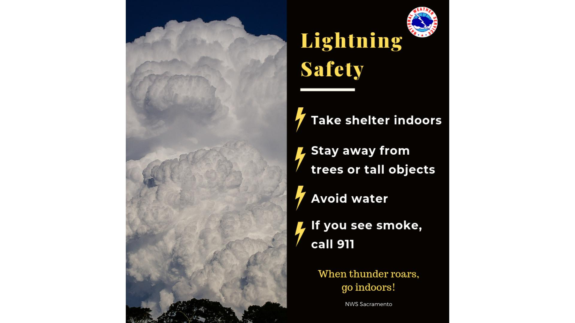
Cold & Fast Waters! How cold is too cold? Below 77°, breathing begins to be affected. From 70° to 60°, breathing is difficult to control or hold. From 60° to 50°, breath cannot be regained after losing it and muscle control is lost after a few minutes. Even strong swimmers can quickly lose muscle control. If you choose to enter the water, on a boat or otherwise, wear a life jacket, avoid alcohol, and keep a close eye on kids!


 Social Media Feeds
 Sacramento Radar
 Beale Radar
 Satellite
 Graphical Forecasts - Local
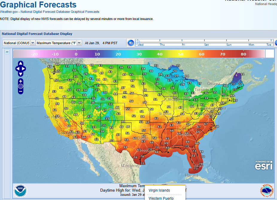 Graphical Forecasts - U.S.
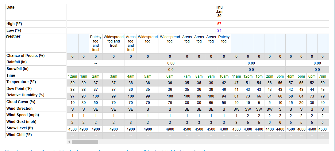 Forecast Weather Tables
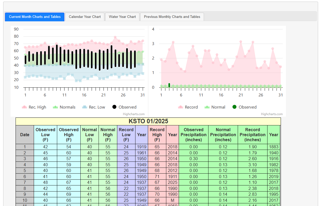 Recent STO Temperatures
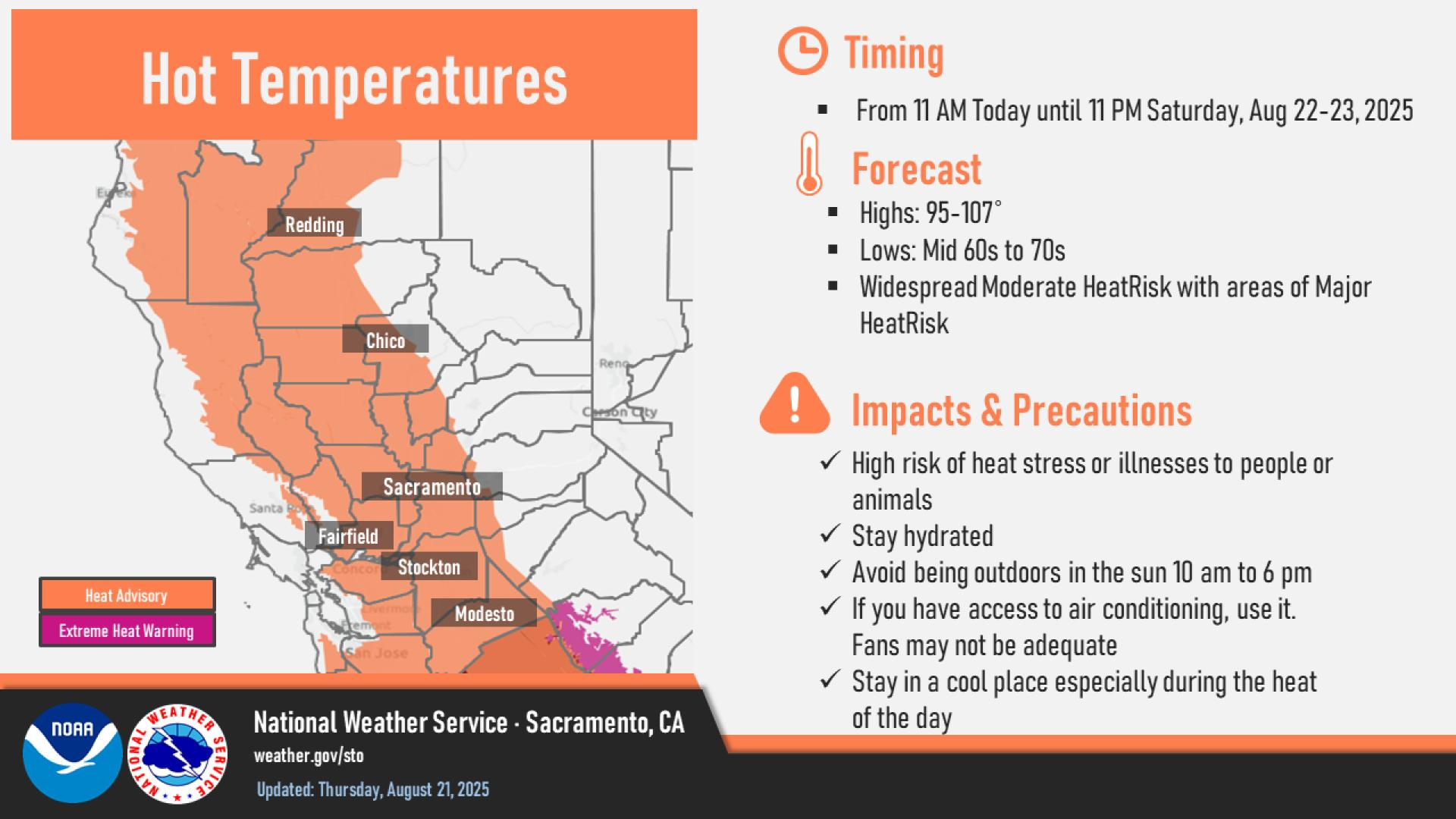
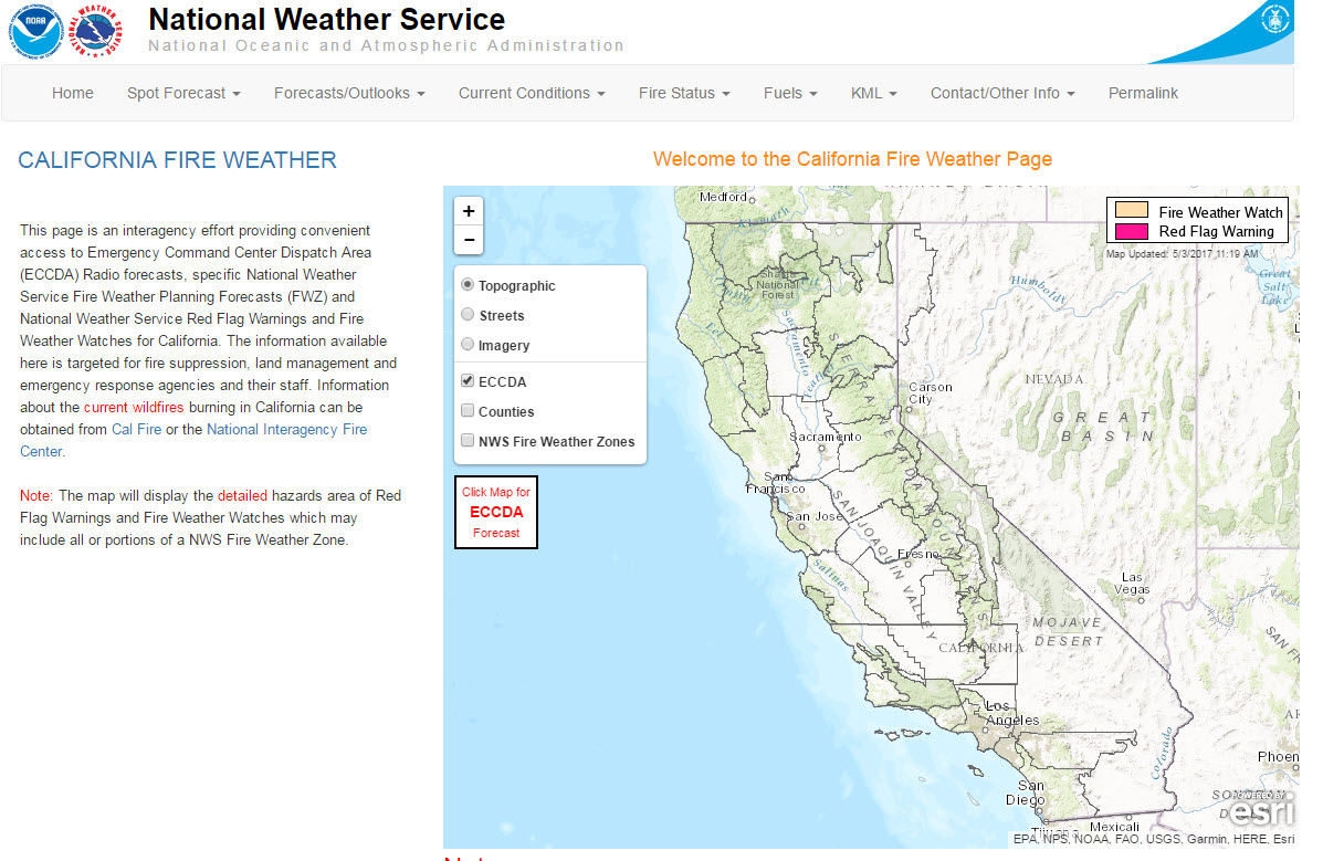 California Fire Weather Page
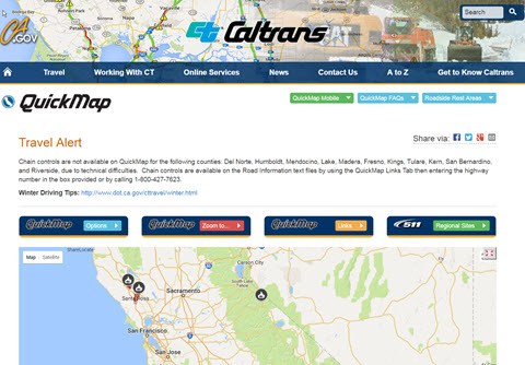 Caltrans QuickMap
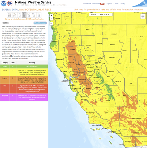 Heat Risk Link
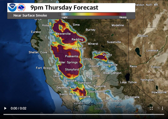 Experimental Smoke Forecast