
Gusty winds and very dry conditions will lead to a critical to extremely critical fire weather threat over portions of the Central and Southern Plains Thursday. Critical fire weather continues through Friday. Moderate to heavy mountain snow and strong winds will expand into the Northern Rockies Thursday, then into Colorado by Friday. Up to a foot of snow accumulation is possible. Read More >
|
Synoptic Overview
|
|
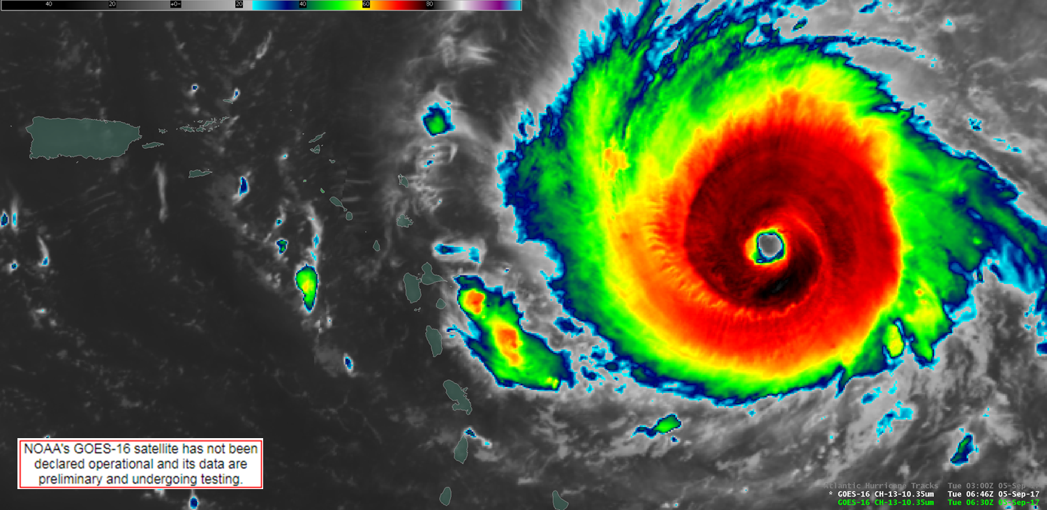
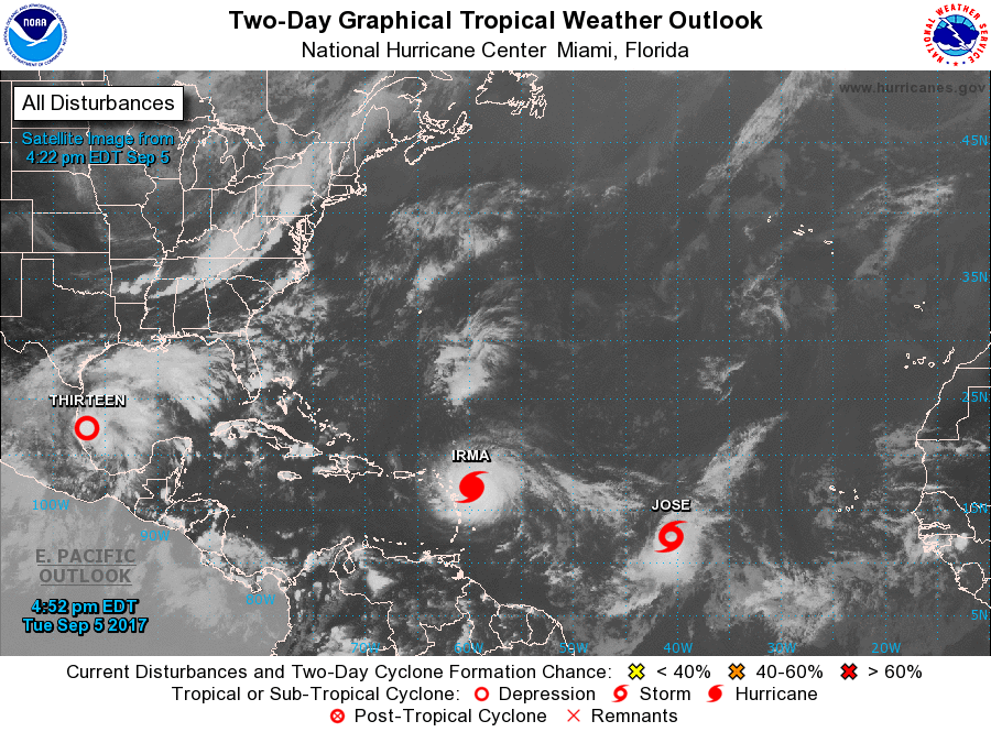
Hurricane Irma began showing its convective appearance on satellite imagery the 26-27th of August 2017 as it moved into the Eastern Atlantic waters. During the morning of August 30th, Irma was classified as a Tropical Storm with maximum sustained winds of 50 mph moving westward at 13 mph about 400 miles to the east of the Cabo Verde Islands. Within the next 30 hours, Irma went through a rapid intensification period primarily due to the moist environment and very warm sea surface temperatures during that time frame. On August 31st, the National Hurricane Center (NHC) classified Irma as a major hurricane, category 3 on the Saffir–Simpson hurricane scale (SSHS). During the next couple of days, there was little change in intensity as the hurricane moved west-northwestward into a drier environment and cooler sea surface temperatures; it had also completed several eyewall replacement cycles.
|
Presione aquí para retornar a la página principal del Servicio Nacional de Meteorología
|
Satellite & Radar Imagery
|
.gif)

Presione aquí para retornar a la página principal del Servicio Nacional de Meteorología
|
Weather Observations
|

|
Marine Observations
|


|
Damages
|
|
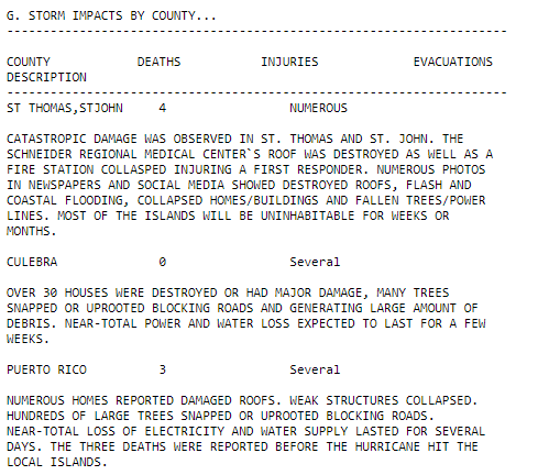
Damages in the U.S. Virgin Islands
|


|
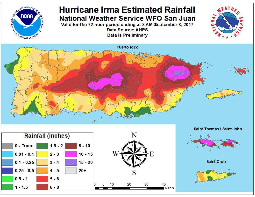
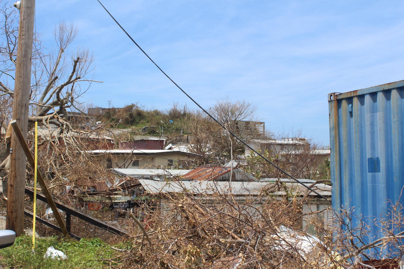
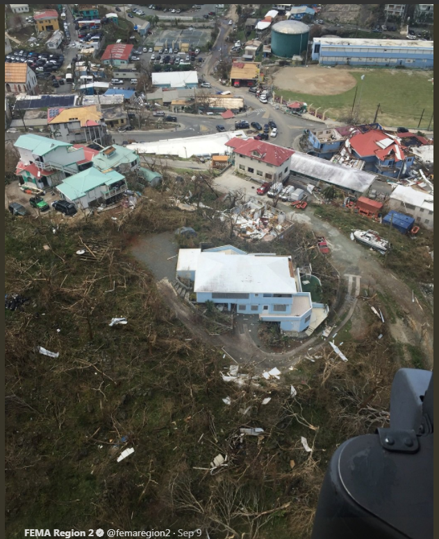
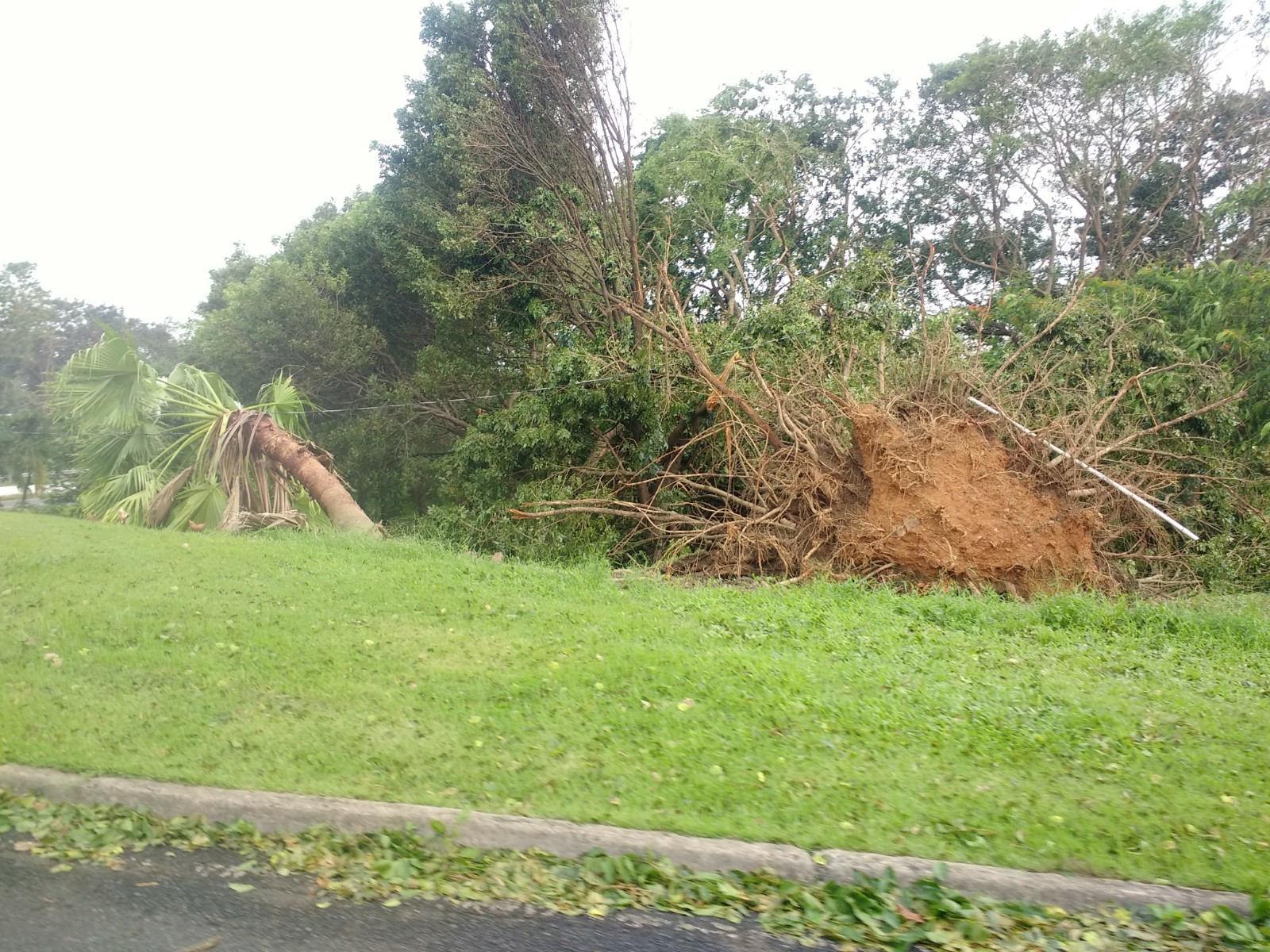
Damages in Puerto Rico
|


.JPG)

.jpg)
.jpg)
.jpg)
Presione aquí para retornar a la página principal del Servicio Nacional de Meteorología
|
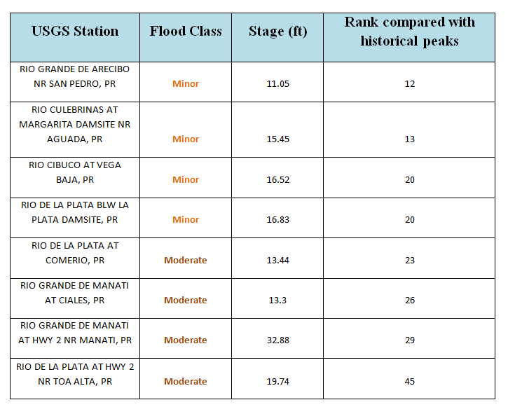
Flooding
|


.png)

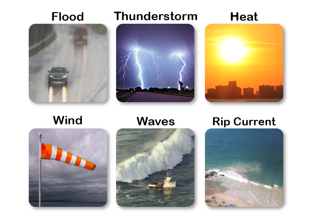 Graphical Hazardous Weather Outlook
 Tropical Analysis
 Tropical Weather
 Regional Satellite
 Puerto Rico and US Virgin Islands
 Local Radar