
Severe thunderstorms are forecast through this weekend along a slow moving cold front and secondary storm system that will impact areas from the southern Plains to the Great Lakes. Large hail and isolated damaging wind gusts are the main threats with these storms along with a risk for heavy to excessive rainfall which could bring flooding. Read More >
|
Synoptic Overview
|
Just after Tropical Storm Fred moved out of the northeast Caribbean, a tropical wave located near 30 West caught the attention of the hurricane's specialists and local forecaster on August 10th. During the next three days, the wave was affected by drier air around it and easterly shear, both factors delayed intensification into a tropical cyclone. When the system was located less than 1000 miles from the Lesser Antilles, the National Hurricane Center (NHC) classified the wave as a Potential Tropical Cyclone (PTC) Seven as environmental conditions became favorable on Friday August 13th. The disturbance was classified as Tropical Storm Grace early Saturday morning as it was approaching the Leeward Islands. However, the NOAA Hurricane Hunters found a weaker cyclone in the afternoon and so, it remained as a weak tropical storm of 40 MPH. At the same time, the NHC specialist shifted the cyclone’s forecast track southward and forecast the cyclone to slow down as it was approaching the U.S. Virgin Islands and Puerto Rico. Based on the track forecast, the storm was forecast to pass near Guadeloupe late Saturday and just south of St Croix and Puerto Rico on Sunday. The closest approach of Tropical Storm Grace was about 45 miles south of St. Croix at 6 AM AST and about the same distance to the south to Guanica at 2 PM AST on Sunday.
Figure 1: National Hurricane Center forecast on Tropical Storm Grace on August 15 at 11 AM AST. |
|
Satellite & Radar Imagery
|
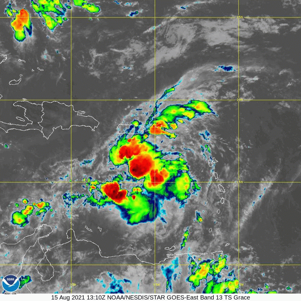
Figure 2: Animated image of GOES-East on August 15, 2021. Image credit NOAA.

Figure 3: Radar loop of Tropical Storm Grace as it moved just south of Puerto Rico and the U.S. Virgin Islands. Image credit NOAA.
|
Total Rainfall Accumulation
|

Figure 4: 36-hours rainfall accumulation associated with Tropical Storm Grace.
|
Maximum Wind Gust Reports
|

Table 1: Maximum Wind Gusts (MPH) measured during the passage of Tropical Storm Grace.
|
Damages
|
|
Impacts associated with Tropical Storm Grace were minor in Puerto Rico and the U.S. Virgin Islands. Rainfall accumulations ranged between 1-3 inches across portions of the local islands with higher amounts up to 4-5 inches in Cabo Rojo and Vieques. Tropical storm force wind gusts were also observed across the U.S. Virgin Islands, Culebra, eastern and southwest Puerto Rico. |


 Graphical Hazardous Weather Outlook
 Tropical Analysis
 Tropical Weather
 Regional Satellite
 Puerto Rico and US Virgin Islands
 Local Radar