|
Event Summary
|
|
A frontal boundary and the associated deep moisture moved over Puerto Rico and the U.S. Virgin Islands on Friday February 4th. This feature enhanced the low-level moisture convergence over northeast Puerto Rico including the San Juan Metro area producing rainfall accumulations of 1-3 inches in some spots. Additionally, showers that developed early in the week led to locally high rainfall totals, in excess of 4 inches in a matter of hours in some areas, including San Juan, Carolina, Vega Alta and Vega Baja. Therefore saturated soils were observed in many areas, especially along the north coast of Puerto Rico and portions of the San Juan metro area. These were the antecedent conditions ahead of the more significant event that came during the weekend. On Saturday and Sunday, a strong upper trough slowly moved southward over Puerto Rico providing a very unstable environment across the region. This upper-level feature combined with the remnants of the front lingering over the region supports the development of another round of heavy rainfall. The convergent flow at low levels caused the higher moisture band to remain over northeastern Puerto Rico leading to better precipitation efficiency that resulted in prolonged periods of heavy rainfall especially in the western half of the metro area especially on Saturday where accumulations across these areas ranged between 3-6 inches with a maximum of 10 in some areas. On Sunday, several rounds of heavy rainfall over the same areas only aggravated the flood problems. Conditions gradually improved on Monday as moisture and instability decreased considerably.
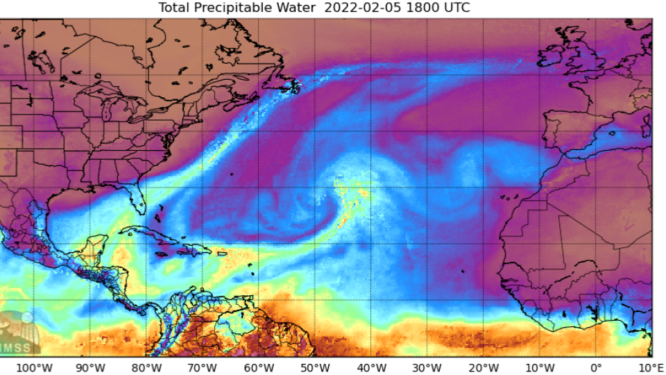
Figure 1: CIMSS Precipitable Water analysis on February 5th, 2022. |
|
Satellite Imagery and Sounding Data
|
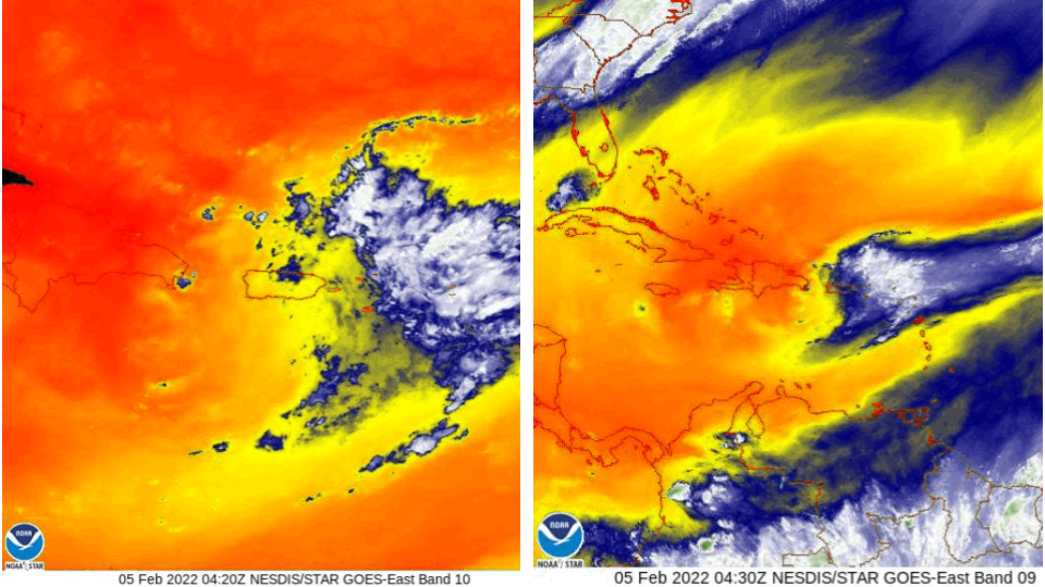
Figure 2: GOES-East Water Vapor images on February 5th, 2022 at 0430Z. Image credit NOAA.
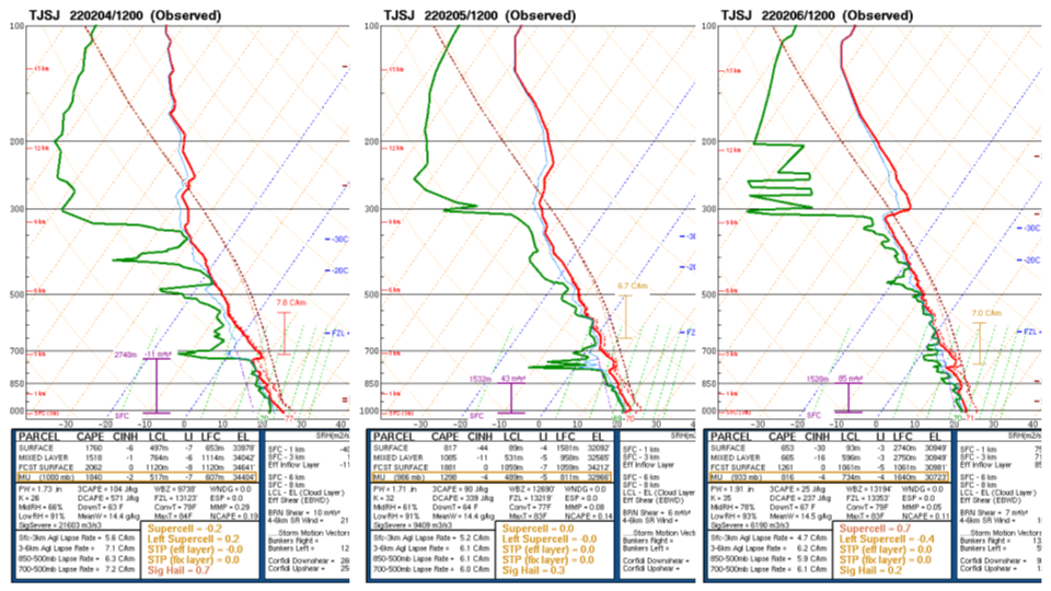
Figure 3: Atmospheric soundings of TJSJ (San Juan station) from February 4th-6th, 2022. Image credit NOAA SPC.
|
Total Rainfall Accumulation
|
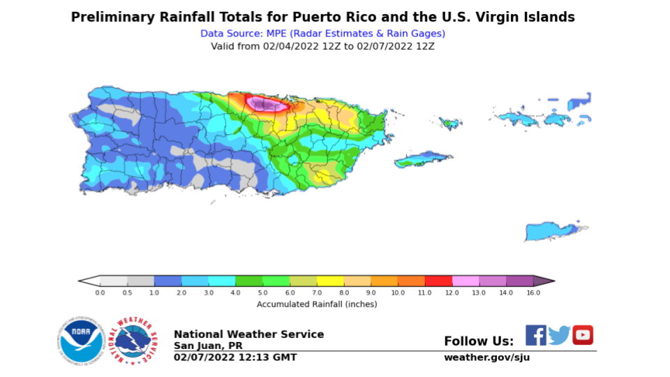
Figure 4: 72-hours rainfall accumulation associated with the event.
|
Warnings issued during the event
|
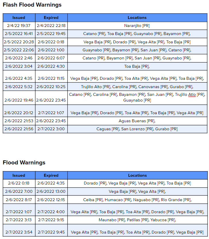
Table 1: Flash flood and flood warnings issued during the event.
|
Damages
|
|
Local 911 email alerts, local emergency managers and media reports provided evidence of the impacts and damages that occurred during the event. One of the most affected municipalities was Catano and Toa Baja where several reports of flooded streets and houses were affected by the excessive runoff and poor drainage. Also, the municipalities of Dorado and Vega Alta reported urban areas flooded as well as major roads impassable and landslides. San Juan and Guaynabo emergency managers reported several streets closed including the Kennedy and Baldioroty de Castro avenues due to flooding. The Puerto Rico Emergency Bureau is documenting all damages and their preliminary numbers suggest losses could be in the millions. |


 7-Day Graphical Hazardous Weather Outlook
 Tropical Analysis
 Tropical Weather
 Regional Satellite
 Puerto Rico and US Virgin Islands
 Local Radar