Elevated to critical fire weather conditions will persist across the central and southern High Plains today as gusty winds and dry conditions continue across the region. A clipper system will bring some lake effect snow to the Great Lakes and snow into the Northeast. Well above-average temperatures are expected to expand across much of the West, into the Plains states, and Southeast. Read More >
On July 1, a strong tropical wave moved off the coast of Africa. This tropical wave moved westward across the Tropical Atlantic at 15-20 MPH for the next couple of days. Late on July 3, the National Hurricane Center (NHC) started monitoring closely the disturbance, giving a 20 percent probability of development during the next 5 days. Twenty four hours later, late on July 4th, the tropical wave became better organized about 1000 miles west-southwest of the Cabo Verde Islands and the probability of development increased to 70 percent. The disturbance developed a closed circulation at the surface, meeting the criteria of a tropical cyclone. Therefore, NHC initiated advisories on Tropical Depression Two on July 5 at 11 AM AST. Six hours later, the tropical depression was upgraded into a tropical storm despite a dry and stable air mass surrounding the cyclone. The convective organization of the cyclone increased early on July 6, making Beryl the first hurricane of the season. The compact hurricane reached the maximum intensity of 80 MPH near 47 West. The deep-layer westerly shear and the dry environment near the cyclone caused Beryl to weaken into a tropical storm on July 7 about 700 miles east of the Lesser Antilles. The storm accelerated westward and moved into a more hostile environment, with strong westerly shear, as it approached the Lesser Antilles. This hostile environment caused the cyclone to deteriorate into an open wave as it entered the Eastern Caribbean during the late afternoon hours on July 8th.

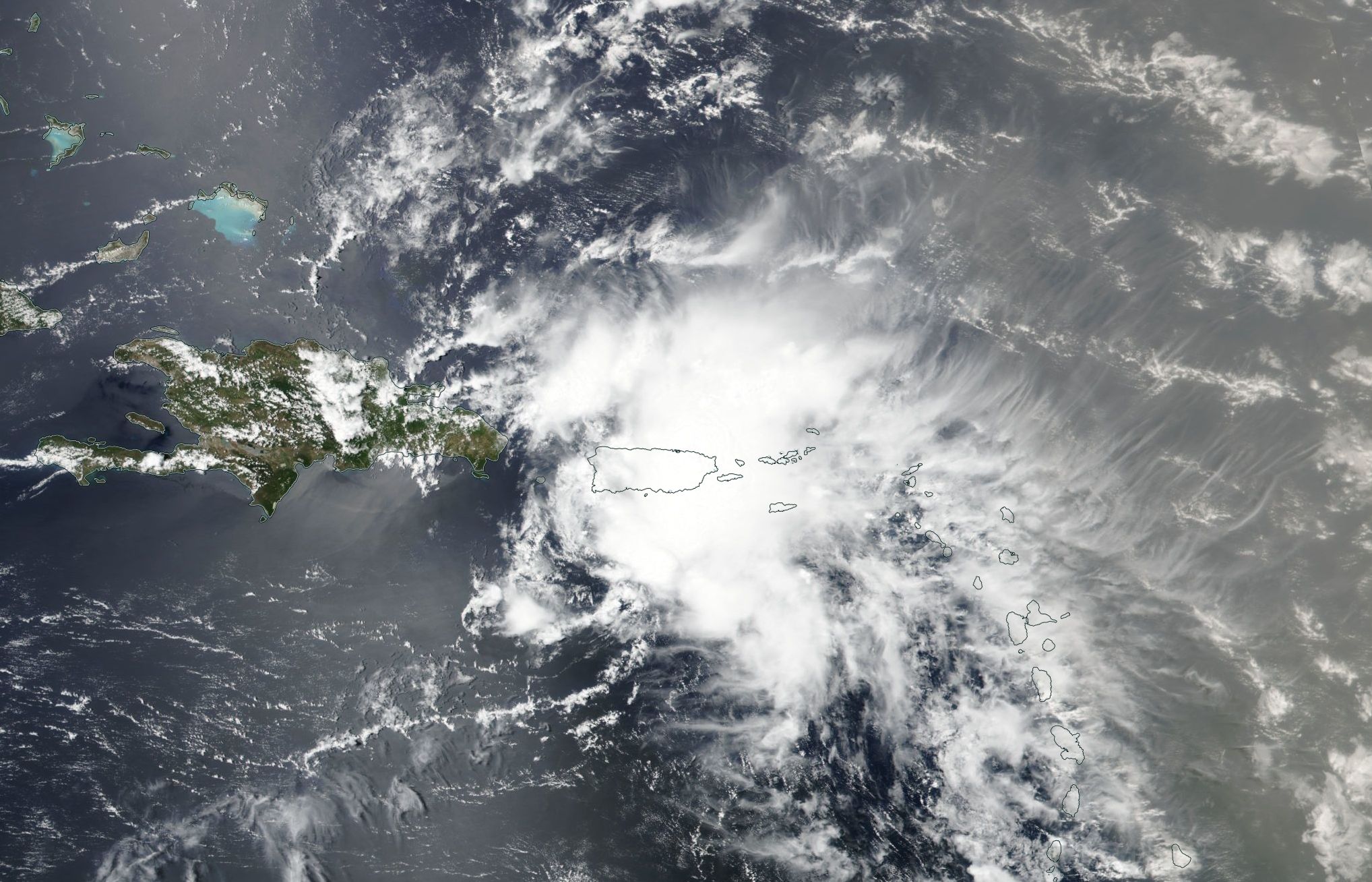
Figure 1: Remnants of Beryl affecting the U.S. Virgin Islands and Puerto Rico on July 9, 2018. Photo: NASA WorldView.
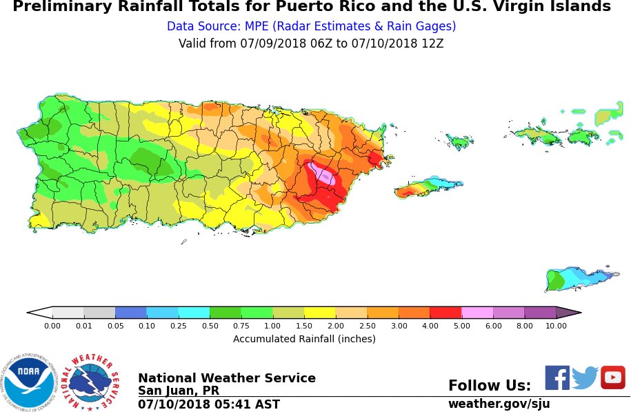
The remnants of Beryl crossed the U.S. Virgin Islands and Puerto Rico on July 9. Strong gusty winds and heavy rainfall affected the islands. On Monday morning, a wind gust of 47 MPH was reported at Cyril King Airport in Saint Thomas and the Luis Muñoz Marin Airport in San Juan around 7:30 AM and 9:00 AM respectively. The average rainfall in Puerto Rico ranged between 1 to 4 inches except over the eastern third of the island where 4-6 inches of rain fell (Figure 6). On the other hand, one to two inches fell over the U.S. Virgin Islands. Flash Flooding was reported in several locations in the eastern third of Puerto Rico.

Figure 2: Preliminary rainfall totals associated with the remnants of Beryl. Image developed by NWS San Juan.
Figure 3: NWS products issued during the passage of the remnants of Beryl.